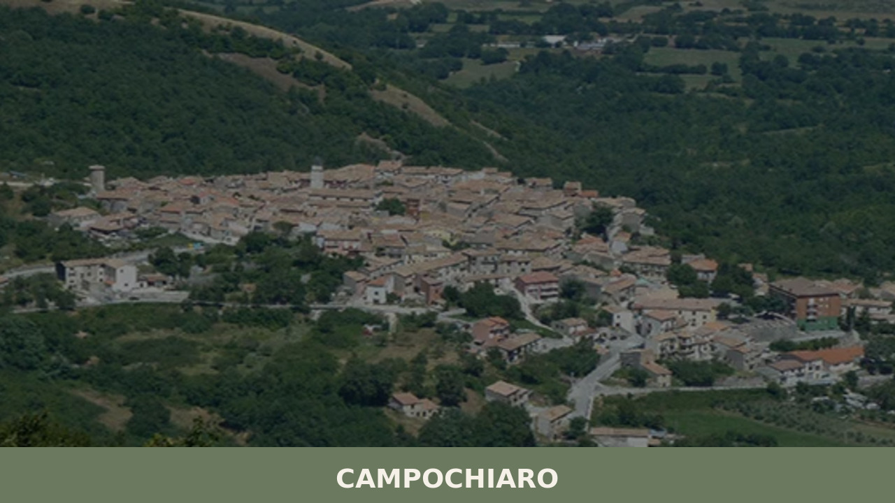
A mountain village of 594 inhabitants at the foot of the Matese massif, Campochiaro holds a Lombard necropolis, Samnite sanctuary, and karst landscapes that reveal Molise’s deepest layers.
Morning light catches the limestone face of the Matese massif, turning it the colour of old parchment. At 750 metres above sea level, the air in Campochiaro carries the cold bite of mountain springs and the faint smell of woodsmoke from the last hearths of the day. This settlement of 594 inhabitants sits in the province of Campobasso, a place where pastoral routines have barely shifted in centuries. If you are wondering what to see in Campochiaro, the answer begins with the mountain itself — and the layers of human history pressed into the rock below it.
The name “Campochiaro” derives from the Latin campus clarus, meaning “bright field” or “clear plain” — a reference to the open, sun-exposed plateau on which the settlement was founded. The area’s human occupation stretches back to the Samnite period, when the Pentri tribe, one of the four principal Samnite groups, controlled much of the central-southern Apennines. Archaeological evidence from the surrounding territory confirms pre-Roman activity, and the Matese massif served as a natural fortress for these Italic peoples during their long conflicts with Rome.
In the early medieval period, Campochiaro gained particular significance through its Lombard-era necropolis, discovered in the locality of Vicenne. Excavations conducted from the 1980s onward revealed a burial ground dating to the 7th century AD, containing the remains of horsemen interred alongside their mounts — a funerary practice linked to the semi-nomadic warrior culture that the Lombards brought into southern Italy. The graves yielded weapons, belt fittings, and horse trappings that now form one of the most important Lombard archaeological collections in the Italian south.
Through the Norman and later Angevin periods, the village followed the feudal trajectory common to much of inland Molise: it passed among various baronial families, its fortunes tied to livestock, transhumance routes, and the seasonal rhythms of mountain agriculture. Depopulation in the 20th century reduced the community to its present modest size, but the village’s archaeological patrimony has increasingly drawn scholarly and cultural attention.
Located just outside the village, this 7th-century burial site is among the most significant Lombard-period finds in southern Italy. Over 130 graves were excavated, some containing horses buried alongside their riders in full ceremonial dress. The artefacts recovered — iron spurs, gilded bronze crosses, ceramic vessels — speak to a warrior elite that governed this mountain territory during the early Middle Ages.
In the nearby locality of Campochiaro-Civitella, the remains of an Italic sanctuary dedicated to Hercules Rix document religious practices of the Samnite Pentri. Votive deposits, including anatomical terracottas and bronze figurines, were discovered here. The site underlines the sacred importance these pre-Roman communities assigned to the springs and high ground of the Matese.
The parish church anchors the village centre. Its stone facade is austere, typical of mountain churches in the Campobasso province, and the interior preserves a modest collection of devotional art accumulated over centuries. The bell tower, visible from the surrounding fields, functions as the village’s principal vertical landmark against the horizontal sweep of the plateau.
Campochiaro sits at the foot of one of the most geologically active karst systems in the southern Apennines. Sinkholes, underground rivers, and limestone caves define the terrain. Walking trails lead from the village into high-altitude pastures and beech forests, offering direct contact with a landscape shaped by water dissolving rock over millennia.
Near Campochiaro, karst waters emerge at one of the principal sources of the Biferno, the only river whose entire course lies within Molise. The spring area is unadorned — a place of cold, transparent water pushing through rock — but its hydrological significance is considerable, feeding the river system that shapes the region’s eastern valleys all the way to the Adriatic.
The cooking here is mountain food, built on preservation and substance. Pasta is made by hand — cavatelli shaped with two fingers, fusilli rolled around a thin metal rod — and dressed with ragù of lamb or pork, meats raised on the same slopes visible from the kitchen window. Aged pecorino cheese, produced from the milk of sheep that graze the Matese uplands, appears on every table. In autumn, wild mushrooms — particularly porcini — are gathered from the beech forests and dried for use through winter. Polenta, once the staple of poverty, retains its place in the local diet, often served with sausage or alongside braised greens.
Campochiaro is not a village of restaurants. Eating here means seeking out small family-run agriturismi in the surrounding territory, where the menu reflects what was harvested that week. The broader Matese area produces honeys, particularly from chestnut and wildflower, and local cured meats — soppressata, ventricina — follow recipes that vary household by household. Wine is modest in production but present: the Tintilia del Molise DOC, the region’s indigenous red grape, is grown at lower altitudes in the province and pairs well with the robust flavours of the mountain table.
Late spring — May through mid-June — brings the Matese into its most vivid state: wildflowers across the high pastures, snowmelt feeding the springs at full volume, and temperatures that make walking comfortable without the summer heat that bakes the lower valleys. Autumn, from late September through October, offers its own rewards: the beech forests turn copper and amber, mushroom foraging is in full season, and the village slows further into its winter preparations.
Summer can be warm during midday but cools significantly in the evening, making Campochiaro a natural refuge from the coastal and lowland heat. Winters are genuinely cold at 750 metres, with snowfall common on the upper Matese. The village’s patron saint feast and other local celebrations tend to fall in the summer months, when emigrants return and the population temporarily swells. For archaeological sites, check seasonal access in advance — some locations may have limited visiting hours or require arrangements through the local municipality.
By car, Campochiaro is reached via the SS17 road that links the Molise interior with the major Apennine corridors. From Campobasso, the provincial capital, the drive is approximately 30 kilometres northwest, taking around 40 minutes on mountain roads. From Naples, the journey covers roughly 120 kilometres via the A1 motorway (exit Caianello or San Vittore) and then secondary roads through the Matese — allow around two hours. From Rome, expect approximately 200 kilometres and a drive time of two and a half to three hours, also using the A1 before turning east into Molise.
The nearest railway station with regular service is Bojano, about 8 kilometres to the east, served by Trenitalia’s regional line connecting Campobasso with Isernia. The closest airports are Naples Capodichino (approximately 130 km) and Pescara Abruzzo Airport (approximately 150 km). There is no direct public transport to the village itself from major cities; a car is effectively essential. Roads are well-maintained but narrow in places, winding through the kind of terrain that demands attention and rewards it with open views of the Matese at every turn.
Molise is Italy’s second-smallest region, but its territory holds a density of villages that repay slow, deliberate exploration. On the Adriatic coast, Termoli offers a striking contrast to Campochiaro’s mountain isolation: a fortified medieval borgo jutting into the sea, with a Romanesque cathedral, a Swabian castle, and a working fishing port where the daily catch still dictates the restaurant menus. The two-hour drive from Campochiaro to Termoli tracks the full elevation drop of the region, from Apennine beech forests to olive groves to salt air.
Inland but at lower altitude, Larino preserves one of Molise’s most important Roman amphitheatres alongside a Gothic cathedral whose carved portal rewards close examination. Larino’s annual Carrese, an ox-cart race with medieval roots, is among the region’s most physically intense traditional events. Together, these villages — Campochiaro in the mountains, Larino on the rolling interior plain, Termoli at the coast — trace a cross-section of Molise’s geography and the distinct cultures each landscape produces.
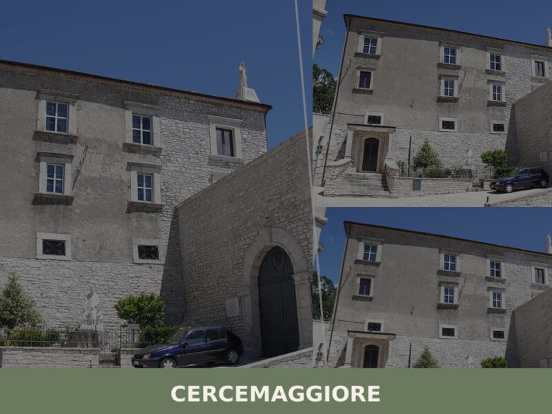
Morning mist spills across the rooftops at 930 metres, thinning as the sun reaches the bell towers. The air carries woodsmoke and the faint sound of a dog barking somewhere below the ridge. Cercemaggiore sits high in the Molise Apennines, a settlement of 3,601 people where stone houses line narrow streets that have changed course […]
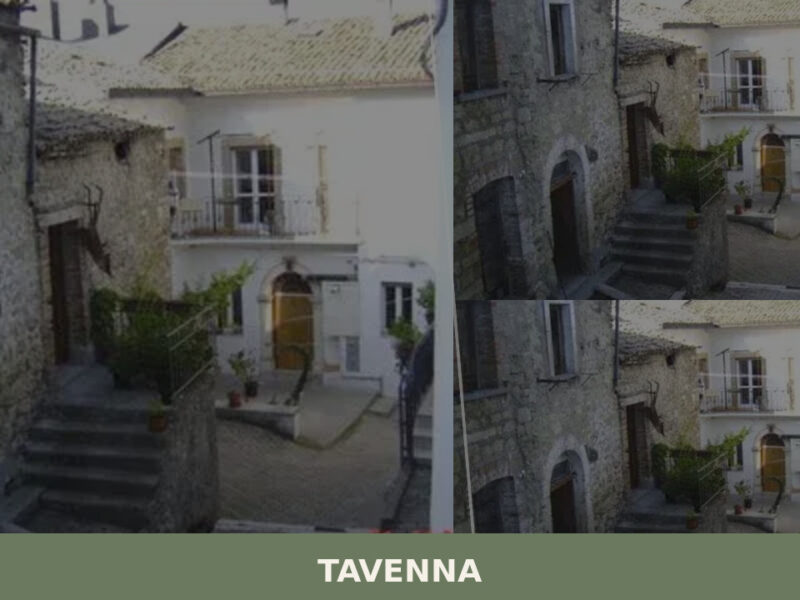
A complete guide to Tavenna in Molise: its medieval stone centre, parish church, panoramic hillside views, and the quiet rhythms of inland southern Italy.
Morning light hits the limestone walls of Ferrazzano at an angle that turns every alley into a corridor of pale gold. At 872 metres above sea level, the air carries a sharpness that the lower towns of Molise never know — a clarity that makes the distant Adriatic coast visible on days when the haze […]
📝 Incorrect information or updates?
Help us keep the Campochiaro page accurate and up to date.
