
Collepietro
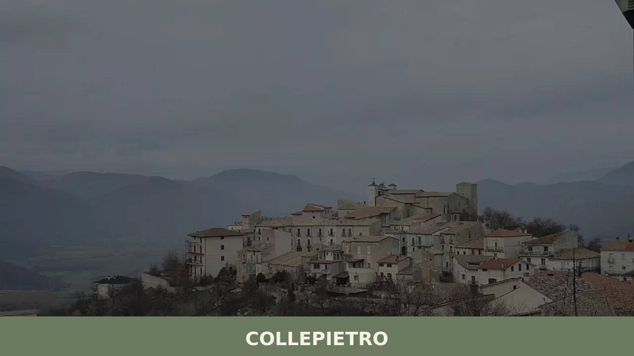
Collepietro has 226 inhabitants and sits at 849 metres above sea level on the eastern slope of the Gran Sasso, in the province of L’Aquila. The municipal territory extends along a ridge overlooking the Piana di Navelli, an area known for saffron cultivation. Those wondering what to see in Collepietro will find a compact settlement […]
Discover Collepietro
Collepietro has 226 inhabitants and sits at 849 metres above sea level on the eastern slope of the Gran Sasso, in the province of L’Aquila. The municipal territory extends along a ridge overlooking the Piana di Navelli, an area known for saffron cultivation. Those wondering what to see in Collepietro will find a compact settlement built from local limestone, with an urban layout that preserves the defensive logic of the fortified villages of inland Abruzzo. The parish church is dedicated to Saint John the Baptist, patron saint of the village, celebrated on 24 June.
History and origins of Collepietro
The place name Collepietro — documented in the Latin forms Collis Petri — indicates a settlement established on a hilltop and linked, in all likelihood, to a landholding or a dedication associated with Saint Peter. Historically, the village falls within the area of influence of the Barony of Carapelle, a feudal system that for centuries governed the southern slopes of the Gran Sasso. Like many centres in the area, Collepietro followed the fortunes of the Kingdom of Naples, passing through various feudal families until the abolition of feudalism in 1806.
The building fabric of the old town bears the marks of successive reconstructions following the earthquakes that have repeatedly struck the L’Aquila area of Abruzzo, particularly those of 1703 and 2009. Carved stone portals, connecting arches between buildings and external staircases document a constructive layering spanning from the 14th to the 18th century. Its position along the Piana di Navelli placed Collepietro within a network of trade linked to transhumance and the saffron commerce — products that defined the economy of this area until the 20th century.
Post-war depopulation drastically reduced the population — from around 800 residents in the 1950s to the current 226 — turning Collepietro into one of the least densely populated municipalities in the province of L’Aquila.
What to see in Collepietro: churches, architecture and landscape
1. Church of San Giovanni Battista
The parish church stands in the central core of the village and is dedicated to the patron saint. The interior retains a single-nave layout with side altars reworked after the seismic damage of the 18th century. The limestone façade features a portal with a lunette displaying locally crafted decorative elements. The patronal feast on 24 June is the main communal gathering of the year.
2. Old town and stone architecture
The historic core of Collepietro stretches along the ridge in a spindle-shaped layout, following the model of Abruzzo’s strada-villages. The buildings are constructed from white and grey limestone, with mortar joints. Portals dating from the 15th to the 17th century can be observed, along with passageway arches connecting opposing building blocks and profferli — the covered external staircases that provide access to the upper floors.
3. View over the Piana di Navelli
From the eastern edge of the settlement, a sweeping view opens across the Piana di Navelli, a karst plateau at around 700 metres elevation where L’Aquila DOP saffron is cultivated. In autumn, between October and November, the fields turn violet with the blooms of Crocus sativus. In the background, the profile of Monte Sirente closes the horizon to the south-west.
4. Church of the Madonna delle Grazie
A small church positioned on the outskirts of the settlement, with a simple structure and a gabled façade. The building is linked to the Marian devotion widespread in the rural centres of the L’Aquila basin. It is one of the minor religious buildings dotting the municipal territory, serving the needs of a community spread between the urban nucleus and the surrounding countryside.
5. Trails towards the Gran Sasso
From the territory of Collepietro, hiking trails climb the southern slope of the Gran Sasso massif. The routes pass through beech forests and high-altitude grasslands, connecting to the trail network of the Gran Sasso and Monti della Laga National Park. The starting altitude of 849 metres allows hikers to reach the summit areas without extreme elevation gains, making the zone accessible to walkers of intermediate fitness.
Food and local produce
The cuisine of Collepietro belongs to the gastronomic tradition of inland mountain Abruzzo. Dishes are based on pulses — lentils, chickpeas, grass peas — grains such as farro, and sheep meat. Sagne e fagioli, hand-cut irregular pasta served in a thick borlotti bean broth, is a preparation found throughout the Piana di Navelli. Lamb arrosticini, cooked on narrow braziers called furnacelle, feature at local festivals and trattorias across the area. L’Aquila DOP saffron, grown in the surrounding fields, is used in risottos, desserts and liqueurs.
Local dairy production includes pecorino cheeses at various stages of ageing, made from flocks grazing on the Gran Sasso meadows. The territory also produces extra virgin olive oil — though in limited quantities compared to the coastal hill areas — and mountain honey, particularly wildflower and sainfoin varieties. To purchase these products, visitors need to contact local producers directly or visit the weekly markets of nearby towns such as Navelli and Capestrano.
When to visit Collepietro: the best time of year
The feast of Saint John the Baptist on 24 June is the moment when the village comes alive with religious and civic celebrations: it is the most tangible occasion to observe the community in its collective dimension. The period between October and November coincides with the saffron harvest on the plain below, an operation carried out by hand in the early morning hours and still involving several local families in the area.
Summer — from June to September — offers favourable conditions for hikes towards the Gran Sasso, with daytime temperatures rarely exceeding 30 degrees thanks to the altitude. Winter brings frequent snowfall and night-time temperatures below zero; access to the village generally remains open, but mountain trails become passable only with proper equipment. Spring, between April and May, is the season of high-altitude meadow blooming — the most spectacular display can be observed at Campo Imperatore, reachable in approximately forty minutes by car.
How to get to Collepietro
Collepietro is reached from the A25 Roma-Pescara motorway, Bussi/Popoli exit, continuing along state road 17 towards L’Aquila and then turning onto the provincial road that crosses the Piana di Navelli. The distance from Rome is approximately 130 kilometres (one hour and forty minutes’ drive), from Pescara approximately 75 kilometres (one hour and ten minutes). L’Aquila is about 30 kilometres to the north-west.
The nearest railway station is Bussi sul Tirino, on the Roma-Sulmona-Pescara line, from which it is necessary to continue by private vehicle for approximately 20 kilometres. The reference airport is Abruzzo Airport in Pescara (approximately 80 kilometres away); alternatively, Rome Fiumicino Airport is approximately 170 kilometres distant. Local public transport is limited to a few daily services operated by TUA Abruzzo: having a car is recommended for exploring the area.
What to see in Collepietro and in nearby Abruzzo villages
Collepietro’s position in the foothills of the Gran Sasso makes it possible to put together an itinerary linking several villages of inland Abruzzo, each with distinct characteristics. To the south, in the Peligna Valley, Bugnara offers an example of a village developed around a baronial castle, with an urban structure following the profile of a rocky spur above the Sagittario river. The distance from Collepietro is approximately 40 kilometres, covered in less than an hour via state road 17 and the Subequana Valley.
Those wishing to combine mountains and coast by heading towards the Adriatic can reach Giulianova, a town in the province of Teramo that pairs an upper medieval nucleus — established by Giuliantonio Acquaviva in the 15th century — with a lower section developed along the shoreline. The route from Collepietro to Giulianova covers approximately 100 kilometres via the A25 motorway and then the A14: just under an hour and a half of driving, a journey that crosses the whole of Abruzzo from the Apennine ridge to the coast.
In Abruzzo More villages to discover
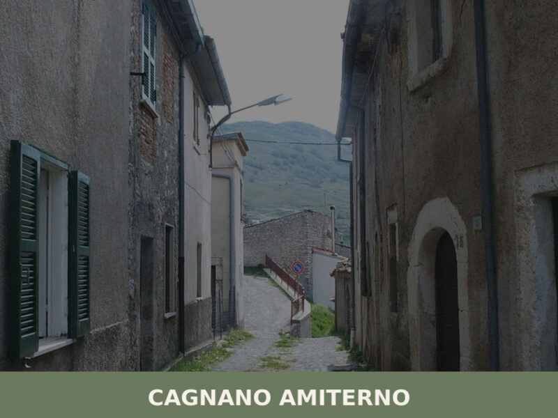
Cagnano Amiterno
Morning light falls flat across the high plateau west of L’Aquila, catching the stone walls of a settlement that has survived earthquakes, depopulation, and the slow erosion of memory. The air carries woodsmoke and the cold mineral scent of mountain water. Cagnano Amiterno, home to just over 1,400 residents, sits in a landscape shaped by […]
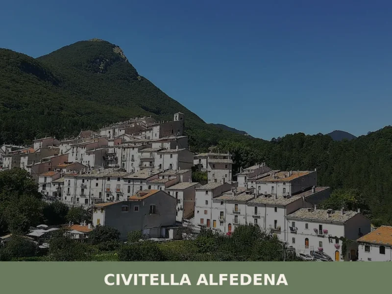
Civitella Alfedena
At 1123 metres above sea level, on the southern slopes of the Abruzzo, Lazio and Molise National Park, Civitella Alfedena is home to just 285 residents — fewer than a single apartment block in Rome — spread along an urban core that retains its medieval defensive layout, complete with stone portals and covered passageways. Asking […]
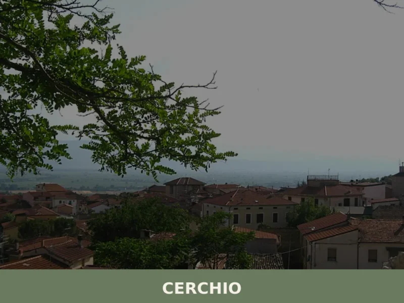
Cerchio
At 834 metres above sea level, on the Fucino plain — the largest lake in central Italy until 1875, when the drainage project commissioned by Prince Alessandro Torlonia transformed the lake bed into agricultural land —, Cerchio has a current population of 1,556 and an economy still tied to those fields reclaimed from the water. […]


📝 Incorrect information or updates?
Help us keep the Collepietro page accurate and up to date.