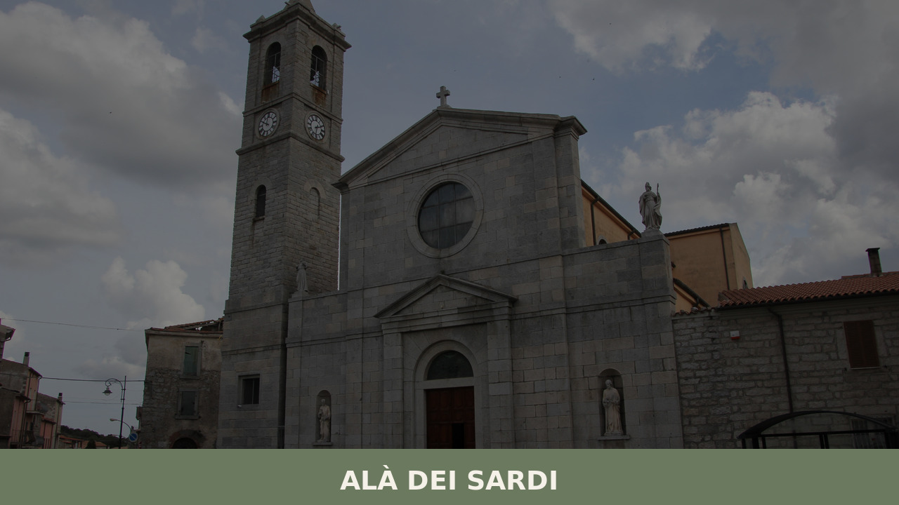
Morning mist rolls off the granite plateau and settles in the narrow streets, carrying the smell of woodsmoke and fresh bread from a communal oven that has not changed position in two centuries. At 663 metres above sea level, the air here is thinner, cooler, and quieter than on the coast below. Alà dei Sardi […]
Morning mist rolls off the granite plateau and settles in the narrow streets, carrying the smell of woodsmoke and fresh bread from a communal oven that has not changed position in two centuries. At 663 metres above sea level, the air here is thinner, cooler, and quieter than on the coast below. Alà dei Sardi — population 1,760 — occupies a stretch of high ground in the province of Sassari where the interior of Sardegna reveals a landscape of wind-bent oaks, ancient stone, and a silence that demands attention. Knowing what to see in Alà dei Sardi begins with understanding this austere, compelling terrain.
The name “Alà” likely derives from the pre-Roman root ala, a term connected to sacred or elevated ground in the languages of Sardegna’s earliest inhabitants. The suffix “dei Sardi” was appended after Italian unification in 1861 to distinguish it from the Piedmontese town of Alà di Stura. Long before official designations, this territory was marked by human presence: the surrounding countryside holds nuraghi, domus de janas (rock-cut tombs), and other remnants of the Nuragic civilisation that shaped the island between the 18th and 2nd centuries BCE.
During the medieval period, Alà fell within the Giudicato di Gallura, one of the four independent kingdoms that governed Sardegna from roughly the 9th to the 15th century. When Gallura was absorbed into the Kingdom of Sardinia, the village passed through feudal hands — Aragonese, then Spanish, then Savoyard — each leaving traces in law, language, and architecture but never quite breaking the pastoral identity of the community. Cattle herding and subsistence farming defined centuries of daily life.
Well into the 19th century, Alà dei Sardi was known across the island for the phenomenon of the bardana — organised cattle raids conducted by groups of mounted men against neighbouring territories. The last documented bardana took place in 1870, an event so significant to local memory that it has been commemorated in public art on the village walls. This was not mere banditry; it was a codified social practice rooted in a pastoral economy where livestock represented wealth, honour, and survival.
The parish church of Sant’Agostino stands at the centre of the village, its stone facade worn to a warm grey by centuries of highland weather. The building combines late-Gothic and Renaissance elements typical of Sardinian ecclesiastical architecture. Inside, a single nave leads to a barrel-vaulted ceiling. The church serves as the focal point for the village’s principal religious festivals, drawing the community together in a rhythm that has not substantially altered in generations.
A few kilometres outside the village, the granite formations of Senalonga rise from the scrubby plateau like the bones of the island itself. Wind and water have sculpted these tafoni — naturally hollowed rocks — into shapes that shift with the light. The site offers an unmediated encounter with the geological forces that built central Sardegna, and it is accessible on foot via unpaved tracks through cork oak woodland.
Painted on a wall in the village centre, this mural depicts the 1870 bardana — the final organised cattle raid from Alà dei Sardi. The artwork captures mounted riders moving livestock across open terrain. It functions as both public art and historical document, a visual marker of the village’s pastoral past. Unlike the more famous murals of Orgosolo, these paintings remain relatively unknown, which lends them an unvarnished authenticity.
From several points along the village’s edges and the surrounding roads, the high plateau unfolds to the horizon — a patchwork of grazing land, maquis scrub, and wind farms whose modern turbines turn slowly against a backdrop of ancient topography. On clear days, the view reaches toward Monte Limbara to the north. The elevation and open terrain produce light conditions — sharp, raking, Mediterranean — that shift dramatically from dawn to dusk.
The countryside around Alà dei Sardi contains scattered remnants of Nuragic and pre-Nuragic occupation, including nuraghi (stone towers) and domus de janas (prehistoric chamber tombs carved into rock). Many of these sites are unmarked and require local knowledge to locate, which makes them all the more rewarding. The Sardinia Tourism Board provides regional guides to archaeological itineraries in the area.
The cuisine of Alà dei Sardi belongs to the pastoral tradition of inland Sardegna. Roast suckling pig (porceddu), prepared over aromatic wood — myrtle, juniper, holm oak — remains the centrepiece of festive meals. Sheep’s milk cheeses are produced locally, ranging from fresh ricotta to aged pecorino; Sardegna’s Pecorino Sardo DOP and Fiore Sardo DOP are both widely available in the area. Bread-making follows old forms: pane carasau, the paper-thin flatbread, and the thicker pane frattau layered with tomato, egg, and cheese are staples.
Home-made pasta includes malloreddus (small semolina gnocchi) and culurgiones (stuffed pasta parcels with potato and mint filling). Local honey, harvested from bees that forage on the plateau’s wild herbs, carries the flavour of rosemary and thistle. Wine from the surrounding region tends toward robust Cannonau reds. Dining options in the village are limited to a small number of trattorie and agriturismi in the surrounding countryside, where meals are served communally and menus follow the season rather than a printed card.
Late spring — May and June — brings wildflowers to the plateau and temperatures that hover between 18°C and 25°C, ideal for walking the granite formations and archaeological sites without the oppressive heat that blankets lower elevations in July and August. Autumn, particularly October, offers warm days, cooler evenings, and the start of mushroom-foraging season in the surrounding cork oak woods. The feast day of Sant’Agostino, the patron saint, is the village’s principal community event, involving processions, traditional costumes, and communal meals that expose the social fabric of the place more clearly than any museum could.
Winter at 663 metres is cold by Sardinian standards — temperatures can drop near freezing at night — but the village gains a stark, depopulated beauty. Fog and low cloud wrap around the granite outcrops, and the few visitors who come in this season will have the landscape almost entirely to themselves. Practical note: limited accommodation means booking ahead is advisable in any season. A car is essential.
The nearest airport is Olbia Costa Smeralda, approximately 60 kilometres to the northeast — roughly one hour by car. From Olbia, take the SS 597 westward toward Monti, then follow the SP 24 south to Alà dei Sardi. From Sassari, the provincial capital, the drive is approximately 100 kilometres southeast via the SS 597, taking around 90 minutes. From Cagliari, the island’s capital, the distance is roughly 230 kilometres — a drive of approximately three hours via the SS 131 and SS 389.
There is no railway station in Alà dei Sardi. The nearest rail connection is at Ozieri-Chilivani, about 40 kilometres to the northwest, served by Trenitalia regional services from Sassari and Cagliari. ARST buses connect Alà dei Sardi to Olbia and other regional centres, though services are infrequent, particularly on weekends. Renting a car at Olbia airport is the most practical option for reaching the village and exploring the surrounding territory.
The interior of Sardegna rewards slow, deliberate exploration. From Alà dei Sardi, the territory opens into a network of small communities, each with its own geological character and cultural inheritance. To the south, the village of Buddusò shares the same high granite plateau and a long tradition of pastoral life; its renowned granite quarries have supplied building material across the island and beyond, and the drive between the two villages passes through cork oak forest and, increasingly, the white towers of the Alà-Buddusò wind farm.
Heading northwest toward the coast, the village of Monti marks the transition from highland to lowland, sitting at the edge of the Vermentino di Gallura wine-producing zone. The shift in altitude, vegetation, and light between Alà dei Sardi and Monti — barely 30 kilometres apart — illustrates how dramatically Sardegna’s landscape can change within a single hour’s drive, a fact that no map fully conveys.
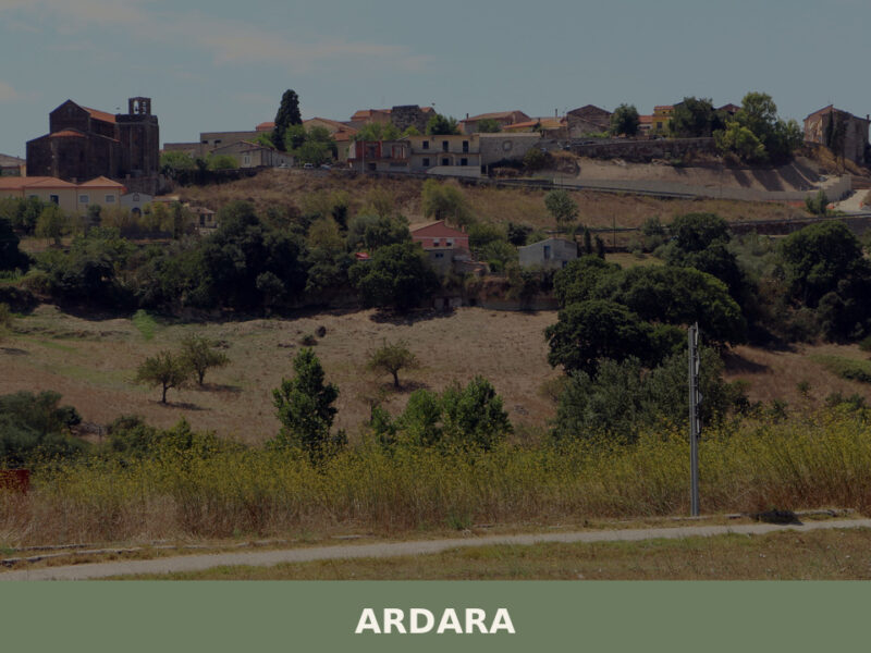
Morning light strikes the dark basalt walls of an old church, turning the stone the colour of wet coal. A rooster calls from somewhere behind the municipio. Ardara sits on a low rise at 296 metres above sea level in the province of Sassari, a village of 729 people that once served as the capital […]
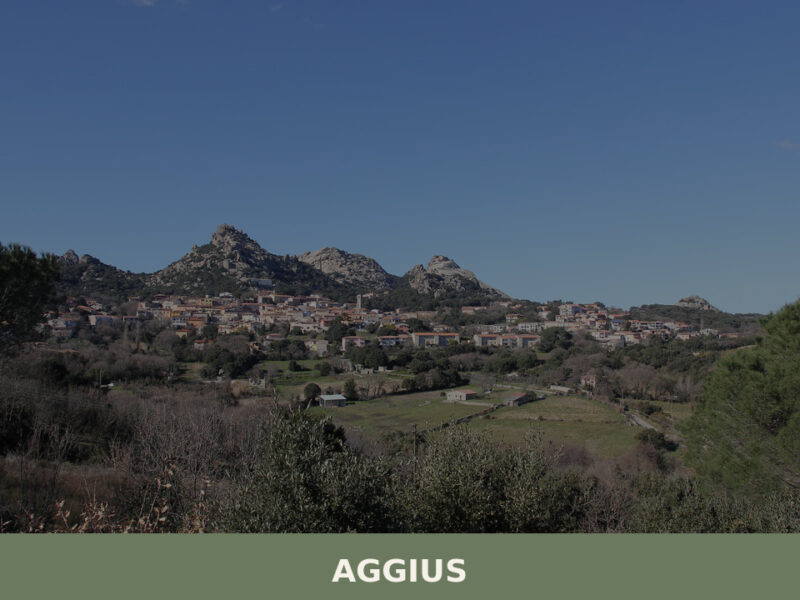
Granite boulders glow amber in the late afternoon, stacked like ancient sentinels across a valley floor that drops away toward the Gallura coast. Wind pushes through narrow lanes of grey stone houses, carrying the faint rhythm of a polyphonic chorus rehearsing behind closed shutters. At 514 metres above sea level, this village of just over […]
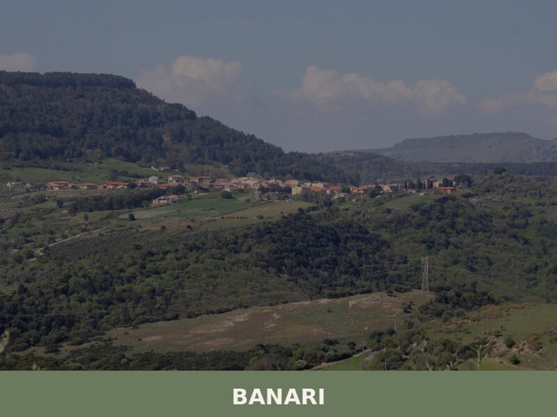
Morning light catches the limestone facades along Via Roma, turning them the colour of raw honey. A rooster calls from behind a courtyard wall. Somewhere below, the Meilogu plain stretches north toward Sassari, its patchwork of olive groves and grain fields still holding the night’s mist. Banari — population 516, perched at 419 metres above […]
📝 Incorrect information or updates?
Help us keep the Alà dei Sardi page accurate and up to date.
