
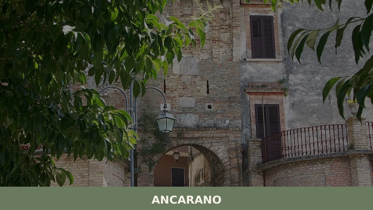
Ancarano
At 295 metres above sea level, where the province of Teramo brushes against the border with the Marche, Ancarano occupies a strip of hilly territory that slopes down towards the Val Vibrata, with a population of 1,824 inhabitants spread between the historic centre and the surrounding hamlets. Anyone wondering what to see in Ancarano will […]
Discover Ancarano
At 295 metres above sea level, where the province of Teramo brushes against the border with the Marche, Ancarano occupies a strip of hilly territory that slopes down towards the Val Vibrata, with a population of 1,824 inhabitants spread between the historic centre and the surrounding hamlets. Anyone wondering what to see in Ancarano will find a municipality of lowland and gentle hills where an agricultural vocation has shaped the landscape more than any human intervention: rows of vines, orderly olive groves, and wheat fields alternating without interruption all the way to the Teramo horizon.
History and origins of Ancarano
The place name “Ancarano” most likely derives from the Latin Ancharanus, linked to a Roman landowner in the area. The presence of settlements in the Val Vibrata is documented as far back as the pre-Roman era: the territory, crossed by communication routes between the Adriatic and the Apennine hinterland, has yielded archaeological materials from the Picene and Italic periods. Under Roman rule, the area was organised according to the pagus system, and agricultural estates took the names of their respective owners — a practice that left its mark on local place names.
In the Middle Ages, Ancarano fell within the orbit of the Duchy of Spoleto and subsequently the Kingdom of Naples. Its position on the border between the Papal States and Neapolitan territory made the village a point of transit and administrative tension. During the fourteenth and fifteenth centuries, the community suffered the consequences of disputes between local feudal families, particularly the Acquaviva, Dukes of Atri, who exercised control over vast stretches of the Teramo province. The patronage of the Martyrs of Porto, to whom the patron saint feast is dedicated, bears witness to an ancient devotional bond with early Christian tradition.
After the Unification of Italy, Ancarano maintained its identity as an autonomous municipality despite its modest size. The economy remained based on the cultivation of wheat, olives, and vines — activities that still define the productive profile of the territory today. Post-war emigration reduced the population, but from the 1970s onward small artisan businesses and agri-food enterprises helped stabilise the local socioeconomic fabric. Further information on the administrative history of the municipality is available on the official website of the Municipality of Ancarano.
What to see in Ancarano: churches, buildings, and the rural landscape
1. Church of the Santi Martiri Portuensi
The main sacred building in the village is dedicated to the patron saints of the municipality. The current structure, the result of successive interventions between the seventeenth and eighteenth centuries, retains a single-nave layout with side altars. Inside are wooden furnishings and devotional paintings that document local religious patronage in the post-Tridentine period.
2. Historic centre and Town Hall
The old nucleus of Ancarano develops along a straight road axis, with brick houses aligned according to the typical rural layout of the Val Vibrata. The Town Hall, seat of the local administration, presents a sober façade that reflects nineteenth-century civic architecture in the Teramo province. From here, there are commanding views over the surrounding cultivated plain.
3. Church of Santa Maria a Propezzano (nearby area)
A short distance from the municipal territory stands the Abbey of Santa Maria di Propezzano, one of the most significant Romanesque complexes in the province of Teramo. Although it does not fall strictly within Ancarano’s boundaries, it is a natural stop for anyone visiting the area: the sculpted portal and medieval cloister fully justify the detour.
4. Agricultural landscape of the Val Vibrata
The municipal territory is crossed by rural roads that wind through a mosaic of plots cultivated with olive trees, vines, and cereals. This agricultural landscape, free of significant urban interruptions, preserves the land structure that took shape between the nineteenth and twentieth centuries. Walks along the farm tracks offer open views towards the Monti della Laga and Gran Sasso.
5. Historic fountains and wash houses
As in many centres of the Val Vibrata, Ancarano still preserves a number of public fountains and masonry wash houses dating from the late nineteenth century and the early decades of the twentieth. These structures, built in brick and local stone, were the focal point of community life and represent an element of rural archaeology still clearly readable within the village fabric.
Food and local produce
The table in Ancarano follows the Teramo peasant tradition, with little concession to elaborate preparation and great attention to raw ingredients. Virtù, a ritual soup prepared on the first of May with dried and fresh legumes, pasta, and seasonal vegetables, is the dish that best encapsulates the agricultural calendar of the area. Pasta alla mugnaia — irregular fettuccine dressed with tomato and meat sauce — and lamb arrosticini complete a solid gastronomic repertoire. The extra virgin olive oil produced in the Val Vibrata, obtained predominantly from Dritta and Leccino cultivars, has a medium fruity profile with herbaceous notes, and is recognised within the DOP Aprutino Pescarese designation and among quality Teramo productions.
Among local products of note are short- and medium-aged pecorino cheeses, Montepulciano d’Abruzzo wine — which in the Teramo hill belt achieves a notable tannic concentration — and pork cured meats prepared according to the traditional method of seasoning with sweet chilli pepper and wild fennel. For up-to-date information on food and wine offerings and local farms, it is worth consulting the Touring Club Italiano website.
When to visit Ancarano: the best time of year
Ancarano’s climate is typical of the mid-Adriatic hills: hot summers with temperatures exceeding 30 °C in July and August, and mild winters with lows rarely dropping below zero. The best months for a visit are May, June, September, and October, when the countryside is in full swing and temperatures allow comfortable outings along the rural roads. The feast of the Martyrs of Porto, patron saints of the municipality, is the most deeply felt occasion in the community: during the celebration the village comes alive with religious services, processions, and convivial gatherings. In summer, local food festivals and neighbourhood fairs revolving around the products of the land take place — useful opportunities to observe up close the relationship between the territory and its agricultural economy.
For those arriving in the winter months, the proximity to the Monti della Laga and the Teramo Apennine district offers the chance to combine a visit to the village with mountain excursions, less than an hour’s drive away.
How to reach Ancarano
- By car: from the A14 Adriatica motorway, take the Val Vibrata/San Benedetto del Tronto exit. From there, Ancarano is about 15 minutes away along the SP259 heading south. From Teramo the distance is approximately 30 km via the SS81.
- By train: the nearest railway station is San Benedetto del Tronto, on the Adriatic line between Bologna and Lecce. From there you will need to continue by local bus or car.
- By air: the closest airport is Abruzzo Airport in Pescara (approximately 85 km), served by domestic flights and a number of European routes. Ancona-Falconara Airport is around 120 km away.
- Approximate distances: Rome 220 km, Pescara 85 km, L’Aquila 110 km, Ascoli Piceno 25 km.
What to see in Ancarano and in other Abruzzo villages
Ancarano’s position in the eastern belt of Abruzzo makes it possible to build itineraries crossing very different landscapes within just a few hours of travel. Those interested in exploring the opposite side of the region — the inland, mountainous part — can head towards Carapelle Calvisio, a small settlement in the Gran Sasso and Monti della Laga National Park, where limestone architecture and a tightly packed urban layout tell a completely different story from the Vibrata countryside: there, the relationship with the mountain produced compact dwelling forms, designed to withstand the cold and winter isolation.
Heading south, in the province of Chieti, lies Borrello, known for the Cascate del Verde — among the tallest waterfalls in the Apennines — and for a territory that drops sharply towards the Sangro valley. The contrast between the agricultural plain of Ancarano and the verticality of Borrello’s landscape gives a measure of Abruzzo’s geographic variety, a region that in less than one hundred and fifty kilometres passes from sea level to altitudes above two thousand metres.
In Abruzzo More villages to discover
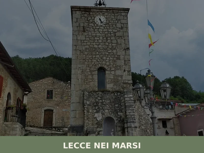
Lecce nei Marsi
Lecce nei Marsi has 1,534 inhabitants spread between the main centre and outlying hamlets along the eastern slope of the Marsica area, at 740 metres above sea level. The municipal territory borders the Abruzzo, Lazio and Molise National Park and falls within the province of L’Aquila. Anyone looking into what to see in Lecce nei […]
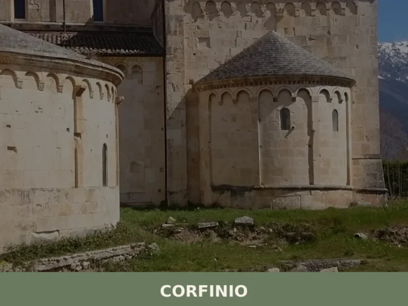
Corfinio
In 91 BC, the Italic peoples chose Corfinium as the capital of the Italic League during the Social War against Rome: for several months, this city in the Peligna Valley was renamed Italica and minted its own coins bearing the image of a bull trampling the Roman she-wolf. Today the village has 1,081 inhabitants, sits […]
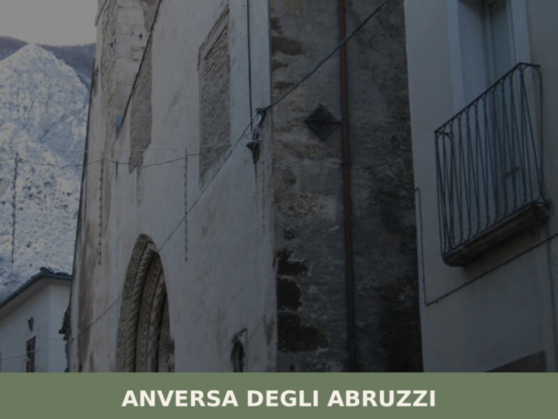
Anversa degli Abruzzi
Morning light strikes the limestone walls of the old quarter at an angle that turns them the colour of raw honey. Below, the Sagittario Gorge drops away — a vertical wound in the rock that swallows sound. The air carries a faint mineral chill even in July. With only 368 residents, Anversa degli Abruzzi holds […]


📝 Incorrect information or updates?
Help us keep the Ancarano page accurate and up to date.