
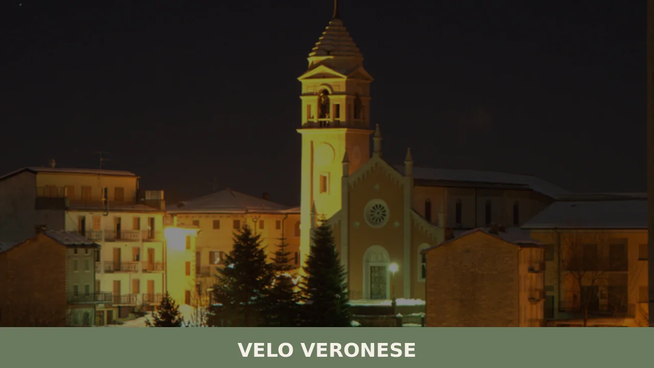
Velo Veronese
At 1,087 metres above sea level, on the eastern slope of the Lessinia range in the Verona province, Velo Veronese has 770 inhabitants spread between its central nucleus and the scattered contrade (hamlets) across the plateau. Anyone wondering what to see in Velo Veronese should know that this municipality is the main gateway to the […]
Discover Velo Veronese
At 1,087 metres above sea level, on the eastern slope of the Lessinia range in the Verona province, Velo Veronese has 770 inhabitants spread between its central nucleus and the scattered contrade (hamlets) across the plateau. Anyone wondering what to see in Velo Veronese should know that this municipality is the main gateway to the Lessinia Regional Natural Park, established in 1990 to protect one of the most extensive karst systems in Italy. The parish church, dedicated to Saint John the Baptist — the patron saint celebrated on 24 June — dominates the central square with a façade that defines the profile of the village as seen from provincial road 13.
History and origins of Velo Veronese
The place name “Velo” probably derives from the Latin velum, referring to a veil of water or a marshy highland area — a hypothesis consistent with the karst morphology of the territory, rich in sinkholes and swallow holes. Documents from the capitular archive of Verona confirm the presence of permanent settlements in the area as early as the 12th century, linked to the colonisation of the plateau by the Cimbri, a population of Bavarian origin that between the 13th and 14th centuries settled on the Veronese mountains, bringing with them their language, building techniques and collective pasture management systems.
Under the Republic of Venice, Velo belonged to the Vicariato della Montagna, an administrative entity that enjoyed a degree of autonomy from the lowlands. The Tredici Comuni (Thirteen Communes), the Cimbrian federation of Lessinia to which Velo belonged, retained fiscal and linguistic privileges until the fall of the Serenissima in 1797. Traces of the Cimbrian language — a Germanic dialect now nearly extinct — still survive in local place names: hamlets such as Camposilvano and Ljetzan (the Cimbrian name for Giazza, a hamlet in the neighbouring municipality of Selva di Progno) are direct evidence of this.
During the First World War, the eastern Lessinia served as a rear area behind the front line, and Velo Veronese hosted military depots and logistical facilities. In the post-Second World War period, emigration towards the factories on the plain halved the population — a phenomenon common to all mountain municipalities in the Lessinia. Today, the municipality maintains an agro-pastoral vocation alongside hiking and nature-based tourism.
What to see in Velo Veronese: 5 main attractions
1. Covolo di Camposilvano
A karst sinkhole roughly 70 metres deep and 50 metres wide, formed by the collapse of the roof of an underground cavity. It is reached on foot from the hamlet of Camposilvano along a path fitted with steps and railings. At the bottom, an accumulation of snow often persists well into summer thanks to the microclimate of the depression, where the temperature remains several degrees lower than at the surrounding surface.
2. Camposilvano Fossil Museum
Housed in a building adjacent to the Covolo, the museum contains ammonites, belemnites and other Jurassic and Cretaceous marine fossils found in the limestone of the Lessinia. The slabs of local stone — the so-called Rosso Ammonitico Veronese — contain specimens visible to the naked eye. The museum documents the fact that the plateau, today at over one thousand metres of elevation, was for millions of years the seabed of a tropical ocean.
3. Parish Church of San Giovanni Battista
The current building, remodelled during the 18th and 19th centuries, retains a single-nave layout with side altars in polychrome marble quarried from the Lessinia. The bell tower, visible from several kilometres along the road climbing from Verona, serves as the village’s vertical landmark. Inside, the church holds paintings from the Veronese school and a restored organ.
4. Covoli Trail and paths in the Lessinia Park
From the centre of Velo, CAI-marked trails cross pastures, beech forests and surface karst formations — sinkholes, limestone pavements, natural bridges. The route to the Ponte di Veja, a natural rock arch 50 metres wide and 29 metres high, takes approximately two hours on foot. The municipal website publishes updates on trail accessibility.
5. Cimbrian hamlets
The scattered hamlets around Velo preserve the architecture of the baiti, structures built from local limestone with double-pitched roofs once covered with stone slabs — the so-called piagne. Contrada San Bartolomeo and Contrada Finetti retain their original building alignments. Some structures still display the dual-level functional layout: stable and hayloft on the ground floor, living quarters on the first floor, following the Cimbrian building tradition.
Food and local products
The food economy of Velo Veronese revolves around alpine cattle farming and cheese-making. The most notable product is Monte Veronese DOP, a semi-cooked cheese produced exclusively with milk from the Lessinia: in the “d’allevo” version it is aged from six months to over two years, developing a granular texture and an intense flavour with notes of mountain herbs. The “whole milk” version has a shorter ageing period and a soft consistency. In the malghe (mountain dairies) active during the summer, fresh ricotta is also produced. Another product of the area is Lessinia Black Truffle (Tuber aestivum), gathered in beech and hornbeam woods between May and November.
Among the traditional dishes of the Lessinia, you will find gnocchi di malga, made with mountain potatoes and dressed with melted butter and grated Monte Veronese; pearà, a Veronese sauce made from bone marrow, stale bread and meat broth that accompanies mixed boiled meats; and polenta from stone-ground cornmeal, served with porcini mushrooms or soppressa — the coarse-grained salami of the Veneto tradition. During the patron saint’s feast on 24 June and at summer festivals, tagliatelle with game ragù and grilled cheese are often prepared. The plateau also produces Lessinia Honey, predominantly mountain wildflower and linden varieties. As for drinks, the proximity to Valpolicella makes Valpolicella DOC and Amarone della Valpolicella DOCG readily available in local trattorias.
When to visit Velo Veronese: the best time
Summer — from mid-June to September — is the most practical season for those planning to hike the trails of the Lessinia Park and visit the working malghe. The feast of Saint John the Baptist on 24 June marks the start of the season with events in the village centre. Summer temperatures range between 10 and 22 degrees Celsius, with sharp temperature swings between day and night. Autumn brings the colours of the beech forests and truffle season, but days grow shorter and valley fog can rise up to the plateau.
Winter transforms the area into a cross-country skiing and snowshoeing district: the Lessinia cross-country trails start from nearby locations, and groomed paths allow excursions even with snow on the ground. Spring, between April and May, is the season when the pastures bloom, but some secondary roads may remain closed until late in the season due to residual ice. It is always advisable to check road conditions before setting out, especially for those arriving from the lowlands in vehicles not equipped for mountain driving.
How to reach Velo Veronese
From Verona, the most direct route is the SP13, which climbs through the Valpantena and then onto the Lessinia plateau: approximately 35 kilometres, covered in 50–60 minutes depending on conditions. The relevant motorway exit is Verona Est on the A4 Turin–Trieste. From Vicenza, the plateau can be reached via the SP246 passing through Recoaro Terme — a longer but more scenic route.
The nearest railway station is Verona Porta Nuova, connected to the Milan–Venice high-speed line and to the Veneto regional rail network. From there, it is necessary to continue by car or by bus services operated by ATV Verona, which runs services to the Lessinia with reduced frequency, especially outside the main season. The nearest airport is Valerio Catullo in Villafranca di Verona, approximately 50 kilometres away. Parking in the centre of Velo is free and generally available even during the summer months.
Other villages to discover in Veneto
Those visiting the Veronese Lessinia can extend their itinerary towards the hilly belt of the province. To the south-west, in the eastern Valpolicella area, Cazzano di Tramigna offers an entirely different setting: here we are in the viticultural belt at around 170 metres of elevation, among rows of Corvina and Rondinella grapes destined for Soave and Valpolicella production. The shift from the Lessinia mountains to the vine-covered hills allows you to observe, within just a few dozen kilometres, the geological and agricultural variety of the Verona province.
For a comparison with another mountain village in Veneto — but one with a profoundly different history and character — it is worth considering Cortina d’Ampezzo, in the Belluno Dolomites. While Velo Veronese retains a rural dimension with its 770 inhabitants and an economy still tied to grazing, Cortina has developed an international tourism model since the 1956 Winter Olympics. Two opposite ways of experiencing the Veneto mountains, both well documented and reachable within the same region.
In Veneto More villages to discover
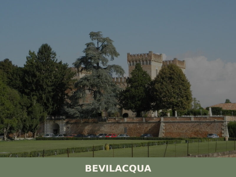
Bevilacqua
A castle rising over the Fratta River, fewer than 1,800 inhabitants, and the quiet agricultural heart of the Veronese plain. Here's what to see in Bevilacqua.
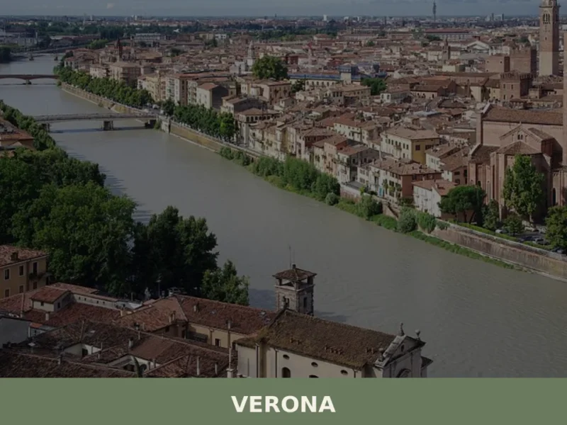
Verona
What to see in Verona, a UNESCO city of 255,000 people. Explore the Roman Arena, Juliet's House, San Zeno Basilica and local dishes like bollito and pearà. Plan your visit now.
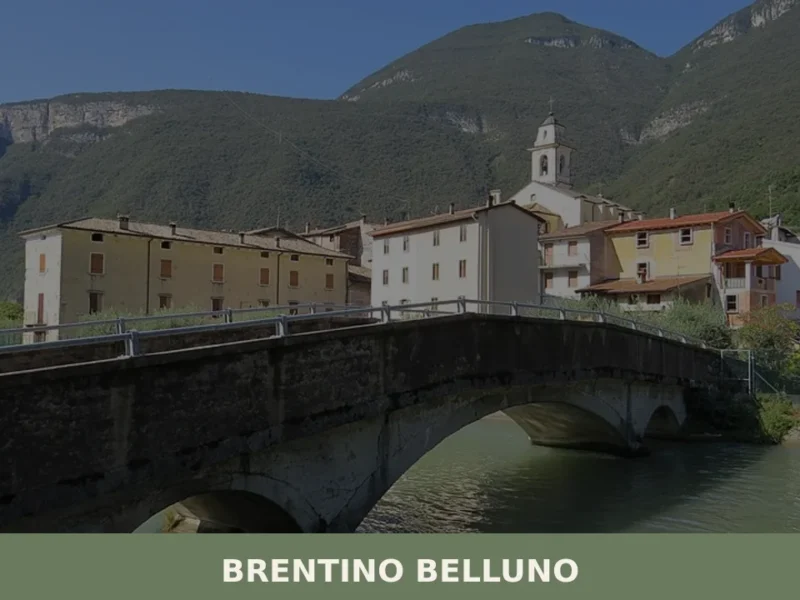
Brentino Belluno
At 137 metres above sea level, where the Adige Valley narrows between Monte Baldo and the Lessini Mountains, Brentino Belluno is a municipality of 1,363 inhabitants created in 1929 through the administrative merger of two distinct settlements: Brentino, on the left bank of the Adige, and Belluno Veronese, clinging to the eastern slope of Monte […]


📝 Incorrect information or updates?
Help us keep the Velo Veronese page accurate and up to date.