
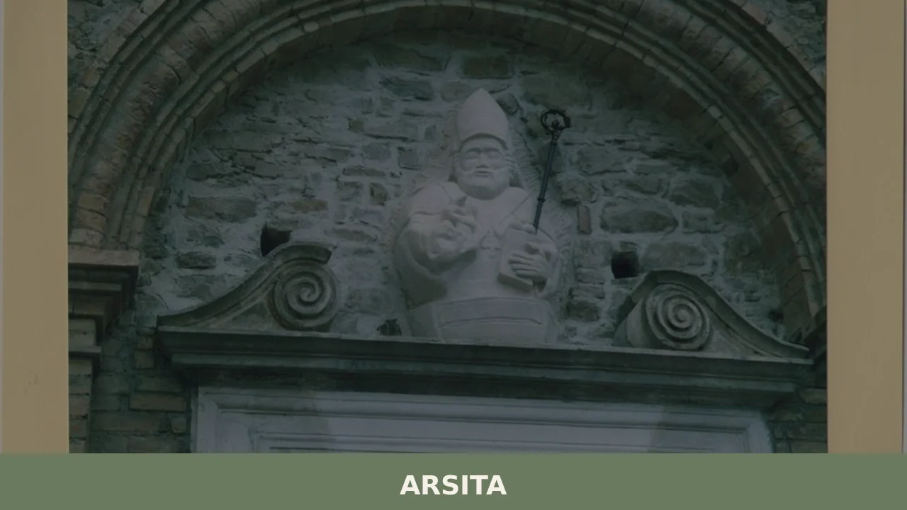
Arsita
Until 1905, this village was called Bacucco, a name likely derived from the Latin bacuca, which referred to olives that had fallen to the ground — a direct reference to the agricultural character of the area. Situated at 470 metres above sea level on the hills of the Teramo province, Arsita and its 733 inhabitants […]
Discover Arsita
Until 1905, this village was called Bacucco, a name likely derived from the Latin bacuca, which referred to olives that had fallen to the ground — a direct reference to the agricultural character of the area. Situated at 470 metres above sea level on the hills of the Teramo province, Arsita and its 733 inhabitants occupy a ridge facing the eastern slopes of the Gran Sasso massif. Understanding what to see in Arsita means exploring a village where even the place names preserve traces of rural life and the production cycles that defined this territory for centuries.
History and origins of Arsita
The settlement appears in medieval documents under the name Bacucco, linked to the fief of the Counts of Pagliara as early as the 12th century. The territory later passed through various lordships, including that of the Acquaviva family, a powerful dynasty that controlled vast areas of the Teramo province. Its hilltop position, far from the main communication routes, helped maintain an economy based almost exclusively on sheep farming and the cultivation of cereals, olives and vines.
In 1905, by royal decree, the municipality officially changed its name from Bacucco to Arsita. The new name, according to the most widely accepted theory, was chosen to suggest a nobler origin, possibly connected to the Latin term arx (fortress, fortified height). The name change coincided with a period of intense emigration to the Americas, a phenomenon that drastically reduced the population and is still reflected today in the communities of Arsita descendants living in the United States and Canada.
During the Second World War, Arsita suffered significant damage, and its territory was crossed by the German defensive line. Post-war reconstruction partly reshaped the urban layout, but the historic centre retained the compact structure typical of Abruzzo’s hilltop villages, organised along a main axis with narrow, steep side alleys. For further details on the municipality’s administrative history, see the dedicated Wikipedia entry.
What to see in Arsita: 5 main attractions
1. Church of San Nicola da Tolentino
Dedicated to the village’s patron saint, celebrated on 10 September, this parish church has a façade that was rebuilt after wartime damage. Inside, it contains sacred furnishings dating from the 18th and 19th centuries. The single-nave plan follows the tradition of minor religious architecture in the Vestina area.
2. Historic centre and entrance gate
The old core extends along a ridge, with houses built from local stone arranged in parallel rows. Some passageway arches between buildings — load-bearing structures that connected facing dwellings — are still visible and can be walked through. The masonry reveals the local sandstone, split-cut and rough-hewn.
3. Ruins of the feudal castle
On the highest part of the village, traces remain of the medieval fortified structure, now reduced to a few wall segments. The position offers a wide view over the valley of the Fino torrent and, on clear days, the ridge of the Gran Sasso d’Italia, whose Corno Grande peak reaches 2,912 metres.
4. Historic public fountain
Near the centre stands a stone fountain that once served as a water supply point for the community and for working animals. These structures, common in Abruzzo’s hilltop villages, functioned as daily gathering places and still mark the pedestrian routes through the village today.
5. Trails towards the Gran Sasso
From the municipal territory, hiking trails climb towards the northern slopes of the Gran Sasso massif, passing through woods of Turkey oak and downy oak. These paths, partly overlapping with ancient transhumance routes, connect the hill zone to the mountain area of the Gran Sasso and Monti della Laga National Park.
Traditional cuisine and local products
The table in Arsita reflects the peasant cooking of the Teramo hinterland. The dishes most deeply rooted in local tradition are sagne e fagioli, hand-cut fresh pasta served with slow-cooked beans, and pallotte cace e ove, cheese and egg fritters that are fried and then simmered in tomato sauce — a dish born from the need to replace meat during times of scarcity. The local pecorino cheese, made from the milk of flocks grazing on the hillside meadows, is aged anywhere from a few weeks to over a year.
Extra virgin olive oil is the most significant product of the area, consistent with the old name Bacucco and its etymology linked to olive growing. The predominant cultivars are Dritta and Leccino, which yield an oil with a bold flavour and herbaceous notes. The Touring Club Italiano includes this area among the olive oil production zones of interest in the province of Teramo. In the autumn months, the olive harvest and pressing at local mills still set the rhythm of village life.
When to visit Arsita: the best time
September coincides with the feast of San Nicola da Tolentino, the village’s patron saint, an occasion when the community organises religious celebrations and communal gatherings. It is the best time to see the village at its most active. Spring, between April and May, offers favourable conditions for hill walks: average temperatures between 12 and 18 degrees, fields in bloom, and good visibility towards the Gran Sasso, often still snow-capped at higher elevations.
Summer brings temperatures exceeding 30 degrees during the middle of the day, but the 470-metre altitude and the hilltop breezes make the evenings cooler than on the coast. Winter is harsh, with possible snowfall between December and February: the village empties further and many services reduce their hours. Those looking for optimal conditions for walking and photography should aim for the weeks between mid-September and mid-October, when the low afternoon light sharply defines the volumes of the historic centre and the foliage colours shift across the surrounding hills.
What to see in Arsita and in nearby Abruzzo villages
The hilly terrain of Abruzzo is dotted with small centres that share with Arsita a similar economic and social structure. Heading towards the province of Chieti, roughly 80 kilometres to the south, you reach Bomba, a village overlooking the artificial lake of the same name, formed by the damming of the Sangro river. Bomba offers a landscape quite different from Arsita’s: water dominates the view and shapes local activities, from sport fishing to walks along the shores.
Continuing in the same area, Borrello deserves attention for the Cascate del Rio Verde, among the tallest natural waterfalls in Italy with a total drop of around 200 metres. Comparing these three villages — Arsita with its olive-clad hills, Bomba with its lake, Borrello with its waterfalls — reveals the geographic variety of inland Abruzzo, where the landscape changes radically within just a few dozen kilometres while maintaining a small human scale and very low population density.
In Abruzzo More villages to discover
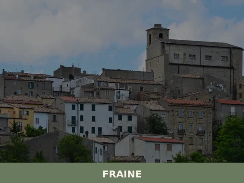
Fraine
At 751 meters above sea level, in the Chieti area, lies Fraine, a municipality with a population of 261 inhabitants. This village, whose history dates back to the 10th-11th century, serves as an observation point over the Alto Vastese territory. For those wondering what to see in fraine, the town offers a journey through the […]
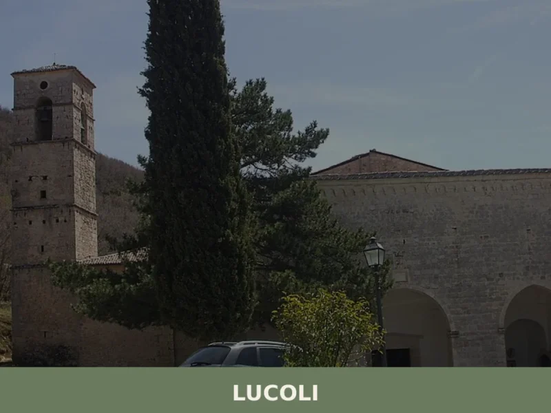
Lucoli
Lucoli is not a compact town centre but a scattered municipality: 839 inhabitants spread across seventeen hamlets along the southern slopes of the Gran Sasso and the Velino-Sirente mountain group, at 956 metres above sea level in the province of L’Aquila. Understanding what to see in Lucoli means crossing a vast, fragmented territory where each […]
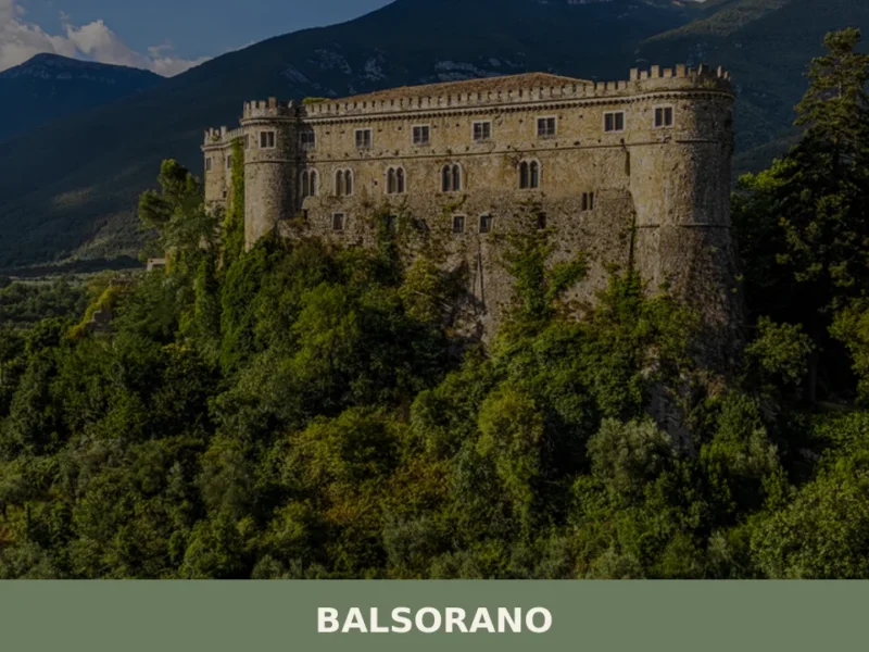
Balsorano
The Val Roveto divides southern Abruzzo from Lazio along a fault line that has determined earthquakes, migrations and feudal borders for over seven centuries. Balsorano occupies the valley floor and the hillside at 340 metres above sea level, with its 3,617 inhabitants spread between the upper historic centre — Balsorano Vecchio — and the modern […]


📝 Incorrect information or updates?
Help us keep the Arsita page accurate and up to date.