


Bomba
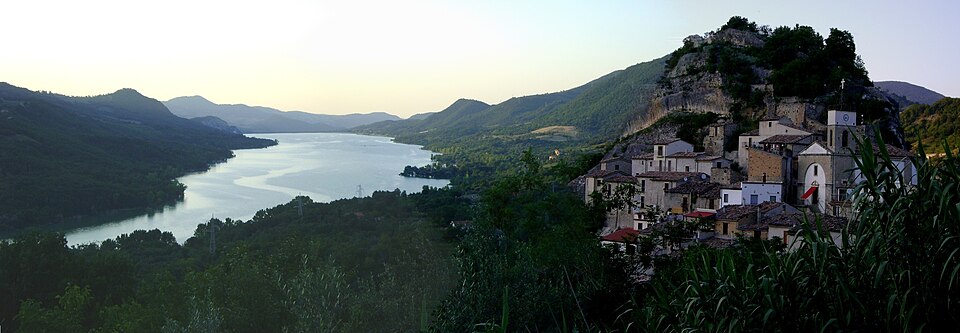
The artificial lake that bears its name, created in 1958 by damming the River Sangro, redefined the geography and economy of Bomba, a municipality of 719 inhabitants in the province of Chieti, at 424 metres above sea level. The reservoir occupies the valley below and today represents one of the key points of interest for […]
Discover Bomba
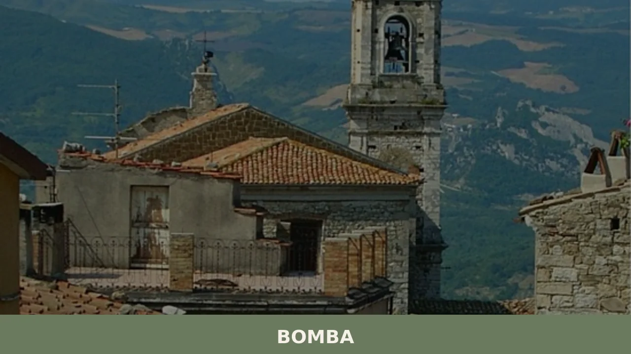
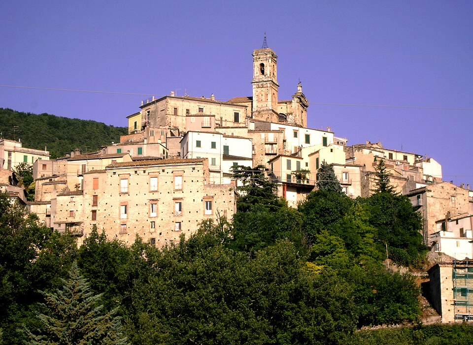
The artificial lake that bears its name, created in 1958 by damming the River Sangro, redefined the geography and economy of Bomba, a municipality of 719 inhabitants in the province of Chieti, at 424 metres above sea level. The reservoir occupies the valley below and today represents one of the key points of interest for anyone wondering what to see in Bomba. The village extends along a hilltop ridge looking west towards the Maiella massif and east towards the Adriatic Sea, roughly thirty kilometres from the coast as the crow flies.
History and origins of Bomba
The earliest documentary records of the name date back to the Norman period: in the Catalogus Baronum, compiled around 1150 under Roger II of Sicily, the fief already appears with its current name. The etymology remains disputed. Some hypotheses link it to the Latin bombus, referring to the sound of the Sangro’s waters in the valley below; others point to a pre-Roman root connected to the shape of the terrain. No definitive evidence supports either theory.
During the Middle Ages the territory passed through the hands of several feudal families. In the fifteenth century the fief belonged to the Caldora, lords who controlled large stretches of the Sangro valley, and later to the d’Avalos. The urban layout of the old town preserves the typical structure of the fortified hilltop villages of the Chieti area, with narrow streets arranged in a herringbone pattern along the ridge and remnants of the defensive walls visible at several points.
During the Second World War, Bomba suffered heavy damage. The town lay on the Gustav Line, the German defensive belt that crossed Abruzzo from coast to coast. Between October and November 1943 the retreating German army mined several buildings and forced the population to evacuate. Post-war reconstruction and the subsequent creation of the lake in the 1950s radically transformed the face of the territory. For further reading, the dedicated Wikipedia entry can be consulted.
What to see in Bomba: 5 main attractions
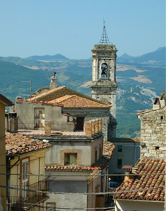
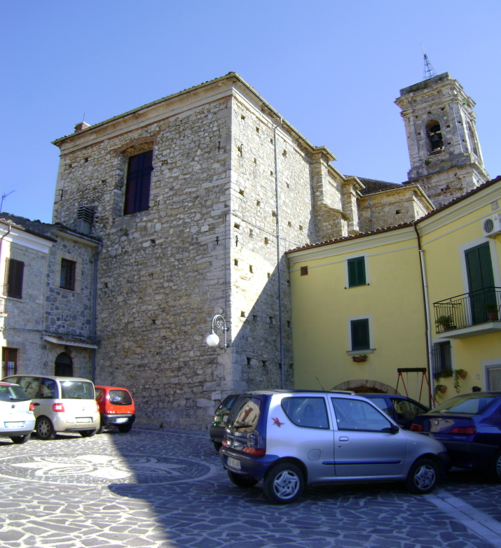
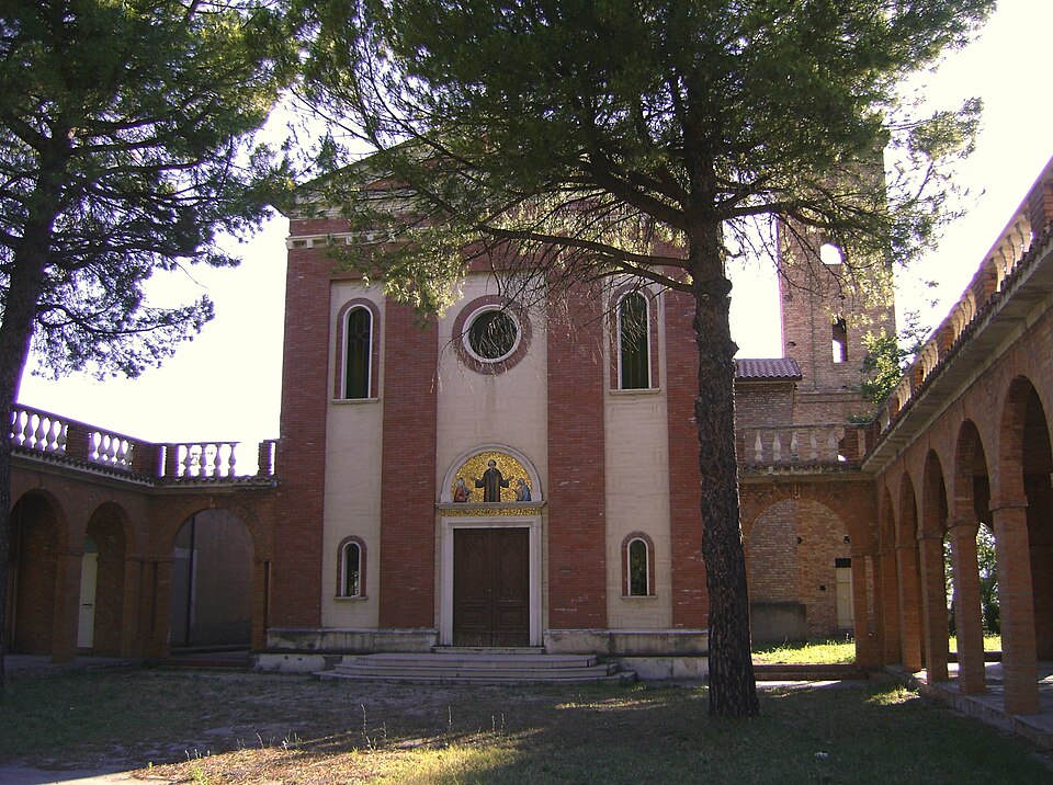
1. Church of Santa Maria del Popolo
The main religious building in the village, rebuilt after wartime damage but with earlier architectural elements still legible on the façade. Inside, it houses sacred furnishings and processional statues linked to the cult of Saint Donatus of Arezzo, patron saint of the town, whose feast day falls on 7 August. The single-nave plan reflects a model widespread among the smaller centres of the Diocese of Chieti.
2. Lake Bomba
An artificial reservoir covering approximately 7.4 square kilometres, created by damming the Sangro by the Ente Autonomo del Volturno. The shores host equipped areas for sport fishing, kayaking and windsurfing. A pedestrian and cycling path runs along part of the perimeter, connecting several picnic areas. The fish population includes carp, tench, pike and perch.
3. Old town and remains of the defensive walls
The historic core retains sections of the medieval curtain wall, with at least two access gates still identifiable in the street layout. The local stone houses, many of which were restored after the war, line up along a longitudinal axis that follows the profile of the ridge. From the upper part of the village, on clear days, the outline of the Maiella massif is clearly visible.
4. Baronial Palace
A structure of sixteenth-century origin situated at the highest point of the settlement, associated with the period of feudal rule by the d’Avalos. The building underwent modifications in subsequent centuries and sustained damage during the war. Some portions of the original masonry are still visible, particularly in the base and the ground-floor openings, which feature squared limestone blocks.
5. Lake nature trail
A route of approximately six kilometres starts from the area below the village and reaches the shores of the lake through a zone of riparian vegetation including willows, poplars and alders. The trail is popular with birdwatchers thanks to the presence of grey herons, cormorants and, during the winter months, grebes. The difficulty level is minimal, suitable for families with children.
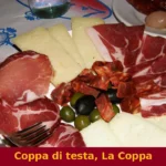
Local cuisine and regional products
The table in Bomba follows the agro-pastoral tradition of the Chieti hills. Sagne a pezze — fresh pasta cut into irregular rectangles and dressed with lamb ragù or with tomato and basil — is the most common first course in the trattorias of the area. The local pecorino, made from the milk of flocks grazing on the surrounding hillsides, is eaten fresh or aged. Among the meat dishes, pallotte cacio e ova (cheese and egg fritters, fried and then cooked in tomato sauce) appear regularly on menus.
The territory falls within the production zone of “Colline Teatine” DOP extra virgin olive oil, obtained predominantly from the Gentile di Chieti cultivar. The proximity to the Sangro valley also brings Montepulciano d’Abruzzo DOC to the table, with vineyards planted at hill elevations between 200 and 500 metres. For up-to-date information on producers and retail outlets, the official website of the Municipality periodically publishes useful details.
When to visit Bomba: the best time of year
The patron saint festival of Saint Donatus of Arezzo, on 7 August, is the main event of the year: a procession through the streets of the old town, market stalls and fireworks draw back emigrants returning for the summer. The lake is accessible from April to October, with peak water sports and swimming activity in June, July and August, when daytime temperatures range between 28 and 33 degrees.
Spring — particularly April and May — offers ideal conditions for hiking: temperatures between 15 and 22 degrees, broom flowers blooming on the slopes and low visitor numbers. Autumn, with the olive harvest between October and November, holds a different appeal, more closely tied to agricultural work and the colours of the hill landscape. Winter is the quietest period: minimum temperatures often drop below zero, but clear days provide excellent visibility of the snow-covered Maiella. Further details about the area can be found on the Touring Club Italiano platform.
Other villages to discover in Abruzzo
Anyone visiting Bomba is well placed to explore other centres in the region. Heading inland towards the Marsica, Aielli has earned an international reputation for its urban art project: dozens of murals by Italian and foreign artists cover the façades of the old town, turning a small municipality in the L’Aquila province into an open-air gallery. The initiative, launched in 2017, reversed the depopulation trend and brought new flows of visitors.
Closer to Bomba, about fifteen kilometres along the Sangro valley, lies Archi, a hilltop settlement with a medieval bridge over the river and a parish church that preserves sixteenth-century architectural elements. The short distance between the two villages makes them easy to combine in a single day, following the provincial roads that cut across the hills of the province of Chieti.
Frequently asked questions about Bomba
What is the best time to visit Bomba?
Spring (April–May) is ideal for hiking, with temperatures between 15 and 22 °C, blooming broom on the hillsides and very few crowds. Summer peaks in June–August when Lake Bomba is fully active for water sports and swimming, with daytime temperatures reaching 28–33 °C. The feast of Saint Donatus of Arezzo on 7 August is the highlight of the year, drawing returning emigrants with a procession, market stalls and fireworks. Autumn suits olive-harvest enthusiasts, while winter offers crisp clear views of the snow-covered Maiella massif.
What are the historical origins of Bomba?
Bomba appears by name in the Catalogus Baronum compiled around 1150 under Roger II of Sicily, making its Norman-period documentation among the earliest in the Sangro valley. The etymology is disputed: one hypothesis links it to the Latin bombus, evoking the sound of the river below; another suggests a pre-Roman topographic root. In the fifteenth century the fief passed to the Caldora lords, then to the d'Avalos family. The village suffered severe damage during World War II, lying directly on the German Gustav Line, and was evacuated between October and November 1943.
What to see in Bomba? Main monuments and landmarks
The five main attractions are: Lake Bomba (7.4 km², equipped for fishing, kayaking and windsurfing, accessible April–October); the Church of Santa Maria del Popolo, housing sacred furnishings linked to Saint Donatus of Arezzo; the medieval old town with surviving sections of curtain wall and two identifiable access gates; the sixteenth-century Baronial Palace of the d'Avalos at the highest point of the ridge; and a six-kilometre lakeside nature trail through riparian woodland, popular with birdwatchers. No admission fees are documented for the outdoor sites; church visiting hours are not officially published.
What are the main natural or scenic attractions of Bomba?
Lake Bomba is the dominant natural feature, covering approximately 7.4 square kilometres in the Sangro valley. Its shores host a pedestrian and cycling path with picnic areas and equipped fishing spots for carp, tench, pike and perch. A six-kilometre nature trail descends from the village through willows, poplars and alders to the lakeside, rated easy and suitable for families. The lake attracts grey herons, cormorants and, in winter, grebes. From the upper village, clear days reveal panoramic views stretching to the Maiella massif to the west and the Adriatic coast some thirty kilometres to the east.
Where to take the best photos in Bomba?
The upper part of the old town, near the Baronial Palace at the ridge's highest point, offers the most expansive views: on clear days you can frame the Maiella massif to the west and glimpse the Adriatic horizon to the east. The lake shoreline at dawn or dusk provides strong reflections and frequent sightings of herons and cormorants. The narrow herringbone lanes of the historic centre, lined with restored stone houses, are well-suited to architectural shots, particularly in the soft morning light of spring and autumn.
Are there museums, churches or historic buildings to visit in Bomba?
The Church of Santa Maria del Popolo is the main religious building, rebuilt after wartime destruction but retaining earlier elements on its façade; it houses processional statues and sacred furnishings tied to the cult of Saint Donatus of Arezzo. The Baronial Palace, of sixteenth-century d'Avalos origin, stands at the village's highest point and preserves original squared limestone masonry on its base and ground-floor openings. Sections of the medieval defensive walls, including at least two gate positions, remain legible within the street layout of the historic centre. No official museum is currently documented in the village.
What can you do in Bomba? Activities and experiences
Lake Bomba supports sport fishing (carp, tench, pike, perch), kayaking, windsurfing and swimming from April to October, with peak activity in summer. A pedestrian and cycling path runs along part of the lake perimeter, linking several picnic areas. The six-kilometre lakeside nature trail is suitable for easy family walks and birdwatching, with grey herons and cormorants present year-round and grebes appearing in winter. The old town is compact enough for a self-guided walking tour taking in the church, palace and wall remnants. The 7 August patron saint festival adds a lively cultural dimension in summer.
Who is Bomba suitable for? Families, couples, hikers, solo travellers?
Bomba suits a broad range of visitors. Families with children benefit from the easy lakeside nature trail, the calm waters for swimming and supervised fishing areas. Outdoor enthusiasts and birdwatchers find value in the lake's wildlife and the spring hiking conditions on the surrounding hills. Couples and cultural travellers will appreciate the quiet medieval old town, the Maiella panoramas and the authentic agro-pastoral food scene. It is less suited to visitors seeking nightlife or large-scale tourist infrastructure. The village combines well with a wider Sangro valley itinerary, making it a good base for slow, independent travel.
What to eat in Bomba? Local products and specialties
The local table follows the agro-pastoral tradition of the Chieti hills. Sagne a pezze — fresh pasta cut into irregular rectangles — is served with lamb ragù or tomato and basil. Pallotte cacio e ova, cheese-and-egg fritters simmered in tomato sauce, appear regularly on menus. Local pecorino is available fresh or aged from flocks grazing the surrounding hillsides. Bomba falls within the Colline Teatine DOP extra virgin olive oil zone, produced mainly from the Gentile di Chieti cultivar, and is close to vineyards yielding Montepulciano d'Abruzzo DOC at hill elevations between 200 and 500 metres.
📷 Photo Gallery — Bomba
Nearby Villages near Bomba


In Abruzzo More villages to discover
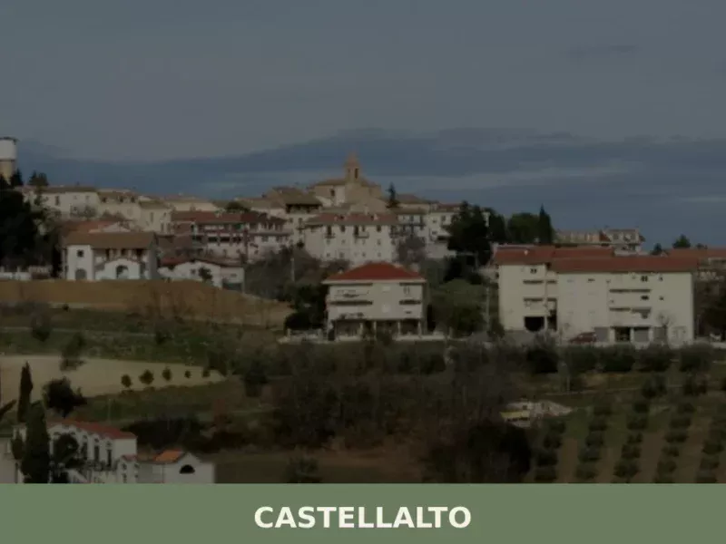
Castellalto
Scopri cosa vedere a Castellalto: borghi medievali, panorami mozzafiato e tesori nascosti dell'Abruzzo. La guida completa alle 5 tappe imperdibili!
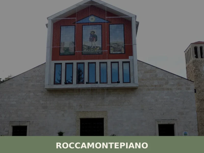
Roccamontepiano
What to see in Roccamontepiano, Abruzzo, Italy: explore a hilltop village at 450 m with a 1765 landslide history. Discover the Saint Roch festival and more.
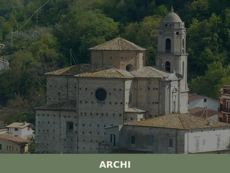
Archi
Archi sits at 492 metres above sea level in the province of Chieti, a settlement of just under 2,000 inhabitants occupying a ridge above the Sangro river valley in southern Abruzzo. The village’s position — commanding views across a landscape that drops sharply toward the river below — has defined its strategic importance since the […]
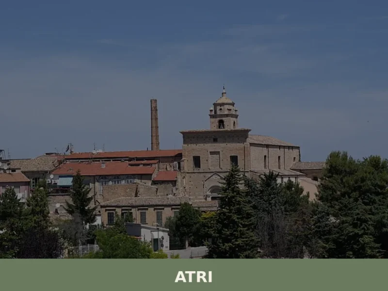
Atri
Atri, in the province of Teramo, stands at 442 meters above sea level, an altitude that allows the city to overlook the Teramo hills. Its origins lie in ancient Hatria, a Picene settlement and later an important Roman municipality, known for minting its own coins as early as the 3rd century BC. This historical richness […]
Filetto
Filetto, a settlement of 854 inhabitants, is located at 403 meters above sea level in the heart of the province of Chieti. This settlement, documented in historical sources dating its presence back to the medieval era, extends across a hill overlooking the Foro Valley. Its urban layout reflects the layering of different periods, with buildings […]
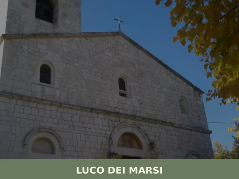
Luco dei Marsi
At 680 metres above sea level, on the eastern edge of what until 1875 was the surface of Lake Fucino — the largest lake in peninsular Italy, drained by Prince Alessandro Torlonia — stands Luco dei Marsi, a municipality of 5,857 inhabitants in the province of L’Aquila. The plain that today stretches as far as […]
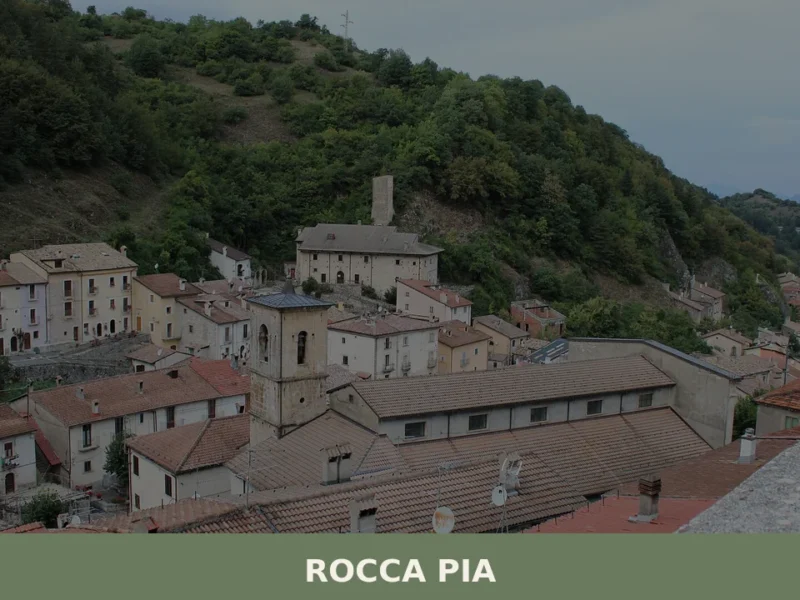
Rocca Pia
what to see in rocca pia, Italy: Explore this Abruzzo comune near L'Aquila. Discover its territory extending to the Cinquemiglia Plain. Read our guide.
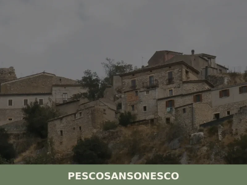
Pescosansonesco
What to see in Pescosansonesco, Italy? Discover this village at 610 m altitude, exploring its ancient ruins and a renowned sanctuary. Read our guide.
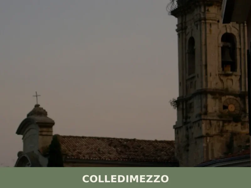
Colledimezzo
Colledimezzo has 440 inhabitants and extends along a hillside ridge at 425 metres above sea level, in the province of Chieti, overlooking the Sangro river valley and the artificial lake of Bomba. Anyone looking for what to see in Colledimezzo will find a settlement whose urban layout preserves the concentric plan of the fortified medieval […]

San Benedetto in Perillis
What to see in San Benedetto in Perillis, Abruzzo, Italy: 2 churches, a medieval monastery used in a 1985 film. Population 120. Discover top attractions and how to get there.


🏡 Know Bomba better than we do?
If you’re a local or have been there, your knowledge matters: add what’s missing or fix a detail on this page.