
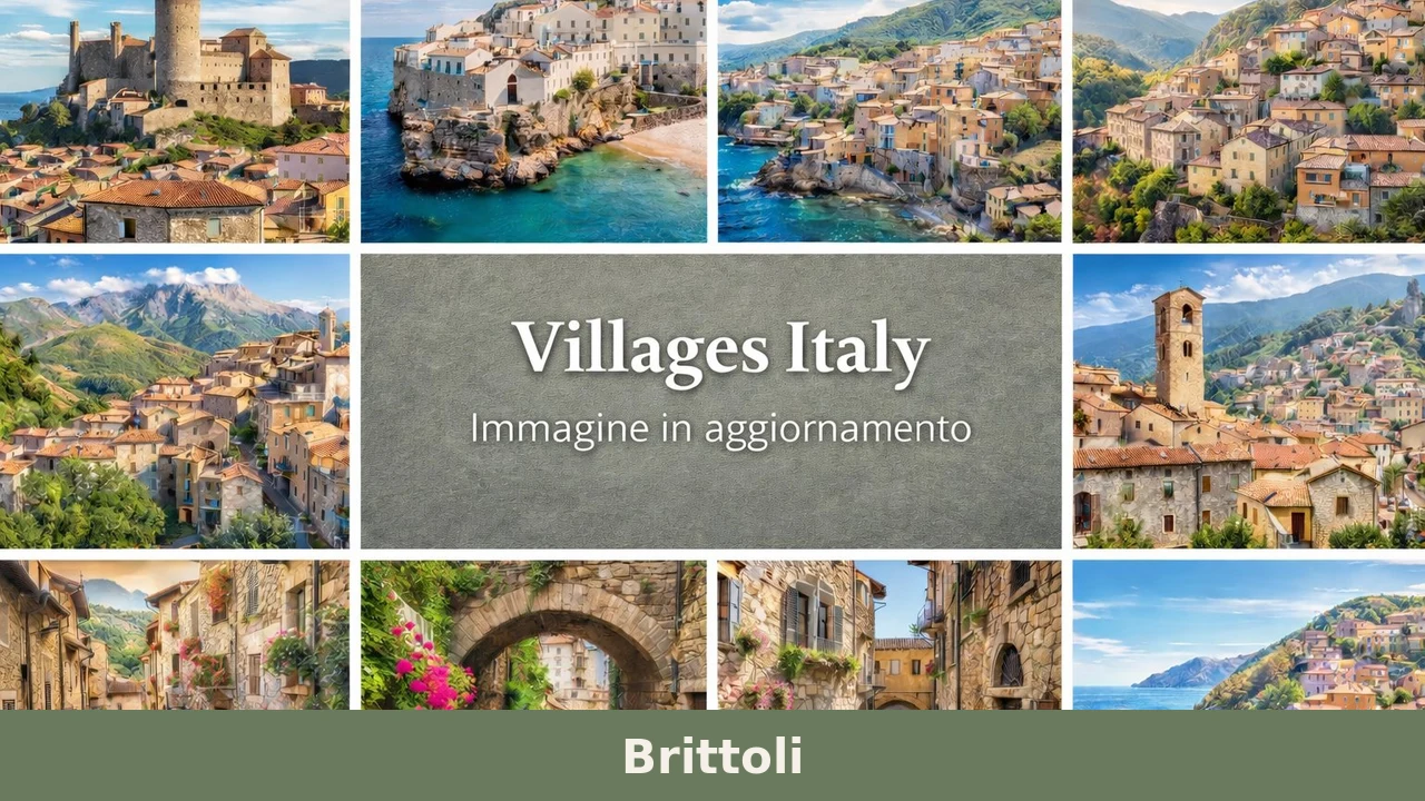
Brittoli
Brittoli has 258 inhabitants today — fewer than it takes to fill a regional railway carriage. Yet this small settlement at 779 metres above sea level, in the western part of the province of Pescara, retains a building fabric that dates in part to the 12th century and a strategic position on the ridge separating […]
Discover Brittoli
Brittoli has 258 inhabitants today — fewer than it takes to fill a regional railway carriage. Yet this small settlement at 779 metres above sea level, in the western part of the province of Pescara, retains a building fabric that dates in part to the 12th century and a strategic position on the ridge separating the Pescara valley from the Tirino valley. Understanding what to see in Brittoli means engaging with a harsh mountain landscape, a church dedicated to snow, and a demographic silence that has preserved, by subtraction, what elsewhere has been demolished or transformed beyond recognition.
History and origins of Brittoli
The place name “Brittoli” appears in medieval documents in the form Brictulum, probably derived from the Latin brictus or from a pre-Roman root linked to the rocky terrain. The village features in the records of the monastery of San Clemente a Casauria, the Benedictine abbey that between the 9th and 12th centuries controlled much of the Abruzzo foothill territory. Dependence on monastic power shaped the land organisation of the area: fields sown with wheat and high-altitude pastures, with a subsistence economy that remained virtually unchanged until the post-World War II period.
During the Norman-Swabian period, Brittoli fell within the feudal system of the Contado di Penne. It then passed to various baronial families during the Angevin and Aragonese eras, following the same trajectory as many inland centres in the Pescara area. The Catalogus Baronum, the 12th-century Norman feudal register, documents the presence of a small fief in this area. Twentieth-century emigration — first to the Americas, then to the industrial triangle of northern Italy — reduced the population from over 1,500 in the 1950s to the current 258 residents, a figure that places Brittoli among the least populated municipalities in the entire province.
This contraction had a paradoxical effect: the absence of building pressure left the historic urban fabric intact, with houses in local stone, external staircases, and carved doorways that in more dynamic centres would have been replaced by modern construction. The Municipality of Brittoli has in recent years undertaken restoration work in the historic centre, compatible with the conservation of the original layout.
What to see in Brittoli: churches, architecture and landscape
1. Church of Our Lady of the Snow
The parish church is dedicated to the village’s patron saint, Our Lady of the Snow, whose feast day is celebrated on 5 August according to the liturgical calendar. The building has a plain stone façade and a single-nave interior. The dedication to the Madonna della Neve is common in Apennine mountain settlements and signals the importance of the seasonal cycle in community life.
2. Medieval historic centre
The old core extends along a ridge with a compact urban layout, designed for defence and to withstand winter winds. The houses, built from local limestone, feature carved lintels and external masonry staircases. Some doorways bear dates carved between the 16th and 18th centuries, documenting successive phases of reconstruction after the earthquakes that have periodically struck the area.
3. Historic fountains
As in many Apennine villages, public fountains were the centre of daily life. Brittoli preserves several stone fountains that served both the population and working animals. Their position, on the edges of the inhabited core, indicates the historic access routes to the village and the stopping points along the minor transhumance routes.
4. Trails towards Monte Picca
From the village, hiking trails climb towards the higher elevations of the Gran Sasso massif, in the direction of Monte Picca. The paths pass through beech woods and clearings used for sheep grazing. The starting altitude — 779 metres — allows hikers to reach mid-mountain environments without extreme elevation gain, with views of the Majella to the south and the Gran Sasso to the north-west.
5. Terraced agricultural landscape
Around the village, agricultural terraces built with dry-stone walls are still visible, historically used for growing cereals, legumes, and vegetables. These structures, now partly abandoned, document a mountain production system that required an enormous amount of manual labour to wrest cultivable surfaces from the slope. Some sections are still visible along the paths leading out of the village centre.
Food and local produce
The cuisine of Brittoli reflects a mountain agro-pastoral economy: dishes based on legumes, handmade pasta, and sheep meat. Sagne e fagioli — irregular strips of water-and-flour pasta cooked with borlotti beans, garlic, extra virgin olive oil, and chilli pepper — are a common first course in the Pescara hinterland. The arrosticino, a skewer of diced sheep meat grilled over charcoal, remains the gastronomic reference point of the region, present also at the festivals of small villages. Short- and medium-aged pecorino cheeses, produced by small-scale local herders, can also be found.
Extra virgin olive oil from the Pescara hills — protected by the Aprutino Pescarese DOP designation — is produced at lower altitudes than Brittoli but is available at the oil mills in the valley below. The province of Pescara is also a production area for Montepulciano d’Abruzzo, a DOC red wine that accompanies the meat dishes of the local tradition. Dining options in the village are limited to a few establishments; for a wider choice, it is necessary to head towards Penne or Farindola.
When to visit Brittoli: the best time
The feast of Our Lady of the Snow, on 5 August, is the moment of greatest activity in the village, when emigrated residents return and the temporary population far exceeds the registered one. Summer — from June to September — is the most practical period for hikes to the upper elevations and for visiting the historic centre in stable weather conditions. Summer temperatures at nearly 800 metres above sea level are markedly lower than on the coast: highs rarely exceed 28–30 degrees, with cool nights.
Winter brings frequent snow and temperatures dropping below zero. Road access can be difficult on days of heavy precipitation. Spring — April and May — brings the flowering of mountain meadows and a raking light that brings out the volumes of the stone architecture. Autumn, with the colours of the surrounding beech woods, is the preferred season for photographers and walkers, but requires attention to weather conditions, which can change rapidly above 700 metres.
How to get to Brittoli
Brittoli lies in the hinterland of the province of Pescara, approximately 40 kilometres from the provincial capital. By car, from the A25 motorway (Rome–Pescara), the most convenient exit is Bussi sul Tirino/Popoli, from where you continue on provincial roads heading south-east. From the A14 motorway (Adriatic), exit at Pescara and follow the direction for Penne-Farindola, then turn off towards the interior.
The nearest railway station is Bussi sul Tirino, on the Rome–Pescara line, approximately 20 kilometres away. From there, no direct public transport connections to Brittoli exist: you will need your own vehicle or a taxi service. Pescara’s Abruzzo Airport is approximately 50 kilometres away. The road up to the village is narrow with several hairpin bends: caution is advised in the winter months, and it is worth checking road conditions in the event of snow or ice.
What to see in Brittoli and in the nearby villages of inland Abruzzo
The Abruzzo hinterland is dotted with minor centres that share the same demographic trajectory as Brittoli — depopulation, partial abandonment, slow rediscovery — but that differ in geography and character. In the Chieti area, about an hour and a half’s drive to the south-east, Carpineto Sinello occupies a hillside position in the Sinello valley, with an agricultural landscape dominated by vineyards and olive groves that contrasts sharply with the mountain setting of Brittoli. The lower altitude and milder climate have produced a different architecture, with brick and terracotta used alongside stone.
Also in the province of Chieti, Bomba overlooks the artificial lake of the same name, created by damming the Sangro river in the 1960s. The village preserves a medieval layout and a relationship with water — the lake, sport fishing activities — that sets it apart from mountain centres like Brittoli, where rock is the dominant element. Visiting these three villages in sequence means crossing three altitude bands of Abruzzo — mountain, inland hill, river valley floor — and observing how elevation determines architecture, economy, and landscape. The Touring Club Italiano includes several of these minor centres in its guides dedicated to inland Abruzzo.
In Abruzzo More villages to discover
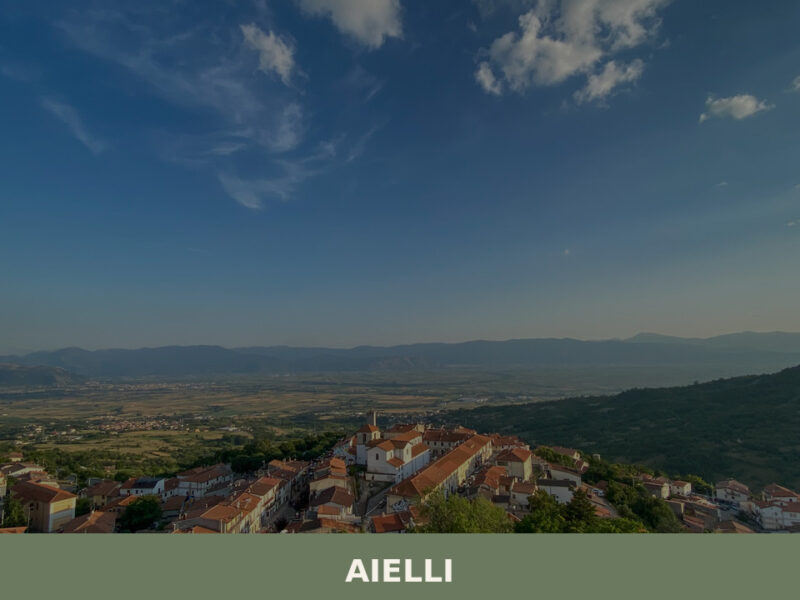
Aielli
Morning light falls across a wall of painted figures three storeys tall, their colours sharp against old stone. A narrow street turns, and another mural appears — an astronomical chart, its constellations precise enough to navigate by. Aielli sits at over 1,000 metres on the Fucino plateau in the province of L’Aquila, a village of […]
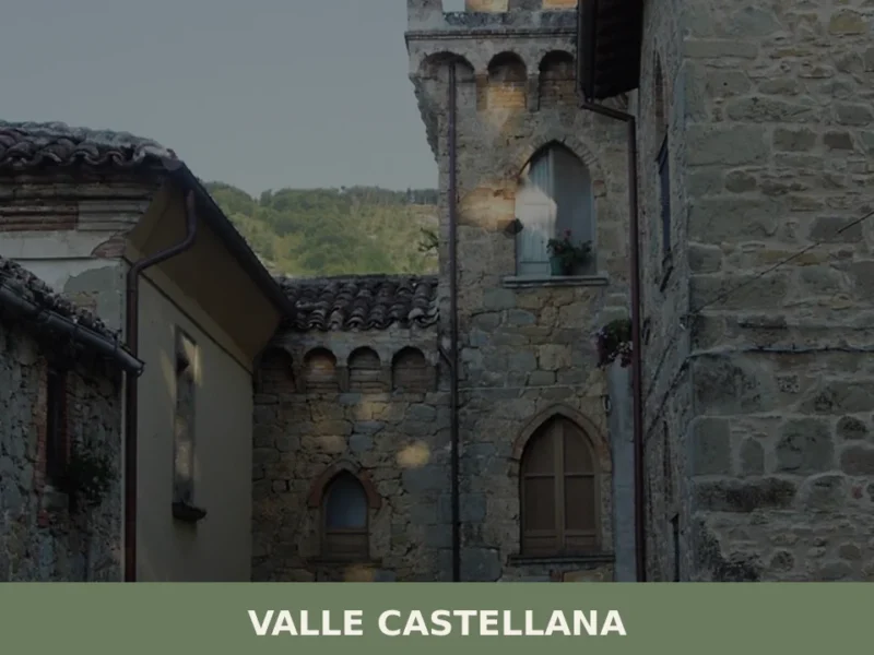
Valle Castellana
The municipality of Valle Castellana has 872 inhabitants spread across a territory fragmented into more than seventy hamlets, scattered between 300 and 1800 metres above sea level along the slopes of the Monti della Laga, in the province of Teramo. Anyone wondering what to see in Valle Castellana should be prepared for a rugged landscape, […]
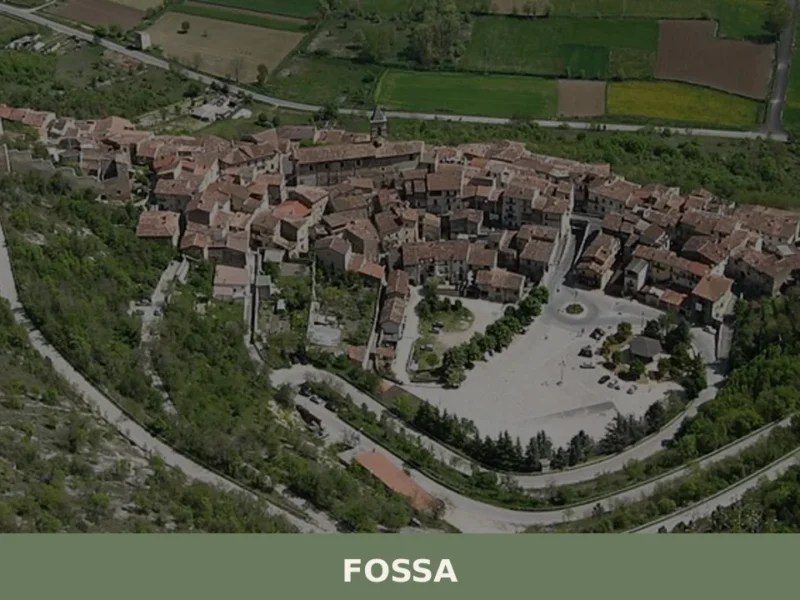
Fossa
The Vestine necropolis of Fossa, unearthed in 1992 along the state road 17, revealed over six hundred tombs dating from the 9th to the 1st century BC — a discovery that rewrote our understanding of pre-Roman central Italy. Anyone wondering what to see in Fossa will find a solid starting point here: a village of […]


📝 Incorrect information or updates?
Help us keep the Brittoli page accurate and up to date.