
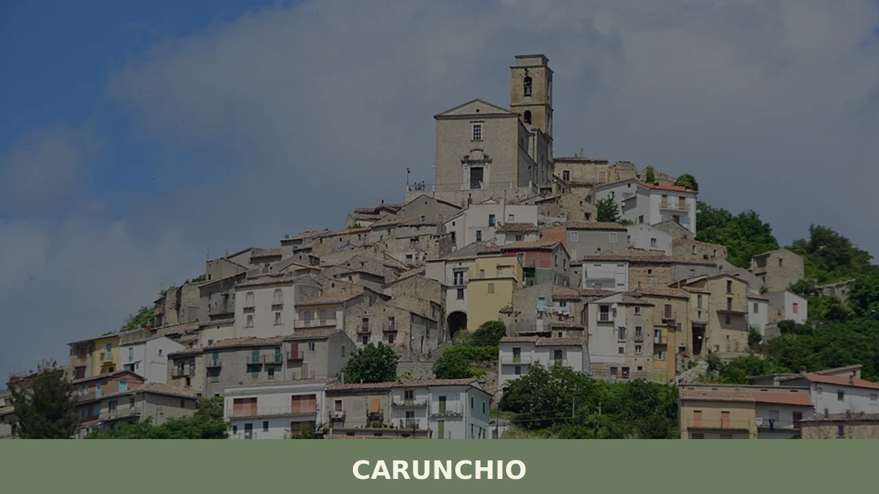
Carunchio
Carunchio is home to 565 inhabitants, spread along a ridge at 714 metres above sea level in the southern part of the province of Chieti, close to the border with Molise. The municipal territory extends between the Treste river and the Elce stream, two watercourses that have shaped the morphology of these clay hills over […]
Discover Carunchio
Carunchio is home to 565 inhabitants, spread along a ridge at 714 metres above sea level in the southern part of the province of Chieti, close to the border with Molise. The municipal territory extends between the Treste river and the Elce stream, two watercourses that have shaped the morphology of these clay hills over time. Asking what to see in Carunchio means entering a compact urban centre organised around a central square where civic and religious life have converged for centuries within the same few square metres.
History and origins of Carunchio
The place name Carunchio first appears in 12th-century documents linked to the feudal dependencies of the Vasto area. The most widely accepted etymological hypothesis traces it back to the Latin Carunclum, a possible diminutive of caro (flesh), perhaps referring to a butchering activity or to a physical characteristic of the terrain. The village fell within the orbit of the feudal system of the Kingdom of Naples, passing over the centuries through the hands of various noble families, including the d’Avalos, who controlled much of the Alto Vastese.
During the Angevin and later Aragonese periods, Carunchio was classified among the hamlets of the Contado di Molise, an administrative district that included centres now split between Abruzzo and Molise. This border position has left traces in the local language — a dialect that blends Abruzzese and Molisan features — and in the civil architecture, with narrow-plan houses in local stone rising vertically, typical of areas where buildable land was limited by the defensive perimeter.
In the 18th century the village experienced a period of relative demographic growth, documented by the enlargement of the main church and the construction of noble palazzi along the main street. The 20th century brought a steady haemorrhage instead: from nearly three thousand residents recorded in the first post-unification census, the population has dropped to the current 565 — a figure that reflects the depopulation dynamics common to the entire southern Apennine hinterland.
What to see in Carunchio: 5 main attractions
1. Church of Santa Maria delle Grazie
The main religious building in the village, located on the central square. The exposed-stone façade features a portal with a round arch. Inside, 18th-century stucco side altars and a wooden statue of Sant’Antonio Abate — the patron saint of the town, carried in procession every 17 January — are preserved. The single nave reflects the modest proportions of sacred buildings across the Alto Vastese.
2. Baronial palazzo
A civic structure of feudal origin that dominates the north side of the square. The building, reworked several times between the 17th and 18th centuries, has a carved stone portal and windows with moulded frames. Its compact bulk — walls over a metre thick — documents the original defensive function, when the palazzo served as the last point of resistance in the event of an attack.
3. The historic centre and the medieval street layout
The internal streets follow a concentric layout dating back to the expansion phase of the 13th–14th century. The covered passageways, locally called sopportici, connect the different levels of the village by exploiting the natural slope of the ridge. The houses display sandstone portals, many of which bear dates carved between the 17th and 19th centuries, useful for reconstructing the phases of building growth.
4. Monumental fountain
Positioned along the road leading into the village, the stone fountain served as a watering trough for livestock and a water supply point before the aqueduct network was built. The multi-basin structure with iron spouts is a recurring feature in the municipalities of the Alto Vastese and documents the importance of water management in a territory where natural springs run scarce in summer.
5. Trails towards the Treste and the surrounding countryside
From the eastern edge of the settlement, dirt tracks descend towards the Treste river valley, crossing land cultivated with durum wheat, olive groves, and small vineyard plots. The view to the south-west opens onto the ridgeline of the Maiella, visible on clear days. These paths, once connecting routes between villages, now serve hikers and cycling tourists exploring the municipal area.
Local cuisine and traditional products
The cuisine of Carunchio reflects the agro-pastoral economy of the Alto Vastese. The dish most deeply rooted in local tradition is pizza scima — an unleavened flatbread, kneaded with extra virgin olive oil and baked in a wood-fired oven — served alongside cured meats and cheeses. Sagne a pezze, fresh pasta cut into irregular rectangles and dressed with tomato sauce and mutton, appears regularly at Sunday lunches. Ventricina, a cured meat made from pork cut by hand at knife-point and flavoured with sweet and hot peppers, is also produced here following a technique widespread across the entire Vasto area and recognised as a traditional agri-food product of the Abruzzo region.
Extra virgin olive oil comes from indigenous cultivars — gentile di Chieti and intosso — that withstand the hilly altitudes and late frosts. Production is family-based, with olive mills operating in neighbouring municipalities. In autumn, mushrooms are gathered in the turkey oak and downy oak woods covering the less exposed slopes of the valley, while sulla honey is a common product among local farms in the area.
When to visit Carunchio: the best time
The 17th of January, the feast day of Sant’Antonio Abate, is the central date in Carunchio’s civic calendar. The celebration involves the lighting of ritual bonfires — the faugne — in the squares and along the streets of the village, following a practice widespread throughout inland Abruzzo and linked to winter purification rites. Summer brings the emigration festivals, when those who left the town for work return in August: food fairs, open-air concerts, and communal dinners mark the middle weeks of the month.
The climate is montane-hilly: harsh winters with possible snowfall between December and February, moderate summers with temperatures that rarely exceed 30 degrees. Spring — from mid-April to late May — is the most suitable period for walking the trails through the surrounding countryside, when the fields are in bloom and visibility towards the Maiella is at its best. Autumn offers mushroom season and woodland colours, but the days shorten rapidly and rain can make the dirt roads impassable.
How to get to Carunchio
By car, the reference point is the A14 Bologna–Taranto motorway: exit at Vasto Sud, then take the SS650 Trignina in the direction of Isernia for approximately 30 kilometres until the turn-off for Carunchio. From Chieti the distance is around 95 kilometres, covered in about one hour and forty minutes via the Trignina. From Pescara, allow approximately 120 kilometres with similar travel times. The nearest railway station is Vasto–San Salvo, on the Adriatic line, roughly 35 kilometres from the village: from there you will need your own transport, as bus connections are limited to a few daily services on weekdays. The closest airport is Pescara (Abruzzo Airport), approximately 130 kilometres away. Those coming from Rome (around 260 kilometres) can follow the A25 motorway to Pescara and then the A14, or take the A1 to San Vittore and head up through Isernia and the Trignina.
What to see in Carunchio and surroundings: other villages in Abruzzo
The Alto Vastese is a territory where small municipalities share common traits — depopulation, stone architecture, an economy still tied to the land — yet each retains its own distinctive elements. Anyone visiting Carunchio who wishes to extend their exploration into inland Abruzzo might consider Cagnano Amiterno, in the L’Aquila area, an urban centre set in the Amiternum basin where the Roman remains of the city of Amiternum document a historical layering spanning over two thousand years. The geographical distance is considerable — around 180 kilometres — but comparing the two places effectively illustrates the orographic and cultural variety of the region.
More distant in terms of location but similar in demographic scale is Aielli, in the Marsica, known for the urban art project that has transformed house façades into surfaces painted by contemporary artists. Where Carunchio preserves a mineral and sober appearance, Aielli has chosen to intervene on the built fabric with colour. Two different responses to the same question — how to keep a village alive when it is losing inhabitants — that are well worth observing side by side.
In Abruzzo More villages to discover
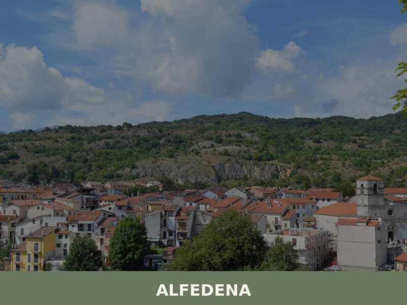
Alfedena
Morning light falls across a line of limestone rooftops, turning them the colour of raw honey. A church bell marks the hour — its sound rolls downhill, across empty streets still cool from the night, and fades into the forested slopes of the upper Sangro valley. Alfedena sits at roughly 914 metres above sea level […]
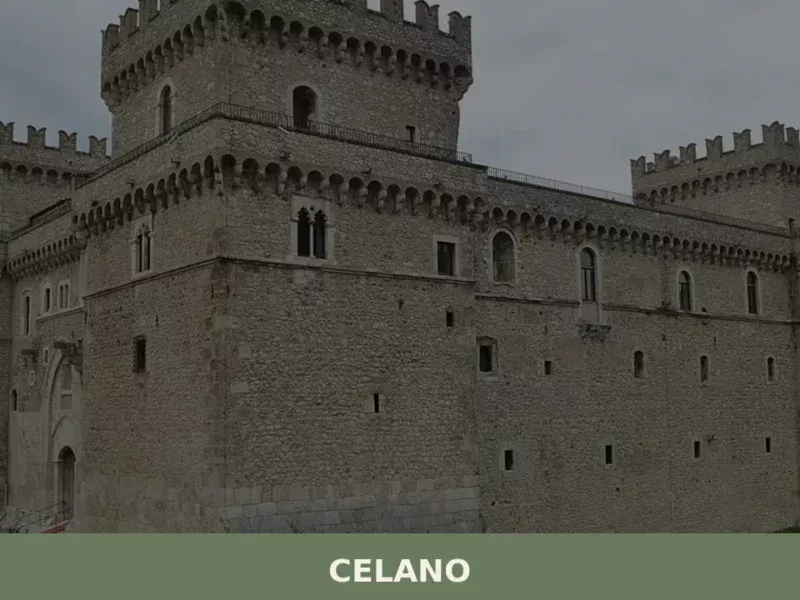
Celano
The Castello Piccolomini in Celano, with its four corner towers and curtain wall enclosing a perimeter of over one hundred metres, commands the Fucino plain from an altitude of 840 metres. Anyone wondering what to see in Celano will find an unequivocal starting point here: a fortress that has endured six centuries of history, earthquakes […]
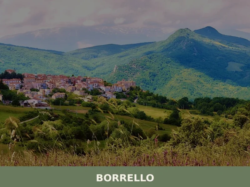
Borrello
At 804 metres above sea level, on the eastern slope of the Majella massif, 338 inhabitants watch over a settlement that in the eighteenth century counted more than two thousand residents. Anyone looking into what to see in Borrello will find a territory shaped more by geology than by human hands: the Cascate del Verde, […]


📝 Incorrect information or updates?
Help us keep the Carunchio page accurate and up to date.