
Ferrara di Monte Baldo
With its 223 registered inhabitants and an elevation of 856 metres above sea level, Ferrara di Monte Baldo is the least populated municipality in the province of Verona. Its territory extends along the western slope of Monte Baldo, the ridge that separates the Val d’Adige from Lake Garda. Understanding what to see in Ferrara di […]
Discover Ferrara di Monte Baldo
With its 223 registered inhabitants and an elevation of 856 metres above sea level, Ferrara di Monte Baldo is the least populated municipality in the province of Verona. Its territory extends along the western slope of Monte Baldo, the ridge that separates the Val d’Adige from Lake Garda. Understanding what to see in Ferrara di Monte Baldo means engaging with a vertical landscape: from beech forests to high-altitude pastures, passing through limestone hamlets where agropastoral life has left precise marks on walls, fountains, and barns. Not an outdoor exhibition, but a place that still operates according to well-defined seasonal rhythms.
History and origins of Ferrara di Monte Baldo
The place name “Ferrara” has no connection with the city in Emilia-Romagna. The most widely accepted hypothesis traces it to the Latin ferrariae, indicating the presence of ancient iron-extraction activities, consistent with the geological composition of Monte Baldo, where metalliferous mineralisations surface. The earliest documented mention of the territory dates to the Middle Ages, when the mountain communities of the Veronese area were organised into vicinie — assemblies of heads of household that regulated the collective use of pastures and woodlands. This system, common across the Veneto pre-Alpine arc, determined the scattered hamlet settlement pattern that still defines the municipality today.
Under the Republic of Venice, from the fifteenth century onward, Ferrara di Monte Baldo fell within the administrative district of the Gardesana. The Serenissima regulated the exploitation of beech forests, which were essential for charcoal production and construction timber destined for the Arsenal. After the territory became part of the Kingdom of Italy in 1866, the local economy remained tied to cattle farming and alpine dairy production, with a gradual pattern of seasonal emigration toward the plains and, in the twentieth century, toward Germany and Switzerland. The municipal offices are located in the hamlet of Ferrara, the main settlement of the municipality.
The dedication of the parish church to Saint Catherine of Alexandria, with the patron saint’s feast day on 25 November, traditionally marked the end of the alpine grazing season and the definitive return of livestock to the valley-floor stables — a religious calendar superimposed on the agricultural cycle.
What to see in Ferrara di Monte Baldo: 5 main attractions
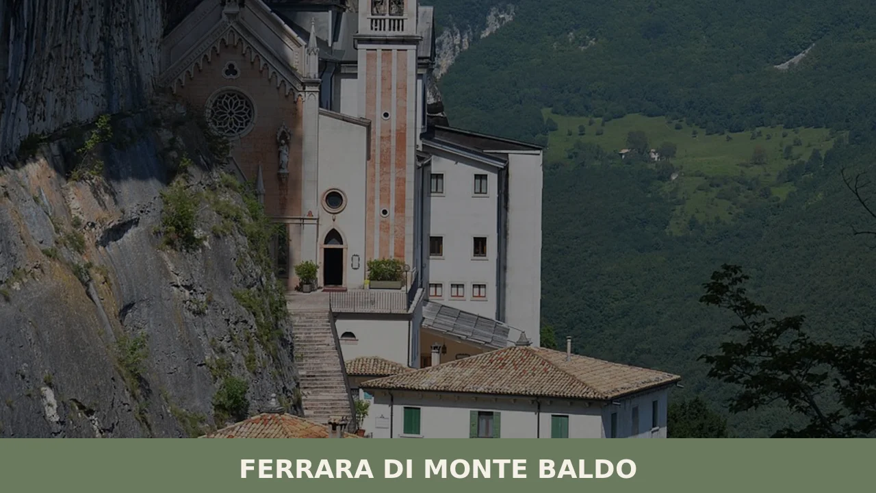
1. Parish Church of Saint Catherine of Alexandria
The current building, with its gabled façade and bell tower in local stone, preserves elements attributable to interventions carried out between the seventeenth and eighteenth centuries. The single-nave interior houses a polychrome marble high altar typical of the Veronese tradition. Its position at the centre of the hamlet of Ferrara makes it the visual focal point of the main settlement, visible from the provincial road climbing up from Spiazzi.
2. Monte Baldo Botanical Garden – Novezzina
At an elevation of 1,232 metres, in the locality of Novezzina, the Monte Baldo Botanical Garden covers approximately 10,000 square metres. Founded in 1989, it documents the flora of Monte Baldo, the mountain that Renaissance botanists — among them Francesco Calzolari in the sixteenth century — called Hortus Italiae for its concentration of endemic species. The garden is open during the summer months and contains over 500 native plant species.
3. The historic hamlets
The municipal territory does not have a single compact centre but is distributed across hamlets: Ferrara, Novezza, Buse, Carpene. Each settlement preserves rural architecture in local grey limestone, with stables on the ground floor and haylofts above. Stone fountains, fed by springs, still function as water points. This settlement pattern documents an alpine model of land management organised by altitudinal bands.
4. CAI Trail 651 and the Monte Baldo ridge
Trail 651 of the Italian Alpine Club connects Ferrara di Monte Baldo to the summit of Monte Baldo (2,218 m) via the Filadonna refuge and the summit ridges. The route passes through beech forests, high-altitude grasslands, and areas of exposed rock. In summer, the blooms of wild orchids and gentians justify the mountain’s long-standing botanical reputation. The total elevation gain from the hamlet exceeds 1,300 metres.
5. Ethnographic and rural life museum
The small local ethnographic collection documents tools of agropastoral life on Monte Baldo: gerle (back-baskets) for transporting hay, cheese moulds, and woodworking implements. It is not a museum in the conventional sense, but rather an exhibition that makes legible the daily workings of a mountain economy that until the 1960s was still largely self-sufficient.
Local cuisine and regional products
The food culture of the Veronese Monte Baldo revolves around two poles: alpine dairy production and a subsistence cuisine based on polenta, preserved vegetables, and pork. Monte Veronese DOP cheese, in its “whole milk” (fresh) and “d’allevo” (aged) versions, is the defining product of the territory. The d’allevo version, aged for more than six months, has a granular texture and a pronounced flavour — it is still produced in some active mountain dairies (malghe) on Monte Baldo during the summer months. Alongside Monte Veronese there is smoked ricotta, traditionally preserved by exposure to chimney smoke. Polenta made from Marano maize flour accompanies game and mushrooms: porcini mushrooms from the Baldo, gathered in the beech forests between August and October, are subject to municipal regulations governing quantity and harvesting periods.
Among the dishes documented in local tradition: gnòchi de malga, potato gnocchi dressed with melted butter and grated Monte Veronese; pearà, a Veronese sauce made with beef marrow, stale bread, and black pepper, served with boiled meats; and stracotto d’asino (slow-cooked donkey stew), a dish from the Veronese lowland tradition but also found in mountain variations using beef. In the outlying hamlets, preserves are made from Monte Baldo chestnuts, harvested in the chestnut groves below 900 metres. Garda DOP extra virgin olive oil, produced on the lake shores just a few kilometres to the west, is the alternative cooking fat to butter. In autumn, black truffle from the Baldo (Tuber aestivum) appears at local markets. Bardolino DOC and Valpolicella Ripasso DOC, from the nearby foothill vineyards, are the wines that accompany the local table.
When to visit Ferrara di Monte Baldo: the best time
The most practical season for a visit runs from mid-May to mid-October. In June and July the Novezzina Botanical Garden is open and the high-altitude wildflowers are at their peak. The feast of Saint Catherine of Alexandria, on 25 November, marks the end of the agropastoral calendar and brings the community together with religious services and communal gatherings, but the climate by that date is already harsh, with night-time temperatures below zero and the possibility of snow. August is the month with the highest volume of hikers on the Baldo ridge: the trails are manageable without mountaineering equipment, but require trekking boots and adequate water supplies. Autumn, between September and October, offers the colours of the beech forests and the mushroom season.
In winter, Ferrara di Monte Baldo receives snowfalls that can temporarily isolate the higher-lying hamlets. There are no ski lifts within the municipality, but cross-country skiing and snowshoeing are possible on the meadows of Novezza when snow cover is sufficient. The provincial road is kept open, but snow chains are mandatory from November to March.
How to reach Ferrara di Monte Baldo
By car, the main access is from the A22 Brenner motorway, Affi exit. From there, follow the SP8 toward Caprino Veronese and then the SP9 toward Spiazzi and Ferrara di Monte Baldo. The distance from Verona is approximately 45 kilometres, covered in about one hour. From Riva del Garda the route is approximately 40 kilometres along the eastern shore of the lake.
The nearest railway station is Rovereto (Brenner line), approximately 30 kilometres away, or Verona Porta Nuova, connected to high-speed rail services. From both stations it is necessary to continue by private vehicle or ATV bus, with services limited to peak hours. The nearest airport is Valerio Catullo in Verona-Villafranca, approximately 55 kilometres away. Bergamo-Orio al Serio airport, reachable in about one hour and forty minutes, offers a wider selection of low-cost flights. The road climbing to Ferrara is narrow and winding: vehicles longer than 7 metres encounter difficulties on the steepest sections.
What to see in Ferrara di Monte Baldo and surroundings: other villages in Veneto
Veneto has a high density of villages with very different characteristics and histories, from Dolomite mountain settings to wine-producing hills. Those visiting the Veronese Monte Baldo can put together an itinerary that connects distinct geographical environments. Cazzano di Tramigna, in the Val di Tramigna east of Verona, lies in the core production zone of Soave DOC. The landscape is hilly, planted with vineyards, and the contrast with the pastoral verticality of Ferrara di Monte Baldo effectively illustrates the variety of the Veronese territory within a radius of just a few kilometres.
For an even sharper contrast, Cortina d’Ampezzo, in the province of Belluno, represents the Dolomite side of Veneto: a community with a Ladin tradition, at over 1,200 metres of elevation, with an economy historically linked to alpine tourism and the collective management of forests through the Regole. The comparison between these two mountain realities — one marginal and nearly uninhabited, the other at the centre of international tourism — reveals a great deal about the demographic dynamics of the Italian Alpine arc. Further information on the historical and geographical profile of the municipality is available on Wikipedia, while the Touring Club Italiano includes Monte Baldo among the areas of hiking interest in Veneto.
In Veneto More villages to discover
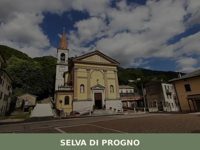
Selva di Progno
At 570 metres above sea level, where the Val d’Illasi narrows and gives way to the eastern Lessinia plateau, Selva di Progno has 923 inhabitants spread between the main settlement and the scattered hamlets on the surrounding slopes. The municipality belongs to the Comunità Montana della Lessinia and preserves in its place names and local […]
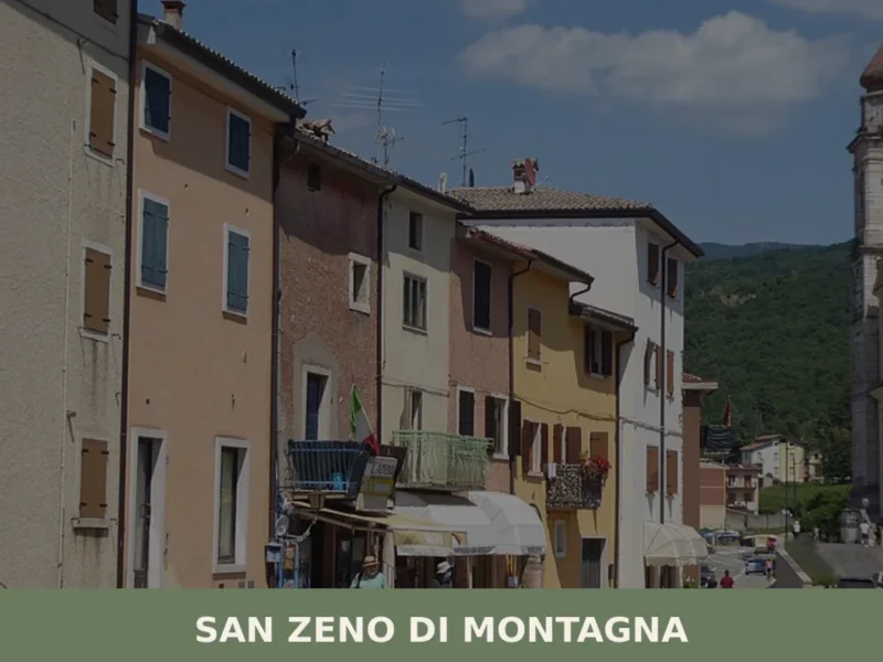
San Zeno di Montagna
At 680 metres above sea level, on the eastern slope of Monte Baldo, San Zeno di Montagna has 1,376 inhabitants spread across a constellation of contrade — Lumini, Castello, Villanova, Ca’ Montagna — each retaining its own architectural and topographic identity. The municipal territory extends from 300 to 2,200 metres in altitude, a range that […]
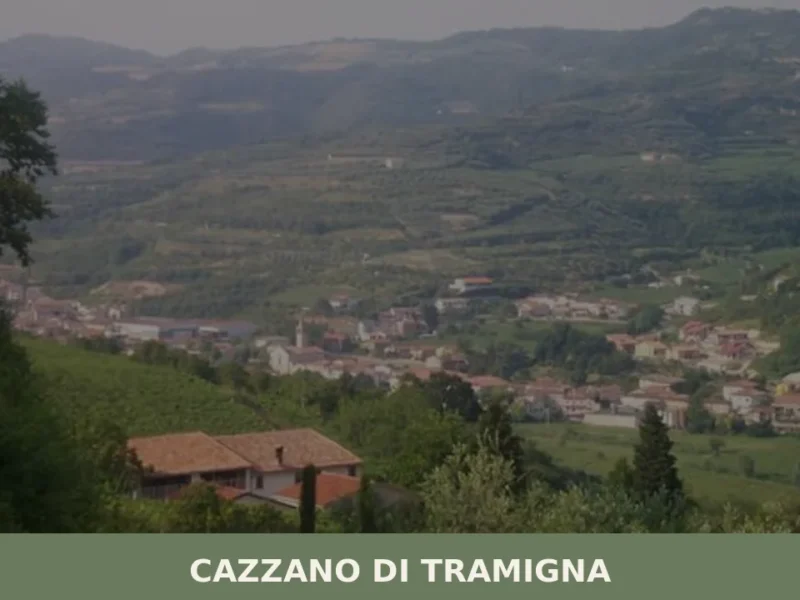
Cazzano di Tramigna
Cazzano di Tramigna has a population of 1,502 and occupies a basin at 100 metres above sea level in the Val Tramigna, a side valley that opens to the east of the Valpolicella area near Verona. The Tramigna stream — from which the village takes part of its name — crosses the municipal territory before […]


📝 Incorrect information or updates?
Help us keep the Ferrara di Monte Baldo page accurate and up to date.