


Selva di Progno
At 570 metres above sea level, where the Val d’Illasi narrows and gives way to the eastern Lessinia plateau, Selva di Progno has 923 inhabitants spread between the main settlement and the scattered hamlets on the surrounding slopes. The municipality belongs to the Comunità Montana della Lessinia and preserves in its place names and local […]
Discover Selva di Progno
At 570 metres above sea level, where the Val d’Illasi narrows and gives way to the eastern Lessinia plateau, Selva di Progno has 923 inhabitants spread between the main settlement and the scattered hamlets on the surrounding slopes. The municipality belongs to the Comunità Montana della Lessinia and preserves in its place names and local speech the traces of the German-Cimbrian colonisation that from the 13th century onwards reshaped the economy and landscape of these valleys. Asking what to see in Selva di Progno means entering a territory where the geology of the Lessini Mountains — Jurassic limestone, marine fossils, karst caves — intersects with a linguistic and cultural history that is unique in the Veneto region.
History and origins of Selva di Progno
The name “Selva” refers to the forest cover that dominated the valley floor until the Middle Ages; “Progno” derives from the dialect term for a seasonal stream — the Progno d’Illasi — that runs through the municipal territory. The first documented mention of the settlement dates to the period of Scaliger rule, when the Della Scala family governed Verona and its surrounding lands. However, the decisive transformation took place between the 12th and 13th centuries, with the arrival of German-Cimbrian-speaking communities, summoned by the Republic of Venice and the bishops of Verona to clear forests and colonise the plateaus of Lessinia.
These settlers brought with them a language — Cimbrian — a system of communal pasture management, and building techniques still recognisable today in the upper hamlets: dry-stone walls in limestone, steeply pitched roofs, and barn-haylofts integrated into the dwelling. During Venetian rule, Selva di Progno formed part of the Vicariato della Val d’Illasi. The economy revolved around charcoal production, sheep farming, and wool processing. Over the course of the 19th century, emigration towards the plains and overseas progressively reduced the population, but did not erase the Cimbrian identity: well into the 20th century, linguistics scholars documented Cimbrian speakers in the most isolated hamlets of the municipality.
During the First World War, the proximity to the front line on the Altopiano dei Fimbri and Monte Pasubio made the area a strategic rear zone. Military paths and mule tracks that are still walkable today cross the woods above the village. In the post-Second World War period, Selva di Progno followed the demographic trajectory of many mountain municipalities in Veneto: depopulation, closure of hamlet schools, and more recently an attempt at revival linked to hiking tourism and the promotion of the Cimbrian heritage.
What to see in Selva di Progno: 5 main attractions
1. Museum of the Cimbri
Housed in the municipal building, the Museum of the Cimbri documents the German-Cimbrian colonisation of Lessinia through agricultural tools, reconstructions of domestic settings, recordings of the Cimbrian language, and panels tracing the migratory routes of the settlers from southern Bavaria and Tyrol. It is the starting point for understanding the linguistic identity of the valley and the settlement system of the hamlets.
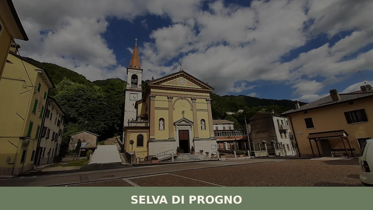
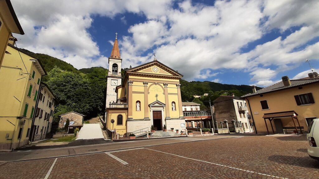
2. Parish Church of the Assumption of Mary
The church dedicated to the village’s patron saint — celebrated on 15 August — has a 19th-century façade and houses inside a polychrome marble high altar of Veronese craftsmanship. The bell tower, visible from the valley floor, serves as a topographic reference point for those travelling along the provincial road. The building was altered several times, but the original floor plan dates to the phase of settlement consolidation under the Serenissima.
3. The hamlet of Giazza
Giazza, a hamlet at a higher altitude than the main settlement, is regarded as the last Cimbrian-speaking settlement in Lessinia. Here the Municipality of Selva di Progno has promoted the restoration of buildings in local stone and the creation of ethnographic trails. The church in Giazza preserves inscriptions and furnishings that document the coexistence of the Italian, Venetian, and Cimbrian languages in local liturgy.
4. Covoli di Velo
Within the municipal territory and in the surrounding areas, karst cavities known as “covoli” open up in the rock; over the centuries they were used as pastoral shelters, storage spaces, and, during conflicts, as refuges. The Jurassic limestone geological formations of eastern Lessinia make the area of considerable interest to speleologists. Some of these caves have yielded archaeological finds dating to the Bronze Age, now held in museums in Verona.
5. European long-distance path E5 and the hiking network
The territory of Selva di Progno is crossed by a section of the European long-distance path E5, which connects Lake Constance to Verona. The trails climb from the valley floor towards the mountain dairies of eastern Lessinia, passing through pastures, beech forests, and fossil outcrops. The trail network also includes former military mule tracks from the Great War, with trenches and positions still visible in the terrain.
Food and local produce
The table in Selva di Progno reflects a mountain agro-pastoral economy. Monte Veronese DOP cheese, in its aged “d’allevo” version — made with milk from the Lessinia mountain dairies — is the defining dairy product of the area. It is joined by the “whole milk” Monte Veronese DOP, younger and softer. In the upper hamlets, “pressed cheese” is still produced according to methods handed down by Cimbrian-speaking families. Soprèssa Vicentina DOP, although originating from the neighbouring Vicenza area, can be found in the butcher shops and farmhouse restaurants of the valley. Among the dishes, “gnocchi sbatùi” — gnocchi made with flour and butter served with melted cheese — and polenta made from Marano maize, a local coarse-grained variety, accompany game and porcini mushrooms gathered in the communal woods. “Pàpare co’ le fassole” (a bean soup made with Lamon IGP beans and fresh pasta) and “bigoli co’ l’arna” (bigoli with duck ragù) appear on the menus of trattorias in the lower valley.
In summer, the active mountain dairies produce fresh ricotta and alpine butter. Black truffle from the Lessini Mountains is hunted in beech and hornbeam woods between September and December. Chestnut honey and mountain wildflower honey round out the range of local products. The patron saint’s feast day on 15 August traditionally coincides with communal banquets where roast mutton is served, accompanied by Lessini Durello DOC, a sparkling wine made from Durella grapes grown in the hillside vineyards of the lower Val d’Illasi. In the hamlets, festivals dedicated to forest products — chestnuts, mushrooms — and to dairy-making in the mountain dairies are still held in summer and autumn.
When to visit Selva di Progno: the best time
The most favourable period to reach Selva di Progno runs from May to October. In summer, daytime temperatures range between 20 and 28 degrees, and the mountain dairies are in operation: it is possible to watch cheese-making and walk the high-altitude trails without snow. On 15 August, the feast of the Assumption of Mary, the village is at its liveliest, with religious celebrations and the gathering of families who have left the municipality. In autumn, the beech forests of eastern Lessinia turn from yellow to red, and the mushroom and black truffle season draws foragers and enthusiasts. Winter, with frequent snowfall above 700 metres, limits access to some hamlets and outlying settlements, but opens up the possibility of snowshoeing along trails marked by the CAI (Italian Alpine Club). Spring, between April and May, is the time of meadow blooming and the ascent of livestock to the alpine pastures.
How to reach Selva di Progno
From Verona, approximately 40 kilometres away, take the SP10 heading north up the Val d’Illasi. The most convenient motorway exit is Verona Est on the A4 Turin–Trieste; from there, take the road to Illasi, then continue towards Tregnago and finally Selva di Progno. The journey takes around 50 minutes. The nearest railway station is Verona Porta Nuova, connected to the Milan–Venice and Verona–Brenner lines. From Verona, the ATV bus service (Azienda Trasporti Verona) covers the route to the Val d’Illasi with limited services, more frequent on weekdays. The reference airport is Valerio Catullo in Verona-Villafranca, approximately 55 kilometres away. For those coming from Vicenza, the distance is around 70 kilometres via the SP246 and the roads of eastern Lessinia. A car is the most practical means of reaching the outlying hamlets and upper settlements.
Other villages to discover in Veneto
Veneto offers a territorial variety that ranges from the alluvial plain to the Dolomites, passing through morainic hills and pre-Alpine uplands. Those interested in the lowland landscape and agricultural land reclamation can head to Concamarise, a small municipality in the lower Veronese plain where the land is marked by irrigation canals and the intensive cultivation of rice and cereals. It is a radically different context from the Lessinia mountain setting of Selva di Progno, useful for grasping the breadth of Veneto’s rural mosaic.
At the opposite end of the altimetric spectrum, Cortina d’Ampezzo represents the Dolomite face of the region: a vertical landscape, Ladin history, Alpine architecture in wood and stone, and an economy tied to winter tourism and the 2026 Olympics. The comparison between these three villages — plain, pre-Alpine hills, high mountains — conveys the geographical and cultural complexity of a regional territory that defies any simplification.
Frequently asked questions about Selva di Progno
What is the best time to visit Selva di Progno?
The ideal window is May to October. Summer brings temperatures between 20–28°C, active mountain dairies, and the patron saint's feast of the Assumption of Mary on 15 August — the village's liveliest day, with religious celebrations, family reunions, and traditional roast mutton paired with Lessini Durello DOC. Autumn (September–November) is peak season for porcini mushrooms, black truffle hunting, and the spectacular colour change of the Lessinia beech forests. Winter above 700 metres allows snowshoeing on CAI-marked trails. Spring (April–May) offers meadow blooms and the spectacle of livestock ascending to alpine pastures.
What are the historical origins of Selva di Progno?
The name combines 'Selva' (the medieval forest covering the valley) and 'Progno' (dialect for the seasonal Progno d'Illasi stream). The first documented mentions date to the Scaliger period, when the Della Scala family ruled Verona. The decisive historical turning point came in the 12th–13th centuries, when German-Cimbrian-speaking settlers — summoned by Venice and the bishops of Verona — cleared the forests and colonised the Lessinia plateau, leaving lasting traces in local place names, architecture, and language documented by linguists well into the 20th century.
What to see in Selva di Progno? Main monuments and landmarks
Five key sites stand out: the Museum of the Cimbri in the municipal building, documenting Cimbrian colonisation through tools, domestic reconstructions, and language recordings; the Parish Church of the Assumption of Mary, with a polychrome Veronese marble high altar; the hamlet of Giazza, the last Cimbrian-speaking settlement in Lessinia, with ethnographic trails and a historically significant church; the karst 'covoli' caves used as pastoral shelters since antiquity; and the European long-distance path E5, which crosses the territory linking Lake Constance to Verona via Great War mule tracks.
What are the main natural or scenic attractions of Selva di Progno?
The territory sits within the eastern Lessinia plateau at 570 metres, offering Jurassic limestone formations, karst caves ('covoli') with Bronze Age archaeological finds, beech and hornbeam forests, and high-altitude pastures. The European long-distance path E5 crosses the municipality, and CAI-marked trails connect the valley floor to mountain dairies and fossil outcrops. In winter, snowshoeing routes are available above 700 metres. The communal woods are rich in porcini mushrooms and black truffle, hunted between September and December in beech and hornbeam stands.
Where to take the best photos in Selva di Progno?
The bell tower of the Parish Church of the Assumption, visible from the valley floor, provides a classic vertical landmark against the Lessinia hillside. The upper hamlet of Giazza — with dry-stone limestone walls, steeply pitched roofs, and barn-haylofts — offers the most authentically Cimbrian architectural compositions. In autumn, the beech forests along the E5 trail and around the mountain dairies of eastern Lessinia deliver striking foliage scenery. The karst cave openings in the limestone escarpments above the village are dramatic subjects for landscape and geological photography.
Are there museums, churches or historic buildings to visit in Selva di Progno?
The Museum of the Cimbri, housed in the municipal building, is the primary cultural institution, covering agricultural tools, domestic reconstructions, language recordings, and Cimbrian migration maps. The Parish Church of the Assumption of Mary holds a polychrome Veronese marble high altar and a bell tower serving as a valley landmark; its floor plan dates to the Venetian period. In the hamlet of Giazza, the local church preserves inscriptions and furnishings in Italian, Venetian, and Cimbrian, making it a rare trilingual liturgical document. For opening hours and admission, contact the Municipality of Selva di Progno directly.
What can you do in Selva di Progno? Activities and experiences
Hiking is the primary activity: the E5 European long-distance path and CAI trails lead to mountain dairies, fossil outcrops, and Great War trenches still visible in the terrain. In summer, visits to active mountain dairies allow guests to watch Monte Veronese DOP cheese production. Autumn brings mushroom foraging and black truffle hunting in communal beech woods. Ethnographic trails in Giazza explore Cimbrian architectural and linguistic heritage. In winter, snowshoeing on marked routes is available above 700 metres. The feast of the Assumption on 15 August offers communal banquets with roast mutton and Lessini Durello DOC sparkling wine.
Who is Selva di Progno suitable for? Families, couples, hikers, solo travelers?
Selva di Progno suits hikers and trekkers of all levels, given its position on the E5 path and the extensive CAI trail network. History and ethnography enthusiasts will find the Cimbrian heritage — the Museum of the Cimbri and the hamlet of Giazza — genuinely rare in the Veneto context. Food lovers are drawn by Monte Veronese DOP dairy production and seasonal truffle and mushroom hunting. Families benefit from manageable altitudes and uncrowded natural surroundings. The village is less suited to travellers seeking beach tourism, urban nightlife, or large-scale resort facilities.
What to eat in Selva di Progno? Local products and specialties
Monte Veronese DOP is the defining cheese: the aged 'd'allevo' version from Lessinia mountain dairies and the softer 'whole milk' variety are both produced in the area. Upper hamlets still make 'pressed cheese' using Cimbrian family methods. Key dishes include 'gnocchi sbatùi' (flour and butter gnocchi with melted cheese), polenta from coarse-grained Marano maize with game or porcini, and 'pàpare co' le fassole' (Lamon IGP bean soup with fresh pasta). Seasonal black truffle, chestnut honey, and fresh ricotta from summer dairies complete the larder. Lessini Durello DOC, from Durella grapes in the lower Val d'Illasi, is the local sparkling wine pairing.
📷 Photo Gallery — Selva di Progno


Nearby Villages near Selva di Progno
In Veneto More villages to discover
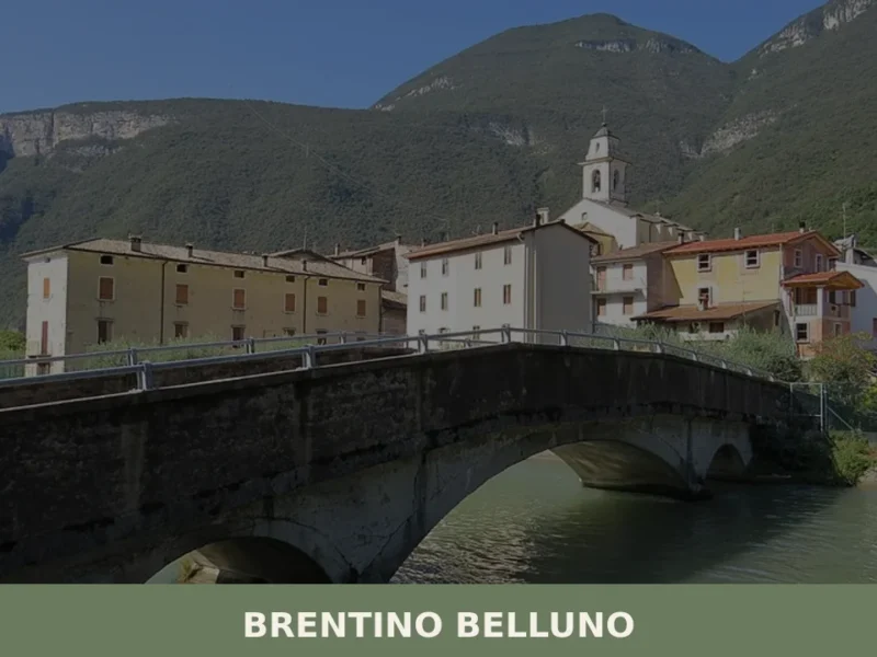
Brentino Belluno
At 137 metres above sea level, where the Adige Valley narrows between Monte Baldo and the Lessini Mountains, Brentino Belluno is a municipality of 1,363 inhabitants created in 1929 through the administrative merger of two distinct settlements: Brentino, on the left bank of the Adige, and Belluno Veronese, clinging to the eastern slope of Monte […]
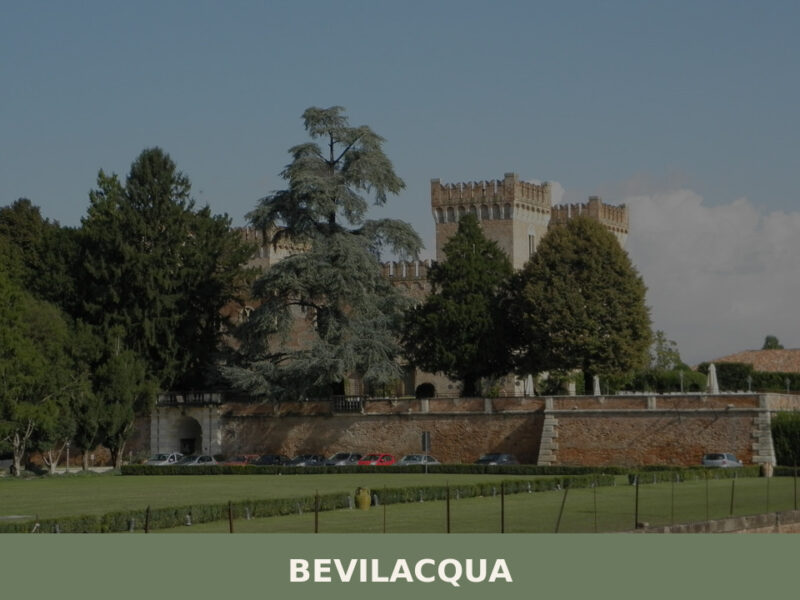
Bevilacqua
A castle rising over the Fratta River, fewer than 1,800 inhabitants, and the quiet agricultural heart of the Veronese plain. Here's what to see in Bevilacqua.
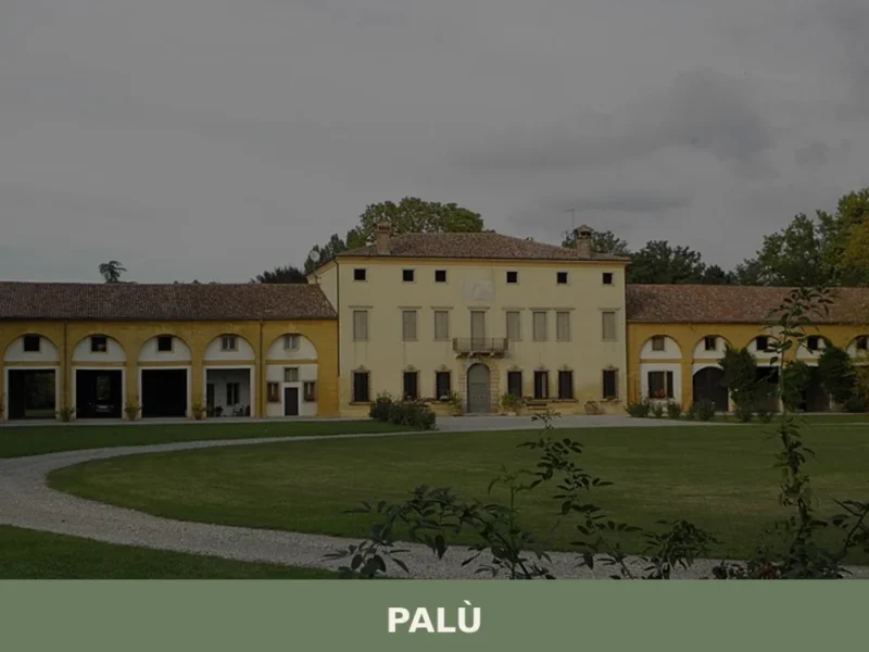
Palù
Palù has 1,266 inhabitants and occupies a stretch of the Veronese plain between the municipalities of Zevio and Ronco all’Adige, roughly fifteen kilometres south-east of the provincial capital. Its territory, covering just 8.5 square kilometres, is crossed by a network of drainage ditches and reclamation canals that still define the geometry of fields planted with […]

Loreggia
Loreggia holds 7 Venetian villas and the site of Italy's first rural credit cooperative, founded in 1883. A compact village with genuine historical depth.
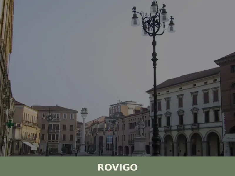
Rovigo
what to see in rovigo? Discover 5 top attractions in this city of 50,000 residents, from Rovigo Castle to La Rotonda. Explore the Polesine region.
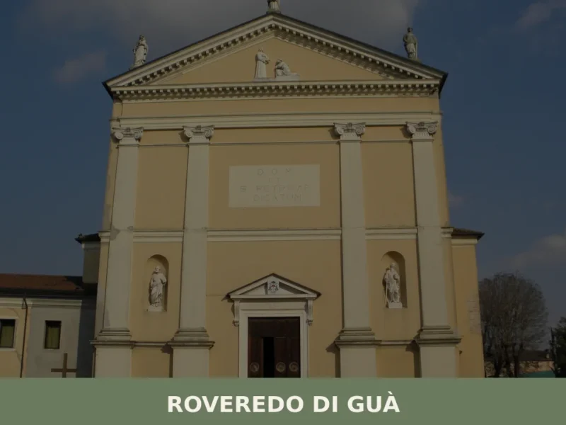
Roveredo di Guà
Roveredo di Guà has 1,542 inhabitants and covers an area of just 8 square kilometres on the lower Veronese plain, 16 metres above sea level, along the course of the Guà canal — a branch of the Adige river system that has determined the shape and economy of this territory. Understanding what to see in […]
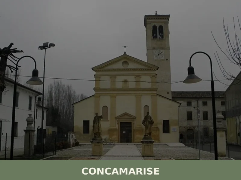
Concamarise
Concamarise, a municipality in Verona province with 1,053 inhabitants, rises only 21 meters above sea level, located in the Bassa Veronese, an area known for its long-standing agricultural tradition and complex hydrographic network. Its very name suggests a connection with water: “Conca” refers to a territorial depression, while “Marise” is likely linked to the marshy […]
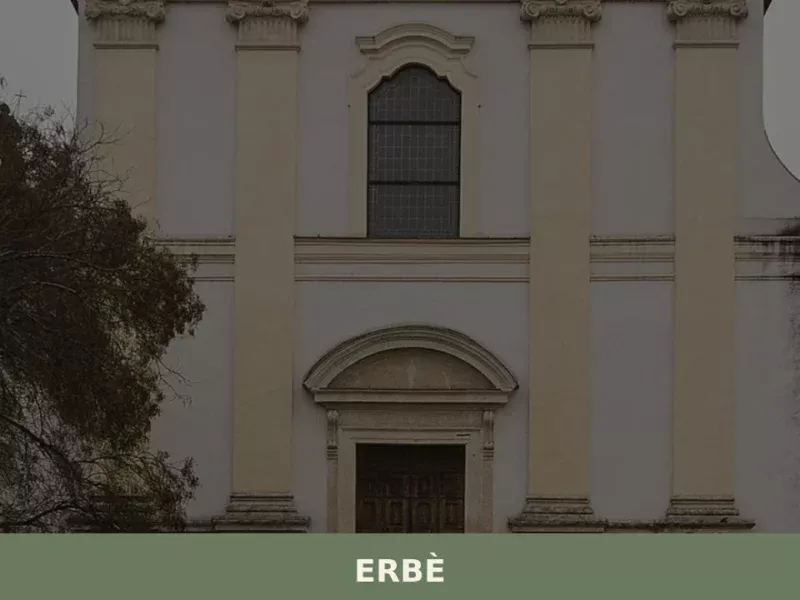
Erbè
Erbè has 1,838 inhabitants and occupies a stretch of the Veronese plain north of the Tione dei Monti river, along the road connecting Verona to Mantua. The municipal territory, almost entirely flat and crossed by a dense network of irrigation canals, was progressively reclaimed starting in the 15th century under the administration of the Republic […]
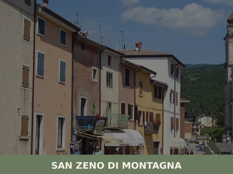
San Zeno di Montagna
At 680 metres above sea level, on the eastern slope of Monte Baldo, San Zeno di Montagna has 1,376 inhabitants spread across a constellation of contrade — Lumini, Castello, Villanova, Ca’ Montagna — each retaining its own architectural and topographic identity. The municipal territory extends from 300 to 2,200 metres in altitude, a range that […]
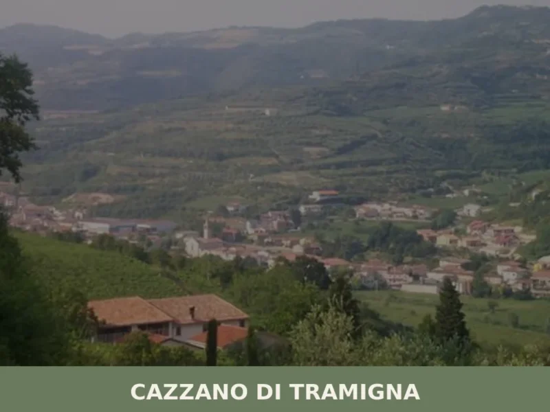
Cazzano di Tramigna
Cazzano di Tramigna has a population of 1,502 and occupies a basin at 100 metres above sea level in the Val Tramigna, a side valley that opens to the east of the Valpolicella area near Verona. The Tramigna stream — from which the village takes part of its name — crosses the municipal territory before […]


🏡 Know Selva di Progno better than we do?
If you’re a local or have been there, your knowledge matters: add what’s missing or fix a detail on this page.