
Filattiera
Filattiera first appears in written records in 884, when the name Filacteriae identified a garrison along the Via Francigena in Lunigiana. Sitting at 213 metres above sea level in the province of Massa and Carrara, this village of 2,393 inhabitants preserves prehistoric stelae, Romanesque parish churches, and a defensive layout that reflects centuries of control […]
Discover Filattiera
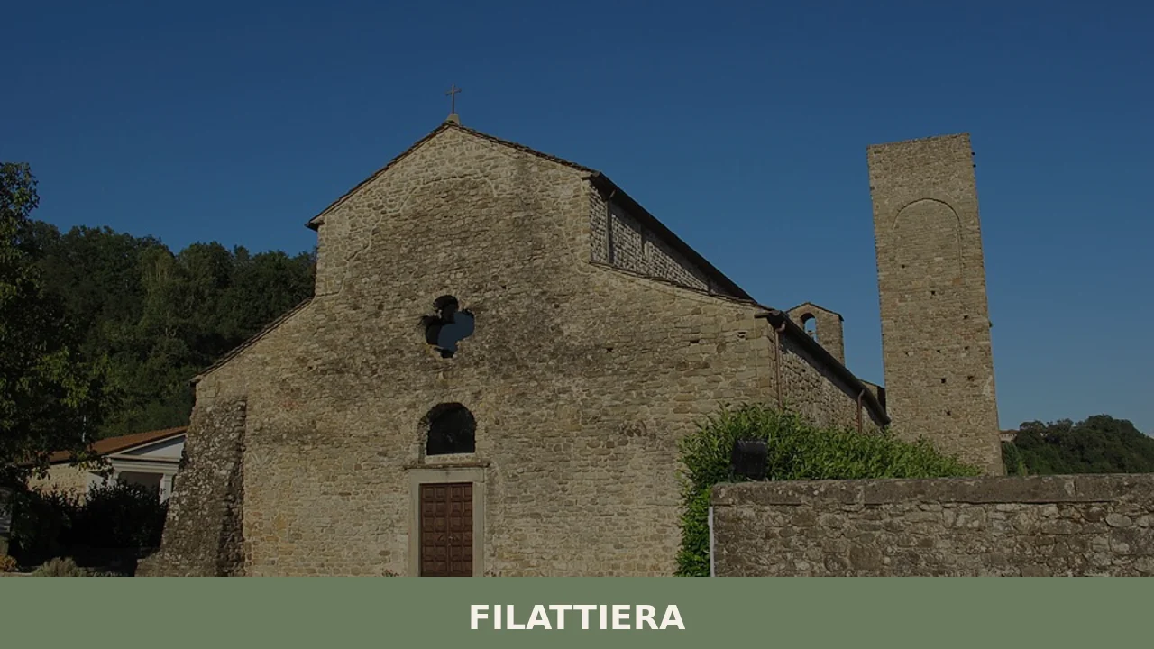
Filattiera first appears in written records in 884, when the name Filacteriae identified a garrison along the Via Francigena in Lunigiana. Sitting at 213 metres above sea level in the province of Massa and Carrara, this village of 2,393 inhabitants preserves prehistoric stelae, Romanesque parish churches, and a defensive layout that reflects centuries of control over the Apennine passes. Anyone wondering what to see in Filattiera will find a privileged vantage point over the Magra valley, where the layers of history can be read in the masonry, the building materials, and the arrangement of structures along the ridge.
History and origins of Filattiera
The etymology of the name is debated among scholars. The most widely accepted theory traces it to the Byzantine term phylakterion, meaning a guard post or military garrison. Between the 6th and 7th centuries, Lunigiana was a border zone between Lombard territories and those under the control of the Eastern Roman Empire: Filattiera would have served as a defensive outpost along the corridor linking the Po Plain to coastal Tuscany. Its position on the Via Francigena — recorded in the description of the journey made in 990 by Archbishop Sigeric of Canterbury — confirmed the settlement’s strategic role for centuries.
In the Middle Ages, Filattiera was a domain of the Malaspina, the powerful feudal family that controlled much of Lunigiana. The village passed to the Spino Secco branch of the Malaspina and retained its function as a road garrison into the modern era. The parish church of Sorano, a few kilometres downhill, documents the Christianisation of the area as early as the early Middle Ages, with architectural elements dating to the 9th–12th centuries. The discovery of several anthropomorphic stelae from the Copper and Iron Ages in the surrounding area has demonstrated that human activity in the zone dates back well before the Roman period.
The patron saint of Filattiera is Saint Stephen, celebrated on 26 December. The choice of the protomartyr as patron saint is linked to the spread of his cult along medieval pilgrimage routes, a further signal of the centrality of the Via Francigena in the village’s history.
What to see in Filattiera: 5 main attractions
1. Pieve di Sorano
A Romanesque building situated along the Via Francigena route, a short distance from the village centre. The sandstone apse and carved capitals featuring plant motifs and zoomorphic figures date to the period between the 9th and 12th centuries. Inside, early medieval sculptural fragments are preserved. The parish church is a reference point for pilgrims walking the Via Francigena southward towards Rome.
2. Malaspina Castle
The fortification dominates the village from above and dates in its current form to the 13th–14th centuries, when the Spino Secco branch of the Malaspina controlled this stretch of Lunigiana. The main tower and the remains of the curtain wall reveal the defensive logic of the settlement, designed to oversee the Magra valley floor and the passages leading to the Cisa Pass.
3. Church of San Giorgio
Located within the fortified core, this church retains a sandstone portal and traces of building phases spanning from the medieval period to the modern era. Its position inside the circuit of walls indicates that the building originally functioned as the castle chapel before becoming a place of worship for the civilian community.
4. Lunigiana Stele Statues Museum (territorial section)
Filattiera is one of the discovery sites of the Lunigiana stelae, prehistoric sandstone artefacts depicting stylised human figures, datable between the 3rd and the 1st millennium BC. Some stelae found in the Filattiera territory are displayed at the Museo delle Statue Stele Lunigianesi in Pontremoli, but the discovery context — in the countryside around the village — makes visiting the original locations a useful complement to understanding these artefacts.
5. The Via Francigena route
The section of the Via Francigena crossing the territory of Filattiera connects the Cisa Pass to Pontremoli and then continues towards Aulla. The walking route passes through cultivated fields, chestnut woods, and rural hamlets where medieval hospices and parish churches can still be identified. Trail signage is maintained by the Municipal Administration in coordination with Via Francigena associations.
Traditional cuisine and local products
The food of Filattiera is that of inland Lunigiana, rooted in chestnuts, wheat flour, and produce from the garden and the forest. The most distinctive dish of the area is testaroli, discs of batter cooked on red-hot cast iron or terracotta plates called testi, then cut into diamond shapes and dressed with Genoese pesto, extra virgin olive oil, or mushroom sauce. This is one of the oldest preparations in Italian cooking based on water and flour, already documented in the Lunigiana farming tradition. Alongside testaroli, panigacci — thin flatbreads cooked between stacked testi — and torta d’erbi, made with seasonal wild greens (chard, nettles, borage) enclosed between two very thin sheets of pastry rolled out with olive oil. Farina di castagne della Lunigiana DOP (Lunigiana chestnut flour PDO) is the most significant denomination product of the area: obtained from chestnuts dried in traditional gradili (slow-fire drying houses), it is used to prepare chestnut flour fritters, castagnaccio, and pattona, a sweet chestnut polenta.
Miele della Lunigiana DOP (Lunigiana honey PDO) — in acacia and chestnut varieties — is the other protected designation product from the territory. Among cheeses, the area produces raw-milk pecorinos from small pastoral farms. Porcini mushrooms gathered in the turkey oak and chestnut forests between Filattiera and the Apennine ridge sustain a significant seasonal trade. The Sagra del Panigaccio, organised in the hamlets of the municipality, is the most popular food event: panigacci are cooked in front of visitors on stacks of wood-heated testi. The reference wine is Colli di Luni DOC, produced in the coastal strip of Lunigiana and on the neighbouring Ligurian hills, especially in the Vermentino version.
When to visit Filattiera: the best time of year
The most favourable season runs from May to October. In spring and early summer, mild temperatures — between 15 and 25 degrees — and lush vegetation make the Via Francigena route easily walkable. Autumn, from September to November, coincides with the chestnut and mushroom harvest: this is when food festivals are concentrated and the woods around the village open to foragers. The patron saint feast of Saint Stephen, on 26 December, falls in the depths of winter, when the Magra valley is often blanketed by low fog banks that leave the village’s profile emerging above the grey layer.
In summer Filattiera sees the heaviest flow of pilgrims along the Via Francigena, especially in June and July. Those planning to walk the stretch between the Cisa Pass and Pontremoli should check trail conditions on the Municipality’s website, as autumn rains can make some unpaved sections muddy.
How to reach Filattiera
By car, Filattiera is reached from the A15 Parma–La Spezia motorway, Pontremoli exit, continuing for about 8 kilometres southward along the regional road 62 della Cisa. From Milan the distance is approximately 200 kilometres (2 hours and 30 minutes), from Florence approximately 170 kilometres (2 hours and 15 minutes), from Parma approximately 100 kilometres (1 hour and 20 minutes), and from La Spezia approximately 55 kilometres (50 minutes).
The nearest railway station is Filattiera, on the Pontremolese line (Parma–La Spezia), served by regional trains. The closest airport is Pisa-Galileo Galilei, approximately 120 kilometres away. Parma airport is an alternative for those coming from the north, at roughly 110 kilometres.
What to see in Filattiera and in nearby Lunigiana villages
Lunigiana is a territory where distances between one village and the next are measured in bends and elevation changes rather than in kilometres. Southeast of Filattiera, heading up the lateral valleys of the Magra, you reach Comano, a scattered mountain municipality at about 550 metres of altitude. Here the rural stone architecture and the hamlet clusters dispersed among the woods document a settlement pattern different from Filattiera’s, less tied to the Via Francigena and more oriented towards pastoral and forestry economies.
To the west, towards the Apuan Alps, Casola in Lunigiana occupies a hinge position between the river-valley Lunigiana and the Apuan highlands. The village is known for the production of marocca di Casola, a bread made from chestnut flour, potatoes, and a small amount of wheat flour, recognised as a Slow Food Presidium. Combining a visit to Filattiera with Comano and Casola means crossing three different micro-environments — the valley floor, the inner mountains, and the Apuan slope — within a radius of about thirty kilometres.
In Tuscany More villages to discover
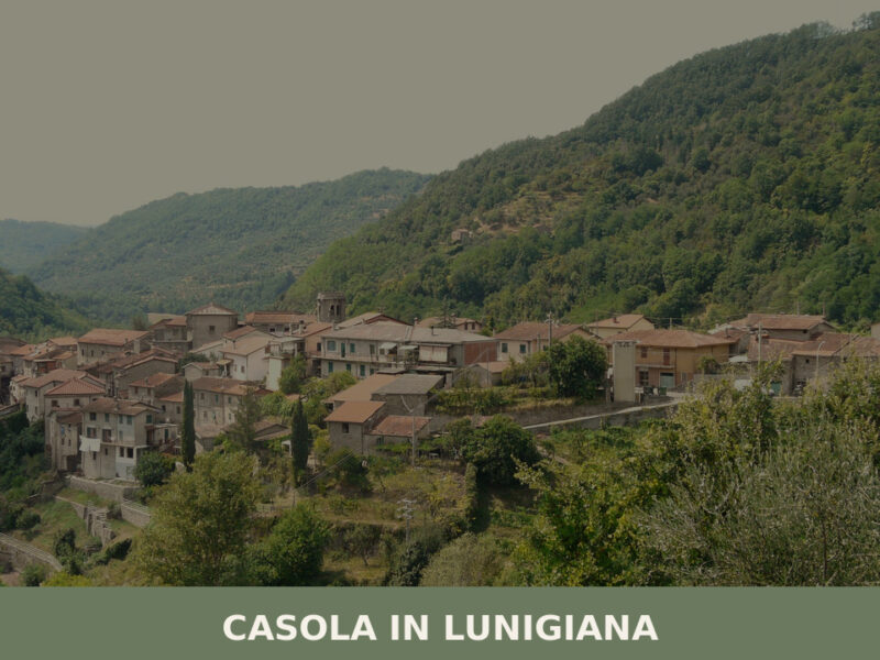
Casola in Lunigiana
Morning fog lifts slowly from the Aulella valley, revealing stone walls the colour of dried clay and a bell tower that has marked the hours here for centuries. The air carries woodsmoke and the faint mineral scent of chestnut groves climbing the surrounding slopes. With roughly one thousand inhabitants, Casola in Lunigiana remains one of […]
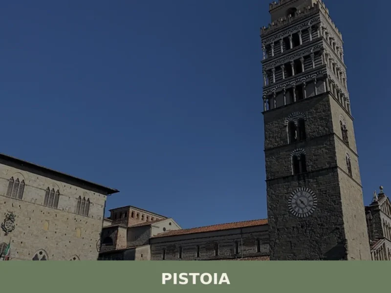
Pistoia
Discover Pistoia, a charming village in Tuscany, Italy. Explore its rich history, stunning architecture, and authentic Italian culture off the beaten path.
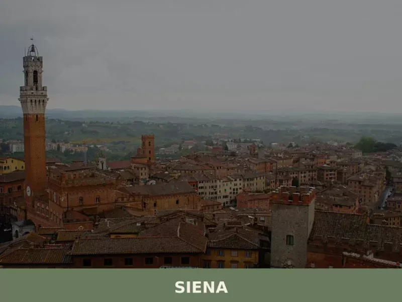
Siena
What to see in Siena: UNESCO centre at 322 m, population 52,883. Explore Piazza del Campo, the Cathedral, the Palio, and local foods like panforte and pici. Plan your visit.


📝 Incorrect information or updates?
Help us keep the Filattiera page accurate and up to date.