
Campoformido
On 17 October 1797, in a country villa on the Friulian plain, plenipotentiaries representing Napoleon Bonaparte and the Austrian Empire signed the treaty that redrew the political map of Europe, erasing the Republic of Venice after more than a millennium of existence. That document bears the name of this place: Campoformido, a municipality of 7,799 […]
Discover Campoformido
On 17 October 1797, in a country villa on the Friulian plain, plenipotentiaries representing Napoleon Bonaparte and the Austrian Empire signed the treaty that redrew the political map of Europe, erasing the Republic of Venice after more than a millennium of existence. That document bears the name of this place: Campoformido, a municipality of 7,799 inhabitants just a few kilometres from Udine, standing 79 metres above sea level. Anyone wondering what to see in Campoformido will find a territory where the grand narrative of European diplomacy has left concrete traces — buildings, plaques, documents — alongside an agricultural daily life that has continued through the centuries without fanfare, marked by the rhythm of the seasons and the cultivation of the plain.
History and origins of Campoformido
The place name “Campoformido” has sparked debate among scholars. The oldest attested Latin form in documents is Campus Formidi, recorded in medieval notarial deeds. The prevailing interpretation traces the name to campus formidolosus, meaning “field of fear,” perhaps referring to a border area or a site of clashes, or possibly a place of executions. Another, less widely accepted hypothesis links it to campus frumenti, the field of wheat, in connection with the area’s cereal-growing vocation. The Gallicised form “Campoformio,” by which the treaty is known in international history textbooks, derives from the transcription adopted by Napoleonic diplomacy, which simplified the original name. The municipality officially retains the form ending in -ido, as attested in administrative records and in its municipal charter. The earliest documented mention of the territory dates to the patriarchal period: the area fell under the jurisdiction of the Patriarchate of Aquileia, which governed large portions of Friuli for centuries.
The event that launched Campoformido onto the world stage was the signing of the Treaty of Campoformido on 17 October 1797. Following his victorious Italian campaign, Napoleon Bonaparte sent General Louis-Alexandre Berthier and diplomat Antoine François de Bourienne to negotiate with Count Ludwig von Cobenzl, representative of Emperor Francis II of Habsburg. The treaty, signed in the villa belonging to the Manin family — descendants of the last Doge of Venice, Ludovico Manin — formalised the cession to Austria of the territories of the Serenissima, including Istria and Dalmatia, in exchange for French recognition of Austrian Belgium and the creation of the Cisalpine Republic. For Friuli, the treaty marked the definitive shift from the Venetian sphere to the Habsburg one, inaugurating an era of Austrian administration that lasted — interrupted by the Napoleonic Kingdom of Italy (1805–1814) — until 1866, when the region was annexed to the Kingdom of Italy after the Third War of Independence.
In the twentieth century, Campoformido also gained importance in the field of military aviation. In 1913 an airfield was established that during the First World War served as an operational base for Italian squadrons engaged on the Isonzo front. Among those who flew from this airport was Francesco Baracca, Italy’s leading flying ace with 34 confirmed aerial victories, who was stationed here at various points during the conflict. During the Second World War, the base was used by Italian forces and, after 8 September 1943, by the German Luftwaffe. In the post-war period the airport area was progressively scaled down, but the memory of its aviation heritage has remained part of local identity. Today Campoformido is a residential and agricultural municipality in the Udine belt, connected to the provincial capital by an efficient road network, with an economy that balances commuting to Udine with farming activities linked to viticulture and the cultivation of cereals and vegetables.
What to see in Campoformido: 5 key attractions
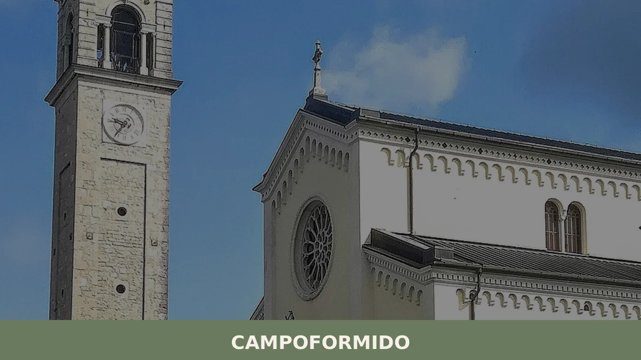
1. Villa Manin di Campoformido
This should not be confused with the far more famous Villa Manin di Passariano, located in the municipality of Codroipo. The villa in Campoformido, where the 1797 treaty was actually signed, is a more modest building that belonged to a junior branch of the Manin family. The structure retains eighteenth-century architectural elements, with a plastered façade and a round-arched entrance portal. Over the centuries it has undergone alterations and changes of ownership. A commemorative plaque on the façade recalls the historic event. The building is privately owned, but viewing it from the outside is the essential starting point for anyone wishing to grasp the historical significance of this place.
2. Parish Church of Santa Maria della Purificazione
Dedicated to the patron saint of the municipality, Santa Maria della Purificazione — whose feast day is celebrated on 2 February, Candlemas — the parish church stands in the centre of the main settlement. The present building is the result of successive interventions between the eighteenth and nineteenth centuries, with a single-nave plan and a neoclassical façade. Inside, it preserves a high altar in polychrome marble and several paintings from the Friulian school. The bell tower, visible from various points across the surrounding plain, serves as the vertical landmark of the village. The church is open for worship and accessible during liturgical services and daytime hours according to schedules posted on site.
3. War Memorial and commemorative plaques
In Campoformido’s main square stands the war memorial dedicated to those who fell in both world wars, a work that reflects the commemorative language of early twentieth-century Italy. Alongside it, various plaques distributed throughout the urban fabric recall not only the victims of the conflicts but also events connected to the Resistance and the presence of the military air base. A careful walk through the streets of the centre allows visitors to read these inscriptions as an open-air chronology: from references to the Great War to the memory of the partisan struggle in Friuli, through to the pilots who operated from the local airfield.
4. The former military airfield site
The footprint of the historic airfield, active since 1913, extends south of the built-up area. Although much of the site has been converted to civilian and agricultural use, traces of the airport infrastructure remain: several hangars, stretches of runway and service buildings in varying states of preservation. For aviation history enthusiasts, this location holds considerable documentary value: it was from here that Spad and Nieuport biplanes took off during the First World War, and here that pilots trained who would go on to write decisive chapters in the aerial war on the Italian front. The area is partially accessible and crossed by municipal roads.
5. The agricultural landscape of the Friulian plain
Campoformido offers one of the most legible stretches of the rural Friulian lowland landscape. Fields planted with maize, soya, barley and vines extend in regular plots, bordered by ditches and rows of mulberry trees and plane trees — remnants of the former silkworm cultivation. Travelling along the municipal roads by bicycle or on foot, especially towards the hamlets of Basaldella and Bressa, allows visitors to observe an agricultural territory that remains actively worked, with wine estates producing wines under designation-of-origin labels. The light of the Friulian plain, sharp and clear on days when the north wind blows, opens up wide horizons towards the Julian and Carnic Pre-Alps to the north.
Local cuisine and traditional products
The table in Campoformido reflects the gastronomic tradition of the lower Friulian plain, where peasant cooking developed robust dishes calibrated to the demands of farm labour. Frico, a preparation based on Montasio DOP cheese — a protected designation of origin dairy product from the Alpine and pre-Alpine area of Friuli — comes in two versions: crispy frico, a thin, golden wafer obtained by frying grated aged cheese, and soft frico, which incorporates potatoes and onion into a mixture cooked slowly in a pan until it forms a compact cake. Musèt cun brovade is another cornerstone dish: it consists of Friulian cotechino (musetto) served with brovada, turnips preserved in grape pomace and then grated and cooked — a product that has been awarded DOP status (Brovada DOP), the only fermented turnip with protected designation of origin in Italy.
The proximity to Udine and the eastern hills of Friuli places Campoformido in a significant wine-producing transition zone. The vineyards within the municipal territory and its immediate surroundings fall within the Friuli Grave DOC denomination, which produces Merlot, Cabernet Franc and Refosco dal Peduncolo Rosso among reds, and Friulano (formerly Tocai), Pinot Grigio and Sauvignon among whites. Friulano, in particular, is the signature wine of the region: dry, with an almond note on the finish, it pairs well with local cured meats and Prosciutto di San Daniele DOP, whose production zone lies less than thirty kilometres away. Among dairy products, in addition to Montasio, there are medium-aged latteria cheeses and smoked ricotta (scuete fumade), a PAT product (Prodotto Agroalimentare Tradizionale) of Friuli Venezia Giulia.
As for pastries, gubana — a roll of leavened dough filled with walnuts, raisins, pine nuts, grappa and citrus peel — is the quintessential Friulian dessert, widespread also across the Udine plain. During the winter holidays it is common to find strucolo de pomi, an apple strudel of Central European origin, a sign of the territory’s long Habsburg connection. Local trattorias offer menus that follow the seasons: barley and bean soups (jota) in the cold months, wild herbs and asparagus in spring. The area does not host food festivals of major national prominence, but the hamlets periodically organise summer village fairs with grilled meats, polenta and local wine — occasions for gathering that preserve the format of the old rural fairs.
When to visit Campoformido: the best time
Campoformido has a sub-continental climate, with cold, damp winters — January temperatures range between -2°C and 6°C — and warm summers, with peaks exceeding 30°C in July and August. Rainfall is concentrated mainly in spring and autumn, with the months of October and November being particularly wet. Fog is frequent on winter mornings, a typical phenomenon of the Friulian plain. The most favourable period for a visit falls between April and June, when temperatures are mild, the countryside is in full growth and the days are long. September also offers excellent conditions, with the grape harvest bringing the local wine estates to life.
The patron saint’s feast of Candlemas, on 2 February, is the most significant religious and community occasion: processions, solemn services and small markets fill the day. In October, the anniversary of the signing of the 1797 treaty is sometimes commemorated with cultural initiatives — lectures, guided tours, documentary exhibitions — organised by the municipality or local associations, although this is not a fixed annual event with a set programme. Those visiting Campoformido in autumn can combine their stop with an exploration of the nearby Udine area, taking advantage of the food and wine events held in the provincial capital and neighbouring municipalities between October and November, including festivals dedicated to new wines and autumn produce.
How to get to Campoformido
Campoformido is easily reached from the A23 Palmanova–Tarvisio motorway by taking the Udine Sud exit, from which the town centre is about 5 kilometres west along regional road 252. Those coming from the A4 Venice–Trieste motorway can exit at Palmanova and continue north on the A23, or use the Udine Sud exit off the ring road. From Udine city centre, Campoformido can be reached in under 10 minutes via the SS 13 Pontebbana towards Codroipo. The nearest railway station is Udine, a hub on the Venice–Tarvisio and Udine–Trieste lines, from where visitors can continue by TPL FVG bus service or by taxi.
The reference airport is Trieste Airport (Ronchi dei Legionari), located approximately 55 kilometres away and reachable in 40–45 minutes by car via the A4. Venice Marco Polo Airport is about 130 kilometres away (roughly an hour and a half by motorway). For those travelling from Austria or Slovenia, the most direct entry point is the Tarvisio border crossing on the A23, with Campoformido reachable in approximately one hour and twenty minutes. Distances from major cities: Udine 7 km, Codroipo 22 km, Gorizia 42 km, Trieste 80 km, Venice 130 km, Ljubljana 140 km. The local cycle network also allows visitors to reach Udine by bicycle along low-traffic secondary roads.
Other villages to discover in Friuli Venezia Giulia
Those visiting Campoformido who wish to explore the landscape and historical variety of Friuli Venezia Giulia can head in two complementary directions. Heading towards the first foothills north-east of Udine, you come to Attimis, a municipality that preserves the remains of two medieval castles — the Upper Castle and the Lower Castle — built by the lords of Attimis from the twelfth century onwards. The contrast with Campoformido is stark: where here the cultivated plain dominates, at Attimis the terrain rises and folds, broadleaf woods replace fields, and the architecture takes on the features of hilltop fortification. The Medieval Museum housed in the village documents everyday life in medieval Friuli through archaeological finds from the castle excavations.
In the opposite direction, towards the south-west, along the course of the Tagliamento — the largest torrential river in Europe — lies Camino al Tagliamento, a lowland village that shares with Campoformido its agricultural vocation and its position in the open landscape of the lower Friulian plain. Here the defining element is the relationship with the river: the Tagliamento’s gravel beds, river terraces and riparian vegetation create a natural environment that can be explored on foot or by bicycle. A two- or three-day itinerary linking Campoformido, Attimis and Camino al Tagliamento allows visitors to cross three distinct landscapes — the peri-urban plain, the pre-Alpine hills, the riverside countryside — all within a radius of forty kilometres, a distance that makes the route feasible even for cycle tourists travelling light.
In Friuli Venezia Giulia More villages to discover
Artegna
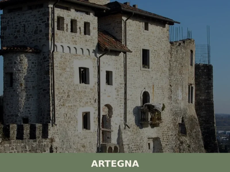
In 1976, two violent earthquakes devastated Friuli, and Artegna was among the hardest-hit communities. The reconstruction that followed did not simply raise walls again: it redesigned the very identity of the town, bringing to light archaeological layers buried beneath the rubble of the San Martino hill. Today, anyone wondering what to see in Artegna will […]
Colloredo di Monte Albano
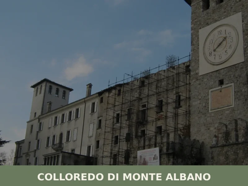
The earthquake of 6 May 1976 split the history of Colloredo di Monte Albano in two: before and after. The castle of the Counts of Colloredo, one of the most imposing noble residences in Friuli, largely collapsed that evening, and with it shattered an architectural heritage built over seven centuries. Today, after decades of restoration, […]
Bordano
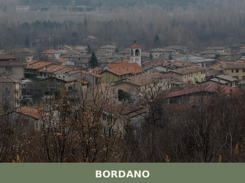
Bordano, the Village of Butterflies in Friuli Venezia Giulia, pairs over 100 painted murals with genuine alpine biodiversity. A guide to its trails, lake, food, and art.


📝 Incorrect information or updates?
Help us keep the Campoformido page accurate and up to date.