


Corte Brugnatella
Corte Brugnatella scatters its stone hamlets above the Trebbia River in the Piacenza Apennines. A guide to its medieval settlements, river gorge, and mountain food.
Discover Corte Brugnatella
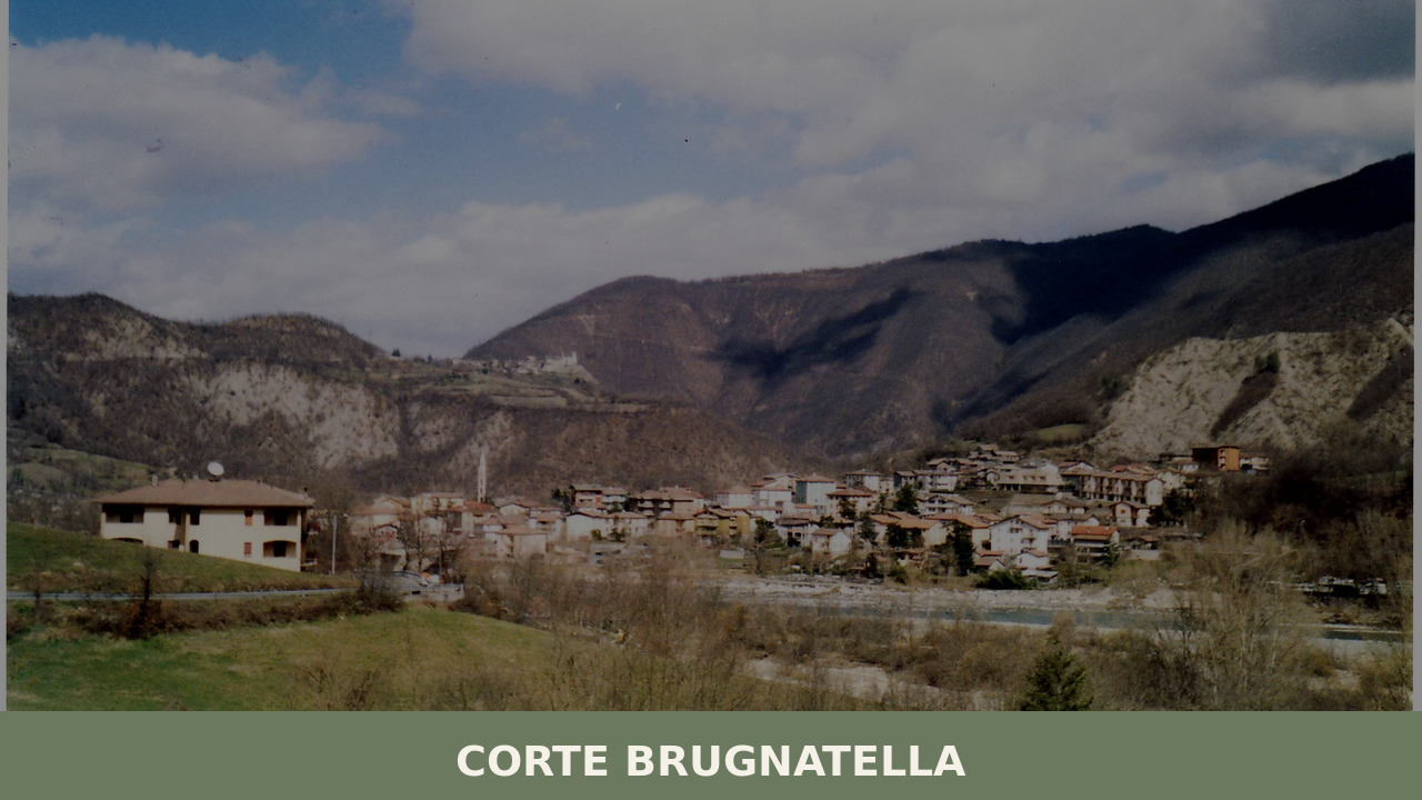
Morning fog lifts off the Trebbia River in slow, deliberate curtains, revealing stone walls the colour of wet clay and a silence broken only by a single church bell counting the hour. Corte Brugnatella — a municipality of 517 people scattered across a handful of hamlets above the Val Trebbia in the province of Piacenza — is not one village but many, each separated by wooded ridges and connected by narrow roads that switchback through chestnut groves. Understanding what to see in Corte Brugnatella means moving between these fragments: the medieval hamlet of Brugnello, the valley-floor settlement of Marsaglia, and the quiet slopes in between.
History of Corte Brugnatella
The name itself maps a feudal past. “Corte” derives from the Latin cohors, indicating a fortified estate or agricultural courtyard — a common administrative unit in early medieval Emilia. “Brugnatella” likely refers to the wild plum (prugnolo, or blackthorn) that still grows on the valley’s limestone edges. The municipality as a modern entity dates to the post-unification reorganisation of the nineteenth century, but the settlements within it are far older, rooted in the Lombard and Carolingian periods when the Val Trebbia served as a transit corridor between the Po Plain and the Ligurian coast.
During the Middle Ages, the valley fell under the influence of successive feudal families tied to the Bishopric of Bobbio and later to the Malaspina lords, who controlled much of the upper Trebbia. The hamlet of Brugnello, perched on a rocky spur above the river, functioned as a lookout and defensive settlement — its position offered clear sightlines both upstream and down. The area’s strategic value persisted through the centuries: in 1799, the Val Trebbia was the site of a major clash between French Revolutionary forces and a combined Austro-Russian army under General Suvorov, a battle that swept through the territory surrounding Corte Brugnatella.
By the twentieth century, the story became one shared by many Apennine communities: depopulation. The municipality’s population, which once numbered in the thousands, has contracted steadily as younger generations have moved toward Piacenza, Genova, and Milan. What remains is a landscape shaped by centuries of human presence — dry-stone terraces, mule tracks, Romanesque chapel walls — now slowly being reabsorbed by forest.
What to see in Corte Brugnatella: 5 must-visit attractions
1. Brugnello
This tiny hamlet, home to barely a dozen permanent residents, occupies a narrow limestone ridge directly above the Trebbia. Its stone houses, many dating to the sixteenth and seventeenth centuries, are built into the rock itself. The Romanesque church of SS. Cosma e Damiano, with its simple bell tower, offers one of the most direct views into the river gorge below — a vertical drop of over a hundred metres to the turquoise water.
2. Marsaglia
The largest settlement in the municipality, Marsaglia sits on the valley floor where the road from Bobbio meets the Trebbia. It functions as the practical centre of daily life: a bar, a small grocery, a parish church. The village’s stone bridge and its position at the junction of several hiking trails make it the logical starting point for exploring the surrounding hamlets on foot.
3. The Trebbia River Gorge
Ernest Hemingway reportedly called the Trebbia the most beautiful river in Italy. Between Marsaglia and Cerignale, the river carves through layered sedimentary rock, creating deep green pools, exposed gravel banks, and cliff faces streaked with iron oxide. In summer, these pools become informal bathing spots — cold, clear, and largely uncrowded.
4. The “Elephant of the Trebbia”
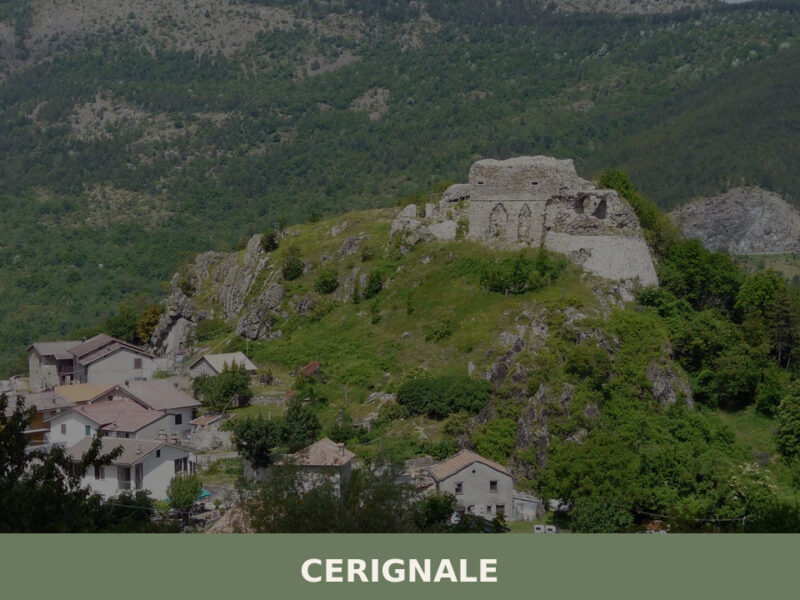
Just downstream toward Cerignale, a geological formation known as the Elefante del Trebbia rises from the Monte Cerello complex. The rock outcrop, shaped by millennia of erosion, bears a striking resemblance to an elephant’s profile — head, trunk, and back all clearly legible from certain angles along the valley road. It has become an informal landmark for hikers and photographers working the trail network.
5. The Sentiero del Tidone-Trebbia
Several long-distance hiking routes cross the municipality’s territory, connecting the Val Trebbia to the Val Tidone and, eventually, to the Ligurian watershed. These paths follow ancient mule tracks through mixed oak and chestnut woodland, passing abandoned farmsteads and offering elevated views across the Apennine ridgeline. The trails are generally well-marked but require proper footwear and navigation awareness.
Local food and typical products
The cooking here follows the grammar of the Piacenza Apennines: labour-intensive, tied to altitude and season, built around preservation. Pisarei e fasö — small hand-rolled bread dumplings served with borlotti beans in a slow-cooked tomato and lard sauce — is the signature first course of the province. Chestnut flour, once a staple when wheat was scarce, still appears in flatbreads and desserts. The cured meats of the province of Piacenza hold DOP status: coppa piacentina, salame piacentino, and pancetta piacentina are produced throughout the valley, with small-scale producers using methods largely unchanged across generations.
Dining options in the municipality are limited but genuine. Marsaglia has a trattoria or two that serve fixed menus heavy on local salumi, fresh pasta, and wild boar ragù in autumn. In the wider Val Trebbia, agriturismi offer meals sourced from their own land — expect homemade tagliatelle, grilled meats, and bottles of Ortrugo or Gutturnio, the characteristic wines of the Colli Piacentini. Reserving ahead is not merely polite; it is often necessary, as kitchens prepare according to the number of expected guests.
Best time to visit Corte Brugnatella
Late spring — May through mid-June — brings the valley into its sharpest focus: the river runs high and cold from snowmelt, wildflowers cover the meadows, and the chestnut canopy is fully leafed but still translucent enough to let light through on the trails. Summer, particularly July and August, draws visitors to the Trebbia’s swimming holes, though temperatures in the valley can climb above 30°C and accommodation fills up on weekends. Autumn is the season for foragers and walkers: mushrooms (especially porcini), chestnuts, and the turning of the beech and oak forests into deep reds and yellows. Winters at 476 metres are quiet and cold, with fog settling into the valley for days at a time — atmospheric but not for every traveller.
The municipality does not host large-scale festivals, but the broader Val Trebbia calendar includes food sagre — particularly chestnut and mushroom fairs in October — and the occasional celebration of patron saints in the individual hamlets. Check with the Comune di Corte Brugnatella for updated schedules. Mobile phone coverage can be patchy in the side valleys, and there are no ATMs within the municipality; come prepared.
How to get to Corte Brugnatella
From Piacenza, follow the SS45 — the Strada Statale della Val Trebbia — south for approximately 55 kilometres. The road is scenic but demanding: a continuous sequence of curves that follows the river upstream through Rivergaro, Travo, and Bobbio before reaching Marsaglia. Allow at least 75 minutes from Piacenza in good conditions. From Genova, the same SS45 approaches from the south via the Passo di Scoffera, covering roughly 90 kilometres in about two hours.
The nearest railway station is in Piacenza, served by Trenitalia’s mainline services from Milan (approximately one hour), Bologna (90 minutes), and other Emilian cities. From Piacenza station, a car is essentially required to reach Corte Brugnatella; local bus services operated by TEMA Mobilità run on the Val Trebbia route but with limited frequency, especially on weekends. The nearest airports are Milan Linate (140 km), Milan Malpensa (185 km), and Parma Giuseppe Verdi (120 km). Renting a car at the airport is strongly recommended — public transport will not take you beyond Piacenza with any reliability.
More villages to discover in Emilia-Romagna
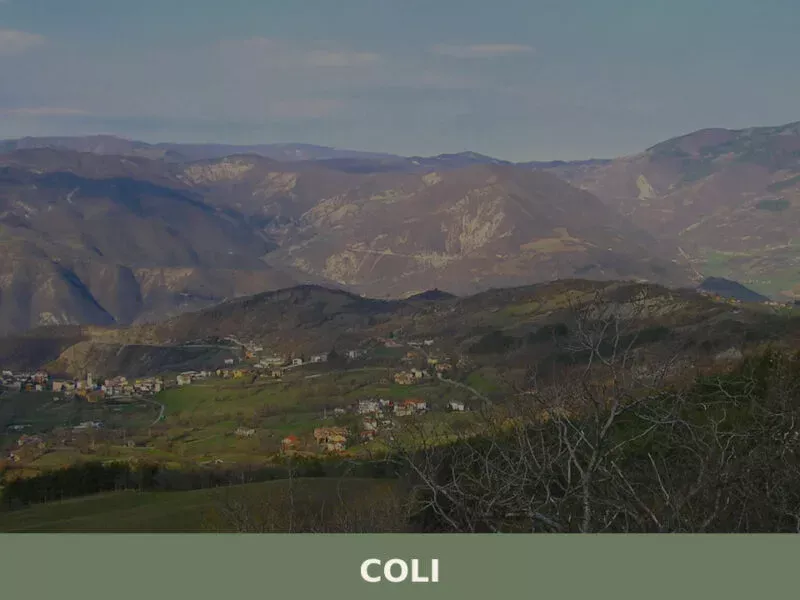
The Val Trebbia rewards those who follow it further upstream. Beyond Corte Brugnatella, the road climbs toward Cerignale, one of the smallest municipalities in Italy, where the valley narrows to a point and the Apennine ridge becomes tangible overhead. Cerignale shares the same geology, the same cuisine, and the same story of depopulation — but its scale is even more compressed, its silence even more complete. The Elephant of the Trebbia, visible from several vantage points in Corte Brugnatella, falls within Cerignale’s territory and offers a useful excuse for extending the drive.
Together, these two municipalities represent a particular expression of inland Emilia-Romagna that has little in common with the flat, fertile image of the region’s Po Valley heartland. This is mountain country — steep, forested, sparsely populated, shaped by rivers rather than roads. For travellers interested in the Apennine backbone of northern Italy, the Val Trebbia’s string of small villages offers an experience that feels proportionally more remote with each kilometre gained from Piacenza.
Frequently asked questions about Corte Brugnatella
What is the best time to visit Corte Brugnatella?
Late spring (May to mid-June) is ideal: the Trebbia runs at its most dramatic, wildflowers cover the hillside meadows, and hiking trails through chestnut woodland are at their most pleasant. Summer (July–August) draws visitors to the river's swimming holes, though valley temperatures can exceed 30°C and weekends get busy. Autumn is excellent for walkers and foragers — porcini mushrooms, chestnuts, and vivid foliage make October particularly rewarding. The patron saint feast of San Giuseppe falls on 19 March, offering a glimpse of local tradition in early spring, though winter visits suit only those who appreciate deep fog and true solitude.
What are the historical origins of Corte Brugnatella?
The name reflects a feudal past: 'Corte' derives from the Latin cohors, denoting a fortified medieval estate, while 'Brugnatella' likely references the wild blackthorn (prugnolo) native to the valley's limestone edges. Settlements here date to the Lombard and Carolingian periods, when the Val Trebbia was a key route between the Po Plain and the Ligurian coast. The hamlet of Brugnello served as a defensive lookout above the Trebbia gorge. The territory also witnessed the 1799 Battle of the Trebbia, a major clash between French Revolutionary forces and an Austro-Russian army under General Suvorov.
What to see in Corte Brugnatella? Main monuments and landmarks
The medieval hamlet of Brugnello is the centrepiece: a cluster of 16th–17th-century stone houses built into a limestone ridge, with the Romanesque church of SS. Cosma e Damiano overlooking a sheer drop to the turquoise Trebbia below. Marsaglia, on the valley floor, offers a stone bridge, parish church, and trailhead access. The Elefante del Trebbia — a striking erosion-sculpted rock formation near Cerignale — is visible from the valley road and is a recognised landmark for photographers and hikers. No admission fees apply to outdoor sites; church access is typically free during daylight hours.
What are the main natural or scenic attractions of Corte Brugnatella?
The Trebbia River Gorge between Marsaglia and Cerignale is the defining natural feature: layered sedimentary cliffs streaked with iron oxide, deep green pools, and exposed gravel banks. In summer these pools serve as informal, largely uncrowded bathing spots. The Sentiero del Tidone-Trebbia long-distance trail crosses the municipality, following ancient mule tracks through mixed oak and chestnut woodland with elevated views across the Apennine ridgeline. Trails are CAI-marked but require sturdy footwear. The wider Val Trebbia is famously cited — attributed to Hemingway — as the most beautiful river valley in Italy.
Where to take the best photos in Corte Brugnatella?
Three spots stand out. The rocky spur of Brugnello offers a dramatic elevated perspective over the Trebbia gorge — the Romanesque bell tower of SS. Cosma e Damiano frames the view particularly well at morning light when river fog is still lifting. Along the valley road between Marsaglia and Cerignale, the Elefante del Trebbia rock formation is best photographed from the roadside at mid-distance, where the elephant profile is fully legible. The Trebbia's turquoise pools beneath the gorge cliffs reward wide-angle shots, especially in late spring when water levels are high and the light enters the canyon mid-morning.
Are there museums, churches or historic buildings to visit in Corte Brugnatella?
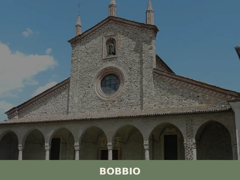
The Romanesque church of SS. Cosma e Damiano in Brugnello is the most historically significant religious building in the municipality — its simple stone bell tower and position above the Trebbia gorge make it architecturally and scenically notable. Marsaglia's parish church functions as the active community place of worship. The dry-stone terracing, mule tracks, and abandoned farmsteads scattered across the hillsides represent an open-air heritage landscape shaped over centuries, now partially reclaimed by woodland. No dedicated museums operate within the municipality; the nearest museum infrastructure is in Bobbio, approximately 15 km downstream.
What can you do in Corte Brugnatella? Activities and experiences
Hiking is the primary activity: the Sentiero del Tidone-Trebbia and connecting CAI trails link the municipality's hamlets and cross wooded Apennine ridges, with routes accessible from Marsaglia. River swimming in the Trebbia's natural pools is the summer draw, concentrated between Marsaglia and Cerignale. Autumn brings mushroom and chestnut foraging across the hillsides, and the broader Val Trebbia calendar includes food sagre — mushroom and chestnut fairs — in October. Dining at a local trattoria or agriturismo for fixed-menu meals built around Piacenza DOP salumi, fresh pasta, and Colli Piacentini wines is itself a worthwhile experience. Book ahead — kitchens cook to order.
Who is Corte Brugnatella suitable for? Families, couples, hikers, solo travelers?
Corte Brugnatella suits travellers who actively seek quiet over convenience. Hikers and nature walkers will find well-marked Apennine trails, dramatic gorge scenery, and river bathing spots that reward those willing to navigate winding mountain roads. Couples looking for an authentic, uncommercialized Italian Apennine experience — stone hamlets, local food, complete absence of tourist crowds — will feel at home here. Families with older children can enjoy summer river swimming and easy village walks. It is not suited to travellers expecting urban amenities: there are no ATMs, mobile coverage is patchy in side valleys, and dining options require advance booking.
What to eat in Corte Brugnatella? Local products and specialties
The cuisine follows the Piacenza Apennine tradition. Pisarei e fasö — hand-rolled bread dumplings with borlotti beans in a slow-cooked tomato and lard sauce — is the province's signature first course. Three cured meats hold EU DOP status and are produced across the Val Trebbia: coppa piacentina, salame piacentino, and pancetta piacentina. Chestnut flour appears in flatbreads and seasonal desserts. Wild boar ragù features on autumn menus. Local wines are Ortrugo and Gutturnio from the Colli Piacentini DOC. Marsaglia's trattorias and nearby agriturismi serve these products directly — portions are generous, menus are fixed, and reservations are essential.
Nearby Villages near Corte Brugnatella
Nearby villages we are mapping:
- Ferriere Emilia-Romagna 📍 11.9 km Coming soon
In Emilia-Romagna More villages to discover
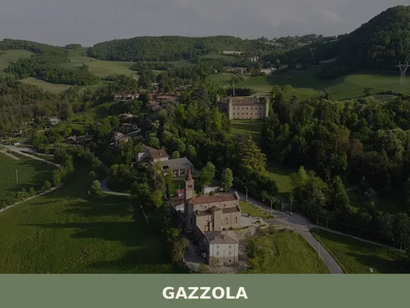
Gazzola
What to see in Gazzola, a Piacenza hill village at 146 m with 2,050 residents. Explore Rivalta Castle, the Luretta valley and Colli Piacentini DOC wines. Plan your visit.
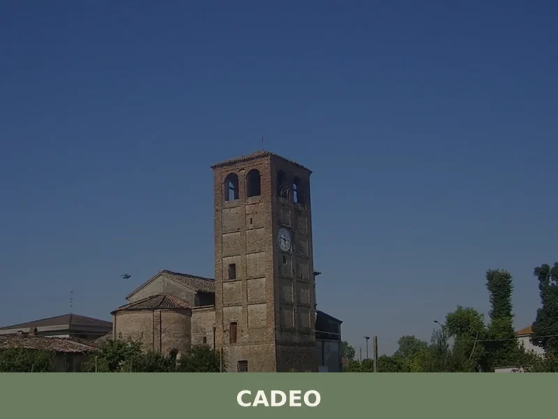
Cadeo
What to see in Cadeo: a Piacenza plain town at 65m with 6,035 residents. Discover Romanesque churches, historic villas and DOP cured meats. Plan your visit.
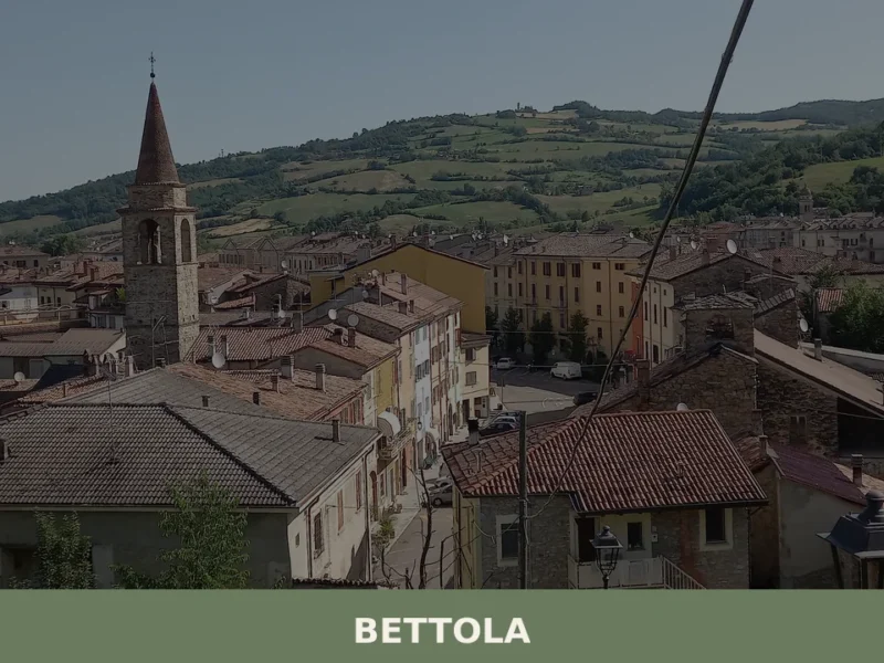
Bettola
What to see in Bettola: a Val Nure village at 329 m with 2,983 residents. Discover the Sanctuary of the Madonna della Quercia, Piacenza DOP cured meats and how to get there.
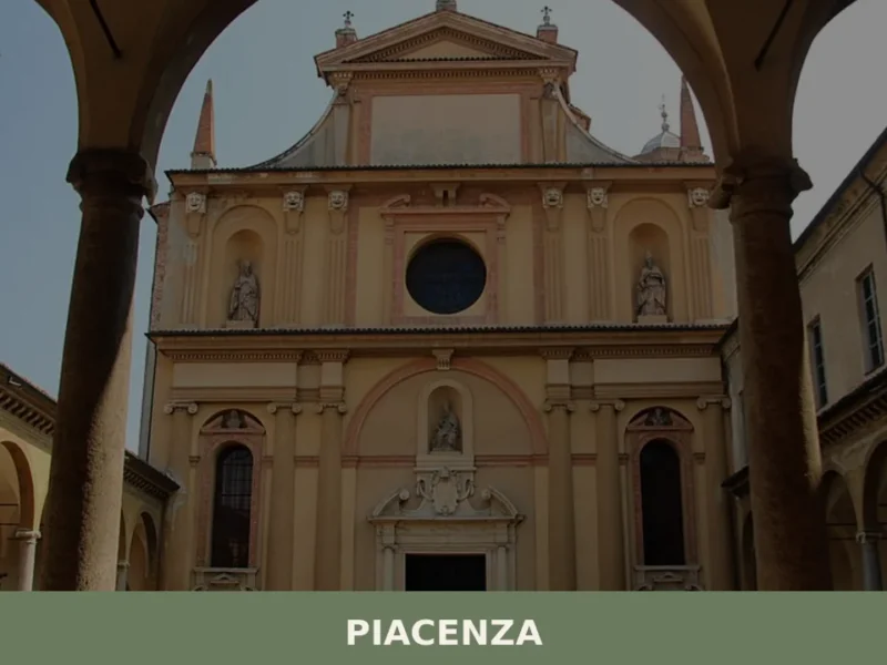
Piacenza
Piacenza, with its 100,843 inhabitants and an altitude of 62 m a.s.l., presents itself as a significant urban center in the heart of Emilia-Romagna, strategically positioned among the communication routes connecting Northern Italy. In this article History and Origins of Piacenza What to see in Piacenza: main attractions Typical cuisine and products of Piacenza Festivals, […]
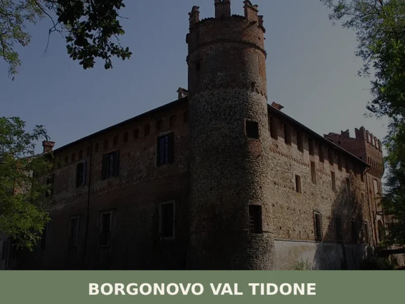
Borgonovo Val Tidone
What to see in Borgonovo Val Tidone: 7,774 residents, a medieval castle, the Santa Maria Assunta church and Piacenza cuisine. Plan your visit with this complete guide.
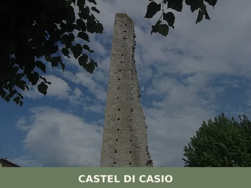
Castel di Casio
In February 1944, during the German retreat along the Gothic Line, the bridges over the Limentra di Treppio torrent were blown up one by one, cutting the territory of Castel di Casio in two. That act of destruction left a lasting mark on the collective memory of a mountain municipality that, as far back as […]
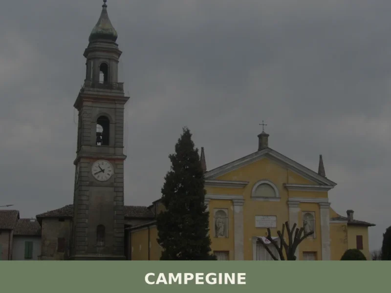
Campegine
What to see in Campegine, Emilia-Romagna, Italy: explore the hometown of the Cervi Brothers, local food traditions and festivals. Population 5,078. Discover now.
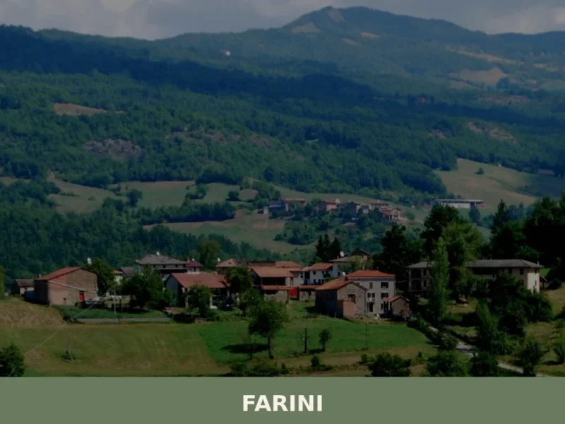
Farini
What to see in Farini, a village at 424 m in Val Nure with 1,043 residents: San Giuseppe Church, Apennine trails, PDO cured meats. Plan your visit and how to get there.
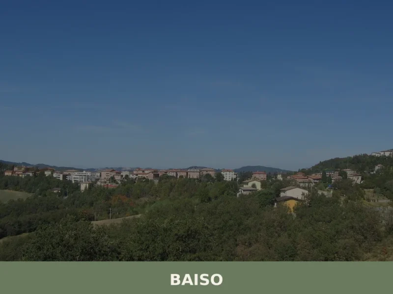
Baiso
The ridge road into Baiso levels out at 542 m (1,778 ft) above the Po Plain and delivers a view across the Apennine foothills that is measurable rather than vague: the valley floors of the Secchia drainage basin lie several hundred metres below, and the profiles of Carpineti and Castellarano mark the horizon to the […]
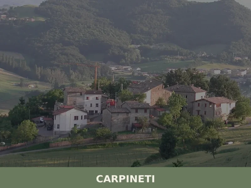
Carpineti
What to see in Carpineti: from the Rocca dei Canossa to the traditional flavors of the Apennines. Find out how to get there and plan your visit.


🏡 Know Corte Brugnatella better than we do?
If you’re a local or have been there, your knowledge matters: add what’s missing or fix a detail on this page.