


Carpineti
What to see in Carpineti: from the Rocca dei Canossa to the traditional flavors of the Apennines. Find out how to get there and plan your visit.
Discover Carpineti
The road from Reggio Emilia climbs into the Apennine foothills and the air thickens with the scent of oak and clay soil.
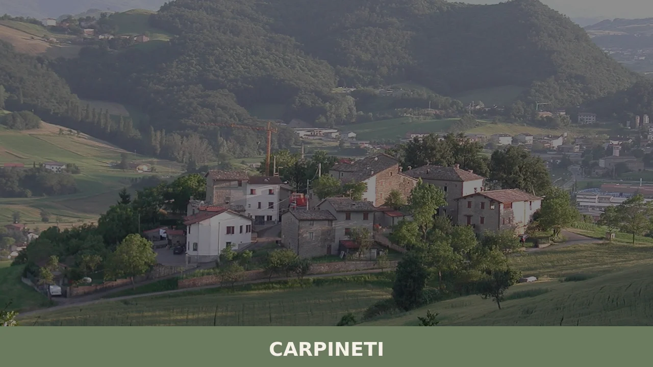
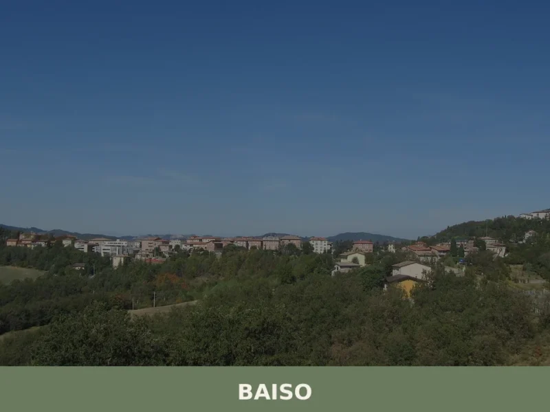
At 562 m (1,844 ft) above sea level, the municipality of Carpineti occupies a ridge in the Province of Reggio Emilia, its built fabric pressed against the hillside while the surrounding terrain drops toward the valleys shared with Baiso, Casina, Castelnovo ne’ Monti, Toano, Viano, and Villa Minozzo.
The 4,125 inhabitants of this borgo di collina, a hill village, have organised their lives around an elevation that keeps the summers cooler than the Po Plain below.
Deciding what to see in Carpineti is a question that rewards advance planning.
The comune sits approximately 30 km (19 mi) southwest of Reggio Emilia and about 70 km (43 mi) west of Bologna, placing it within easy reach of two major Emilian cities for a focused day trip. Visitors to Carpineti find a territory shaped by medieval political history, a local food culture tied to the Apennine pastoral economy, and a calendar anchored by the feast of its patron saint.
The Carpineti highlights include the remains of its medieval fortification, the surrounding natural landscape, and the seasonal produce markets of the hill communes.
History of Carpineti
The name Carpineti derives from carpinus, the Latin term for the hornbeam tree, a species that still grows across the Apennine slopes surrounding the settlement. The Reggiano dialect renders the name as Carpnèida, with the local variant Carpnéda in use among older residents. This botanical etymology points to a landscape that was forested and relatively undisturbed before organised settlement took hold, a pattern common to many hill communes along the northern flank of the Apennines in what is now Emilia-Romagna.
Carpineti’s documented medieval history is closely tied to the Canossa dynasty, which held extensive territories across this portion of the Apennines from the 10th century onward.
The counts of Canossa — and most famously Matilde di Canossa, who governed her inheritance from 1076 until her death in 1115 — used the network of Apennine fortifications to control movement between the Po Plain and the Ligurian and Tuscan territories to the south.
The castle at Carpineti was part of this strategic network, one of several strongholds the countess employed to manage her political and military affairs.
The broader Canossa territory also touched the area around Coli, another Emilian comune that developed under comparable hill-fortress conditions during the same period.
After the death of Matilde di Canossa, the territory passed through successive feudal and ecclesiastical administrations as the medieval commune system gradually supplanted the older county structures across northern Italy.
Carpineti was incorporated into the administrative orbit of Reggio Emilia, which itself changed hands between papal authority, Este family governance, Napoleonic reorganisation, and finally the unified Italian state in 1861.
The commune as it exists today — with its current boundaries adjoining Baiso, Casina, Castelnovo ne’ Monti, Toano, Viano, and Villa Minozzo — reflects territorial consolidations that occurred across the 19th and 20th centuries.
The official municipal website at Comune di Carpineti documents the current administrative structure of the settlement.
What to see in Carpineti, Emilia-Romagna: top attractions
The Medieval Castle of Carpineti
The castle site stands on the high ground above the modern village centre, its remaining stonework in local Apennine limestone and sandstone visible from the approach roads. This fortification belonged to the defensive network of Matilde di Canossa and was in active use during the late 10th and 11th centuries, a period when control of the Apennine passes carried direct political consequence.
Standing at the site today, a visitor can read the logic of the position: the ridge commands clear sightlines north toward the Po Plain and south toward the upper valleys.
The access path from the village centre is uneven and involves a moderate ascent, so appropriate footwear is advisable, particularly after rain in the spring and autumn months.
The Parish Church of the Village Centre
The main parish church of Carpineti occupies a central position within the built fabric of the settlement, its bell tower marking the elevation of the historic core at 562 m (1,844 ft).
Ecclesiastical buildings of this type in the Province of Reggio Emilia typically preserve layers of construction ranging from Romanesque foundations to later baroque interventions, and the interior stonework repays close attention. The church is dedicated to the traditions of the local diocese and forms the focal point for the feast of the patron saint, San Prospero di Reggio Emilia, celebrated on 24 November each year.
Visitors arriving outside the feast period will generally find the church open during daylight hours on weekdays and for all Sunday services.
The Surrounding Apennine Landscape and Valley Viewpoints
The terrain around Carpineti includes the valleys shared with neighbouring communes Baiso, Casina, and Toano, and the altitude of 562 m (1,844 ft) means that clear days open long views across the Apennine ridgeline.
Several marked footpaths extend from the village perimeter into the surrounding woodland, where hornbeam and oak are the dominant species — the same vegetation that gave the settlement its Latin name. The paths vary in difficulty, with the flatter tracks along the valley floor suitable for a two-hour circuit and the ridge routes requiring more elevation gain.
Spring, from late April through June, is the period when the woodland flora is most active and the temperature at altitude remains manageable, typically between 12°C and 22°C (54°F and 72°F).
The Historic Village Fabric
The compact built centre of Carpineti retains a street plan that follows the natural contours of the ridge, with narrow lanes between stone buildings whose facades show the local grey-green sandstone characteristic of this zone of the Reggio Emilia Apennines.
The central square, which functions as the gathering point for market days and civic events, is flanked by buildings from the 18th and 19th centuries, though foundations in several structures date to earlier periods.
It is worth spending time on the secondary lanes that branch from the main axis, where the scale drops and the relationship between the buildings and the hillside terrain becomes most legible. Afternoon light from the west falls directly onto the main facades and is the most useful time for examining the masonry detail.
The Canossa Heritage Circuit
Carpineti forms one point in a broader territorial circuit of sites associated with Matilde di Canossa, whose political reach across the 11th-century Apennines left a documented record in the fortifications and ecclesiastical foundations of the region. The countess governed from 1076 to 1115, and in that four-decade span the strategic importance of the hill communes in this corridor was at its maximum.
Within the Province of Reggio Emilia, several communes preserve physical evidence of this period, and Carpineti’s castle site is among the documented nodes.
Visitors pursuing this wider circuit should allow a full day for the driving route between sites, as the mountain roads between communes add travel time beyond the straight-line distances of 10–20 km (6–12 mi) between them.
Local food and typical products of Carpineti
The food traditions of Carpineti belong to the broader Apennine pastoral economy of the Province of Reggio Emilia, where altitude, seasonal grazing, and the relative isolation of the hill communes have historically produced a kitchen distinct from that of the Po Plain cities.
The difference is not primarily one of prestige ingredients but of technique: long cooking over wood, preservation through salting and drying, and a reliance on grain, pork, and dairy produced within a tight geographic radius.
This context explains why the local table in a hill comune like Carpineti differs in texture and composition from what a visitor might encounter in Reggio Emilia city, even though the two settlements are separated by only 30 km (19 mi).
The pasta tradition in this zone of the Apennines centres on egg-based dough worked by hand. Tagliatelle and tortelli — the latter filled with a mixture of ricotta, spinach or chard, and local aged cheese — appear on local tables throughout the year, though the filling varies with the season and the household.
Gnocco fritto, a fried dough prepared with lard and served alongside cured meats, is the standard accompaniment at the opening of a meal in the hill communes of this province.
The cured meat tradition draws on pork raised in the surrounding farms: salame and coppa in their local forms are made with coarse-ground pork seasoned with black pepper and sometimes wine, then air-dried for a minimum of several weeks in the cool Apennine air.
Dairy production in the Reggio Emilia Apennines feeds into the supply chain of Parmigiano Reggiano PDO (Protected Designation of Origin), one of the most strictly governed cheese denominations in Italy.
The production zone for Parmigiano Reggiano covers the provinces of Reggio Emilia, Parma, Modena, Mantua (right bank of the Po), and Bologna (left bank of the Reno), and milk from farms in the Carpineti territory contributes to this chain.
The cheese is produced in wheels of approximately 40 kg (88 lb), aged for a minimum of 12 months and commonly for 24 or 36 months, during which the paste firms and the flavour intensifies from mildly milky to granular and deeply savoury.
Aceto Balsamico Tradizionale di Reggio Emilia DOP is another certified product of the province, though its production is more concentrated in the lowland areas where the grape harvest yields the cooked must used as the base.
Local markets and farm shops in the hill communes of the Province of Reggio Emilia typically stock seasonal products from September through November, when the harvest of chestnuts, mushrooms, and the autumn pig-slaughtering season coincides.
The sagra, a traditional local food festival, format is common in the Apennine communes during this period, with individual villages hosting events centred on a single product.
Visitors planning a trip specifically around food production should target the September to November window and confirm event dates with the municipality, as programming changes between years.
The village of Fontanelice, another Emilian hill comune in the region, organises comparable autumn food events tied to its own local agricultural calendar.
Festivals, events and traditions of Carpineti
The civic and religious calendar of Carpineti is anchored by the feast of San Prospero di Reggio Emilia, the patron saint of the commune, celebrated on 24 November.
San Prospero is also the patron of the city of Reggio Emilia itself, which creates a shared devotional calendar between the provincial capital and several of its hill communes.
In Carpineti, the feast is marked by a religious ceremony in the parish church, with a procession through the central streets of the village that involves the local population and visiting faithful from neighbouring communes.
The late-November timing places the feast in the early winter season, when the Apennine hills have typically shed their autumn foliage and temperatures at 562 m (1,844 ft) fall to between 2°C and 8°C (36°F and 46°F), making the outdoor portions of the procession a brisk occasion.
Beyond the patron feast, the commune participates in the wider calendar of Apennine seasonal events that marks this portion of Emilia-Romagna through the warmer months.
Summer brings a series of local gatherings in the village square, where the format of the sagra — evening events combining food stalls, local music, and communal eating — organises social life from June through August. These events are organised at the commune level and publicised through the , which posts the seasonal programme typically in May and June.
Visitors wishing to attend should check the site in the weeks before their planned arrival, as specific dates shift between years.
When to visit Carpineti, Italy and how to get there
The best time to visit Carpineti for those prioritising the outdoor landscape and walking routes is late spring, specifically May and June, when daytime temperatures at 562 m (1,844 ft) are consistently between 14°C and 24°C (57°F and 75°F) and the deciduous woodland is at full leaf.
The autumn months of September and October offer a second viable window, with the additional interest of the chestnut and mushroom season and the local food events that accompany it.
Winter visits are possible but the roads between the hill communes can carry snow and ice from December through February, and some local businesses reduce their hours or close during this period.
Summer, while warm, keeps the Apennine altitude noticeably cooler than the Po Plain cities, making Carpineti a practical destination for those already visiting Emilia-Romagna in July or August.
Carpineti, Emilia-Romagna, Italy sits approximately 30 km (19 mi) southwest of Reggio Emilia and 70 km (43 mi) west of Bologna, two cities with major rail connections to the rest of Italy.
If you arrive by car, the most direct approach from Reggio Emilia follows the SS63 provincial road south from the city, with a journey time of approximately 45 minutes depending on traffic on the approach roads to the hill communes. From Bologna, the A1 motorway connects to Reggio Emilia in under an hour, and the onward drive into the hills adds another 45 minutes.
The nearest train stations with regular intercity service are Reggio Emilia on the Milan–Bologna high-speed line, served by Trenitalia, from where local bus services connect to the hill communes.
For those arriving by air, Aeroporto di Bologna Guglielmo Marconi is the nearest international airport, located approximately 85 km (53 mi) from Carpineti, with a combined journey time by train and road of around 90 minutes.
International visitors should note that English is not widely spoken in the smaller shops and bars of the hill communes, and carrying cash in euros is practical, as card acceptance is inconsistent at local markets and farm shops.
A day trip from Reggio Emilia to Carpineti is a realistic and straightforward itinerary. Leaving the city by 9:00, a visitor can reach the village, walk the castle site and historic centre, eat lunch at a local trattoria, and return before early evening.
Those extending the trip can combine Carpineti with a stop at one of the adjacent communes: Alseno, another commune of the Emilian Apennine territory, offers an additional point of reference for understanding how the hill settlements of this province relate to their agricultural hinterland.
Visitors to Carpineti who want to broaden their itinerary across the province can also consider San Pietro in Cerro, a further Emilian comune that provides contrasting lowland context to the hill territory explored from Carpineti’s ridge.
The two settlements together illustrate the geographic range of the Province of Reggio Emilia from plain to Apennine crest.
Frequently asked questions about Carpineti
What is the best time to visit Carpineti?
Late spring (late April through June) is ideal: woodland flora is at its peak, temperatures at 562 m stay between 12°C and 22°C, and the hiking trails around the village are in excellent condition. Summer offers cooler air than the Po Plain below, making July and August a pleasant escape from the heat. For a cultural visit, plan around 24 November, the feast of patron saint San Prospero di Reggio Emilia, when the parish church becomes the focal point for local celebrations. Autumn brings vivid foliage across the hornbeam and oak woodlands surrounding the village.
What are the historical origins of Carpineti?
The name derives from carpinus, the Latin word for hornbeam tree, reflecting the ancient forested landscape of the Apennine slopes. Carpineti's documented medieval history is closely tied to the Canossa dynasty: the castle was part of the strategic fortification network used by Countess Matilde di Canossa (1076–1115) to control the Apennine passes between the Po Plain and territories to the south. After Matilde's death, the area passed through feudal and ecclesiastical administrations before entering the orbit of Reggio Emilia, eventually becoming part of unified Italy in 1861.
What to see in Carpineti? Main monuments and landmarks
The key attraction is the Medieval Castle of Carpineti, a fortification linked to Matilde di Canossa, set on high ground above the village with commanding views north toward the Po Plain. Access via an uneven uphill path from the village centre requires sturdy footwear, especially in wet weather. The central parish church, dedicated to San Prospero, anchors the historic core at 562 m and is generally open during daylight hours on weekdays. The compact stone village centre, with its narrow lanes in grey-green Apennine sandstone, rounds out a walkable historic itinerary.
What are the main natural or scenic attractions of Carpineti?
The territory around Carpineti encompasses valleys shared with Baiso, Casina, and Toano, offering long Apennine ridge views on clear days. Several marked footpaths depart from the village perimeter into hornbeam and oak woodland — the same species that gave Carpineti its Latin name. Easier circuits along the valley floor take roughly two hours; ridge routes involve more elevation gain and require appropriate preparation. Spring is the best season for woodland flora, while autumn colours make October and November particularly scenic for walking.
Where to take the best photos in Carpineti?
The castle site on the ridge above the village provides the most dramatic panorama, with sightlines north toward the Po Plain and south into the upper Apennine valleys. Within the village, the central square flanked by 18th- and 19th-century stone buildings is best photographed in afternoon light, when the western sun falls directly onto the main facades highlighting the characteristic grey-green sandstone. The secondary lanes branching from the main axis, where buildings hug the natural hillside contours, offer intimate architectural compositions ideal for detail photography.
Are there churches or historic buildings to visit in Carpineti?
The main parish church in the historic centre is dedicated to San Prospero di Reggio Emilia and forms the religious and civic heart of the village. Like many Apennine churches in the Province of Reggio Emilia, it preserves construction layers from Romanesque foundations through later interventions; the interior stonework is worth close attention. The church is generally accessible during daylight hours on weekdays and for all Sunday services. The medieval castle ruins on the ridge above are the other principal historic structure, freely visible from the approach roads.
What can you do in Carpineti? Activities and experiences
Hiking is the primary outdoor activity: marked trails from the village perimeter range from easy two-hour valley circuits to more demanding ridge walks above 562 m. The village also forms a documented stop on the broader Canossa Heritage Circuit, a driving route linking Apennine fortifications associated with Matilde di Canossa across the Province of Reggio Emilia — allow a full day for the complete circuit. Food and wine experiences centre on tasting local Apennine cured meats, hand-rolled pasta, and Parmigiano Reggiano PDO from farms in the surrounding territory.
Who is Carpineti suitable for? Families, couples, hikers, solo travelers?
Carpineti suits hikers and nature lovers seeking cooler Apennine air and woodland trails away from Po Plain crowds. History enthusiasts following the Canossa Heritage Circuit will find the castle site a rewarding stop. Couples and slow-travel visitors appreciate the compact stone village, the local food culture, and the unhurried pace of a hill comune with under 4,000 inhabitants. Families with older children can manage the castle ascent and valley footpaths comfortably. The village is less suited to visitors seeking beach, nightlife, or extensive museum infrastructure.
What to eat in Carpineti? Local products and specialties
The local table reflects the Apennine pastoral economy of the Reggio Emilia hills. Handmade egg pasta — tagliatelle and ricotta-and-chard tortelli — is the cornerstone of the first course. Gnocco fritto, fried lard dough, typically opens a meal alongside locally produced salame and coppa, cured in the cool Apennine air. Parmigiano Reggiano PDO, one of Italy's most tightly regulated cheeses, is produced from milk sourced in part from farms in the Carpineti territory; aged wheels at 24 or 36 months are the most prized. Locally foraged chestnuts and mushrooms appear seasonally.
Nearby Villages near Carpineti
In Emilia-Romagna More villages to discover
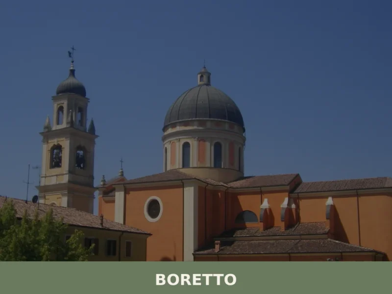
Boretto
What to see in Boretto, Italy: explore the Basilica Minore of San Marco, the Po riverfront, and local food traditions. Population 5,402. Discover Emilia-Romagna.
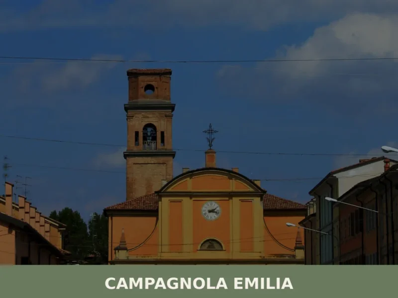
Campagnola Emilia
What to see in Campagnola Emilia, Italy: explore a Po Plain comune at 22 m altitude, 25 km from Reggio Emilia. Discover local festivals and food. Read the guide.
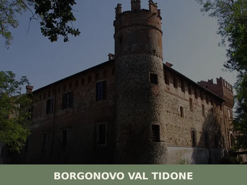
Borgonovo Val Tidone
What to see in Borgonovo Val Tidone: 7,774 residents, a medieval castle, the Santa Maria Assunta church and Piacenza cuisine. Plan your visit with this complete guide.
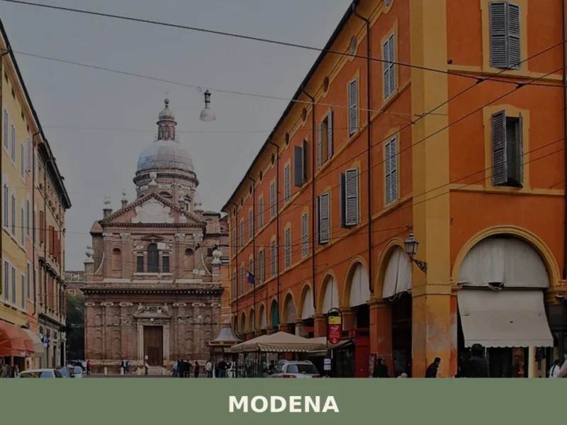
Modena
what to see in modena. Discover the UNESCO Duomo and Ducal Palace. Explore this city of 179,000+ residents and taste typical Modenese products.
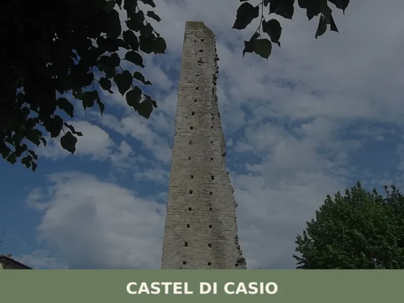
Castel di Casio
In February 1944, during the German retreat along the Gothic Line, the bridges over the Limentra di Treppio torrent were blown up one by one, cutting the territory of Castel di Casio in two. That act of destruction left a lasting mark on the collective memory of a mountain municipality that, as far back as […]
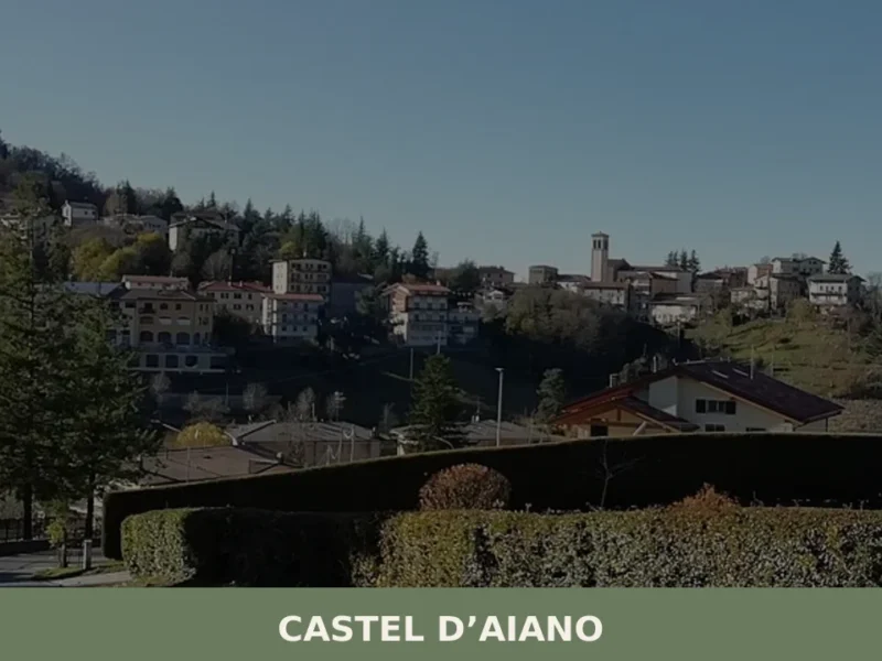
Castel d’Aiano
In 1944 the Gothic Line cut through these mountains, and Castel d’Aiano found itself at the centre of the clash between Allied forces and German troops: the hamlets of Villa d’Aiano, Sassomolare and Rocca di Roffeno still bear the marks of that period. Today the municipality has 1,916 inhabitants spread across a vast, hilly territory […]
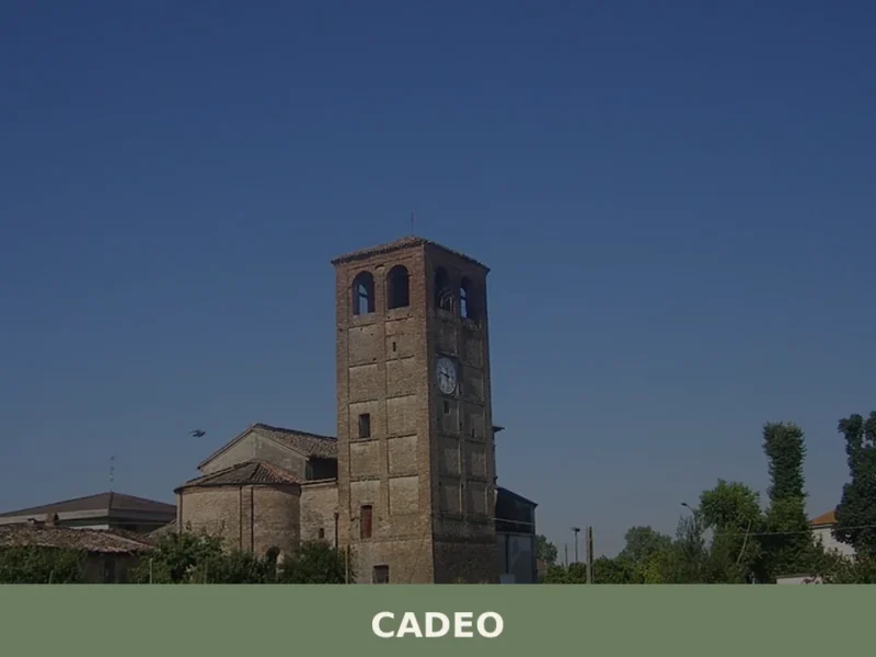
Cadeo
What to see in Cadeo: a Piacenza plain town at 65m with 6,035 residents. Discover Romanesque churches, historic villas and DOP cured meats. Plan your visit.
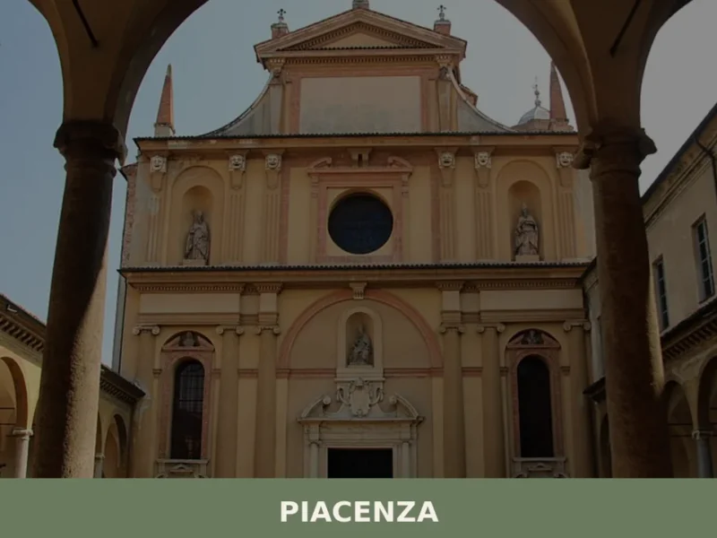
Piacenza
Piacenza, with its 100,843 inhabitants and an altitude of 62 m a.s.l., presents itself as a significant urban center in the heart of Emilia-Romagna, strategically positioned among the communication routes connecting Northern Italy. In this article History and Origins of Piacenza What to see in Piacenza: main attractions Typical cuisine and products of Piacenza Festivals, […]

Sorbolo
Sorbolo offers 3,000 years of history from Bronze Age terramare to Farnese noble palaces. Visit for Roman centuriation, a Serassi organ and authentic Po Valley cuisine.
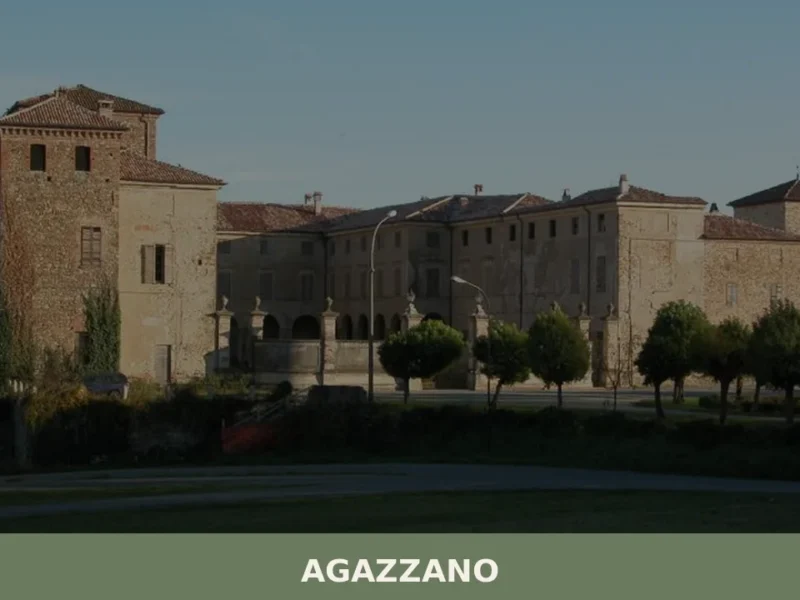
Agazzano
What to see in Agazzano, a village at 187 m in Piacenza province with 2,054 residents. Explore the medieval castle, Santa Maria Assunta church and Val Luretta. Plan your visit.


🏡 Know Carpineti better than we do?
If you’re a local or have been there, your knowledge matters: add what’s missing or fix a detail on this page.