
Alpette
At 957 metres above sea level, on the eastern slope of Gran Paradiso, Alpette has 251 inhabitants spread between the central settlement and a handful of hamlets scattered along the pastures that climb towards Cima Quinzeina. Those looking into what to see in Alpette will find a village built almost entirely from local stone and […]
Discover Alpette
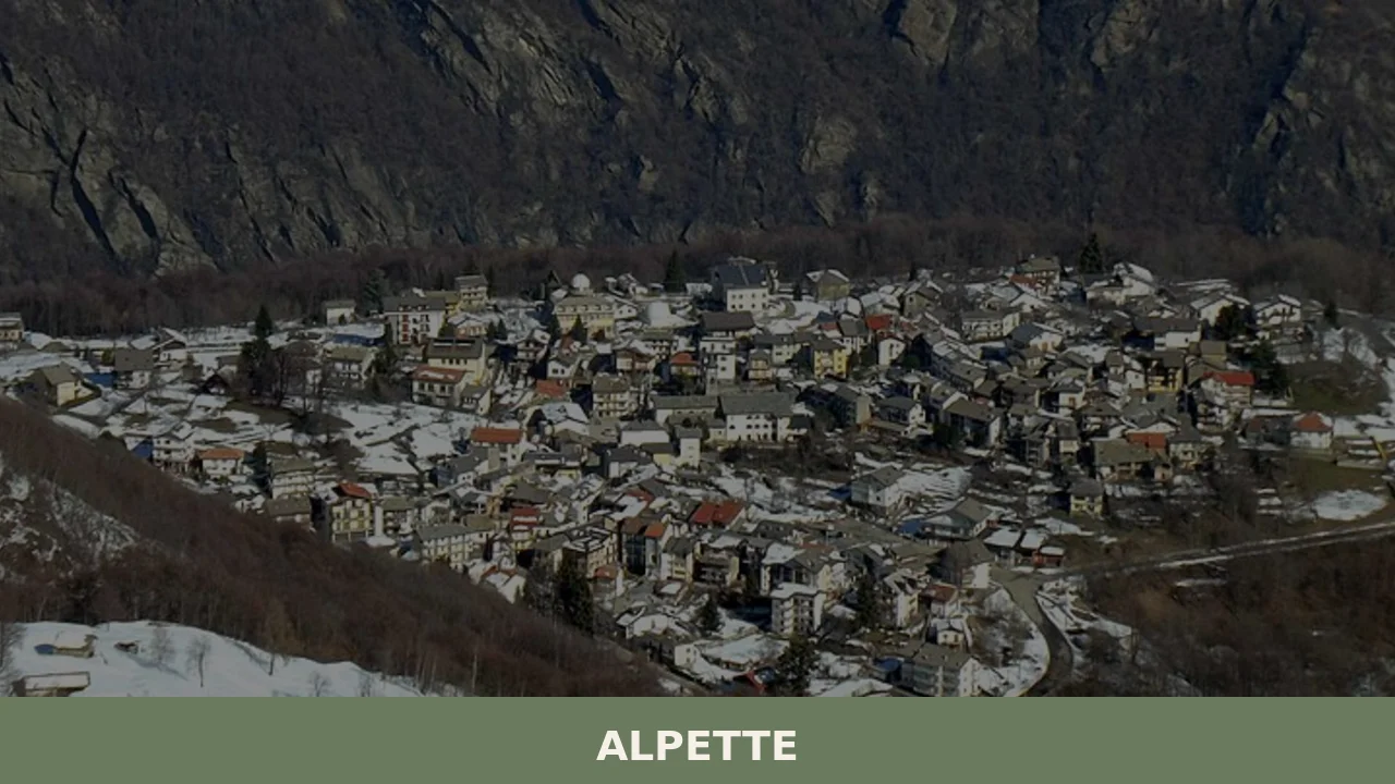
At 957 metres above sea level, on the eastern slope of Gran Paradiso, Alpette has 251 inhabitants spread between the central settlement and a handful of hamlets scattered along the pastures that climb towards Cima Quinzeina. Those looking into what to see in Alpette will find a village built almost entirely from local stone and larch wood, where the economy revolved for centuries around alpine herding and toma cheese production. The provincial road connecting it to Cuorgnè, twelve kilometres further down, is the only vehicle access to the municipality.
History and origins of Alpette
The place name most likely derives from the Latin alpeta, plural of alpetum, a term indicating high-altitude land used for summer grazing. The earliest documented mention of the territory dates to the period when the Marquises of Ivrea controlled the Canavese valleys, between the 10th and 11th centuries. For much of the Middle Ages, Alpette fell under the feudal jurisdiction of the Counts of San Martino, one of the most influential families in the Canavese, who administered a vast system of mountain communities between the Orco Valley and the Valle Sacra.
With the transition to Savoy rule, the village maintained its role as a pastoral community. In the 18th-century Savoyard land registry, Alpette was recorded as home to several hundred residents, nearly all engaged in cattle rearing and dairy processing. Seasonal emigration to the plains around Turin was a widespread practice: men descended to the lowlands during winter months to work as masons or charcoal burners, while women managed the stables and haylofts. This economic structure remained essentially unchanged until the mid-20th century, when accelerated depopulation reduced the population to a fraction of its 19th-century level.
Today the Municipality of Alpette comprises the main settlement and several hamlets scattered across the mountain slope, some of which are inhabited only during the summer months.
What to see in Alpette: churches, trails and rural architecture
Parish Church of Saints Peter and Paul
The main religious building in the village, dedicated to the patron saints — with the feast of Saint Peter celebrated on the last Sunday of June. The current structure, altered several times over the centuries, retains a single-nave plan and a bell tower visible from various points across the valley. Inside, wooden furnishings and an altar reflect the devotional traditions of the Canavese mountain communities.
Stone hamlets and alpine architecture
The hamlets of Alpette — scattered along the slope at varying altitudes — preserve clusters of rural buildings constructed in dry stone with lose roofs, the gneiss slabs typical of high-altitude Piedmontese construction. Stables, haylofts and dwellings form compact structures designed to withstand heavy winter snow loads. Walking through them allows visitors to observe building techniques that remained consistent across generations.
Trail to Cima Quinzeina
Quinzeina, at 2,346 metres, is the defining mountain for Alpette. The trail starting from the village passes through successive bands of vegetation: beech and larch forests, then alpine meadows, and finally summit scree fields. The ascent takes approximately four hours and offers, from the ridge, a direct view of the Gran Paradiso massif and across the plain as far as Turin on clear days.
Votive pillars along the mule tracks
Distributed along the paths connecting the hamlets, the masonry votive pillars mark crossroads and resting points. Some bear devotional frescoes dating from the 18th and 19th centuries, with Marian subjects and scenes of protection from storms and avalanches — an iconography consistent with the practical concerns of a community exposed to high-altitude weather.
Pastures and alpine farms in the Alpette basin
The grassy basin surrounding the village, still used for cattle grazing during the summer months, forms a system of alpine pastures that defined the economic identity of the settlement. Several working dairy farms produce toma cheese and butter following procedures passed down orally. Reaching them on foot, along unpaved tracks, offers a view of a production cycle that depends entirely on the seasonal calendar.
Food and local products
The table in Alpette reflects the mountain economy of the Canavese. The local toma, made from raw cow’s milk during the alpine grazing season, has a firm texture and a flavour that varies according to the pastures and the cheesemaking period. Polenta — from stone-ground maize flour — accompanies cheeses, melted butter and, in the autumn months, game. Soups made with stale bread, fontina and meat broth are a recurring winter dish, alongside the Canavese supa barbetta.
Among the products of the surrounding area are mountain honey, wild berries and, at lower elevations towards the plain, Erbaluce di Caluso DOCG, the Canavese white wine produced just a few kilometres away. During the summer months, several agriturismos and refreshment points in the hamlets serve dishes prepared with short-supply-chain ingredients, often available for purchase directly from the producers.
When to visit Alpette: the best time of year
Summer, from June to September, is the most accessible season: daytime temperatures range between 18 and 25 degrees, the trails towards Quinzeina are passable and the alpine farms are active. On the last Sunday of June, with the patron feast of Saints Peter and Paul, the village comes alive with a procession and a communal lunch involving residents and summer visitors. Autumn brings the colours of the larches and beeches, with October particularly well suited to lower-altitude hikes.
Winter, with frequent snowfall from December to March, keeps the village reachable but requires appropriate equipment and snow chains on board. Spring arrives late at nearly one thousand metres: snow can persist until April, and the high-altitude trails clear completely only by the end of May. For up-to-date information on local conditions, it is useful to consult the dedicated page on Wikipedia.
How to reach Alpette
From Turin, the distance is approximately 55 kilometres. Take the A5 Turin–Aosta motorway to the Ivrea exit, then continue on the provincial road towards Cuorgnè and finally climb towards Alpette along the SP 460 and the municipal road, with a stretch of approximately 12 kilometres uphill and several hairpin bends. Travel time from Turin is around one hour and fifteen minutes under normal conditions.
The nearest railway station is Cuorgnè-Castellamonte, served by the Turin–Pont Canavese line operated by GTT. From Cuorgnè there are no regular public transport connections to Alpette: a private car or an on-demand service is required. The reference airport is Turin-Caselle, approximately 60 kilometres away. For those coming from Milan, the motorway route via the A4 and then the A5 takes around two hours.
What to see in Alpette and the villages of the Canavese
Alpette sits within a territory — the mountainous Canavese — where small municipalities of a few hundred inhabitants preserve urban layouts and rural practices shaped over the course of centuries. Those with several days to spare would do well to explore the network of villages dotting the valleys and hills between Ivrea and the Alpine chain, each with its own characteristics linked to altitude, aspect and feudal history.
Descending towards the valley floor and heading in the direction of Lake Viverone, it is worth reaching Alice Superiore, a small settlement in the Ivrea morainic amphitheatre where the landscape changes dramatically: from alpine scree fields, the terrain gives way to chestnut woods and glacier-moulded hills. The contrast between these two environments — the pastoral mountain of Alpette and the rolling, lakeside landscape around Alice Superiore — conveys the geographic variety of a territory that, within just a few dozen kilometres, crosses profoundly different elevations and climates. For further reading on the regional context, the Touring Club Italiano portal offers detailed guides on Canavese itineraries.
Nearby Villages near Alpette
In Piedmont More villages to discover
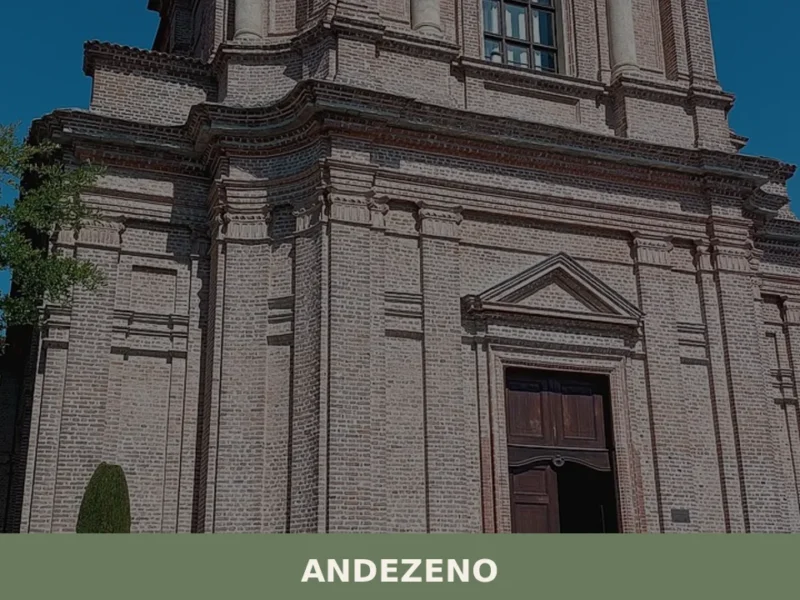
Andezeno
At 306 metres above sea level, on the eastern Turin hills, Andezeno has 2,012 inhabitants spread between the historic centre and its rural hamlets. The municipality appears in medieval documents as early as the 10th century, linked to the affairs of local lords and the Diocese of Turin. Today, anyone wondering what to see in […]
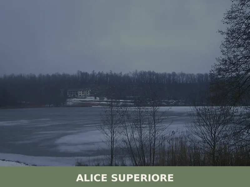
Alice Superiore
Alice Superiore sits at 610 metres above sea level in the Chiusella Valley, a lateral branch of the Canavese district within the Metropolitan City of Torino. Home to 711 inhabitants, the village occupies a stretch of sloping terrain where chestnut woods give way to Alpine pasture. For anyone researching what to see in Alice Superiore, […]
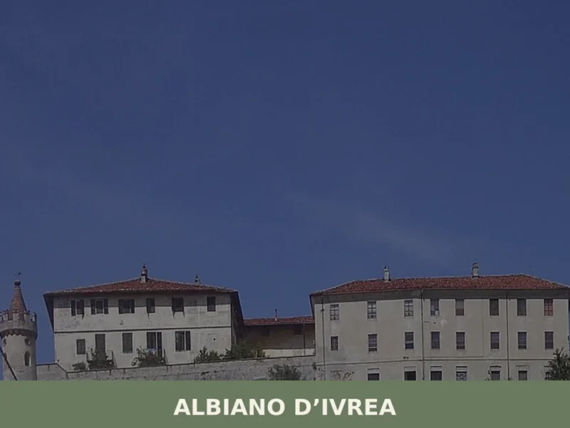
Albiano d’Ivrea
At an elevation of 230 metres, on the left bank of the Dora Baltea, Albiano d’Ivrea has 1,628 inhabitants spread between the main settlement and the hamlets scattered across the Canavese countryside. The municipal territory extends over a hilly strip that slopes down towards the plain, shaped by the moraine deposits of the Ivrea Morainic […]


📝 Incorrect information or updates?
Help us keep the Alpette page accurate and up to date.