
Canosa Sannita
At 231 metres above sea level, on the plain that opens between the Maiella massif and the Teatine coast, Canosa Sannita is home to 1,268 inhabitants spread across an agricultural landscape where the cultivation of vines and olive trees marks the rhythm of the seasons. The village’s very name carries a precise indication: a reference […]
Discover Canosa Sannita
At 231 metres above sea level, on the plain that opens between the Maiella massif and the Teatine coast, Canosa Sannita is home to 1,268 inhabitants spread across an agricultural landscape where the cultivation of vines and olive trees marks the rhythm of the seasons. The village’s very name carries a precise indication: a reference to the Samnites, the Italic people who controlled these lands before the Roman conquest. Asking what to see in Canosa Sannita means interrogating a landscape where the Chieti plain preserves layered traces of human presence, from the pre-Roman period through to the post-World War II reconstructions.
History and origins of Canosa Sannita
The designation “Sannita” was officially added to the municipality’s name in 1863, to distinguish it from the better-known Canosa di Puglia. The original name, Canosa, is thought by some scholars to derive from the Latin canusium or from a pre-Latin term linked to the shape of the terrain. The territory falls within the area of influence of the Samnite civilisation — the Carricini tribe in particular — which between the 5th and 3rd centuries BC occupied the hilly and flat belt of what is now the province of Chieti.
During the Middle Ages, the settlement followed the fortunes of the Teatine county, passing under the control of various feudal families tied to the Kingdom of Naples. The structure of the rural settlement consolidated around the parish church and the scattered farming hamlets. The village suffered significant damage during the Second World War: in 1943, during the German retreat along the Gustav Line, numerous buildings were destroyed or damaged. Post-war reconstruction partly redefined the urban layout, giving the centre an appearance in which pre-conflict elements coexist with twentieth-century architecture.
From an administrative standpoint, Canosa Sannita belongs to the province of Chieti and lies in the hilly-flat belt that slopes down towards the Adriatic coastline, an area historically dedicated to cereal farming and the production of oil and wine.
What to see in Canosa Sannita: 5 main attractions
1. Church of Saints Philip and James
The parish church, dedicated to Saint Philip the Apostle and Saint James, is the religious focal point of the village. The current building is the result of successive interventions following wartime damage. Inside, sacred furnishings and processional statues used during the patron saint’s feast day, which falls on the first of May, are preserved. The façade features sober lines, consistent with rural Abruzzese ecclesiastical architecture.
2. The agricultural landscape of the Teatine plain
The municipal territory extends across a predominantly flat and rolling surface, where rows of vines and olive groves trace regular geometric patterns visible from the provincial roads. Local farms produce extra virgin olive oil from native cultivars and wine from Montepulciano and Trebbiano grapes, the two dominant varieties of Chieti’s viticulture. A walk along the farm tracks conveys the real measure of an economy still tied to the land.
3. The historic centre and urban layout
The central core of the village retains some buildings that predate the Second World War, recognisable by their brickwork and local stone masonry. The main square serves as a daily gathering point. The street layout, partially altered by reconstruction, maintains the logic of the Abruzzese agricultural settlement: houses built close together along a main road, with internal courtyards once used for sheltering animals and storing tools.
4. Rural routes towards the Maiella
From Canosa Sannita, secondary roads climb towards the foothills of the Maiella, the massif that dominates the village’s western horizon. Some of these routes trace historical paths used for local transhumance, connecting the plain to higher elevations through a gradual change in vegetation, from arable fields to oak and Turkey oak woods. The moderate elevation gain makes them suitable for cycling as well.
5. Fountains and rural water points
As in many settlements across the Chieti plain, Canosa Sannita preserves public fountains and drinking troughs built between the nineteenth and twentieth centuries to serve the farming community. These stone and cement structures, often placed along the roads leading into the village, document the water management of a territory where the supply of water has always shaped human settlement patterns.
Cuisine and local products
The table in Canosa Sannita reflects the peasant tradition of the Teatine plain. The main dishes revolve around homemade pasta — sagne, chitarra, tacconelle — dressed with lamb ragù or with tomato and pepper sauce. Extra virgin olive oil, produced by mills operating within the municipal territory and neighbouring areas, accompanies every course. Bread baked in wood-fired ovens, still found in some households, has a thick crust and a dense crumb suited to pancotto, a frugal dish prepared with wild greens, garlic and chilli pepper.
Among the area’s benchmark products, Montepulciano d’Abruzzo finds one of its production zones here. Local wineries vinify grapes grown just a few kilometres from the town centre. In autumn, the olive harvest sets the pace of daily life and the mills operate around the clock. Honey, dried legumes and preserved tomatoes round out the local pantry.
When to visit Canosa Sannita: the best time
The patron feast of Saints Philip and James, celebrated on the first of May, is the most significant annual event for the community: a procession, solemn mass and convivial gatherings in private homes follow a well-established script. Spring — from April to June — offers the most favourable weather conditions for exploring the area: mild temperatures, fields in bloom, and daylight lasting well into the evening. Summer brings temperatures that can exceed 30 degrees on the plain, but the proximity of the coast (about 20 km) ensures a constant breeze.
Autumn is the season of the grape harvest and olive pressing: anyone visiting Canosa Sannita between October and November will find a territory in full agricultural activity, with tractors on the roads and the pungent scent of freshly pressed oil drifting from the mills. Winter is the quietest period, with short days and temperatures that rarely drop below zero at this altitude.
How to reach Canosa Sannita
By car, the reference route is the A14 Bologna–Taranto motorway: the most convenient exit is Pescara Sud/Francavilla al Mare, from which you continue for about 15 km along provincial roads heading inland towards the Chieti hinterland. From Chieti, the provincial capital, the distance is approximately 20 km, reachable in 25 minutes. From Pescara, the journey takes no more than 30 minutes.
The nearest railway station is Chieti Scalo, on the Adriatic Rome–Pescara line. The closest airport is “Pasquale Liberi” in Pescara, about 25 km away, with domestic connections and some international routes. Once in the area, a car is the most practical means of reaching the village and getting around the surrounding territory: intercity bus services exist but run on limited schedules.
What to see in Canosa Sannita and nearby: other Abruzzese villages
Inland Abruzzo offers a network of small centres worth passing through to understand the variety of the regional landscape. To the south-west, towards the border with Molise, Borrello occupies a position entirely different from that of Canosa Sannita: here the landscape changes dramatically, with the Rio Verde waterfalls — among the highest in Italy with a drop of around 200 metres — carving a deep gorge into the limestone. The contrast between the cereal-growing Chieti plain and the wooded gorges of Borrello conveys the scale of Abruzzo’s geographical diversity.
In the opposite direction, towards the north-west, in the L’Aquila area, Cagnano Amiterno stands in the upper Aterno valley, at an altitude and in a climatic context worlds apart from the Teatine plain. Here the historical economy was pastoral, not agricultural, and the architecture of the inhabited nuclei reflects harsher environmental conditions. Placing these villages in relation to one another — Canosa Sannita, Borrello, Cagnano Amiterno — means reading Abruzzo as a system of micro-environments, each with its own settlement rules and its own forms of adaptation.
In Abruzzo More villages to discover
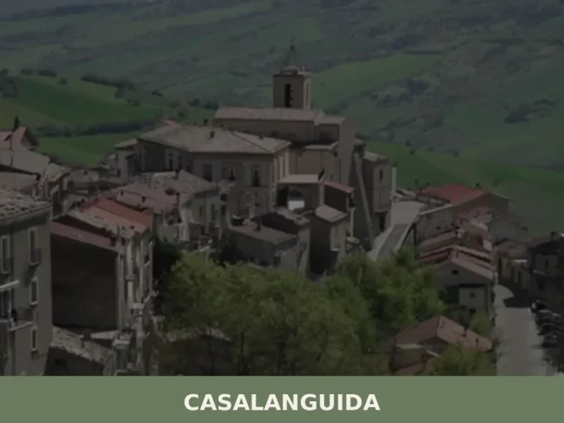
Casalanguida
With its 818 registered inhabitants and an elevation of 470 metres above sea level, Casalanguida occupies a hilltop ridge in the middle Sinello valley, in the province of Chieti. The municipal territory extends across vineyards and olive groves that mark the landscape with regular geometric patterns, visible from the provincial road that climbs up from […]
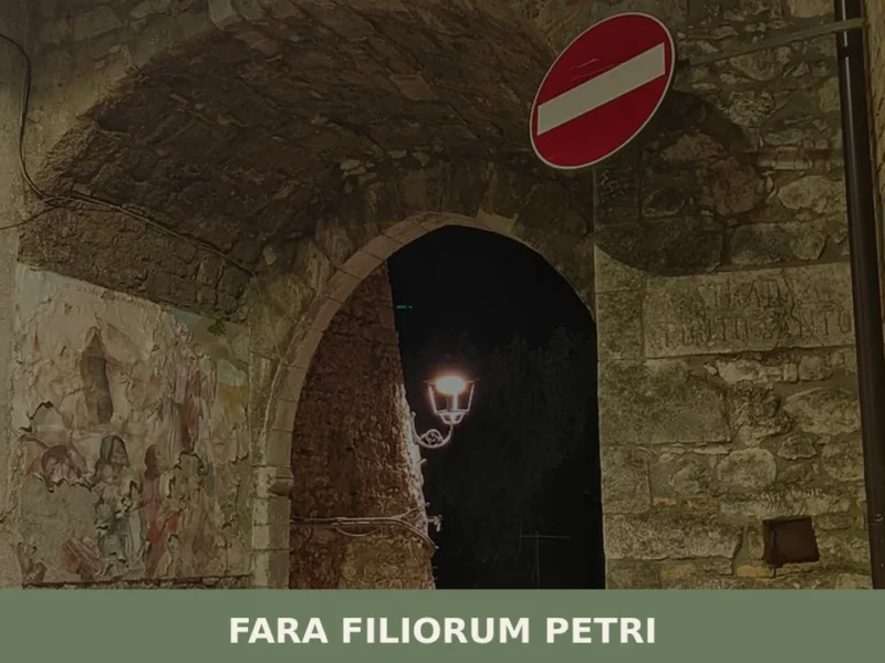
Fara Filiorum Petri
Fara Filiorum Petri, a municipality in the province of Chieti with 1,942 inhabitants, stands at 227 meters above sea level. The toponym itself, of complex origin, suggests historical layering: “Fara” refers to Lombard settlements, while “Filiorum Petri” is linked to the feudal family of Filiorum Petri, who held control in subsequent eras. This duality names […]
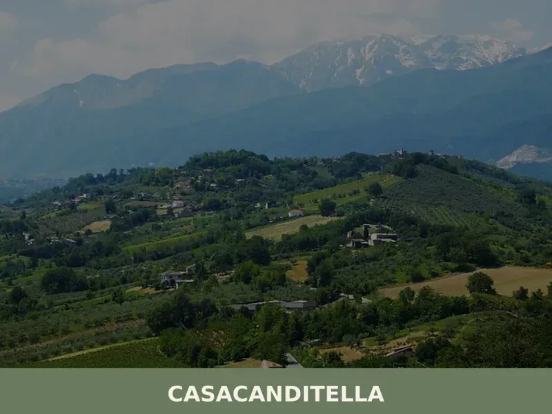
Casacanditella
At 432 metres above sea level, on the eastern slope of the Majella descending towards the Foro river valley, Casacanditella has 1,169 inhabitants and a municipal territory that extends entirely across hilly terrain in the province of Chieti. Anyone wondering what to see in Casacanditella will find a compact urban centre, a church dedicated to […]


📝 Incorrect information or updates?
Help us keep the Canosa Sannita page accurate and up to date.