
Casalanguida
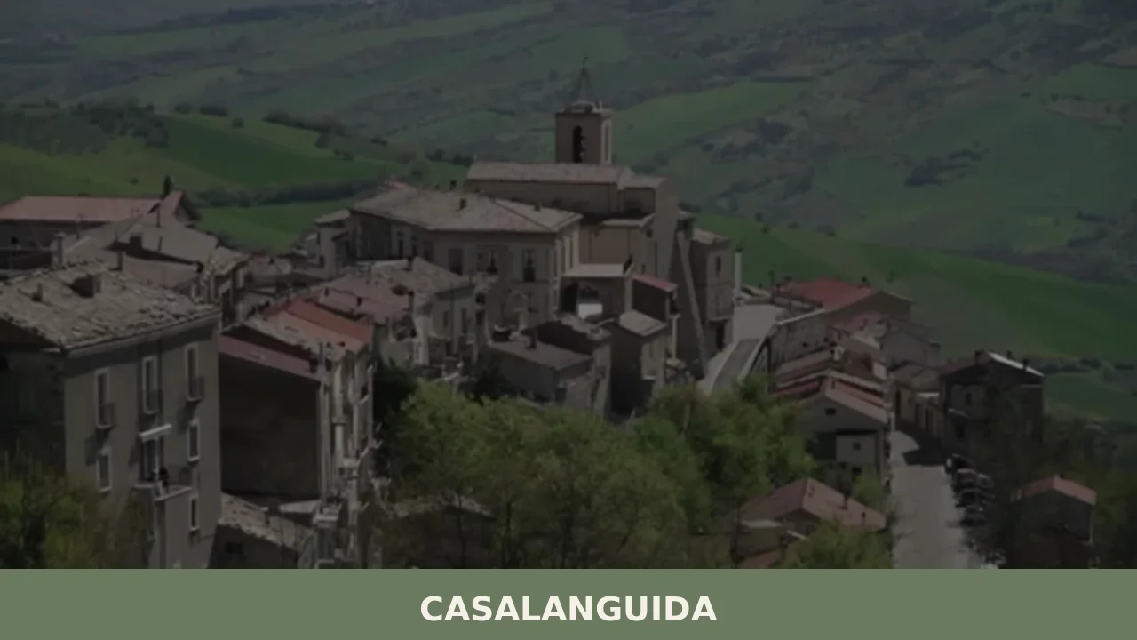
With its 818 registered inhabitants and an elevation of 470 metres above sea level, Casalanguida occupies a hilltop ridge in the middle Sinello valley, in the province of Chieti. The municipal territory extends across vineyards and olive groves that mark the landscape with regular geometric patterns, visible from the provincial road that climbs up from […]
Discover Casalanguida
With its 818 registered inhabitants and an elevation of 470 metres above sea level, Casalanguida occupies a hilltop ridge in the middle Sinello valley, in the province of Chieti. The municipal territory extends across vineyards and olive groves that mark the landscape with regular geometric patterns, visible from the provincial road that climbs up from the valley floor. Asking what to see in Casalanguida means entering a compact urban centre where local stone buildings preserve the layout the village assumed between the late Middle Ages and the early modern period, with the parish church dedicated to Saint Nicholas serving as its central topographic reference point.
History and origins of Casalanguida
The place name appears in medieval documents in the forms Casalanguida and Casale Languidum, and its etymology has been the subject of various interpretations: some scholars link it to the Latin casale combined with a Lombard personal name, while others see it as a descriptive reference to the terrain’s configuration. The village fell within the Norman feudal sphere after the conquest of southern Italy in the twelfth century, and subsequently passed under the control of several baronial families in the Kingdom of Naples, following the feudal dynamics common to many settlements in the Sinello valley and the Vasto area.
During the Angevin and Aragonese periods, Casalanguida was recorded in the fiscal cedolari as a fief of modest demographic size, economically tied to cereal farming and transhumant pastoralism that linked the Chieti hills to the pastures of the Tavoliere plain. In the eighteenth century the village came under the administration of local landowners, while the nineteenth century brought post-unification changes: the construction of the provincial road network and a steady wave of emigration to the Americas that significantly reduced the population — a phenomenon shared by many inland towns in Abruzzo.
In November 1943, during the German retreat along the Gustav Line, the territory of Casalanguida suffered considerable war damage. Post-war reconstruction partly reshaped the appearance of the settlement, but preserved the original street layout and several sandstone buildings that still make up the urban fabric today. For further details on the historical and administrative background, see the dedicated Wikipedia page.
What to see in Casalanguida: churches, palazzi and landscape
1. Church of San Nicola di Bari
The parish church, dedicated to the patron saint Nicholas, dominates the old centre with its stone façade. The interior features a single-nave plan with side altars and sacred furnishings dating from the seventeenth and eighteenth centuries. The bell tower, visible from various points across the valley, serves as an orientation landmark for anyone walking through the village streets.
2. Historic centre and stone-built fabric
The houses in the oldest core feature walls of local sandstone, with carved doorways and raised loggias once used for drying agricultural produce. The layout of the buildings follows the profile of the ridge, with external staircases and covered passages connecting the different levels of the village.
3. Baronial palazzo
The most notable noble building in the centre retains architectural elements dating to the seventeenth and eighteenth centuries: an arched portal, stone-framed windows and an internal courtyard. The structure documents the presence of landowning families who administered the fief during the final centuries of the Ancien Régime.
4. Belvedere over the Sinello valley
From the southern edge of the settlement, an expansive view opens out over the Sinello stream valley and the surrounding hills planted with vineyards and olive groves. On clear days, the Adriatic coastline is visible on the horizon, roughly thirty kilometres away as the crow flies. It is a useful vantage point for understanding the village’s strategic position between coast and mountains.
5. Rural paths through vineyards and olive groves
The farm tracks that branch out from the village centre cross plots of vines — predominantly Montepulciano and Trebbiano — and olive groves producing oil in line with the Abruzzo olive oil tradition. These routes, suitable for walking or cycling, range from three to ten kilometres in length and connect Casalanguida to the surrounding farmland.
Local cuisine and regional products
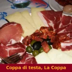
The table in Casalanguida reflects the hill cuisine of the southern Chieti area. Among the first courses, sagne a pézze — broad, irregularly shaped lasagne sheets dressed with tomato and pork sauce — and maccheroni alla chitarra served with lamb ragù are recurrent dishes. Mutton, a legacy of the pastoral tradition, is prepared in several ways: boiled in aromatic broth, or grilled over embers during patron saint festivities. Pallotte cace e ove, fried cheese-and-egg balls then simmered in tomato sauce, are a thrifty dish common throughout the province.
The territory produces extra-virgin olive oil from local cultivars and red wines based on Montepulciano d’Abruzzo. Ventricina del Vastese, a cured meat made from pork cut by hand at knife-point and seasoned with sweet and hot pepper, is the signature salume of the area and is also prepared in the butcher shops and households of Casalanguida during the winter months. Honey, semi-cooked sheep’s-milk cheeses and vegetable preserves round out the range of local food products.
What to see in Casalanguida by season: when to go
Spring, from April to June, offers the best conditions for walking the rural paths: daytime temperatures range between 15 and 25 degrees, the vineyards are in their growing phase and the olive trees are in bloom. Summer brings warm days tempered by the hilltop elevation, with evenings noticeably cooler than on the coast. The patron saint feast of San Nicola, celebrated on 6 December, is the main community event, featuring a solemn mass, a procession and the distribution of traditional sweets.
Autumn coincides with the grape harvest and the olive picking, periods when the agricultural landscape is particularly active and visitors can observe the pressing operations at local olive mills. Winter, with temperatures that often drop below zero during the night hours, is the quietest season but also the one during which domestic food preparations are concentrated: cured meats, preserves and homemade pasta. The village is easily accessible all year round, though it is advisable to check conditions on the provincial roads in case of snow.
How to reach Casalanguida
By car, Casalanguida is reached from the A14 Bologna–Taranto motorway by exiting at the Vasto Sud–Montenero di Bisaccia toll station, from which approximately 25 kilometres remain heading west along the SP 152 and the municipal roads that climb the Sinello valley. From Chieti the distance is around 75 kilometres, drivable in just over an hour via the Strada Statale Trignina or the inland provincial roads.
The nearest railway station is Vasto–San Salvo, on the Adriatic line, approximately 30 kilometres away. From there a car or a local transport service is needed. The reference airport is Pescara’s Pasquale Liberi, about 100 kilometres away, served by domestic flights and some European routes. For up-to-date information on the municipal administration, consult the portal of the Department for Internal and Territorial Affairs.
Other villages to visit in inland Abruzzo
Those exploring inland Abruzzo starting from Casalanguida can extend their itinerary towards the Apennine ridge. Cansano, in the province of L’Aquila, lies close to the Piano delle Cinquemiglia, in a mountain setting entirely different from the hilly terrain of the Vasto area. Its territory, shaped by pastoralism and proximity to the Maiella National Park, provides a direct comparison with the agro-pastoral economy that for centuries linked the Abruzzo highlands to the Apulian pastures via the drovers’ tracks known as tratturi.
Equally interesting is the route towards Carapelle Calvisio, a small settlement at the foot of the Gran Sasso, in the L’Aquila basin. With a population even smaller than that of Casalanguida, Carapelle Calvisio preserves a very compact medieval urban layout, with defensive structures and a limestone building fabric that documents the construction techniques of the central Apennines. Both villages, though far from each other and from Casalanguida, share the demographic condition of small inland municipalities and the need to safeguard a fragile architectural and landscape heritage.
In Abruzzo More villages to discover
Cerchio
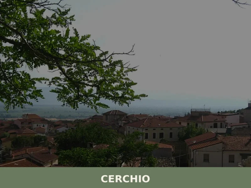
At 834 metres above sea level, on the Fucino plain — the largest lake in central Italy until 1875, when the drainage project commissioned by Prince Alessandro Torlonia transformed the lake bed into agricultural land —, Cerchio has a current population of 1,556 and an economy still tied to those fields reclaimed from the water. […]
Fossa
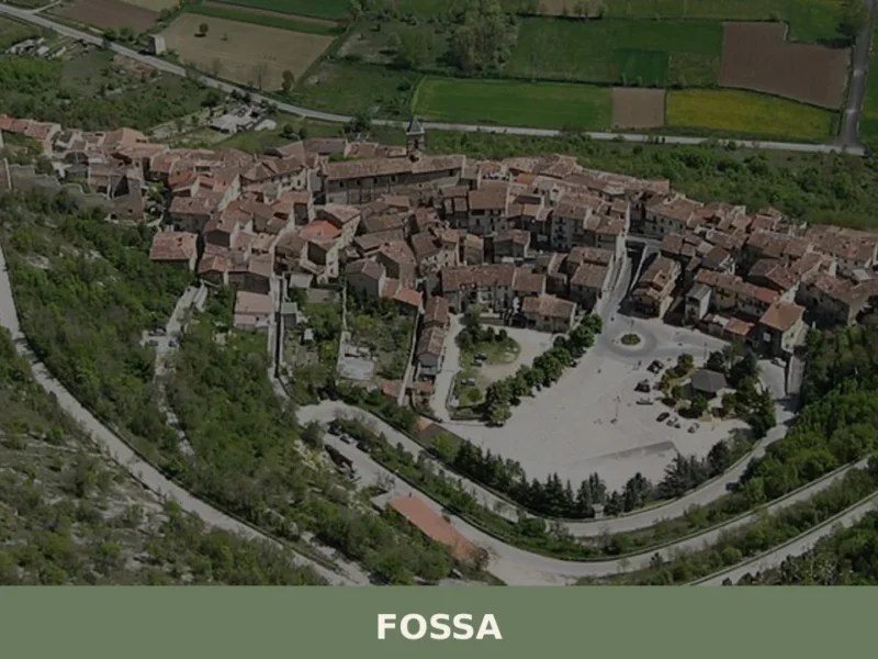
The Vestine necropolis of Fossa, unearthed in 1992 along the state road 17, revealed over six hundred tombs dating from the 9th to the 1st century BC — a discovery that rewrote our understanding of pre-Roman central Italy. Anyone wondering what to see in Fossa will find a solid starting point here: a village of […]
Cermignano
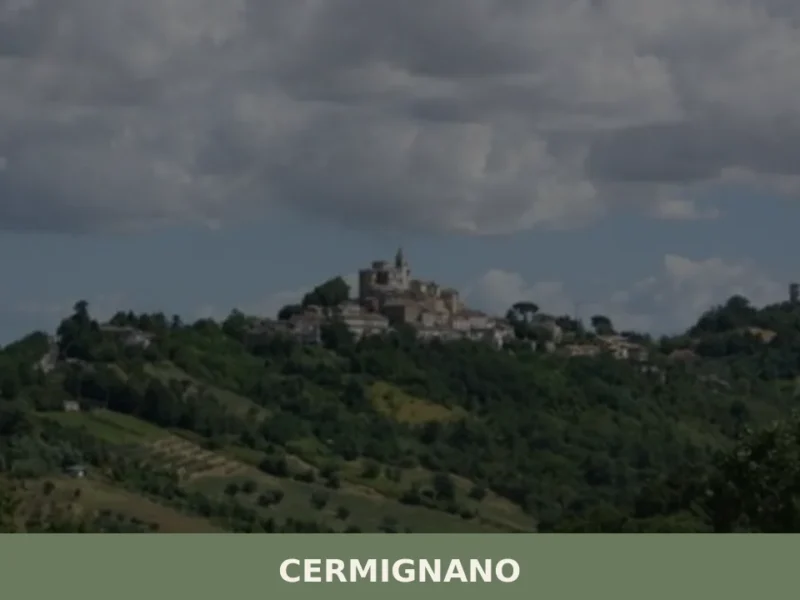
With its 1,440 inhabitants, Cermignano stands at 563 meters above sea level, offering a view of the Vomano valley and the foothills of Gran Sasso. This town in the province of Teramo, whose patron saint is Saint Sylvester, appears as a hillside settlement that retains traces of its historical development. For those wondering what to […]


📝 Incorrect information or updates?
Help us keep the Casalanguida page accurate and up to date.