
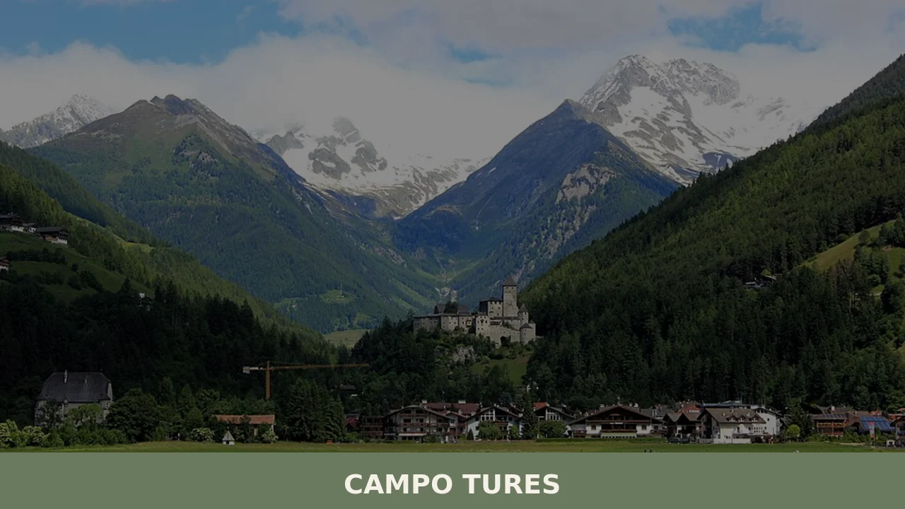
Campo Tures
Tures Castle, first documented in 1136, dominates Campo Tures from a rocky spur at the entrance to the Tures Valley, a side valley of the Aurina Valley. The village has 5,321 inhabitants, spread across an elevation of 864 metres, in a basin where the Aurino torrent slows before continuing south. Understanding what to see in […]
Discover Campo Tures
Tures Castle, first documented in 1136, dominates Campo Tures from a rocky spur at the entrance to the Tures Valley, a side valley of the Aurina Valley. The village has 5,321 inhabitants, spread across an elevation of 864 metres, in a basin where the Aurino torrent slows before continuing south. Understanding what to see in Campo Tures means working through layers of history accumulated across fortified architecture, Gothic churches, and a network of trails connecting isolated farmsteads at over two thousand metres. The municipality is part of the Puster Valley district community.
History and origins of Campo Tures
The Latin name Tauris, recorded in medieval documents, may derive from a pre-Roman root related to the shape of the terrain or an ancient settlement. The German form Sand in Taufers — Sand referring to the sandy deposits left by the Aurino torrent — reveals the geological nature of the valley floor. The first documented noble family, the lords of Taufers, controlled the castle and surrounding territories from the 12th century until the male line died out in 1340, when the estates passed to the Counts of Tyrol.
During the 15th century, the castle was expanded under various noble families, including the Fieger family, who retained ownership until the 17th century. The structure endured fires and restorations, until its purchase by the Südtiroler Burgeninstitut in 1977, which launched a systematic recovery programme. The village itself grew around the parish church dedicated to the Assumption of Mary, whose current structure dates to the late Gothic period, with later Baroque additions. The local economy long depended on mountain agriculture — cattle breeding and cold-resistant grain cultivation — supplemented by trade along the route connecting the Puster Valley to the northern Alpine passes.
During the 19th century, Campo Tures began appearing in German and Austrian mountaineering guides as a departure point for excursions towards the Vedrette di Ries mountain group. Annexation by Italy in 1919 brought the linguistic and administrative tensions common to all of South Tyrol, only partially resolved with the second Statute of Autonomy in 1972. Today, bilingualism — Italian and German — defines every aspect of public life, from signage to the resolutions of the municipal council.
What to see in Campo Tures: 5 main attractions
1. Tures Castle (Burg Taufers)
Sixty-four rooms spread across multiple levels, with frescoes from the school of Michael Pacher in the chapel and an armoury housing original pieces from the 14th to the 17th century. The main tower reaches 24 metres. Guided tours run from April to November and grant access to the noble chambers, the dungeons, and the sentry walk, which offers views over the entire Campo Tures basin.
2. Riva Waterfalls (Reinbachfälle)
Three consecutive drops of the Riva stream, the tallest of which exceeds 40 metres, reachable via a forest path of roughly 30 minutes from the hamlet of Acereto. The route, partly equipped with wooden walkways, passes through a narrow gorge where broadleaf and conifer vegetation forms an almost continuous canopy. The roar of the water can be heard from hundreds of metres away.
3. Parish Church of the Assumption of Mary
The building retains a Gothic apse with ribbed vaults and a Baroque high altar. The bell tower, topped with the onion-shaped dome typical of the Tyrolean area, reaches approximately 50 metres. Inside, several tomb slabs of the lords of Taufers document the connection between the religious community and local feudal power. The patronal feast on 15 August remains one of the most widely attended events of the year.
4. Vedrette di Ries-Aurina Nature Park
Covering more than 31,000 hectares of protected land, the park extends north of the village to the Austrian border. Elevations range from 800 metres on the valley floor to 3,499 metres at Vetta d’Italia, the northernmost point of Italian territory. Marked trails link alpine refuges and active mountain dairies, where cattle are still brought up to summer pastures during the warmer months. The flora includes species such as edelweiss and rusty-leaved alpenrose.
5. Mineral Museum and Civic Library
The Vedrette di Ries area is known for finds of rare minerals, including fluorite, smoky quartz, and almandine garnet. The civic museum displays specimens extracted from the local mine tunnels, accompanied by documentation on the valley’s mining history. The collection provides a geological perspective on the formation of the Eastern Alps, with panels illustrating the composition of the local metamorphic rocks.
Food and local products
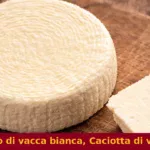
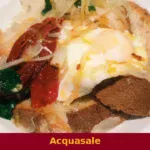
The cuisine of Campo Tures follows the South Tyrolean tradition with certain specificities linked to the Aurina Valley. Schlutzkrapfen — rye-dough half-moons filled with spinach and ricotta — are the most common first course in the village’s trattorias. Tirtlan, a thin-dough fritter stuffed with sauerkraut or ricotta and fried in lard, appears as a single-dish meal in mountain dairies during the summer. Speck Alto Adige IGP, also produced by some farms in the valley, is cured with juniper and bay laurel for at least twenty-two weeks. Canederli — Knödel — are prepared in several variations: with speck, with grey cheese (Graukäse), or with beetroot. Graukäse from the Aurina Valley is a lean, soft-paste cheese made without rennet, obtained through the natural fermentation of skimmed milk: its sour, intense flavour sets it clearly apart from other Alpine cheeses. It is traditionally eaten dressed with seed oil, vinegar, and raw onion.
Among desserts, Strauben — a spiral of fried batter served with lingonberry jam — and Kaiserschmarren, a shredded sweet omelette dusted with icing sugar and accompanied by plum compote, feature on nearly every menu. Rye bread (Schüttelbrot), crisp and flavoured with caraway seeds and wild fennel, is traditionally baked twice a year and kept for months. South Tyrolean craft beer has seen a growing number of microbreweries in the province of Bolzano, and some establishments in Campo Tures offer local labels. In autumn, the Törggelen festival — the South Tyrolean tradition of sampling new wine, chestnuts, and speck at farmsteads — extends to venues in the valley as well, although the high altitude limits viticulture and the wine arrives mainly from the lower Adige area.
When to visit Campo Tures: the best time
Summer, from mid-June to mid-September, provides the most favourable conditions for hikes in the Vedrette di Ries-Aurina Nature Park: daytime temperatures range between 18 and 25 degrees, the refuges are open, and the mountain dairies are active. On 15 August, the feast of the Assumption of Mary, the patronal procession fills the village along with a series of events organised by local associations. September and October are the months of Törggelen and autumn colours — the valley’s larches turn a deep yellow, creating a sharp contrast with the evergreen conifers.
Winter turns Campo Tures into a centre for cross-country skiing and snowshoeing: the Aurina Valley cross-country track stretches for several kilometres along the valley floor. The Klausberg ski area, reachable in just a few minutes, has downhill runs up to 2,510 metres. Winter temperatures regularly drop below -10°C on January nights, and snowfall is frequent from December to March. Spring, between April and May, is the least busy period: the higher elevations still hold snow, while the valley floor comes alive with meadow blossoms and the gradual reopening of trails.
How to reach Campo Tures
By car, from the Brenner motorway (A22), take the Bressanone exit and continue on the SS49 national road towards the Puster Valley as far as Brunico, from where the SP621 provincial road leads to Campo Tures in about 15 minutes. The distance from Bolzano is approximately 85 kilometres (one hour and fifteen minutes), from Innsbruck approximately 115 kilometres, and from Munich approximately 250 kilometres.
By train, the nearest station is Brunico, served by the Puster Valley line (Fortezza–San Candido). From Brunico, SAD public buses connect to Campo Tures with frequent services throughout the day. The closest airport is Innsbruck (115 km), followed by Bolzano (85 km, with limited air traffic) and Verona Villafranca (approximately 250 km), which offers the largest number of domestic and international connections.
Other villages to discover in Trentino-Alto Adige
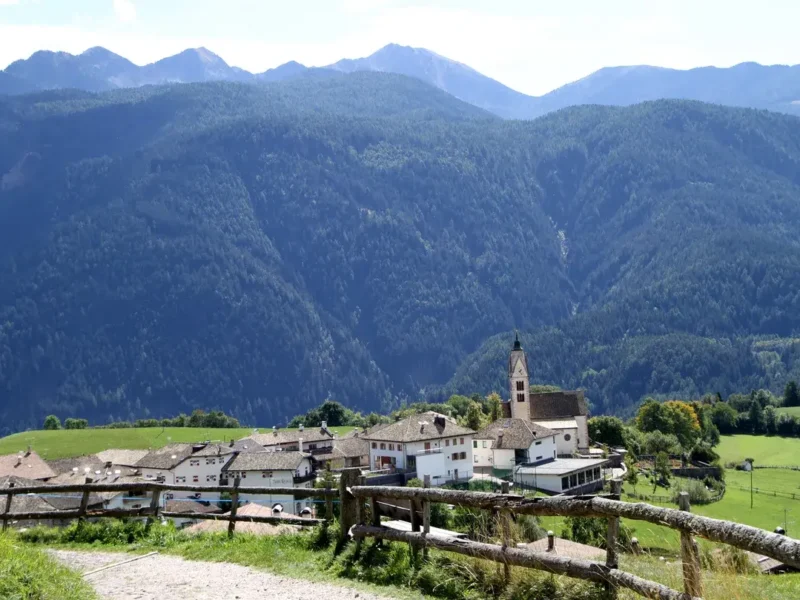
Those travelling through Trentino-Alto Adige along its side valleys will find a concentration of smaller centres with distinct identities and varied architectural heritage. Andriano, in the lower Adige area just a few kilometres from Bolzano, sits at a much lower elevation than Campo Tures and revolves around viticulture — its slopes produce grapes for South Tyrolean whites and reds in an almost Mediterranean climate, far from the harsh temperatures of the Aurina Valley.
Further north, along the Isarco Valley, Barbiano occupies a sun-facing slope above Chiusa, with scattered farmsteads and a compact core around the church. The Barbiano waterfall, plunging over 80 metres, shares the same Alpine geological origin as the Riva waterfalls in Campo Tures, but in a narrower, more vertical valley setting. Both villages illustrate how, in South Tyrol, each valley has developed its own economy and its own dialect, often incomprehensible just a few dozen kilometres away.
In Trentino-South Tyrol More villages to discover
Anterivo
Anterivo has 393 inhabitants and sits at 1,209 metres above sea level, in the far south-east of Alto Adige (South Tyrol), on the linguistic border between the German-speaking and Romance-speaking worlds. The municipality — one of the smallest in the province of Bolzano — occupies a south-facing slope of the Val di Fiemme, separated from […]
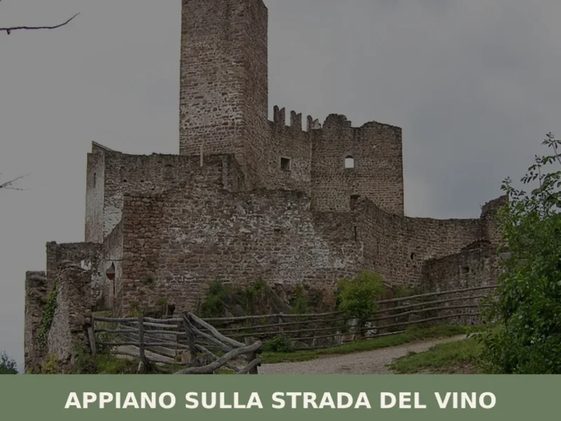
Appiano sulla strada del vino
The municipality of Appiano sulla strada del vino has 14,304 inhabitants spread across eight hamlets — San Michele, San Paolo, Cornaiano, Frangarto, Missiano, Monticolo, Gaido and Girlan (Cornaiano) — set between 200 and 500 metres above sea level on the left bank of the Adige river, in the middle of the Bassa Atesina (Lower South […]
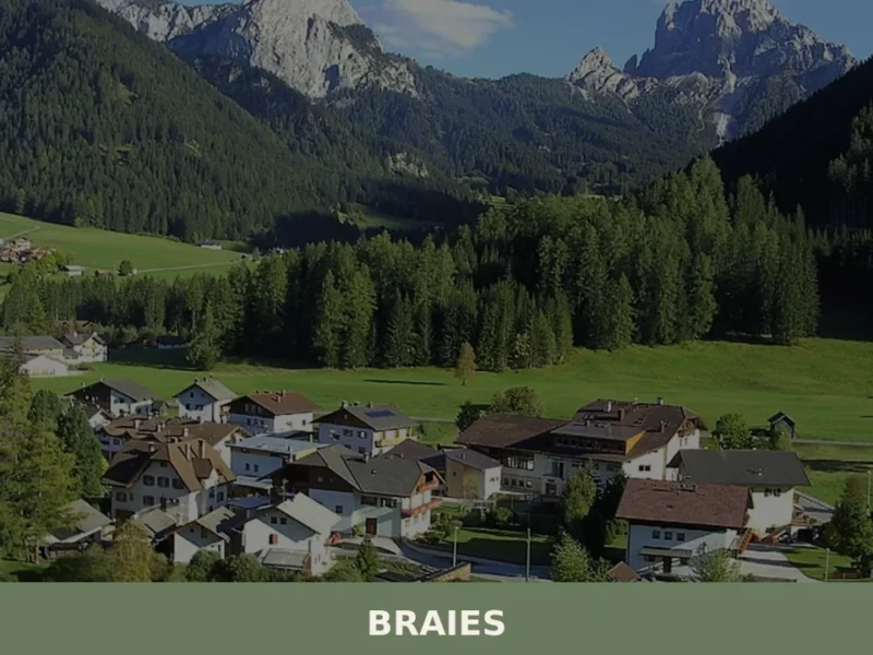
Braies
Lake Braies, sitting at 1496 metres above sea level, is the deepest natural lake in South Tyrol: 36 metres at its maximum point, fed by underground springs that filter through the Dolomite rock. This geological fact alone explains why hundreds of thousands of people reach this side valley off the Puster Valley every year. But […]


📝 Incorrect information or updates?
Help us keep the Campo Tures page accurate and up to date.