


Anterivo
In the valleys of Trentino-Alto Adige, at 1209 meters above sea level, lies Anterivo, a small mountain village with just 393 inhabitants. Here, the rhythm of life is dictated by the surrounding nature, with coniferous forests embracing wooden and stone houses, and the crisp air carrying the scent of alpine pastures. In this article History […]
Discover Anterivo
In the valleys of Trentino-Alto Adige, at 1209 meters above sea level, lies Anterivo, a small mountain village with just 393 inhabitants. Here, the rhythm of life is dictated by the surrounding nature, with coniferous forests embracing wooden and stone houses, and the crisp air carrying the scent of alpine pastures.
The municipality, also known by its German place name Altrei, represents an oasis of tranquility for those seeking an authentic experience amidst the Dolomites’ panoramas.
For those wondering about what to see in Anterivo, the village offers a range of opportunities, from religious architecture to nature trails.
Visitors can explore the historic parish church dedicated to Saint Catherine of Alexandria, venture into the Palù Longa Biotope, or walk the larch educational trail. This village is an ideal starting point for those wishing to immerse themselves in local culture and discover five concrete points of interest that tell its history and natural beauty.
History and origins of Anterivo
The origins of Anterivo are rooted in a remote past, marked by its peculiar geographical location and its status as a German linguistic island, surrounded by predominantly Italian valleys. The first settlements in the area probably date back to the pre-Roman era, with evidence of pastoral activities and exploitation of forest resources that shaped the landscape and the lives of its inhabitants.
The name itself, Anterivo, derives from the Latin “ante rivum”, meaning “before the stream”, suggesting the presence of a significant watercourse as a reference point for the first colonizers of the area.
During the Middle Ages, Anterivo was part of the wider historical territory of Tyrol, under the influence of the Prince-Bishops of Trento and Brixen, and subsequently the County of Tyrol.
Historical documentation, though fragmentary for such a small center, indicates that the community lived mainly from mountain agriculture and livestock farming, with a subsistence economy that required great adaptability to rigorous climatic conditions. In the 13th and 14th centuries, the area saw a gradual increase in population, with the expansion of pastures and the reclamation of land for cultivation, consolidating the village structure that is still visible today.
The modern age has seen Anterivo maintain its identity as a mountain community, while progressively integrating into the territorial dynamics of the province of Bolzano. The village has resisted industrial and urban transformations, preserving traditional architecture and a lifestyle linked to the seasons and rhythms of nature.
Today, Anterivo is recognized as a place where alpine culture blends with tranquility, offering visitors an experience that values the history and traditions of a unique territory in the heart of the Alps.
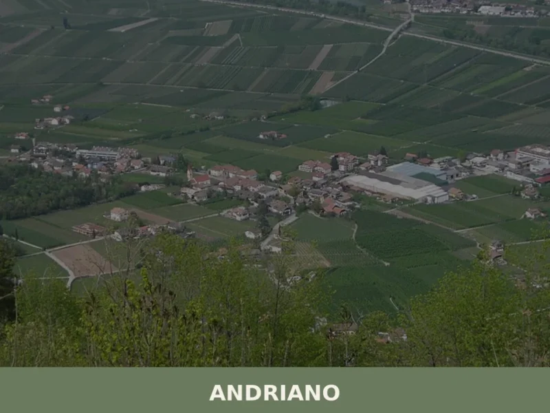
Those wishing to explore other mountain realities in Trentino-Alto Adige may consider a visit to Andriano, which offers a different but equally fascinating landscape.
What to see in Anterivo: main attractions
Church of Saint Catherine of Alexandria
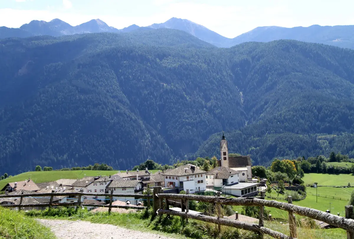
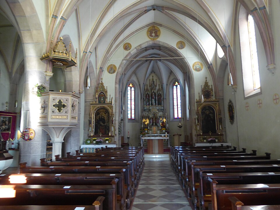
Anterivo’s parish church, dedicated to Saint Catherine of Alexandria, is the spiritual and architectural heart of the village, recognizable by its sturdy bell tower rising above the gabled roof. The sacred building, whose current structure mainly dates back to the 18th century, incorporates elements from earlier periods, including a Romanesque bell tower that testifies to its ancient foundation.
Inside, visitors can admire a finely carved Baroque high altar and frescoes decorating the vaults, depicting scenes from the life of the patron saint and other biblical episodes, created by local artists.
The church stands on a natural promontory offering a privileged view of the surrounding valleys and mountain peaks, serving as a visual landmark for those arriving in Anterivo.
Its robust and simple stone walls reflect the typical architecture of Alpine churches, designed to withstand the elements and integrate harmoniously into the landscape. The churchyard in front is a gathering place for the community, especially during religious festivities, and offers a moment of quiet and contemplation. The feast day of the patron saint, November 25th, is a particularly heartfelt event, attracting faithful from all over the surrounding area.
Palù Longa Biotope
The Palù Longa Biotope appears as a vast wetland area, characterized by peat bogs and marshy meadows, a rare and precious ecosystem at an altitude of 1200 meters. This nature reserve, established in 1993, extends for about 24 hectares and is recognized for its extraordinary biodiversity, hosting endemic or rare plant and animal species.
Those who walk the paths equipped with wooden boardwalks can observe carnivorous plants like sundew, particular mosses, and a rich aquatic avifauna, which finds an ideal habitat here for nesting and resting during migrations.
The area is a significant example of how Alpine nature can preserve unique environments, the result of millennia of geological and climatic processes.
The presence of spring waters and peaty soil create specific conditions that favor the development of plant species adapted to nutrient-poor soils. Visiting Palù Longa offers the opportunity to understand the importance of environmental conservation and to appreciate the delicate balance of nature. The best time to visit is late spring or early summer, when the flora is in full bloom and the birds are most active.
Larch Educational Trail
The Larch Educational Trail is a nature path that winds through the forests of Anterivo, offering an educational and immersive experience in Alpine silviculture. The route, approximately 3.5 kilometers long with a modest elevation gain, is dotted with informative panels illustrating the characteristics of the larch, a deciduous conifer typical of the Alps, and its role in the forest ecosystem.
Visitors learn to recognize the different growth phases of the tree, its economic importance, and sustainable forest management techniques.
This trail is suitable for all ages and offers an excellent opportunity to combine physical activity with learning about local flora.
Along the path, one encounters centuries-old larch specimens, some of which exceed 30 meters in height, and can observe closely the peculiarities of their cones and needles. The walk allows one to appreciate the coolness of the forest and the panoramic views of the surrounding peaks, making it an enjoyable activity in any season. The starting point of the trail is easily accessible from the village center, with clear directions for access.
Malga Cislon
Malga Cislon, located at an altitude of approximately 1400 meters, is a traditional Alpine refuge that embodies the essence of mountain life in Anterivo. Built with local materials, mainly wood and stone, the malga maintains the rustic architecture characteristic of high-altitude constructions, offering a welcoming environment.
Historically, these structures were used for summer pasturing, where livestock was brought to graze and milk was transformed into cheeses and butter according to ancient recipes.
Today, Malga Cislon is a popular destination for hikers seeking a refreshing break after traversing the numerous trails connecting it to the village and the surrounding peaks.
From its elevated position, one can enjoy an extensive panorama of the Dolomites and the Adige Valley, which on clear days stretches as far as the eye can see. Here, you can savor typical Alpine dishes, prepared with fresh, seasonal ingredients, often sourced from nearby pastures. The malga is usually open during the summer months and part of autumn, but it is always advisable to check opening hours before visiting.
Bletterbach Geopark
The Bletterbach Geopark, altho
Il canyon si estende per circa 8 chilometri di lunghezza e raggiunge una profondità di 400 metri, esponendo rocce che vanno dal Permiano all’inizio del Triassico.
I visitatori possono percorrere sentieri segnalati che si addentrano nel canyon, osservando le diverse formazioni rocciose, i fossili di piante e animali preistorici e i segni lasciati dall’erosione glaciale e fluviale. Il centro visitatori di Aldino offre guide e informazioni dettagliate per esplorare al meglio questa meraviglia naturale, che permette di comprendere i processi che hanno modellato le Dolomiti.
Tra le formazioni più spettacolari si annoverano le “piramidi di terra”, colonne di detriti rocciosi sormontate da un masso. Per chi si trova ad Anterivo, una visita al Geoparc Bletterbach è un’occasione imperdibile per un viaggio attraverso il tempo geologico e un modo per estendere l’esplorazione del territorio, magari proseguendo verso Aldino, che offre ulteriori spunti di interesse.
Typical cuisine and products of Anterivo
The gastronomic tradition of Anterivo, deeply rooted in the alpine culture of Trentino-Alto Adige, reflects the influence of Tyrolean cuisine and the skillful use of local ingredients.
The cuisine is characterized by hearty and nutritious dishes, designed to sustain work in the fields and woods, with a strong connection to the local resources. Recipes are handed down from generation to generation, keeping alive the authenticity of flavors and the simplicity of preparations.
Among the typical dishes that can be savored in Anterivo and its surrounding areas, Canederli stand out, which are dumplings made of stale bread enriched with speck, cheese, or spinach, served in broth or with melted butter and sage.
Another specialty is Schlutzkrapfen, half-moon shaped ravioli filled with spinach and ricotta, seasoned with melted butter and Parmesan, representing a delicate yet flavorful first course.
Also prominent is South Tyrolean Speck, a smoked and cured raw ham, a star of many appetizers and charcuterie boards, and Apple Strudel, a dessert made of puff pastry filled with apples, raisins, and pine nuts, often flavored with cinnamon.
Although Anterivo does not boast specific DOP or IGP certified products for its territory, the quality of its gastronomy lies in the freshness and authenticity of its raw ingredients. Local mountain dairies (malghe) and farms produce mountain cheeses, fresh milk, game meat, and seasonal vegetables, which form the basis of every recipe.
This approach to cooking, which values “zero-kilometer” produce, guarantees authentic flavors and a culinary experience that respects tradition and the landscape.
For those wishing to discover and purchase local specialties, the small shops in the village and the mountain dairies (malghe) open to the public offer artisanal products, often directly from the producers. Throughout the year, especially in the summer and autumn months, small farmers’ markets or gastronomic festivals may be organized in the area, where these delicacies can be tasted and bought.
It is always advisable to consult the official municipal website for updated information on events and sales points.
Festivals, events, and traditions of Anterivo
The traditions and festivities of Anterivo are deeply connected to the cycle of the seasons and religious faith, reflecting the alpine identity of the village. The most important festival is undoubtedly dedicated to the patron saint of the town, Saint Catherine of Alexandria, celebrated on November 25th. On this day, the community gathers for a solemn mass in the parish church, often followed by a procession through the village streets, where the faithful carry the statue of the saint on their shoulders. The anniversary is a moment of strong social cohesion, accompanied by convivial gatherings and, at times, small markets offering artisanal products and local gastronomic specialties.
In addition to the patron saint’s festival, Anterivo, like other villages in Trentino-Alto Adige, participates in widespread traditions of the alpine region.
Although there are no documented major tourist-attracting events specific to the village, community life is enlivened by harvest-related celebrations, such as the Erntedankfest (harvest thanksgiving festival) in autumn, or by propitiatory rites for spring.
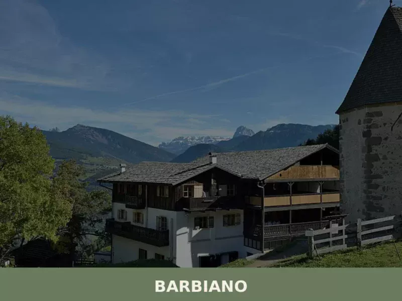
These occasions often feature folk music, traditional costumes, and the sharing of typical dishes, offering visitors an authentic glimpse into local culture and the opportunity to experience the village in an atmosphere of festivity and tradition. Another village that keeps its traditions alive is Barbiano, also rich in folklore.
When to visit Anterivo and how to get there
The choice of the best period to visit Anterivo depends on the activities you wish to undertake, as the village offers different attractions depending on the season. Summer, from June to September, is ideal for hiking and trekking enthusiasts, with pleasant temperatures and well-marked trails leading to alpine pastures and panoramic viewpoints. Autumn, particularly October, offers a unique chromatic spectacle thanks to the larch foliage, perfect for peaceful walks and for savoring harvest products. Winter transforms Anterivo into a snowy landscape, suitable for cross-country skiing or snowshoeing, although the range of tourist services is more limited compared to larger resorts.
To reach Anterivo, the most convenient way is by car.
The village is connected to the motorway network via the A22 Brenner motorway, with the recommended exit being Egna/Ora (Neumarkt/Auer), from which you continue along provincial roads for about 20-30 kilometers.
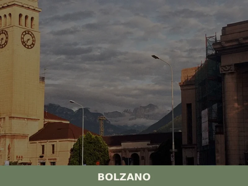
Those who prefer the train can arrive at Ora (Auer) station, which offers regional connections, and from there use local bus services, whose timetable it is always advisable to check on the official website of the municipality of Anterivo or on local public transport portals. The closest airport is Bolzano, with limited flights, while the international airports of Verona and Innsbruck (Austria) offer more options, albeit at greater distances.
Here is a summary table of the main connections:
| Starting Point | Distance | Estimated Time |
|---|---|---|
| Bolzano | ~35 km | ~45 minutes |
| Verona (Airport) | ~150 km | ~1 hour and 45 minutes |
| Ora (Train Station) | ~20 km | ~30 minutes |
Where to stay in Anterivo
Anterivo, with its tranquil atmosphere and unspoiled nature, offers various accommodation options, ideal for those seeking an authentic experience away from mass tourism.
The accommodation facilities in the village and its immediate surroundings primarily include family-run hotels, known locally as “Gasthöfe,” and welcoming farm stays (agriturismi).
These options allow visitors to fully immerse themselves in the local culture, often with the opportunity to savor traditional cuisine prepared with fresh local ingredients.
The hotels and farm stays (agriturismi) in Anterivo are typically characterized by traditional mountain architecture, with wooden interiors that create a warm and comfortable environment. Many establishments offer rooms with views of the surrounding mountains and services designed for nature lovers, such as storage for trekking equipment or bicycles. To ensure availability, especially during high season months like July, August, and during winter holidays, it is advisable to book in advance, consulting tourist portals or the municipality’s website for an updated list of available options.
Frequently asked questions about Anterivo
What is the best time to visit Anterivo?
The ideal period for hiking and exploring the Monte Corno Nature Park is mid-June to mid-September, when trails are snow-free and alpine dairies are active. October is particularly scenic, with larch trees turning deep yellow on the surrounding slopes. Winter suits snowshoeing and cross-country skiing. The patronal feast of Saint Catherine of Alexandria falls on 25 November, already a winter period with frequent snow, marked by a liturgical service and procession. Low tourist density makes every season viable for those seeking a quiet Alpine experience.
What are the historical origins of Anterivo?
The village's German name, Altrei, is documented in medieval sources from the 12th century. The most accepted etymology derives it from the Latin ultra rivum — 'beyond the stream' — referring to the Avisio torrent marking the boundary with Val di Fiemme. For centuries Anterivo belonged to the County of Tyrol under the jurisdiction of Enn and Caldiff, governed first by the Counts of Tyrol, then by the Prince-Bishops of Trento. The Italian name was formalised after Alto Adige's annexation to Italy in 1919. The community has historically relied on pastoralism, forestry and mountain agriculture.
What to see in Anterivo? Main monuments and landmarks
The Parish Church of Saint Catherine of Alexandria is the village's main landmark, dating in its current form to the 15th century. Its Gothic spired bell tower is visible from the valley below. Inside, a carved wooden altar and altarpieces from the Tyrolean school are preserved. The historic centre displays traditional South Tyrolean rural architecture: larch-wood balconies, steep snow-shedding roofs and raised hay barns. Scattered 17th- and 18th-century farmsteads with carved door lintels and painted religious symbols can be reached on foot via unpaved paths around the village.
What are the main natural or scenic attractions of Anterivo?
Anterivo is an access point to the Monte Corno Nature Park (Parco Naturale Monte Corno), the oldest protected area in Alto Adige, established in 1980. Marked trails from the village lead to Monte Corno summit at 1,817 metres through forests of Norway spruce and larch. The park hosts over 1,000 recorded plant species, including wild orchids. The road descending towards Capriana and Val di Fiemme crosses a geological transition zone between Atesina porphyry and Dolomitic limestone, with stratifications visible along the hairpin bends over a 600-metre elevation drop in under ten kilometres.
Where to take the best photos in Anterivo?
The most photographed view of Anterivo is from the valley below, where the Gothic bell tower of the Parish Church of Saint Catherine of Alexandria defines the village's skyline against the forested slopes. In October, the larch-covered hillsides surrounding the village turn vivid yellow, offering exceptional landscape shots. The hairpin road descending towards Capriana reveals panoramic views over Val di Fiemme. The isolated farmsteads scattered around the village, with larch balconies and painted façades, provide strong documentary and architectural photographic subjects.
Are there museums, churches or historic buildings to visit in Anterivo?
The main historic building is the Parish Church of Saint Catherine of Alexandria, a 15th-century Gothic structure with a distinctive spired bell tower. Inside, visitors can see a carved wooden altar and altarpieces attributed to the Tyrolean school. The historic centre itself functions as an open-air architectural document, with several rural buildings featuring traditional South Tyrolean construction techniques. Isolated farmsteads from the 17th and 18th centuries, some with dates carved into door lintels, can be visited on foot. No dedicated museum facility is documented within the municipal territory.
What can you do in Anterivo? Activities and experiences
The primary activities in Anterivo are outdoor and nature-based. Hiking in the Monte Corno Nature Park — with marked trails to the 1,817-metre summit — is the main summer activity. Autumn walks among the larches are highly regarded for colour and tranquillity. In winter, snowshoeing and cross-country skiing are available on the Monte Corno trail network. Food and wine experiences are concentrated in local gasthöfe and agritourisms, where regional dishes such as canederli, speck and barley soup are served. The patronal feast on 25 November offers a traditional religious and community event.
Who is Anterivo suitable for?
Anterivo suits hikers and nature lovers seeking uncrowded trails and direct access to the Monte Corno Nature Park. It appeals to couples and solo travellers looking for a quiet, authentic Alto Adige village far from mass tourism circuits. Architecture and history enthusiasts will appreciate the 15th-century parish church and traditional South Tyrolean rural buildings. Those interested in linguistic and cultural borderlands — where German and Romance traditions meet — will find Anterivo particularly distinctive. Families with young children can enjoy gentle forest walks, though large resort-style facilities are absent.
What to eat in Anterivo? Local products and specialties
Anterivo's food tradition follows the South Tyrolean mountain canon. Canederli (Knödel) — dumplings made with stale bread, speck and cheese, served in broth or with melted butter — are a staple. Speck Alto Adige IGP appears in almost every meal. Winter dishes include barley soup (Gerstsuppe) and buckwheat polenta. Apple strudel and Krapfen filled with apricot or poppy-seed jam are the typical desserts. Local farms produce semi-hard cow's milk cheese, alpine butter and fresh ricotta in small quantities. Wine comes from the nearby Val di Fiemme and Bassa Atesina, notably Lagrein and Gewürztraminer.
📷 Photo Gallery — Anterivo

Nearby Villages near Anterivo
In Trentino-South Tyrol More villages to discover
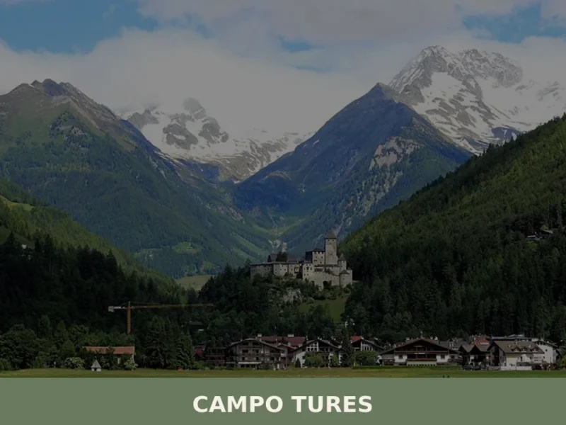
Campo Tures
Tures Castle, first documented in 1136, dominates Campo Tures from a rocky spur at the entrance to the Tures Valley, a side valley of the Aurina Valley. The village has 5,321 inhabitants, spread across an elevation of 864 metres, in a basin where the Aurino torrent slows before continuing south. Understanding what to see in […]
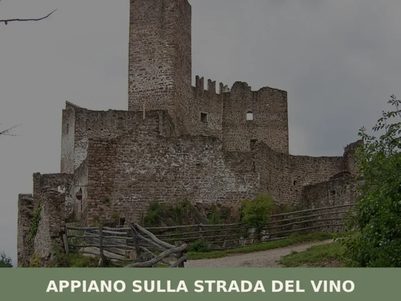
Appiano sulla strada del vino
The municipality of Appiano sulla strada del vino has 14,304 inhabitants spread across eight hamlets — San Michele, San Paolo, Cornaiano, Frangarto, Missiano, Monticolo, Gaido and Girlan (Cornaiano) — set between 200 and 500 metres above sea level on the left bank of the Adige river, in the middle of the Bassa Atesina (Lower South […]
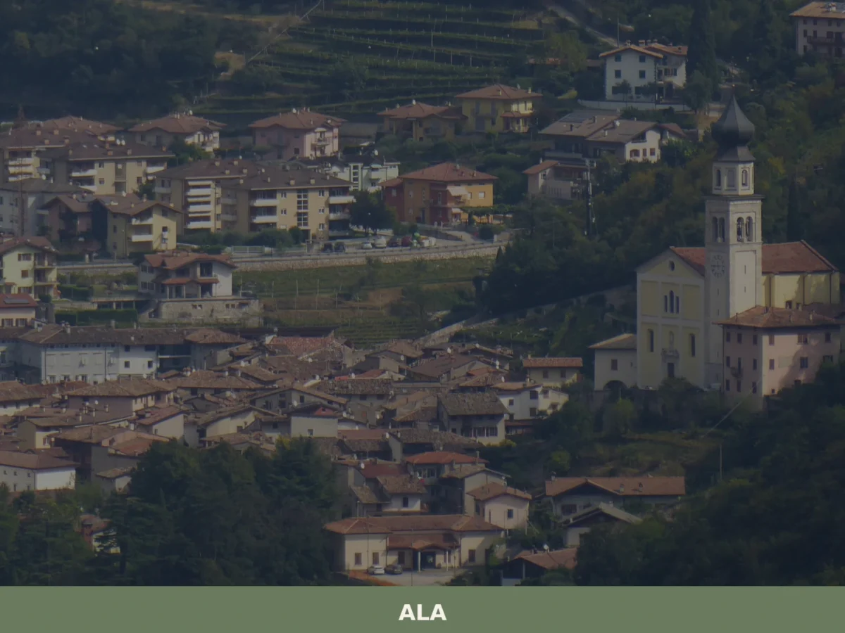
Ala
Discover what to see in Ala, Trentino: silk merchant palazzi, Habsburg border history, Vallagarina wines and the Valle dei Ronchi. Practical tips included.
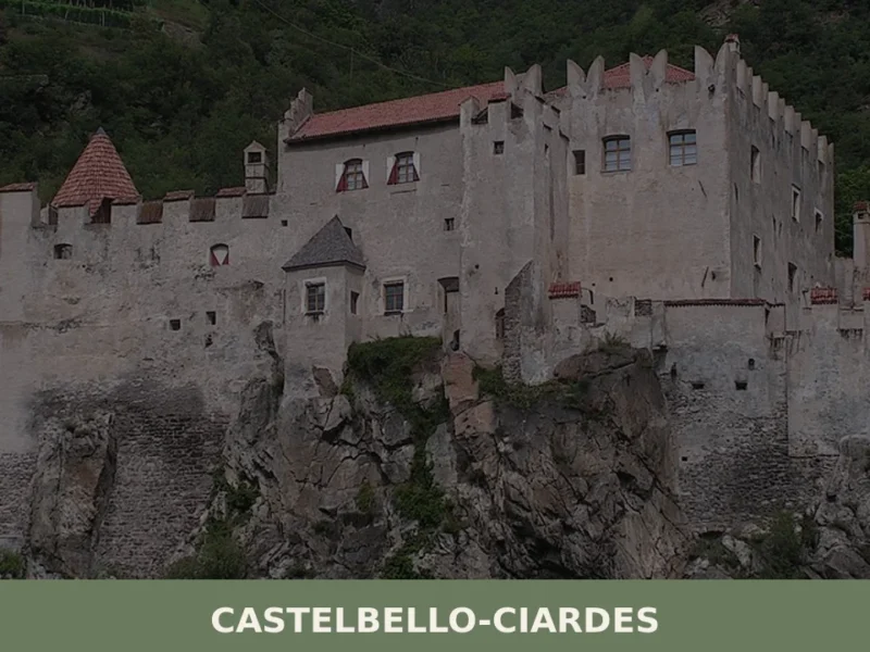
Castelbello-Ciardes
The municipality of Castelbello-Ciardes, home to 2,379 inhabitants at 587 metres above sea level in the Venosta Valley, owes its existence to a dual administrative identity: in 1928 the two separate villages of Castelbello (Kastelbell) and Ciardes (Tschars) were merged into a single municipality. Anyone looking into what to see in Castelbello-Ciardes will find an […]
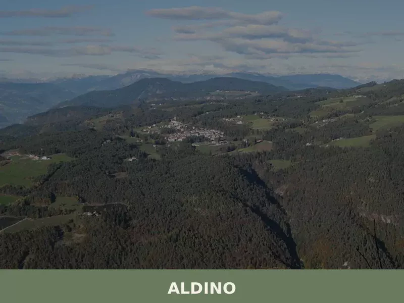
Aldino
Population 1,607. Aldino sits at 1,225 metres in Bolzano province, where Alpine architecture and seasonal rhythms shape daily life.

Trento
What to see in Trento, a city of 119,359. Discover its Duomo, Castello del Buonconsiglio, and typical cuisine. Explore its rich Council history.
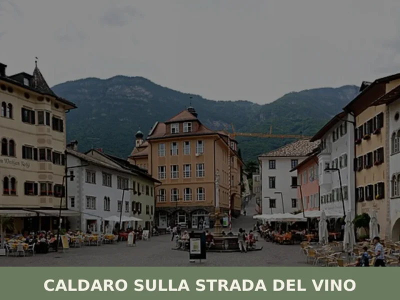
Caldaro sulla strada del vino
Caldaro sulla strada del vino — Kaltern an der Weinstraße in German — has 7,735 inhabitants and over 600 hectares of vineyards, the largest cultivated wine-growing area in South Tyrol. The place name itself declares the vocation of this centre in the province of Bolzano, which grew along the trade route linking the Bassa Atesina […]
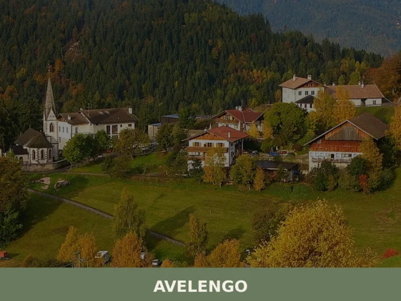
Avelengo
Population 816. A high-altitude comune in South Tyrol offering mountain access and traditional alpine settlement patterns without mass tourism infrastructure.
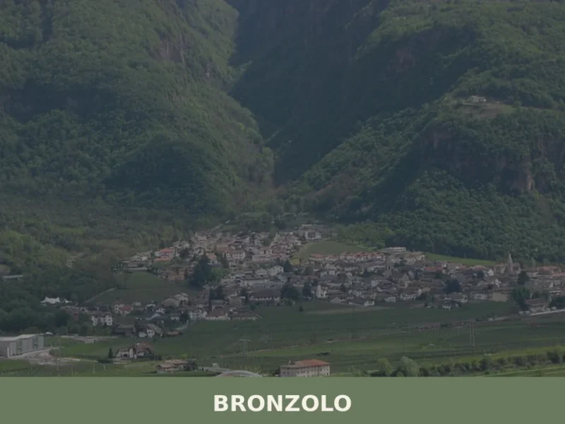
Bronzolo
Bronzolo has 2,646 inhabitants and sits at 238 metres above sea level, on the right bank of the Adige River, at the point where the Isarco Valley meets the Adige plain. The German name for the town — Branzoll — already appears in medieval documents related to the control of trade routes between the Germanic […]
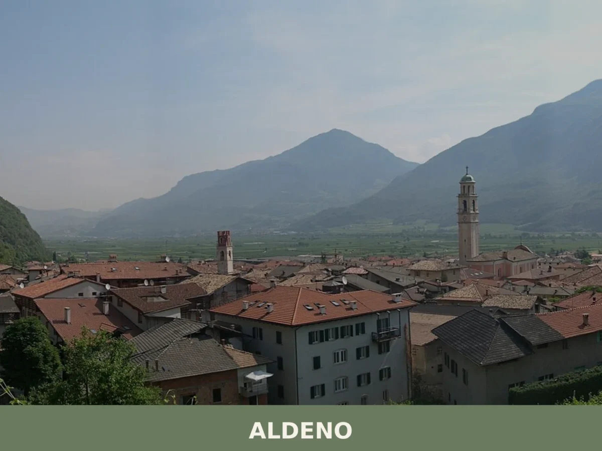
Aldeno
A 3,374-inhabitant comune on the Adige's bank, Aldeno blends prehistoric trade crossings with baroque churches and the memory of the Austro-Hungarian Great War command.
🧀 Italian traditional products


🏡 Know Anterivo better than we do?
If you’re a local or have been there, your knowledge matters: add what’s missing or fix a detail on this page.