
Ari
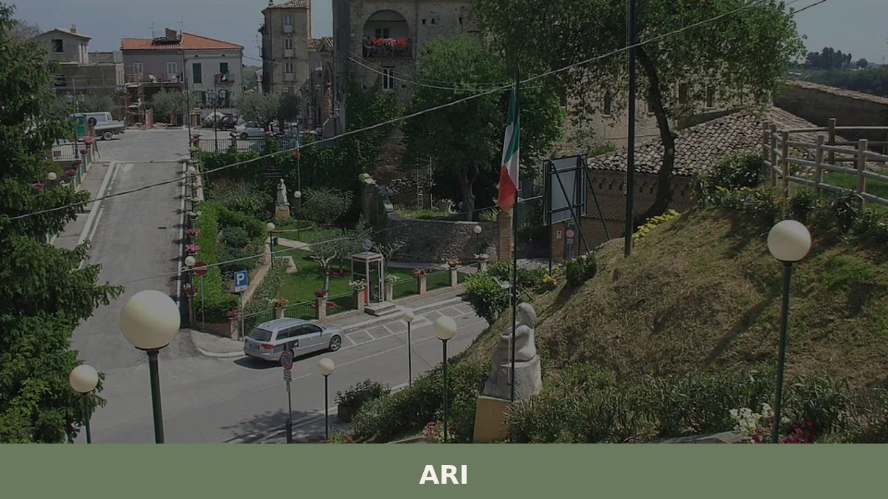
Ari has 1,071 inhabitants spread across a hilly area at 289 metres above sea level, in the strip of land that separates the Teatine coast from the first undulations of the Maiella massif. The municipality, in the province of Chieti, occupies a position that commands a view over the valley corridor of the Dendalo stream, […]
Discover Ari
Ari has 1,071 inhabitants spread across a hilly area at 289 metres above sea level, in the strip of land that separates the Teatine coast from the first undulations of the Maiella massif. The municipality, in the province of Chieti, occupies a position that commands a view over the valley corridor of the Dendalo stream, a tributary of the River Foro. Asking what to see in Ari means looking at a rural centre that has preserved its agricultural settlement layout, with a compact core of houses built in local stone and a countryside dotted with rows of olive trees and vineyards. The patron saint festival dedicated to Saint John the Baptist, celebrated on 29 August, still marks the community calendar today.
History and origins of Ari
The earliest documentary references to the place name date back to the Norman period, when the Catalogus Baronum — the feudal census commissioned by Roger II in the 12th century — records the fief under the name “Ari” or “Ara”. The etymology remains debated: some scholars link it to the Latin ara (altar), suggesting the presence of a pre-Christian place of worship on the hilltop; others trace it to a pre-Roman root related to the shape of the terrain. The territory fell within the jurisdiction of the ancient diocese of Chieti and, during the Middle Ages, was part of the holdings that passed between various feudal families of the Teatine county.
In the 15th and 16th centuries, Ari followed the fortunes of the Kingdom of Naples, suffering the consequences of the conflicts between the Angevins and the Aragonese. The village was not the scene of any major military events, but its economy — based on the cultivation of wheat and olives and on sheep farming — was affected by the famines and epidemics that struck the Abruzzese hinterland. With the abolition of feudalism in 1806, the municipality gained administrative autonomy and maintained its territorial structure up to the present day, resisting the mergers that during the 20th century reduced the number of small Italian municipalities.
Post-war emigration halved the population, which in the 1951 census exceeded two thousand residents. This phenomenon left visible traces in the built fabric of the old town, where several buildings show signs of neglect alongside recent restorations. The current community, according to ISTAT data, stands at around 1,071 inhabitants, with an economy that combines agriculture, small-scale artisan enterprise and commuting to Chieti and Pescara.
What to see in Ari: 5 main attractions
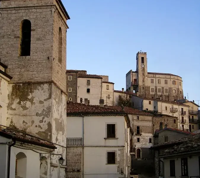
1. Church of San Giovanni Battista
The sacred building dedicated to the patron saint of the village stands at the highest point of the settlement. The current structure is the result of successive interventions between the 17th and 19th centuries, with a simple brick façade and a single-nave interior. Inside, handcrafted liturgical furnishings and a main altar in carved stone are preserved, the latter representing the element of greatest artistic interest in the church.
2. Old town and rural architecture
The old core of Ari has a concentric layout organised around the parish church. The houses, built in local limestone with clay tile roofs, feature round-arched doorways and small internal courtyards — recurring elements in the rural architecture of the hilly Chieti area. The external masonry staircases connecting the ground floor to the first floor are a distinctive feature that remains clearly legible.
3. Historic public fountain
Along the road that crosses the village stands a stone fountain that served as a water supply point for the community and as a drinking trough for livestock. The structure, with stacked rectangular basins, documents the hydraulic organisation of Abruzzese hilltop villages before the modern aqueduct network and is one of the best-preserved pieces of historic street furniture in the municipality.
4. Olive-growing landscape of the Dendalo valley
The hills surrounding Ari are covered with olive groves that produce indigenous cultivars of the Teatine hill belt. The agricultural landscape, best appreciated from the provincial road connecting the village to Giuliano Teatino and Vacri, offers a direct view of the traditional Abruzzese farming system. In autumn, during the harvest, it is possible to see the nets spread beneath the trees and the small olive mills still active in the area.
5. Rural paths towards the Maiella
From the municipal territory, footpaths and farm tracks lead from Ari to neighbouring municipalities, crossing a mosaic of cultivated fields, Mediterranean scrubland and small downy oak woods. These routes, historically used for local transhumance and the transport of agricultural produce, now allow visitors to walk or cycle through the foothill belt with views of the Maiella range to the west and the Adriatic Sea to the east.
Traditional cuisine and local products
The table in Ari reflects the gastronomic tradition of the Chieti hinterland, based on cereals, pulses, extra virgin olive oil and sheep meat. Arrosticini — skewers of mutton cut into small cubes and grilled over the embers of the hearth known as a furnacella — feature at every local festival and are the most emblematic dish of Abruzzese cooking. Homemade pasta dominates the first courses: sagne a pezze, broad irregular sheets of flour-and-water dough dressed with tomato sauce and ricotta, and maccheroni alla chitarra, produced with the characteristic metal-stringed tool, are common preparations in the village’s households. Olio extravergine d’oliva Colline Teatine DOP, made from the Gentile di Chieti, Leccino and Intosso cultivars, forms the fat base of nearly every local recipe. Among the pulses, the tradition calls for chickpea and bean soups enriched with pork rind, a winter dish linked to home butchering.
Sweets follow the liturgical calendar: at Christmas calgionetti (or caggionetti) are prepared — fried pastry parcels filled with chickpea paste, cooked grape must, cocoa, almonds and cinnamon; at Easter the fiadone, a pastry shell filled with eggs and fresh cheese. Montepulciano d’Abruzzo DOC and Trebbiano d’Abruzzo DOC accompany daily meals; the Teatine hill area falls entirely within the production zone of both denominations. Among the dairy products are pecorino abruzzese and scamorze, often smoked with beech wood. During the patron saint festival on 29 August and at the summer food fairs in neighbouring municipalities, these preparations can be sampled at open-air communal gatherings, with stalls set up in the squares and collective charcoal grilling.
What to see in Ari and surroundings: when to visit the village
The best period to visit Ari runs from May to October. In late spring temperatures range between 15 and 25 degrees, the vegetation is at its peak bloom and the long days allow walkers to follow the rural paths with good light until evening. Summer culminates with the feast of San Giovanni Battista on 29 August: the procession, live music and communal tables in the square offer a concrete opportunity to observe the village’s community life. Autumn, between October and November, coincides with the olive harvest and the grape vintage — the agricultural landscape is in full activity and the olive mills open their doors for pressing.
Winter is the quietest season: temperatures drop to a few degrees above zero on January nights, but sunny winter days make the view of the snow-covered Maiella from the hill ridge remarkably clear. Those who prefer to visit Ari without the summer heat will find March and April a good compromise, with the countryside regaining colour after the cold months and an almost non-existent flow of visitors.
How to get to Ari
Ari can be reached from the A14 Bologna–Taranto motorway by taking the Pescara Ovest–Chieti exit, from which it is approximately 20 kilometres heading south along the provincial road through Vacri and Giuliano Teatino. The drive takes around 25 minutes on hilly roads. From Chieti the distance is 15 kilometres, covered in about twenty minutes.
The nearest railway station is Chieti Scalo, on the Rome–Pescara line, from where you need to continue by car or local bus. The reference airport is Pescara’s “Pasquale Liberi”, about 30 kilometres away — the only airport in Abruzzo with domestic and international connections. From Rome the distance is approximately 220 kilometres via the A25 and then the A14, for a travel time of roughly two and a half hours. For those coming from Naples, the journey is about 250 kilometres via the A1 and the A25, with similar travel times. The village does not have frequent public transport: a private or rental car is the most practical solution for reaching it and for exploring the surrounding area.
Other villages to discover in Abruzzo
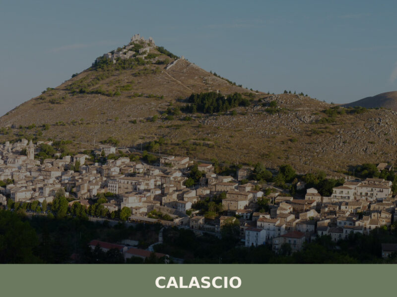
Inland Abruzzo has dozens of small centres that share with Ari the layout of a compact rural village and an economy still tied to the land. Moving towards the Aquila Apennines, Carapelle Calvisio is a case study in Abruzzese fortified architecture: its circular urban plan, built for defensive purposes, retains a legibility that is rare in the regional landscape. The village, located within the Gran Sasso and Monti della Laga National Park, offers a sharp contrast with the Teatine hill landscape of Ari — here grey stone and mountain altitudes above one thousand metres prevail.
Staying in the province of Chieti but heading south, Bomba overlooks the lake of the same name, an artificial reservoir created by the damming of the River Sangro. The town has linked part of its recent identity to this body of water, used for sports and recreational activities. During the Second World War, Bomba was at the centre of dramatic events connected to the Gustav Line, and its territory still bears traces of that period. For those visiting Ari who wish to deepen their knowledge of hilly and mountainous Abruzzo, both villages are reachable as day trips, each with a distinct historical and landscape profile. Further information on the heritage of Abruzzese villages is available on Wikipedia and on the Italia.it portal.
Nearby Villages near Ari

In Abruzzo More villages to discover
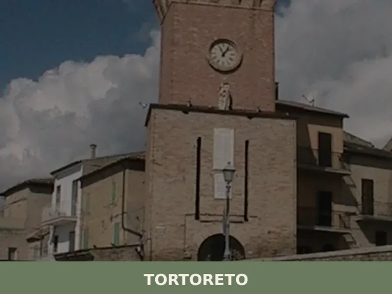
Tortoreto
The village of Tortoreto, located in the province of Teramo, stands at 227 meters above sea level, maintaining an observation position over the Adriatic coast. Its historical foundation is attested in Roman times with the name of Castrum Salini, a settlement that indicated its proximity to salt pans and its function of territorial control. Today, […]
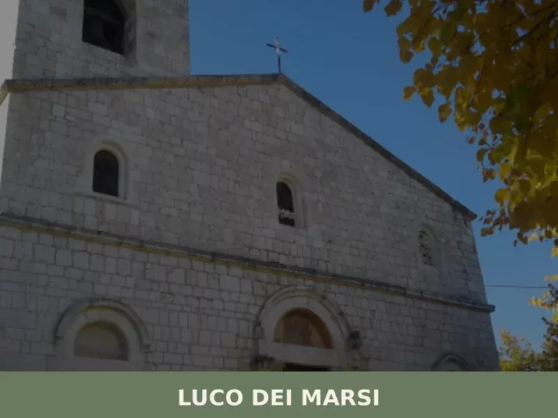
Luco dei Marsi
At 680 metres above sea level, on the eastern edge of what until 1875 was the surface of Lake Fucino — the largest lake in peninsular Italy, drained by Prince Alessandro Torlonia — stands Luco dei Marsi, a municipality of 5,857 inhabitants in the province of L’Aquila. The plain that today stretches as far as […]
Gamberale
At 1,343 metres above sea level, along the eastern ridge of the Majella mountains where the slopes descend towards the Sangro valleys, 277 residents keep alive a settlement that the catasto onciario of the Kingdom of Naples already recorded in the eighteenth century as a community of shepherds and charcoal burners. Visitors arriving in Gamberale […]


📝 Incorrect information or updates?
Help us keep the Ari page accurate and up to date.