
Bagnaria Arsa
In 1420, when the Venetian Republic extended its dominion over Friuli, the territory of Bagnaria Arsa came firmly into the Venetian orbit: the Republic’s cadastral records document a rural settlement structured around two distinct centres — Bagnaria and Sevegliano — separated by fields planted with cereals and crossed by drainage channels. Today, anyone wondering what […]
Discover Bagnaria Arsa
In 1420, when the Venetian Republic extended its dominion over Friuli, the territory of Bagnaria Arsa came firmly into the Venetian orbit: the Republic’s cadastral records document a rural settlement structured around two distinct centres — Bagnaria and Sevegliano — separated by fields planted with cereals and crossed by drainage channels. Today, anyone wondering what to see in Bagnaria Arsa will find a lowland landscape that preserves that dual identity, with the parish church dominating the centre of Bagnaria and the hamlet of Sevegliano maintaining its own separate character a few kilometres away, along the road connecting Udine to Cervignano del Friuli.
History and origins of Bagnaria Arsa
The place name “Bagnaria” almost certainly derives from the Latin balnearia, indicating the presence of wetlands, marshes or waterlogged ground. The qualifier “Arsa” appeared later and refers to the practice of slash-and-burn — the controlled burning of marsh vegetation to make the land cultivable — or, according to another documented interpretation, to the gradual reclamation that “burned,” that is, drained the marshy areas. This etymology precisely describes the nature of the place: a portion of the lower Friulian plain, just 20 metres above sea level, where water was for centuries the dominant element of both the landscape and the economy. The earliest written documents mentioning the territory date back to the early Middle Ages, when the area fell under the jurisdiction of the Patriarchate of Aquileia, the great ecclesiastical and temporal body that governed much of Friuli until the fifteenth century.
The medieval history of Bagnaria Arsa is inseparable from the events of the Patriarchate of Aquileia and the conflicts that marked its decline. During the fourteenth century, the territory suffered the consequences of wars between the Patriarchate and the surrounding lordships, particularly the Counts of Gorizia and the della Torre family. With the Venetian conquest of 1420, Bagnaria Arsa was incorporated into the Patria del Friuli, administered by a Lieutenant of the Venetian Republic based in Udine. During Venetian rule, which lasted nearly four centuries, the settlement consolidated its agricultural vocation. Fields were progressively expanded through water management works, and the cultivation of cereals — wheat, barley, rye — became the prevailing economic activity. The hamlet of Sevegliano, recorded in documents under the Latin name Sevilhanum, developed as an autonomous nucleus tied to farming and livestock raising, maintaining its own church and a community distinct from that of Bagnaria.
With the fall of the Venetian Republic in 1797, the territory passed under Napoleonic rule and subsequently under the Austro-Hungarian Empire, remaining in Habsburg hands until the First World War. Bagnaria Arsa’s position in the lower Friulian plain made it a transit and rear-line zone during the 1915–1918 conflict: after the rout at Caporetto in October 1917, the territory was occupied by Austro-Hungarian troops until the Italian victory of November 1918. During the Second World War, the Sevegliano area was the scene of episodes linked to the Resistance and the complex situation along the eastern border. In the post-war period, the construction of the Aussa Corno industrial zone, a few kilometres from the town centre, partially transformed the local economy, adding manufacturing and logistics activities alongside traditional agriculture. Today the municipality has 3,574 inhabitants distributed between the main settlement and the hamlets, and retains the profile of a lowland community where the organisation of rural space remains legible in the layout of the fields, farm tracks and drainage ditches.
What to see in Bagnaria Arsa: 5 top attractions
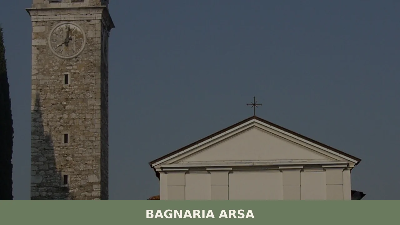
1. Parish Church of San Giorgio
The church dedicated to Saint George, patron saint of the municipality — celebrated on 23 April — stands in the centre of Bagnaria and is the main place of worship in the area. The current building, the result of successive architectural interventions, has a sober façade and a single-nave interior containing locally crafted liturgical furnishings. The bell tower, visible from various points across the surrounding plain, serves as a geographical landmark for the entire settlement. The square in front of the church is the focal point of community life, especially during the patron saint’s feast in April, when religious celebrations and civic events bring together the entire population of the municipality.
2. Church of Sevegliano
In the hamlet of Sevegliano stands an independent parish church that documents the historical separation between the municipality’s two centres. The sacred building, reached by following the provincial road that crosses the plain south of Bagnaria, maintains its own liturgical cycle and a distinct community of reference. The architectural structure reflects the typical forms of rural Friulian churches: modest dimensions, local materials, and a direct relationship with the surrounding agricultural space. Visiting Sevegliano after the main town allows you to grasp the dual territorial structure of the municipality, an uncommon feature among the small settlements of the lower plain.
3. Agricultural landscape of the lower Friulian plain
The municipal territory of Bagnaria Arsa offers one of the most intact examples of agricultural landscape in the eastern lower Friulian plain. The cultivated fields, crossed by a network of drainage channels and ditches, extend in regular surfaces bounded by rows of trees and straight farm tracks. The main crops include maize, soya and autumn cereals. A walk or bicycle ride along the secondary roads — particularly towards the Aussa Corno area to the south — allows you to observe up close the land-holding structure, the isolated farmsteads and the hydraulic system that made it possible to put originally marshy land to productive use. It is a landscape shaped by human effort over the course of centuries.
4. Aussa Corno area
To the south of the municipal territory lies the zone associated with the Aussa and Corno rivers, two spring-fed watercourses that flow into the Marano lagoon. This area, shared with the neighbouring municipalities of Cervignano del Friuli and Torviscosa, presents a transitional environment between the agricultural plain and the lagoon zone. The navigable channels and riverbanks support riparian vegetation and birdlife typical of the upper Adriatic wetlands. For those wondering what to see in Bagnaria Arsa beyond the built-up areas, this river corridor is a natural excursion reachable in just a few minutes by car or bicycle, with unpaved paths running along the embankments.
5. The rural farmstead system
Scattered across the municipal territory, several rural farmsteads document Friulian agricultural architecture of the eighteenth and nineteenth centuries. These structures — built predominantly in stone and brick, with double-pitched roofs covered in clay tiles — comprise the main dwelling, stables, barns and tool sheds, arranged around an internal courtyard or laid out in a line along the road. Some of these complexes, visible along the municipal roads between Bagnaria and Sevegliano, retain original features such as arched portals, wells and bread ovens. They are not open to the public as museums, but observing them from the outside provides a concrete picture of rural life on the Friulian plain.
Traditional cuisine and local products
The table in Bagnaria Arsa reflects the gastronomic tradition of the lower Friulian plain, where cooking has historically been tied to the availability of cereals, pulses, pork and garden produce. The most representative dish of the area is frico, prepared in its crispy version — using only aged Montasio cheese, grated and pan-fried until it forms a crunchy crust — or in its soft version, enriched with potatoes and onion. Montasio DOP, a cooked-curd cheese produced according to specifications that protect its origin in the Friulian and Veneto zones, is the key ingredient of this dish and is found regularly in home kitchens and restaurants in the area. Alongside frico, brovada — white turnips macerated in grape pomace, then grated and slow-cooked — traditionally accompanies musetto, a sausage made from pork rind and snout seasoned with cinnamon and cloves, consumed mainly during the winter months.
Among local products worth noting are Prosciutto di San Daniele DOP, whose production zone is about forty kilometres away but whose presence on Friulian tables is widespread, and polenta, prepared with local maize flour — often stone-ground in the region’s surviving mills — which remains the staple of the traditional diet. Polenta is served soft with game or mushroom sauces, or grilled as an accompaniment to cheeses and cured meats. Among desserts, gubana, a roll of leavened dough filled with walnuts, raisins, pine nuts, grappa and lemon zest, is the quintessential festive sweet of eastern Friuli, present on Bagnaria Arsa tables during major celebrations. Also worth mentioning is stucco di pesce, a preparation based on soaked stockfish, slow-cooked with oil, garlic and parsley, which reflects the influence of Venetian cuisine on Friulian gastronomy.
Local festivals, concentrated mainly in the summer and autumn months, are the principal occasion for tasting these specialities. The patron saint’s feast of Saint George, on 23 April, traditionally includes a communal meal featuring local dishes. During the summer, the hamlets organise outdoor festivals where you can enjoy polenta-based dishes, grilled meats and homemade desserts. For up-to-date information on food events, it is useful to consult the official website of the Municipality of Bagnaria Arsa.
When to visit Bagnaria Arsa: the best time of year
The lower Friulian plain has a temperate continental climate with Adriatic influences: winters are cold and often foggy, with temperatures frequently dropping below zero between December and February; summers are hot and humid, with highs exceeding 30 degrees in July and August. Spring — particularly the months of April and May — is the most favourable period for visiting Bagnaria Arsa: temperatures are mild, the fields are in full growth and on 23 April the patron saint’s feast of Saint George enlivens the town centre with religious celebrations and civic events. It is the time when the local community is most visible and engaged.
Autumn, especially September and October, offers pleasant weather conditions and the chance to attend the outdoor festivals that accompany the end of the farming season. The days are still long and the light on the plain, low and golden in the late afternoon, enhances the rural landscape. Summer suits those who want to combine a visit with bicycle excursions towards the Aussa Corno area or the Marano lagoon, but it is advisable to set out in the morning or evening hours to avoid the intense heat. Winter, with its frequent fogs, transforms the landscape into a rarefied and silent setting, interesting for those seeking a different kind of experience from the usual tourist visit, but less practical for getting around on foot or by bicycle.
How to reach Bagnaria Arsa
Bagnaria Arsa lies along the road connecting Udine to Cervignano del Friuli, in a position well served by the regional road network. The A4 Venice–Trieste motorway is accessible via the Palmanova exit, approximately 8 kilometres away, or via the Villesse-Gorizia exit. From Udine the route covers about 25 kilometres along the SR352 regional road, with a journey time of thirty minutes. The nearest railway station is Cervignano del Friuli-Aquileia, on the Venice–Trieste line, about 6 kilometres from the centre of Bagnaria; from there you can continue by local bus or taxi. For further information on the location and services of the area, you can consult the Wikipedia page for Bagnaria Arsa.
The nearest airport is Trieste Airport at Ronchi dei Legionari, approximately 20 kilometres away with a driving time of twenty minutes along the SR14 or the A4 motorway. Venice Marco Polo Airport is about 120 kilometres away (one hour and twenty minutes via the A4). From Trieste, Bagnaria Arsa can be reached in approximately fifty minutes by taking the A4 motorway towards Venice and exiting at Palmanova. The regional cycle route network — in particular the Alpe Adria cycleway, which crosses Friuli from Tarvisio to Grado — passes close to the municipal territory, making Bagnaria Arsa accessible also to those travelling by bicycle along the region’s long-distance routes.
Other villages to discover in Friuli Venezia Giulia
The plain of Bagnaria Arsa represents just one of the many faces of Friuli Venezia Giulia, a region that within a few kilometres shifts from twenty metres above sea level to the peaks of the Julian Pre-Alps. Those wishing to explore the mountainous side of the region can head to Bordano, the village known for the butterfly murals covering the façades of its houses and for its proximity to Lake Cavazzo, the largest natural lake in Friuli. Bordano offers a radically different experience from the lower plain: mountains surround the settlement, the vegetation is alpine and the relationship between human habitation and the natural environment takes vertical rather than horizontal forms. Combining a day at Bagnaria Arsa with one at Bordano allows you to traverse, in less than an hour’s drive, the entire cross-section of the Friulian landscape.
Another possible direction leads to the eastern moraine hills, where you will find Attimis, a village dominated by the remains of two medieval castles — the Upper Castle and the Lower Castle — which document the defensive system of the Friulian feudal lords. At Attimis the landscape is hilly, with vineyards and mixed woodland that contrast sharply with the open fields of the lower plain. An itinerary linking Bagnaria Arsa, Attimis and Bordano covers roughly one hundred and twenty kilometres and can be completed in two or three days, offering a comprehensive reading of the geographical, historical and cultural variety of Friuli Venezia Giulia — from the reclaimed plain to the hilltop strongholds, all the way to the pre-Alpine villages overlooking the lakes.
In Friuli Venezia Giulia More villages to discover
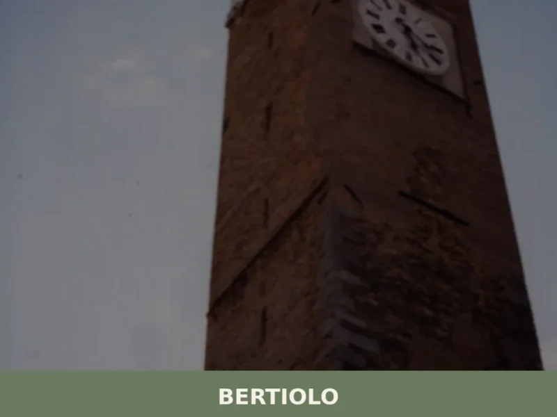
Bertiolo
The earliest documented mention of the name Bertiolo dates back to 1219, in a notarial deed linked to the properties of the Patriarchate of Aquileia. Arriving today along the road that leads south from Codroipo, visitors encounter a compact urban centre laid out along a grid of orderly streets, surrounded by fields of maize and […]
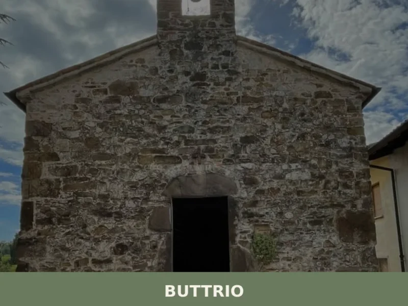
Buttrio
In 1031 a document issued by Emperor Conrad II mentioned for the first time the name Butrium, referring to a hilltop settlement where grapevines had already been cultivated for centuries. Today that nucleus has become a municipality of 4,040 inhabitants in the province of Udine, standing at 79 metres above sea level and surrounded by […]
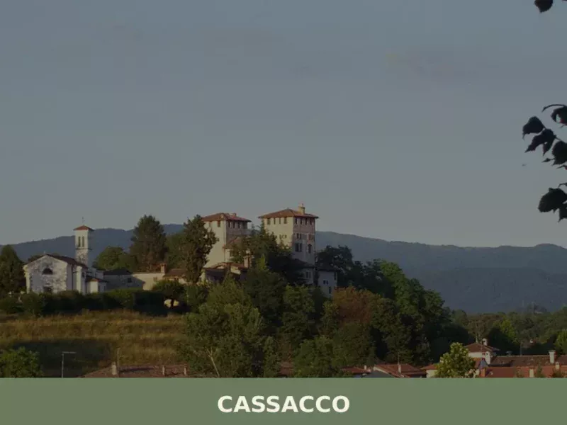
Cassacco
The Castle of Cassacco appears in documents of the Patriarchate of Aquileia as early as 1158, when Patriarch Ulrich II confirmed its possession to the local lords. Since then, that manor in a commanding position over the Friulian plain has shaped the life of an entire rural territory, defined by cultivated fields, rows of vines […]


📝 Incorrect information or updates?
Help us keep the Bagnaria Arsa page accurate and up to date.