
Gamberale
At 1,343 metres above sea level, along the eastern ridge of the Majella mountains where the slopes descend towards the Sangro valleys, 277 residents keep alive a settlement that the catasto onciario of the Kingdom of Naples already recorded in the eighteenth century as a community of shepherds and charcoal burners. Visitors arriving in Gamberale […]
Discover Gamberale
At 1,343 metres above sea level, along the eastern ridge of the Majella mountains where the slopes descend towards the Sangro valleys, 277 residents keep alive a settlement that the catasto onciario of the Kingdom of Naples already recorded in the eighteenth century as a community of shepherds and charcoal burners. Visitors arriving in Gamberale today drive up the final switchbacks of the provincial road to find a compact cluster of buildings, with local stone façades and pitched roofs designed to bear the weight of snow that here, in winter, regularly exceeds one metre. Asking what to see in Gamberale means preparing to read a landscape where the agro-pastoral economy has left precise marks: fountains, drove roads, dry-stone walls, a church dedicated to San Lorenzo, and a direct — almost vertical — relationship with the mountain.
History and origins of Gamberale
The place name “Gamberale” has been the subject of several etymological hypotheses, none of them definitive. The most widely accepted links it to the medieval Latin cambaralis, derived from cambarus — the freshwater crayfish — referring to the small watercourses in the area where the species was once common. Another interpretation, supported by certain scholars of Abruzzese place names, traces it back to a Lombard personal name, connected to a landowner who supposedly gave his name to the earliest core of habitation. The first documentary mention of the village dates to the Norman period: in the 12th century, Gamberale appears among the fiefs of the County of Sangro, a strategic area for controlling the communication routes between the Adriatic coast and the Apennine interior. By that time the settlement was already organised around a small fortification and a church, evidence of a stable and structured community.
During the Middle Ages the village passed through various feudal lordships, following the fortunes of the Kingdom of Naples. It was held by the Di Sangro family, then by the D’Aquino, and eventually came under the control of minor noble families who administered its lands until the abolition of feudalism in 1806. The local economy revolved around transhumance: Gamberale lay close to the drove roads connecting the summer pastures of the Majella with the winter grazing lands of the Tavoliere plain in Puglia, and this position guaranteed the village a role — modest but constant — in the wool and cheese trade networks. The production of charcoal from the surrounding beech forests represented another significant source of income, documented up until the first half of the twentieth century.
The Second World War struck Gamberale hard. In the autumn of 1943, the village found itself on the Gustav Line, the German defensive system that cut across central Italy. Nazi troops occupied the area and the population endured round-ups, forced evacuations, and destruction. Several buildings in the historic centre were damaged or razed to the ground during the fighting and reprisals. Post-war reconstruction was slow, and like many villages in the Abruzzese Apennines, Gamberale experienced intense emigration towards the cities of northern Italy and abroad — particularly Canada and Venezuela — which drastically reduced its population. From roughly 1,500 inhabitants in the immediate post-war period, the number has fallen to today’s 277, a figure that tells of half a century of mountain depopulation but also of the tenacity of those who stayed to look after a difficult and steep territory. The Municipality of Gamberale now promotes initiatives to recover local historical identity, from cataloguing parish archives to promoting the trails linked to transhumance.
What to see in Gamberale: 5 key attractions
1. Church of San Lorenzo Martire
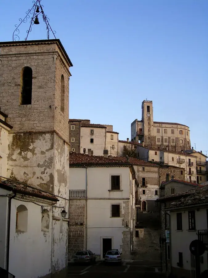
Built in the upper part of the village, the Church of San Lorenzo Martire is Gamberale’s main place of worship and the venue for the patron saint’s celebrations, held on 10 August. The current structure largely dates from the post-war reconstruction, following the damage sustained in 1943, but it preserves elements of the earlier building, including the carved stone portal and several wooden statues of Abruzzese craftsmanship. The interior, with a single nave, houses a marble high altar and a canvas depicting the martyrdom of San Lorenzo. The church overlooks a small parvis from which the view opens out towards the Sangro valley, with a visual arc that on clear days reaches as far as Molise.
2. Historic centre and stone architecture
The old core of Gamberale retains a compact urban layout, typical of mountain settlements designed to withstand cold and wind. The houses are built one against the other, with load-bearing walls of local limestone — grey, coarse-grained — with a thickness exceeding sixty centimetres. Arched doorways, external stone staircases, small wrought-iron balconies, and covered passageways mark the sequence of buildings. Several structures still bear the scars of war: walls rebuilt with different materials, visible patches, uneven heights. It is an open-air reading of the village’s material history, where every façade documents a specific era.
3. Trails of the eastern Majella
Gamberale serves as a direct access point to the trails on the eastern slopes of the Majella, within the territory of the Maiella National Park. From the village, hiking routes lead into beech forests at altitudes between 1,300 and 1,600 metres, and beyond, towards the summit grasslands. These paths partly follow the old routes of charcoal burners and transhumant shepherds, with stretches still marked by dry-stone walls and stone shelters. CAI trail markers are present on the main routes. In spring and summer, the flowering of wild orchids and gentians makes the hikes particularly rewarding from a botanical standpoint.
4. Historic fountains
Water supply has always been a central concern for mountain communities, and Gamberale preserves several historic fountains distributed between the built-up area and its immediate surroundings. Made from local stone, with rectangular basins originally intended also for watering livestock, these functional structures document the collective management of water in a setting where natural springs were — and remain — the primary resource. The main fountain, near the centre, still maintains a continuous flow fed by a mountain spring. These are spatial and social reference points, places where the communal life of the village found a moment of daily encounter.
5. Panoramic viewpoint over the Sangro valley
On the southern edge of the village, a natural vantage point offers an unobstructed view over the Sangro river valley and the ridges that separate Abruzzo from Molise. From this position, the profiles of the surrounding mountains are clearly distinguishable, including the Majella massif to the north-west and the heights of the Abruzzo, Lazio and Molise National Park to the south-west. The high elevation — over 1,300 metres — and the absence of built obstacles in the field of vision make this spot a natural observation point of remarkable breadth. In winter, with snow covering the slopes, the contrast between the white ridgelines and the dark green of the conifer forests in the valley below composes a landscape of rare definition.
Local cuisine and regional products
The table in Gamberale reflects a mountain economy where every ingredient was used to its fullest potential. The most representative dish of the area is pasta alla chitarra, an egg pasta format cut with the characteristic steel-stringed instrument, traditionally served with lamb ragù or castrated-mutton sauce. Sheep meat, from local herds, also takes centre stage in arrosticini — skewers of mutton cut into small cubes and grilled over the embers of a long, narrow brazier called a fornacella — and in pecora alla callara, a slow-cooked preparation in a large copper pot with tomato, peppers, and mountain herbs. Polenta, prepared with cornmeal and dressed with sausage sauce or melted cheese, was the quintessential winter meal at these altitudes.
Among the local products, Pecorino d’Abruzzo — a hard or semi-hard cheese made from raw sheep’s milk — is the most widespread and is aged in cool cellars for periods ranging from two months to over a year. Fresh sheep’s-milk ricotta, obtained by processing the residual whey, accompanies both desserts and first courses. The beech forests surrounding Gamberale yield porcini mushrooms (Boletus edulis), gathered between late summer and early autumn, as well as summer black truffles. Mountain honey, produced by local beekeepers who take advantage of the high-altitude meadow blooms, has a complex aromatic profile with notes of thyme and wild savory. Sagne e fagioli — broad, irregular ribbons of water-and-flour pasta cooked together with beans in a broth flavoured with pork rind — are another dish firmly rooted in the local winter tradition.
The patron saint’s feast of San Lorenzo, on 10 August, is the main occasion on which local cooking is celebrated publicly, with communal tables set up in the centre of the village. During these days it is possible to taste home-made preparations that for the rest of the year remain confined to private kitchens. There are no starred restaurants in Gamberale, but a few family-run trattorie and agriturismi in the immediate surroundings offer menus tied to seasonality, with a quality-to-price ratio that reflects the spare economy of the Abruzzese mountains. For those looking for bread baked in a wood-fired oven — a practice still carried on by some families — it is worth asking the residents directly, who often sell surplus from their weekly baking.
When to visit Gamberale: the best time of year
Gamberale is a mountain village with a distinctly Apennine climate, and the choice of when to visit has a significant impact on the experience. From December to March snowfall is frequent and heavy, night-time temperatures regularly drop below -5°C, and the access roads may require snow chains or winter tyres. This is the right period for those seeking the winter mountain landscape and proximity to the ski facilities of Pizzoferrato and Gamberale (a small local station for cross-country skiing and snowshoeing). Spring, from April to June, brings the snowmelt and the progressive flowering of the mountain meadows: it is the best season for hiking through the beech forests, when the trails dry out and visibility is often sharp. July and August offer pleasant daytime temperatures — between 20°C and 25°C — and cool evenings that make Gamberale a natural refuge from the summer heat of the coastal cities and the lowlands.
10 August, the feast of the patron saint San Lorenzo, is the most significant date in the local calendar: a religious procession, fireworks, and a communal dinner bring together residents, returning emigrants, and visitors in the village. Autumn, from September to November, is the season of mushrooms and of the beech forest’s changing colours, which between October and the first ten days of November take on shades of copper and amber before the trees shed their leaves. Those who visit Gamberale during this period will find few tourists and a working silence, punctuated by the agricultural tasks of harvesting and preparing for winter. It is advisable to check road conditions on the Municipality’s website, especially during the transitional months between autumn and winter.
How to reach Gamberale
By car, Gamberale is reached from the A25 motorway (Torano–Pescara) by exiting at Castel di Sangro, then continuing on the SS652 (Fondovalle Sangro) and the provincial road to Gamberale — roughly 20 minutes from the motorway exit. From Pescara the distance is approximately 120 km, drivable in about one hour and forty minutes. From Rome, the journey is approximately 200 km, with a travel time of around two and a half hours via the A25. From Naples, via the A1 and then the A25, the distance is roughly 210 km with similar travel times. The access roads are paved but narrow and winding over the final kilometres, with switchbacks that demand caution especially in snow or icy conditions.
The nearest railway station is Castel di Sangro, served by the Sulmona–Isernia line (one of Italy’s most scenic Apennine railways, for those with time and patience). From there it is necessary to continue by private vehicle or with local transport services, which run infrequently. The nearest airport is Pescara (Abruzzo Airport), approximately 130 km away, connected to several Italian cities and a number of European hubs. Rome Fiumicino airport, roughly 230 km away, is the alternative for those arriving from further afield. Having your own car is strongly recommended: public transport to the mountain villages of the Abruzzese interior is sparse and does not provide the flexibility needed to explore the surrounding territory.
Other villages to discover in Abruzzo
Visitors to Gamberale who wish to deepen their knowledge of inland Abruzzo can put together an itinerary that crosses different yet complementary settings. Heading north, in the province of Chieti, one encounters Fara Filiorum Petri, a foothill village at the base of the eastern Majella, known for the Farchie — enormous bundles of reeds set ablaze on 16 January in honour of Sant’Antonio Abate, one of the most spectacular fire rituals in central-southern Italy. Fara sits at a much lower elevation than Gamberale and offers a hilly landscape where olive trees and vineyards replace the beeches, allowing one to observe within just a few dozen kilometres the altitudinal and climatic variety that defines Abruzzo.
In the opposite direction, towards the Marsica area and the province of L’Aquila, a detour to Aielli is well worth making — a village known for its contemporary urban art project that has turned building façades into an open-air gallery of commissioned murals, and for its medieval tower converted into an astronomical observatory. Aielli represents a model of cultural regeneration for inland villages that engages in an interesting dialogue with the more conservative and rural character of Gamberale. A circular itinerary encompassing Gamberale, Fara Filiorum Petri, and Aielli covers roughly 180 km and passes through three distinct altitudinal bands — high mountain, foothills, and plateau — offering a complete cross-section of the landscape and material culture of Apennine Abruzzo. For further information on the network of Abruzzese villages, the Touring Club Italiano provides updated profiles and thematic itineraries useful for planning.
In Abruzzo More villages to discover
Brittoli
Brittoli has 258 inhabitants today — fewer than it takes to fill a regional railway carriage. Yet this small settlement at 779 metres above sea level, in the western part of the province of Pescara, retains a building fabric that dates in part to the 12th century and a strategic position on the ridge separating […]
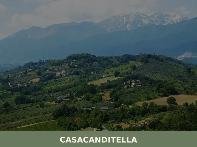
Casacanditella
At 432 metres above sea level, on the eastern slope of the Majella descending towards the Foro river valley, Casacanditella has 1,169 inhabitants and a municipal territory that extends entirely across hilly terrain in the province of Chieti. Anyone wondering what to see in Casacanditella will find a compact urban centre, a church dedicated to […]
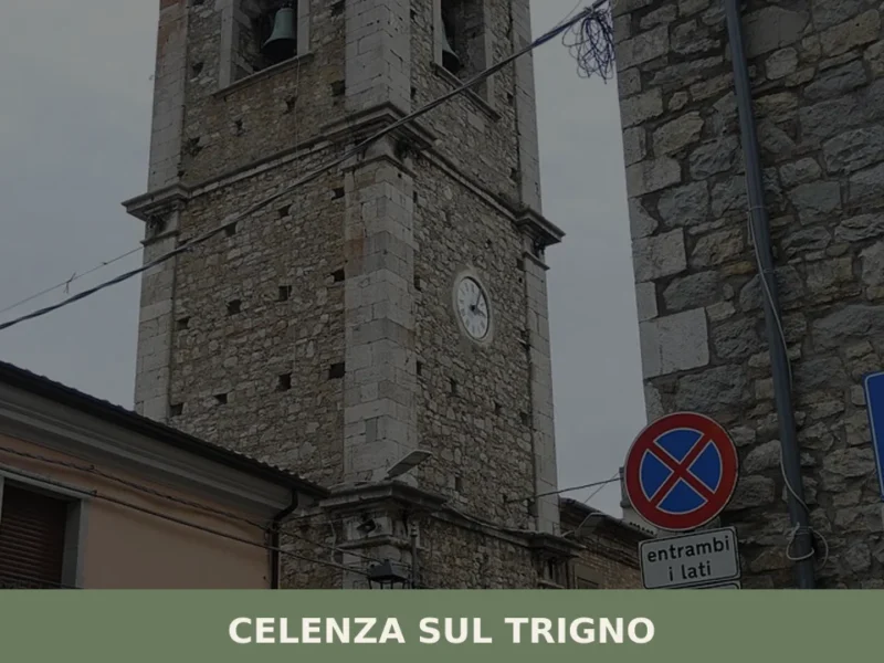
Celenza sul Trigno
At 646 metres above sea level, with 781 registered residents, Celenza sul Trigno occupies a ridge separating the Trigno river valley from the Treste stream, in the province of Chieti. The village appears in medieval documents as a Norman possession, and its urban layout preserves the concentric plan typical of 12th-century fortified settlements. Anyone wondering […]


📝 Incorrect information or updates?
Help us keep the Gamberale page accurate and up to date.