
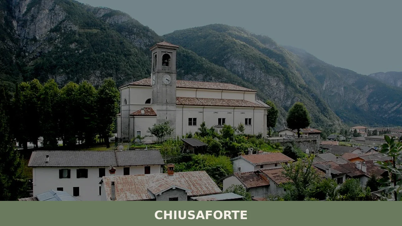
Chiusaforte
Anyone travelling along the A23 motorway towards the Austrian border will notice, quite suddenly, the Fella valley narrowing between sheer rock walls. Right at that point stands Chiusaforte, a settlement of 684 inhabitants at 391 metres above sea level, whose name — from “chiusa forte,” meaning “strong barrier” — declares without ambiguity the military and […]
Discover Chiusaforte
Anyone travelling along the A23 motorway towards the Austrian border will notice, quite suddenly, the Fella valley narrowing between sheer rock walls. Right at that point stands Chiusaforte, a settlement of 684 inhabitants at 391 metres above sea level, whose name — from “chiusa forte,” meaning “strong barrier” — declares without ambiguity the military and strategic function this outpost has served for centuries. The village controls the obligatory passage between the Friulian plain and the Tarvisio pass, a corridor traversed by Roman legions, Napoleonic armies, and railway convoys bound for Vienna.
Understanding what to see in Chiusaforte means reading the landscape as a map of history, geology, and human resistance against the forces of nature.
History and origins of Chiusaforte
The Latin place name Clusa Fortis appears in medieval documents from the 13th century onward and describes the nature of the site with precision: a chiusa, that is, a natural barrier across the valley, made strong by the configuration of limestone walls that squeeze the course of the River Fella down to a passage just a few dozen metres wide. The position was exploited as early as the Roman era as a control point along the road linking Aquileia to Noricum, via the Monte Croce Carnico pass and the Canal del Ferro. The Patriarchate of Aquileia maintained control of this bottleneck for a long period, erecting defensive structures documented as early as the 14th century. The locality was part of the system of customs posts and tolls that regulated commercial transit between the Adriatic area and the Germanic territories.
In 1420 Friuli came under the rule of the Republic of Venice, and Chiusaforte became an outpost of the Serenissima on the border with Habsburg possessions. The frontier function profoundly shaped the life of the village: the settlement housed a permanent garrison and a customs office that monitored the movement of goods and people. During the Napoleonic wars, in 1797 and again in 1809, French troops passed through the narrows of Chiusaforte in the course of military campaigns against Austria. With the Treaty of Campoformido in 1797, Friuli was ceded to Austria, and the village remained under Habsburg administration until 1866, when it became part of the Kingdom of Italy after the Third War of Independence.
The 20th century left deep scars on Chiusaforte.
During World War I, the village’s proximity to the front made it a strategic rear area: the Pontebbana railway line, completed in 1879, transported men and materials towards Alpine positions. But the hardest blow came on 6 May 1976, when the Friuli earthquake, with its epicentre in the nearby Gemona district, severely damaged the settlement. The reconstruction, completed in the 1980s, partially redesigned the appearance of the historic centre. A second seismic event in the autumn of the same year worsened the damage. Despite depopulation — from roughly 1,800 residents in the 1950s to the current 684 — Chiusaforte retains its role as the gateway to the Valcanale and the system of valleys leading towards Austria and Slovenia.
What to see in Chiusaforte: 5 essential attractions
1. The Chiusa and the bridge over the Fella
The most striking point in the village is the natural gorge from which Chiusaforte takes its name. Here the River Fella flows confined between vertical limestone walls, and the road bridge offers a direct view down into the gorge below. In the past this passage was physically blocked by a fortified gate that controlled transit along the valley. Today the defensive structure no longer exists, but the geological formation remains intact and makes it immediately clear why this site held strategic importance for nearly two thousand years. The visible rocks belong to the Dachsteinkalk formation, a Triassic limestone typical of the Carnic and Julian Alps.
2. Parish Church of San Bartolomeo
Dedicated to the patron saint of the village, celebrated on 24 August, the Church of San Bartolomeo stands in the centre of the settlement and is the main place of worship in Chiusaforte. The present building is the result of several restoration campaigns, the most recent of which was made necessary by the damage caused by the 1976 earthquake. The original structure dates to the late medieval period, when the parish depended on the pieve of Dogna. Inside, items of sacred furnishing recovered after the earthquake are preserved. The sober façade, in local stone, reflects the architectural tradition of Alpine churches in Carnia and the Canal del Ferro, where functionality takes precedence over decoration.
3. The Alpe Adria Cycle Path (former Pontebbana railway)
The section of the Alpe Adria Cycle Path that crosses the municipal territory of Chiusaforte is among the most spectacular on the entire route linking Salzburg to Grado. The path follows the course of the old Pontebbana railway, decommissioned in 2000 after the new rail line opened. The route passes through tunnels carved into the rock, now lit and made safe, and viaducts that span the Fella valley at heights of several dozen metres. The stretch between Chiusaforte and Dogna, roughly eight kilometres long, is particularly valued for its sequence of tunnels and bridges offering vantage points over the river gorge below. The infrastructure is open to both cyclists and pedestrians.
4. Chiusaforte Fort (remains of the fortifications)
Within the municipal territory lie the remains of military structures built in successive periods, from Venetian rule to Habsburg control, through to World War I installations. The 19th-century fortifications, constructed by the Royal Italian Army after 1866 to defend the new border with Austria-Hungary, are partly still visible along the slopes overlooking the valley. These are works in stone and concrete integrated into the terrain, with embrasures oriented northward. Some can be reached via marked trails. These structures form part of the broader defensive system of the Vallo Alpino del Littorio and the earlier fortified lines of the Canal del Ferro.
5. The Raccolana torrent gorge
A short distance from the village centre, the Val Raccolana opens to the south-west, providing access to a mountain environment of considerable naturalistic interest. Over millennia the Raccolana torrent has carved a deep gorge into the limestone, creating walls polished by water and pools of intense green. The valley leads towards the Montasio massif, whose main summit reaches 2,753 metres, and serves as the starting point for numerous Alpine hikes. The valley floor is followed by a paved road that reaches the hamlets of Piani di Lùs and Sella Nevea, the latter a winter ski resort.
The vegetation shifts rapidly from mixed beech and fir woodland to high-altitude grassland.
What to eat in Chiusaforte: local cuisine and regional products
The cooking of Chiusaforte belongs to the gastronomic tradition of the Canal del Ferro and Carnia, an area where the diet was historically built around the few ingredients available in a mountain territory with long, harsh winters. The influences are twofold: on one hand the Friulian peasant kitchen, on the other the Alpine cuisine of Austrian and Slavic origin, a direct consequence of the frontier position that defined the village for centuries. Dishes are based on cereals, dairy, game, and garden produce preserved through smoking, salting, and fermentation. The abundance of timber made smoking a particularly widespread technique in this area.
The most representative dish on the local table is frico, a preparation based on cheese — typically aged Montasio — cooked in a pan until it forms a crisp crust, often mixed with potatoes and onion in the soft version. Polenta accompanies nearly every course and is prepared with yellow cornmeal or, in the older tradition, with white corn flour or buckwheat. Cjarsons, stuffed ravioli with a variable filling — herbs, ricotta, potatoes, raisins, cinnamon, and bitter cocoa depending on the valley — are a ritual dish once prepared mainly on feast days.
They are dressed with melted butter and grated smoked ricotta.
Among the dairy products of the area, Montasio cheese, which takes its name from the very mountain group visible from Chiusaforte, is the only one to hold DOP (Protected Designation of Origin) status in the region, with production documented since the 13th century by the monks of the Abbey of Moggio Udinese, some twenty kilometres away. In the malghe (mountain dairies) of the Val Raccolana, malga cheese is still produced during the summer season, following cheesemaking techniques handed down through generations. Smoked ricotta, obtained by exposing fresh ricotta to beechwood smoke, is a fundamental ingredient in the local kitchen: it is grated over cjarsons, gnocchi, and barley soups.
The patron saint’s feast of San Bartolomeo, on 24 August, is the main occasion to taste the traditional preparations of the village. During summer, village festivals in the hamlets of the Canal del Ferro offer traditional dishes accompanied by craft beer and Friulian wines. To purchase local products — cheeses, cured meats, mountain honey — it is worth seeking out the small producers of the valley or the weekly markets in nearby towns such as Tarvisio and Tolmezzo, where local dairies sell directly to the public.
The Chiusaforte area is not a wine-producing zone, given the altitude and Alpine climate.
However, meals are traditionally paired with white wines from Friuli, in particular those of the Friuli Colli Orientali DOC designation — Friulano, Ribolla Gialla, Malvasia Istriana — produced in the eastern hillside belt of the region. In the cold months, Friulian grappas are widely consumed, often flavoured with Alpine herbs such as rue or juniper, along with infusions made from herbs gathered on the Montasio pastures.
When to visit Chiusaforte: the best time of year
Summer, from June to September, is the ideal season for those wishing to ride the Alpe Adria Cycle Path and tackle hikes in the Val Raccolana and towards the Montasio massif. August concentrates the main events: the feast of San Bartolomeo on the 24th of the month brings processions, market stalls, and open-air dinners to the village. July and August see the highest influx of cycle tourists arriving from Austria and Germany along the Salzburg–Grado route. Summer temperatures range between 15 and 28 degrees Celsius, with cool evenings that make overnight stays comfortable even without air conditioning.
Spring and autumn offer different but equally valid conditions.
In May and June the flowering of Alpine meadows and the snowmelt swell the Fella and its tributary streams, creating a particularly intense waterscape. Autumn, from October to November, brings the foliage of beeches and larches along the valley slopes — a combination of yellow, orange, and red reflected in the river waters. Winter is the season for heading to Sella Nevea, the ski resort reachable from the Val Raccolana, frequented above all by ski mountaineers and Alpine skiing enthusiasts. Those seeking solitude will find the village nearly deserted in January and February, with the surrounding mountains covered in snow down to the valley floor.
How to reach Chiusaforte
Chiusaforte lies along the A23 motorway between Udine and Tarvisio, with a dedicated exit at the Chiusaforte toll station. From Udine the distance is approximately 65 kilometres, covered in 45 minutes. From Trieste, expect around 130 kilometres and an hour and a half of driving. The Austrian border crossing at Coccau-Tarvisio is just 30 kilometres to the north, making the village easily reachable also from Villach (55 km) and Klagenfurt (90 km). State road 13 Pontebbana passes through the village centre and serves as an alternative to the A23 for those who prefer a scenic route.
The nearest railway station currently in service is Pontebba, approximately 15 kilometres away, on the Udine–Tarvisio line operated by Trenitalia.
The direct rail connection to Udine takes around 50 minutes. The reference airport is Trieste-Ronchi dei Legionari, 120 kilometres away and reachable in an hour and a half. For those arriving from Austria, Klagenfurt Airport is an alternative at roughly 90 kilometres. Local public transport is managed by regional bus services with limited frequency, so a private car or rental remains the most practical option for getting around the municipal territory and the surrounding valleys.
Other villages to discover in Friuli Venezia Giulia
Visitors to Chiusaforte who wish to explore the Friulian mountains can build an itinerary heading up into Carnia towards Arta Terme, a spa town about 50 kilometres to the west, reachable in just under an hour via the Fella valley floor and then the But valley.
Arta Terme, known for its sulphurous waters exploited since the Roman era, offers an experience that complements Chiusaforte: while the Canal del Ferro is dominated by the verticality of its gorges and by railway and military infrastructure, the basin of Arta opens into a more expansive landscape, where the thermal springs and Carnic hamlets preserve an architecture of wood and stone in the Alpine tradition. It is an effective combination for those with two or three days to spare.
Heading down towards the plain, about 45 kilometres from Chiusaforte, lies Artegna, a foothill village dominated by the hill of San Martino and its fortress, one of the most extensively studied archaeological sites in eastern Friuli, with layers spanning the Bronze Age to the Middle Ages. Artegna marks the point where the mountains give way to the plain and represents a logical stop for anyone travelling the north–south axis between Tarvisio and Udine.
The contrast between the two villages — Chiusaforte compressed within its gorge, Artegna open to the hillside panorama — illustrates in concrete terms the geographic variety of Friuli Venezia Giulia, a region where one can travel from Alpine elevations to the Adriatic coast in less than two hours by car.
In Friuli Venezia Giulia More villages to discover
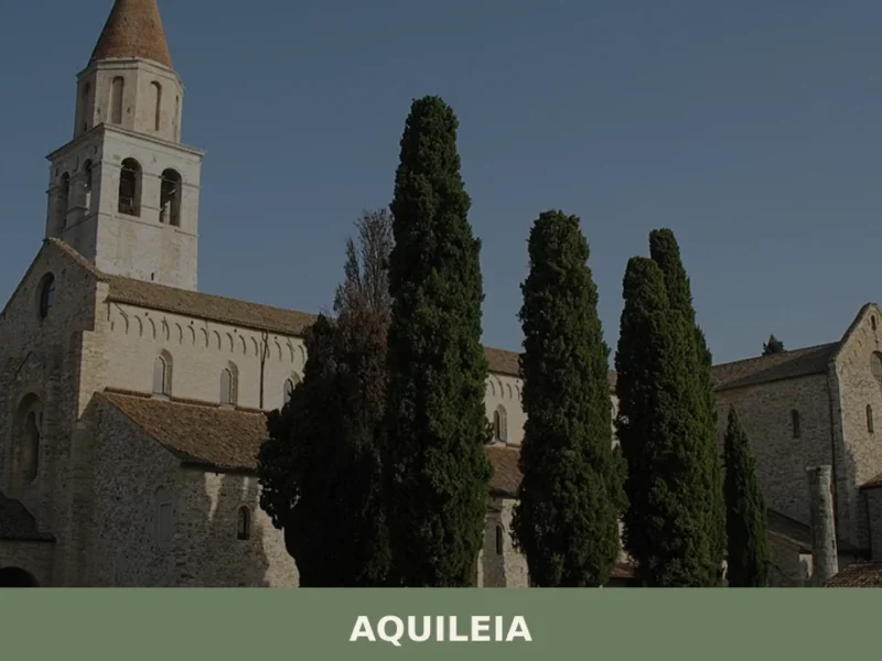
Aquileia
What to see in Aquileia: early Christian basilica, UNESCO mosaics, Roman forum, archaeological museum. Guide with history, cuisine and how to get there.
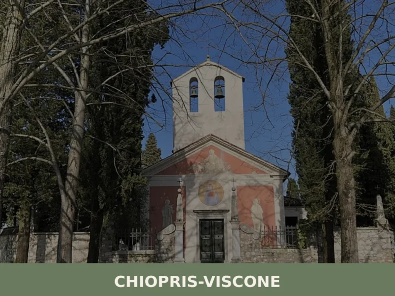
Chiopris-Viscone
Two hamlets, two bell towers, two patron saints — and a single road running through both, the provincial route from Palmanova towards the Slovenian border. Anyone arriving in Chiopris-Viscone for the first time immediately notices this duality: the municipality, created in 1928 through the administrative merger of two distinct settlements, still retains a twin-centre layout, […]
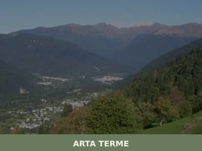
Arta Terme
In 1687, the physician and naturalist Giovanni Battista De Candido published the first treatise on the healing properties of the sulphurous waters flowing from the Fonte Pudia spring in the territory of Arta. That document marked the beginning of a thermal spa tradition that would define the economic identity of this Carnic centre for the […]
🧀 Italian traditional products


📝 Incorrect information or updates?
Help us keep the Chiusaforte page accurate and up to date.