
Erbè
Erbè has 1,838 inhabitants and occupies a stretch of the Veronese plain north of the Tione dei Monti river, along the road connecting Verona to Mantua. The municipal territory, almost entirely flat and crossed by a dense network of irrigation canals, was progressively reclaimed starting in the 15th century under the administration of the Republic […]
Discover Erbè
Erbè has 1,838 inhabitants and occupies a stretch of the Veronese plain north of the Tione dei Monti river, along the road connecting Verona to Mantua. The municipal territory, almost entirely flat and crossed by a dense network of irrigation canals, was progressively reclaimed starting in the 15th century under the administration of the Republic of Venice. Asking yourself what to see in Erbè means entering an agricultural landscape where 16th-century rural courtyards and parish churches preserve visible layers of history, from Romanesque stone to 18th-century brick, within a radius of just a few square kilometres.
History and origins of Erbè
The place name “Erbè” appears in medieval documents as early as the 10th century, linked to the Latin word herba or herbetum, indicating pastureland. The area, part of the Roman centuriated farmland along the Via Postumia, retained a pastoral and cereal-growing vocation for centuries. In 1405, when the Veronese territory was annexed to the Most Serene Republic of Venice, Erbè was incorporated into the administrative system of the district of Isola della Scala, and its economy came under the regulation of the Venetian magistracies responsible for waterways and communal assets.
During the 16th and 17th centuries, noble Veronese families — including the Bevilacqua and the Nogarola — built villas and manor courtyards across the municipal territory, using Erbè as a base for managing their landed estates. The parish church dedicated to San Martino Vescovo dates in its current form to the 18th century, although the original structure is older. During the Napoleonic campaigns, the territory was crossed by French and Austrian troops; the Battle of Arcole in 1796 was fought just a few dozen kilometres to the south-east.
With the Unification of Italy, Erbè was included in the Province of Verona. In the 20th century, the municipality experienced the same transformations as the rest of the lower Veronese plain: emigration towards the industrial cities of the North, agricultural mechanisation and, from the 1960s onwards, a gradual demographic stabilisation. Today the settlement fabric retains its scattered courtyard structure and the network of farm roads that reflect centuries of agrarian organisation.
What to see in Erbè: 5 main attractions
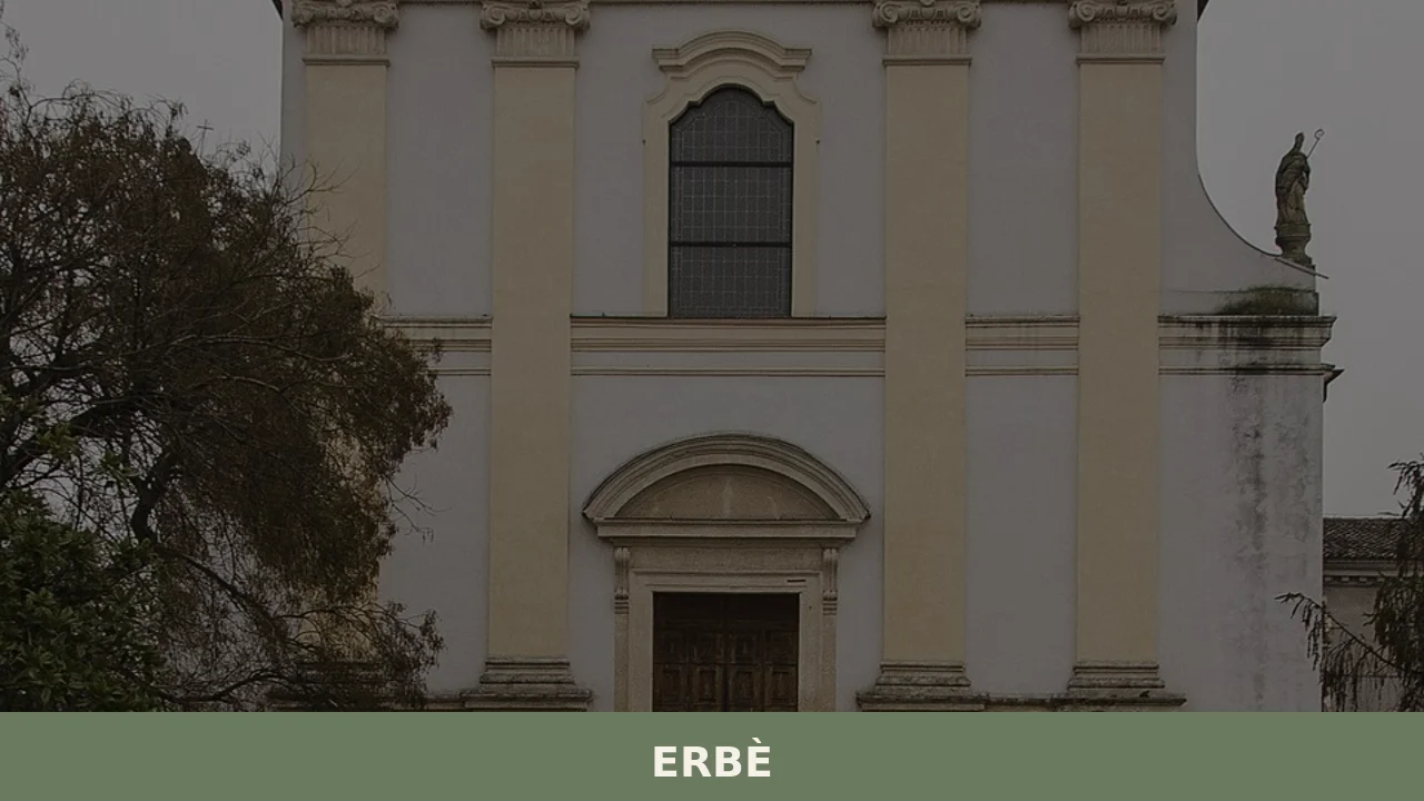
1. Parish Church of San Martino Vescovo
A single-nave building rebuilt in the 18th century on older foundations. Inside, it preserves a high altar in polychrome marble and paintings from the Veronese school. The sober, plastered façade features a portal in local limestone. The bell tower, with its mullioned belfry, is visible from several points across the surrounding plain.
2. 16th-century rural courtyards
Scattered across the municipal territory, the enclosed-plan courtyards — with dovecote tower, barchessa and manor house — represent the typical building model of the Veronese countryside under Venetian rule. Some still have tufa portals with carved noble coats of arms. They can be observed along the secondary roads between the centre and the hamlets, where exposed brick perimeter walls still mark the boundaries of the old estates.
3. Irrigation canal network and the Tione dei Monti
The Tione dei Monti river and its derived canals — part of the system managed by the Consorzio di Bonifica Veronese — define the landscape of Erbè. Along the embankments, unpaved paths suitable for cycling run between rows of poplars and fields planted with rice and maize. The hydraulic infrastructure dates in part to the Venetian water management works of the 15th and 16th centuries.
4. Rural oratory in the hamlet
In the rural areas of the municipality, small oratories and votive shrines survive, built between the 17th and 19th centuries as acts of private devotion or as markers along farm tracks. These are simple structures — sometimes an arch with a frescoed niche — that document the rural religiosity of the lower Veronese plain and the relationship between landowner patronage and the farming community.
5. Town Hall square and historic centre
The urban core of Erbè is organised around the square where the town hall and the parish church stand. The residential buildings, two or three storeys high, display 18th- and 19th-century façades with wrought-iron balconies. The square, not large but well-proportioned, still functions as the site of the weekly market and a civic gathering point.
Food and local products
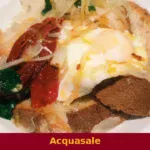
The table in Erbè reflects the rice-growing traditions of the lower Veronese plain. Riso Nano Vialone Veronese IGP, cultivated in the fields of the municipality and the wider Isola della Scala area, is the foundation of risotto all’isolana, prepared with minced pork and veal, butter, cinnamon and pepper, slow-cooked until each grain is dry and separate. Alongside rice, the local tradition includes bigoli con le sarde — soft wheat pasta extruded through a press, dressed with desalted lake sardines and onion — and pearà, a thick sauce made from stale bread, meat broth and bone marrow, served with bollito misto. The area also produces Radicchio Rosso di Verona IGP, recognisable by its round leaf and white central vein, eaten raw in salads or grilled.
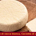
Among the cheeses, Monte Veronese DOP — both in its whole-milk version and the aged d’allevo variant — accompanies dishes of yellow polenta or is eaten on its own. The Veronese territory is also a production area for Olio extravergine di oliva Veneto Valpolicella DOP, although the olive-growing hills lie further north. As for wines, Erbè falls within the production zone of Custoza DOC and Bianco di Custoza DOC, fresh whites based on Trebbiano Toscano, Garganega and Cortese. In nearby Isola della Scala, between September and October each year, the Fiera del Riso (Rice Fair) takes place — the main food event in the area, with over 500,000 visitors in some editions: the distance from Erbè is less than ten kilometres.
When to visit Erbè: the best time
The climate of the lower Veronese plain is continental, with hot and humid summers (temperatures exceeding 30 °C in July and August) and harsh winters, often marked by fog between November and February. The most suitable period for a visit runs from April to June and from September to October, when temperatures are moderate and the countryside changes appearance: in spring the rice paddies are flooded, creating geometric sheets of water; in autumn the rice harvest and the grape harvest bring the territory to life.
September and October coincide with the Fiera del Riso season in Isola della Scala, which provides a concrete reason to combine a visit to Erbè with a food event of regional importance. Check the official website of the Municipality for any calendar of local festivals and events, generally concentrated between late summer and early autumn.
How to reach Erbè
By car, Erbè is reached from the A22 Brenner motorway, Nogarole Rocca exit, continuing for approximately 15 kilometres north-east along the SP24. From Verona city centre the distance is about 30 kilometres (35–40 minutes). From Mantua, the journey covers approximately 35 kilometres along the SS62 and then the SP24.
The nearest railway station is Isola della Scala, on the Verona–Bologna line, approximately 8 kilometres from the centre of Erbè. From there you need to continue by private transport or local bus (ATV line). The reference airport is Valerio Catullo di Villafranca, about 25 kilometres away. Venice Marco Polo and Brescia Montichiari airports are located approximately 140 and 80 kilometres away respectively.
Other villages to discover in Veneto
Veneto presents a geographical variety that extends from the rice-growing plain of Erbè all the way to the Dolomites. Those seeking a sharp contrast with the landscape of the lower Veronese plain can head north to Cortina d’Ampezzo, in the heart of the Belluno Dolomites: at 1,224 metres above sea level, with an Alpine setting of larch forests and dolomite rock faces, it represents an entirely different way of inhabiting the Veneto territory, far removed in climate, architecture and economic history from the Veronese countryside.
Staying within the Province of Verona, Cazzano di Tramigna occupies the Val Tramigna, between the eastern Lessini Mountains and the plain. Unlike Erbè, the territory is hilly and devoted to viticulture — within the Soave production area — with volcanic soils that create distinctive conditions for the Garganega grape. The two localities, less than forty kilometres apart, illustrate how the Province of Verona shifts from rice paddy to vineyard in a short stretch of road.
In Veneto More villages to discover
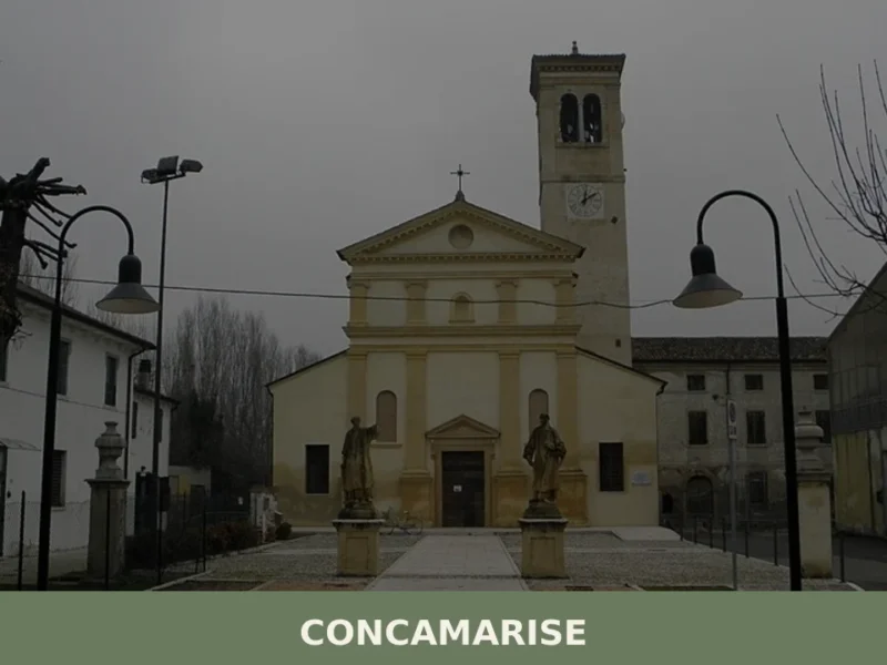
Concamarise
Concamarise, a municipality in Verona province with 1,053 inhabitants, rises only 21 meters above sea level, located in the Bassa Veronese, an area known for its long-standing agricultural tradition and complex hydrographic network. Its very name suggests a connection with water: “Conca” refers to a territorial depression, while “Marise” is likely linked to the marshy […]
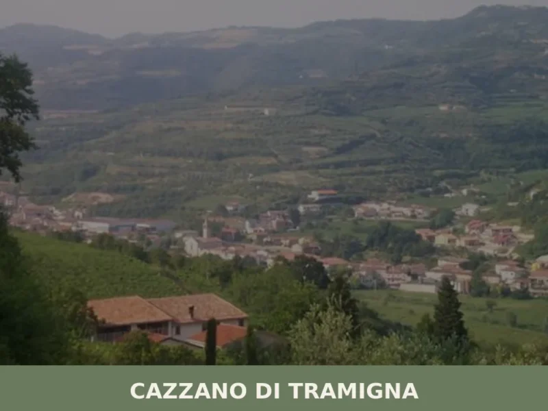
Cazzano di Tramigna
Cazzano di Tramigna has a population of 1,502 and occupies a basin at 100 metres above sea level in the Val Tramigna, a side valley that opens to the east of the Valpolicella area near Verona. The Tramigna stream — from which the village takes part of its name — crosses the municipal territory before […]
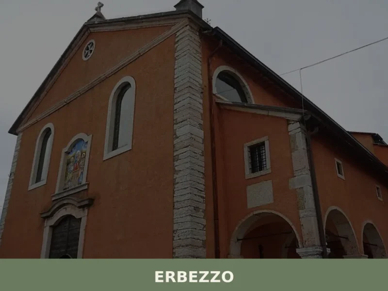
Erbezzo
At 1,118 metres above sea level, on the eastern edge of the Veronese Lessinia, Erbezzo has 756 inhabitants spread between the municipal centre and a handful of hamlets scattered across the pastures. It is the highest municipality in the province of Verona and one of the few where the pastoral economy has never fully given […]
🧀 Italian traditional products


📝 Incorrect information or updates?
Help us keep the Erbè page accurate and up to date.