
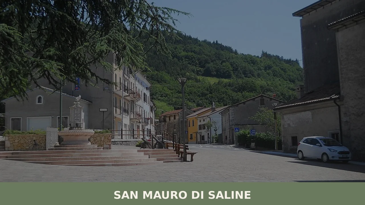
San Mauro di Saline
At 804 metres above sea level, on the eastern slope of the Veronese Lessini Mountains, San Mauro di Saline has a current population of 558 inhabitants spread between the municipal centre and the scattered hamlets along the pastures. The village’s name derives from the saline — the brackish water pools that historically surfaced in this […]
Discover San Mauro di Saline
At 804 metres above sea level, on the eastern slope of the Veronese Lessini Mountains, San Mauro di Saline has a current population of 558 inhabitants spread between the municipal centre and the scattered hamlets along the pastures. The village’s name derives from the saline — the brackish water pools that historically surfaced in this part of the Lessinia — and from the patron saint, Abbot Mauro, celebrated every 21 November. Asking what to see in San Mauro di Saline means preparing to explore a territory where the silvo-pastoral economy has shaped the form of every building, every path, and every limestone wall marking the boundaries between properties.
History and origins of San Mauro di Saline
Human presence in the Lessini Mountains area is documented since prehistoric times: lithic artefacts found in the area attest to seasonal visits linked to hunting and gathering. However, it was during the Middle Ages that the territory of San Mauro took on a recognisable identity. The “saline” in the place name refers to springs with saline traces, resources that held economic and strategic value in the medieval period. The village fell within the domains of the Scaliger Lordship of Verona, and later passed under the control of the Republic of Venice, which administered these mountain territories until its fall in 1797.
Under Venetian rule, San Mauro di Saline was incorporated into the system of Vicariati of the Lessinia, administrative structures that governed the mountain communities with a degree of autonomy. The local economy revolved around cattle and sheep farming, charcoal production, and the processing of timber from beech and hornbeam forests. This agro-pastoral vocation remained dominant until the post-Second World War period, when emigration towards the plains and the industrial cities of the Veneto drastically reduced the resident population, bringing it to its current numbers. The Municipality holds cadastral documentation in its archives that traces the land-ownership evolution of the territory from the Napoleonic period onwards.
The dedication to Saint Maurus the Abbot, a disciple of Saint Benedict of Nursia according to Benedictine tradition, suggests a possible monastic influence in the Christianisation of this mountain area. The patron saint’s feast on 21 November traditionally marks the end of the high-pasture season and the beginning of the winter period, a calendrical transition that for centuries dictated the rhythm of local life.
What to see in San Mauro di Saline: 5 main attractions
1. Parish Church of San Mauro Abate
The village’s main sacred building is dedicated to the patron saint and stands in the central core of the settlement. The current structure is the result of successive interventions that have modified the original layout. Inside, liturgical furnishings and devotional works document the religious history of the Lessinia community. The façade in local stone dialogues with the surrounding mountain profile.
2. Historic hamlets of the eastern Lessinia
The municipal territory is not concentrated in a single nucleus but is distributed across hamlets — clusters of limestone farmhouses with roofs made of stone slabs, known as laste. These constructions, typical of Lessinia rural architecture, feature stables on the ground floor and living quarters on the upper floor. Walking through them allows visitors to read the social and economic organisation of the Veronese mountains.
3. Trails of the Lessini Mountains
The network of trails crossing the municipality connects San Mauro to the high-altitude pastures and beech forests. Some routes follow the ancient paths used for transhumance and charcoal transport. During the summer months, these trails provide access to highland meadows where alpine grazing is still practised. Elevations range between 600 and 1,200 metres, with moderate altitude differences suitable for various fitness levels.
4. Baito and mountain dairies of the territory
Scattered across the communal pastures, the malghe — seasonal structures for milk processing — represent an architectural and productive heritage of the Lessinia. Some remain active during the alpine grazing months, between June and September, and produce cheeses according to methods handed down through generations of dairymen. The baiti, small stone shelters for shepherds and livestock, dot the meadows at higher elevations.
5. Fossil outcrops of the Lessinia
The Lessini Mountains area is known in geological circles for its fossiliferous deposits from the Eocene and Cretaceous periods. In the territory of San Mauro di Saline and the surrounding zones, the limestone formations preserve marine fossils that document the ancient seabed of the Tethys Sea. This is a geological heritage recognised at a scientific level, also described on the dedicated page for the Lessinia on Wikipedia.
Traditional cuisine and local products
The table in San Mauro di Saline reflects the mountain economy of the Veronese Lessini. The most representative product is Monte Veronese DOP, a semi-cooked cheese made from cow’s milk, which in these areas is produced both in the “whole milk” version — younger, with a delicate flavour — and in the “d’allevo” version, aged and with a more intense taste. The malghe active during alpine grazing also produce fresh ricotta and butter. Soppressa Veronese, a coarse-ground pork sausage aged for at least forty days, traditionally accompanies homemade bread. Another staple of the local pantry is black truffle from the Lessini, gathered in the broadleaf woods between autumn and winter, used to dress fresh pasta such as bigoli, the long soft-wheat pasta typical of the Veneto, extruded through a press.
Among the traditional dishes are pearà, a thick sauce made from beef bone marrow, grated stale bread, and broth, served with boiled meat; polenta made from Marano maize flour, cooked in a copper cauldron and accompanied by porcini mushrooms gathered in the surrounding woods or melted Monte Veronese cheese; and gnocchi di malga, a potato and flour dough dressed with alpine butter. In autumn, chestnuts from the lower-altitude woods are used in the preparation of desserts and soups. Olio extravergine di oliva Veneto Valpolicella DOP, produced at the lower elevations of the foothill belt, reaches the Lessinia tables as a condiment. Valpolicella DOC and Amarone della Valpolicella DOCG, vinified in the valleys below, are the wines traditionally paired with the dishes of this mountain area.
When to visit San Mauro di Saline: the best time
The mountain climate of the eastern Lessini brings harsh winters with temperatures frequently dropping below zero and snowfall between December and March. The period between May and October allows visitors to walk the trails and visit the hamlets under more stable weather conditions. Summer, with average daytime temperatures between 18 and 24 degrees, is the alpine grazing season: the malghe are active and Monte Veronese DOP is produced at altitude.
The patron saint’s feast of San Mauro Abate, on 21 November, is the main community gathering. In autumn, mushroom and chestnut foraging draws hikers to the Lessinia trails. Those planning to visit the village should note that services are limited and that the mountain road network can be demanding in the winter months, when snow chains or winter tyres are required.
How to reach San Mauro di Saline
San Mauro di Saline can be reached by car from Verona — approximately 35 kilometres away — via the SP6 road that climbs from the Valpolicella towards the Lessini Mountains. The nearest motorway exit is Verona Nord on the A22 Brenner motorway, from which you continue towards San Mauro through Fumane or Marano di Valpolicella. From Vicenza, the distance is approximately 60 kilometres along provincial roads that cross the Lessinia hill belt.
The nearest railway station is Verona Porta Nuova, connected to the main national lines and high-speed services. The reference airport is Valerio Catullo in Villafranca di Verona, approximately 45 kilometres away. There are no frequent direct public transport connections to the village: a car remains the most practical option. Parking in the municipal centre is free and generally available, given the low population density.
Other villages to discover in Veneto
The Veneto offers a variety of mountain villages that share with San Mauro di Saline their small scale and close relationship with the Alpine and pre-Alpine landscape. Cortina d’Ampezzo, in the Belluno Dolomites, represents the best-known side of mountain Veneto: while San Mauro has remained tied to the pastoral economy of the Lessini, Cortina developed an international tourist vocation from the nineteenth century onwards, while still preserving the Ampezzo architectural layout and the traditions of the Ladin community.
On the opposite end of the Veneto experience, in the lower Veronese plain, Concamarise offers an interesting point of comparison: a plains village where water — springs, canals, irrigation channels — has determined human settlement with the same force with which limestone has moulded the Lessinia hamlets of San Mauro. Visiting both allows you to measure the geographical and cultural distance that separates the Veronese mountains from its plain, two territories within the same province with profoundly different histories and landscapes.
In Veneto More villages to discover
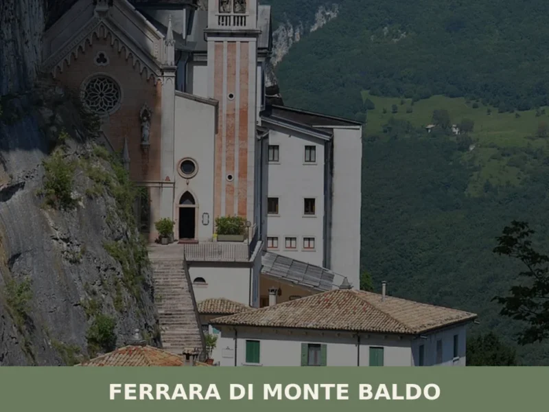
Ferrara di Monte Baldo
With its 223 registered inhabitants and an elevation of 856 metres above sea level, Ferrara di Monte Baldo is the least populated municipality in the province of Verona. Its territory extends along the western slope of Monte Baldo, the ridge that separates the Val d’Adige from Lake Garda. Understanding what to see in Ferrara di […]
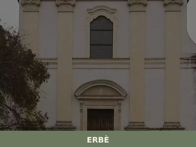
Erbè
Erbè has 1,838 inhabitants and occupies a stretch of the Veronese plain north of the Tione dei Monti river, along the road connecting Verona to Mantua. The municipal territory, almost entirely flat and crossed by a dense network of irrigation canals, was progressively reclaimed starting in the 15th century under the administration of the Republic […]
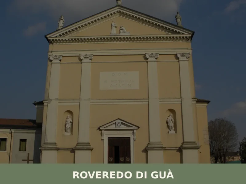
Roveredo di Guà
Roveredo di Guà has 1,542 inhabitants and covers an area of just 8 square kilometres on the lower Veronese plain, 16 metres above sea level, along the course of the Guà canal — a branch of the Adige river system that has determined the shape and economy of this territory. Understanding what to see in […]


📝 Incorrect information or updates?
Help us keep the San Mauro di Saline page accurate and up to date.