Andriano
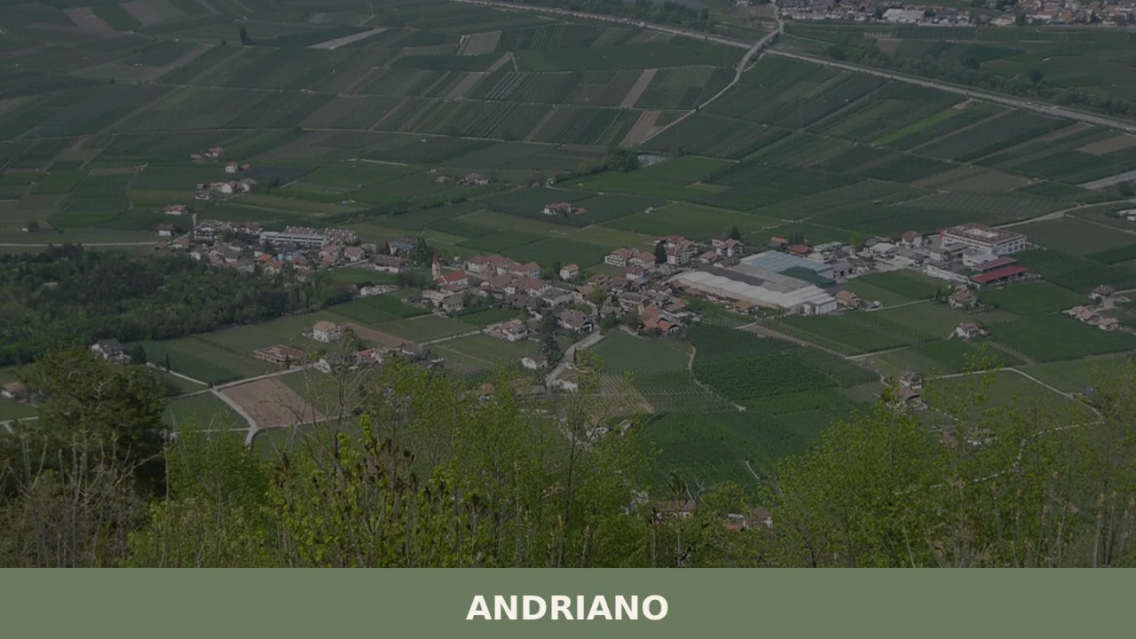
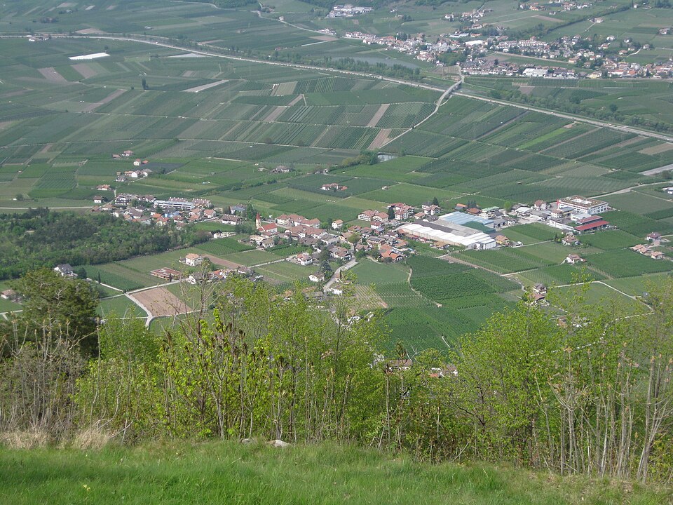
At 274 metres above sea level, on the left bank of the Adige river, Andriano has 1,025 inhabitants spread between the historic centre and the farmsteads scattered among rows of vines. The municipality, one of the smallest in South Tyrol by area, extends entirely across flat ground along the alluvial strip connecting Bolzano to Merano. […]
Discover Andriano
At 274 metres above sea level, on the left bank of the Adige river, Andriano has 1,025 inhabitants spread between the historic centre and the farmsteads scattered among rows of vines. The municipality, one of the smallest in South Tyrol by area, extends entirely across flat ground along the alluvial strip connecting Bolzano to Merano. Understanding what to see in Andriano means entering a place where viticulture is not folklore but an everyday economic activity: ninety per cent of the agricultural land is devoted to growing vines and apple trees, and the local wine cooperative vinifies grapes that end up in bottles of Schiava and Lagrein distributed well beyond provincial borders.
History and origins of Andriano
The place name Andriano — Andrian in German — first appears in documents dating to the 12th century, although settlements in the area are attested in Roman times thanks to its position along the road linking the Adige valley floor with the Val di Non. The name may derive from the Latin gentile name Andrius, indicating an ancient agricultural estate from the imperial period. During the Middle Ages the territory fell under the jurisdiction of the Counts of Tyrol, and the village maintained its rural character without developing an independent urban structure, remaining tied to the feudal dynamics of the nearby County of Tyrol.
In the 14th and 15th centuries, several noble families built residences and Ansitze — the typical South Tyrolean manor houses — that still define the architectural profile of the centre today. The transfer from the Habsburg Empire to Italy in 1919, following the Treaty of Saint-Germain-en-Laye, brought a gradual linguistic shift in official place names, but the community has remained predominantly German-speaking: according to linguistic census data, over 90% of residents declare German as their everyday language.
In the post-war period, Andriano underwent the transformation typical of agricultural municipalities in South Tyrol: mechanisation of viticulture, a decline in the active farming population, and the growth of low-key tourism linked to the Adige Valley cycle path network. The municipality has maintained its administrative autonomy despite its small size, and today it manages services for just over a thousand residents.
What to see in Andriano: 5 main attractions
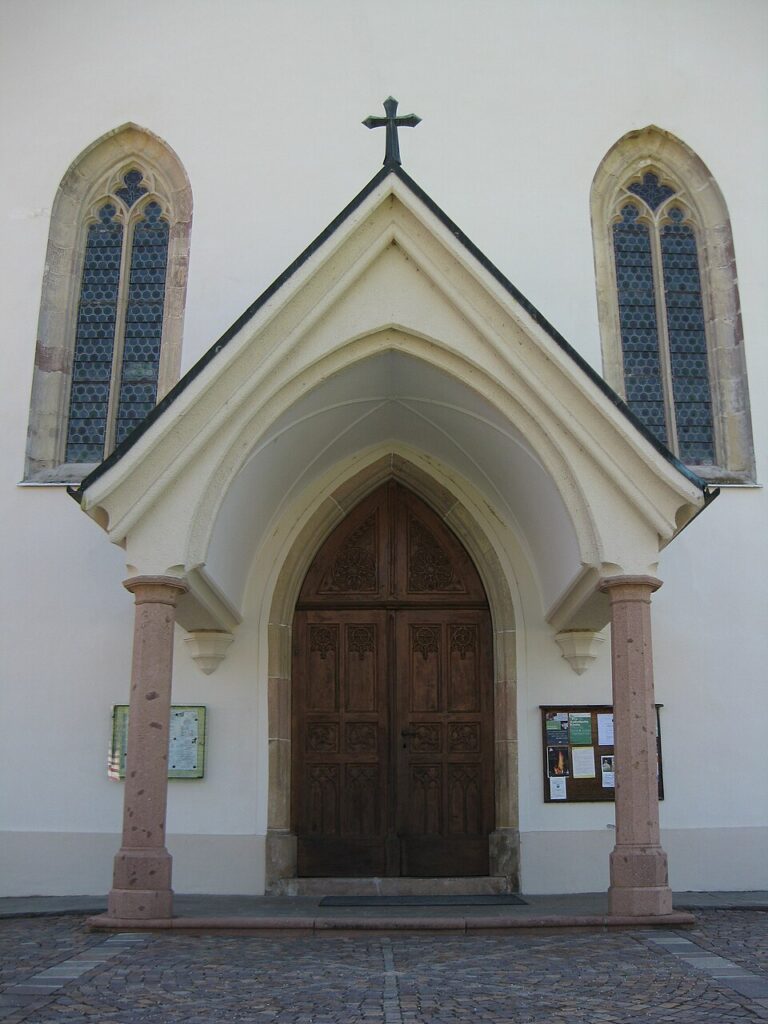
1. Parish Church of San Valentino
Dedicated to the patron saint of the village, celebrated on 14 February, the parish church has a Gothic structure with Baroque modifications visible in the nave vault and the high altar. The bell tower, visible from several points across the plain, is the most recognisable vertical landmark in the village. Inside, frescoes and wooden furnishings document local religious patronage between the 17th and 18th centuries.
2. The Ansitze of the historic centre
Several noble residences from the late medieval and Renaissance periods are dotted around the inhabited centre. These buildings, recognisable by their stone portals, arched loggias and coats of arms on their façades, belonged to noble families connected to the Tyrolean administration. Some have been restored and converted into private wineries, open to visitors during tasting days organised by the local cooperative.
3. Oltradige Wine Trail
The hiking path that crosses the vineyards of Andriano is part of the Oltradige trail network and connects the village to the neighbouring municipalities of Terlano and Nalles. The elevation gain is minimal — you walk almost entirely on flat ground — and the route passes through plots planted with Schiava, Pinot Bianco and Gewürztraminer, offering a direct reading of the South Tyrolean agricultural landscape.
4. Adige Valley Cycle Path
Andriano is crossed by the cycle path that runs along the Adige river from Merano to Bolzano and beyond. The section passing through the municipality is flat and paved, suitable for families and inexperienced cyclists. From the path there is direct access to the village centre, and several bike racks and water points have been placed along the route by the municipality.
5. View of Appiano Castle
From the western edge of the village, looking towards the hill of Appiano sulla Strada del Vino, there is a direct view of the ruins of Appiano Castle (Burg Hocheppan), a 12th-century fortress with celebrated Romanesque frescoes in its internal chapel. The castle does not fall within the municipal territory of Andriano, but its proximity — less than five kilometres — makes it reachable on foot or by bicycle.
Traditional cuisine and local products
The table in Andriano reflects the dual culinary identity of southern South Tyrol. Canederli — Knödel in German — are prepared with stale bread, speck and cheese, served in broth or dry with melted butter and chives. Schlutzkrapfen, rye ravioli filled with spinach and ricotta, appear on the menus of restaurants in the surrounding area. Speck Alto Adige IGP, produced at various facilities in the province of Bolzano, can be found in local shops and butchers.
The product that defines Andriano is wine. The Andriano Winery, founded in 1893, is one of the oldest wine cooperatives in South Tyrol. It primarily vinifies Schiava, Lagrein, Pinot Bianco, Sauvignon and Gewürztraminer. Alongside wine, apple cultivation supplies Golden Delicious and Gala apples destined for national markets through the producer consortia of the Adige Valley. In the autumn months, Törggelen — a farming tradition involving tastings of new wine, chestnuts and rustic dishes — also involves the farms of Andriano.
When to visit Andriano: the best time
The valley-floor climate, with mild temperatures from as early as March, makes spring the most suitable period: between late March and mid-April the apple blossom transforms the plain into a white and pink expanse, and daytime temperatures range between 15 and 22 degrees. Summer is hot — July and August regularly exceed 30 degrees — but the low humidity makes it more bearable than the Po Valley. The patron saint’s feast of San Valentino, on 14 February, falls in the middle of winter and is celebrated with a solemn mass and a local market in the village centre.
Autumn, from September to November, coincides with the grape harvest and the Törggelen season: this is the time when Andriano most clearly expresses its bond with viticulture. Days often remain clear until mid-October, with highs around 18–20 degrees, ideal for riding the cycle path and walking the trails through the vineyards without the summer heat.
How to reach Andriano
Andriano is located along State Road 38, approximately 15 kilometres north-west of Bolzano and 20 kilometres south-east of Merano. From the Brenner Motorway A22, the nearest exit is Bolzano Sud: from there, continue on the SS38 towards Merano for about 15 minutes.
- By train: the nearest railway station is Terlano, on the Bolzano–Merano line, about 3 kilometres from the centre of Andriano. Services are frequent, running every 20–30 minutes during peak hours. From Terlano, a SASA bus connects the station to the village.
- By air: the nearest airport is Bolzano (about 20 km), with limited connections. The airports of Verona Villafranca (160 km) and Innsbruck (120 km) offer a greater number of domestic and international routes.
- By bicycle: the Adige Valley cycle path connects Andriano to Bolzano in about 45 minutes of flat cycling, making it a practical alternative to the car for those already in the area.
What to see in Andriano and in the nearby villages of Trentino-Alto Adige
The Oltradige is an area where municipalities follow one another just a few kilometres apart, each with its own agricultural and architectural identity. Heading north-west, along the road towards Merano, you reach Terlano, known for its Pinot Bianco production and the asparagus beds that supply white asparagus between April and June. Terlano has a railway station on the Bolzano–Merano line and a historic centre with a late-Gothic parish church.
Heading south, past the vineyards of the Wine Road, you come to Appiano sulla Strada del Vino, the largest wine-producing municipality in South Tyrol, with more than fifteen hamlets spread between the hillside and the valley floor. Here you will find the already mentioned Appiano Castle with its Romanesque frescoes, Lake Monticolo — open for swimming in summer — and a concentration of wineries producing some of the most renowned labels in the province. The two villages, together with Andriano, form an itinerary that can be covered in a single day on foot or by bicycle, without ever leaving the provincial cycle path network.
Getting there
Via Wehrburg, 39010 Andriano (BZ)
📷 Photo Gallery — Andriano
Nearby Villages near Andriano
In Trentino-South Tyrol More villages to discover
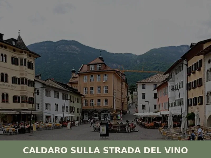
Caldaro sulla strada del vino
Caldaro sulla strada del vino — Kaltern an der Weinstraße in German — has 7,735 inhabitants and over 600 hectares of vineyards, the largest cultivated wine-growing area in South Tyrol. The place name itself declares the vocation of this centre in the province of Bolzano, which grew along the trade route linking the Bassa Atesina […]
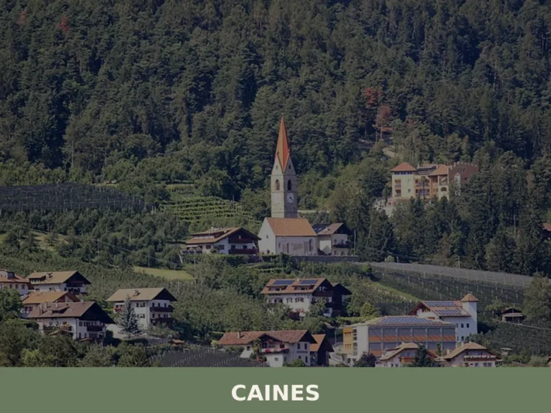
Caines
With just 398 registered inhabitants and an elevation of 592 metres above sea level, Caines — Kuens in German — is one of the smallest municipalities in the province of Bolzano. It extends across the sun-facing slope of the middle Passiria Valley, a few kilometres from Merano, on a natural terrace overlooking the confluence of […]
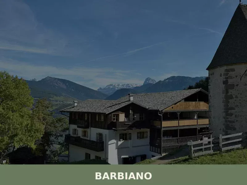
Barbiano
Barbiano covers 25.26 square kilometres on the right-hand slope of the Isarco Valley, spread across five hamlets — Barbiano village, Colma, San Giacomo, Saubach and Dreikirchen — each with its own architectural identity and historical function. Understanding what to see in Barbiano means crossing a territory that rises from 471 metres on the valley floor […]


📝 Incorrect information or updates?
Help us keep the Andriano page accurate and up to date.