


Avelengo
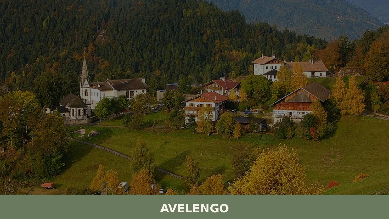
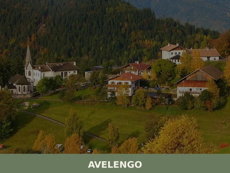
Avelengo has 796 inhabitants and sits at 1,290 metres above sea level on the plateau overlooking the Merano basin, on the southern side of the Sarntal Alps. Its municipal territory spans an altitudinal range from 600 to 2,200 metres, with high-altitude pastures that gave rise to one of the most extensively documented native horse breeds […]
Discover Avelengo
Avelengo has 796 inhabitants and sits at 1,290 metres above sea level on the plateau overlooking the Merano basin, on the southern side of the Sarntal Alps. Its municipal territory spans an altitudinal range from 600 to 2,200 metres, with high-altitude pastures that gave rise to one of the most extensively documented native horse breeds in Europe: the Haflinger, whose German name — Hafling — corresponds exactly to the name of the village. Understanding what to see in Avelengo means crossing a landscape where horse breeding, mountain haymaking and South Tyrolean rural architecture continue to define the profile of every season.
History and origins of Avelengo
The first documented mention of the place name “Haualingen” dates back to 1166, in a deed relating to the possessions of the Counts of Tyrol. The most widely accepted etymology traces the name to a Germanic personal name, probably a settler called Hafal or Havaling, to which the suffix -ing was added, typical of Bavarian settlements. The Italian form “Avelengo” is a phonetic adaptation recorded consistently from the annexation of South Tyrol to Italy in 1919. The village fell within the County of Tyrol under the Counts of Merano and subsequently under the Habsburgs, following the administrative events of the region up to the Treaty of Saint-Germain-en-Laye.
The event that permanently linked Avelengo to the history of European horse breeding dates back to 1874, when the oriental stallion El Bedavi XXII was crossed with a local mare of native breed: the foal 249 Folie was born, the recognised founding sire of the Haflinger breed. From that moment on, breeding the blond horse with its light mane became the economic and identity-defining activity of the village, with a genealogical register that today counts thousands of horses distributed across forty countries. The municipal office holds documentation relating to the history of local breeding.
Over the course of the twentieth century, Avelengo underwent a transition from a purely agro-pastoral economy to a mountain tourism centre linked to cross-country skiing, hiking and the thermal wellness facilities of nearby Merano. The demographic structure remains that of a small bilingual municipality — German and Italian — with a clear predominance of the German-speaking community, in line with the linguistic composition of the entire province of Bolzano.
What to see in Avelengo: churches, trails and rural heritage
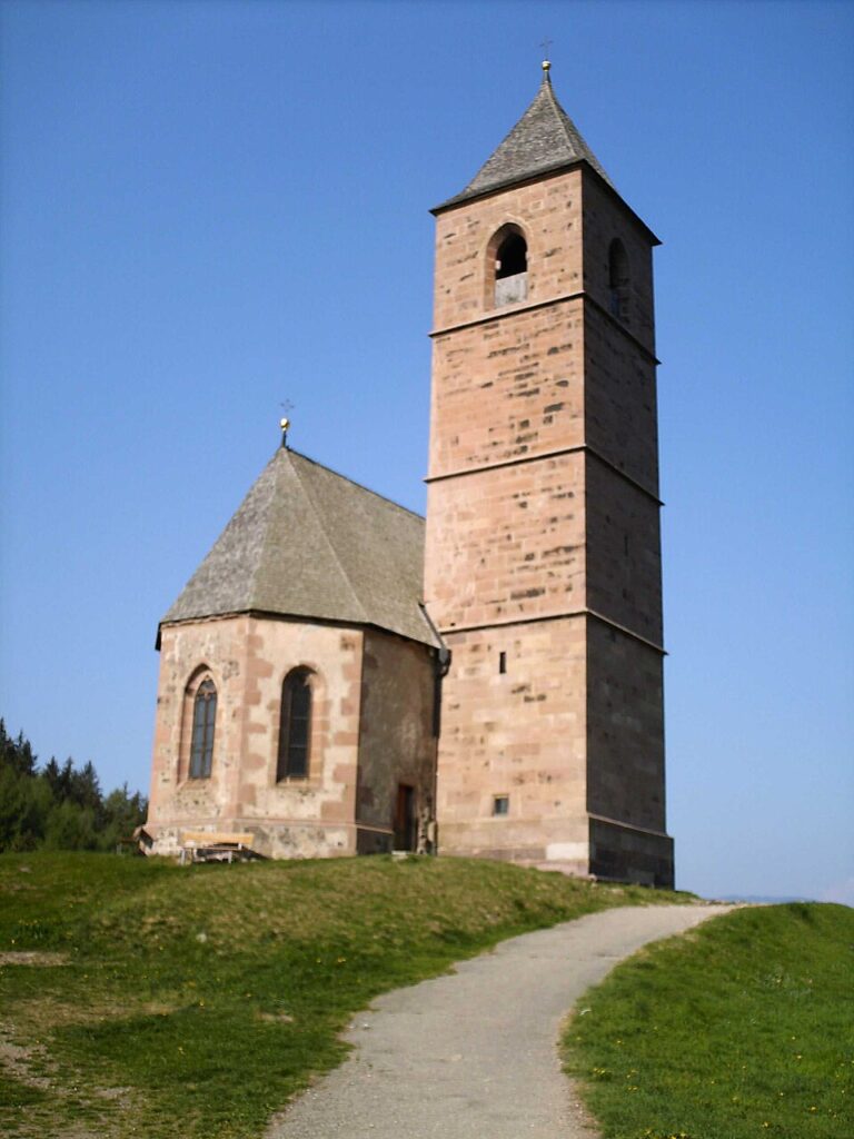
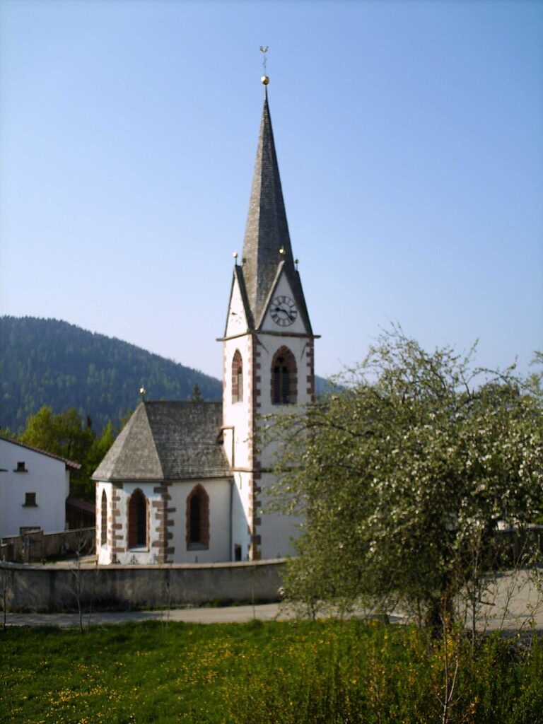
1. Parish Church of San Giovanni Battista
Dedicated to the patron saint of the village, celebrated on 24 June, the church stands in the centre of the village and features a bell tower with a pointed spire visible from several kilometres along the Adige valley. The interior preserves decorative elements from the Tyrolean school. The current structure dates from late-Gothic interventions with subsequent Baroque modifications.
2. Haflinger Horse Monument
Near the centre stands the monument dedicated to the horse breed that originated here in 1874. The sculpture depicts a Haflinger stallion at full scale — approximately 140 centimetres at the withers — and has become a reference point for breeders who travel to Avelengo each year for the provincial equine shows.
3. Avelengo–Verano ridge trail
The hiking trail connecting Avelengo to the neighbouring municipality of Verano follows the ridge of the plateau at a constant altitude between 1,200 and 1,400 metres. The route, approximately 8 kilometres long, crosses hay meadows and larch clearings, offering a direct view of the peaks of the Texel Group and the Passeier Valley.
4. Traditional farmsteads and rural architecture
The scattered hamlets around the central core — Falzeben, Oberavelengo, Certosa — retain farmsteads built in wood and stone with half-timbered balconies and steeply pitched roofs covered in shingles. Some of these structures, still in agricultural use, date back to the seventeenth and eighteenth centuries and document the building techniques of South Tyrolean peasant construction.
5. Cross-country ski trails and the Merano 2000 area
From the municipal territory, access to the Merano 2000 ski area is provided by the Falzeben cable car, which reaches an altitude of 2,000 metres. In winter, cross-country loops run through coniferous forests, while in summer the same trails become routes for mountain biking and high-altitude walks.
What to see in Avelengo: cuisine and local products
The table in Avelengo follows the repertoire of South Tyrolean mountain cooking. Canederli — Knödel — are prepared with stale bread, speck and cheese, served in broth or dry with melted butter. Speck Alto Adige IGP features in nearly every course, from cured meat platters to pasta dishes. In the cold months, Gerstsuppe is consumed, a barley soup with vegetables and smoked meat. Desserts include apple strudel from the Adige Valley and Krapfen filled with apricot or poppy seed jam.
Milk from the surrounding alpine pastures is processed to produce semi-hard cheeses, sold at the farmers’ markets in Merano. Some high-altitude mountain dairies, accessible during the summer months, offer tastings of Graukäse — a lean grey cheese with a granular texture — and alpine butter. The production of mountain honey, particularly rhododendron and high-altitude wildflower varieties, completes the agri-food offer of the area, together with the small berries cultivated on farms between 1,000 and 1,400 metres.
When to visit Avelengo: the best time
The 24th of June, the feast of San Giovanni Battista, is the central date in the civic and religious calendar: the patron saint procession passes through the centre with traditional South Tyrolean costumes, accompanied by the local brass band. In autumn, the equine shows dedicated to the Haflinger breed draw breeders and veterinarians from across the province. Summer — from mid-June to mid-September — offers optimal conditions for hiking, with average daytime temperatures between 15 and 22 degrees and rainfall concentrated in the late afternoon.
Winter transforms the plateau into an area for cross-country skiing and snowshoeing. Night-time temperatures regularly drop below -10°C between December and February, while snow cover remains generally reliable above 1,500 metres from December to April. Spring, from April to May, is the period of meadow flowering and the ascent of herds to the alpine pastures: a less frequented time, suited to those who prefer to walk without encountering substantial tourist flows.
How to reach Avelengo
By car, the most direct route starts from the Brenner motorway A22: exit at Bolzano Sud, then take the main road towards Merano and turn onto the provincial road that climbs to the plateau. From Merano the journey is approximately 12 kilometres with an elevation gain of nearly 1,000 metres. From Bolzano the distance is approximately 35 kilometres, from Innsbruck approximately 110 kilometres, from Verona approximately 200 kilometres.
The nearest railway station is Merano, connected to Bolzano by the Adige Valley regional line with services roughly every 30 minutes. From Merano to Avelengo, the journey continues by SAD scheduled bus or taxi. The closest airport is Bolzano (approximately 40 km), with limited connections; the main international airports serving the area are Innsbruck (Austria), Verona Villafranca and Milan Bergamo. For detailed information on access and local transport, the Wikipedia portal provides further geographical and administrative data.
Other villages to discover in Trentino-Alto Adige
Those reaching Avelengo from the Adige valley cross a territory where villages change character within just a few kilometres of elevation difference. Descending towards the Lower Atesina area, Andriano sits at approximately 250 metres above sea level, surrounded by vineyards producing grapes for South Tyrolean white wines — a landscape that has nothing in common with the high-altitude pastures of Avelengo. The comparison between the two centres makes visible the altitudinal and agricultural variety of the province of Bolzano: orchards and vine rows lower down, larches and hay meadows higher up.
Trentino-Alto Adige, also documented by the Touring Club Italiano, has one of the highest densities of small mountain municipalities in Europe. Every valley preserves distinct linguistic variants, building techniques and agricultural calendars. Travelling along the network of South Tyrolean villages — from the Adige valley floor up to the farmsteads above a thousand metres — means registering these differences metre by metre, without needing to seek forced similarities between places that geography has made profoundly different.
Frequently asked questions about Avelengo
What is the best time to visit Avelengo?
Summer (mid-June to mid-September) offers the best hiking conditions, with daytime temperatures between 15 and 22°C. The feast of San Giovanni Battista on 24 June — the village patron saint — is the highlight of the civic calendar, with a traditional procession in South Tyrolean costume accompanied by the local brass band. Autumn brings the Haflinger horse shows, drawing breeders from across the province. Winter suits cross-country skiing and snowshoeing enthusiasts, with reliable snow cover above 1,500 metres from December to April. Spring (April–May) is quieter, ideal for witnessing meadow flowering and the ascent of herds to alpine pastures.
What are the historical origins of Avelengo?
Avelengo is first documented in 1166 under the name 'Haualingen' in a deed related to the County of Tyrol. The name likely derives from a Bavarian settler called Hafal or Havaling, with the Germanic suffix -ing. The Italian form 'Avelengo' was adopted after South Tyrol's annexation to Italy in 1919. The village's defining historical moment came in 1874, when the crossing of the oriental stallion El Bedavi XXII with a local mare produced the foal 249 Folie — the recognised founding sire of the Haflinger breed, whose German name Hafling corresponds directly to the village name.
What to see in Avelengo? Main monuments and landmarks
The Parish Church of San Giovanni Battista stands at the village centre, featuring a pointed-spire bell tower visible from the Adige valley; the interior preserves Tyrolean decorative elements within a late-Gothic structure with Baroque modifications. Nearby, a life-size Haflinger horse monument commemorates the breed's 1874 origins. The scattered hamlets of Falzeben, Oberavelengo and Certosa preserve 17th- and 18th-century farmsteads in wood and stone with half-timbered balconies and shingle roofs. The Falzeben cable car provides access to the Merano 2000 area at 2,000 metres, open both in winter and summer.
What are the main natural or scenic attractions of Avelengo?
Avelengo's municipal territory spans from 600 to 2,200 metres, offering remarkable altitudinal variety. The plateau's high-altitude pastures overlook the Merano basin, with direct views of the Texel Group peaks and the Passeier Valley. The ridge trail connecting Avelengo to neighbouring Verano runs approximately 8 kilometres across hay meadows and larch clearings at 1,200–1,400 metres. From the Falzeben cable car terminus at 2,000 metres, summer walkers and mountain bikers access the same routes used for winter cross-country skiing through coniferous forests.
Where to take the best photos in Avelengo?
The most photogenic viewpoints are concentrated on the plateau ridge between Avelengo and Verano, where the trail at 1,200–1,400 metres frames the Texel Group and the Passeier Valley against hay meadow foregrounds. The bell tower of San Giovanni Battista, visible from the Adige valley, offers a classic South Tyrolean village composition from below. At 2,000 metres, reached via the Falzeben cable car, the panorama extends across the Merano basin and towards the main Alpine chains. In late June, the patron saint procession provides documentary photography of traditional South Tyrolean costumes.
Are there museums, churches or historic buildings to visit in Avelengo?
The Parish Church of San Giovanni Battista is the main historic building in the village centre, with a late-Gothic structure modified in the Baroque period and interior decorative elements from the Tyrolean school. The municipal office holds documentation on local Haflinger breeding history. The farmsteads of Falzeben, Oberavelengo and Certosa — some dating to the 17th and 18th centuries — represent authentic examples of South Tyrolean rural architecture still in agricultural use. The Haflinger horse monument near the village centre commemorates the breed's documented foundation in 1874.
What can you do in Avelengo? Activities and experiences
Avelengo offers year-round outdoor activities across its 600–2,200 metre territory. In summer: hiking the Avelengo–Verano ridge trail (8 km), mountain biking at altitude via the Falzeben cable car, and attending the Haflinger horse shows in autumn. In winter: cross-country skiing and snowshoeing on plateau loops through coniferous forests, with access to the Merano 2000 ski area. Cultural experiences include the San Giovanni Battista patron feast on 24 June with costumed processions. The thermal spa facilities of nearby Merano — approximately 12 km — complement active stays with wellness options.
Who is Avelengo suitable for? Families, couples, hikers, solo travellers?
Avelengo suits hikers and outdoor enthusiasts seeking uncrowded South Tyrolean plateau landscapes, with trails suitable for moderate fitness levels along the ridge to Verano. Families with children benefit from gentle summer walks, horse-related attractions centred on the Haflinger breed, and easy access to the Merano 2000 area. Couples looking for quiet mountain stays will appreciate the spring flowering season and the rural farmstead atmosphere. Those interested in equine culture and traditional South Tyrolean architecture find Avelengo particularly distinctive. The proximity to Merano's thermal facilities adds a wellness dimension for visitors of all ages.
What to eat in Avelengo? Local products and specialties
The local table follows South Tyrolean mountain tradition. Canederli (Knödel) — bread dumplings with speck and cheese — are served in broth or with melted butter. Speck Alto Adige IGP appears across all courses. Winter brings Gerstsuppe, a barley soup with smoked meat and vegetables. Desserts include apple strudel and Krapfen filled with apricot or poppy seed jam. Local dairy production yields semi-hard alpine cheeses and Graukäse — a lean grey cheese with granular texture — from high-altitude mountain dairies open in summer. Rhododendron and high-altitude wildflower honey complete the area's agri-food offer.
📷 Photo Gallery — Avelengo
Nearby Villages near Avelengo
In Trentino-South Tyrol More villages to discover
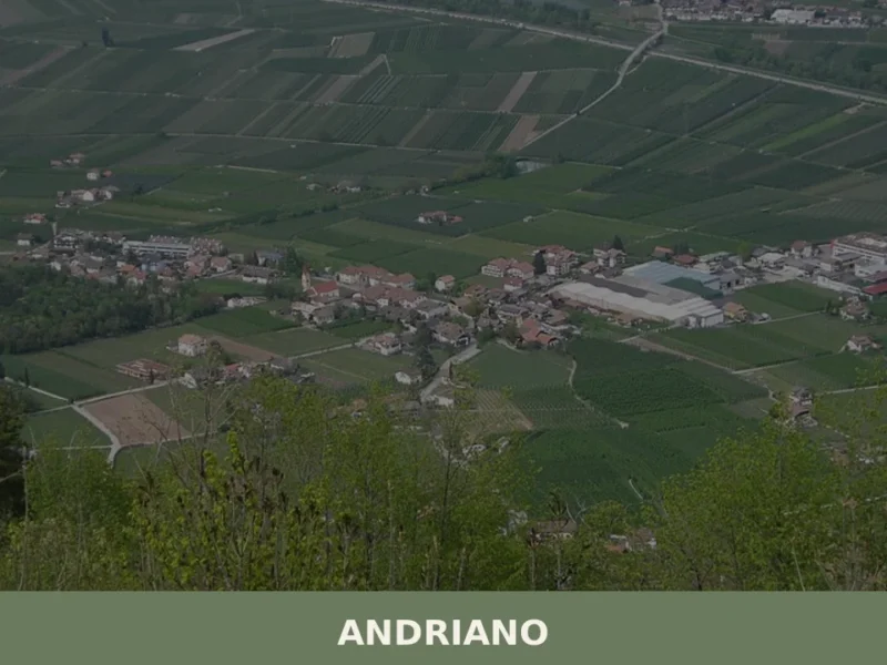
Andriano
At 274 metres above sea level, on the left bank of the Adige river, Andriano has 1,025 inhabitants spread between the historic centre and the farmsteads scattered among rows of vines. The municipality, one of the smallest in South Tyrol by area, extends entirely across flat ground along the alluvial strip connecting Bolzano to Merano. […]
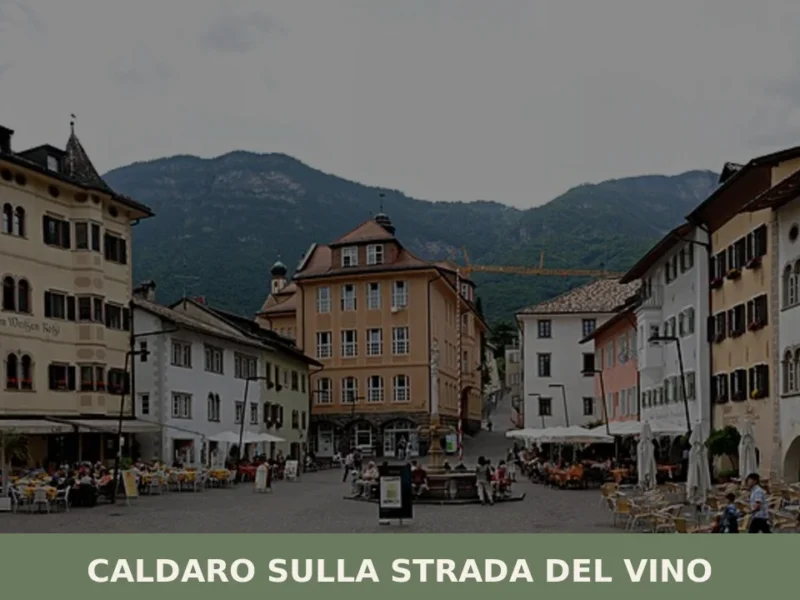
Caldaro sulla strada del vino
Caldaro sulla strada del vino — Kaltern an der Weinstraße in German — has 7,735 inhabitants and over 600 hectares of vineyards, the largest cultivated wine-growing area in South Tyrol. The place name itself declares the vocation of this centre in the province of Bolzano, which grew along the trade route linking the Bassa Atesina […]
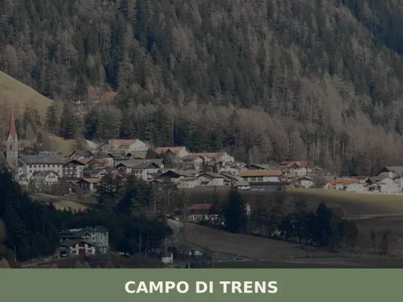
Campo di Trens
At 937 metres above sea level, along the Isarco valley between Vipiteno and Fortezza, the municipality of Campo di Trens has 2,679 inhabitants spread across the hamlets of Trens, Stilves and Mules. Anyone looking into what to see in Campo di Trens will find an area where the German language predominates — the official German […]
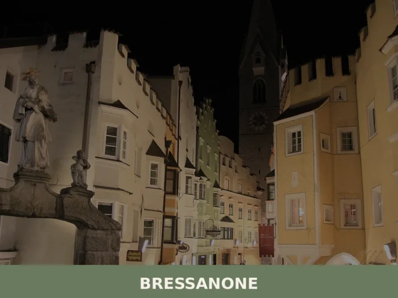
Bressanone
Bressanone is the oldest city in Tyrol, with a bishopric founded around 990 AD that shaped the urban, economic and cultural structure of the entire valley for centuries. Situated at 559 metres above sea level, at the point where the Rienza river flows into the Isarco, the city has a current population of 22,816 and […]

Trento
What to see in Trento, a city of 119,359. Discover its Duomo, Castello del Buonconsiglio, and typical cuisine. Explore its rich Council history.
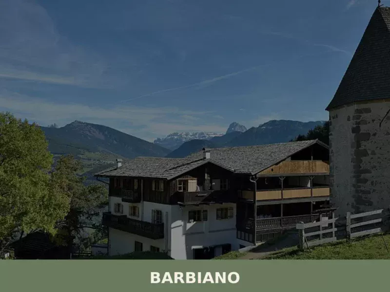
Barbiano
Barbiano covers 25.26 square kilometres on the right-hand slope of the Isarco Valley, spread across five hamlets — Barbiano village, Colma, San Giacomo, Saubach and Dreikirchen — each with its own architectural identity and historical function. Understanding what to see in Barbiano means crossing a territory that rises from 471 metres on the valley floor […]

Castelrotto
7,000 residents, three languages and one of the Alps' highest-altitude market towns. Castelrotto offers medieval architecture, Ladin heritage and alpine pastures.
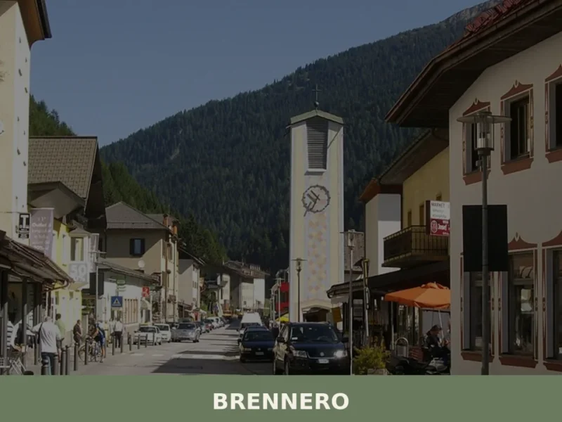
Brennero
The Brenner Pass, at 1,370 metres above sea level, is the lowest Alpine crossing between Italy and Austria, and this geographical circumstance has shaped every aspect of life in the village that bears its name. With 2,111 inhabitants spread across the hamlets of Brennero, Fleres, Ponticolo and Terme di Brennero, the municipality marks the northern […]
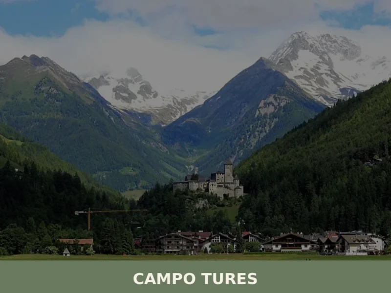
Campo Tures
Tures Castle, first documented in 1136, dominates Campo Tures from a rocky spur at the entrance to the Tures Valley, a side valley of the Aurina Valley. The village has 5,321 inhabitants, spread across an elevation of 864 metres, in a basin where the Aurino torrent slows before continuing south. Understanding what to see in […]
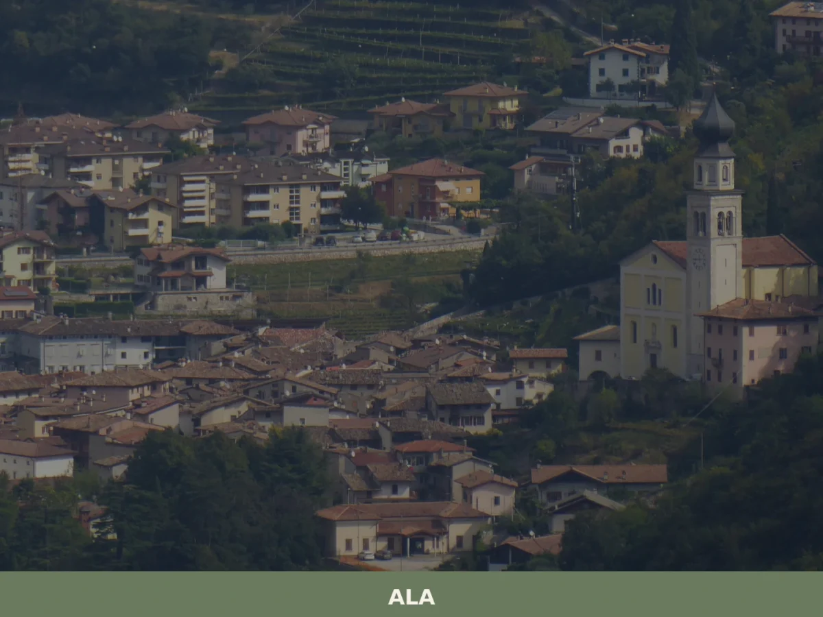
Ala
Discover what to see in Ala, Trentino: silk merchant palazzi, Habsburg border history, Vallagarina wines and the Valle dei Ronchi. Practical tips included.
🧀 Italian traditional products


🏡 Know Avelengo better than we do?
If you’re a local or have been there, your knowledge matters: add what’s missing or fix a detail on this page.