


Caines
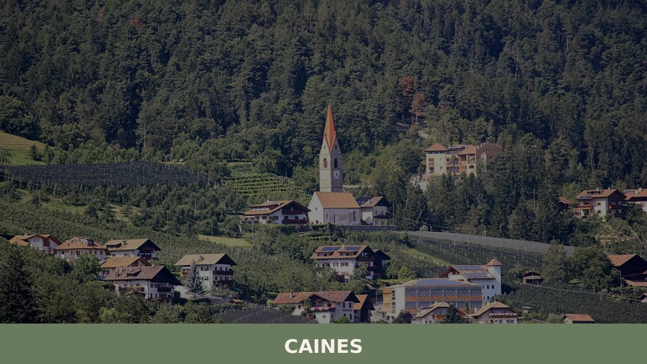
With just 398 registered inhabitants and an elevation of 592 metres above sea level, Caines — Kuens in German — is one of the smallest municipalities in the province of Bolzano. It extends across the sun-facing slope of the middle Passiria Valley, a few kilometres from Merano, on a natural terrace overlooking the confluence of […]
Discover Caines
With just 398 registered inhabitants and an elevation of 592 metres above sea level, Caines — Kuens in German — is one of the smallest municipalities in the province of Bolzano. It extends across the sun-facing slope of the middle Passiria Valley, a few kilometres from Merano, on a natural terrace overlooking the confluence of the Passirio torrent and the Plan stream. Asking what to see in Caines means entering a territory where mountain farming has shaped every hillside into terraces planted with apple trees and grapevines, and where bilingual place names reflect a linguistic border that remains very much alive.
History and origins of Caines
The name “Caines” most likely derives from the pre-Roman term *kòina, referring to a landform — a wedge or sloping hillside. The first documented mention of the settlement dates to the Early Middle Ages: the territory fell under the influence of the Counts of Tyrol, whose main seat, Castel Tirolo, lies less than five kilometres away as the crow flies. For centuries the community’s fate was tied to the jurisdiction of Merano, sharing in the events of the Prince-Bishopric of Bressanone and the County of Tyrol.
After 1919, when South Tyrol was transferred to the Kingdom of Italy under the terms of the Treaty of Saint-Germain-en-Laye, Caines was Italianised in both name and administration. The Option Agreement of 1939 affected this community as well: part of the German-speaking population chose to emigrate to the Reich, only to return after the war. Today the municipality is almost entirely German-speaking — over 97% of the population declares belonging to the German linguistic group — and it retains administrative autonomy guaranteed by the Special Statute of Trentino-Alto Adige.
The settlement pattern reflects the dispersed model of South Tyrolean masi (Höfe): isolated farmsteads, each with its own historical name, distributed between 500 and 900 metres of altitude. This dispersal is not accidental but responds to the need to exploit every altitudinal band for different crops — fruit at the lower levels, cereals and grazing land higher up.
What to see in Caines: 5 main attractions
1. Parish Church of San Lorenzo
A religious building documented at least from the 14th century, remodelled in Gothic and later Baroque forms. The bell tower with its pyramidal spire defines the skyline of the village centre. Inside, carved wooden altars in the tradition of the Passiria Valley workshops and frescoes restored during the 20th century are preserved. The church serves as a visual reference point from every trail crossing the slope.
2. Caines Irrigation Channel Path (Kuenser Waalweg)
The Waalwege are paths that follow the medieval irrigation channels typical of South Tyrol. The one at Caines runs for approximately 4 kilometres along a channel that carries water to the orchards below, with almost no elevation change. The route offers a direct view over the Merano basin and the Tessa mountain group. It is accessible from April to November and serves as a living document of traditional agricultural hydraulic engineering.
3. Historic farmsteads of the Saltusio (Saltaus) hamlet
The lower part of the municipal territory includes the hamlet of Saltusio, along the Passiria Valley road. Here, several farmsteads dating from the 16th and 17th centuries retain façades painted with floral motifs and family crests, following the Lüftlmalerei tradition widespread in the Tyrolean area. The wood-and-stone structures display the Blockbau construction technique, with interlocking stacked logs.
4. Tessa Group Nature Park
The northern boundary of the municipality borders the Tessa Group Nature Park, the largest protected area in South Tyrol with over 33,000 hectares. From Caines, trails climb towards the higher elevations of the park, passing through larch and Norway spruce forests. The fauna includes chamois, red deer and golden eagles. The European long-distance path E5, which connects Lake Constance to Verona, passes through this area.
5. Castel Planta and the surrounding fortified ruins
In the area between Caines and the neighbouring municipality of Tirolo, remains of medieval fortified structures linked to the defensive network of the Counts of Tyrol can be found. Castel Planta, although now privately owned and not always open to visitors, stands out for its position on a rocky spur. The density of castles along this stretch of the Passiria Valley is among the highest in Europe: within a ten-kilometre radius, more than a dozen can be counted.
Local cuisine and regional products
Caines’ position in the middle Passiria Valley, at elevations that are relatively low for South Tyrol, allows for a dual agricultural vocation: intensive fruit growing on the valley floor and livestock farming on the high pastures. The most significant product is the Mela Alto Adige IGP (Südtiroler Apfel g.g.A.), cultivated in the Golden Delicious, Gala and Fuji varieties on south-facing terraces. Alongside the apple orchards grow vineyards of Schiava (Vernatsch) and Lagrein, which fall within the Alto Adige DOC (Südtirol DOC) designation. Speck Alto Adige IGP is also produced by small artisanal workshops in the valley: the production specification requires a minimum ageing period of 22 weeks with beechwood smoking. Worth noting is Graukäse, a lean grey-paste cheese made from acidified skimmed milk without rennet, listed among the Traditional Agri-food Products of the Province of Bolzano. Another local cheese is Stelvio DOP (Stilfser), a semi-hard cheese produced with cow’s milk from the South Tyrolean alpine area.
In the home cooking of Caines, dishes from the South Tyrolean farming tradition endure: Schlutzkrapfen (half-moon pasta filled with spinach and ricotta), Knödel (bread dumplings) in speck or grey cheese versions, Gerstsuppe (barley soup with vegetables and smoked meat) and Kaiserschmarren (shredded sweet pancake served with lingonberry jam). Rye bread — Schüttelbrot, thin and crisp, flavoured with caraway seeds and fenugreek — accompanies every meal. During autumn, the farmsteads of the area celebrate Törggelen, the tradition involving the tasting of new wine together with roasted chestnuts, speck and Kaminwurzen (smoked sausages). In Merano, reachable in just a few minutes, the Merano WineFestival is held every November, providing an opportunity to sample the wine production of the entire valley.
When to visit Caines: the best time of year
The slope on which Caines sits faces south and receives more sunshine than the Passiria Valley average. Annual precipitation is around 700 mm, a low figure for the Alps, which makes the climate relatively dry. Spring — from mid-March to late April — coincides with the apple blossom: the terraces are covered in white and pink, and daytime temperatures range between 12 and 18 degrees. It is the most photogenic and least crowded period.
Summer allows high-altitude hikes in the Tessa Group Nature Park, with trails accessible until October. Autumn brings the Törggelen tradition and the apple harvest, with tractors loaded with crates travelling the narrow roads between the farmsteads. Winter is mild compared to the more interior valleys: snow at 592 metres is not constant, but the Merano 2000 ski slopes, reachable in twenty minutes by car from Caines, offer a ski area within easy reach.
How to get to Caines
Caines is 6 kilometres from Merano and 33 kilometres from Bolzano. By car, from the Brennero A22 motorway, take the Bolzano Sud or Merano/Sinigo exit and continue on the Passiria Valley state road (SS44). From Merano, the provincial road climbs to Caines in about ten minutes.
The nearest railway station is Merano, connected to Bolzano by the Trenitalia/SAD regional line with services approximately every 30 minutes. From Merano, SAD bus line no. 240 towards the Passiria Valley reaches Caines in a few minutes. The reference airport is Bolzano–Dolomiti (approximately 30 km), but the airports with the most international traffic are Verona Villafranca (180 km), Innsbruck (110 km) and Bergamo Orio al Serio (270 km). Those arriving can consult the official website of the Municipality of Caines for updated local public transport timetables.
What to see in Caines and in nearby villages of Trentino-Alto Adige
Caines’ position in the Merano basin connects it to a network of small centres that share an agricultural history and alpine landscape. To the south, along the South Tyrol Wine Road, you reach Andriano, a wine-growing municipality of around 1,000 inhabitants in the Lower Atesina area, known for its production of Pinot Bianco and Gewürztraminer within the Alto Adige DOC. The comparison between the two territories is instructive: Caines grows apples on sun-exposed terraces in the Passiria Valley, while Andriano cultivates grape varieties on the Adige valley floor, where average temperatures are two to three degrees higher.
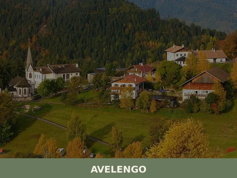
In the opposite direction, climbing towards the plateau above Merano, you find Avelengo, at over 1,200 metres of altitude, homeland of the horse breed that bears its name — the Haflinger, selectively bred here from 1874 onwards. From Caines to Avelengo the elevation difference is around 700 metres, and the change is evident in the vegetation: apple orchards give way to high-altitude pastures, painted façades are replaced by dark-wood farmsteads. Visiting all three of these villages in sequence offers a layered picture of South Tyrol, from vineyard to alpine pasture.
Frequently asked questions about Caines
What is the best time to visit Caines?
Spring (mid-March to late April) is the most photogenic period, when apple orchards on the south-facing terraces burst into white and pink blossom and daytime temperatures reach 12–18°C with few crowds. Summer is ideal for hiking in the Tessa Group Nature Park, with trails open until October. Autumn brings the Törggelen tradition — new wine, roasted chestnuts and speck — and the apple harvest. Winter is mild at 592 metres; snow is not constant, and the Merano 2000 ski area is just 20 minutes away.
What are the historical origins of Caines?
The name Caines likely derives from the pre-Roman term *kòina, meaning a wedge or sloping hillside. The settlement is documented from the Early Middle Ages, when it fell under the influence of the Counts of Tyrol, whose seat at Castel Tirolo lies less than five kilometres away. For centuries Caines was tied to the jurisdiction of Merano, within the Prince-Bishopric of Bressanone and the County of Tyrol. After 1919 it was transferred to Italy under the Treaty of Saint-Germain-en-Laye. Today over 97% of residents belong to the German linguistic group, with autonomy guaranteed by the Special Statute of Trentino-Alto Adige.
What to see in Caines? Main monuments and landmarks
The Parish Church of San Lorenzo, documented from at least the 14th century, features a pyramidal-spire bell tower, carved wooden altars and restored frescoes — it is the village's defining landmark. The Kuenser Waalweg, a 4-kilometre flat path following a medieval irrigation channel, offers panoramic views over the Merano basin and is accessible April to November. In the hamlet of Saltusio, 16th–17th-century farmsteads display Lüftlmalerei painted façades and Blockbau timber construction. Remains of Castel Planta, linked to the Counts of Tyrol's defensive network, stand on a rocky spur between Caines and Tirolo.
What are the main natural or scenic attractions of Caines?
The northern boundary of Caines borders the Tessa Group Nature Park, South Tyrol's largest protected area at over 33,000 hectares. Trails from the village climb through larch and Norway spruce forests to the park's higher elevations, where chamois, red deer and golden eagles are present. The European long-distance path E5 — connecting Lake Constance to Verona — passes through this area. The south-facing terrace on which Caines sits also provides sweeping views over the confluence of the Passirio torrent and the Plan stream and across the Merano basin.
Where to take the best photos in Caines?
The Kuenser Waalweg irrigation channel path offers a nearly level 4-kilometre walkway with unobstructed views over the Merano basin and the Tessa mountain group — ideal at any time of day. In spring, the apple-blossom terraces between 500 and 900 metres provide foreground colour against alpine backdrops. The bell tower of the Parish Church of San Lorenzo, visible from every trail on the slope, makes a classic compositional anchor. The painted Lüftlmalerei façades of the historic farmsteads in the Saltusio hamlet are also highly photogenic subjects.
Are there museums, churches or historic buildings to visit in Caines?
The Parish Church of San Lorenzo is the principal historic building, documented from the 14th century and remodelled in Gothic and later Baroque forms. It preserves carved wooden altars from Passiria Valley workshops and 20th-century restored frescoes. In the hamlet of Saltusio, several farmsteads from the 1500s and 1600s retain painted façades and Blockbau timber construction, representing the Tyrolean Lüftlmalerei tradition. Castel Planta, a medieval fortified structure on a rocky spur near the border with Tirolo, is privately owned and not regularly open to visitors.
What can you do in Caines? Activities and experiences
Walking the Kuenser Waalweg (4 km, flat, April–November) is the signature activity, combining landscape and agricultural heritage. Trails into the Tessa Group Nature Park depart from the upper part of the municipality for multi-day or day hiking, including stretches of the E5 long-distance path. In autumn, Törggelen gatherings at local farmsteads offer new wine, roasted chestnuts and cured meats. The Merano WineFestival in November, held in nearby Merano (6 km), is accessible in minutes. In winter, the Merano 2000 ski area is reachable in about 20 minutes by car.
Who is Caines suitable for?
Caines suits hikers and nature lovers drawn to the Tessa Group Nature Park and the flat Waalweg irrigation path, which is also accessible to older visitors and families with children. Couples seeking a quiet, scenic retreat away from mass tourism will appreciate the dispersed farmstead landscape and the proximity to Merano's thermal facilities. Food and wine enthusiasts are well served by the Törggelen autumn tradition, local speck and cheese producers, and the Alto Adige DOC wines grown on the village slopes. The village's small size and bilingual heritage also appeal to cultural travellers interested in the South Tyrolean borderland identity.
What to eat in Caines? Local products and specialties
The area produces Mela Alto Adige IGP apples (Golden Delicious, Gala, Fuji) on south-facing terraces and Schiava and Lagrein wines under the Alto Adige DOC. Speck Alto Adige IGP, aged a minimum of 22 weeks with beechwood smoking, is made by artisanal workshops in the valley. Graukäse — a lean grey-paste cheese produced without rennet from acidified skimmed milk — is a listed Traditional Agri-food Product of Bolzano province. Traditional dishes include Schlutzkrapfen, Knödel, Gerstsuppe and Kaiserschmarren. Crisp Schüttelbrot rye bread flavoured with caraway and fenugreek accompanies every meal.
📷 Photo Gallery — Caines

Nearby Villages near Caines
In Trentino-South Tyrol More villages to discover
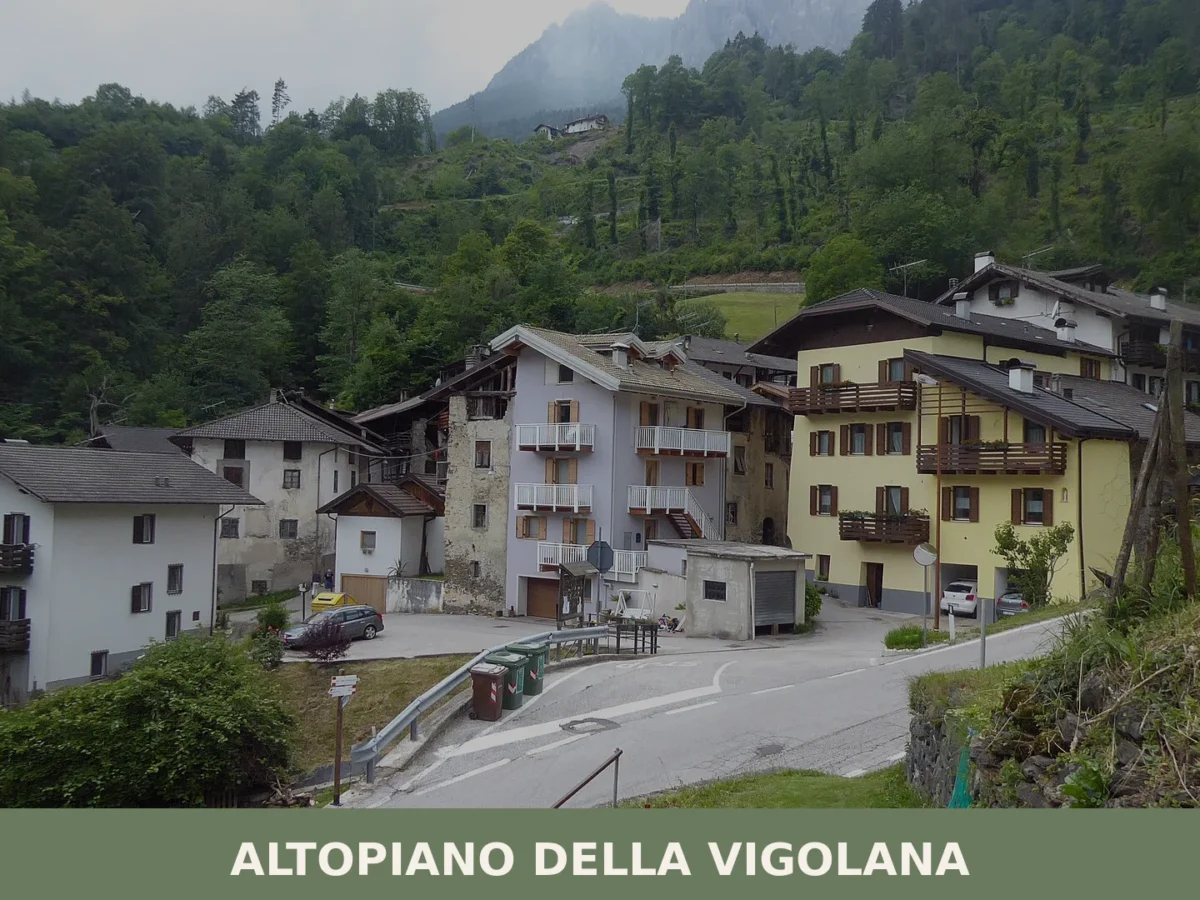
Altopiano della Vigolana
Five thousand inhabitants spread across four frazioni at 725 metres altitude. Roman roads, medieval churches and a 2015 municipal reunification anchor this mountain village in the Upper Valsugana.
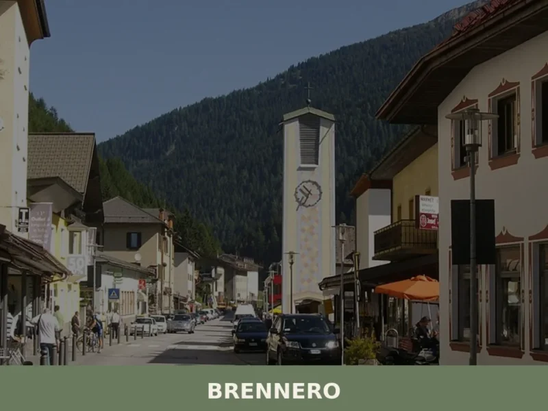
Brennero
The Brenner Pass, at 1,370 metres above sea level, is the lowest Alpine crossing between Italy and Austria, and this geographical circumstance has shaped every aspect of life in the village that bears its name. With 2,111 inhabitants spread across the hamlets of Brennero, Fleres, Ponticolo and Terme di Brennero, the municipality marks the northern […]
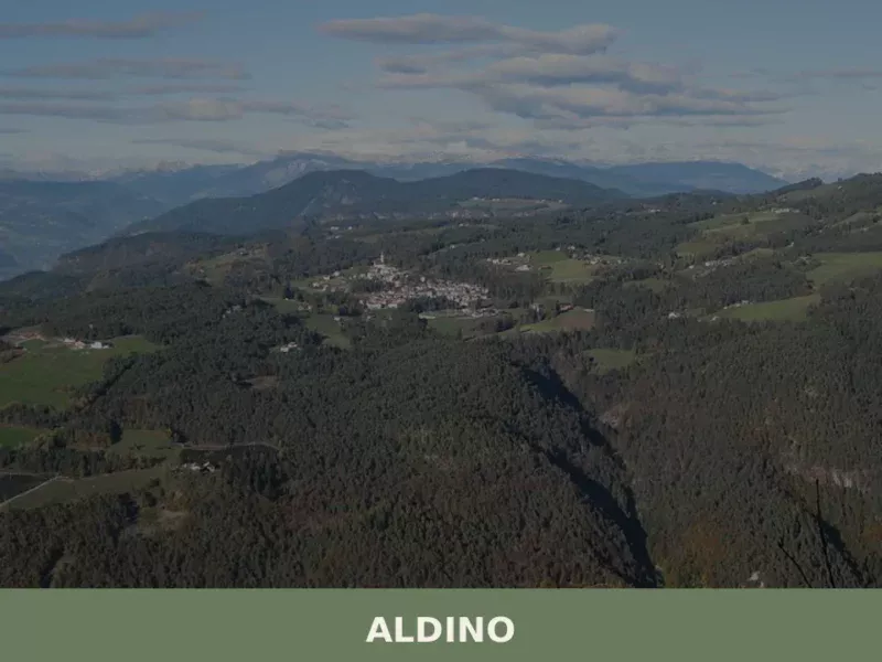
Aldino
Population 1,607. Aldino sits at 1,225 metres in Bolzano province, where Alpine architecture and seasonal rhythms shape daily life.
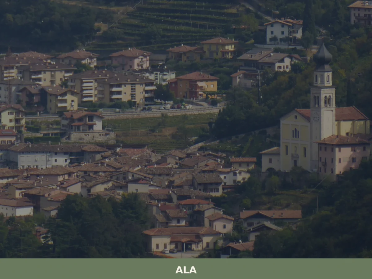
Ala
Discover what to see in Ala, Trentino: silk merchant palazzi, Habsburg border history, Vallagarina wines and the Valle dei Ronchi. Practical tips included.
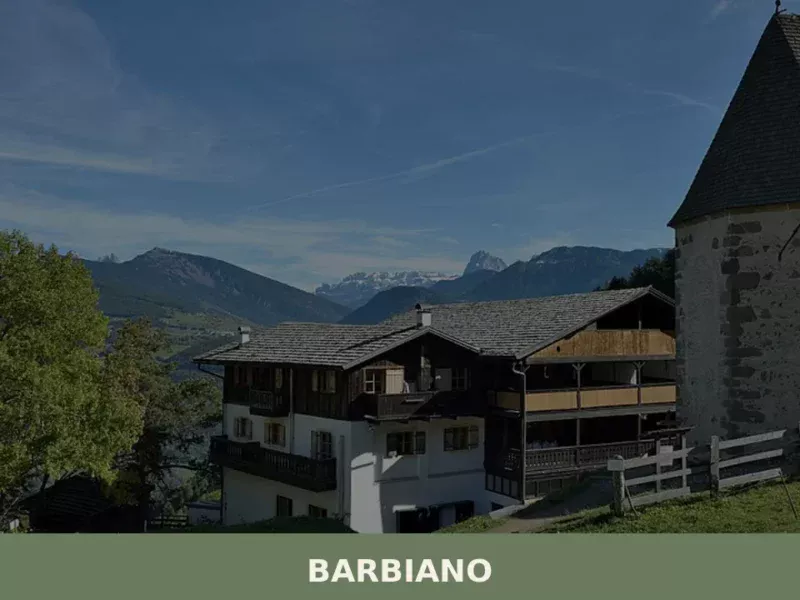
Barbiano
Barbiano covers 25.26 square kilometres on the right-hand slope of the Isarco Valley, spread across five hamlets — Barbiano village, Colma, San Giacomo, Saubach and Dreikirchen — each with its own architectural identity and historical function. Understanding what to see in Barbiano means crossing a territory that rises from 471 metres on the valley floor […]
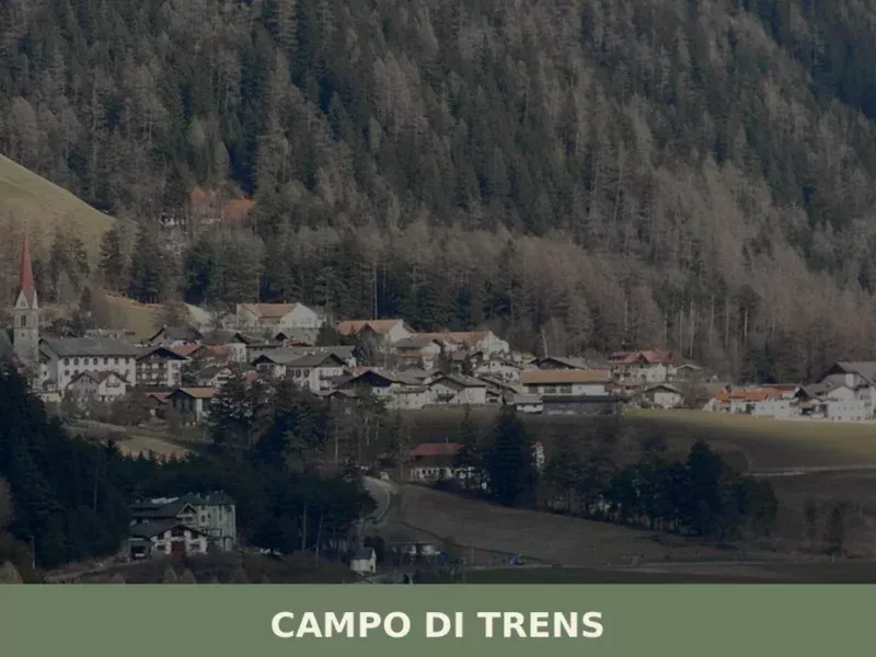
Campo di Trens
At 937 metres above sea level, along the Isarco valley between Vipiteno and Fortezza, the municipality of Campo di Trens has 2,679 inhabitants spread across the hamlets of Trens, Stilves and Mules. Anyone looking into what to see in Campo di Trens will find an area where the German language predominates — the official German […]
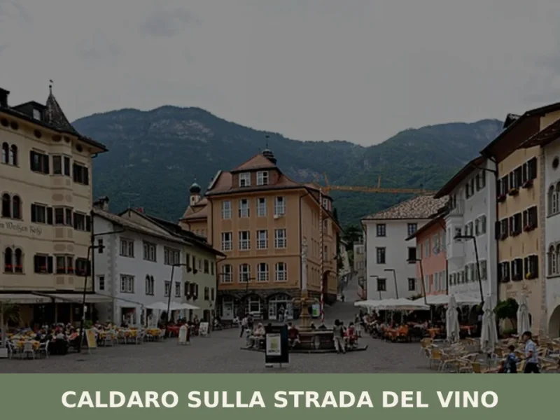
Caldaro sulla strada del vino
Caldaro sulla strada del vino — Kaltern an der Weinstraße in German — has 7,735 inhabitants and over 600 hectares of vineyards, the largest cultivated wine-growing area in South Tyrol. The place name itself declares the vocation of this centre in the province of Bolzano, which grew along the trade route linking the Bassa Atesina […]
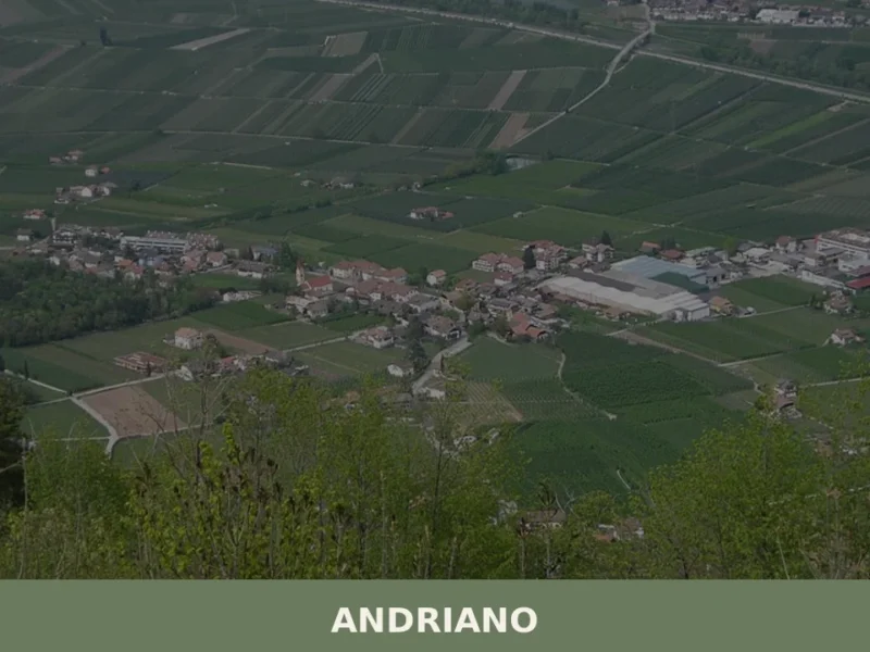
Andriano
At 274 metres above sea level, on the left bank of the Adige river, Andriano has 1,025 inhabitants spread between the historic centre and the farmsteads scattered among rows of vines. The municipality, one of the smallest in South Tyrol by area, extends entirely across flat ground along the alluvial strip connecting Bolzano to Merano. […]
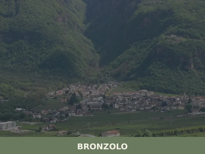
Bronzolo
Bronzolo has 2,646 inhabitants and sits at 238 metres above sea level, on the right bank of the Adige River, at the point where the Isarco Valley meets the Adige plain. The German name for the town — Branzoll — already appears in medieval documents related to the control of trade routes between the Germanic […]
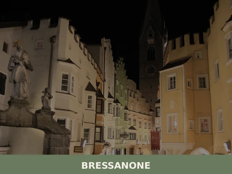
Bressanone
Bressanone is the oldest city in Tyrol, with a bishopric founded around 990 AD that shaped the urban, economic and cultural structure of the entire valley for centuries. Situated at 559 metres above sea level, at the point where the Rienza river flows into the Isarco, the city has a current population of 22,816 and […]


🏡 Know Caines better than we do?
If you’re a local or have been there, your knowledge matters: add what’s missing or fix a detail on this page.