
Roccaforzata
Roccaforzata is home to 1,762 inhabitants, spread across a plateau at 145 metres above sea level in the eastern Taranto countryside. The municipal territory covers just 6.67 square kilometres, making it one of the smallest in the province of Taranto. Anyone looking into what to see in Roccaforzata will find a compact urban centre, developed […]
Discover Roccaforzata
Roccaforzata is home to 1,762 inhabitants, spread across a plateau at 145 metres above sea level in the eastern Taranto countryside. The municipal territory covers just 6.67 square kilometres, making it one of the smallest in the province of Taranto. Anyone looking into what to see in Roccaforzata will find a compact urban centre, developed around the remains of a medieval fortification and a mother church that houses a Marian icon venerated for centuries. The surrounding plain, cultivated with olive groves and vineyards, marks the boundary between the Taranto Murgia and northern Salento.
History and origins of Roccaforzata
The village’s name most likely derives from the presence of a fortified stronghold — a defensive structure documented from the Norman period, when the Taranto territory was reorganised into fiefs and hamlets. The word “forzata” (fortified) refers to the site’s role as a military garrison, placed in a strategic position along the routes connecting Taranto to the Salento hinterland. As happened with many centres in the province of Taranto, the village grew around this defensive structure, attracting farmers and craftsmen seeking protection.
Over the centuries, Roccaforzata passed through the hands of several feudal families. During the Angevin and Aragonese periods, the fief followed the fortunes of the Principality of Taranto, one of the largest in southern Italy. Historical documentation places the founding of the hamlet between the 12th and 13th centuries, in an area already inhabited during the Messapian and later Roman periods, as suggested by sporadic finds in the surrounding territory. The historic centre still preserves its medieval urban layout: a network of narrow streets converging towards the highest point, where the original fortress once stood.
Between the 16th and 18th centuries, Roccaforzata was governed by noble families of southern Italy who administered the fief until the abolition of feudalism in 1806. With Italian unification, the village became an autonomous municipality and retained a predominantly agricultural vocation, linked to the cultivation of olives, vines and cereals — activities that still define the local economy today.
What to see in Roccaforzata: 5 main attractions
1. Chiesa Madre della Madonna della Camera
Dedicated to the patron saint of the village, the church houses the icon of the Madonna della Camera, a sacred image that is the focus of the community’s devotion. The building, remodelled at various times, has a sober façade and a single-nave interior. The patron saint’s feast day on 19 July draws worshippers each year from neighbouring municipalities as well, with a procession that passes through the entire town centre.
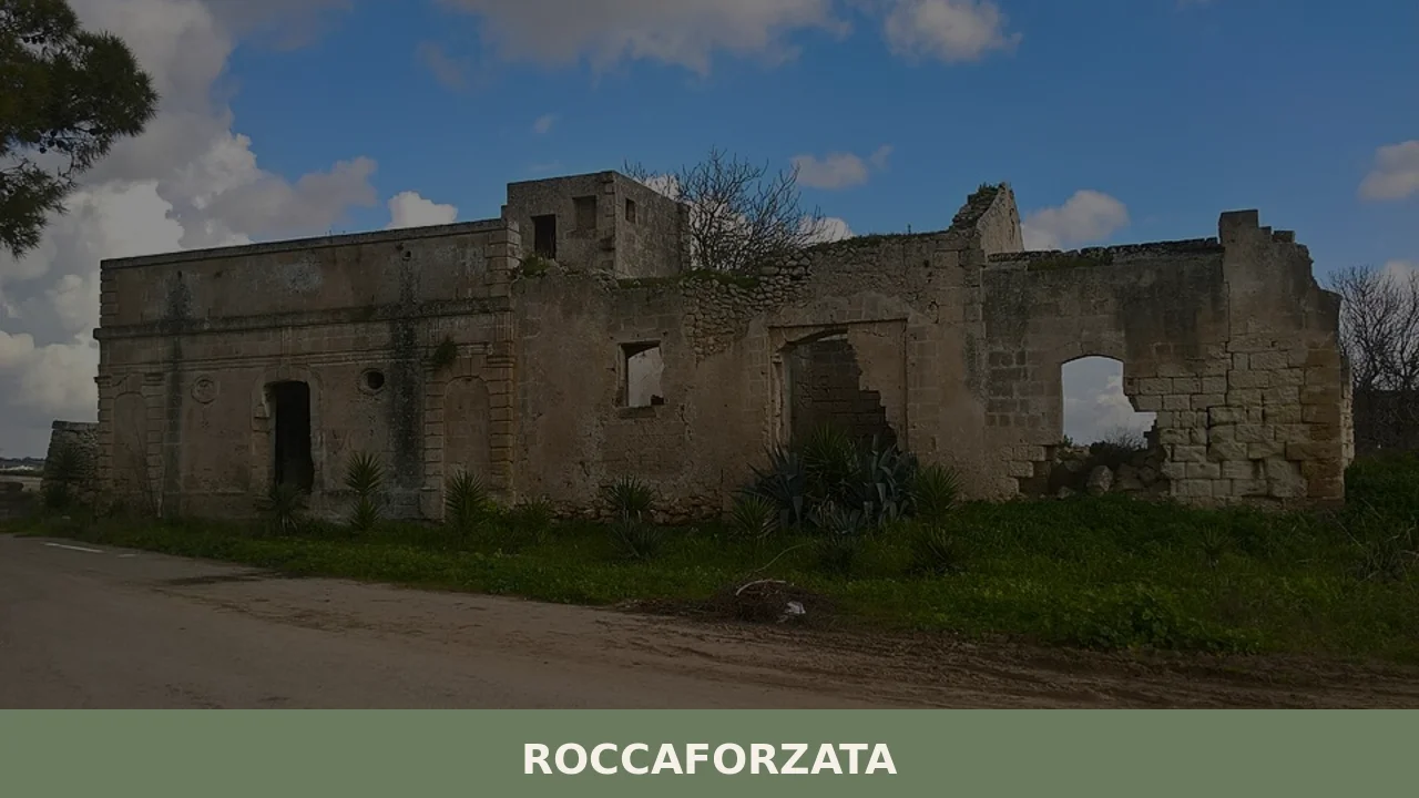
2. Remains of the medieval fortress
Of the fortification that gave the village its name, traces remain incorporated into the buildings of the historic centre. The summit area, at 145 metres elevation, was the hamlet’s main point of defence. From here, the surrounding plain stretches out in full view, and on clear days, the outline of the Ionian Sea is visible. The surviving walls make it possible to reconstruct the original dimensions of the Norman garrison.
3. Historic centre and medieval layout
The old nucleus of Roccaforzata retains the urban structure of the medieval hamlet: narrow streets, internal courtyards, houses built from local tufa stone with external staircases. The oldest dwellings feature carved stone doorways and small votive niches at street corners. A walk through the centre takes less than an hour but conveys with precision the reduced scale and defensive logic of the original settlement.
4. Chapel of Sant’Elia
Dedicated to the village’s second patron saint, the Chapel of Sant’Elia is a modest-sized building that reflects the layered devotional history of the town. The prophet Elijah is celebrated alongside the Madonna della Camera, and the chapel serves as a focal point for the community. The building stands within the perimeter of the old centre, along one of the main street axes.
5. Agricultural landscape of the plain
The municipal territory, entirely flat or gently undulating, is marked by dry-stone walls, scattered farmsteads and expanses of centuries-old olive trees. The countryside around Roccaforzata falls within the production area of Apulian extra-virgin olive oil. In spring, the flowering crops transform the plain into a succession of different greens, from the silvery grey of the olive trees to the deep green of the vineyards.
Cuisine and local products
The table in Roccaforzata reflects the farming tradition of the Taranto Murgia. Extra-virgin olive oil is the cornerstone product: the Ogliarola and Cellina di Nardò cultivars dominate the surrounding groves and yield an oil with a robust flavour, with bitter and peppery notes. Orecchiette with turnip tops, legumes cooked in terracotta pots — especially broad beans and chicory — and durum wheat bread baked in wood-fired ovens make up the everyday repertoire. Primitivo wine, grown in the Taranto area, accompanies meat dishes, particularly bombette and the offal rolls known as gnumareddi.
During the summer months, patron saint celebrations and food festivals provide the opportunity to taste less common preparations: fried pittule, Christmas pettole also made in a summer version, and sweets based on almond paste. The territory falls within the production zones of several Apulian DOP and IGP labels, including Terra d’Otranto DOP olive oil. Local farms sell directly to the public, and some farmsteads in the surrounding countryside offer tastings by appointment.
When to visit Roccaforzata: the best time
The Mediterranean climate of the Taranto plain makes Roccaforzata a year-round destination, but the months between April and June and between September and October offer the most favourable conditions: temperatures between 18 and 28 degrees, extended daylight, and countryside in full agricultural activity. The 19th of July, the feast day of the Madonna della Camera and Sant’Elia, is the central date in the civic and religious calendar: the evening procession, illuminations and fireworks enliven the village for several days. High summer, from July to August, brings temperatures that often exceed 35 degrees on the plain, making morning visits or those after sunset preferable.
Winter is mild compared to the rest of Italy — the temperature rarely drops below 5 degrees — and offers the advantage of experiencing the village in its most ordinary rhythm, without outside visitors. The olive harvest period, between October and December, allows visitors to observe the work in the oil mills at close range, some of which are open to the public.
How to reach Roccaforzata
Roccaforzata is located approximately 18 kilometres east of Taranto. By car, from the A14 Bologna–Taranto motorway, take the Taranto exit and continue along the provincial road towards Fragagnano–Sava. From Lecce, the distance is around 70 kilometres, reachable in about an hour via the 7ter state road. The nearest railway station is Fragagnano, on the Ferrovie del Sud Est line, approximately 5 kilometres from the town centre. Brindisi-Salento airport is about 80 kilometres away and is connected to Taranto by scheduled bus services and car hire. Bari-Palese airport, at 110 kilometres, is an alternative with a greater number of domestic and international connections. There are no frequent public transport services to Roccaforzata: a private or rental car remains the most practical solution.
Other villages to discover in Puglia
Puglia is a region best explored gradually, moving between coastal plains and inland plateaus where each province maintains its own distinct character. Anyone visiting Roccaforzata who wishes to explore the Gargano side of the region can head to Cagnano Varano, a village overlooking the coastal lake of the same name on the Gargano: an environment entirely different from the Taranto plain, dominated by water and the karst heights of the promontory. The contrast between the two territories — one flat and cultivated, the other vertical and wooded — captures the geographic variety of Puglia better than any description.
On the opposite side, in the province of Foggia, Troia occupies an elevated position above the Tavoliere plain and preserves a Romanesque cathedral with an eleven-spoked rose window that represents one of the high points of medieval architecture in southern Italy. From Roccaforzata to Troia the distance is roughly 200 kilometres, but the journey crosses three distinct landscapes — the Taranto plain, the Murge, the Tavoliere — allowing you to measure the distance not only in kilometres but in geology, crops, dialects and building traditions.
Getting there
Via Papa Giovanni XXIII, 74020 Roccaforzata (TA)
Nearby Villages near Roccaforzata
In Apulia More villages to discover
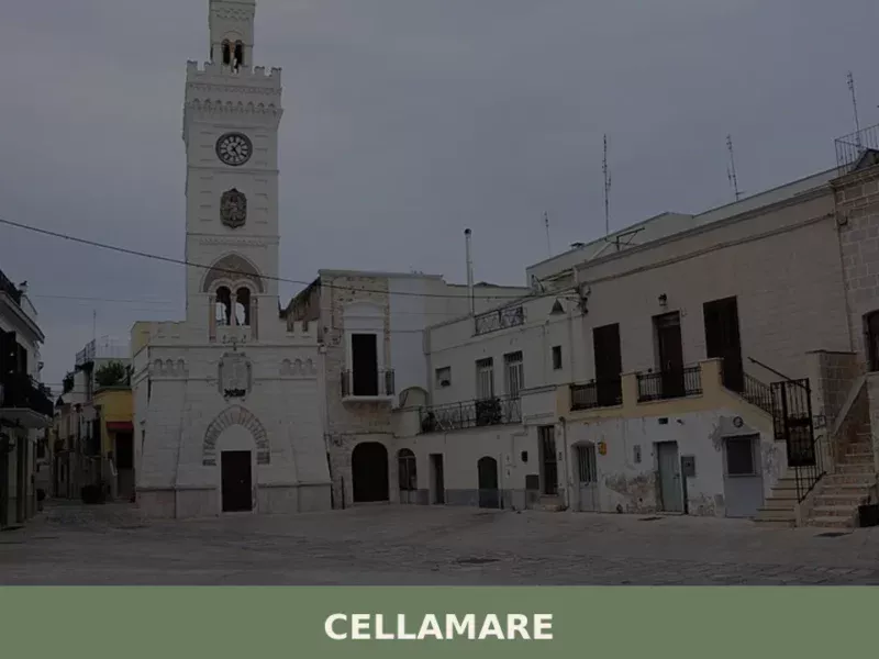
Cellamare
Cellamare, a municipality in the province of Bari, is situated on mostly flat terrain at 110 meters above sea level. With its 5,810 inhabitants, this Apulian settlement has historical ties to agricultural activities, which have shaped its landscape and economy since its earliest records. Its location, a short distance from the provincial capital, makes it […]
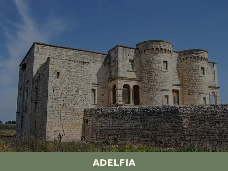
Adelfia
In 1927, a royal decree unified two separate municipalities — Canneto di Bari and Montrone — into a single administrative entity given the name Adelfia, from the Greek adelphós, meaning brother. It was a political gesture that encapsulated centuries of coexistence between two settlements separated by less than a kilometre of countryside, yet each fiercely […]
Mola di Bari
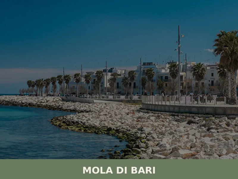
In 1278, Charles I of Anjou ordered the construction of a castle on the Adriatic coast south of Bari, at a spot where fishermen had been hauling their boats ashore for generations. That castle still stands, and it marks the exact centre of Mola di Bari, a town of 24,416 inhabitants spread out at just […]


📝 Incorrect information or updates?
Help us keep the Roccaforzata page accurate and up to date.