


Anguillara Sabazia
What to see in Anguillara Sabazia, Lazio, Italy: lake beaches, a Roman villa 18 m tall, and 18,816 residents. Discover top things to do and how to get there.
Discover Anguillara Sabazia
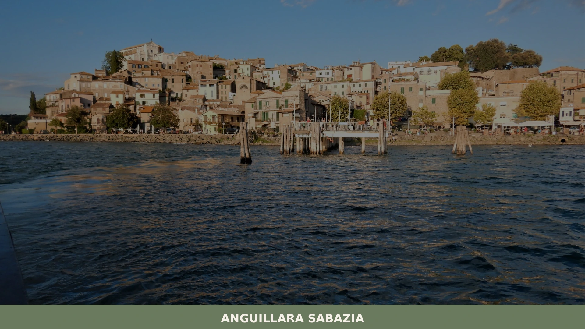
The cape juts into Lake Bracciano at 195 m (640 ft) above sea level, its medieval stone buildings arranged tightly along the shoreline edge.
From the upper lanes of the old center, the water stretches northwest toward the far volcanic rim, and on still mornings the surface reflects the brick-and-travertine facades with enough clarity to count the window openings.
About 3 km (1.9 mi) to the east, a second lake — Martignano, smaller and fed by the same volcanic geology — sits in its own shallow crater, largely unreached by organized tourism.
Three kilometres (1.9 mi) to the south, a Roman structure rises to 18 m (59 ft), its arched openings still framing the sky.
Deciding what to see in Anguillara Sabazia starts with understanding what the town actually contains: a compact medieval center on a lakeside cape, two volcanic lakes inside a Regional Park, and the standing ruins of a 2nd-century Roman villa that survive to a height few comparable sites in Lazio can match. With a resident population of 18,816, the town functions year-round rather than as a seasonal resort alone.
Visitors to Anguillara Sabazia find a working lakeside community 30 km (19 mi) northwest of Rome, reachable in under an hour, with enough documented sites to fill a full day.
History of Anguillara Sabazia
The settlement at Anguillara Sabazia occupies a cape that volcanic activity shaped over millennia, the same geological process that carved out the basins of both Lake Bracciano and Lake Martignano. The lake district of northern Lazio was crossed in antiquity by the Via Clodia, a Roman consular road that connected Rome to Etruria, and the area around the cape shows continuous human presence from at least the Republican period.
The name Anguillara is generally linked to the Italian word for eel — anguilla — which were historically abundant in Lake Bracciano and constituted a documented local resource through the medieval and early modern periods. The addition of “Sabazia” differentiates the town from other Italian settlements sharing the first element of the name.
The medieval center visible today developed during a period when the lake cape offered both a defensible position and direct access to freshwater and fish stocks.
The town passed through the hands of several noble families during the medieval and Renaissance periods, following the common pattern of settlements in the Roman campagna — the agricultural and pastoral hinterland of Rome — which were controlled by powerful baronial houses as territorial assets rather than administrative centers.
The surrounding area was organized as a latifundium, a large landed estate, a system whose roots in this specific territory go back at least to the Roman period, as the nearby villa at Mura di Santo Stefano directly demonstrates.
Proximity to Rome made the lake district both economically productive and politically contested across centuries of Papal State governance.
During the 20th century, Anguillara Sabazia grew from a small rural comune into a town of nearly 19,000 residents, partly driven by internal migration from Rome and broader Lazio, and partly by its function as a weekend and summer destination for the capital’s population.
The Regional Park designation that now governs both Lake Bracciano and Lake Martignano introduced formal naturalistic controls on development and land use, preserving the shoreline and the volcanic upland from the kind of building pressure that affected other towns in the metropolitan hinterland.
Today, the municipality of Anguillara Sabazia administers a territory that balances residential growth with the environmental constraints of the protected area. Visitors exploring other parts of northern Lazio might also consider Viterbo, which sits in the same volcanic upland zone and shares the medieval urban fabric characteristic of the region.
What to see in Anguillara Sabazia, Lazio: top attractions
The Medieval Center on the Lake Cape
The old town occupies the full width of the cape, so no building in the historic center stands more than a few dozen meters from the water on either side.
The street plan is compact and largely pedestrian, with lanes running parallel to the shoreline and connecting stairways that drop toward the lake edge.
The facades are a mixture of medieval stonework and later brick repairs, with some sections of the perimeter retaining their original defensive function as lake-facing walls. The best approach is from the lakeside road, which gives an unobstructed view of the full silhouette of the cape before entering the upper streets.
Late afternoon light strikes the eastern facades directly, making that the most practical time to read the architectural detail of the older structures.
Lake Bracciano and the Municipal Beach
Lake Bracciano covers approximately 57 km² (22 sq mi) and reaches a maximum depth of around 160 m (525 ft), making it one of the larger volcanic lakes in central Italy. The lake’s shoreline at Anguillara Sabazia includes a beach area that has historically made the town a summer destination for Rome’s residents, given the 30 km (19 mi) distance from the capital.
The water quality is subject to the controls of the Regional Park authority, which monitors the lake environment. Swimming is possible from the accessible beach area near the town.
For those interested in understanding the full geography of the volcanic basin, it is worth walking the shoreline north of the cape to appreciate the scale of the crater rim that encircles the water.
Lake Martignano
Smaller than its neighbor, Lake Martignano sits in its own distinct volcanic crater approximately 3 km (1.9 mi) east of Anguillara Sabazia. The lake has no significant built development on its shores, a condition maintained by the Regional Park regulations that cover both lakes and the surrounding land. Its surface area is considerably more modest than Lake Bracciano, and the absence of large-scale visitor infrastructure keeps summer use lower in volume. The access road from Anguillara Sabazia reaches the lake via a route through agricultural land.
The Regional Park that protects both lakes is administered under strict naturalistic controls, and the combination of two volcanic lakes within walking distance of a single town is a documented geographical feature specific to this territory.
Roman Villa of Mura di Santo Stefano
The remains of this Roman structure stand approximately 3 km (1.9 mi) south of Lake Bracciano, on a site that was originally positioned along the Via Clodia.
Construction dates to the end of the 2nd century AD, built on or near an earlier villa rustica from the 1st century.
The surviving walls of the three-story building rise to approximately 18 m (59 ft), constructed in cement with brick cladding in alternating yellow and red courses. Arched openings face outward, framed by brick pillars, while the interior organized around a central courtyard with pillar supports for three floors — the cross vaults of those floors have since disappeared.
The original decoration used 19 documented types of marble, and the covered side corridors still retain traces of marble cladding on the walls. A cistern survives nearby.
The complex functioned as a luxury retreat, possibly the residential component of a large landed estate, with evidence of use continuing into the 3rd or early 4th century AD.
The Regional Park of Lake Bracciano and Lake Martignano
The two lakes and the land surrounding them are formally designated as a Regional Park, subject to strict naturalistic controls that cover both aquatic and terrestrial environments. The park boundary encompasses the volcanic upland between the two lake basins and extends to include agricultural and wooded areas around the crater rims.
Walking paths within the park connect the two lakes and provide access to viewpoints above the water.
The park designation directly shapes what visitors see when they arrive: undeveloped shorelines, restricted building zones, and the absence of large-scale commercial infrastructure on the lakeshores. Those planning a day of outdoor activity in the area should note that the park operates under regulations managed by the regional authority, and some access points have seasonal limitations on vehicle entry.
Local food and typical products of Anguillara Sabazia
The food culture of Anguillara Sabazia reflects its position as a lakeside town in the Roman hinterland, drawing on both the freshwater resources of Lake Bracciano and the agricultural production of the surrounding volcanic upland.
The lake has historically supplied eel, perch, and other freshwater species to local kitchens, a tradition that connects directly to the documented etymology of the town’s name. The volcanic soil of the Lazio lake district supports viticulture and cereal cultivation, and the proximity to Rome — 30 km (19 mi) — has historically made this territory part of the supply network for the capital’s markets.
Freshwater fish preparations are the most geographically specific element of the local table.
Anguilla in umido, eel slow-cooked with tomato, white wine, garlic, and local herbs, appears in trattorie around the lake and directly references the species that gave the town its name.
Coregone al forno, baked whitefish from Lake Bracciano seasoned with olive oil and aromatic herbs, is a second lake-specific dish.
The cooking technique for both relies on low heat and long resting times rather than high-temperature methods, producing a result that keeps the fish structure intact while absorbing the cooking liquid. Pasta dishes in the area follow the broader Roman tradition, with pasta alla gricia — made with guanciale, pecorino, black pepper, and no tomato — appearing regularly on menus alongside lake fish.
The volcanic soil around Lake Bracciano supports olive cultivation, and locally pressed extra-virgin olive oil is available from producers in the municipal territory and neighboring comuni.
The oil from this part of Lazio tends toward a grassy, slightly bitter profile due to the mineral composition of the volcanic soil, though specific certification designations covering Anguillara Sabazia were not confirmed in the available sources.
Local markets in the area sell seasonal produce including wild herbs, legumes, and the small tomatoes typical of Lazio’s agricultural calendar.
The territory does not have documented DOP or IGP-certified specialty products specific to the Anguillara Sabazia comune based on the sources consulted for this guide.
The lakeside setting means that the best period to find fresh fish on local menus is from late spring through early autumn, when fishing activity on Lake Bracciano is most intensive. Small food events tied to the lake and its produce take place during summer weekends, drawing visitors from Rome who combine a meal with a day at the beach. The town’s sagra — a traditional local food festival — calendar follows the broader Lazio pattern of late summer and early autumn events, though specific confirmed dates for recurring fairs were not available in the verified sources for this edition.
Festivals, events and traditions of Anguillara Sabazia
The principal religious observance of the municipal calendar falls on 3 February, the feast day of San Biagio vescovo e martire, the patron saint of Anguillara Sabazia.
San Biagio — Saint Blaise, bishop and martyr — is venerated across Catholic Italy, and in communities where he holds patron status, the 3 February feast typically involves a solemn Mass, a procession through the streets of the historic center, and the blessing of throats, a liturgical practice specific to this saint tied to a documented episode in his hagiography.
The winter date places the celebration outside the summer tourist season, meaning it is primarily a community observance attended by residents rather than a large-scale public event.
The summer months bring informal lakeside events and weekend gatherings tied to the beach season, when the population of the town increases significantly with day visitors and short-stay guests from Rome and the metropolitan area.
The Regional Park’s presence shapes the nature of outdoor events, as large-scale commercial activities on the lakeshore are restricted by the park regulations.
Traditions linked to the lake itself — including fishing-related customs and seasonal food preparations — continue as part of the local calendar, though specific documented dates for regular festivals beyond the patron saint feast were not confirmed in the sources available for this guide.
When to visit Anguillara Sabazia, Italy and how to get there
The most practical period to visit is late spring, specifically May and June, when temperatures are moderate and the lake is fully accessible without the peak summer crowds that arrive in July and August.
September is an effective alternative: the water remains warm enough for swimming, visitor numbers drop after the school holidays end, and the light on the lake in early autumn is direct and clear rather than the hazy midday intensity of high summer.
Those focused on the Roman villa at Mura di Santo Stefano or the medieval center have no strong seasonal reason to avoid winter months, as both sites are outdoor visits unaffected by beach-season logic.
February visitors will coincide with the San Biagio feast on the 3rd, which gives a specific reason to plan around that date. This is one of the best times to visit Lazio if you are looking for a quieter experience away from the major summer influx.
Anguillara Sabazia is a practical day trip from Rome by any of the standard routes. By car, the most direct route from Rome takes approximately 45 to 50 minutes via the Via Aurelia (SS1) or the Via Cassia (SS2), exiting toward Bracciano and continuing south along the lake road. By regional train, the Trenitalia Roma-Viterbo line stops at Anguillara station; the journey from Roma Ostiense takes approximately 50 minutes.
The nearest international airport is Rome Fiumicino (Leonardo da Vinci), located approximately 45 km (28 mi) to the south by road, with a travel time of roughly one hour depending on traffic conditions.
Domestic travelers from Florence can reach Anguillara Sabazia in approximately 3 hours by car via the A1 motorway and then the ring roads of Rome.
For international visitors, English is not widely spoken in smaller local shops and restaurants, so carrying some cash in euros is a practical precaution, as card acceptance is not universal in the town’s smaller establishments.
Those combining the visit with a stop in northern Lazio might consider continuing northwest to Gradoli, a small comune on Lake Bolsena that sits within the same volcanic lake geography and is reachable in under an hour from Anguillara Sabazia.
Where to stay near Anguillara Sabazia
Accommodation options in and around Anguillara Sabazia include agriturismi in the agricultural land between the two lakes, B&Bs in the town itself, and holiday rental apartments in the old center and lakeside buildings. The town functions as a short-stay destination rather than a major hotel resort, so the available lodging tends toward smaller, independently operated structures.
Visitors arriving for more than a day — whether to explore both lakes, the Roman villa, and the medieval center, or to combine the town with other stops in northern Lazio — will find the local accommodation adequate for a one- or two-night stay. Booking in advance is advisable for July and August, when demand from Rome-area visitors consistently exceeds the available inventory of rooms.
Visitors extending their stay in Lazio can use Anguillara Sabazia as a base for broader regional exploration.
The medieval hill town of Casperia, in the Sabina area of Lazio, represents a different landscape register — limestone upland rather than volcanic lake basin — and is reachable within roughly two hours by car for those wanting to compare two contrasting sides of the region.
Those interested in the Franciscan heritage of Lazio might also plan a detour to Poggio Bustone in the Rieti valley, a documented stop on the route of Saint Francis and a different kind of Lazio entirely from the volcanic lake district around Anguillara Sabazia.
Frequently asked questions about Anguillara Sabazia
What is the best time to visit Anguillara Sabazia?
Late spring (May–June) and early autumn (September–October) offer the most comfortable conditions: mild temperatures, clear lake reflections, and fewer crowds than the peak summer weeks when Romans arrive en masse for the beach. Summer remains viable given the 30 km distance from Rome and the lake's cooling effect, but July and August bring the heaviest visitor pressure. Winter visits are quieter; the feast of the patron saint San Biagio vescovo e martire falls on 3 February and provides a local cultural occasion outside the tourist season.
What are the historical origins of Anguillara Sabazia?
The cape has been continuously settled since at least the Roman Republican period, when the Via Clodia — the consular road linking Rome to Etruria — crossed the surrounding lake district. The name Anguillara derives from anguilla (eel), reflecting the historically abundant eel stocks of Lake Bracciano. 'Sabazia' was added to distinguish the town from other Italian places sharing the same root name. During the medieval and Renaissance periods, the town passed through several powerful baronial families, following the common pattern of the Roman campagna under Papal State governance.
What to see in Anguillara Sabazia? Main monuments and landmarks
Three sites stand out. The medieval center sits on a lake cape with stone and brick facades overlooking Lake Bracciano on both sides — best approached from the lakeside road in late afternoon light. The Roman Villa of Mura di Santo Stefano, about 3 km south, preserves walls rising to 18 m with alternating red and yellow brick courses and arched openings, dating to the late 2nd century AD; it is one of the tallest surviving Roman villa structures in Lazio. Lake Martignano, 3 km east, offers a pristine volcanic crater lake with no built development on its shores.
What are the main natural or scenic attractions of Anguillara Sabazia?
The Regional Park of Lake Bracciano and Lake Martignano formally protects both volcanic lakes and the upland between them. Lake Bracciano covers approximately 57 km² with a maximum depth of 160 m, while the smaller Lake Martignano sits undeveloped in its own crater. Walking paths within the park connect the two lakes and reach viewpoints above the water. The park authority imposes strict naturalistic controls that keep the shorelines free of large-scale construction, and some access points carry seasonal vehicle restrictions.
Where to take the best photos in Anguillara Sabazia?
The lakeside road approaching the cape from the south gives an unobstructed view of the entire medieval silhouette reflected in Lake Bracciano — on calm mornings the brick-and-travertine facades mirror clearly enough to count individual window openings. The upper lanes of the old center frame northwest views across the lake toward the distant volcanic crater rim. Late afternoon light strikes the eastern facades directly, making that the practical window for architectural detail shots. The arched openings of the Mura di Santo Stefano, still framing open sky at 18 m height, provide a second strong subject.
What can you do in Anguillara Sabazia? Activities and experiences
Swimming is possible from the beach area near the old town on Lake Bracciano, historically the main draw for Rome's summer visitors. Walking paths inside the Regional Park connect the two volcanic lakes with viewpoints above the water. The Roman Villa of Mura di Santo Stefano rewards a short drive south for anyone interested in Roman archaeology. The compact medieval center is best explored on foot via its pedestrian lanes and lakeside stairways. Local trattorie around the lake serve freshwater fish dishes including eel and whitefish specific to the Bracciano basin.
Who is Anguillara Sabazia suitable for? Families, couples, hikers, solo travelers?
Anguillara Sabazia works well for a broad range of visitors. Families with children benefit from the lake beach, the accessible medieval center, and the short distance from Rome (30 km). Couples find the lakeside cape atmospheric, particularly in the quieter spring and autumn months. Hikers and nature travelers have direct access to the Regional Park's paths between the two volcanic lakes. Day-trippers from Rome can cover the medieval center, the Roman villa ruins, and a lakeside lunch within a single day. The town's year-round resident population of nearly 19,000 means services remain open outside peak season.
What to eat in Anguillara Sabazia? Local products and specialties
The most geographically specific dishes come from Lake Bracciano itself. Anguilla in umido — eel slow-cooked with tomato, white wine, garlic, and local herbs — directly references the species behind the town's name and appears in local trattorie. Coregone al forno, baked whitefish from the lake seasoned with olive oil and aromatic herbs, is a second lake-specific preparation. Both rely on low heat and long resting times. The volcanic soil of the surrounding upland supports viticulture and cereal cultivation, and the proximity to Rome historically integrated this territory into the capital's food supply network.
Nearby Villages near Anguillara Sabazia
In Lazio More villages to discover
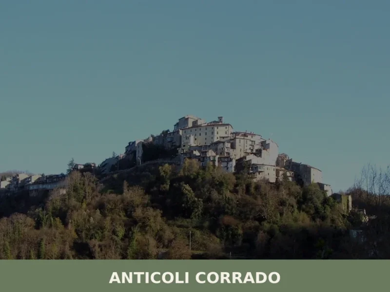
Anticoli Corrado
Stone walls rise in tight formation above the Aniene valley, 40 kilometres (25 mi) northeast of Rome, where a cluster of houses at 508 metres (1,667 ft) altitude holds the ruins of a medieval castle and an 11th-century church. The fountain in Piazza delle Ville was cast by Arturo Martini, a sculptor whose work now […]
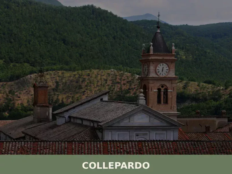
Collepardo
The karst stone beneath the Monti Ernici does not announce itself gradually. It opens without warning into vertical drops and hollow chambers, some sealed by centuries of slow dissolution, others wide enough to swallow the sound of a person speaking. In this article History of Collepardo What to see in Collepardo, Lazio: top attractions Local […]
Arlena di Castro
With its 839 registered inhabitants and an elevation of 260 metres above sea level, Arlena di Castro occupies a tuff plateau in the Tuscia area of the Viterbo province, just a few kilometres from the border with the Lazio Maremma. The municipal territory preserves traces of Etruscan presence documented by necropolises and ceramic materials found […]
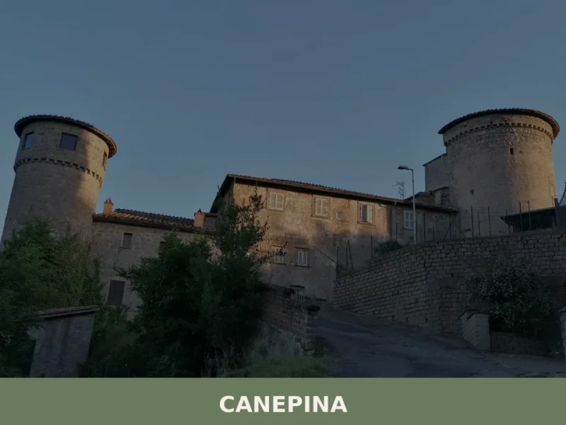
Canepina
What to see in Canepina, Lazio, Italy: explore this 3,127-inhabitant hill village 60 km from Rome. Discover its hemp heritage, patron saint feast and local cuisine.

Artena
What to see in Artena, Lazio, Italy: cyclopean walls from the 5th century BC, Palazzo Borghese, and 4 historic churches. Discover how to get there from Rome.
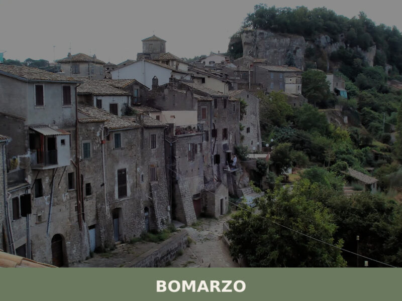
Bomarzo
Population 1,679. Visit for the Parco dei Mostri and the village's unadorned religious and domestic architecture rooted in the Cimini landscape.
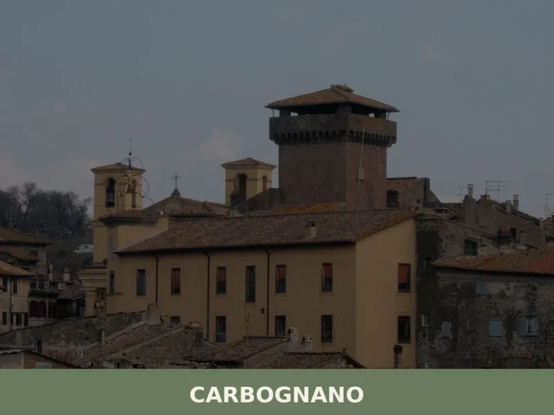
Carbognano
What to see in Carbognano, Italy: a hilltop village at 394 m, 50 km from Rome. Explore its churches, local food, and festivals. Discover Viterbo province.
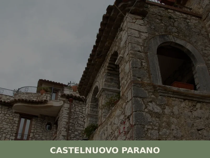
Castelnuovo Parano
What to see in Castelnuovo Parano, Lazio, Italy: a village of 885 at 310 m. Discover the 1059 castle origins, Gustav Line history and local hilltop culture.
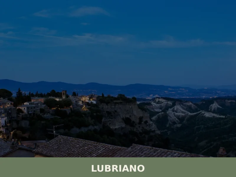
Lubriano
Lubriano has 864 inhabitants and occupies a tuff plateau at 441 metres above sea level, separated from the more famous Civita di Bagnoregio by a calanchi valley nearly two hundred metres deep. The municipal boundary runs along the edge of a gorge that geologists classify as one of the most active in Tuscia for erosion. […]
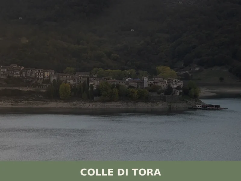
Colle di Tora
What to see in Colle di Tora: a village at 542 m on Lake Turano with 381 residents, a medieval centre and 3 PAT-certified products. Plan your visit today.


🏡 Know Anguillara Sabazia better than we do?
If you’re a local or have been there, your knowledge matters: add what’s missing or fix a detail on this page.