
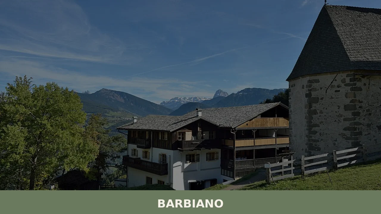
Barbiano
Barbiano covers 25.26 square kilometres on the right-hand slope of the Isarco Valley, spread across five hamlets — Barbiano village, Colma, San Giacomo, Saubach and Dreikirchen — each with its own architectural identity and historical function. Understanding what to see in Barbiano means crossing a territory that rises from 471 metres on the valley floor […]
Discover Barbiano
Barbiano covers 25.26 square kilometres on the right-hand slope of the Isarco Valley, spread across five hamlets — Barbiano village, Colma, San Giacomo, Saubach and Dreikirchen — each with its own architectural identity and historical function. Understanding what to see in Barbiano means crossing a territory that rises from 471 metres on the valley floor to 1,837 metres along the ridge, a difference in elevation that produces distinct microclimates, different crops and a settlement pattern shaped first and foremost by the mountain. Its 1,737 inhabitants make their living primarily from agriculture, hiking tourism and woodworking.
History and origins of Barbiano
The place name “Barbiano” — Barbian in German — appears in medieval documents from the twelfth century onwards, although the area was already inhabited in Roman times as a transit point along the Isarco Valley route, the artery connecting the Italian world to the Alpine passes toward the Brenner. The most widely accepted etymological hypothesis traces the name to the Latin praedium Barbianum, a landed estate belonging to a proprietor named Barbius. This Roman agrarian origin explains the territory’s agricultural vocation, which has continued without interruption through the centuries.
During the Middle Ages the territory of Barbiano fell under the jurisdiction of the Counts of Tyrol and, in part, under the influence of the Prince-Bishopric of Bressanone. The sunny position of the slope, sheltered from northern winds, encouraged the development of a network of scattered farmsteads (Höfe), a settlement structure still readable in the landscape today. In 1810, during the Napoleonic period, Barbiano was administratively merged with other municipalities in the valley, only to regain its autonomy with the return of Habsburg sovereignty. Annexation to the Kingdom of Italy took place in 1919, at the end of the First World War.
A distinctive element in local history is the complex of the Three Churches (Dreikirchen), three sacred buildings erected within a short distance of one another between the twelfth and fifteenth centuries on a plateau at around 1,130 metres above sea level. This concentration of places of worship, rare across the Alpine arc, has generated legends and historiographical hypotheses over time, but the most plausible explanation relates to the gradual layering of votive chapels linked to different phases of colonisation of the slope.
What to see in Barbiano: 5 top attractions
1. The Three Churches of Dreikirchen
Three separate sacred buildings — dedicated to Saint Nicholas, Saint Gertrude and Saint Mary Magdalene — stand just metres apart on a natural terrace at 1,130 metres. The church of Saint Nicholas preserves fourteenth-century frescoes of the Bolzano school. Access is via a trail of approximately 40 minutes from the centre of Barbiano, with no ordinary vehicle access available.
2. Parish Church of San Giacomo
Located in the hamlet of the same name, the church dedicated to the patron saint of the municipality — celebrated on 25 July — features a Gothic bell tower with mullioned windows and an interior remodelled in the Baroque period. The carved and gilded wooden high altar dates from the eighteenth century. From the small square in front of the church, there is a direct view across to the Sciliar massif and the Isarco plain.
3. Barbiano Waterfalls
The Barbiano stream forms a series of cascades with a combined drop of over 85 metres. The equipped path that runs alongside them — roughly one hour’s walk there and back — passes through a narrow ravine with porphyry walls and riparian vegetation. The period of greatest water flow coincides with snowmelt between May and June.
4. Chestnut Trail (Keschtnweg)
Barbiano is crossed by one of the central sections of the Keschtnweg, a 63-kilometre themed trail that runs along the sunny slope of the Isarco Valley from Bressanone to Bolzano. The local stretch passes through centuries-old chestnut groves between 500 and 900 metres of altitude. In October, during the harvest, open chestnut burrs cover the path and the farmsteads along the route sell fresh and dried chestnuts.
5. Plunhof Farmstead and the historic scattered farms
The settlement structure of Barbiano can be read in the wood-and-stone farmsteads distributed along the slope, many of which retain their original layout with stable, hayloft and a Stube panelled in Swiss pine. Some farmsteads, still operating as working farms, sell milk, cheese and berries directly to visitors. The rural architecture follows building models documented as far back as the fourteenth century in the Isarco Valley.
What to see in Barbiano: cuisine and local products
Traditional cuisine and local products
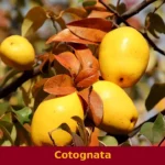
The table in Barbiano reflects the municipality’s dual altitude range. In the lower belt grow the chestnut trees that supply the production of the Kastanie (Isarco Valley chestnut), used for soups, flours and desserts such as Kastanientorte, a dense cake made from boiled chestnuts, butter and chocolate. At higher elevations, dairy products dominate: Graukäse (grey cheese with a lean paste, produced without rennet from acidified skimmed milk, recognised as a PAT — Traditional Agri-food Product — of the Province of Bolzano), Zieger (smoked alpine ricotta) and alpine butter churned in the summer mountain dairies above 1,500 metres. Schlutzkrapfen — half-moon rye-dough parcels filled with spinach and ricotta, dressed with melted butter and chives — are the most common first course, alongside Pressknödel, pressed dumplings that are sliced and pan-fried in butter. Speck Alto Adige IGP is found in every farmstead that practises home butchering, cured with a blend of salt, pepper, juniper and bay leaf for at least 22 weeks.
In autumn, the chestnut harvest is celebrated during the Keschtnriggl, the Isarco Valley chestnut weeks (between October and November), with tastings at the farmsteads and along the Keschtnweg. Among the fruit products, Barbiano is part of the Mela Alto Adige IGP (South Tyrolean Apple PGI) supply chain, cultivated on the warmer valley floors. Vernatsch (Schiava), a red-grape variety of the Isarco Valley, produces a light, easy-drinking wine that pairs well with smoked-meat dishes. In the cold months, Gerstsuppe is served — a barley soup with speck, potatoes and seasonal vegetables, offered in the Stuben of the farmsteads and in local Gasthöfe. Rye bread (Schüttelbrot), thin and crunchy, seasoned with caraway seeds (Brotklee) and fenugreek, is made by artisan bakeries in the area and is registered as a traditional South Tyrolean product.
When to visit Barbiano: the best time of year
The slope on which Barbiano sits enjoys a south-west exposure that guarantees over 2,000 hours of sunshine per year, a figure that places this area among the sunniest in South Tyrol. Spring, from April to June, is the period when the waterfalls reach their peak flow and the meadows bloom with a remarkable density of species: gentians, arnica, crocuses. Temperatures at 836 metres during that period range between 7°C at night and 20°C during the day — ideal conditions for hiking along the Keschtnweg and up to Dreikirchen.
Autumn, from mid-September to late November, is the second optimal window: the chestnut harvest brings the farmsteads and trails to life, the larches turn golden yellow, and visibility across the Isarco Valley is often sharp for days on end. The feast of the patron saint San Giacomo, on 25 July, falls in the height of summer and includes a procession from the parish church followed by music from the local band and farmstead dishes served outdoors. Winter is quiet — no ski lifts operate directly within the municipality — and lends itself to snowshoeing in the woods above Colma and Saubach, with snow generally covering the ground above 1,000 metres from December to March.
How to reach Barbiano
Barbiano is reached from the Brenner motorway A22 by taking the Chiusa – Val Gardena exit, from which the village centre is approximately 8 kilometres along a climbing provincial road with regular hairpin bends (15 minutes by car). The nearest railway station is Chiusa, on the Brenner line (Verona–Innsbruck), connected to Barbiano by SAD bus service line 165. From Bolzano the distance is 28 kilometres (approximately 30 minutes), from Bressanone 15 kilometres (20 minutes). The nearest airport is Bolzano (35 km), while the main international airports of reference are Innsbruck (110 km) or, alternatively, Verona Villafranca (190 km). In summer, cycling is a practical option: the Isarco Valley cycle path runs along the valley floor, and from there a 5-kilometre climb with 370 metres of elevation gain leads up to the village.
Other villages to discover in Trentino-Alto Adige
Visitors to Barbiano find themselves centrally positioned within a network of small South Tyrolean municipalities that share the same scattered-farmstead structure and the same economy built on fruit growing, livestock farming and slow tourism. To the south, toward Bolzano, Andriano occupies the opposite slope of the Adige Valley, at just 260 metres above sea level: an altitude difference of nearly 600 metres compared to Barbiano that translates into a completely different landscape, dominated by Gewürztraminer and Pinot Bianco vineyards. Comparing the two villages captures precisely the climatic and agricultural variety that South Tyrol concentrates within minimal distances.
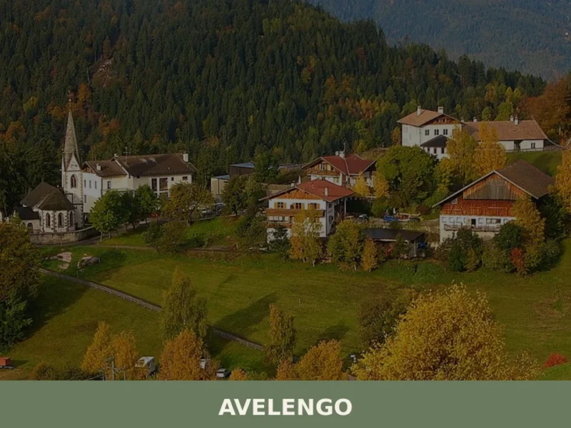
To the west, on the plateau above Merano, Avelengo shares Barbiano’s altitude — around 1,300 metres in the upper part — and its summer hiking vocation, but differs through the presence of the Haflinger horse, a breed that originated in that very area. An itinerary linking Barbiano, Andriano and Avelengo covers approximately 90 kilometres of provincial roads and allows travellers to cross three altitude bands, three microclimates and three distinct ways of inhabiting the South Tyrolean mountains.
Nearby Villages near Barbiano
In Trentino-South Tyrol More villages to discover
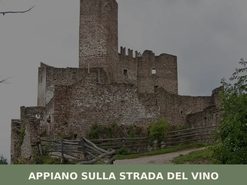
Appiano sulla strada del vino
The municipality of Appiano sulla strada del vino has 14,304 inhabitants spread across eight hamlets — San Michele, San Paolo, Cornaiano, Frangarto, Missiano, Monticolo, Gaido and Girlan (Cornaiano) — set between 200 and 500 metres above sea level on the left bank of the Adige river, in the middle of the Bassa Atesina (Lower South […]
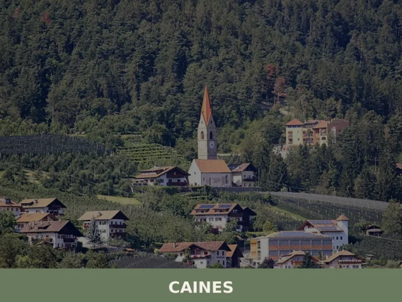
Caines
With just 398 registered inhabitants and an elevation of 592 metres above sea level, Caines — Kuens in German — is one of the smallest municipalities in the province of Bolzano. It extends across the sun-facing slope of the middle Passiria Valley, a few kilometres from Merano, on a natural terrace overlooking the confluence of […]
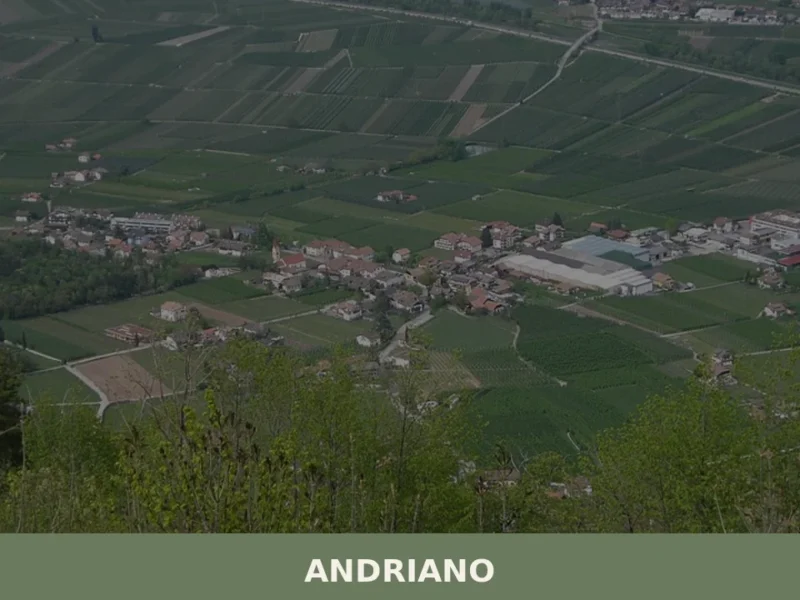
Andriano
At 274 metres above sea level, on the left bank of the Adige river, Andriano has 1,025 inhabitants spread between the historic centre and the farmsteads scattered among rows of vines. The municipality, one of the smallest in South Tyrol by area, extends entirely across flat ground along the alluvial strip connecting Bolzano to Merano. […]


📝 Incorrect information or updates?
Help us keep the Barbiano page accurate and up to date.