
Roveredo di Guà
Roveredo di Guà has 1,542 inhabitants and covers an area of just 8 square kilometres on the lower Veronese plain, 16 metres above sea level, along the course of the Guà canal — a branch of the Adige river system that has determined the shape and economy of this territory. Understanding what to see in […]
Discover Roveredo di Guà
Roveredo di Guà has 1,542 inhabitants and covers an area of just 8 square kilometres on the lower Veronese plain, 16 metres above sea level, along the course of the Guà canal — a branch of the Adige river system that has determined the shape and economy of this territory. Understanding what to see in Roveredo di Guà means reading the landscape carefully: cultivated fields stretching as far as the eye can see, a network of ditches and drainage channels that regulate the water flow, a parish church marking the civic centre, and a rural building fabric where farmstead courtyards still retain their original enclosed layout.
History and origins of Roveredo di Guà
The place name “Roveredo” derives from the Latin roboretum, a term indicating an oak forest (Quercus robur), the dominant tree species on the alluvial plains of the Veneto before the great land reclamation campaigns. The suffix “di Guà” identifies the watercourse that crosses the municipal territory, distinguishing this settlement from other identically named places in the region. The earliest written documentation of the village dates to the medieval period, when the territory fell under the jurisdiction of the bishopric of Vicenza and later passed to the control of the Most Serene Republic of Venice, which administered these lands until its fall in 1797.
During Venetian rule, Roveredo di Guà formed part of the agricultural system of the Veneto plain geared towards cereal production. Noble families from Vicenza and Verona held landed estates in the area, and the rural courtyards served both as centres of agricultural management and as seasonal residences. The gradual reclamation of marshland, initiated as early as the sixteenth century by the water magistrates of the Serenissima, progressively transformed the area from woodland and swamp into arable expanse.
With annexation to the Kingdom of Italy in 1866, the municipality took on its current administrative structure. During the twentieth century, agricultural mechanisation and migration towards industrial centres significantly reduced the population — a phenomenon common to many municipalities on the lower Veneto plain. Today Roveredo di Guà retains an identity tied to the land, visible in its dispersed urban layout and in the predominance of farming within the local economy.
What to see in Roveredo di Guà: the 5 main attractions
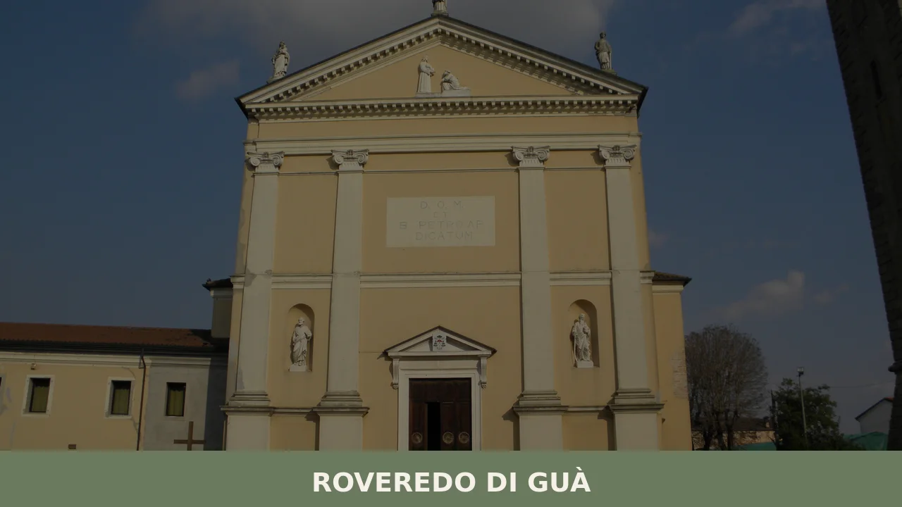
1. Parish church of San Pietro Apostolo
Dedicated to the patron saint, whose feast day falls on 29 June, the church is the focal point of community life. The building, remodelled in several phases between the eighteenth and nineteenth centuries, has a neoclassical façade and preserves liturgical furnishings of Venetian craftsmanship inside. The bell tower, the dominant vertical element against the flat profile of the village, is visible from a considerable distance across the plain.
2. The enclosed-plan rural courtyards
Scattered throughout the municipal territory, the farmstead courtyards of Roveredo di Guà follow the Venetian corte chiusa (enclosed courtyard) typology: a ring of buildings — the main house, the barchessa (open-sided barn), the stable, the hayloft — surrounding a central threshing yard. Some of these structures retain stone doorways and exposed brickwork datable to the seventeenth and eighteenth centuries, readable as direct evidence of the agrarian organisation under the Serenissima.
3. The Guà canal and the hydraulic system
The Guà, which gives the village its name, is a canal derived from the Agno-Guà river in its lowland stretch. The banks and hydraulic structures — sluice gates, small bridges, earthen embankments — compose a waterscape that can be explored on foot or by bicycle along the towpath roads. Water management remains the founding theme of the relationship between the community and its territory.
4. The agricultural landscape of the lower Veronese plain
The flat horizon, punctuated by rows of Lombardy poplars and straight-line ditches, represents a well-preserved example of reclaimed Venetian countryside. In spring, the fields of wheat, maize, and soya create a colour palette that shifts week by week. The network of white farm tracks allows cycling excursions between the hamlets, with visibility on clear days reaching the Berici Hills and the Euganean Hills.
5. The town hall square and the historic centre
The central core of Roveredo di Guà develops around the square overlooked by the town hall and the church. The houses in the centre have plastered façades with simple mouldings, painted wooden shutters, and clay tile roofs. This is not a monumental historic centre, but a place where the scale of the buildings remains human, proportioned to the daily life of a rural community.
Cuisine and local products
The table in Roveredo di Guà reflects the cooking of the lower Veronese plain, built on humble ingredients and slow cooking methods. The cornerstone dish is pearà, a thick sauce made from stale bread, beef marrow, broth, and black pepper, served alongside bollito misto (mixed boiled meats) — a dish shared with the entire province of Verona. Risotto all’Isolana, prepared with diced veal and pork and cooked slowly without the final creaming stage, is another widespread preparation in the area. Riso Nano Vialone Veronese IGP, cultivated on the plain between Verona and Vicenza, is the rice variety used par excellence in these recipes. Among first courses, bigoli — long pasta made from soft wheat and extruded through a press — are served with duck ragù (bigoli co l’arna) or with sardines (bigoli in salsa), a condiment of salt-cured sardines and white onion slowly sautéed together.
The surrounding territory supplies several products with recognised designation status. Radicchio Rosso di Verona IGP, in its late-season variety, appears on winter tables raw in salads or grilled. Olio Extravergine di Oliva Veneto Valpolicella DOP, although produced in the hillier belt further north, is the reference olive oil in kitchens across the province. The wines of the area fall under the Arcole DOC designation, which covers wine production on the plain between Verona and Vicenza with whites based on Garganega and reds from Merlot. For desserts, the Veronese Christmas tradition brings Pandoro di Verona to the table, while Mandorlato di Cologna Veneta, produced in the nearby town, is a hard almond and honey nougat present at winter festivities. The patron saint’s feast of San Pietro on 29 June is traditionally accompanied by food stalls where local preparations can be sampled.
When to visit Roveredo di Guà: the best time of year
The climate of the lower Veronese plain is continental: hot, humid summers with temperatures regularly exceeding 30 °C, and cold winters with frequent days of thick fog between November and February. The most suitable season to visit the village and explore the surrounding countryside runs from mid-April to mid-June, when the fields are in full growth and temperatures remain pleasant for cycling excursions.
The 29th of June, the patron saint’s feast of San Pietro, is the moment when the community gathers for religious celebrations and convivial events in the central square. Autumn, between September and October, offers the advantage of mild temperatures and low-angled light that brings out the geometry of the agricultural landscape after the harvest. Those who accept the winter fog will discover a territory with a different character — muffled and silent — where the outlines of farmhouses emerge from the grey like the wings of an empty stage set.
How to reach Roveredo di Guà
Roveredo di Guà is located in the south-eastern portion of the province of Verona, on the border with the province of Vicenza. By car, the nearest motorway exit is Montebello Vicentino on the A4 Turin–Trieste, approximately 20 kilometres to the north. From the city of Verona the distance is around 45 kilometres in a south-easterly direction, reachable in 40–50 minutes via the SR500 and provincial roads. From Vicenza the journey covers approximately 35 kilometres heading south-west.
The nearest railway station is Lonigo, on the Verona–Rovigo line, about 10 kilometres away. Intercity bus connections are operated by ATV (Azienda Trasporti Verona), but services are limited and geared towards school and work commuters: a car remains the most practical means of transport. The reference airports are Valerio Catullo di Verona-Villafranca, approximately 55 kilometres away, and Marco Polo di Venezia-Tessera, approximately 100 kilometres away.
Other villages to discover in Veneto
Visitors to Roveredo di Guà who wish to continue exploring rural Veneto can head towards Concamarise, another small municipality in the province of Verona situated on the plain to the north-west. With a similar population size and a landscape equally linked to rice and cereal cultivation, Concamarise shares with Roveredo di Guà the condition of an agricultural centre that has maintained a compact urban scale, where collective life is still measured by the rhythm of the farming seasons.
For a radical contrast, Cortina d’Ampezzo represents the other extreme of the Veneto: an altitude of 1,224 metres, a Dolomite landscape, and an international tourism economy. Placing the two territories side by side — the cereal-growing plain of Roveredo and the rock faces of the Tofane — means traversing the entire geographical range of a region that rises from sea level to three thousand metres in less than two hundred kilometres.
In Veneto More villages to discover
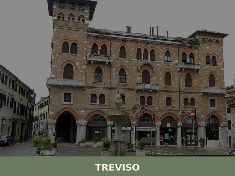
Treviso
What to see in Treviso: 84,000 inhabitants, Venetian walls from 1509, frescoed churches and Radicchio Rosso IGP. Plan your visit with our complete guide.
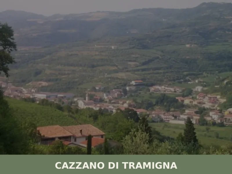
Cazzano di Tramigna
Cazzano di Tramigna has a population of 1,502 and occupies a basin at 100 metres above sea level in the Val Tramigna, a side valley that opens to the east of the Valpolicella area near Verona. The Tramigna stream — from which the village takes part of its name — crosses the municipal territory before […]
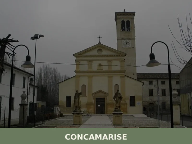
Concamarise
Concamarise, a municipality in Verona province with 1,053 inhabitants, rises only 21 meters above sea level, located in the Bassa Veronese, an area known for its long-standing agricultural tradition and complex hydrographic network. Its very name suggests a connection with water: “Conca” refers to a territorial depression, while “Marise” is likely linked to the marshy […]


📝 Incorrect information or updates?
Help us keep the Roveredo di Guà page accurate and up to date.