
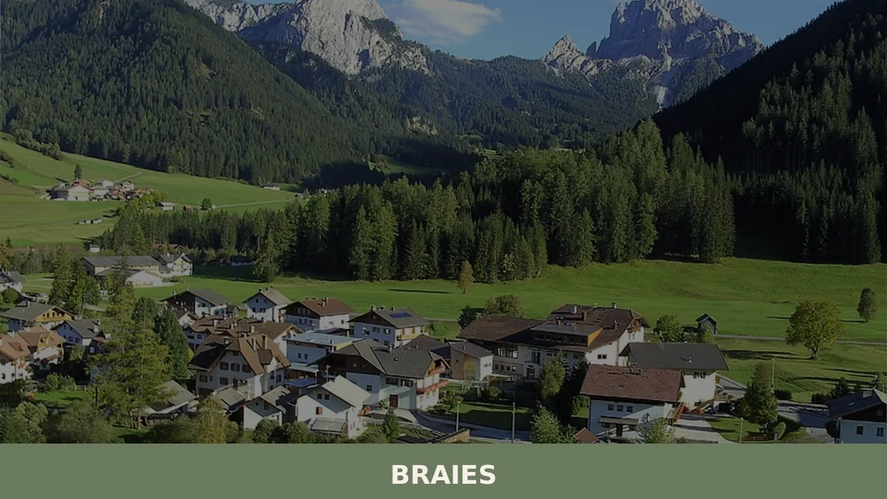
Braies
Lake Braies, sitting at 1496 metres above sea level, is the deepest natural lake in South Tyrol: 36 metres at its maximum point, fed by underground springs that filter through the Dolomite rock. This geological fact alone explains why hundreds of thousands of people reach this side valley off the Puster Valley every year. But […]
Discover Braies
Lake Braies, sitting at 1496 metres above sea level, is the deepest natural lake in South Tyrol: 36 metres at its maximum point, fed by underground springs that filter through the Dolomite rock. This geological fact alone explains why hundreds of thousands of people reach this side valley off the Puster Valley every year. But truly understanding what to see in Braies means going beyond the emerald-green surface of that lake and looking at the 658 inhabitants, the 1213 metres of altitude of the main settlement, the working alpine dairies, and the trails that cut through the Fanes-Senes-Braies Nature Park.
History and origins of Braies
The place name “Prags” — the German form of Braies — appears in documents as early as the 12th century, linked to the properties of the Benedictine monastery of Castel Badia (Sonnenburg) near San Lorenzo di Sebato. The valley was long used as seasonal grazing land, exploited by communities of the Puster Valley for summer alpine pasture. The name may derive from a pre-Roman term indicating marshy or waterlogged terrain, consistent with the hydrogeological makeup of the area, which is rich in springs and peatbogs. Ecclesiastical jurisdiction passed over the centuries through the Diocese of Bressanone, which maintained a decisive influence on the territorial organisation of the entire area.
During the Second World War, Braies acquired an unexpected role in European history. In April 1945, a group of 139 high-profile prisoners — including former French Prime Minister Léon Blum, Austrian Chancellor Kurt von Schuschnigg, and several members of the Italian royal family — was transferred by the SS to the Hotel Pragser Wildsee, on the lake. On 4 May 1945, troops from the US Army’s 42nd Infantry Division reached the hotel and liberated the prisoners. This episode is documented in several historiographical sources and gave the lake a significance that extends well beyond its landscape dimension.
The municipality, which is part of the autonomous province of Bolzano, is made up of several scattered hamlets — Ferrara, San Vito, Braies di Dentro, Braies di Fuori — and retains a settlement structure tied to the agro-pastoral economy, with isolated farmsteads (masi) distributed along the valley slopes.
What to see in Braies: 5 main attractions
1. Lake Braies (Pragser Wildsee)
A natural lake of landslide origin, surrounded by the north face of Croda del Becco (2810 m). The perimeter trail of approximately 3.5 km can be walked in about an hour on flat terrain. Wooden rowing boats, available from May to October, allow visitors to reach the centre of the lake where the depth reaches 36 metres. The water takes on colours ranging from deep green to turquoise depending on the season and the light.
2. Fanes-Senes-Braies Nature Park
Covering 25,680 hectares, it is one of the largest protected areas in South Tyrol. From the valley floor of Braies, trails lead up to the Fanes plateau, a karst zone with dolines and sinkholes. The Legend Trail (Sagenweg) passes through landscapes that Ladin tradition connects to the underground kingdom of Fanes, narrated in the epic cycles collected by Karl Felix Wolff in 1913.
3. Church of San Vito (Kirchlein St. Veit)
A Gothic building in the hamlet of the same name, documented since the 14th century. The interior holds a carved wooden altarpiece and late-Gothic frescoes. The modest structure — a single nave, a pointed bell tower — is representative of the valley churches of the South Tyrolean Dolomite area, built to serve communities of just a few dozen families scattered across the surrounding farmsteads.
4. Chapel at Lake Braies
A small votive chapel located on the southern shore of the lake, near the Hotel Pragser Wildsee. The building is linked to the memory of the liberation of the prisoners in 1945. A commemorative plaque bears the names of the detainees and the date of the liberation. The spot offers a direct view of Croda del Becco and the head of the valley.
5. Malga Foresta (Waldmalm) and Val Foresta
Val Foresta opens to the north-west of the lake and leads towards Rifugio Biella (2327 m) along a trail of approximately three hours. The alpine dairy, still active during the summer months, produces milk and butter according to the traditional cycle of alpine grazing. The route passes through larch and spruce forests before reaching the high-altitude meadows, with views of Croda Rossa d’Ampezzo.
Local cuisine and regional products
The cuisine of Braies is that of the Puster Valley, with specificities tied to the alpine dairy economy. Schlutzkrapfen (rye-dough half-moons filled with spinach and ricotta) are the most common first course in the local trattorias. Pressknödel — pressed bread dumplings with speck, stale bread, and chives, served in broth or dry with melted butter — represent the systematic use of leftover bread in peasant cooking. Speck Alto Adige IGP, produced across the province according to a specification that requires smoking with beechwood and a minimum ageing of 22 weeks, is found in every farmstead and mountain hut in the valley. Graukäse (grey cheese of the Puster Valley), made from acidified skimmed milk without the addition of rennet, is a PAT product of Trentino-Alto Adige with a sour and pungent flavour, traditionally dressed with oil, vinegar, and onion in the preparation known as Graukäse mit Essig und Zwiebeln.
Among the desserts, Strauben — a spiral-shaped fritter made from liquid batter, served with lingonberry jam — is associated with village festivals and autumn fairs. Kaiserschmarrn, a shredded sweet omelette dusted with icing sugar and served with plum compote, appears on the menus of mountain huts and alpine dairies. Tirtlan, a disc of fried dough filled with spinach, sauerkraut, or ricotta, is typical of the Puster Valley and can be found at the rural festivals of the district. As for drinks, the area falls within the zone of Puster Valley craft beer production, and on the farmsteads freshly produced Buttermilch (buttermilk) is still consumed. Puster Valley rye bread (Pusterer Breatl), baked in the wood-fired ovens of the farmsteads with rye flour, caraway seeds, and wild fennel, is another regional PAT product and accompanies every meal.
When to visit Braies: the best time
The Braies valley is accessible year-round, but conditions change dramatically. From June to September the lake reaches its maximum water level and its most intense colour; the high-altitude trails towards Fanes and Rifugio Biella are generally free of snow from mid-June. In July and August the tourist influx at the lake is such that since 2023 the Municipality of Braies has introduced a mandatory booking system for car access to the lake area, with replacement shuttle buses from the Puster Valley.
Autumn — October in particular — turns the larches golden and significantly reduces visitor numbers. Winter transforms the valley into a cross-country skiing and snowshoeing area: the Braies cross-country ski trail extends for approximately 20 km along the valley floor. The lake partially freezes between December and March, but walking on the surface is not permitted for safety reasons. Winter temperatures regularly drop below -10°C on January nights.
How to reach Braies
Braies is reached from the Puster Valley along the provincial road that branches off the SS49 at Villabassa (Niederdorf). From there it is approximately 13 km to the main settlement and 18 km to the lake car park.
- By car: from the Brenner motorway A22, exit at Bressanone, then take the SS49 through the Puster Valley to Villabassa. From Bolzano approximately 110 km (1 hour and 30 minutes). From Innsbruck approximately 130 km. From Munich approximately 270 km.
- By train: the nearest railway station is Villabassa, on the Fortezza–San Candido line. From Villabassa, SAD public buses run to Braies (with an increased seasonal service in summer).
- By air: the nearest airports are Bolzano (105 km), Innsbruck (130 km), and Verona Villafranca (250 km). Bolzano airport has limited connections; Innsbruck and Verona offer more options.
- Access to the lake: during the summer months (June–September) it is necessary to book parking or use the shuttle buses from the Puster Valley floor. The service is managed by the local tourism consortium.
Other villages to discover in Trentino-Alto Adige
Travelling across South Tyrol from east to west, leaving the Puster Valley to head up towards the Isarco Valley, you encounter places very different from Braies. Barbiano, clinging to the eastern slope of the Isarco Valley above Chiusa, is a scattered municipality of agricultural hamlets where chestnut and vine cultivation coexists with hay meadows. Its waterfalls — the Barbiano Waterfalls, with a total drop of over 80 metres — represent a geological feature quite distinct from the Dolomite lakes.
Further south still, in the Lower Adige area, Andriano sits at just 260 metres above sea level on the Wine Road, in a climatic context that has nothing in common with Braies’s 1213 metres. Here viticulture dominates the landscape: rows of Schiava and Pinot Bianco occupy the south-facing terraces. The comparison between these three municipalities — Braies, Barbiano, Andriano — captures the altimetric and climatic variety of South Tyrol, a territory where in less than one hundred kilometres you pass from Dolomite glaciers to valley-floor vineyards.
In Trentino-South Tyrol More villages to discover
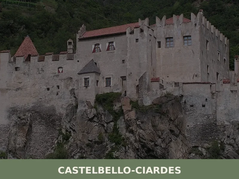
Castelbello-Ciardes
The municipality of Castelbello-Ciardes, home to 2,379 inhabitants at 587 metres above sea level in the Venosta Valley, owes its existence to a dual administrative identity: in 1928 the two separate villages of Castelbello (Kastelbell) and Ciardes (Tschars) were merged into a single municipality. Anyone looking into what to see in Castelbello-Ciardes will find an […]
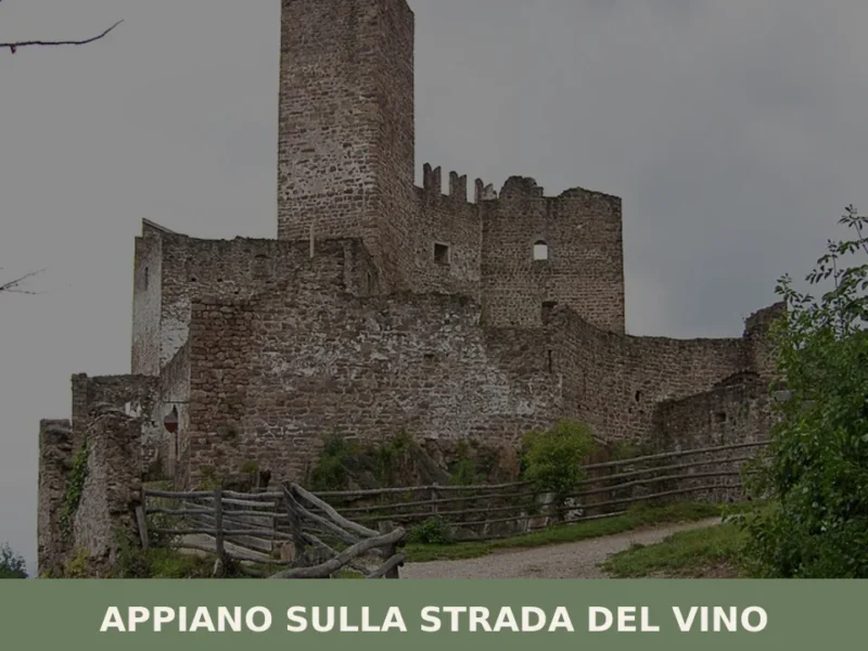
Appiano sulla strada del vino
The municipality of Appiano sulla strada del vino has 14,304 inhabitants spread across eight hamlets — San Michele, San Paolo, Cornaiano, Frangarto, Missiano, Monticolo, Gaido and Girlan (Cornaiano) — set between 200 and 500 metres above sea level on the left bank of the Adige river, in the middle of the Bassa Atesina (Lower South […]
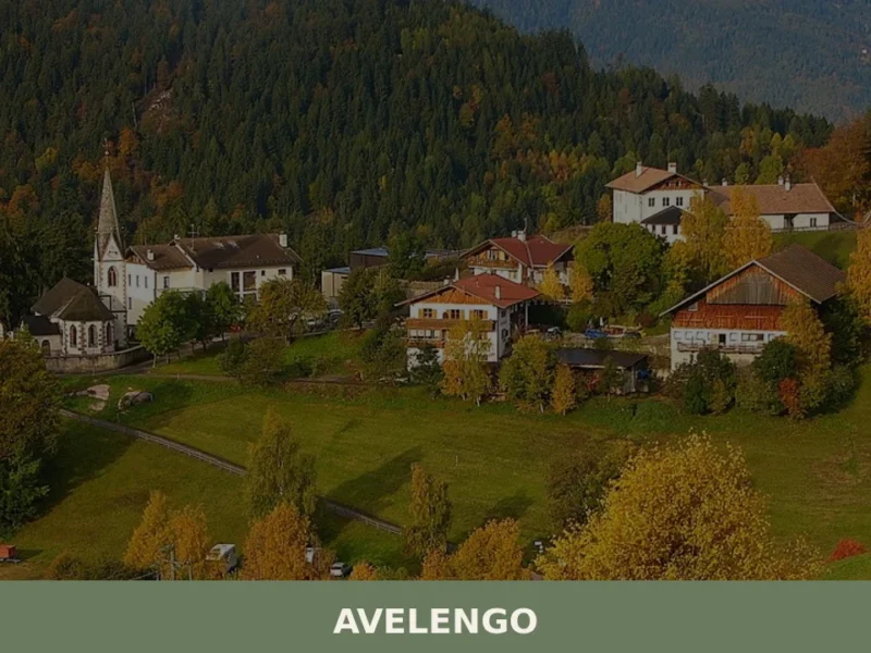
Avelengo
Avelengo has 796 inhabitants and sits at 1,290 metres above sea level on the plateau overlooking the Merano basin, on the southern side of the Sarntal Alps. Its municipal territory spans an altitudinal range from 600 to 2,200 metres, with high-altitude pastures that gave rise to one of the most extensively documented native horse breeds […]


📝 Incorrect information or updates?
Help us keep the Braies page accurate and up to date.