
Aldino
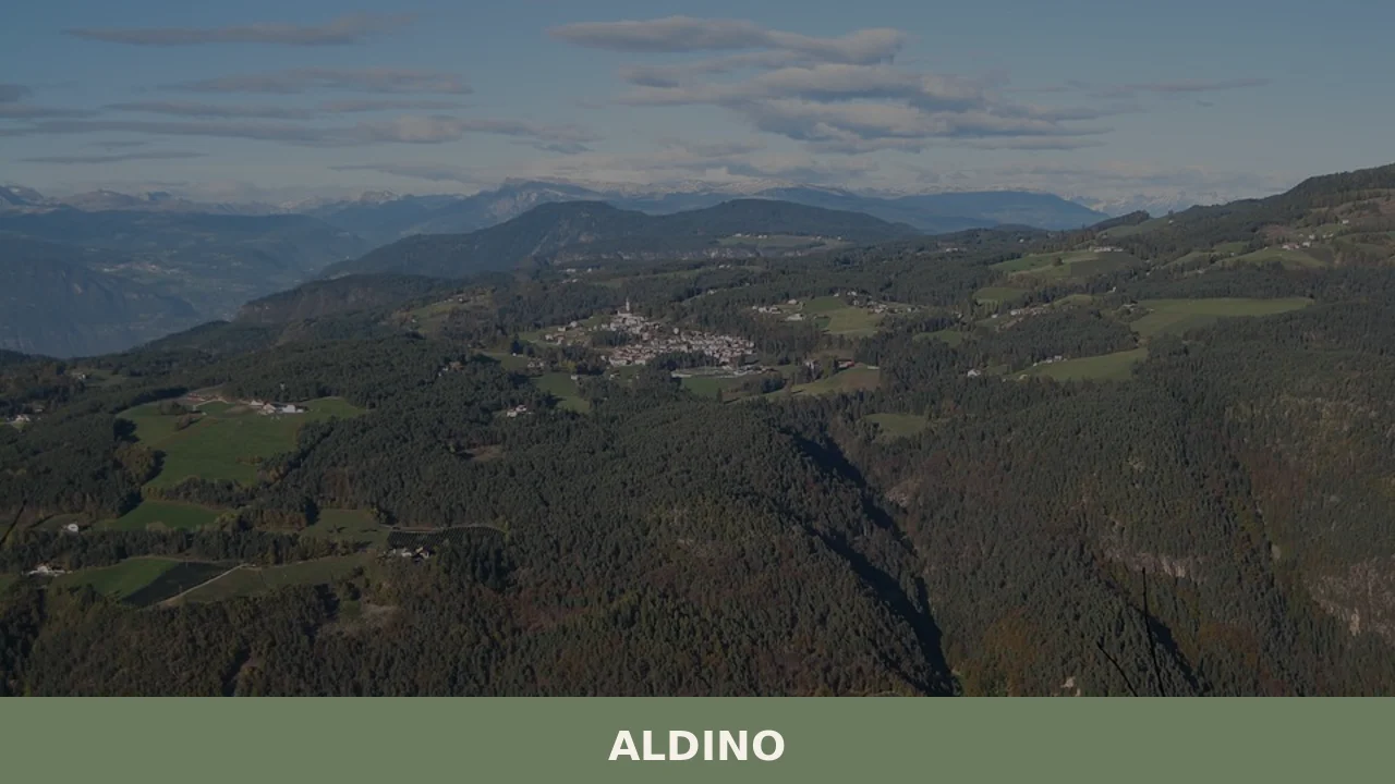
At 1,225 metres above sea level, on the western slope of the Val di Fiemme, Aldino has 1,629 inhabitants spread between the centre and the scattered hamlets along the hillsides facing the Latemar group. The municipality, bilingual as required by the South Tyrol statute, bears the German name Aldein — a term some linguists trace […]
Discover Aldino
At 1,225 metres above sea level, on the western slope of the Val di Fiemme, Aldino has 1,629 inhabitants spread between the centre and the scattered hamlets along the hillsides facing the Latemar group. The municipality, bilingual as required by the South Tyrol statute, bears the German name Aldein — a term some linguists trace back to a pre-Roman root linked to the shape of the terrain. Asking what to see in Aldino means preparing for a territory where geology and rural culture still set the rhythms of daily life.
History and origins of Aldino
The earliest traces of settlement in the area date back to prehistoric times. A few kilometres from the centre, near the Bletterbach gorge — an erosion canyon roughly 400 metres deep — fossils and reptile footprints from the Permian period have been found, dating to over 250 million years ago. This geological significance has made Aldino a reference point for Alpine palaeontology, so much so that the Bletterbach site was included in 2009 among the UNESCO World Heritage properties as part of the Dolomites.
In the medieval period, the territory of Aldino fell under the jurisdiction of the Counts of Tyrol. The parish dedicated to Saint James dates back to at least the 13th century, and documents from the period attest to the existence of farmsteads (Höfe) already organised according to the closed-farm inheritance system, a legal norm specific to South Tyrol that prevented the fragmentation of agricultural property. This system determined the distribution of settlements still visible today: isolated clusters, each self-sufficient, connected by footpaths and forest roads.
The patron saint of the village, Saint Flavia Julia Helena — mother of Emperor Constantine — is celebrated on 25 July. The choice of this dedication, unusual for an Alpine settlement, suggests a cultural influence linked to the transit routes between the Germanic and Italian areas, along which cults of Roman imperial origin spread.
What to see in Aldino: 5 main attractions
1. Bletterbach Gorge (UNESCO Heritage Site)
A natural canyon approximately 8 kilometres long and up to 400 metres deep, carved by erosion over the last 15,000 years. The exposed rock layers span a time frame of over 40 million years, from the Permian to the Triassic. The GEOPARC visitor centre, open from May to October, documents the fossil discoveries and organises guided excursions along the floor of the gorge.
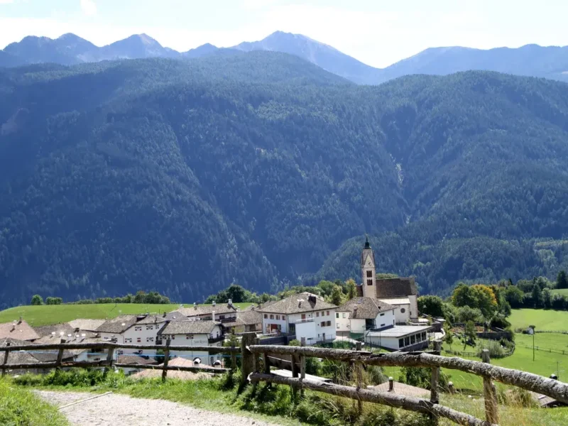
2. Parish Church of Saint James
A Gothic building with a spired bell tower, remodelled during the 15th and 16th centuries. Inside, late-Gothic frescoes and a carved wooden altarpiece are preserved. Its elevated position above the inhabited centre offers a direct view of the surrounding Dolomite peaks, particularly Corno Bianco (Weisshorn, 2,317 m).
3. Corno Bianco and Corno Nero
Two peaks marking the boundary between the Adige Valley and the Val di Fiemme. Corno Bianco (2,317 m) owes its name to the pale limestone rock at the summit, while Corno Nero (2,439 m) features dark porphyry formations. The trails start directly from Aldino and require approximately 3–4 hours of walking to reach the summit of Corno Bianco.
4. Farmstead Museum of Radein (Redagno)
In the hamlet of Redagno, about 4 kilometres from the centre, several farmsteads retain their original structure with Stuben panelled in Swiss pine, stables on the lower floor, and haylofts under the roof. Visits are periodically organised to illustrate how the agro-pastoral mountain economy functioned from the Middle Ages through to the 20th century.
5. Bletterbach Geological Trail
Separate from the excursion into the gorge itself, this circular educational trail of approximately 2 hours passes through the woods above and offers explanatory panels on the rock formations visible from the upper rim of the canyon. Accessible to families with children as well, it serves as a hands-on introduction to Dolomite stratigraphy without the need for trekking equipment.
Food and local products
The table in Aldino reflects the village’s position within the South Tyrolean mountain belt. The most common dishes served in local establishments are canederli (Knödel) in broth or with butter, speck — also produced by small local artisans using traditional curing in ventilated rooms — and Schlutzkrapfen, rye ravioli filled with ricotta and spinach. During autumn, the farmsteads that practise Törggelen (the rural custom of tasting the new wine) offer roasted chestnuts, Kaminwurzen (smoked sausages), and Strauben, spiral-shaped fritters dusted with icing sugar.
The municipal territory does not support any wine cultivation — the altitude prevents it — but its proximity to the South Tyrolean Wine Road, which runs through the valley below between Appiano and Cortina sulla Strada del Vino, ensures a direct supply of Gewürztraminer, Lagrein, and Schiava. Milk from the farmsteads is processed in small dairies to produce semi-hard cheeses, consumed locally. The official website of the Municipality of Aldino provides up-to-date information on farms that offer direct sales.
When to visit Aldino: the best time
The GEOPARC Bletterbach generally opens from early May to late October, and this defines the most suitable period for those who want to explore the gorge. Summer, with average daytime temperatures between 18 and 23 degrees, allows extended hikes towards Corno Bianco and Corno Nero. The feast day of Saint Flavia Julia Helena, on 25 July, coincides with local celebrations that include a solemn mass and a community gathering in the village square.
Autumn, from mid-September to late October, brings the Törggelen and the colouring of the larches on the slopes — a sharp visual phenomenon, with the intense yellow of the needles contrasting against the dark green of the Norway spruces. Winter turns Aldino into a starting point for snowshoeing and cross-country skiing, although the infrastructure is limited compared to the major ski resorts. Snow covers the ground on average from December to March. In spring, the late thaw (April–May at this altitude) makes some hikes impracticable until June.
How to get to Aldino
By car, the most direct access is from the Brenner motorway (A22): exit at Ora/Egna, then take provincial road SP48 towards Aldino for approximately 20 kilometres of hairpin bends, with an elevation gain of nearly 1,000 metres. The travel time from the motorway exit is approximately 30–35 minutes. Bolzano is 35 kilometres away (45 minutes), Trento roughly 55 kilometres (one hour).
The nearest railway station is Ora, on the Brenner line, from where you need to continue by SAD public bus or private vehicle. The nearest airport is Verona Villafranca, approximately 160 kilometres away (one hour and 45 minutes by car). Innsbruck Airport in Austria is about 130 kilometres away and can be reached in just under two hours via the Brenner Pass. For further logistical information, the dedicated section on Touring Club Italiano offers updated guides on Alpine road conditions.
Other villages to discover in Trentino-Alto Adige
The province of Bolzano has a high density of small mountain municipalities that share with Aldino the scattered-farmstead settlement pattern and dual linguistic identity. To the south-east, descending towards the Val di Fiemme and crossing the provincial boundary, you reach Trodena nel Parco Naturale, a municipality bordering Aldino that shares the same Monte Corno protected area and offers an alternative access point to the Bletterbach gorge from the eastern side.
Heading north instead along the Isarco Valley, Villandro stands out for the broad grazing plateau above the settlement — the most extensive in South Tyrol — and for its mid-slope position connecting it to both the Bolzano basin and the upper valley. Both villages document a model of Alpine life in which mountain agriculture, forest management, and restrained tourism coexist in a balance that the valley floor lost long ago.
Nearby Villages near Aldino
In Trentino-South Tyrol More villages to discover
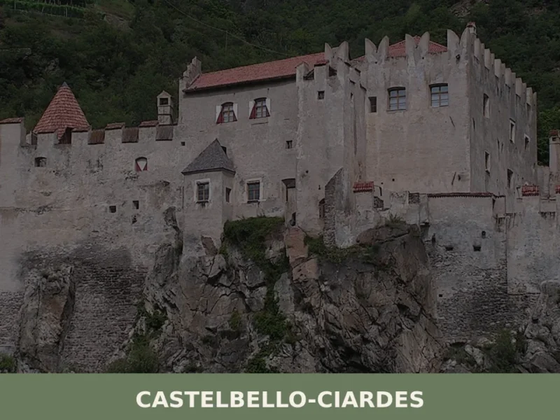
Castelbello-Ciardes
The municipality of Castelbello-Ciardes, home to 2,379 inhabitants at 587 metres above sea level in the Venosta Valley, owes its existence to a dual administrative identity: in 1928 the two separate villages of Castelbello (Kastelbell) and Ciardes (Tschars) were merged into a single municipality. Anyone looking into what to see in Castelbello-Ciardes will find an […]
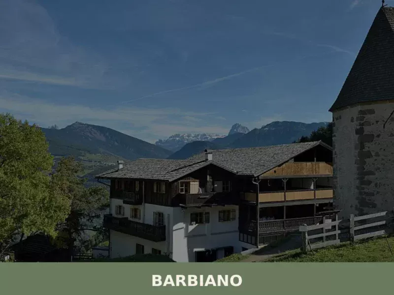
Barbiano
Barbiano covers 25.26 square kilometres on the right-hand slope of the Isarco Valley, spread across five hamlets — Barbiano village, Colma, San Giacomo, Saubach and Dreikirchen — each with its own architectural identity and historical function. Understanding what to see in Barbiano means crossing a territory that rises from 471 metres on the valley floor […]
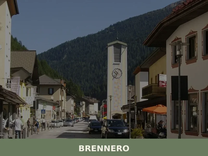
Brennero
The Brenner Pass, at 1,370 metres above sea level, is the lowest Alpine crossing between Italy and Austria, and this geographical circumstance has shaped every aspect of life in the village that bears its name. With 2,111 inhabitants spread across the hamlets of Brennero, Fleres, Ponticolo and Terme di Brennero, the municipality marks the northern […]
🧀 Italian traditional products


📝 Incorrect information or updates?
Help us keep the Aldino page accurate and up to date.