
Castelbello-Ciardes
The municipality of Castelbello-Ciardes, home to 2,379 inhabitants at 587 metres above sea level in the Venosta Valley, owes its existence to a dual administrative identity: in 1928 the two separate villages of Castelbello (Kastelbell) and Ciardes (Tschars) were merged into a single municipality. Anyone looking into what to see in Castelbello-Ciardes will find an […]
Discover Castelbello-Ciardes
The municipality of Castelbello-Ciardes, home to 2,379 inhabitants at 587 metres above sea level in the Venosta Valley, owes its existence to a dual administrative identity: in 1928 the two separate villages of Castelbello (Kastelbell) and Ciardes (Tschars) were merged into a single municipality. Anyone looking into what to see in Castelbello-Ciardes will find an unusual concentration of features: a thirteenth-century castle still intact, a system of medieval irrigation channels running through apple orchards, and a stretch of the Via Claudia Augusta that can be walked on foot. Two languages, two inhabited centres, and a territory that extends from the Adige valley floor to the sunny slopes of the western Venosta Valley.
History and origins of Castelbello-Ciardes
The first documented mention of Castelbello dates to 1238, when Castrum Jufal and the nearby Castrum Kastelbel appear in records linked to the lords of Montalban. Ciardes, on the opposite side of the valley floor, is already cited in 1164 as Zardis in a document from the bishopric of Chur. Their position along the route connecting the Resia Pass to Merano made both settlements points of transit and commercial control. The castle of Castelbello, built in the thirteenth century by the lords of Montalban, passed over the centuries to the counts of Tyrol and later to the Hendl family, who held it until the nineteenth century.
The local economy was founded for centuries on irrigated agriculture, made possible by the Waale, hand-dug channels that conveyed glacial meltwater down to the cultivated terraces. Some of these channels, documented from the fourteenth century onward, are still in operation. After annexation to Italy in 1919, the area retained a largely German-speaking population: according to the linguistic census, over 95% of residents declare German as their mother tongue. The administrative merger of 1928 did not erase the distinction between the two centres, each of which retains its own parish church and its own village core.
During the Second World War, the Venosta Valley was the scene of tensions linked to the Options of 1939, the agreement between Hitler and Mussolini that forced South Tyroleans to choose between emigrating to the Reich or remaining and accepting Italianisation. Castelbello-Ciardes, like many municipalities in the valley, saw a significant portion of its population leave, some of whom returned after 1945. The provincial autonomy established by the Special Statute of 1972 has allowed the community to preserve bilingual educational and administrative structures.
What to see in Castelbello-Ciardes: 5 top attractions
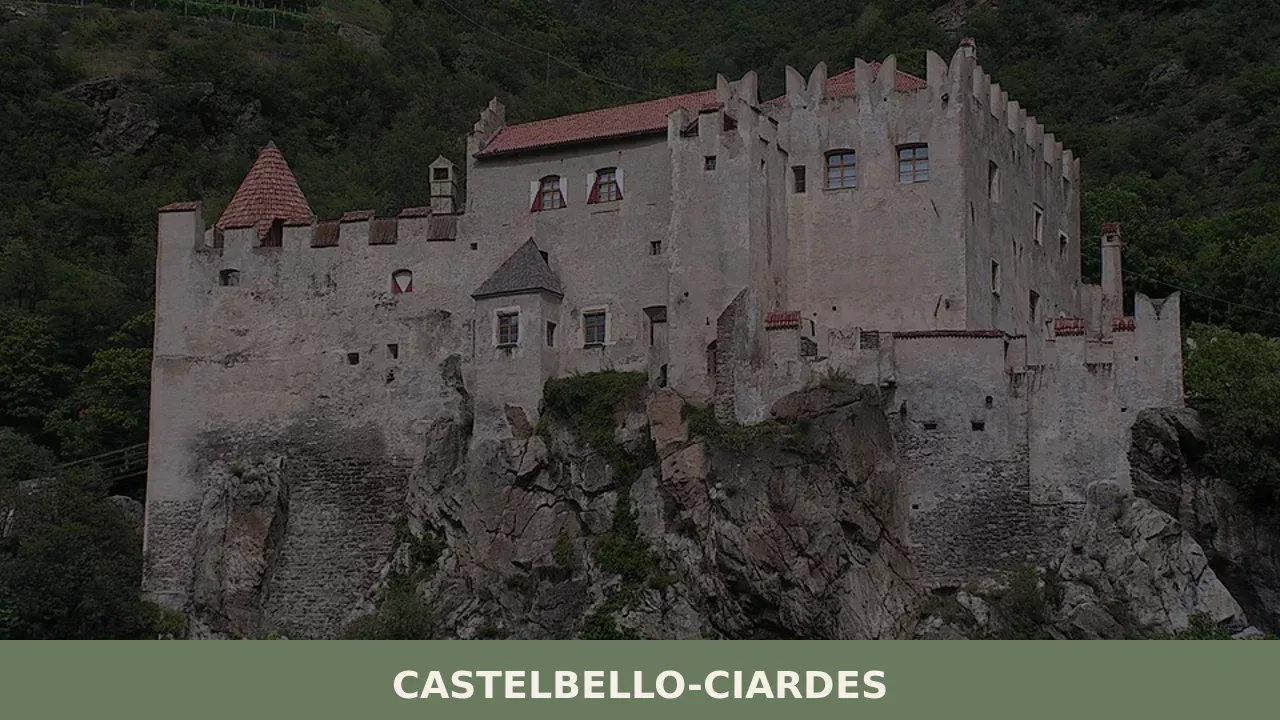
1. Castelbello Castle (Schloss Kastelbell)
Built in the thirteenth century and rebuilt after a fire in 1531, the castle dominates the valley floor from its elevated position. Today it serves as a venue for contemporary art exhibitions organised by the municipality. The halls retain barrel vaults and remnants of late-Gothic frescoes. Access is through an ogival arched portal. The inner courtyard hosts cultural events during the summer months, with programming that varies from year to year. It is advisable to check opening hours on the official municipal website.
2. Juval Castle (Schloss Juval)
Erected in 1278 at the entrance to the Senales Valley, since 1983 it has been the summer residence of mountaineer Reinhold Messner, who established the Messner Mountain Museum here, dedicated to the myth of the mountain. The collections include Tibetan ritual masks, paintings of Himalayan peaks, and expedition memorabilia. Access to the castle is only by shuttle bus from the car park in the valley below, as the road is private. Opening is limited to the months from March to November.
3. The Waale: the Tscharser Waal and the Latschanderwaal
The Waale are medieval irrigation channels that carry water to the fields along flat-running paths. The Tscharser Waal, approximately 3 kilometres long, starts from the village of Ciardes and runs alongside apple orchards and vineyards with minimal elevation change. The Latschanderwaal, longer and more dramatic, passes through a rocky gorge with sections carved into the cliff face. Both routes are accessible from April to October and serve as a living record of rural hydraulic engineering.
4. Parish Church of Saints Peter and Paul in Castelbello
Documented from the fourteenth century and rebuilt in Baroque forms in the eighteenth, the church preserves a gilded wooden high altar and an altarpiece attributed to the Tyrolean school of painting. The spired bell tower, visible from across the valley floor, reaches approximately 50 metres in height. Inside, the stuccowork of the central nave features floral motifs and figures of saints. The church is open during services and at set times during the summer months.
5. The Via Claudia Augusta section
The Roman road that connected the Po Plain to Augusta Vindelicorum (present-day Augsburg, in Bavaria) crossed the Venosta Valley passing through the territory of Castelbello-Ciardes. A stretch of the route, now signposted and equipped for hikers and cyclists, follows the valley floor along the Adige. Information panels along the way illustrate the original course and the archaeological finds from the area, also documented on the dedicated Wikipedia page.
Traditional cuisine and local products
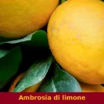
The Venosta Valley is Europe’s largest mountain apple-growing district, and Castelbello-Ciardes is a full participant in this production. The Val Venosta Apple, marketed under the VI.P consortium brand, includes varieties such as Golden Delicious, Gala, and Pinova, grown in orchards that occupy the valley floor between 500 and 900 metres above sea level. Alongside apple cultivation, the area produces Vinschger Paarl, a flat double-disc rye bread flavoured with caraway (Brotklee) and wild fennel, traditionally baked once or twice a year and kept dry for months. Viticulture, favoured by the dry climate of the Venosta Valley (less than 500 mm of annual rainfall), focuses on grape varieties such as Riesling, Pinot Bianco, and Schiava, also vinified under the Alto Adige DOC Val Venosta (Südtirol Vinschgau DOC) designation. Some wineries in the area also produce Gewürztraminer and Pinot Nero in limited quantities.
Among the traditional local dishes, Schlutzkrapfen — half-moon rye pasta parcels filled with spinach and ricotta (Topfen) — appear on the menus of nearly every restaurant in the area. Knödel (canederli) are prepared here in the version with speck and stale bread, often served in beef broth, or in the sweet variant with Venosta Valley apricots (Marillenknödel), another significant local crop. Speck Alto Adige IGP is omnipresent: cold-smoked with beechwood and juniper, aged for at least 22 weeks. Graukäse, a lean grey-paste cheese produced without added rennet and typical of the area, is often served with raw onions and vinegar, in the dish known as Graukäse con Essig und Zwiebel. In autumn, the Vinschger Markt festival in Silandro — just a few kilometres from Castelbello — brings together local producers of honey, fruit distillates (Edelbrand), and preserves.
When to visit Castelbello-Ciardes: the best time
The Venosta Valley is one of the driest areas in the Alpine arc, with approximately 500 mm of annual rainfall and over 300 days of sunshine recorded at the Silandro weather station. From April to June the apple orchards are in blossom and all the Waal paths are open: daytime temperatures range between 15 and 25 degrees. Summer, from July to August, brings the longest and warmest days — peaks above 30 degrees are not uncommon on the valley floor — but it is also the period when Juval Castle and the Messner museum are open on a continuous schedule.
Autumn, from September to November, brings the grape harvest and the apple picking: in the orchards the work is visible up close, and the wineries of the Val Venosta designation organise tastings. Törggelen, the South Tyrolean tradition of walking the paths between farmsteads to taste the new wine, roasted chestnuts, and speck, is practised in this area between October and November. Winter is dry and cold, with nighttime temperatures regularly dropping below zero; winter tourism in the area focuses more on the surrounding ski areas (Val Senales, Merano 2000) than on Castelbello itself, but clear days offer exceptional visibility towards the peaks of the Palla Bianca and the Ortles group.
How to reach Castelbello-Ciardes
By car, Castelbello-Ciardes is reached from the Brenner motorway (A22) by exiting at Bolzano Sud and continuing on the MeBo expressway (SS38) towards Merano, then on the SS38 towards the Resia Pass. The distance from Bolzano is approximately 50 km (45 minutes), from Merano approximately 25 km (20 minutes). From Innsbruck the most direct route crosses the Brenner Pass and covers approximately 140 km in just under two hours.
The Castelbello-Ciardes railway station lies on the Merano–Malles line, operated by SAD (Società Autobus Alto Adige), with trains approximately every 30 minutes during peak hours. From Merano the train journey takes about 25 minutes. The nearest airport is Bolzano (approximately 55 km), with limited connections; the international airports of Innsbruck (140 km), Verona (200 km), and Munich (330 km) offer more options. Local bus services connect Castelbello with the Senales Valley and with the scattered hamlets on the mountain side.
What to see in Castelbello-Ciardes and other villages in Trentino-Alto Adige
The Venosta Valley and the South Tyrolean territory offer a density of hill and mountain villages that allows closely spaced itineraries. Approximately 60 km to the east, on the plateau above Merano, Avelengo occupies a high plain at over 1,200 metres above sea level, with a tradition linked to the breeding of the Haflinger horse — the breed takes its name from the German version of the village, Hafling. The perspective on the landscape changes radically compared to the Venosta valley floor: open pastures instead of apple orchards, thinner air, and farmstead architecture scattered across the meadows.
In the direction of the Isarco Valley, Barbiano stretches along a south-facing slope between 400 and 1,100 metres, known for waterfalls that plunge over 200 metres down the rock face below the village. The contrast with Castelbello-Ciardes is sharp: where the Venosta Valley is wide and dry, the Isarco Valley is narrow and rainier, and the architecture reflects this difference in steeper roofs and more compact facades. Visiting the three villages in sequence allows you to cross three microclimates and three distinct agricultural landscapes within a single day’s travel.
In Trentino-South Tyrol More villages to discover
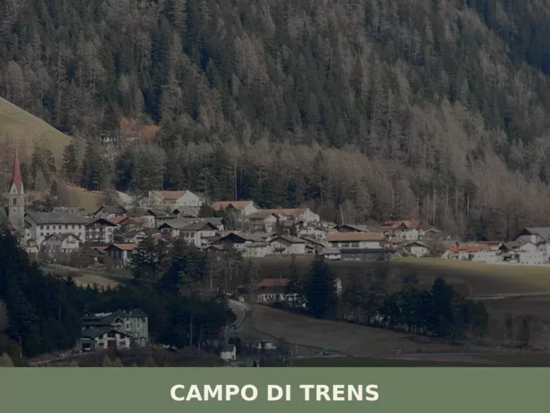
Campo di Trens
At 937 metres above sea level, along the Isarco valley between Vipiteno and Fortezza, the municipality of Campo di Trens has 2,679 inhabitants spread across the hamlets of Trens, Stilves and Mules. Anyone looking into what to see in Campo di Trens will find an area where the German language predominates — the official German […]
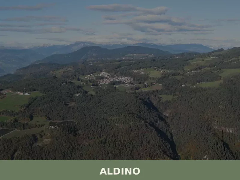
Aldino
At 1,225 metres above sea level, on the western slope of the Val di Fiemme, Aldino has 1,629 inhabitants spread between the centre and the scattered hamlets along the hillsides facing the Latemar group. The municipality, bilingual as required by the South Tyrol statute, bears the German name Aldein — a term some linguists trace […]
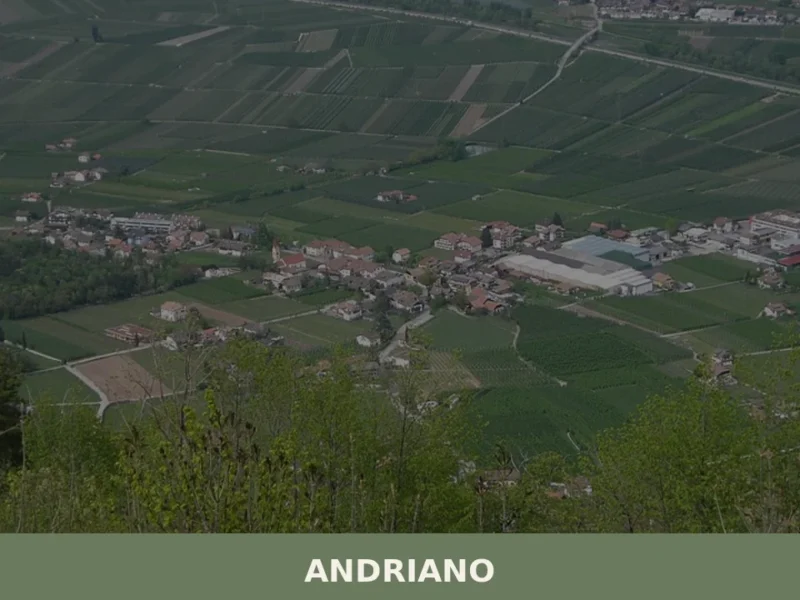
Andriano
At 274 metres above sea level, on the left bank of the Adige river, Andriano has 1,025 inhabitants spread between the historic centre and the farmsteads scattered among rows of vines. The municipality, one of the smallest in South Tyrol by area, extends entirely across flat ground along the alluvial strip connecting Bolzano to Merano. […]


📝 Incorrect information or updates?
Help us keep the Castelbello-Ciardes page accurate and up to date.