


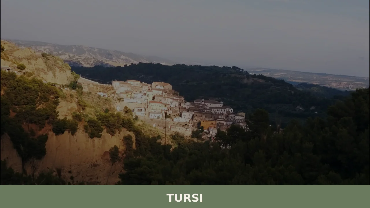
Tursi
The ochre-yellow clay slopes that surround Tursi do not stay still. Every significant rainfall shifts the marly sediment, exposing new gullies in the Cenozoic rock and deepening the three chasms — the Palmara ditch to the north, the St. Francis ditch to the east, and the Cathedral ditch to the west — that have protected […]
Discover Tursi
The ochre-yellow clay slopes that surround Tursi do not stay still. Every significant rainfall shifts the marly sediment, exposing new gullies in the Cenozoic rock and deepening the three chasms — the Palmara ditch to the north, the St.
Francis ditch to the east, and the Cathedral ditch to the west — that have protected the historic quarter of Rabatana for over a thousand years.
The urban core climbs from 170 m (558 ft) at its lowest districts to 346 m (1,135 ft) around the castle, giving the skyline a stacked, stratified quality that reflects the geology beneath it.
Deciding what to see in Tursi means engaging with a city — formally elevated to that status by decree of President Carlo Azeglio Ciampi on 4 May 2006 — whose 4,712 inhabitants live alongside visible layers of Saracen, Byzantine, Norman, and medieval history. Visitors to Tursi find a distinct Saracen quarter whose street pattern survives intact, a cathedral positioned above one of the town’s defining geological chasms, and a landscape framed by two of Basilicata’s four main rivers.
The town sits roughly 20 km (12.4 mi) from the Ionian coast, placing it at a manageable distance from both the sea and the inland Lucanian uplands.
History of Tursi
The origins of the settlement reach back well before any written record. Archaeological excavations around the area of Anglona and the nearby site of Policoro have uncovered material dating to the early Iron Age, confirming human presence linked to the Oenotrian populations who occupied the Agri and Sinni river valleys from at least the 15th century BC. By the 8th century BC, Greek colonists from Ionia had founded coastal settlements including Siris, Heraclea, Metaponto, and Pandosia.
Pandosia, considered the oldest city of the Siritide, stood at the intersection of the two navigable rivers and the ancient Via Herculea, a road running more than 60 km (37.3 mi) from Heraclea up the Agri valley to the Roman city of Grumentum. Historical sources associate the site with Alexander Molossus, king of Epirus and maternal uncle of Alexander the Great, who died there in 330 BC in battle against the Lucanians. Pandosia was ultimately destroyed between 81 BC and 72 BC during the Social Wars under Roman general Lucius Cornelius Sulla, and from its ruins the settlement of Anglona emerged shortly before the Christian era.
The name Tursi itself carries a documented etymology.
Most historians trace it to “Turcico,” a Byzantine military commander who extended the existing Saracen village of Rabatana toward the valley, giving the expanded area the Greek name Toursikon. The first written record appears in 968, in the Relatio de legatione Constantinopolitana written by Bishop Liutprand of Cremona, where the place is called “Turcico” and “Tower of Turcico.” Norman pronunciation shifted the name through Tursico, Tursio, and finally Tursi.
A papal bull of Pope Alexander II in 1068 records it as “Tower of Tursio,” and in 1154 the Arab geographer Muhammad al-Idrisi, working on the Tabula Rogeriana for Roger II of Sicily, listed it as Tursah. The Saracen period itself, which began around 826 during the Islamic campaigns across southern Italy, left a durable imprint: Arab settlers who arrived initially to raid eventually established residential quarters called rabatane, the most significant of which survive in Tursi, Tricarico, and Pietrapertosa.
In 968, under Byzantine rule, Tursi became the capital of the theme of Lucania and an episcopal see of the Greek rite, with the bishop’s seat at the church of St.
Michael the Archangel, where a synod of bishops was held in 1060. The first documented bishop, the Greek Michael, appears in a testamentary act of 1050. The city’s administrative importance continued across subsequent centuries: from the early 18th century until the Bourbon reform of 1816, Tursi served as the first of the four subdivisions of the province of Basilicata, hosting the Royal Collector of Basilicata.
By 1601 it had become the most populous city in its provincial division of the kingdom, recording 1,799 fires — a historical unit of household measurement — ahead of Melfi with 1,772, Venosa with 1,095, and Potenza, which recorded 1,082 in the same count.
What to see in Tursi, Basilicata: top attractions
The Rabatana Quarter
The Rabatana is the Saracen-era residential nucleus of Tursi, a compact settlement of narrow lanes and stone buildings set on the ridge that divides the Cathedral ditch from the Palmara ditch.
Its name derives from the Arabic ribāṭ, the term for a military garrison that evolved into a permanent residential quarter. The Saracens who settled here around 850 were, according to documented sources, skilled dry-crop farmers and artisans whose technical knowledge allowed them to integrate with the local population.
Walking through the Rabatana today, the building fabric reflects both the original Arab layout and subsequent medieval modifications. The natural protection afforded by three chasms, each more than 100 m (328 ft) in length and formed by landslides in the marly clay terrain, meant the quarter required no artificial defensive walls on most sides.
The best light for reading the building surfaces falls in the morning, when the ochre tones of the clay-limestone walls are at their most legible.
The Cathedral and Cathedral Ditch
Tursi’s cathedral stands at the western edge of the historic center, above the chasm known as the Cathedral ditch — u fòss da Catr’dé in the local Tursitano dialect. The position is not incidental: the geology of the terrain, composed of extremely plastic marly rock, created the ravine through repeated landslides, and the cathedral’s founders placed the building at the precise point where the ridge narrows and the drop becomes most dramatic.
The diocese of Tursi has documented continuity from at least 968, when Patriarch Polyeuctus of Constantinople authorized the metropolitan see of Otranto to recognize Tursi as a suffragan diocese. The Notitiae Episcopatuum of the patriarchate of Constantinople records Tursi as the sole confirmed suffragan see. The structure visible today reflects later rebuilding phases, but the site retains its original strategic and symbolic relationship with the surrounding landscape.
Visitors who look west from the cathedral terrace see the full extent of the valley that separates the historic center from the modern districts below.
The Anglona Sanctuary
The sanctuary of Anglona stands at the elevation of the old settlement of Anglonum, which arose from the ruins of Pandosia after the latter’s destruction between 81 BC and 72 BC. Archaeological evidence recovered from the surrounding area, now held at the National Archaeological Museum of the Siritide in Policoro, confirms continuous human settlement from the early Iron Age.
The site’s historical weight is considerable: it occupies the same ground where, according to ancient sources examined by historian Placidus Troyli, the oppidum of Contrada Castello stood, providing the material precondition for the eventual development of Tursi itself. The sanctuary’s position on the hill gives it a wide view over the Agri and Sinni river corridors — the same geographic advantage that made Pandosia commercially significant when both rivers were still navigable.
The access road involves a modest climb; sturdy footwear is advisable given the clay-rich soil, which becomes slippery after rain.
The Gannano Dam and Agri River Landscape
The Gannano dam, located near the hamlet of Caprarico within the municipal territory, holds a total capacity of 2.6 million cubic meters and interrupts the course of the Agri River — one of the four main rivers of Basilicata, which forms Tursi’s northern municipal boundary. The dam sits within a landscape shaped by the same Cenozoic geology that defines the town itself: the clay and limestone terrain creates a continually shifting topography of gullies and ridges.
For visitors interested in the territory’s hydrology, the Gannano reservoir offers a direct view of how water management intersects with the region’s unstable geology. The Agri was historically navigable, a fact that determined the commercial importance of Pandosia and the ancient Via Herculea route. Standing at the dam, the scale of the valley becomes immediately legible: the Agri corridor connects the Ionian coastal plain to the Lucanian interior over a distance that determined the region’s political geography for more than two millennia.
The Pescogrosso Stream Gorge
East of the town, a spring on the hill feeds the Pescogrosso stream, named after the large boulders — pesci grossi in old Lucanian usage — found along its course.
The stream crosses Tursi at 190 m (623 ft) above sea level and runs approximately 10 km (6.2 mi) eastward before joining the Sinni River. The gorge it has cut through the marly terrain produces a sequence of exposed rock faces where the strata of Cenozoic sediment are clearly visible: clay layers alternating with limestone bands, the same material that causes the town’s ongoing seismic risk classification of level 2 — defined as medium-high seismicity in Italy’s current index.
The path along the stream’s lower course passes through terrain that changes character with each rainfall, which makes spring and early autumn the most practical seasons for exploration. The hamlet of Panevino, on the eastern edge of the municipal territory, lies roughly 6 km (3.7 mi) from the Ionian coast and can be combined with a visit to the gorge on the same day trip.
Local food and typical products of Tursi
Tursi’s position between the Agri and Sinni rivers, at a mid-elevation between the Ionian coastal plain and the Lucanian interior, has historically exposed the area to a range of agricultural influences.
The Saracen settlers who established the Rabatana quarter around 850 were documented as expert dry-crop farmers, and their presence left a durable mark on the cultivation practices of the territory. The clay-rich, moisture-retaining soil of the Cenozoic terrain supports cereal and legume agriculture, while the proximity to the coast — 20 km (12.4 mi) from the Ionian shoreline — has always made fish a component of the local diet alongside inland products.
The culinary output of the territory reflects these overlapping influences in its most characteristic preparations.
Lagane e ceci, wide flat pasta strips cooked with chickpeas in a broth seasoned with local olive oil and dried chilli, represents the archetype of Lucanian inland cooking: simple ingredients, long cooking, and a final drizzle of raw oil that carries the flavor of the specific variety of olives grown on the slopes.
Peperoni cruschi — red peppers dried in the summer heat until they become crisp and almost caramelized — appear as a garnish on pasta dishes and as a standalone snack, fried briefly in olive oil until they shatter. The technique of drying peppers over long warm periods is specifically suited to the climate of this stretch of Basilicata, where August averages 25.5°C. Pane di Matera, a large-format sourdough loaf made with durum wheat semolina and shaped into a curved form locally called a cornetto, is baked in the province and keeps its dense crumb for several days — a practical quality in a territory where market days are infrequent.
The territory of Tursi falls within the province of Matera, which encompasses several products recognized under Italian and European quality frameworks, though the specific certifications applicable to Tursi’s immediate municipal area are best verified directly with the local Pro Loco or the municipal offices. The broader Basilicata region is associated with IGP-registered products including the Peperone di Senise, a variety of sweet red pepper grown along the Sinni valley — the same river that marks Tursi’s southern boundary.
Senise lies upstream along the Sinni, making this product genuinely local to the river corridor that defines Tursi’s southern landscape.
The most practical point of purchase for local food products is the weekly market held in the modern lower districts of Tursi.
Visitors planning a food-focused stop should aim for the morning hours, when producers from the surrounding contrade, or rural hamlets, bring seasonal vegetables, dried legumes, and cured meats directly to market. Autumn, from September through November, is the season when dried peppers, preserved vegetables, and the first-press olive oil become available in their freshest form.
Festivals, events and traditions of Tursi
The most significant recurring event in Tursi’s calendar is the feast of the Madonna of Anglona, celebrated at the sanctuary site on the hill where the settlement of Anglonum once stood. The sanctuary’s connection to the town dates to the period when Anglona emerged from the ruins of Pandosia, and the religious observance has maintained continuity through the successive layers of Byzantine, Norman, and later Bourbon governance that shaped the town.
The feast draws participants from across the Sinni valley and involves a procession from the town up to the sanctuary, a practice that gives physical form to the historical relationship between the modern urban center and its ancient predecessor site on the hill.
The broader calendar of the municipality includes observances tied to the agricultural cycle, a pattern consistent with communities in Basilicata whose economy was historically organized around dry-crop farming and animal husbandry.
The Saracen influence documented in the town’s founding history is referenced in local cultural events that focus on the Rabatana quarter and its Arab-derived building fabric. The Tursitano dialect, which preserves phonetic traces of Greek, Arab, and Norman linguistic layers, is itself treated as a cultural resource in local events organized by associations in the historic center.
When to visit Tursi, Italy and how to get there
The climate data recorded at the nearest meteorological station, Montalbano Jonico, over the 30-year reference period from 1961 to 1990 shows January averaging 7.4°C and August averaging 25.5°C. For those asking about the best time to visit Basilicata in general, and Tursi specifically, the most practical answer points to May through June and September through October.
These months avoid the peak summer heat that makes walking on clay terrain in the middle of the day uncomfortable, while offering the agricultural landscape at its most productive and accessible.
Spring brings the wheat and legume crops to visible growth across the Agri and Sinni valleys; autumn delivers the dried pepper harvest and the olive-pressing season. Winter visits are possible given the mild January average, though the clay-rich roads in the rural areas of the municipality can become impassable after prolonged rain.
Getting to Tursi from Rome involves approximately 4 hours by car, following the A2 Autostrada del Mediterraneo southward and exiting at Lauria Nord or Policoro depending on the approach direction, then taking the SS598 road through the Agri valley. The town lies roughly 20 km (12.4 mi) inland from Policoro on the Ionian coast. For those arriving by rail, the nearest functioning station is Policoro-Tursi on the Taranto–Reggio Calabria line, served by Trenitalia regional services; from the station, the town is reachable by local bus or taxi.
The nearest airport with regular connections is Bari Karol Wojtyła Airport, approximately 160 km (99.4 mi) to the north, from which the drive takes roughly 2 hours via the SS7 and SS598 roads.
International visitors planning a day trip from the nearest major city should note that Matera — the provincial capital, 60 km (37.3 mi) northwest of Tursi — makes a logical base, with the two sites combining well into a single itinerary. English is spoken rarely in smaller local shops and at the market; carrying euro cash is advisable as card payment infrastructure is limited in the historic center.
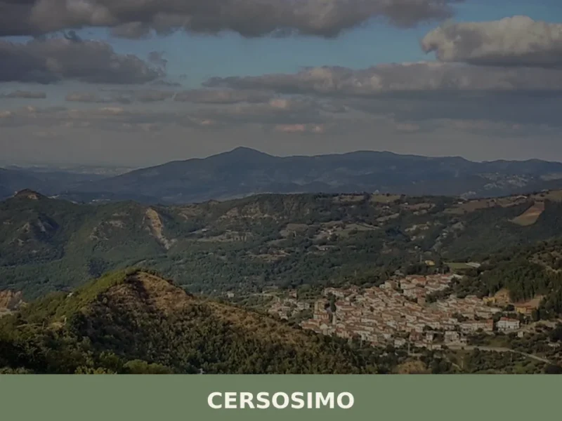
The village of Banzi, located in the northern part of Basilicata and sharing the province’s history of Byzantine and Norman settlement, can extend a longer regional itinerary for visitors who arrive by car and want to cover more of the Lucanian interior. Those approaching from the western Basilicata uplands may also pass through the area of Albano di Lucania, a small comune in the mountainous interior whose position illustrates the dramatic elevation change between the Lucanian Apennines and the Ionian coastal plain that Tursi occupies at its midpoint.
Frequently asked questions about Tursi
What is the best time to visit Tursi?
Spring and early autumn are the ideal seasons. May is particularly significant: on 26 May the town celebrates its patron San Filippo Neri with religious ceremonies and local festivities. On 8 September, the Feast of the Sanctuary of Santa Maria Regina di Anglona draws pilgrims and visitors to the hilltop sanctuary in one of Basilicata's most deeply rooted devotional traditions. Spring also offers the best conditions for exploring the Pescogrosso stream gorge and the clay ravines around Rabatana, when wildflowers soften the ochre landscape and temperatures remain moderate.
What are the historical origins of Tursi?
Human presence in the Tursi area dates to at least the 15th century BC, linked to Oenotrian populations of the Agri and Sinni valleys. The name derives from 'Turcico,' a Byzantine commander who expanded the existing Saracen village of Rabatana. The first written record appears in 968 in Bishop Liutprand of Cremona's Relatio de legatione Constantinopolitana. That same year Tursi became capital of the Byzantine theme of Lucania and an episcopal see. The Arab geographer al-Idrisi listed it as 'Tursah' in 1154, and a papal bull of 1068 records it as 'Tower of Tursio.'
What to see in Tursi? Main monuments and landmarks
The top sites are: the Rabatana quarter, a rare surviving Saracen-era residential nucleus of narrow lanes protected by three natural clay ravines over 100 m deep; the Cathedral, dramatically positioned above the Cathedral ditch with views over the valley; and the Sanctuary of Anglona, set on the hill of the ancient settlement of Anglonum with panoramic views over the Agri and Sinni corridors. The Gannano dam on the Agri River and the Pescogrosso stream gorge complete the main itinerary. Sturdy footwear is recommended for the Anglona access road and stream paths.
What are the main natural or scenic attractions of Tursi?
Tursi's territory offers three distinct natural features. The three geological chasms — Palmara, St. Francis, and Cathedral ditches — carved into Cenozoic marly clay frame the Rabatana quarter and are visible from multiple points in the historic center. The Gannano reservoir on the Agri River, within the hamlet of Caprarico, sits in a landscape of shifting ridges and gullies. The Pescogrosso stream gorge, running approximately 10 km eastward to the Sinni River, exposes clear stratigraphic sections of alternating clay and limestone. Spring and early autumn are the most practical seasons for exploration.
Where to take the best photos in Tursi?
The cathedral terrace offers the most dramatic viewpoint: looking west, it reveals the full depth of the Cathedral ditch and the valley separating the historic center from the modern districts. Morning light is best for photographing the Rabatana quarter, when the ochre tones of the clay-limestone building surfaces are most vivid. The hilltop of Anglona provides wide-angle views over the converging Agri and Sinni river corridors — the same geographic panorama that made Pandosia strategically important in antiquity. The Gannano dam area rewards photography of Basilicata's clay-ridge landscape at any time of day.
Are there museums, churches or historic buildings to visit in Tursi?
The Sanctuary of Santa Maria Regina di Anglona is the principal religious monument, occupying the site of the ancient settlement of Anglonum on a panoramic hill. Archaeological finds from the surrounding area are held at the National Archaeological Museum of the Siritide in nearby Policoro. The Cathedral, above the Cathedral ditch, retains its original strategic positioning from the 10th-century episcopal see founded in 968. The Rabatana quarter itself functions as an open-air historic monument, its Arab-derived street layout and stone buildings reflecting more than a millennium of continuous settlement.
What can you do in Tursi? Activities and experiences
Visitors can walk the medieval lanes of the Rabatana quarter, explore the Pescogrosso stream gorge — best in spring or early autumn — and visit the Anglona sanctuary on foot along its access road (sturdy footwear advised given clay soil). The Gannano reservoir area is suitable for quiet landscape observation. On 8 September, the pilgrimage to the Anglona sanctuary is an authentic local devotional experience. The town's position 20 km from the Ionian coast makes it easy to combine an inland cultural day with a coastal visit, using Tursi as a base for exploring the lower Sinni and Agri valleys.
Who is Tursi suitable for? Families, couples, hikers, solo travelers?
Tursi suits culturally curious travelers — couples, solo visitors, and small groups — drawn to authentic southern Italian history with minimal tourist crowds. The compact Rabatana quarter is walkable and accessible for most ages, though the uneven terrain requires comfortable shoes. History enthusiasts will find exceptional depth: Saracen, Byzantine, Norman, and medieval layers are all legible in a single afternoon. The gorges and stream paths appeal to light hikers rather than technical trekkers. Families with older children will appreciate the geological storytelling of the ravines. The Anglona feast on 8 September adds a meaningful experiential dimension for those interested in local devotional traditions.
What to eat in Tursi? Local products and specialties
Tursi lies within the Agri and Sinni river valleys of Basilicata, a region whose documented food traditions center on legumes, durum wheat pasta, lamb, and preserved pork products including the IGP-certified Lucanica di Basilicata sausage. Extra virgin olive oil from the Matera province, where Tursi is located, is produced from centuries-old Majatica and Ogliarola cultivars. Peperoni cruschi — crispy dried red peppers, a Basilicata PAT product — appear in local cooking. For the most direct access to local products, the weekly market and any agriturismo within the municipal territory are the recommended starting points.
Getting there
Piazza Maria Santissima di Anglona, 75028 Tursi (MT)
Nearby Villages near Tursi
In Basilicata More villages to discover

Gallicchio
Discover Gallicchio, a hilltop village in Potenza province with a medieval castle, historic streets, and stunning views over the Val d'Agri valley.
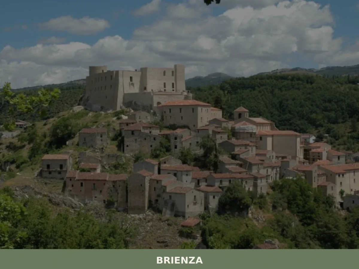
Brienza
What to see in Brienza? Explore 5 historic points of interest in this Basilicata village. Discover Caracciolo Castle and ancient churches. Plan your visit!
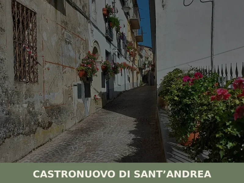
Castronuovo di Sant’Andrea
With a population of 1,111 inhabitants, Castronuovo di Sant’Andrea is a Lucanian town located in the province of Potenza, in the heart of the southern Apennines. The settlement, whose origins are lost in the folds of history, presents an urban structure that reflects centuries of layers. For those wishing to understand the essence of this […]
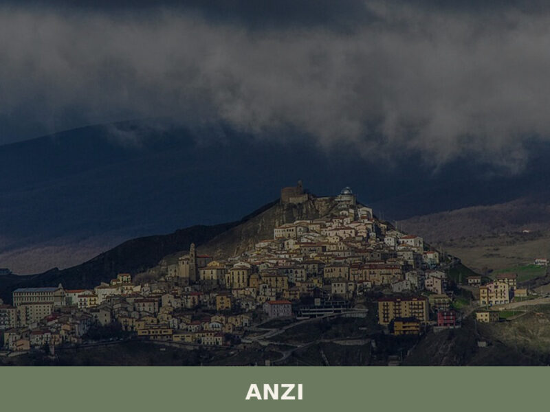
Anzi
Anzi sits at 1,008 metres above sea level in the province of Potenza, making it one of the highest settlements in Basilicata. Home to 1,745 inhabitants, this small Lucanian village occupies a rocky spur along the upper valley of the Camastra river, surrounded by dense forests of oak and chestnut. For anyone researching what to […]
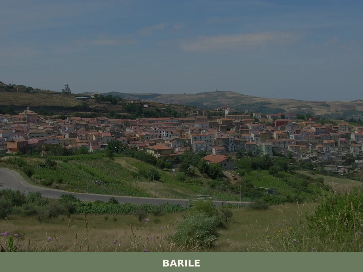
Barile
What to see in Barile? Discover 5 must-see attractions in this Basilicata village. The complete guide to visiting Barile awaits you. Plan your trip!
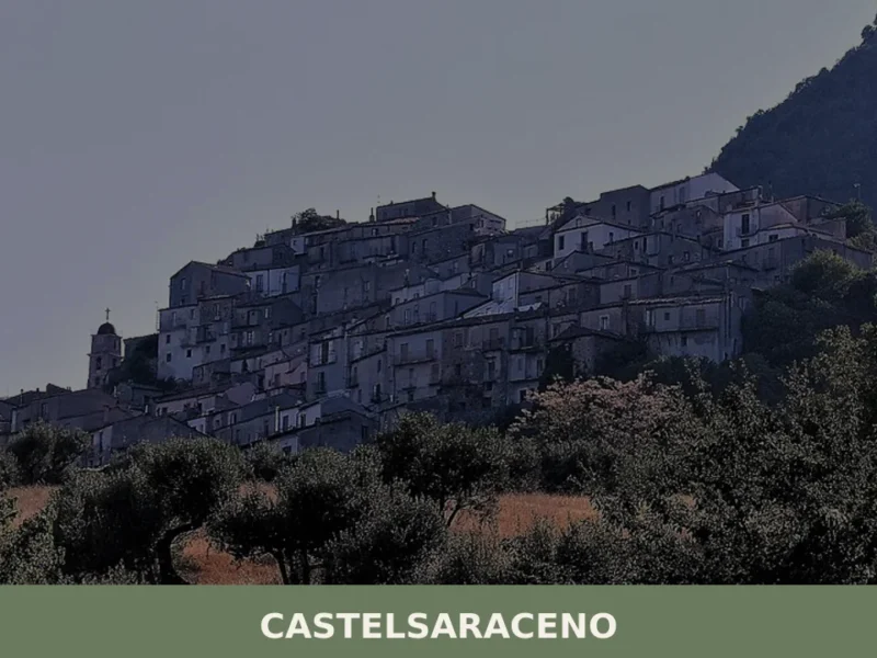
Castelsaraceno
What to see in Castelsaraceno, Italy? Explore this mountain village at 916 m (3,005 ft) altitude. Discover the 586 m (1,923 ft) Tibetan Bridge and its historic core. Read our guide.

Ferrandina
What to see in Ferrandina, Basilicata, Italy: 6 historic churches, olive oil production, and a hilltop at 482 m. Discover top attractions and how to get there.
Baragiano
What to see in Baragiano, Italy: a village at 625 m altitude with 2,485 inhabitants. Discover top attractions, local food, festivals and how to get there.
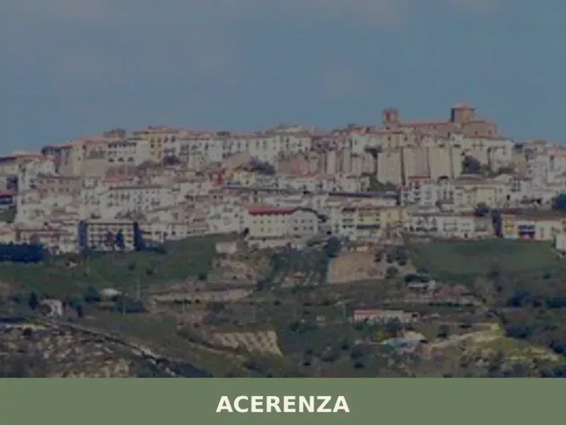
Acerenza
Discover what to see in Acerenza, Basilicata: a Norman cathedral, medieval streets, calanchi views and local food. Practical tips for visiting this hilltop episcopal town.

Genzano di Lucania
Discover Genzano di Lucania, a stone-built hilltop village in Alta Basilicata, where ancient alleys, Apennine views, and local traditions shape everyday life.


🏡 Know Tursi better than we do?
If you’re a local or have been there, your knowledge matters: add what’s missing or fix a detail on this page.