
Anterivo
Anterivo has 393 inhabitants and sits at 1,209 metres above sea level, in the far south-east of Alto Adige (South Tyrol), on the linguistic border between the German-speaking and Romance-speaking worlds. The municipality — one of the smallest in the province of Bolzano — occupies a south-facing slope of the Val di Fiemme, separated from […]
Discover Anterivo
Anterivo has 393 inhabitants and sits at 1,209 metres above sea level, in the far south-east of Alto Adige (South Tyrol), on the linguistic border between the German-speaking and Romance-speaking worlds. The municipality — one of the smallest in the province of Bolzano — occupies a south-facing slope of the Val di Fiemme, separated from Trentino by the course of the Avisio torrent. Asking what to see in Anterivo means preparing for a territory where human presence is sparse, population density extremely low, and historical traces concentrated in a few buildings of considerable documentary interest.
History and origins of Anterivo
The German name for the village is Altrei, already attested in medieval documents from the 12th century. The most widely accepted etymology traces it back to the Latin ultra rivum — “beyond the stream” — referring to the watercourse that marks the natural boundary with the Val di Fiemme. The Italian form “Anterivo” preserves the same root, Italianised during the period when Alto Adige came under Italian administration after 1919. For centuries the village belonged to the County of Tyrol and, more specifically, to the jurisdiction of Enn and Caldiff, governed by the Counts of Tyrol and later by the Prince-Bishops of Trento.
The community lived for centuries on pastoralism, forestry and mountain agriculture. Its geographical position — far from the main trade routes of the Adige valley — kept the settlement compact and demographically stable. In 18th-century parish registers the population already hovered around a few hundred, a figure that has remained constant to this day. The parish is dedicated to Saint Catherine of Alexandria, patron saint of the village, celebrated on 25 November with a liturgical service and a procession marking the end of the agricultural season.
During the First World War, Anterivo found itself close to the Dolomite front line, and several buildings were requisitioned as logistical depots. After annexation to Italy, the municipality was subject to Fascist Italianisation policies, but the population maintained the use of the South Tyrolean dialect. Today Anterivo is a bilingual municipality where German remains the mother tongue of the majority of inhabitants, as certified by the latest linguistic census of the Autonomous Province of Bolzano.
What to see in Anterivo: five places to know
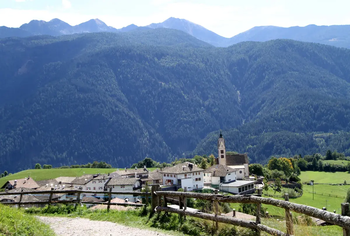
1. Parish Church of Saint Catherine of Alexandria
The main sacred building in the village dates in its current form to the 15th century, with a Gothic spired bell tower that defines the profile of the village as seen from the valley below. Inside, it preserves a carved wooden altar and several altarpieces from the Tyrolean school. The single nave and modest dimensions reflect the proportions of a small but steadfast community in its religious practice.
2. The historic centre of Altrei
The settlement consists of farmsteads and rural houses built with timber and mixed masonry, arranged along the main road. Several buildings display typical South Tyrolean rural architecture: balconies in sun-darkened larch, steeply pitched roofs for shedding snow, and raised hay barns. The relationship between residential volumes and agricultural volumes is still legible in the layout of the buildings.
3. The Trudner Horn trail (Monte Corno Nature Park)
Anterivo is one of the access points to the Monte Corno Nature Park, the oldest protected area in Alto Adige, established in 1980. From the village, marked trails lead to the summit of Monte Corno (1,817 m) through forests of Norway spruce and larch. The park’s flora includes over 1,000 recorded plant species, among them several wild orchids.
4. The scattered farmsteads of the valley
Around the centre, isolated farmsteads are distributed across the landscape, some still active in milk and cheese production. These structures — reachable by unpaved paths — document an Alpine settlement model based on self-sufficiency. Some farmsteads date back to the 17th and 18th centuries, with dates carved into door lintels and religious symbols painted on façades.
5. The geological route towards the Val di Fiemme
The road descending from Anterivo towards Capriana and the Val di Fiemme crosses a zone of geological transition between the Atesina porphyry platform and the Dolomitic limestone formations. The exposed rock sections along the hairpin bends display stratifications visible to the naked eye. The elevation drop of roughly 600 metres is covered in less than ten kilometres, with a rapid and documentable change in vegetation.
Food and local produce
The cuisine of Anterivo follows the South Tyrolean mountain tradition. The most common dishes are canederli (Knödel), prepared with stale bread, speck and cheese, served in broth or dry with melted butter. Speck Alto Adige IGP features in almost every meal, thinly sliced or used as a base ingredient. In winter, barley soup (Gerstsuppe) and buckwheat polenta are widely consumed, while the most common desserts are apple strudel and Krapfen filled with apricot or poppy-seed jam.
Local cheese production is limited in quantity but follows well-established methods: semi-hard cheeses from cow’s milk, alpine butter and fresh ricotta. There are no wineries within the municipal territory — the altitude is too high for viticulture — but the nearby Val di Fiemme and the Bassa Atesina supply wines such as Lagrein and Gewürztraminer. Dining options are concentrated in a handful of establishments, including gasthöfe and agritourisms, where the connection between the food served and the surrounding territory remains direct and verifiable.
When to visit Anterivo: the best time of year
Anterivo’s climate is Alpine, with cold, snowy winters (average January temperatures around -4°C) and cool summers (July averages around 15–17°C). The most favourable period for hiking in the Monte Corno Nature Park runs from mid-June to mid-September, when the trails are free of snow and the alpine dairies are in operation. The patronal feast of Saint Catherine of Alexandria, on 25 November, falls in what is already a winter period, often with snow on the ground.
Autumn — October in particular — offers distinctive light conditions, with the larches turning deep yellow on the slopes around the village. Those visiting Anterivo in winter will find a landscape suited to snowshoeing and cross-country skiing on the trails of the Monte Corno area. Low tourist density is a constant in every season: Anterivo has never developed a mass tourism economy, and this is reflected in the absence of large accommodation facilities.
How to reach Anterivo
By car, Anterivo is reached from the Brenner motorway (A22) by taking the Egna-Ora exit and continuing on the provincial road SP71 towards Trodena and then Anterivo. The distance from Bolzano is approximately 45 km (around 50 minutes’ driving time); from Trento approximately 55 km. The nearest railway station is Ora, on the Brenner line, from which you need to continue by private vehicle or scheduled bus service (SAD). The closest airport is Bolzano (approximately 50 km), while the main international airports serving the area are Verona Villafranca (approximately 140 km) and Innsbruck (approximately 150 km). The official municipal website provides updated information on transport links and available services.
What to see in Anterivo and in the nearby villages of Trentino-Alto Adige
The south-eastern slope of Alto Adige is an area far less frequented than the main tourist valleys, yet it preserves settlements of notable documentary interest. A few kilometres from Anterivo, heading north, you reach Trodena nel Parco Naturale, another municipality within the Monte Corno Park, with a similar settlement structure and an equally direct relationship with the forest and pastoralism. The two villages share the park’s trail network and a historical bond dating back to the same medieval jurisdiction.
Descending towards the Val di Fiemme and re-entering Trentino territory, it is worth reaching Capriana, a valley-floor village that marks the linguistic shift from German to Italian and offers a different perspective on the same mountain territory. Taken together, these minor centres provide a precise picture of how life has been organised at high altitudes, along a cultural boundary that has crossed the eastern Alps for centuries without ever coinciding perfectly with administrative borders.
Nearby Villages near Anterivo
In Trentino-South Tyrol More villages to discover
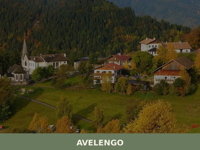
Avelengo
Avelengo has 796 inhabitants and sits at 1,290 metres above sea level on the plateau overlooking the Merano basin, on the southern side of the Sarntal Alps. Its municipal territory spans an altitudinal range from 600 to 2,200 metres, with high-altitude pastures that gave rise to one of the most extensively documented native horse breeds […]
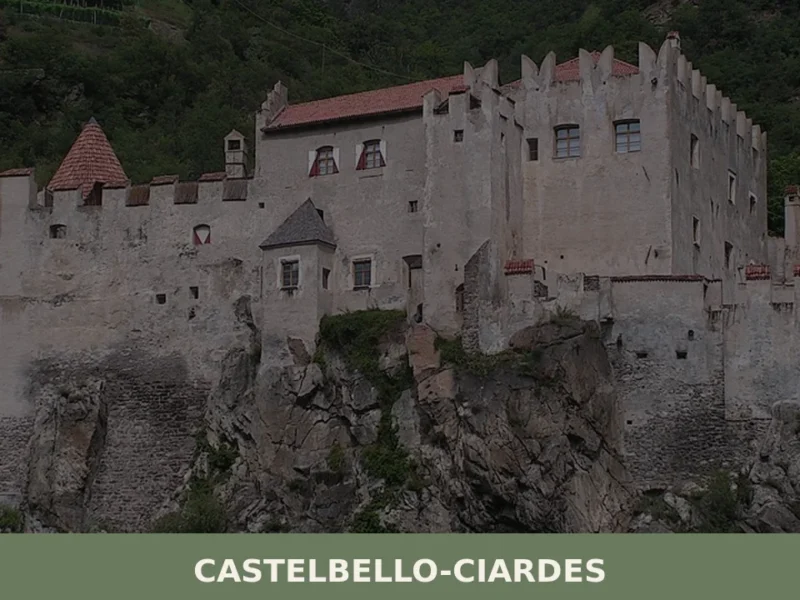
Castelbello-Ciardes
The municipality of Castelbello-Ciardes, home to 2,379 inhabitants at 587 metres above sea level in the Venosta Valley, owes its existence to a dual administrative identity: in 1928 the two separate villages of Castelbello (Kastelbell) and Ciardes (Tschars) were merged into a single municipality. Anyone looking into what to see in Castelbello-Ciardes will find an […]
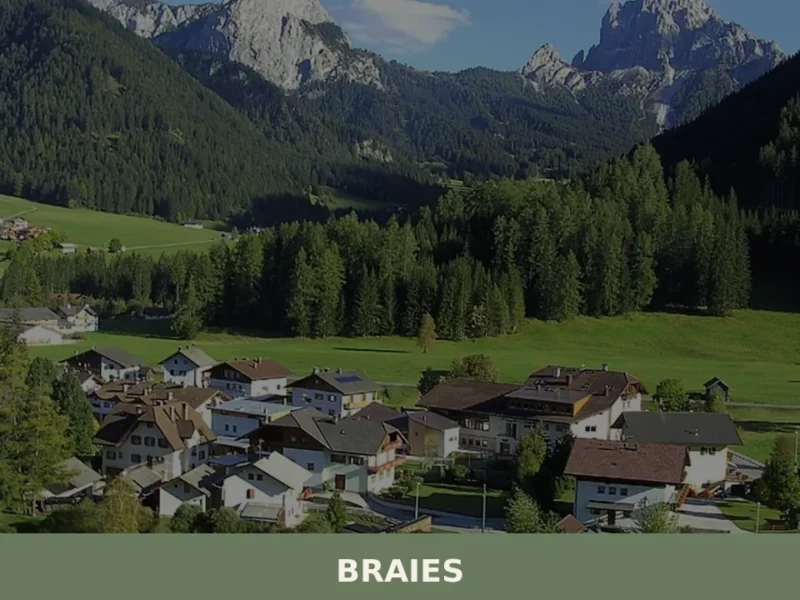
Braies
Lake Braies, sitting at 1496 metres above sea level, is the deepest natural lake in South Tyrol: 36 metres at its maximum point, fed by underground springs that filter through the Dolomite rock. This geological fact alone explains why hundreds of thousands of people reach this side valley off the Puster Valley every year. But […]


📝 Incorrect information or updates?
Help us keep the Anterivo page accurate and up to date.