


Agosta
A block of tuff rock rises above the Aniene valley in the Monti Simbruini area, and on its crown sits a tight cluster of stone buildings at 382 m (1,253 ft) above sea level. The Arch of the Cardinal still stands near the point where a bridge once crossed the Aniene river, its masonry dated […]
Discover Agosta
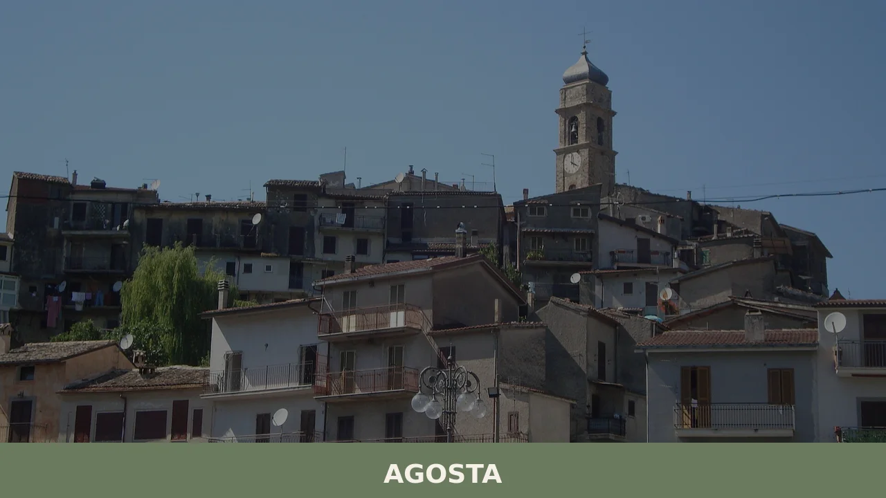
A block of tuff rock rises above the Aniene valley in the Monti Simbruini area, and on its crown sits a tight cluster of stone buildings at 382 m (1,253 ft) above sea level.
The Arch of the Cardinal still stands near the point where a bridge once crossed the Aniene river, its masonry dated to 1503.
Agosta borders five municipalities — Canterano, Cervara di Roma, Marano Equo, Rocca Canterano, and Subiaco — and its position on the tuff outcrop gives the village a clear physical logic: every street, every roofline, answers to the rock beneath it.
Deciding what to see in Agosta starts with understanding that this is a compact hill village of 1,757 inhabitants, located about 45 km (28 mi) east of Rome in the Metropolitan City of Rome, Lazio, Italy.
Visitors to Agosta find a medieval castle, a 17th-century sanctuary dedicated to the Madonna del Passo, and the Arch of the Cardinal — three distinct structures spanning roughly a thousand years of building activity.
The village is categorised among the borghi di collina, or hill villages, of Lazio, a designation that signals both its terrain and its character as a settlement shaped by defensive and agricultural necessity rather than by commercial growth.
History of Agosta
The area around Agosta has been occupied since prehistoric times, long before any formal settlement appeared on the tuff ridge. The first historically significant reference comes from the Res Gestae Divi Augusti, the account of Emperor Augustus’s own deeds, which names this locality as the source of the Aqua Marcia, one of ancient Rome’s principal aqueducts.
That connection to Rome’s water infrastructure gave the place both strategic importance and, eventually, its name: Agosta derives directly from Augustus, the Latin form of the emperor’s title, preserved through centuries of spoken Romanesco as Austa.
By 1051 AD, documentary sources record a castle at Agosta. At that time the structure came under the authority of the monastery of Subiaco, a Benedictine institution that exercised considerable influence across the Simbruini hill zone during the medieval period.
The monastery’s control over local territories was common practice in central Lazio, where ecclesiastical landowners managed both spiritual and secular affairs of smaller settlements.
Agosta’s position on an easily defensible tuff outcrop made it a natural candidate for a fortified outpost within the monastic network, and the castle documented in 1051 reflects that function precisely. Those interested in the broader medieval landscape of this part of Lazio may also find relevant context in Belmonte in Sabina, another Lazio hill settlement where Benedictine influence left a comparable architectural and administrative legacy.
The early sixteenth century brought a further layer of construction to the village.
In 1503, the Arch of the Cardinal — also known locally as the Arco della Porta — was built near a bridge that then crossed the Aniene river. This date places the arch squarely in the period of intense architectural patronage that followed the Italian Wars, when local lords and ecclesiastical figures alike commissioned lasting works as markers of territorial authority.
The arch survives today as one of the oldest datable structures in the village above ground level, and its proximity to the former river crossing confirms that Agosta once controlled an important passage across the Aniene.
What to see in Agosta, Lazio: top attractions
The Medieval Castle
The castle of Agosta occupies the highest point of the tuff rock on which the village stands, its walls following the irregular perimeter of the outcrop rather than any geometric plan.
Its first documented mention appears in 1051, making it one of the older recorded fortifications in the Monti Simbruini zone. From this position the structure commanded views across the Aniene valley and served the monastery of Subiaco as a defensible administrative node. Visitors approaching from the lower streets of the village will notice how the castle’s stonework merges with the natural rock face at several points, the tuff and the masonry becoming difficult to distinguish.
The site rewards close inspection of the base walls, where the transition between cut stone and raw cliff is most legible.
Arch of the Cardinal (Arco della Porta)
Built in 1503, the Arch of the Cardinal stands near the site of a bridge that once crossed the Aniene river, making it a structure with both a civic and a topographic function.
The arch marks what was effectively the main entry point into the village from the valley floor, controlling movement along the route that followed the river. Its construction date places it at the intersection of medieval fortification logic and early Renaissance building practice. The stonework is compact and utilitarian rather than decorative, which distinguishes it from contemporary arches built purely for ceremonial purposes.
It is worth examining the arch from the valley side to understand how the original bridge approach would have worked relative to the Aniene’s former course.
Sanctuary of the Madonna del Passo
The Sanctuary of the Madonna del Passo was built in the 17th century and sits within the territory of Agosta as a devotional structure associated with a specific point on a local route — the word passo in Italian denotes a pass or a ford, suggesting the sanctuary marks a place where travellers historically crossed difficult terrain.
Seventeenth-century rural sanctuaries of this type in Lazio were typically built at sites already considered significant before formal Christian settlement, often at natural features used as orientation points by local populations.
The building itself is modest in scale, consistent with the functional tradition of wayside shrines upgraded to sanctuary status. Visiting in the late summer months connects the site to the liturgical calendar that still governs community life in villages of this size.
The Tuff Rock Setting and Village Fabric
Agosta stands on a defined tuff rock formation at 382 m (1,253 ft), and the geology shapes everything visible at street level: the building material, the profile of the lanes, and the way structures step down the rock’s natural terracing.
Tuff, a volcanic stone quarried easily and common across central Lazio, gives the walls a warm ochre tone that changes noticeably between morning and afternoon light.
The village perimeter, particularly on the sides facing the Aniene valley, retains sections of older walling that follow the natural edge of the rock.
For those interested in comparable hill-village geology in Lazio, Bassano Romano offers a similar tuff-dominated streetscape about 60 km (37 mi) to the northwest, in the Viterbo province.
The Aniene Valley Surroundings
The territory around Agosta is part of the Monti Simbruini area, which the village borders alongside municipalities including Subiaco, located a short distance to the southeast.
The Aniene river — historically significant as the watercourse connected to the ancient Aqua Marcia aqueduct — flows through the valley below the tuff rock, and its course defines the landscape visible from the upper parts of the village.
The distance from Rome of 45 km (28 mi) places Agosta within the drainage basin of one of the ancient capital’s primary water supply systems, a geographical fact that gives the surrounding hills a relevance extending well beyond the medieval period.
Walking the perimeter of the village gives a direct view of the valley gradient that made this water source viable for Rome’s engineers.
Local food and typical products of Agosta
The food culture of Agosta belongs to the broader culinary tradition of the hill villages east of Rome, shaped by the resources of the Simbruini uplands: sheep farming, foraging, and subsistence agriculture on steep terrain. This part of Lazio has historically produced dishes built around preserved meats, legumes, and cheeses rather than the more elaborate preparations found closer to Rome.
The proximity to Subiaco and the surrounding Aniene valley municipalities means that Agosta shares its table traditions with a cluster of communities where the rhythms of pastoral life set the terms of what was eaten and when.
Typical preparations in villages of this zone centre on ingredients that kept well and required minimal equipment.
Pasta e fagioli, a thick soup of borlotti beans cooked with short pasta and finished with local olive oil, is a consistent presence across the area, thickened by the starch released during slow cooking rather than by the addition of cream or flour.
Abbacchio alla cacciatora, milk-fed lamb braised with white wine, garlic, rosemary, and anchovy paste, follows a technique common to central Lazio that uses anchovy as a salt and umami element rather than as a flavour in itself. Pecorino produced in the Simbruini hill zone is typically aged for at least 60 days, developing a firm paste and a pronounced lactic sharpness that distinguishes it from the younger, milder versions sold in urban markets.
No certified products with a formal PDO or PGI designation specific to Agosta are recorded in available sources.
The food economy of the village is best understood through the seasonal markets and small producers operating across the Monti Simbruini area, where direct purchase from farms remains the primary channel for obtaining local cheeses, cured meats, and olive oil. Visitors arriving in autumn will find the greatest variety of fresh produce available, as this is the period when chestnuts, mushrooms, and newly pressed oil enter circulation across the hill villages east of Rome.
The agricultural calendar in Agosta and its neighbouring municipalities also produces informal food events tied to the harvest and to the feast days of the liturgical year.
Local sagre — traditional food festivals, usually organised by village committees — take place across the Simbruini zone between late July and September, when the summer population swells with visitors from Rome and the surrounding region.
These events typically feature grilled meats, local wines from the Lazio hills, and simple pasta dishes served in outdoor settings.
Checking with the official municipality of Agosta before travel is the most reliable way to confirm specific dates and locations for events in any given year.
Festivals, events and traditions of Agosta
The principal civic and religious event in Agosta is the feast of Sant’Agostino, the village’s patron saint, celebrated on 28 August each year.
The feast falls at the end of summer, a timing that has historically made it a point of convergence for both resident families and those who return to the village from Rome and other cities during the August holiday period.
The celebration follows the pattern common to central Lazio hill villages: a religious procession through the main streets of the borgo, a solemn Mass in the parish church, and an evening programme of music and communal gathering in the village square.
The date on 28 August places the feast within the final days of the Italian summer holiday season, giving it a social function that goes beyond the strictly liturgical.
The August feast also coincides with the broader summer calendar of outdoor events that characterises this part of Lazio between July and early September. For a village of 1,757 inhabitants, the patron saint celebration represents the largest annual gathering and the moment when the community’s social fabric is most publicly visible.
Traditions associated with the feast — including the preparation of specific foods, the decoration of the streets, and the lighting of fireworks — are documented as recurring elements of the celebration, following a pattern maintained across successive generations in villages of this type throughout the Monti Simbruini area.
When to visit Agosta, Italy and how to get there
The best time to visit Agosta is between late April and early June, or again in September and October.
Spring brings mild temperatures at 382 m (1,253 ft) altitude, with the Aniene valley fully green and the hill roads in good condition after winter. Autumn offers lower crowds than August and the seasonal produce associated with harvest time across the Simbruini uplands.
August remains the most animated month — the feast of Sant’Agostino on 28 August draws visitors — but the roads east of Rome are at their busiest during this period. Winter visits are possible but the village is quiet and some local services may operate on reduced hours. For international visitors, it is practical to carry euros in cash, as smaller establishments in hill villages of this size rarely accept card payments, and English may not be widely spoken in local shops.
Agosta is located 45 km (28 mi) east of Rome, making it a realistic day trip from the capital.
By car, the most direct route follows the Via Tiburtina (SS5) eastward from Rome, continuing towards Subiaco and then following local roads north to Agosta.
The journey from central Rome takes approximately one hour under normal traffic conditions. Drivers coming from the A24 motorway (Rome–L’Aquila) can exit at Vicovaro-Mandela and cover the remaining distance on secondary roads through the Aniene valley. The nearest major railway hub is Rome Tiburtina, from which regional trains operated by Trenitalia run toward Subiaco on the Tivoli–Subiaco line; from Subiaco, bus connections or a taxi cover the final kilometres to Agosta.
The nearest international airport is Rome Fiumicino (Leonardo da Vinci), approximately 80 km (50 mi) from Agosta, with a transfer time of roughly 90 minutes by car depending on Rome city traffic. Rome Ciampino airport is somewhat closer at approximately 60 km (37 mi).
Those planning a broader itinerary through Lazio can extend their trip to include Rieti, the capital of its own province to the northeast, which serves as a logical base for exploring the Sabine and Simbruini hill zones.
The hill town of Canepina, in the Cimini Hills of Viterbo province, offers a comparable hill-village experience for those routing their trip through northern Lazio on the return journey to Rome.
Frequently asked questions about Agosta
What is the best time to visit Agosta?
Spring (April–June) and early autumn (September–October) offer mild temperatures and clear views over the Aniene valley, making them the most comfortable seasons for exploring the village on foot. Summer is warm but manageable at 382 m altitude. The highlight of the local calendar is the feast of Sant'Agostino on 28 August, when the village celebrates its patron saint — visiting around this date combines sightseeing with an authentic community tradition. Autumn also brings the widest variety of local seasonal produce from farms across the Monti Simbruini area.
What are the historical origins of Agosta?
Agosta's origins trace back to ancient Rome: the Res Gestae Divi Augusti identifies this locality as the source of the Aqua Marcia, one of Rome's principal aqueducts. The village name itself derives from Augustus — preserved through centuries of spoken Romanesco as Austa. By 1051 AD, documentary sources record a castle under the authority of the Benedictine monastery of Subiaco. In 1503, the Arch of the Cardinal was built near a bridge over the Aniene river, marking a key passage through the valley. These three layers — imperial, medieval, and Renaissance — define the historical identity of the settlement.
What to see in Agosta? Main monuments and landmarks
Agosta has three main attractions. The Medieval Castle (first documented 1051) sits at the highest point of the tuff outcrop, its walls merging with the natural rock face — inspect the base walls for the clearest tuff-to-masonry transition. The Arch of the Cardinal (1503), near the former Aniene river crossing, is best viewed from the valley side to understand the original bridge approach. The 17th-century Sanctuary of the Madonna del Passo marks a historic route crossing and is particularly relevant during late summer visits aligned with the liturgical calendar. All three sites are accessible on foot within the compact village perimeter.
What are the main natural or scenic attractions of Agosta?
Agosta sits within the Monti Simbruini area, one of the largest protected natural zones in Lazio, bordering municipalities including Subiaco, Cervara di Roma, and Rocca Canterano. The Aniene river flows through the valley directly below the tuff rock on which the village stands, offering a landscape historically connected to the ancient Aqua Marcia aqueduct. Walking the village perimeter provides direct views of the valley gradient. The surrounding Simbruini uplands are documented for foraging traditions and pastoral land use, characteristic of this hill zone east of Rome.
Where to take the best photos in Agosta?
The most rewarding photographic positions in Agosta are along the village perimeter facing the Aniene valley, where the tuff rock drops away and the valley floor is fully visible. The base of the Medieval Castle offers views across the outcrop that show how the stonework grows directly from the natural cliff. The Arch of the Cardinal, photographed from the valley side, frames the former river-crossing route effectively. The tuff walls throughout the village change tone markedly between morning and afternoon light, making mid-morning and late afternoon the best windows for architectural photography.
Are there museums, churches or historic buildings to visit in Agosta?
The three documented historic structures in Agosta are the Medieval Castle (first recorded 1051), the Arch of the Cardinal (built 1503, also called Arco della Porta), and the Sanctuary of the Madonna del Passo (17th century). No opening hours or admission fees are recorded in available sources for these sites, which is consistent with small hill villages in Lazio where access is generally unrestricted for exterior viewing. The Sanctuary is a functional devotional building whose visiting context is most meaningful around the late summer liturgical calendar tied to the feast of Sant'Agostino on 28 August.
What can you do in Agosta? Activities and experiences
Agosta is suited to slow, on-foot exploration of its compact medieval fabric, with the tuff rock setting and valley views providing the main experiential draw. The Monti Simbruini area surrounding the village supports rural walking in the broader hill zone shared with Subiaco and Cervara di Roma. Autumn visits offer direct access to seasonal produce — cheeses, cured meats, and olive oil — from small producers across the area, where farm-direct purchase is the primary channel. The feast of Sant'Agostino on 28 August provides an opportunity to experience a live community celebration in a village of this scale.
Who is Agosta suitable for?
Agosta suits visitors who value quiet, historically layered hill villages over busy tourist destinations. History enthusiasts will appreciate the documented continuity from the ancient Aqua Marcia aqueduct through the 1051 castle to the 1503 arch. Couples and solo travellers looking for an authentic Lazio experience away from Rome's crowds will find the village compact and unhurried. Walkers and nature-oriented visitors benefit from the Monti Simbruini surroundings. Families with older children who can navigate uneven stone streets will find the setting engaging. At 45 km from Rome, it works well as a focused day trip combined with nearby Subiaco.
What to eat in Agosta? Local products and specialties
Agosta's food culture belongs to the hill-village tradition of the Simbruini uplands east of Rome. Documented local specialties include pasta e fagioli — a thick borlotti bean and short pasta soup finished with local olive oil — and abbacchio alla cacciatora, milk-fed lamb braised with white wine, garlic, rosemary, and anchovy paste, a technique common across central Lazio. Pecorino from the Simbruini hill zone, aged at least 60 days for a firm paste and sharp flavour, is available from small producers in the area. No PDO or PGI certification specific to Agosta is recorded. Autumn offers the widest seasonal variety.
Nearby Villages near Agosta
In Lazio More villages to discover
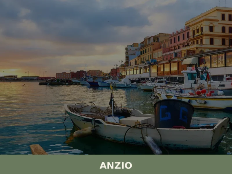
Anzio
What to see in Anzio, Lazio, Italy: from WWII cemeteries to Roman ruins 51 km from Rome. Discover top attractions, local seafood, and how to get there.
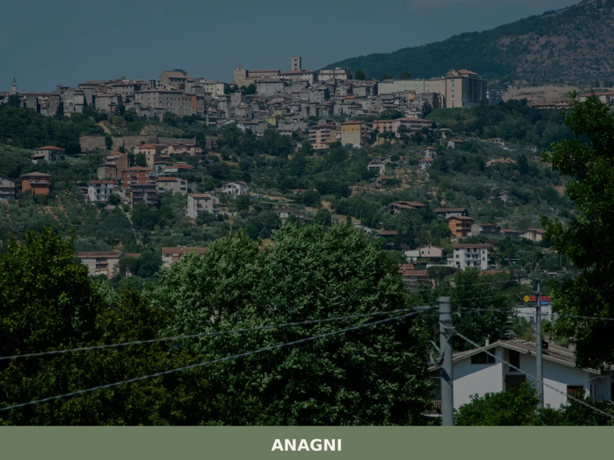
Anagni
What to see in Anagni: from the Cathedral of Santa Maria to the medieval Crypt. Complete guide with 5 attractions, practical tips and a one-day itinerary.
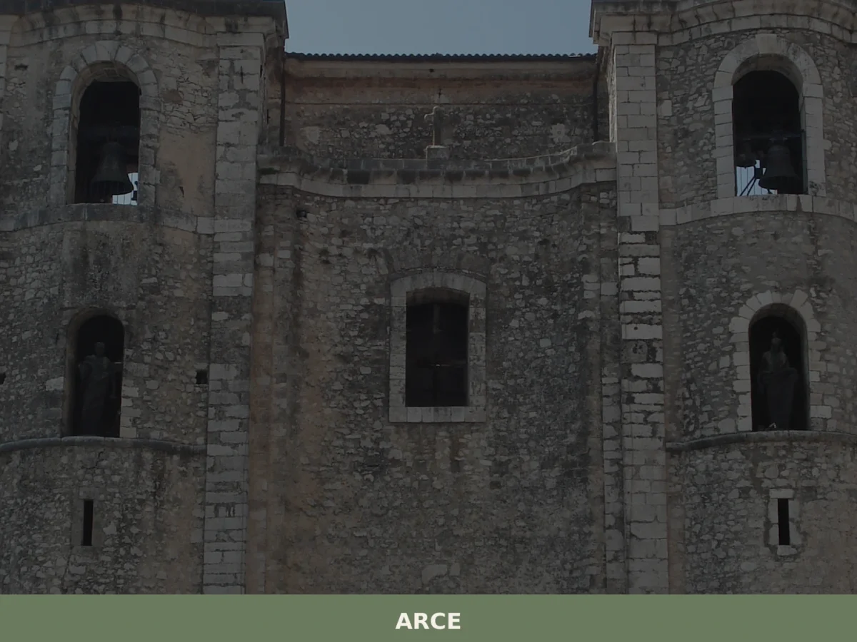
Arce
What to see in Arce: discover the 5 unmissable aspects of this Lazio village. From medieval fortresses to scenic views, your complete guide. Plan your visit!
Atina
What to see in Atina, Lazio, Italy: explore polygonal walls, a DOC wine zone, and a Baroque cathedral. Discover top things to do in this Frosinone village.
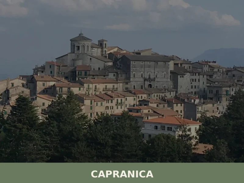
Capranica
Capranica, a Lazio village between history and nature: discover what to see, how to get there and the top places to visit. Plan your trip with this guide.
Tessennano
In the heart of Viterbo’s Tuscia region, 302 meters above sea level, lies Tessennano, a settlement with 284 residents. Its hillside location, distant from major thoroughfares, has defined its profile through the centuries. For those wondering what to see in Tessennano, the village presents a historical layering perceptible in its architecture. The settlement develops around […]
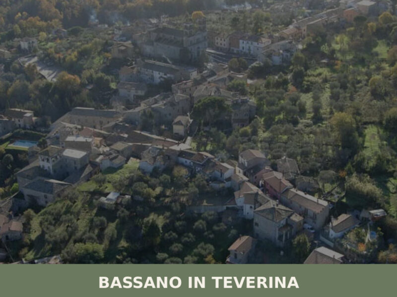
Bassano in Teverina
Standing at 304 metres above sea level, with a population of 1,260, Bassano in Teverina occupies a tuff plateau overlooking the Tiber valley in the province of Viterbo. The village owes the second part of its name to the river that flows just a few kilometres to the east — a geographical reference that distinguishes […]
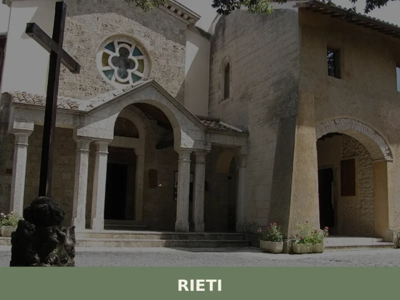
Rieti
What to see in Rieti: from the medieval walls to the Cathedral, discover the top 5 attractions. Complete guide to visiting Rieti in one day.
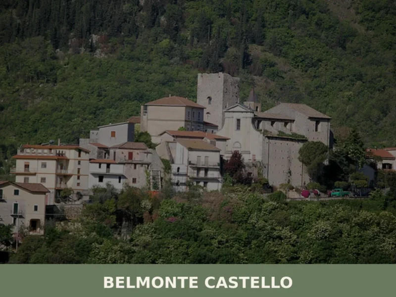
Belmonte Castello
What to see in Belmonte Castello: discover the 5 main attractions of this Lazio village, from the medieval castle to the Church of San Salvatore. Plan your visit.
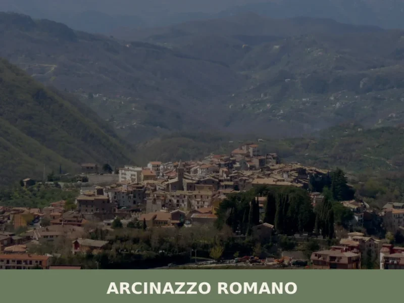
Arcinazzo Romano
What to see in Arcinazzo Romano, Lazio, Italy: explore Trajan's Villa ruins at 831 m altitude, the plateau landscape and local traditions. Discover the complete guide.


🏡 Know Agosta better than we do?
If you’re a local or have been there, your knowledge matters: add what’s missing or fix a detail on this page.