


Arcinazzo Romano
What to see in Arcinazzo Romano, Lazio, Italy: explore Trajan’s Villa ruins at 831 m altitude, the plateau landscape and local traditions. Discover the complete guide.
Discover Arcinazzo Romano
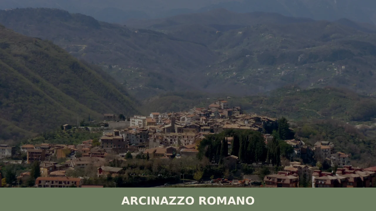
At 831 metres (2,726 ft) above sea level, the plateau of Arcinazzo Romano spreads wide and flat above the Aniene valley, a geological anomaly in a landscape otherwise shaped by steep ridges and ravines. The population numbers just 1,226 inhabitants.
Stone farmhouses dot the edges of the altopiano — the Italian term for high plateau — and in the middle of that open ground, partially excavated, partially reclaimed by grass and scrub, lie the remains of a Roman emperor’s summer palace.
Deciding what to see in Arcinazzo Romano means engaging, above all, with that imperial past and with the particular character of a mountain comune located about 50 kilometres (31 mi) east of Rome.
Visitors to Arcinazzo Romano find a place where Roman archaeology coexists with a working mountain village, where the feast of San Giorgio on 23 April draws residents back from the valley towns, and where the surrounding municipalities — Affile, Subiaco, Jenne, Piglio, Roiate, Serrone, Trevi nel Lazio — form a circuit worth exploring over several days.
History of Arcinazzo Romano
The municipality’s current name is relatively recent. Until 1891, the settlement was officially recorded as Ponza — not to be confused with the island of the same name in the Tyrrhenian Sea. The 1891 renaming to Arcinazzo Romano reflects a broader administrative reorganisation of the period under the Kingdom of Italy, when many localities in the Roman hinterland adopted names that distinguished them more clearly from other identically named places. The word Arcinazzo itself is of local topographic origin, rooted in the morphology of the plateau that defines the territory.
The deeper historical significance of the area lies in its Roman imperial period.
Emperor Trajan, who ruled from 98 to 117 CE, selected the Arcinazzo plateau as the site for his summer palace and hunting residence, a choice that speaks to both the climate advantages of the elevation and the accessibility of the territory from Rome via the Via Sublacense.
The Villa of Trajan was a substantial imperial complex, and its presence here places Arcinazzo Romano within a constellation of imperial retreats that extend across the Lazio uplands — a pattern that also connects, geographically and historically, to the broader Aniene river corridor explored by travellers reaching as far as Viterbo in northern Lazio, where Etruscan and medieval layers accumulate in a similarly stratified fashion.
The village itself developed across the medieval and early modern periods as an agricultural and pastoral community, its economy shaped by the plateau’s grasslands and the surrounding forest. The municipal boundary, which today touches seven neighbouring comuni, reflects centuries of territorial negotiation across the sub-Apennine uplands.
The formal administrative identity of Arcinazzo Romano as a comune in the Metropolitan City of Rome positions it within a governance structure that dates, in its modern form, to the post-unification reorganisation of the Italian state in the nineteenth century, with the 1891 renaming marking a clear moment of civic redefinition.
What to see in Arcinazzo Romano, Lazio: top attractions
The Villa of Trajan
The exposed foundations and partial walls of Trajan’s Villa occupy a section of the Arcinazzo plateau, their Roman concrete and brick visible at ground level across a wide area.
Emperor Trajan built the complex as a summer palace and hunting residence during his reign between 98 and 117 CE, and the choice of this site — elevated at over 800 metres (2,625 ft) — reflects deliberate planning for a cooler climate than Rome. Standing among the remains, a visitor can read the scale of the original complex through the extent of the ruins, which spread across the plateau rather than concentrating on a single promontory. The site is most comfortably visited in the warmer months when the ground is dry and the vegetation has not obscured the structural outlines.
The Arcinazzo Plateau
The altopiano of Arcinazzo is a wide, elevated plain sitting at roughly 831 metres (2,726 ft) above sea level, a landform that sets this municipality apart from the narrow valley communes of the surrounding territory.
The plateau historically functioned as a summer resort area, drawing visitors from Rome and the lowlands for its cooler temperatures. Walking the plateau perimeter reveals sharp drops toward the valleys below and clear sightlines toward the Ernici and Simbruini mountains. The Simbruini range, which encloses part of the municipality’s natural context, is best observed from the open edges of the plateau in the late afternoon when the ridgeline is sharpest against the western light.
The Historic Village Centre
The built fabric of Arcinazzo Romano concentrates in a compact residential core typical of sub-Apennine mountain villages in the province of Roma.
The street pattern is tight, with lanes between stone structures that follow the contour logic of the hillside below the plateau. The parish church, dedicated to the patron San Giorgio, forms the social and architectural focal point of the centre, its presence confirmed by the annual feast celebrated on 23 April. The elevation means that even in summer the village retains noticeably lower temperatures than Rome, a factor that made the entire area a documented resort destination through much of the twentieth century.
Visitors exploring what to see in Arcinazzo Romano should allow time to walk the full perimeter of the village centre.
The Surrounding Municipal Borders and Viewpoints
Arcinazzo Romano borders seven municipalities: Affile, Jenne, Piglio, Roiate, Serrone, Subiaco, and Trevi nel Lazio, and the roads connecting these places pass through some of the most topographically varied terrain in the Lazio uplands. The road toward Subiaco, located to the north of Arcinazzo, descends through a series of switchbacks that offer clear views of the Aniene river valley at several hundred metres below the plateau level. The road toward Piglio runs through agricultural land associated with the Cesanese del Piglio wine zone. These boundary roads function as practical viewpoint routes, accessible by car and offering orientation across the full breadth of the Simbruini uplands that frame the municipality on its eastern and northern sides.
The Natural Landscape of the Simbruini Uplands
The territory of Arcinazzo Romano sits within the ecological zone of the Simbruini mountains, an upland block in the Apennine chain east of Rome.
The plateau at 831 metres (2,726 ft) transitions at its edges into mixed woodland and pasture characteristic of the sub-Apennine belt at this elevation. The natural setting drew holiday visitors through the twentieth century precisely because the vegetation and air quality at this altitude differ markedly from the Tiber plain.
For those interested in walking routes, the network of paths connecting Arcinazzo to its neighbouring communes — including Jenne and Trevi nel Lazio — provides direct access to the wider upland landscape without requiring specialist equipment. Spring, from April through June, is the most productive season for observing the plateau flora at its most active.
Local food and typical products of Arcinazzo Romano
The food culture of the Arcinazzo plateau draws from the pastoral and agricultural economy that sustained the village through its history. At this elevation, livestock grazing dominated the local economy across the medieval and early modern periods, and that foundation shaped a cuisine centred on sheep’s milk products, cured meats, and the hearty preparations suited to a mountain climate. The proximity to Rome — roughly 50 kilometres (31 mi) to the west — brought periodic contact with urban markets and their demand for highland products, reinforcing the pastoral identity of the territory.
The table in this area reflects the broader tradition of the Roman mountain hinterland.
Pasta alla gricia, a preparation of pasta with cured pork cheek (guanciale), rendered fat, and aged sheep’s milk cheese, is a recurring presence in the kitchens of the sub-Apennine comuni east of Rome.
Abbacchio, milk-fed lamb roasted with rosemary and garlic, represents the direct output of the local pastoral economy and appears in various preparations — roasted, braised with vinegar, or cooked alla cacciatora with vinegar, anchovies, capers, and herbs. Polenta with wild boar ragù reflects the hunting culture of the surrounding mountain territory, where the forested slopes between Arcinazzo and Jenne have historically supported game populations. Bread and legume soups, particularly with lentils and dried beans, form the everyday register of a mountain table.
The territory immediately surrounding Arcinazzo Romano is adjacent to the Cesanese del Piglio wine zone, centred on the commune of Piglio, which borders Arcinazzo to the west. Cesanese del Piglio is a DOCG-classified red wine produced from the Cesanese grape variety, native to the Ciociaria and Lazio upland zone. The wine’s production area includes the commune of Piglio and its neighbouring territories, and bottles from this zone appear regularly in the restaurants and osterie of the surrounding area.
Visitors spending time in and around Arcinazzo Romano will encounter this wine as the dominant local red throughout the mountain corridor between Palestrina and the Simbruini uplands.
Local food purchasing in Arcinazzo Romano itself is best undertaken at the periodic village market and through the small number of producers operating in the plateau area.
The seasonal calendar concentrates food activity in the warmer months, from May through September, when the village population increases with returning summer residents and the demand for local products rises accordingly. International visitors should carry cash, as card payment facilities may not be available at smaller local vendors, and English-language assistance in shops is limited.
Festivals, events and traditions of Arcinazzo Romano
The central event in the annual calendar of Arcinazzo Romano is the feast of San Giorgio, the patron saint of the municipality, celebrated on 23 April. The feast follows the pattern common to mountain villages in the Roman hinterland: a religious procession through the village streets, a solemn Mass in the parish church dedicated to the saint, and a public gathering in the village square that extends through the afternoon. The date of 23 April places the feast firmly in spring, when the plateau is emerging from its coldest months and the surrounding landscape carries the first consistent warmth of the season.
For residents who have spent the winter in Rome or the valley towns, the feast functions as a point of return to the village community.
Beyond the patron saint feast, the village observes the broader rhythm of the Italian liturgical and agricultural calendar, with summer bringing increased activity to the plateau as the holiday population arrives.
The mountain resort character of Arcinazzo, documented through much of the twentieth century, means that the months of July and August carry their own informal festivity — outdoor markets, evening gatherings in the village square, and the general increase in social life that summer brings to a community that doubles or triples its effective population with seasonal residents. Specific food fairs or documented sagre — traditional local food festivals — tied to particular products have not been recorded in the available sources for this municipality.
When to visit Arcinazzo Romano, Italy and how to get there
The best time to visit Arcinazzo Romano, Italy follows directly from its elevation of 831 metres (2,726 ft). The plateau records markedly cooler summers than Rome, making July and August genuinely comfortable for outdoor activity — average daytime temperatures remain significantly below those of the capital. Spring, from late April through June, combines mild temperatures with the clearest visibility across the surrounding mountain ranges and the most active plateau vegetation.
Autumn, from September through October, offers stable weather and lower visitor numbers.
Winter at this altitude brings cold conditions and occasional snow, which closes some of the rural access roads and is suitable only for visitors specifically seeking a winter mountain environment. For those planning a day trip from Rome, the 50 km (31 mi) distance makes Arcinazzo accessible in well under an hour by car, making it a realistic single-day excursion from the capital.
Reaching Arcinazzo Romano by car from Rome involves taking the A24 motorway in the direction of L’Aquila, exiting at Vicovaro-Mandela, and then following the provincial road SP35b toward Subiaco and onward to Arcinazzo. The total drive from Rome’s ring road (Grande Raccordo Anulare) is approximately 50 kilometres (31 mi) and typically takes between 50 and 70 minutes depending on traffic on the A24. The nearest railway station is at Mandela-Sambuci on the Rome-Avezzano line, operated by Trenitalia, from which Arcinazzo Romano is reached by road.
There is no direct public bus route documented from Rome to Arcinazzo Romano in the available sources, so a private vehicle or taxi from the nearest station is the practical option for most visitors.
The official municipality website of Arcinazzo Romano provides current administrative and contact information for the commune. International visitors arriving via Rome’s airports — Fiumicino or Ciampino — should plan for a combined journey of approximately 90 to 120 minutes including the drive from the airport to the A24 access point.
For those building an itinerary across the Lazio mountain zone, the village of Morro Reatino in the Rieti province offers a comparable mountain-village experience further north in the Apennine belt, and can be combined with Arcinazzo Romano over two days.
Similarly, visitors interested in lake landscapes alongside mountain villages may consider extending eastward to Colle di Tora or the nearby Castel di Tora, both positioned on the shores of Lake Turano in the Rieti uplands, roughly two hours north of Arcinazzo Romano by car.
Carrying cash and a basic Italian phrasebook remains practical advice for any visit to the smaller villages in this part of Lazio, where English is rarely spoken outside the main tourist circuits.
Knowing what to see in Arcinazzo Romano gives a visit to this plateau municipality a clear focus: the ruins of Trajan’s Villa, the open expanse of the altopiano, the village feast of San Giorgio on 23 April, and the pastoral food culture of the Simbruini uplands. At 1,226 inhabitants, Arcinazzo Romano functions as a working mountain comune first and a visitor destination second — which is precisely what gives the plateau its particular character among the villages east of Rome.
Frequently asked questions about Arcinazzo Romano
What is the best time to visit Arcinazzo Romano?
Spring (April–June) is the ideal time to visit Arcinazzo Romano. The plateau flora is at its most vivid, temperatures are pleasant at 831 metres above sea level, and the feast of San Giorgio on 23 April brings the village to life with its patron saint celebrations. Summer is also excellent: the altitude keeps temperatures noticeably cooler than Rome, making the village a classic highland retreat. Autumn offers clear sightlines across the Simbruini and Ernici mountains. Winter can be cold and snowy at this elevation, limiting access to the Roman ruins and walking routes.
What are the historical origins of Arcinazzo Romano?
The settlement was officially known as Ponza until 1891, when it was renamed Arcinazzo Romano during an administrative reorganisation of the Kingdom of Italy to distinguish it from other localities sharing the same name. The name Arcinazzo derives from local topographic terminology related to the plateau's morphology. The area's deepest historical significance lies in its Roman imperial period: Emperor Trajan (98–117 CE) built a summer palace and hunting residence on the plateau, exploiting its elevation and accessibility from Rome via the Via Sublacense.
What to see in Arcinazzo Romano? Main monuments and landmarks
The primary attraction is the Villa of Trajan, a partially excavated imperial complex built between 98 and 117 CE as a summer palace and hunting residence. Its Roman concrete foundations and brick walls are visible at ground level across a wide area of the plateau and are most accessible in dry weather from late spring through autumn. The compact historic village centre, with its stone lanes and the parish church of San Giorgio, is a second focal point. The road descending toward Subiaco and the plateau perimeter offer commanding views over the Aniene valley.
What are the main natural or scenic attractions of Arcinazzo Romano?
The Arcinazzo plateau itself — a wide, flat landform at 831 metres (2,726 ft) — is the defining natural feature, geologically unusual amid the surrounding ridges and ravines. Its edges drop sharply toward the valleys below, providing clear sightlines to the Simbruini and Ernici mountain ranges. The territory sits within the ecological zone of the Simbruini uplands, with mixed woodland and pasture at its margins. Walking paths connect Arcinazzo to neighbouring communes including Jenne and Trevi nel Lazio, offering access to the broader upland landscape without specialist equipment.
Where to take the best photos in Arcinazzo Romano?
The perimeter of the Arcinazzo plateau offers the most rewarding viewpoints: the sharp drops toward the Aniene valley and the open ridgeline of the Simbruini mountains are clearest in late afternoon light when the western sky frames the ridges. The descent road toward Subiaco provides multiple switchback viewpoints several hundred metres above the valley floor. The exposed ruins of Trajan's Villa set against the open plateau make for a distinctive archaeological landscape photograph, best captured when vegetation is low in spring or after summer grazing.
What can you do in Arcinazzo Romano? Activities and experiences
Visitors can explore the partially excavated ruins of Trajan's Villa on foot, walk the plateau perimeter, and follow paths connecting to neighbouring communes such as Jenne and Trevi nel Lazio through the Simbruini uplands. The boundary roads toward Subiaco and Piglio double as scenic driving routes with valley and mountain viewpoints. The area around Piglio, which borders Arcinazzo to the west, is part of the Cesanese del Piglio DOCG wine zone, making a short wine-focused excursion easily combinable with a stay. The San Giorgio feast on 23 April is the main annual community event.
Who is Arcinazzo Romano suitable for? Families, couples, hikers, solo travelers?
Arcinazzo Romano suits hikers and nature lovers drawn to the Simbruini uplands and the open plateau landscape. History enthusiasts will find the remains of Trajan's Villa genuinely compelling as an off-the-beaten-track imperial site. Couples and slow travellers seeking a cool, quiet retreat within 50 kilometres of Rome will appreciate the altitude and the unhurried pace of a working mountain village with only 1,226 inhabitants. It is less suited to visitors expecting urban amenities or coastal activities. Families with an interest in Roman archaeology and mountain walking will also find it rewarding.
What to eat in Arcinazzo Romano? Local products and specialties
The local table reflects the pastoral economy of the sub-Apennine uplands. Abbacchio (milk-fed lamb roasted with rosemary and garlic, or cooked alla cacciatora with vinegar, anchovies and capers) is the most characteristic dish. Pasta alla gricia — made with guanciale (cured pork cheek) and aged sheep's milk cheese — is a staple of the Roman mountain hinterland. Polenta with wild boar ragù and hearty legume soups round out the mountain repertoire. The dominant local wine is Cesanese del Piglio DOCG, produced from the native Cesanese grape in the neighbouring commune of Piglio.
Nearby Villages near Arcinazzo Romano
In Lazio More villages to discover

Terracina
44,000 residents, one ancient temple on a cliff, and centuries of Roman, medieval and papal history waiting along the Tyrrhenian coast.

Boville Ernica
What to see in Boville Ernica, Lazio, Italy: 18 intact medieval towers, a mosaic attributed to Giotto, and pre-Roman walls. Discover the complete travel guide.
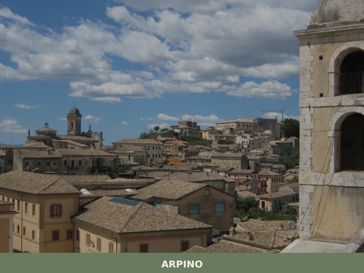
Arpino
What to see in Arpino, Lazio, Italy: polygonal walls, Cicero's birthplace, and Roman history 100 km from Rome. Discover the top attractions and how to get there.
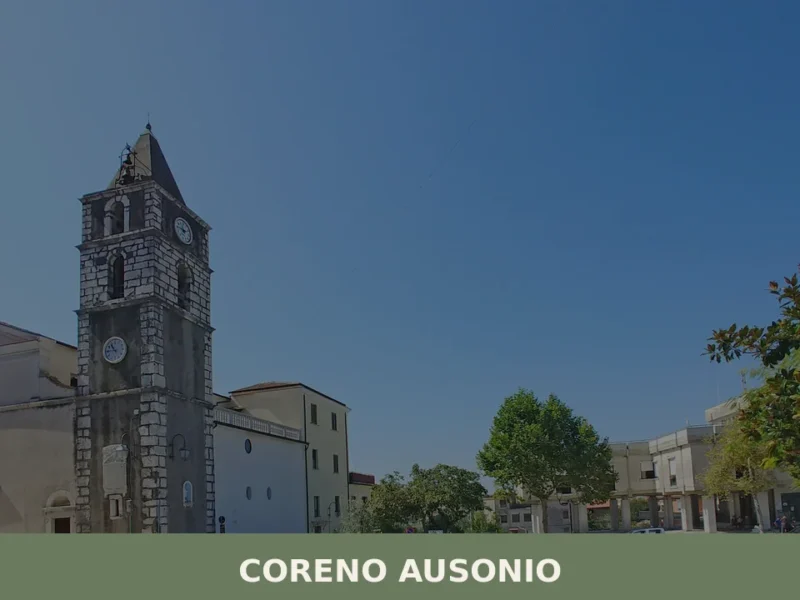
Coreno Ausonio
What to see in Coreno Ausonio, Italy: explore a village at 318 m with an 8th-century BC grotto, local festivals and hill scenery. Discover the complete guide.
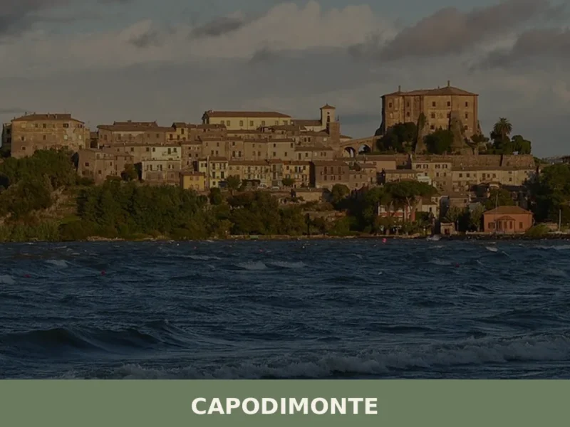
Capodimonte
What to see in Capodimonte, Italy: Discover this village of 1,667 inhabitants on Lake Bolsena's shore. Explore its unique headland and historic core. Read our guide!
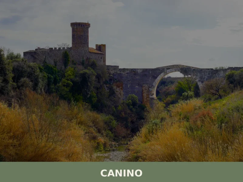
Canino
What to see in Canino: from historic monuments to traditional cuisine. Discover the main attractions and how to get to this village in Lazio.
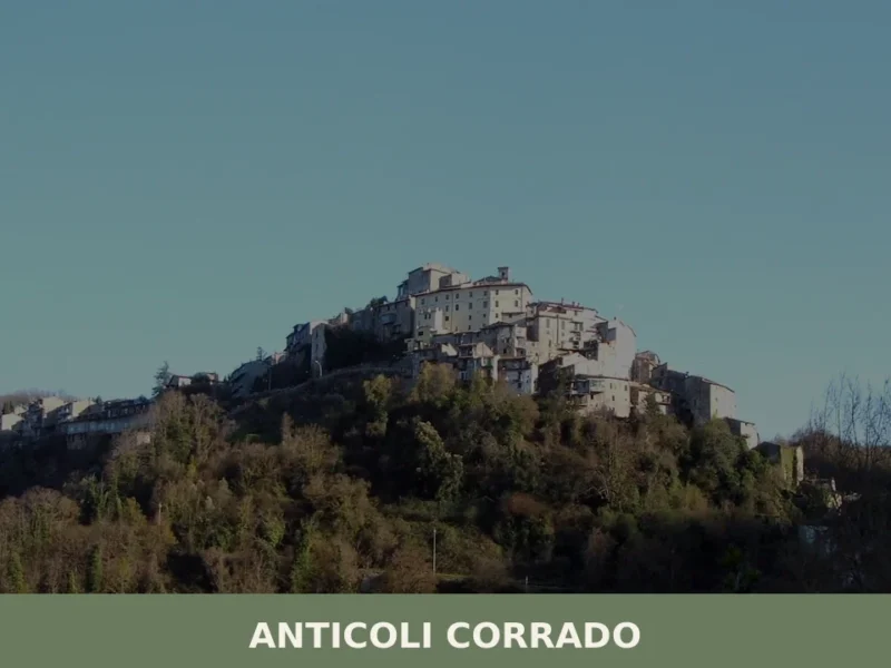
Anticoli Corrado
Stone walls rise in tight formation above the Aniene valley, 40 kilometres (25 mi) northeast of Rome, where a cluster of houses at 508 metres (1,667 ft) altitude holds the ruins of a medieval castle and an 11th-century church. The fountain in Piazza delle Ville was cast by Arturo Martini, a sculptor whose work now […]
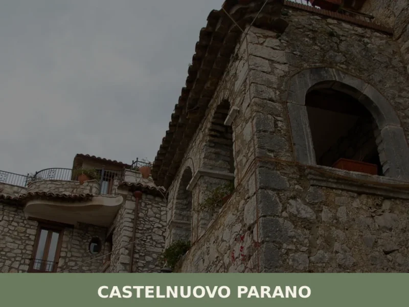
Castelnuovo Parano
What to see in Castelnuovo Parano, Lazio, Italy: a village of 885 at 310 m. Discover the 1059 castle origins, Gustav Line history and local hilltop culture.

Sutri
A village of 6,707 inhabitants built on a dramatic tufo ridge above the ancient Cassia road. Medieval churches, Roman monuments and Etruscan archaeology define its character.
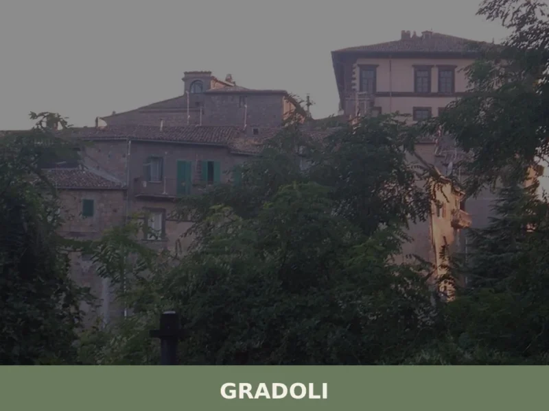
Gradoli
What to see in Gradoli, Italy: Discover the historic Farnese Palace and the Museum of Garments in this village at 470 m. Explore its medieval past and unique cultural events.


🏡 Know Arcinazzo Romano better than we do?
If you’re a local or have been there, your knowledge matters: add what’s missing or fix a detail on this page.