


Pietrapertosa
What to see in Pietrapertosa, Basilicata, Italy: from the Volo dell’Angelo zip line to Dolomiti Lucane rock formations. Discover top things to do. Read the guide.
Discover Pietrapertosa
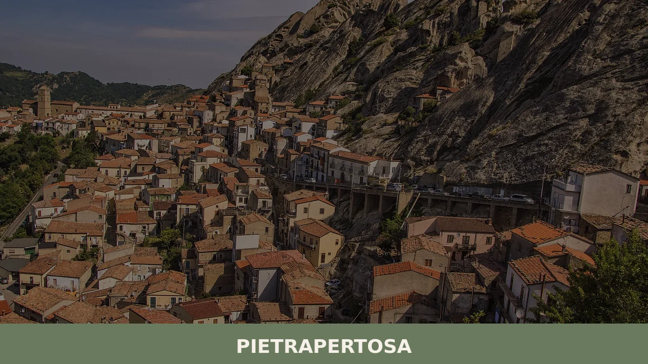
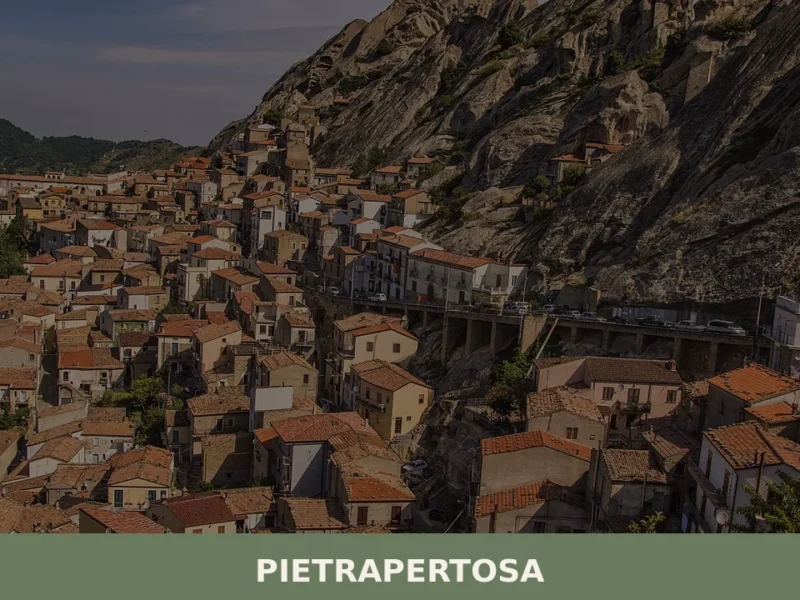
The rock face drops sharply from the base of the Saracen village, limestone ridges rising in vertical formations that geographers call the Dolomiti Lucane — Lucanian Dolomites — a concentrated cluster of eroded peaks in the province of Potenza. Stone houses follow the contours of the ridge so closely that walls and cliff face merge into a single surface, and the alleyways between them are carved more than built. In 2019, CNN placed this village among twenty of the most beautiful in all of Italy, a recognition that reflects the physical drama of its position rather than any manufactured appeal.
Deciding what to see in Pietrapertosa is easier than reaching it, but the effort is specific and rewarding.
The comune sits at over 1,000 m (3,280 ft) above sea level in Basilicata, southern Italy, and counts among the certified borghi più belli d’Italia — the most beautiful villages of Italy, an official Italian quality designation. Visitors to Pietrapertosa find a medieval urban fabric largely intact, the world-class Volo dell’Angelo zip line connecting it to the adjacent village of Castelmezzano, and a landscape that requires no embellishment to hold attention. This guide covers the key sites, the food, the practical logistics, and the best time to make the trip.
History of Pietrapertosa
The name itself encodes the place: pietra means stone, pertosa derives from the Latin pertusum, meaning pierced or perforated. The village grew around and into a limestone ridge so thoroughly riddled with caves and fissures that habitation and geology became inseparable early on. Archaeological evidence places human presence in the area well before the medieval period, with the cave formations providing natural shelter that pre-Roman populations exploited. The Saracen settlement that eventually gave its name to the upper quarter of the village — the Rione Saraceno — points to a period of Arab-Berber influence that left traces across this part of southern Italy during the ninth and tenth centuries.
The Norman conquest of southern Italy in the eleventh century brought the Pietrapertosa area into the orbit of the Kingdom of Sicily, and the fortified character of the settlement intensified under feudal organisation.
The castle ruins visible today on the highest point of the ridge correspond to this consolidation of defensive architecture. Throughout the medieval period, Pietrapertosa functioned as a strategic control point over the surrounding valleys, and its boundaries touched those of several neighbouring territories. The village of Albano di Lucania, which shares the same upland geography to the north-west, developed under similar feudal pressures during the same era, and the two communities exchanged agricultural and pastoral activities across the intervening ridges.
In more recent recorded history, Pietrapertosa gained national attention for a different reason. Lucia Lauria Vigna, who lived her entire life in the village, held the verified title of oldest person in Italy for almost two and a half years. Her longevity became a point of documented record rather than local legend, and the fact that she spent her life entirely within the village speaks to the self-contained character that Pietrapertosa maintained well into the twentieth century. The comune belongs to the province of Potenza and is bounded by eight other municipalities: Accettura, Albano di Lucania, Campomaggiore, Castelmezzano, Cirigliano, Corleto Perticara, Gorgoglione, and Laurenzana.
What to see in Pietrapertosa, Basilicata: top attractions
Volo dell’Angelo — Angel Flight Zip Line
Two steel cables stretch between the peaks of Pietrapertosa and Castelmezzano across a valley that drops several hundred metres below the launch platform.
The Volo dell’Angelo — Angel Flight — ranks among the longest and highest zip lines in the world, and it operates in both directions, allowing riders to return to their starting village on a parallel cable. Participants are suspended horizontally in a harness, face down, covering the distance between the two peaks at speeds that make the rock formations below readable as geological strata rather than abstract colour. Booking is required and the service operates seasonally; the summer months see the highest demand, so advance reservation is advisable for anyone visiting between June and September.
Rione Saraceno — the Saracen Quarter
The uppermost section of Pietrapertosa, known as the Rione Saraceno, sits directly against the limestone cliff and incorporates cave dwellings alongside stone-built structures in a fabric that has evolved over more than a thousand years. Walking through the quarter means moving between passages so narrow that sunlight reaches the ground only at midday, and the cliff above functions as both backdrop and structural support for some of the older buildings. The cave openings visible at height were used as storage and shelter before being partially sealed or integrated into later constructions.
Visiting in the morning, when the eastern face of the rock catches direct light, gives the best reading of the layered construction history.
The Norman Castle Ruins
At the highest accessible point of the village ridge, the remains of a Norman-era castle occupy a spur of rock that commands unobstructed sight lines across the Basento valley and the surrounding Dolomiti Lucane. The structure dates to the period of Norman consolidation in southern Italy, placing its original construction in the eleventh or twelfth century, and while the walls have lost much of their height, the foundation courses and partial towers remain identifiable. The climb to the ruins follows a path that rises steeply from the upper village lanes, gaining approximately 80 m (262 ft) of elevation over a short distance. Wear footwear with grip; the path is uneven and exposed in sections.
The Dolomiti Lucane Viewpoints
The rock formations surrounding Pietrapertosa are formally recognised as the Dolomiti Lucane, a range of eroded limestone and conglomerate peaks whose vertical faces and sharp ridges bear a visual resemblance to the Dolomites of northern Italy, though they formed through different geological processes. Several viewpoints within and immediately above the village offer direct sightlines onto the main formations, including the peak known as Aglio, which rises to approximately 1,088 m (3,569 ft). The late afternoon light sharpens the contrast between the pale rock and the forested flanks of the valleys, making that period the most useful for photography.
The viewpoints are accessible on foot from the village centre without specialist equipment.
The Church of Santa Maria Assunta
The parish church of Santa Maria Assunta stands in the lower section of the village and represents the primary religious building of the comune. Its architecture reflects successive interventions from the medieval period through the early modern era, with the current façade incorporating elements from different construction phases. The interior contains devotional objects and painted panels that have accumulated over several centuries of parish use. The church functions as the focal point for the village’s main religious calendar, including the feast of the patron, and remains open during morning and late afternoon hours on most days of the year. It is the logical starting point for any exploration of the lower village lanes.
Local food and typical products of Pietrapertosa
The food culture of the Potenza uplands developed under conditions of geographic isolation and limited agricultural land. Pietrapertosa sits at an altitude where grain cultivation was marginal and animal husbandry — sheep, goats, pigs — shaped the dietary base over centuries. The result is a cuisine built around preserved meats, legumes, foraged vegetables, and pasta forms that require no specialist equipment to produce. The culinary tradition here overlaps substantially with the broader Lucanian kitchen, itself one of the least altered regional food cultures in southern Italy, given the area’s historical distance from major trade routes.
Among the dishes most directly associated with this upland Basilicata territory, lagane e ceci — wide, flat pasta strips cooked with chickpeas, olive oil, and dried chilli — represents one of the oldest documented pasta forms in Italian culinary history, with Roman-era references to laganum as a flat dough.
Crapiata is a thick soup of mixed legumes and cereals — borlotti beans, lentils, wheat, and chickpeas — slow-cooked together and dressed only with raw olive oil; it originates in the Matera area but circulates throughout Basilicata’s interior. Pezzente sausage, made from the secondary cuts of pork with dried sweet and hot peppers, garlic, and fennel seeds, is air-cured for several weeks and eaten sliced or crumbled into cooked dishes. Sheep’s milk cheeses, pressed and salted by hand, accompany most meals and range from fresh cacioricotta to harder aged forms.
No certified DOP or IGP product is specifically registered to Pietrapertosa in the available sources, but the village falls within the broader production zones for several Basilicata-wide designations. The Potenza uplands contribute to the regional traditions around dried peppers and pork-based charcuterie, and local producers in the village and surrounding municipalities maintain small-scale production of preserved meats and cheeses sold at farm level.
Visitors should note that production quantities are limited and tied to seasonal slaughter and curing cycles, meaning availability of fresh charcuterie is highest in late autumn and winter.
The local markets and occasional food fairs during summer months provide the most direct access to these products. The sagra format — a traditional village food fair centred on a single ingredient or dish — appears during the warmer months across Basilicata’s upland comuni, and Pietrapertosa participates in this regional calendar, though specific dates vary annually and are confirmed locally each year.
Festivals, events and traditions of Pietrapertosa
The religious calendar of Pietrapertosa centres on the feast of Santa Maria Assunta, the Assumption of the Virgin Mary, celebrated on 15 August. This date aligns with the national public holiday of Ferragosto and draws back many former residents who have relocated to larger cities, giving the celebration a dual character: religious observance and community reunion.
The day includes a procession through the village lanes, with the statue of the Madonna carried from the church through the upper and lower quarters, accompanied by the local band and followed by evening fireworks visible from the valley below.
Beyond the August feast, the Volo dell’Angelo zip line generates its own seasonal calendar of events, with organised flying days and competitions that bring visitors from across the region during summer weekends. The surrounding Dolomiti Lucane territory also hosts trekking and outdoor events tied to the network of marked trails connecting Pietrapertosa and Castelmezzano, and these events are coordinated at a municipal and regional level, with dates published through local tourism channels each spring.
When to visit Pietrapertosa, Italy and how to get there
The best time to visit Pietrapertosa falls between late May and early October, when the Volo dell’Angelo operates, the mountain trails are clear of snow, and daylight hours are long enough to cover both the village and the surrounding landscape in a single day. July and August bring the most visitors and the hottest temperatures, though at over 1,000 m (3,280 ft) the heat is substantially moderated compared to coastal Basilicata. Spring and early autumn offer quieter conditions, good visibility, and the advantage of lower accommodation prices. Winter is technically accessible but the village becomes very quiet, some services close, and snow or ice on the approach roads can complicate travel for those without appropriate tyres.
Reaching Pietrapertosa requires a car for all practical purposes. The village has no direct rail connection; the nearest train stations are at Potenza Centrale, approximately 50 km (31 mi) to the west, and Salerno, roughly 130 km (81 mi) to the north-west, both served by Trenitalia.
From Potenza by road, the route follows the SS407 Basentana eastward before turning south on provincial roads toward the Dolomiti Lucane; allow around one hour. The nearest major airport with regular international connections is Bari Karol Wojtyła Airport, approximately 170 km (106 mi) to the east, with a driving time of around two hours under normal conditions. From Rome, Pietrapertosa is reachable in approximately three and a half to four hours by car via the A2 Autostrada del Mediterraneo, making it feasible as a destination within a southern Italy road trip rather than a day trip from the capital. If you arrive by car, note that parking is available at the lower entrance to the village and that the upper lanes are not accessible by vehicle. For international visitors, English is not widely spoken in smaller local shops, and carrying some euros in cash is useful as card payment infrastructure is limited in the village.
Where to stay near Pietrapertosa
Accommodation in Pietrapertosa itself is limited to small-scale options including agriturismi — farmhouses offering rooms and meals — and private holiday rentals available through national and international booking platforms. The adjacent village of Castelmezzano, connected by the zip line, offers a comparable range of small guesthouses and B&Bs. Visitors who prefer a wider choice of hotels and services can base themselves in Potenza, 50 km (31 mi) away, and drive into the Dolomiti Lucane for the day.
Booking any accommodation in the immediate area well in advance is strongly advisable for July and August, when demand consistently exceeds local supply.
Those extending their stay in the province of Potenza might consider the village of Chiaromonte, in the southern part of the province, which offers a different landscape and architectural character, or the village of Carbone, a smaller comune in the same upland zone that sees far fewer visitors and provides a useful contrast to the more organised tourism of the Dolomiti Lucane circuit. Both are reachable by car within 90 minutes of Pietrapertosa and can be incorporated into a multi-day itinerary through inland Basilicata.
Frequently asked questions about Pietrapertosa
What is the best time to visit Pietrapertosa?
The best time to visit Pietrapertosa is between late spring and early autumn, with June to September offering the most reliable weather at 1,088 m altitude. Summer is peak season for the Volo dell'Angelo zip line, which operates seasonally — book well in advance between June and September. Late afternoon visits reward photographers with sharp contrast on the Dolomiti Lucane rock faces. Winter brings snow and cold at this elevation, making access difficult. The village celebrates its patron saint James the Greater (San Giacomo il Maggiore) in late July, which adds a local festival dimension to a summer visit.
What are the historical origins of Pietrapertosa?
The name Pietrapertosa derives from the Latin pietra (stone) and pertusum (pierced), reflecting the cave-riddled limestone ridge on which the village developed. Human presence predates the Roman period, with natural caves providing early shelter. Arab-Berber influence during the ninth and tenth centuries shaped the upper Rione Saraceno quarter. Norman conquest in the eleventh century integrated the settlement into the Kingdom of Sicily, prompting construction of the castle ruins still visible today. The village functioned as a strategic control point over the surrounding Basento valley throughout the medieval period.
What to see in Pietrapertosa? Main monuments and landmarks
Key sites include: the Rione Saraceno, the ancient Saracen quarter carved directly into the cliff face with cave dwellings and narrow passages best visited in the morning light; the Norman Castle Ruins at the highest point of the ridge, reached via a steep 80 m climb requiring grip footwear; the Church of Santa Maria Assunta in the lower village, open during morning and late afternoon hours; and the Volo dell'Angelo zip line connecting Pietrapertosa to Castelmezzano, which requires advance booking and operates seasonally. The village holds official certification as one of the Borghi più Belli d'Italia.
What are the main natural or scenic attractions of Pietrapertosa?
Pietrapertosa sits within the Dolomiti Lucane, a cluster of eroded limestone and conglomerate peaks in the province of Potenza whose vertical faces visually resemble the Dolomites of northern Italy. The peak known as Aglio rises to approximately 1,088 m. The Volo dell'Angelo zip line traverses the valley between Pietrapertosa and Castelmezzano, dropping several hundred metres below the launch platform and offering an unmatched aerial perspective of the rock formations. The surrounding forested valleys and ridge paths are accessible on foot from the village without specialist equipment.
Where to take the best photos in Pietrapertosa?
The most rewarding photography spots in Pietrapertosa are the viewpoints above the village looking onto the main Dolomiti Lucane formations, particularly in late afternoon when low light sharpens the contrast between pale limestone and the forested valley flanks. The Rione Saraceno quarter, where stone walls and cliff face merge, offers striking architectural images best captured in morning light when the eastern rock face is directly lit. The Norman Castle ruins provide panoramic sightlines across the Basento valley. All these spots are reachable on foot from the village centre.
Are there museums, churches or historic buildings to visit in Pietrapertosa?
The Church of Santa Maria Assunta, located in the lower village, is the principal religious building and is open during morning and late afternoon hours on most days. Its interior contains devotional objects and painted panels accumulated over several centuries. The Rione Saraceno quarter preserves cave dwellings and stone structures dating back over a thousand years and is freely explorable on foot. The Norman Castle ruins at the top of the ridge represent the main historic fortification; the climb follows a steep path from the upper village lanes. No dedicated municipal museum is documented in available sources.
What can you do in Pietrapertosa? Activities and experiences
The signature activity is the Volo dell'Angelo zip line — one of the longest and highest in the world — connecting Pietrapertosa to Castelmezzano across a deep valley, operating in both directions at speeds that render the geological formations below clearly visible. Advance booking is essential in summer. Hiking through the Dolomiti Lucane landscape is accessible directly from the village, with viewpoints reachable without specialist equipment. Exploring the medieval Rione Saraceno on foot and climbing to the Norman Castle ruins are central experiences. Local food fairs during summer months offer access to traditional Lucanian charcuterie and cheeses.
Who is Pietrapertosa suitable for? Families, couples, hikers, solo travelers?
Pietrapertosa suits adventure-seekers and couples drawn by the Volo dell'Angelo zip line and dramatic Dolomiti Lucane scenery. Hikers will appreciate the ridge paths, viewpoints, and castle climb, though grip footwear is essential on uneven terrain. History and architecture enthusiasts will find the Rione Saraceno and Norman ruins compelling. Families should note that the village is small, the terrain steep, and access by winding mountain roads demanding. It is less suited to visitors seeking beach or lowland ease — the altitude and physical character of the place reward those who actively engage with its geography and medieval fabric.
What to eat in Pietrapertosa? Local products and specialties
The food tradition of Pietrapertosa reflects upland Basilicata's history of isolation and animal husbandry. Key dishes include lagane e ceci — wide flat pasta with chickpeas, olive oil, and dried chilli, one of Italy's oldest documented pasta forms — and crapiata, a slow-cooked soup of mixed legumes and cereals dressed with raw olive oil. Pezzente sausage, made from secondary pork cuts with dried peppers, garlic, and fennel seeds, is air-cured and eaten sliced or crumbled into cooked dishes. Sheep's milk cheeses, from fresh cacioricotta to aged forms, accompany most meals. Availability of fresh charcuterie is highest in late autumn and winter.
📷 Photo Gallery — Pietrapertosa
Nearby Villages near Pietrapertosa

In Basilicata More villages to discover
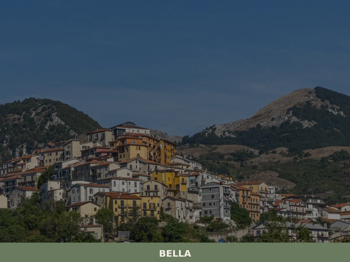
Bella
What to see in Bella, the Lucanian village of 4,516 inhabitants? Discover its must-see places and history. Plan your visit!

Lauria
Three river valleys, a Norman castle and the snow-capped Sirino massif give Lauria a territorial identity unlike any other town in southern Basilicata.
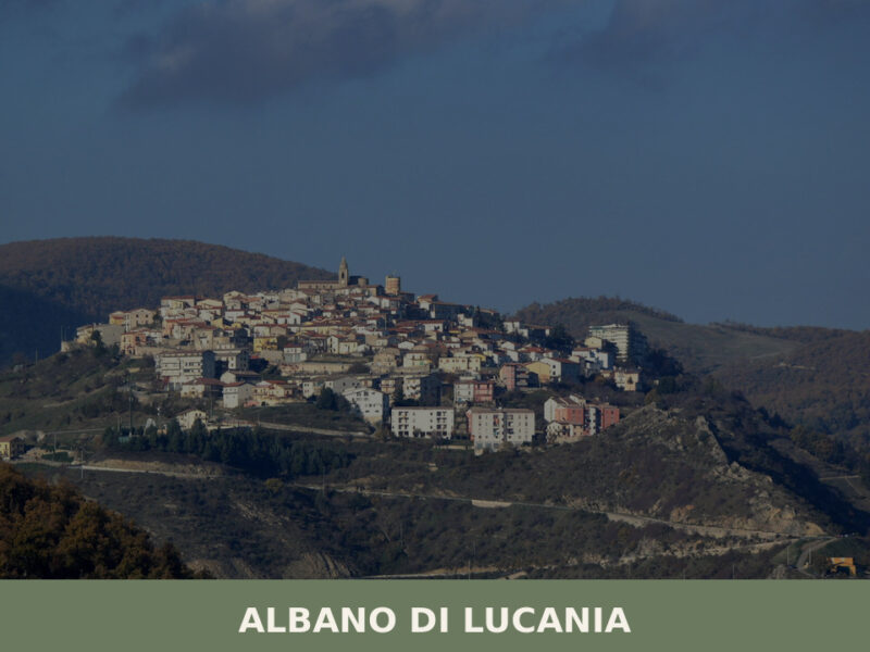
Albano di Lucania
A complete guide to Albano di Lucania in Basilicata — its medieval lanes, stone churches, Lucanian cuisine, and the quiet landscapes of the upper Basento valley.
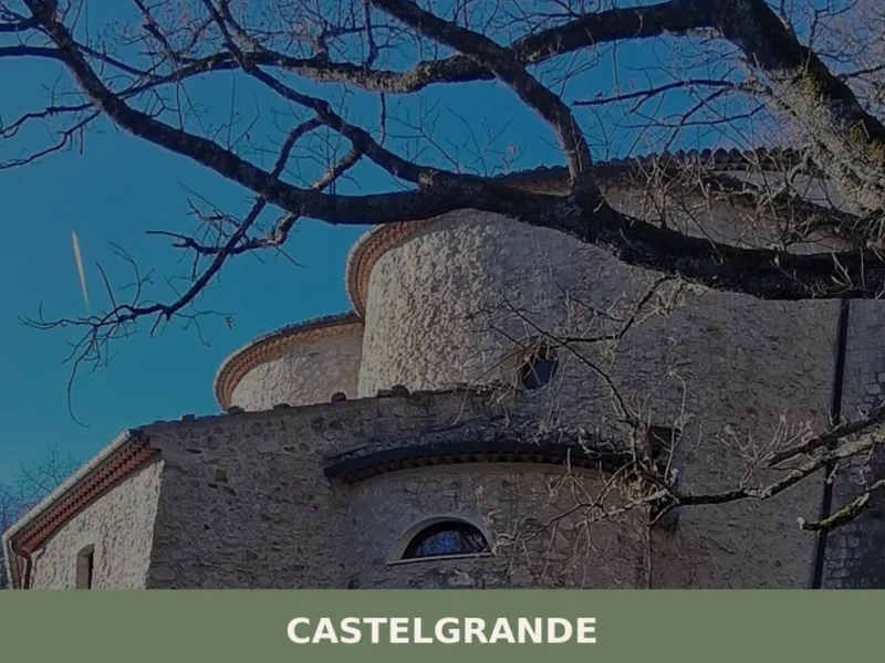
Castelgrande
Discover what to see in Castelgrande, a mountain village in Basilicata. From the Mother Church to the historic center, a journey through history and nature. Includes practical tips for your visit.
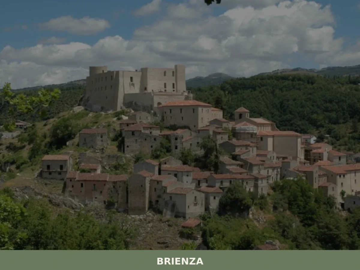
Brienza
What to see in Brienza? Explore 5 historic points of interest in this Basilicata village. Discover Caracciolo Castle and ancient churches. Plan your visit!
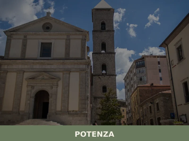
Potenza
What to see in Potenza: from the historic centre churches to Castello Tramontano. Complete guide with 5 attractions and practical tips for your visit.
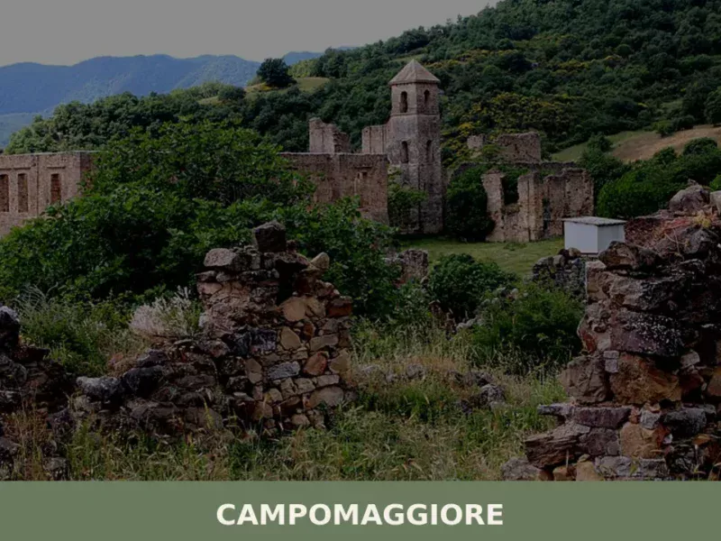
Campomaggiore
As the morning mist reluctantly peels back from the Lucanian Apennines, a faint scent of wild herbs drifts through the narrow lanes of Campomaggiore. At 795 meters above sea level, this small community, home to 832 inhabitants, begins its day with a quiet rhythm. Sunlight catches the weathered stone of an ancient wall, illuminating moss […]

Ferrandina
What to see in Ferrandina, Basilicata, Italy: 6 historic churches, olive oil production, and a hilltop at 482 m. Discover top attractions and how to get there.
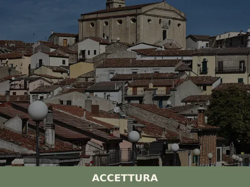
Accettura
Population 1,575. Altitude 770m. Accettura hosts the Gallipoli Cognato Piccole Dolomiti Lucane regional park and commands views across the Matera uplands.
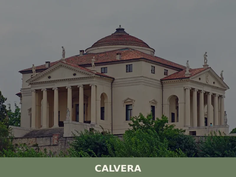
Calvera
At 630 meters above sea level, in the heart of the province of Potenza, lies Calvera, a small Lucanian municipality distinguished by its elevated position and authentic atmosphere. The village, with its stone houses clinging to the hillside, offers panoramic views of the surrounding valley, bearing witness to a history of mountain life and a […]


🏡 Know Pietrapertosa better than we do?
If you’re a local or have been there, your knowledge matters: add what’s missing or fix a detail on this page.