


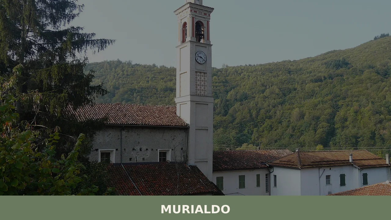
Murialdo
What to see in Murialdo, Liguria, Italy: 8 borgate, Monte Camulera, and local cuisine across 37.5 sq km. Discover top attractions, events, and how to get there.
Discover Murialdo
The valley floor at Riofreddo sits quiet in the early morning, the sound of water audible before the hamlet itself comes into view. Murialdo’s eight borgate — the Italian term for the subdivisions, villages and hamlets that compose a municipality — spread across 37.5 square kilometres (14.5 sq mi) of inland Ligurian terrain, each one occupying its own fold in the landscape between the Ligurian Apennines and the Province of Savona.
The elevation shifts noticeably between the valley settlements and the higher ground toward Monte Camulera, and that contrast defines how the territory feels to anyone moving through it on foot or by road.
Knowing what to see in Murialdo means understanding the territory first.
The municipality sits approximately 60 km (37 mi) west of Genoa and 25 km (16 mi) west of Savona, placing it within reach of both cities for a day trip. With a recorded population of around 851 inhabitants, the scale is intimate but the geography is substantial.
Visitors to Murialdo find a dispersed settlement pattern, a documented mountain reference point in Monte Camulera, an international twin-town relationship with Schweich in Germany established in 1994, and a food culture rooted in the agricultural and pastoral traditions of the Ligurian-Piedmontese border zone.
History of Murialdo
The name Murialdo carries traces of its linguistic layering across multiple regional traditions. In the Ligurian dialect it becomes Moriaodo, while the Piedmontese form is Muriaud — both variants reflecting the village’s position on a historical boundary between the Ligurian coastal cultural sphere and the Piedmontese interior. This linguistic duality is not merely philological curiosity.
It signals that Murialdo occupied a transitional zone for centuries, subject to competing administrative and cultural influences from both sides of the Apennine ridge. The settlement pattern, with its dispersed borgate rather than a single nucleated centre, is consistent with the land-use strategies common to communities managing both valley-floor agriculture and upland pasture.
The Province of Savona, within which Murialdo is recorded, has roots in the medieval Ligurian coastal lordships and their gradual extension inland.
Murialdo’s surrounding municipalities — Calizzano, Millesimo, Osiglia, Roccavignale, and others — form a cluster of small comuni that together define the character of the upper Bormida valley hinterland. Millesimo, the nearest larger centre, served historically as a market and administrative node for the scattered smaller settlements in the surrounding hills. The geography of Murialdo, bordering eight separate municipalities including Castelnuovo di Ceva and Priero to the north, positioned it as a passage point between the Ligurian and Cuneo-province networks, a role visible in its road connections today.
The formal twinning with Schweich, Germany, ratified in 1994, represents a modern chapter in Murialdo’s institutional identity.
Schweich is a municipality in the Trier-Saarburg district of Rhineland-Palatinate, and the partnership reflects a broader pattern of European municipal cooperation that connected many small Italian comuni to German counterparts during the 1990s.
By the demographic count of 31 December 2004, Murialdo recorded 882 residents — a figure that has settled to approximately 851 in more recent tallies, consistent with the gradual depopulation affecting many inland Ligurian municipalities as younger residents migrate toward coastal and urban centres. That demographic arc, from a mid-twentieth-century agricultural community to a lower-population settlement with a strong landscape identity, defines the context in which the village presents itself to visitors today.
What to see in Murialdo, Liguria: top attractions
Monte Camulera
Monte Camulera is the principal topographic reference point associated with the municipality, and the ascent from the valley settlements gains enough elevation to open views across multiple provincial boundaries. The mountain stands as the defining natural feature linking Murialdo to the wider Ligurian Apennine ridge, and on clear days the orientation from the summit allows walkers to distinguish the drainage systems running toward the Ligurian coast from those descending into the Piedmontese plain.
The approach from the borgata of Piani is the most direct route, following tracks used historically by shepherds moving stock between seasonal pastures.
Late spring and early autumn offer the most reliable visibility, with the summer heat haze reducing long-distance clarity at midday.
The Eight Borgate of Murialdo
The full settlement structure of Murialdo comprises eight officially recognised borgate: Piani, Piavata, Piano, Ponte, Bonetti, Valle, Isolagrande, and Riofreddo. Each has a distinct character determined by its position in the terrain — Ponte sits near a river crossing point, Riofreddo references cold water in its name, and Isolagrande suggests a larger isolated landholding. Moving between them on foot or by car reveals how the municipality functions as a constellation of small communities rather than a single village core.
The distances between borgate are modest by map measurement but feel longer given the changes in gradient; a circuit taking in Valle, Bonetti, and Piano covers roughly 8 to 10 km (5 to 6.2 mi) of mixed terrain depending on the route chosen.
The Landscape of the Municipal Borders
Murialdo borders eight separate municipalities: Calizzano, Castelnuovo di Ceva, Massimino, Millesimo, Osiglia, Perlo, Priero, and Roccavignale. Walking or driving the perimeter of the comune brings the visitor into contact with sharply varying terrain — the Osiglia border runs near the artificial lake of the same name, one of the largest reservoirs in Liguria, created by a dam on the Bormida di Pallare river.
The boundary with Calizzano to the south-west crosses higher ground associated with the Ligurian Apennine watershed. For those interested in the regional geography rather than a single destination, Murialdo’s position at the intersection of eight municipal territories makes it a useful base for exploring the wider Savona hinterland. The road network connecting these comuni is serviceable year-round but can be slow given the switchback gradients.
The Ponte Borgata and Valley Floor
The borgata of Ponte occupies the lowest-lying section of the municipality, where a crossing structure gives the settlement its name.
Valley-floor borgate in this part of Liguria typically developed around water management and road junctions, and Ponte fits that pattern — its position made it a natural stopping point on routes connecting the coastal province to the Piedmontese interior. The surrounding land along the valley floor retains a different texture from the upper settlements: wider, more open, with cultivated plots replacing the dense woodland cover that dominates the slopes above 600 m (1,969 ft). It is worth arriving here in the morning when the light enters the valley directly, before the surrounding ridges cast shadow over the lower ground.
Isolagrande
Of the eight borgate, Isolagrande carries the most evocative toponym.
The name — literally “large island” — suggests a landform historically perceived as distinct from the surrounding terrain, possibly a flat-topped rise surrounded by wetter or differently vegetated ground. The settlement here is among the smaller nodes in the municipal constellation, but its name preserves a record of how the medieval and early modern inhabitants read and labelled their landscape.
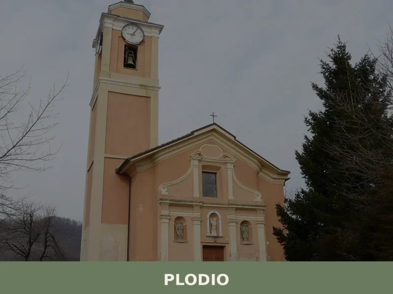
The approach road from the main municipal axis is narrow, typical of secondary access tracks in this part of the Savona province. Visitors arriving by car should expect single-lane sections requiring passing places; the track is manageable in a standard vehicle outside winter snowfall periods. Plodio, a nearby village in the Province of Savona, shares this pattern of dispersed small settlements across similarly rugged terrain, and makes a natural complement to an itinerary through this part of inland Liguria.
Local food and typical products of Murialdo
The food culture of Murialdo belongs to the inland Ligurian tradition, which diverges considerably from the coast-facing cuisine of Savona or Genoa. At this altitude and distance from the sea, the larder historically relied on wheat, chestnut flour, field vegetables, freshwater resources, and animal husbandry rather than on fish and seafood. The Piedmontese influence — audible in the dialect and visible in the place names — extends into the kitchen, where preparations using polenta, braised meats, and preserved pork products reflect the agricultural economy of the upland border zone rather than the olive-oil-and-basil register of Ligurian coastal cooking.
Both traditions are present, and the local table typically blends elements from both.
Among the preparations associated with this zone of the Savona hinterland, cima alla genovese represents the Ligurian contribution — a poached veal breast stuffed with a mixture of offal, vegetables, eggs, and cheese, then sliced cold.
The technique requires patient, long cooking and uses the whole animal in a way consistent with upland farming economies. Pansoti, a pasta format filled with a mixture of foraged wild herbs and fresh cheese, is the vegetable-forward counterpart — the filling depends on what the hillside provides seasonally, typically borage, chard, and other greens bound with prescinsêua, a slightly sour curd cheese specific to Liguria.
On the Piedmontese side of the culinary border, polenta with braised rabbit or slow-cooked pork ribs appears regularly in the cooler months, using chestnut flour as a partial substitute for maize in some households.
Chestnuts deserve separate attention. The wooded slopes around Murialdo and its neighbouring municipalities historically supported chestnut cultivation as a dietary staple. Dried, milled into flour, roasted, or preserved in syrup, the chestnut underpins a range of local preparations from castagnaccio — a flat, dense cake made with chestnut flour, rosemary, and pine nuts — to simple roasted chestnuts sold at autumn markets.
The harvest period, from late September through November, coincides with the most active season for local food events in the Province of Savona. No certified designation of origin product has been recorded in the available sources specifically attributed to Murialdo’s municipal territory, but the chestnut and the pastoral dairy products associated with the surrounding area remain the most documented local food resources.
Local markets and autumn food events in the broader Savona hinterland tend to concentrate in October and November, when the chestnut harvest drives a seasonal circuit of sagre — traditional local food festivals — across the inland comuni.
Millesimo, the nearest market town at approximately 5 km (3.1 mi) from Murialdo, hosts periodic markets where producers from the surrounding municipalities bring local cheeses, cured meats, and seasonal produce. Visitors planning a food-focused trip should time their arrival for this autumn window, when both the harvest activity and the cooler temperatures make the inland villages more accessible and the food supply more varied.
Festivals, events and traditions of Murialdo
The available verified sources do not document a specific patron saint festival date or named recurring event unique to Murialdo.
What the territory’s structure does confirm is a pattern consistent with other inland Ligurian comuni of comparable size: religious observance centred on the parish church calendar, communal events linked to the agricultural cycle, and the kind of seasonal gathering — at harvest, at the end of summer pasture, at the approach of winter — that structures rural calendar life in the Province of Savona.
The dispersed borgata structure means that celebrations tend to be localised rather than concentrated in a single central square; each hamlet maintains its own small-scale ritual calendar alongside any municipality-wide observances.
The twin-town relationship with Schweich, Germany, formalised in 1994, generates a documented framework for periodic exchange events, though the specific scheduling of these exchanges is not recorded in the available sources. Cultural exchanges under municipal twinning agreements in Italian comuni of this size typically involve delegations traveling in both directions in alternate years, with visits timed to coincide with either the German partner’s local festival or the Italian comune’s own patron saint celebrations.
For precise dates of current events, the municipal administration of Murialdo is the most reliable point of contact. Visitors arriving in summer will find the period from late June through August the most active for outdoor communal life across the inland Ligurian comuni.
When to visit Murialdo, Italy and how to get there
The best time to visit Murialdo depends on what draws you to the inland Ligurian hills.
Late spring — from mid-May through June — combines mild temperatures, green hillside cover, and accessible mountain tracks without the heat that settles into the valleys by July. This window is the most practical for walking between the borgate and for attempting the Monte Camulera ascent. Autumn, from late September through early November, brings the chestnut harvest and the food market circuit across the Province of Savona, making it the preferred season for visitors with a gastronomic focus.
Winter brings snow at higher elevations and occasional road closures on the narrower secondary tracks connecting the outlying borgate; a standard car with winter tyres handles the main municipal roads, but the minor tracks to Isolagrande and Riofreddo require more caution. For international visitors arriving from outside Italy, carrying euro cash is advisable, as smaller local establishments in inland comuni of this size do not always accept cards, and English is not widely spoken in shops and bars.
Murialdo sits approximately 60 km (37 mi) west of Genoa and 25 km (16 mi) west of Savona, making both cities realistic departure points for a day trip. From Genoa, the A26 motorway toward Alessandria connects to the A6 Torino-Savona axis; the exit for Millesimo places the driver approximately 5 km (3.1 mi) from Murialdo along the SS28 and local roads. Journey time from Genoa by car runs to approximately 50 to 70 minutes depending on traffic on the coastal stretch.
From Savona the drive is shorter, roughly 30 to 40 minutes via the A6 and the Millesimo exit.
The nearest Trenitalia station with reasonable service frequency is Millesimo, served by regional trains on the Savona-Turin line; from Millesimo a taxi or local bus connection covers the remaining distance to the municipal territory. The nearest international airport is Genoa Cristoforo Colombo Airport, approximately 70 km (43.5 mi) from Murialdo, with transfer time by car of around 60 to 75 minutes. For those arriving from further afield, Turin Airport lies approximately 120 km (74.6 mi) to the north and connects via the A6 motorway directly toward Savona.
Visitors combining Murialdo with a broader itinerary through inland Liguria can extend the route to include Fontanigorda, a village in the Genoa Apennines that shares the same pattern of small-scale mountain settlement and dispersed borgata structure, or move east toward Mezzanego in the Val Graveglia, which occupies a comparable position in the inland Ligurian hill system.
Both add geographic variety without requiring a return to the coast between stops.
If you arrive by car and plan to walk between borgate, park at Ponte or Piano, where the valley floor gives the most direct access to the wider municipal network on foot.
Those travelling specifically along the Savona hinterland can also consider a stop at Maissana, a small commune in the Spezia province that represents the eastern counterpart of this inland Ligurian typology — a dispersed municipality across forested hill terrain with a similarly modest population and a food culture rooted in chestnut and pastoral agriculture.
Frequently asked questions about Murialdo
What is the best time to visit Murialdo?
Late spring (May–June) and early autumn (September–October) offer the best conditions for visiting Murialdo. Trails toward Monte Camulera are clear, temperatures at 524 m are mild, and visibility from higher ground is at its sharpest before summer haze sets in. The most important local event is the feast of the patron saint San Lorenzo on 10 August, which draws the community together and offers a direct window into village traditions. Summer midday heat reduces long-distance views from the summit, making morning starts advisable for walkers in July and August.
What are the historical origins of Murialdo?
Murialdo's origins reflect its position on the historical boundary between the Ligurian coastal sphere and the Piedmontese interior. The village's name appears in both Ligurian dialect (Moriaodo) and Piedmontese (Muriaud), signalling centuries of dual cultural and administrative influence from across the Apennine ridge. Its dispersed pattern of eight borgate — rather than a single nucleated centre — is consistent with upland communities managing both valley-floor agriculture and seasonal pasture. The nearest larger centre, Millesimo, historically served as the market and administrative hub for the surrounding smaller settlements.
What to see in Murialdo? Main monuments and landmarks
The key landmarks of Murialdo are its eight officially recognised borgate — Piani, Piavata, Piano, Ponte, Bonetti, Valle, Isolagrande, and Riofreddo — each with a distinct character shaped by its terrain. Monte Camulera is the principal natural reference point, accessible from the borgata of Piani. The valley-floor settlement of Ponte, built around a historic river crossing, and the evocatively named Isolagrande — meaning 'large island' — are the most distinctive individual nodes. The municipality borders Lago di Osiglia, one of Liguria's largest reservoirs, reachable along the boundary with Osiglia.
What are the main natural or scenic attractions of Murialdo?
Monte Camulera is the defining natural feature, with summit views spanning both the Ligurian coastal drainage and the Piedmontese plain on clear days. The approach from the borgata of Piani follows historical shepherd tracks. Along the municipal border with Osiglia lies the artificial Lago di Osiglia, one of Liguria's largest reservoirs, formed by a dam on the Bormida di Pallare river. The boundary with Calizzano crosses the Ligurian Apennine watershed at higher elevations. Late spring and early autumn give the most reliable visibility and comfortable walking conditions across the territory.
Where to take the best photos in Murialdo?
The summit area of Monte Camulera offers the widest panoramic views, with clear orientations toward both the Ligurian coast and the Piedmontese plain — best photographed in morning light before midday haze develops in summer. The valley floor at the borgata of Riofreddo is most atmospheric at dawn, when the sound of water precedes the hamlet coming into view. The borgata of Ponte rewards photography in the morning hours before the surrounding ridges cast shadow over the lower ground. Autumn colour on the chestnut-covered slopes surrounding the borgate provides strong seasonal foreground interest.
What can you do in Murialdo? Activities and experiences
Walking is the primary activity in Murialdo. A circuit taking in the borgate of Valle, Bonetti, and Piano covers roughly 8–10 km of mixed terrain. The ascent to Monte Camulera from Piani follows former shepherd tracks and is suitable for walkers with basic hill experience. Driving or walking the municipal perimeter brings visitors into contact with eight neighbouring comuni and the landscape of the upper Bormida valley. The feast of San Lorenzo on 10 August provides a direct experience of local village life. Exploring the food traditions of the inland Ligurian–Piedmontese border zone — chestnuts, pansoti, cima alla genovese — adds a culinary dimension to any visit.
Who is Murialdo suitable for?
Murialdo suits walkers and hikers who prefer quiet Apennine terrain over crowded coastal destinations. The dispersed borgata structure and the Monte Camulera ascent appeal to those interested in slow, landscape-driven travel. Couples and independent travellers looking for an authentic inland Ligurian experience away from tourist infrastructure will find the village rewarding. Food-curious visitors drawn to the Ligurian–Piedmontese culinary border zone have strong reason to visit. Families with older children can manage the valley-floor circuits comfortably; the mountain ascent requires reasonable fitness. The village is not suited to those seeking beaches, nightlife, or urban amenities.
What to eat in Murialdo? Local products and specialties
Murialdo's food culture belongs to the inland Ligurian tradition blended with Piedmontese influences. Key dishes include pansoti — pasta filled with foraged wild herbs and prescinsêua curd cheese — and cima alla genovese, a cold poached stuffed veal breast. In cooler months, polenta with braised rabbit or slow-cooked pork ribs reflects the Piedmontese side of the culinary border. Chestnuts from the surrounding wooded slopes are a historical staple, appearing as castagnaccio, chestnut flour preparations, and roasted or preserved forms. Prescinsêua, the slightly sour Ligurian curd cheese, is specific to this regional tradition and integral to several local recipes.
📷 Photo Gallery — Murialdo
Nearby Villages near Murialdo
In Liguria More villages to discover
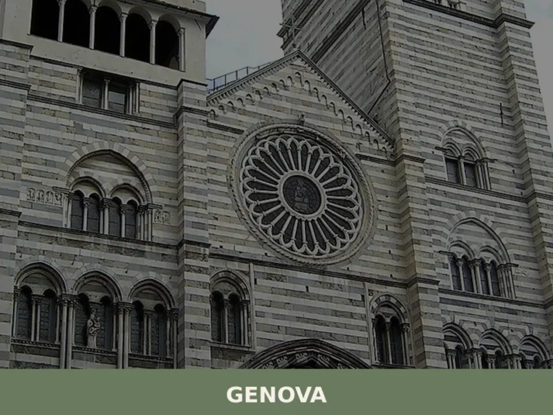
Genova
What to see in Genova: city at 18 m above sea level with UNESCO Rolli palaces and Europe's largest aquarium. Plan your visit with our full guide.
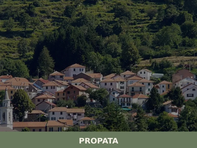
Propata
What to see in Propata, Italy: Discover the parish church and its Maragliano statue in this Ligurian village of 156 inhabitants. Explore its history.
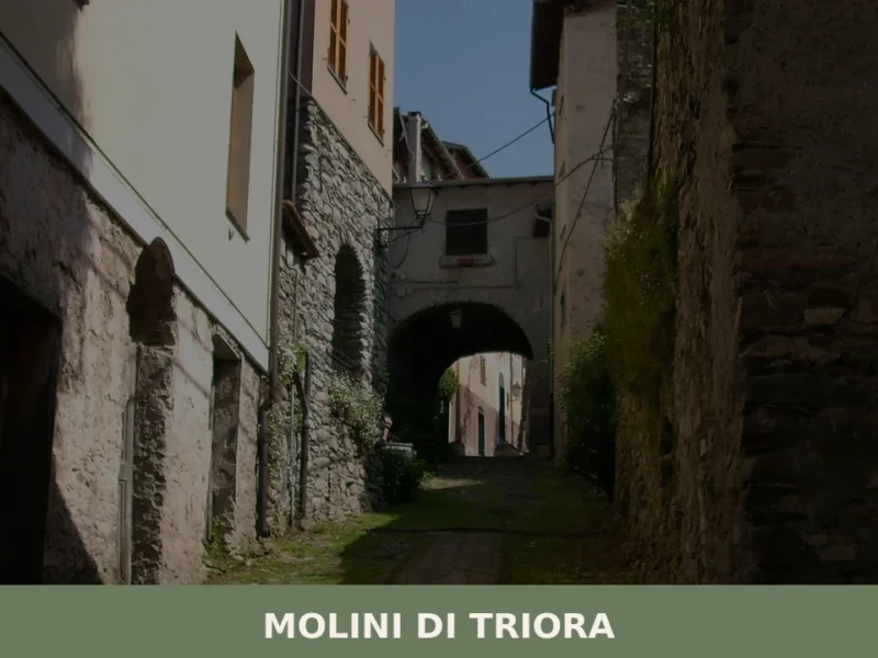
Molini di Triora
What to see in Molini di Triora, Italy: a village at 460 m in Liguria. Discover top attractions, local food, festivals and how to get there. Read the guide.
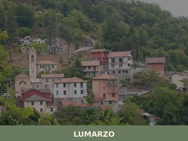
Lumarzo
What to see in Lumarzo: a Ligurian village at 228m with 1,419 residents, historic oratories, Fontanabuona valley trails and the Saint Camillus feast. Plan your visit now.
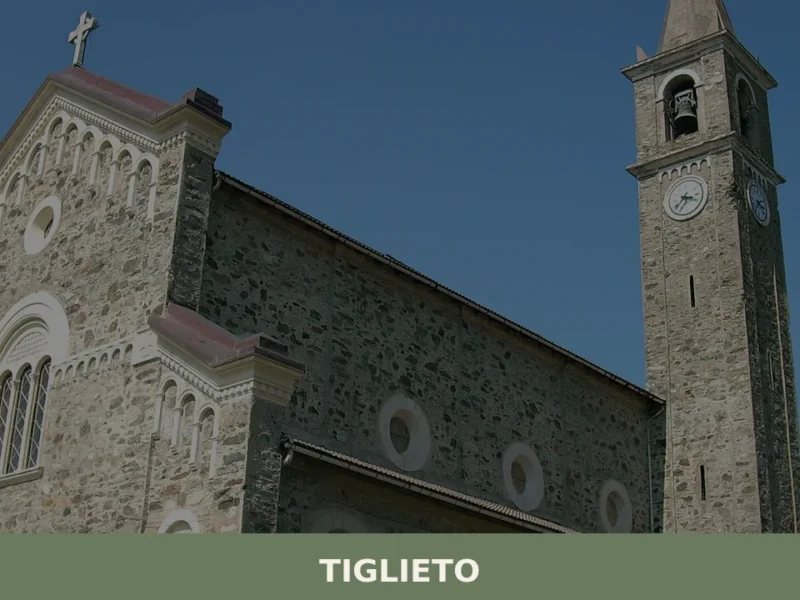
Tiglieto
what to see in tiglieto: Explore Tiglieto, Italy, located 52 km (32 mi) from Genoa. Discover the historic Abbey and the Beigua Regional Park.
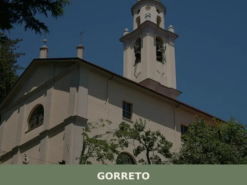
Gorreto
Gorreto: Complete Editorial Guide The stone bridge over the Trebbia, with its centuries-old arches, marks the entrance to Gorreto, a village that reveals itself with the discretion of a place that has watched the passage of people and goods for centuries. At 533 metres above sea level, in the province of Genova, this settlement of […]
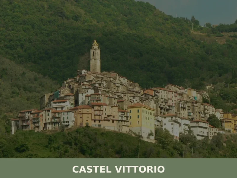
Castel Vittorio: Liguria’s Enduring Stone Village
What to see in Castel Vittorio, Liguria, Italy: at 420 m altitude, 261 inhabitants, parish art by Venusti & Maragliano. Discover top attractions & travel tips.
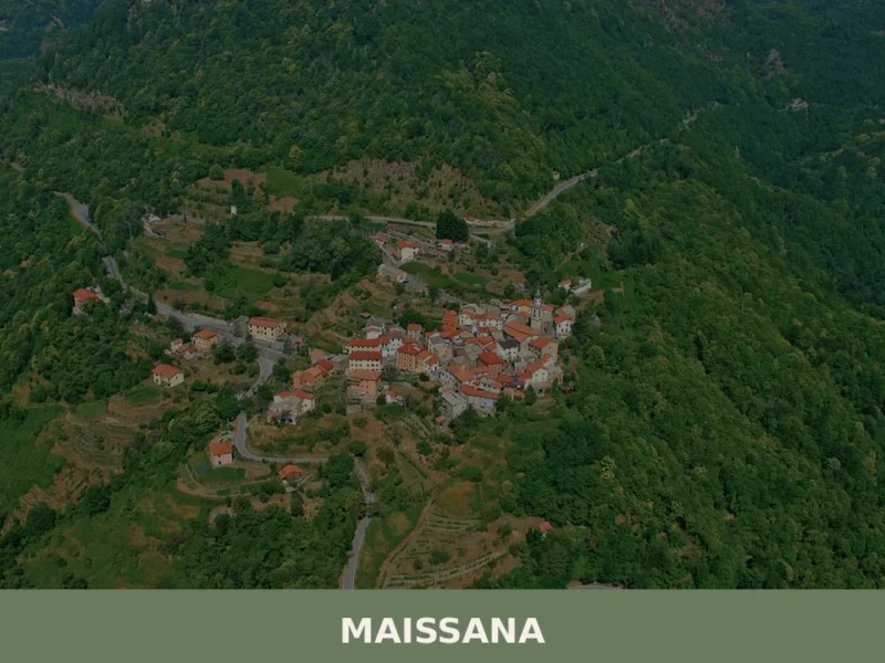
Maissana
What to see in Maissana, Italy: 644 inhabitants, 50 km from Genoa. Discover top attractions, local food, festivals and how to get there. Explore now.
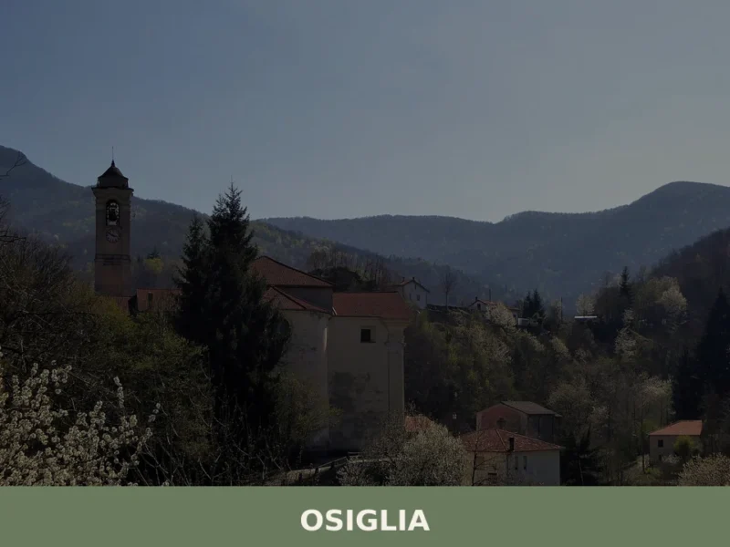
Osiglia
What to see in Osiglia, Italy? Explore this Ligurian comune of 458 inhabitants, 25 km (16 mi) from Savona. Discover its mountainous surroundings and tranquil environment.
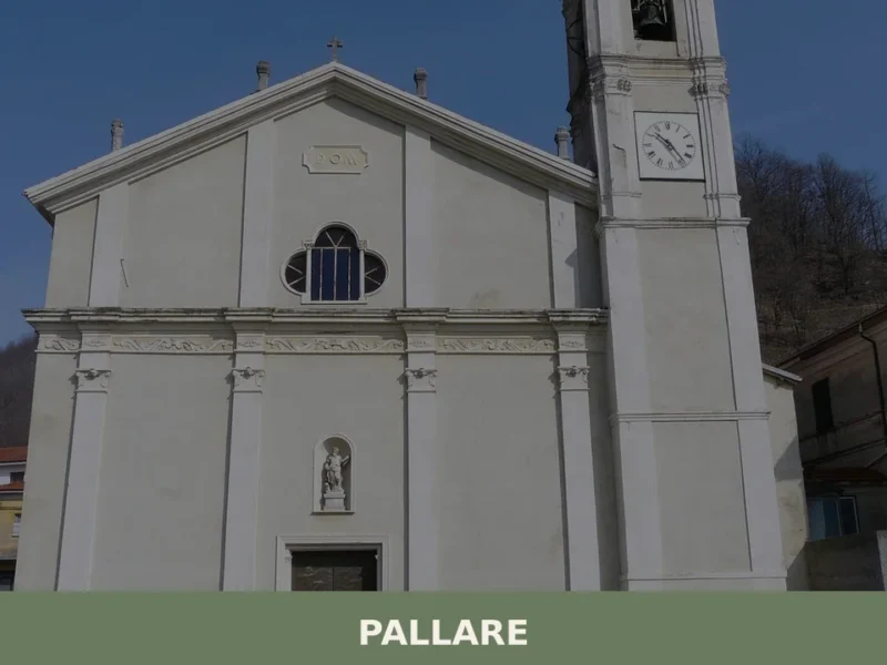
Pallare
what to see in pallare: Explore this Ligurian comune, 15 km from Savona, Italy. Discover its geographical context and accessibility. Read our guide.


🏡 Know Murialdo better than we do?
If you’re a local or have been there, your knowledge matters: add what’s missing or fix a detail on this page.