


Amandola
What to see in Amandola: 5 attractions in this Marche village, from the historic centre to the Sibillini Mountains. Discover the complete guide and plan your visit.
Discover Amandola
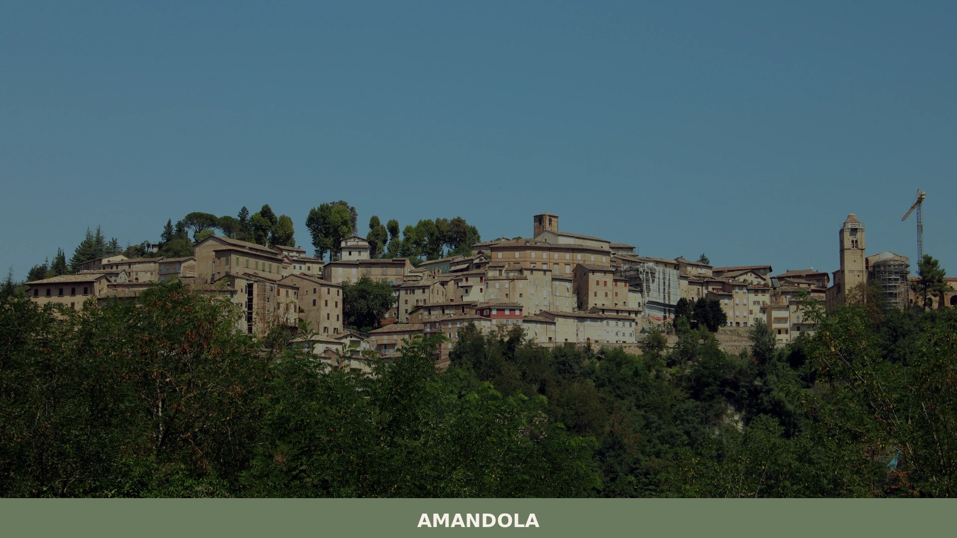
Three medieval castles merged into a single walled settlement in 1248, and the stone record of that union is still legible in the street plan today. The walls of Amandola follow the ridges of a hill rising above the Tenna valley, and on clear mornings the profile of the Monti Sibillini fills the western skyline from end to end.
The 2016 earthquake that struck central Italy left marks here too — some buildings still show the bracing and reinforcement work that followed the event on 24 August of that year.
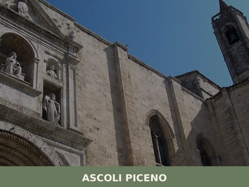
Deciding what to see in Amandola is easier with a basic orientation: the town stands about 70 km (43 mi) south of Ancona and about 25 km (16 mi) northwest of Ascoli Piceno, in the Province of Fermo, Marche, Italy.
Visitors to Amandola find a compact historic centre, a position inside one of Italy’s largest national parks, access to mountain routes, and a local food tradition rooted in the upland agriculture of the Sibillini foothills. The Amandola highlights include medieval ecclesiastical architecture, a documented founding history, and the natural infrastructure of the park that surrounds it.
History of Amandola
The municipality came into existence on a precise date: 1248, when the three hilltop castles of Agello, Leone and Marrubbione were formally united to create a single comune libero, a free municipality with its own governing statutes.
This was not an organic process of gradual urban growth but a deliberate political act, the kind of consolidation that characterised much of central Italian communal life in the mid-thirteenth century. The three original settlements each occupied a separate rise in the terrain, and the town plan that emerged from their union retained the irregular geometry of three distinct nuclei joined by a shared enclosure wall.
The name Amandola itself appears in documented records from the medieval period, and the town’s administrative identity as a comune has remained unbroken since its foundation.
Through the following centuries, Amandola functioned as a market and ecclesiastical centre for the surrounding upland communities, drawing the agricultural population of the Tenna and Aso valleys into its orbit.
The town’s position — elevated enough to be defensible, low enough to be accessible from multiple valley approaches — made it the natural administrative hub for this stretch of the Sibillini foothills. Other villages in the broader Marche region share a similar pattern of medieval consolidation; the fortified town of Fermo, the provincial capital roughly 35 km (22 mi) to the east, grew through comparable processes of territorial authority in the same period.
The earthquake of 24 August 2016, centred near Amatrice in the Apennines, caused structural damage across a wide arc of central Italy that included Amandola. The event was a reminder of the seismic character of this part of the peninsula, where the Apennine chain concentrates both geological stress and some of the country’s oldest continuously inhabited settlements.
Restoration and consolidation work has continued in the years since, and the town’s historic fabric — its churches, civic buildings and residential blocks — reflects both the original medieval construction and the interventions required after the earthquake.
What to see in Amandola, Marche: top attractions
Monti Sibillini National Park access point
Amandola is one of 18 municipalities that lie within the boundaries of the Monti Sibillini National Park, a protected area covering the central Apennine range along the border between Marche and Umbria.
The park’s terrain rises well above 2,000 m (6,562 ft) at its highest ridges, and the trails accessible from the Amandola side include routes into the valleys and upland plateaux on the eastern flank of the massif. The town serves as a practical base for day walks: paths lead west from the built-up area directly into the park territory, with elevation gain starting from the town’s own altitude in the hill zone.
Spring and early summer, when snow has retreated from the lower paths, offer the most reliable walking conditions.
Historic centre and medieval street plan
The layout of the old town reflects the 1248 union of three separate castle settlements, and a walk through the upper streets makes the original triple-nucleus structure physically apparent. The main axes follow the ridges that each of the three original castles — Agello, Leone and Marrubbione — occupied independently before the consolidation. Stone buildings along the central corso preserve the proportions and materials of medieval and early modern construction, with facades in the pale limestone typical of the Sibillini foothills.
The earthquake damage of 2016 is visible in patches: some buildings carry steel tie rods and fresh render where masonry was stabilised, giving the streetscape a layered quality that documents both the original construction and the recent intervention.
Churches of the historic centre
Several churches are distributed across the historic centre, each occupying a position that corresponds to one of the three original settlement nuclei absorbed into the comune in 1248.
The façades range from Romanesque stonework to later baroque interventions, and the interiors preserve devotional art accumulated over several centuries of continuous use. Portal carvings and decorative stonework on the exterior walls reward close attention — the detailing varies considerably from one building to the next, reflecting different construction campaigns and different workshops. Visiting in the morning, when natural light enters from the east-facing windows, gives the clearest view of interior details.
Views over the Tenna valley and the Sibillini skyline
From the upper terraces of the historic centre, the ground drops sharply to the west and south, opening a direct sightline across the Tenna valley floor to the Sibillini ridge. On days without atmospheric haze — most common in autumn and in the period after spring rainfall — the mountain profile extends across the full western horizon, with individual peaks distinguishable above the foothills. The elevation of the town itself, set on the Sibillini foothills at several hundred metres above sea level, means that the panoramic views from the perimeter walls and elevated piazzas are substantial without requiring any additional climb.
The best light for photography falls in the late afternoon, when the sun is behind the viewer and the mountains are fully illuminated.
The town’s position within the 18-municipality park network
Amandola’s status as one of exactly 18 Italian municipalities inside the Monti Sibillini National Park places it within a defined network of communities that together manage the human-inhabited portions of the protected area.
This designation has practical consequences for the visitor: the park authority organises information services and trail maintenance that extend into the town’s territory, and the boundaries of protected land begin at the edge of the built area. Exploring what to see in Amandola therefore includes engaging with the park infrastructure — visitor information, marked routes, regulations on access to specific zones — which are coordinated through the park authority.
Travelling between the park-member municipalities is straightforward by car, and a circuit taking in several of them, including a stop at the related hill settlement of Borgo Pace further north in Marche, gives a broader picture of the region’s upland geography.
Local food and typical products of Amandola
The food tradition of the Amandola area is shaped by the upland agricultural economy of the Sibillini foothills. The terrain at this altitude favours livestock grazing, cereal cultivation on the valley floors, and the foraging of fungi, truffles and wild herbs on the wooded slopes above the town.
These are not marginal products: they define the character of local cooking, which tends toward robust preparations that reflect the caloric demands of mountain farm work rather than the lighter traditions of the Adriatic coast 35 km (22 mi) to the east.
The most representative dishes of the local table draw on sheep and lamb reared on the Sibillini grasslands, combined with legumes — particularly lentils and chickpeas — that have been cultivated in this part of Marche since at least the medieval period.
Vincisgrassi, the layered pasta bake that is one of Marche’s most documented regional dishes, appears on tables here in versions that include game offal and black truffle rather than the gentler preparations more common near the coast. Maccheroni al torchio, a thick extruded pasta made from durum wheat, is dressed with meat ragù or with a sauce based on local sausage and tomato.
Sheep’s milk cheese, produced from flocks that graze the park territory, is eaten both fresh and aged, and appears in both savoury preparations and the region’s sweetened pastry tradition.
The truffle is the product most closely associated with the Sibillini area as a whole. Both the black truffle (Tuber melanosporum) and the summer truffle (Tuber aestivum) are harvested in the wooded zones around Amandola and the surrounding comuni. The product is not registered under a single dedicated certification specific to Amandola, but truffle from the Sibillini foothills is traded through the town and used in local restaurants throughout the autumn season.
Lamb and pork products — including locally produced salumi, cured meats — are standard items in the markets and small shops of the historic centre.
The market activity in Amandola concentrates in autumn, when the truffle harvest and the end of the summer grazing season bring the fullest range of local products into circulation.
Visitors planning a trip specifically for food should aim for October and November, when truffle, cured meats, aged cheese and preserved funghi are all available simultaneously. Small alimentari and farm-direct sales points in and around the town are the most reliable source for these products; cash payment is standard practice at these outlets, and carrying euros is advisable for any purchase outside the main hotel and restaurant circuit.
Festivals, events and traditions of Amandola
The confirmed annual event associated with Amandola is the Corsa all’Anello, a historical re-enactment that takes place each September and draws on the medieval identity established by the town’s 1248 foundation. The event involves costume processions through the historic centre, with the three original rioni — the districts corresponding to the three founding castles — competing against one another in equestrian and athletic challenges.
The pageantry references the communal period directly, and the preparation of costumes and organisation of teams is handled by the district associations through the year.
Religious celebrations follow the liturgical calendar, with the patron saint’s feast bringing a procession through the upper streets of the historic centre that incorporates both formal ecclesiastical ceremony and the informal gathering of residents who return to the town for the occasion.
Market activity and food stalls accompany the major annual events, and the autumn period in particular combines the harvest calendar with the town’s festival schedule. The sagra, a traditional local food festival format, appears in various forms in the broader Sibillini area during late summer and autumn, with the Amandola area participating in a regional circuit of such events.
When to visit Amandola, Italy and how to get there
The most practical period for visiting Amandola covers late spring through early autumn, roughly May to October. Spring — from late April onward — brings the Sibillini meadows into flower and makes the lower mountain trails fully accessible after the winter snowpack retreats. Summer temperatures at this elevation are moderate compared to the Adriatic coast, making the town a functional base for daytime excursions into the park followed by evenings in the cooler hill air.
Autumn, as noted above, is the peak season for local food products and is also the period for the Corsa all’Anello re-enactment in September. Winter visits are possible but limited by reduced services and the possibility of snow on approach roads to the park.
Getting to Amandola by car is the most straightforward option for international visitors. From the A14 Adriatic motorway, the most direct approach uses the Civitanova Marche or Porto San Giorgio exits, from which provincial roads lead inland to Fermo and then west toward Amandola.
The total distance from the motorway to Amandola is approximately 50 km (31 mi) depending on the exit chosen, with a travel time of around 50 to 60 minutes on the inland provincial roads. From Rome, the distance is approximately 230 km (143 mi), manageable as a day trip or as part of a longer stay in the region. From Ancona, the drive covers roughly 70 km (43 mi) and takes approximately one hour. The nearest railway connection is at Porto San Giorgio or Fermo on the Adriatic coastal line, served by Trenitalia; from either station, onward travel to Amandola requires a car or local bus connection covering approximately 35 km (22 mi).
The nearest international airport is Ancona Falconara, approximately 80 km (50 mi) to the north, from which a hire car is the most efficient means of reaching the town. For international visitors arriving without local language skills, English is not widely spoken in smaller shops and family-run businesses; carrying euros in cash and having a printed or offline map of the provincial roads is a practical precaution.
Visitors using Amandola as a base can reach other parts of Marche’s interior efficiently by car. The village of Agugliano, set in the hills north of Ancona, illustrates how the Marche interior combines medieval settlement patterns with accessible terrain across the region’s full north-south extent.
Those entering from the northern part of the province might also note that Fratte Rosa, a small comune in the Metauro valley, sits along a plausible driving route from Ancona southward and shares the region’s characteristic combination of ceramic craft tradition and hill-town layout — a useful stop when exploring what to see in Amandola in the context of a wider Marche itinerary.
Where to stay near Amandola
The accommodation offer in and around Amandola is anchored by the agriturismo model — farm-based accommodation that operates within or adjacent to the national park territory. These properties typically offer rooms in converted rural buildings, with meals prepared from produce grown or reared on site. The town itself has small hotel and bed and breakfast options in the historic centre, suited to visitors who prefer to be within walking distance of the main streets and churches. Given the park setting and the relatively modest scale of the town, booking in advance is advisable for the September festival period and for the main summer walking season from July onward.
Frequently asked questions about Amandola
What is the best time to visit Amandola?
The best time to visit Amandola is during spring and autumn, when the weather is mild and the trails in Monti Sibillini National Park offer the best conditions for hiking. These seasons also provide clear views, ideal for photography. If you're interested in local festivals, visiting around January 25 will allow you to experience the feast of the beato Antonio da Amandola, the town's patron saint.
What to see in Amandola? Main monuments and landmarks
In Amandola, the medieval street plan is a must-see, reflecting its unique history as a union of three castles. The town's layout allows visitors to walk through its historic center, taking in the facades of stone buildings and exploring churches with varied architectural styles. While specific attraction details like hours and admission might vary, the historic atmosphere itself is open for exploration.
Who is Amandola suitable for?
Amandola is suitable for outdoor enthusiasts, especially hikers and nature lovers, due to its location in Monti Sibillini National Park. The scenic views and trails provide excellent opportunities for exploration. Couples and families may also enjoy the historical and architectural aspects of the village, with its compact center offering an intimate experience of Italian medieval history.
📷 Photo Gallery — Amandola
Nearby Villages near Amandola

In Marche More villages to discover
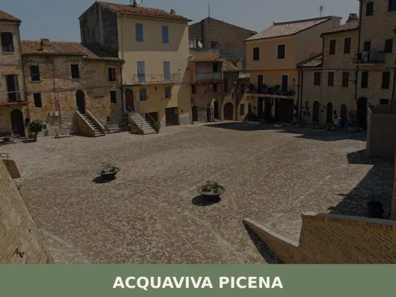
Acquaviva Picena
Discover what to see in Acquaviva Picena: medieval fortress, town walls, local food and travel tips for this hilltop village in Ascoli Piceno, Marche.

Camerata Picena
Discover Camerata Picena, a charming hilltop village in Ancona province with medieval churches, scenic views, and authentic Marche countryside.
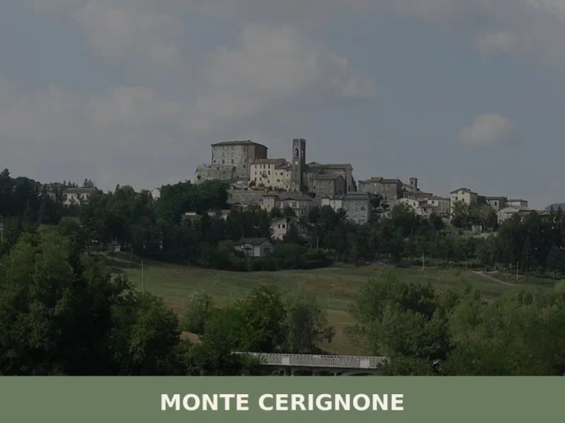
Monte Cerignone
What to see in Monte Cerignone: discover 5 must-see attractions, from Malatesta Fortress to St. Blaise Church. Plan your trip to this Marche village.
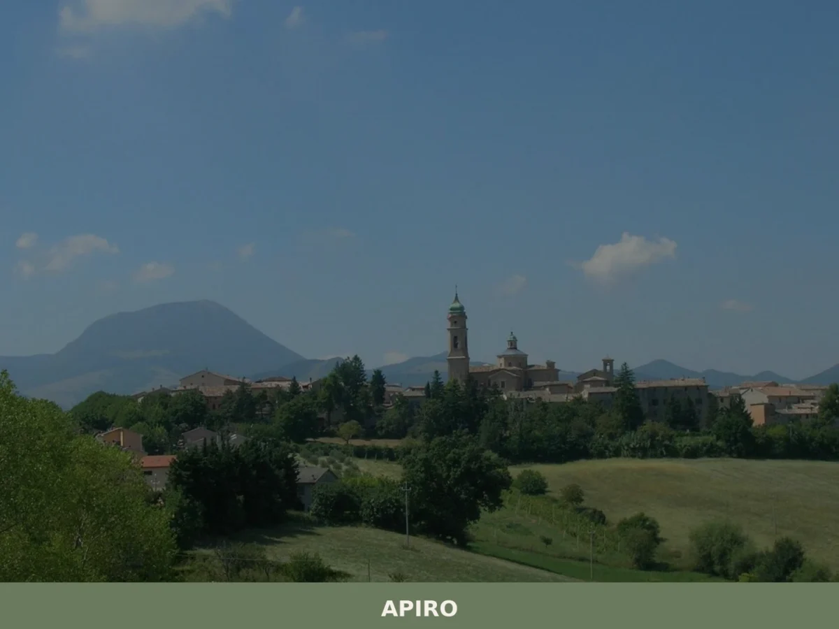
Apiro
What to see in Apiro, Marche, Italy: discover the Sant'Urbano museum, a 14th-century church, and local cuisine 40 km from Ancona. Explore the full guide.
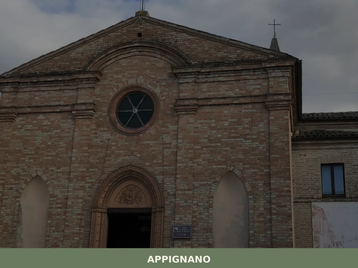
Appignano
What to see in Appignano, Marche, Italy: discover the church of San Giovanni, local food traditions, and a village 35 km from Ancona. Explore the full guide.
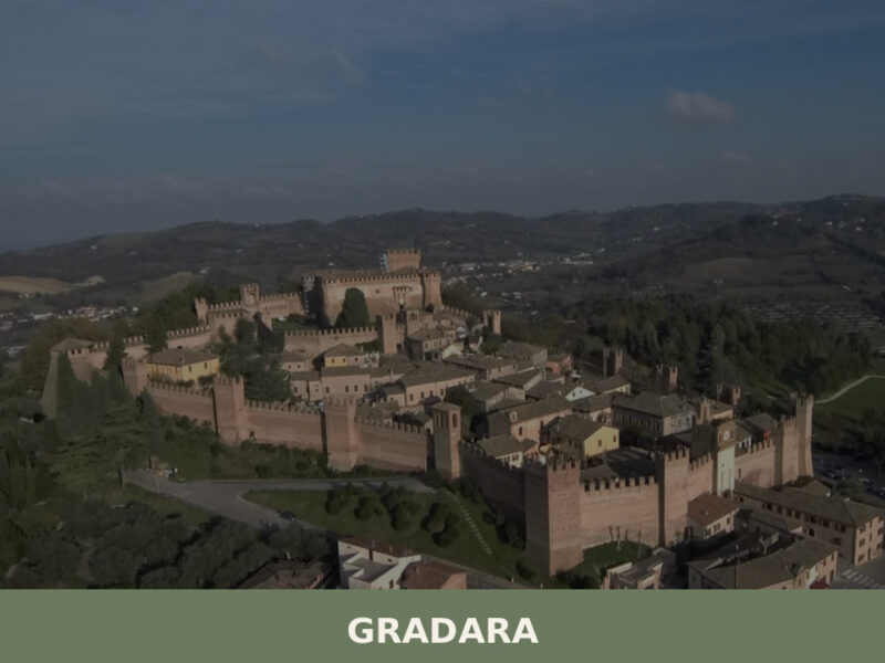
Gradara
What to See in Gradara: discover Malatesta Castle and 4 other must-see attractions. Plan your trip to this Marche village of 4,889 inhabitants.
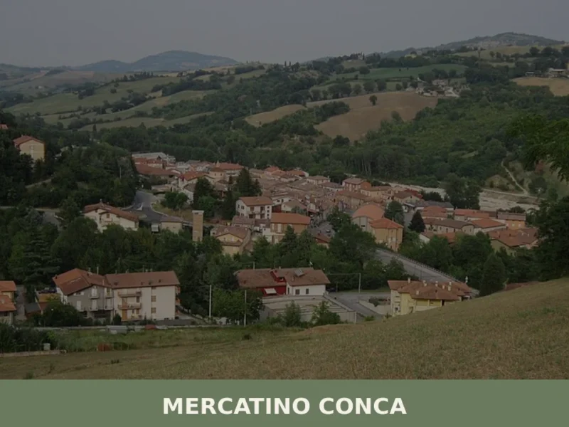
Mercatino Conca
At 275 meters above sea level, in the province of Pesaro and Urbino, lies Mercatino Conca, a settlement with 1,033 residents. The name itself, “Mercatino” (meaning “little market”), suggests a historical commercial function, likely linked to its position in the Conca river valley, a crossroads for trade and activities since ancient times. For those wondering […]
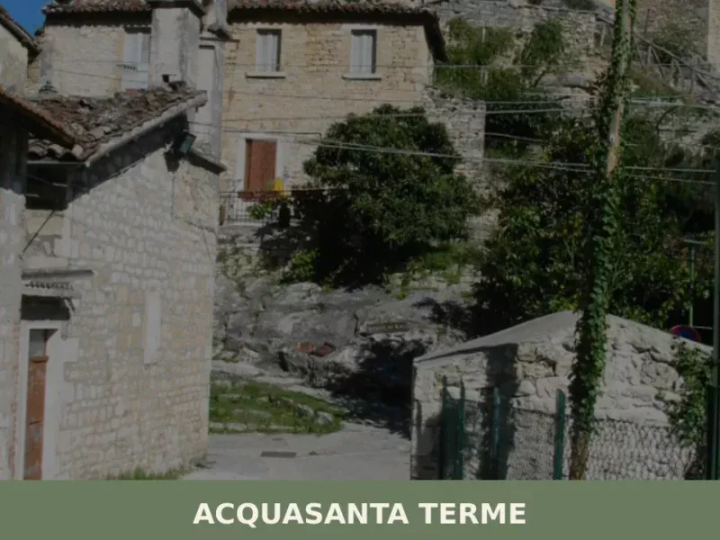
Acquasanta Terme
Discover what to see in Acquasanta Terme: Roman thermal baths, Tronto gorge, medieval hamlets and Apennine landscapes in Marche's Ascoli Piceno province.
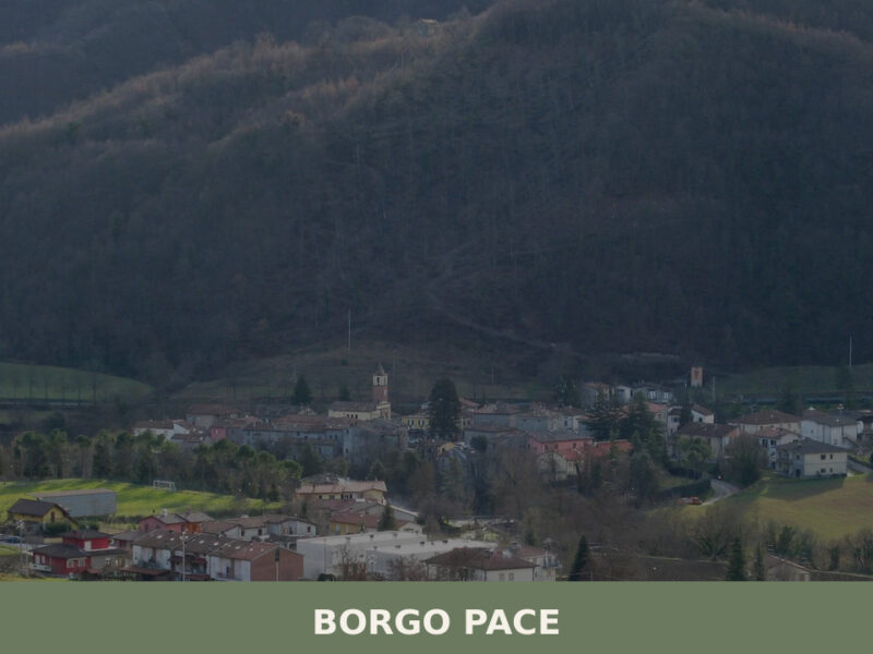
Borgo Pace
Two rivers converge here — the Meta and the Auro — and their meeting point gives this settlement its ancient rhythm. In the early morning, mist lifts off the water and clings to stone walls darkened by centuries of wood smoke. Borgo Pace sits at the edge of the Apennine watershed in the province of […]
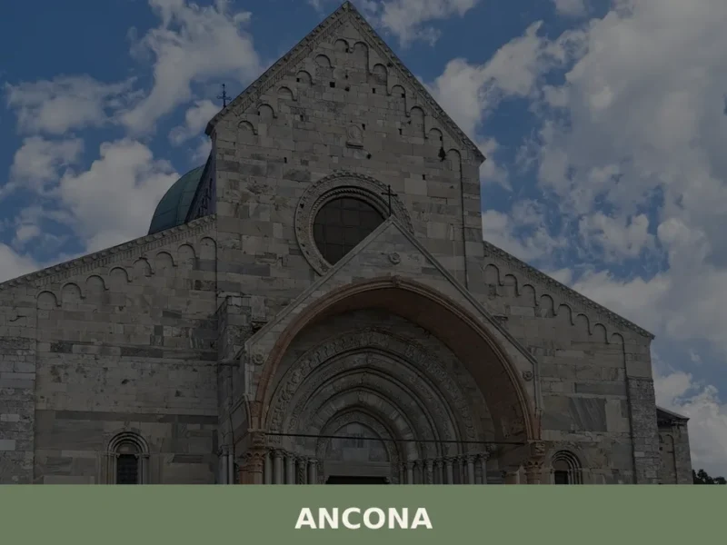
Ancona
what to see in ancona, a city with 99,000 inhabitants. Discover 5 main attractions like the Duomo di San Ciriaco and Trajan's Arch. Plan your visit.


🏡 Know Amandola better than we do?
If you’re a local or have been there, your knowledge matters: add what’s missing or fix a detail on this page.