


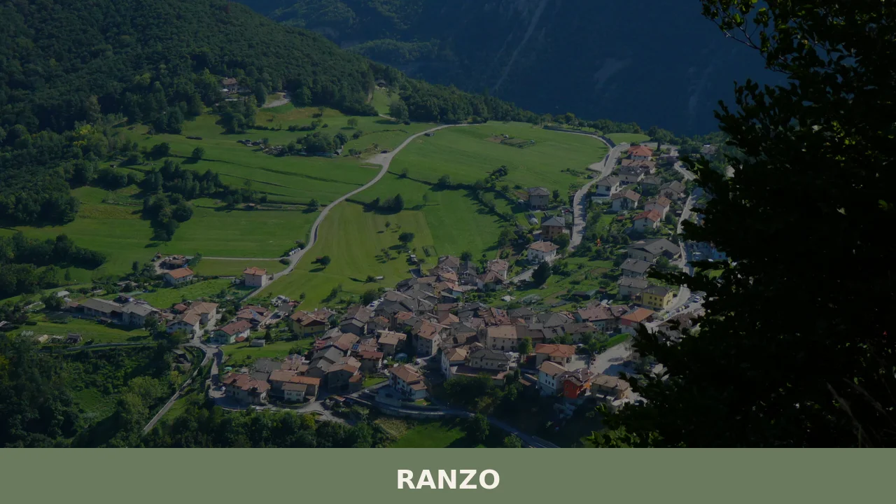
Ranzo
What to see in Ranzo, Liguria, Italy: explore a village of 550 inhabitants, 80 km from Genoa. Discover top attractions, local food, and how to get there.
Discover Ranzo
The valley floor below Ranzo stays in shadow until mid-morning, when the light finally clears the ridge to the east and picks out the stone fronts of the upper houses. The municipality sits in the Province of Imperia, in Liguria’s inland arc, where the Arroscia river system has carved a sequence of narrow corridors between ridges that rise steadily toward the Maritime Alps.
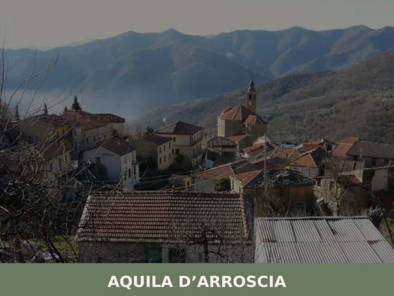
Around 550 people live here, spread across a comune — the Italian term for a municipality — that borders Aquila di Arroscia, Borghetto d’Arroscia, Casanova Lerrone, Nasino, and Onzo.
Deciding what to see in Ranzo takes on a different shape when you understand the village’s position: 80 km (50 mi) southwest of Genoa and 20 km (12 mi) north of Imperia, it occupies a corridor between the coast and the high interior.
Visitors to Ranzo find a compact settlement where the architecture of the Ligurian hills — narrow facades, deep archways, stone paving — is still the dominant visual language. The Ranzo highlights include its oratory churches, the surrounding municipal borderlands that open onto walking routes, and a food tradition rooted in the olive groves and vegetable terraces of the Imperia hinterland.
History of Ranzo
The Ligurian name for the village, Ranso, points to a pre-medieval layer of settlement in this part of the Arroscia valley, where place names often preserve traces of the Ligurian and later Latin administrative vocabulary applied to small agricultural communities.
The inland valleys of what is now the Province of Imperia were, through the early medieval period, corridors of movement between the Ligurian coast and the passes leading into Piedmont.
Villages in this corridor — Ranzo among them — developed as nodes along routes used by traders, drovers, and seasonal workers moving between the maritime plain and the upland pastures.
During the medieval period, the territory passed through the jurisdictional frameworks that shaped most of inland Liguria: lordships tied to the larger regional powers, periodic incorporation into the spheres of influence radiating from Genoa, and the slow consolidation of ecclesiastical structures that gave each settlement its parish church and, in many cases, its oratory.
The oratory system — small lay confraternities maintaining their own chapels — became one of the most durable features of Ligurian village life, and Ranzo preserves this pattern. The municipality’s borders with Casanova Lerrone and Onzo reflect historical divisions that were already in place by the early modern period, when the Genoese Republic exercised administrative control over the inland territories of western Liguria.
By the nineteenth century, when Liguria was absorbed into the unified Italian state, Ranzo was a functioning agricultural commune with a population dependent on the cultivation of olives, vines, and vegetable plots on the terraced slopes characteristic of this part of the Imperia province. The twentieth century brought the same demographic pressures felt across inland Liguria: outmigration toward the coast and toward industrial centres further north reduced populations in many hill villages.
Ranzo today, with its 550 inhabitants, reflects this long process of adjustment while retaining the spatial structure — the lanes, the stone buildings, the church at the settlement’s centre — that dates from earlier centuries.
The village of Castelbianco, which lies within the same provincial and geographical frame of inland Imperia, experienced a parallel trajectory during this period, its history intertwined with the same cycles of agriculture, ecclesiastical organisation, and twentieth-century depopulation.
What to see in Ranzo, Liguria: top attractions
The Parish Church of Ranzo
The parish church forms the gravitational centre of the village plan, as it does in virtually every Ligurian comune of this scale. Its facade faces the main gathering space of the settlement, and the building’s proportions — a single nave with lateral chapels — follow the typology established across the Imperia hinterland from the sixteenth century onward.
Inside, the visitor’s eye moves to the altar furnishings and any votive paintings surviving from earlier periods, objects that record both the devotional life of the community and the circulation of craftsmen and workshops through the valley.
The church is most accessible during morning hours on weekdays and before and after services on Sundays; it is worth arriving early to see the interior in natural light before the main door is closed.
The Oratory and Confraternity Chapel
Ranzo preserves the oratory tradition that defines the religious landscape of inland Liguria. These small chapels were built and maintained by lay confraternities — associations of local men organised around devotional and mutual-aid functions — and their interiors often hold carved wooden furnishings, processional objects, and painted panels that were never transferred to larger institutions.
The oratory in Ranzo operates on a different calendar from the parish church, opening primarily for feast days and confraternity gatherings, which means that visiting during a local festival significantly increases the chance of seeing the interior.
The building’s exterior stonework and the proportions of its door frame are themselves worth examining as examples of local craft at a domestic scale.
The Village Lane Network and Stone Architecture
The internal circulation of Ranzo follows the logic of a pre-automotive settlement: lanes narrow to 1.5–2 m (5–6.5 ft) in places, bordered by continuous stone facades that eliminate any visual separation between private buildings and public space. Walking the full length of the main lane from one end of the built fabric to the other takes under ten minutes, but the detail visible at close range — tooled stone lintels, iron fixtures, the way different building phases abut one another — holds considerably more than a single pass reveals.
The best light for looking at the facades falls in the late afternoon, when the sun is at a low western angle and the texture of the stone becomes more legible. This network also connects to the footpaths leading out toward the municipal borders with Nasino and Aquila di Arroscia.
The Valley and Municipal Border Landscape
Ranzo’s five neighbouring municipalities — Aquila di Arroscia, Borghetto d’Arroscia, Casanova Lerrone, Nasino, and Onzo — define a walking territory that extends well beyond the built village. The valley landscape between these settlements preserves olive terraces, dry-stone retaining walls, and sections of mule track that predate the motor road network.
From the high point of the municipal boundary toward Nasino, the elevation gain over the village is sufficient to place the coastal strip of Imperia — 20 km (12 mi) to the south — in direct view on clear days.
This cross-border walking territory is best approached in spring (April to early June) or autumn (September to October), when temperatures in the valley are moderate and the vegetation has not closed over the older paths. The village of Giustenice, further east along the Ligurian inland arc, offers comparable access to this kind of terraced valley landscape for visitors extending their exploration across the province.
Views toward the Arroscia Valley
The position of Ranzo within the Arroscia river system gives the village an orientation toward a valley corridor that functions as one of the main inland routes of western Liguria.
From the upper part of the built settlement, the view down the valley axis takes in the profile of the ridges on either side and, depending on atmospheric conditions, the distant silhouette of higher terrain to the north.
This is a landscape structured by geology — the ridges are formed by the same limestone and schist sequences that run through the Maritime Alps — and by centuries of agricultural modification: the terracing visible on the opposite slope represents several generations of investment in land that is now, in places, reverting to secondary woodland. The view is most open in winter, when deciduous growth along the valley floor has dropped its leaves.
Local food and typical products of Ranzo
The food tradition of Ranzo belongs to the inland Ligurian kitchen, which is structurally different from the coastal one. Where the coast organises its cooking around fish and the products of the sea, the hinterland of the Imperia province works with olive oil from the Taggiasca olive — a small, low-acidity fruit grown on terraced slopes throughout this part of Liguria — together with dried legumes, foraged herbs, and vegetables grown in the kitchen gardens attached to every farmhouse.
Wheat was historically the staple grain, ground at mills along the valley watercourses, and its presence in the local diet is felt in the range of pasta and bread forms still made in the area.
Among the dishes that belong to this culinary territory, trofie al pesto appears in a form shaped by what grows locally: the basil in the inland version of pesto is sometimes supplemented with other herbs, and the pine nuts can be replaced by walnuts from trees that grow at higher altitudes where pine cultivation is less practical.
Coniglio alla ligure — rabbit braised with olives, rosemary, and white wine — is the standard meat preparation in this part of the province, using the Taggiasca olives that give the sauce a slight bitterness balanced by the wine’s acidity. Farinata, a flatbread made from chickpea flour, water, olive oil, and salt, baked at high temperature in a copper pan, crosses the boundary between street food and table food in Ligurian villages; in the inland version it is sometimes finished with fresh rosemary pressed into the surface before baking.
The olive oil produced in this zone of the Imperia province is the foundation of the local table.
The Taggiasca olive yields an oil with a low polyphenol bitterness and a smooth finish, making it suitable both for cooking and for dressing raw vegetables and bread. The production territory for this oil covers a large portion of western Liguria, including the municipalities that border Ranzo. Local producers in the Arroscia valley sell directly from their farms during the harvest season, which runs from October through December, and this is also the period when freshly pressed oil — olio nuovo, with its green colour and more pronounced grassy notes — is available at the roadside.
The autumn months also bring the chestnut harvest from the wooded slopes above the valley floor.
Chestnuts have been a dietary staple in Ligurian inland villages since at least the medieval period, eaten boiled, roasted, or dried and ground into flour for polenta and baked goods. A number of small sagre — traditional local food festivals — organised in the villages of the Arroscia valley in October and November centre on the chestnut, combining the harvest with communal cooking and music.
Checking with the municipality or the provincial tourism office for specific dates before visiting in autumn is advisable, as the programme changes from year to year.
Festivals, events and traditions of Ranzo
The primary annual fixed point in Ranzo’s calendar is the feast of the patron saint, celebrated with the pattern common to Ligurian inland villages: a solemn morning Mass in the parish church, a procession through the village lanes in which the confraternity carries the statue of the saint under a canopy, and an afternoon of outdoor gathering in the main square or forecourt of the church. The exact date of the patron feast follows the liturgical calendar and should be verified with the local parish before planning a visit specifically around it.
Fireworks in the evening, where the terrain and regulations permit, close the day, a practice maintained in most municipalities of the Imperia hinterland.
Beyond the patron feast, the agricultural calendar generates informal observances tied to the olive harvest in autumn and, in some years, to the chestnut and mushroom seasons that animate the wooded slopes above the valley.
The confraternity attached to the oratory maintains its own cycle of devotional events, including processional observances on specific feast days of the liturgical year. These are community events rather than tourist productions, and visitors who attend them are present as observers of a functioning local tradition. Dress appropriately for a religious context, and follow the lead of local participants regarding photography inside the oratory or church.
When to visit Ranzo, Italy and how to get there
The best time to visit Ranzo depends on what the visitor is looking for. Spring — specifically April through June — offers the most favourable combination of mild temperatures in the valley (typically 15–22°C / 59–72°F at village elevation), clear visibility for views toward the coast and the northern ridges, and the full flowering of the terraced olive groves and wild herbs on the slopes.
Autumn, from mid-September through October, is the second strong season: the olive harvest begins, the chestnut woods above the valley are productive, and the light in the afternoons has the lower angle that makes the stone architecture most readable.
July and August bring higher temperatures and more road traffic on the provincial routes connecting the coast to the interior, as residents of Imperia and the Ligurian riviera move inland to escape the coastal heat. Winter is quiet and cold at this elevation, but functional — the village operates normally, and the views are the most open of any season.
Ranzo lies 80 km (50 mi) southwest of Genoa, making it a feasible day trip from the regional capital for those with a car. The most direct road route from Genoa follows the A26 motorway south toward Savona and then connects via the A6 or the provincial roads into the Imperia hinterland; from Imperia itself, Ranzo is approximately 20 km (12 mi) north on the SP (provincial road) network.
Drivers should be aware that the final approach to the village uses roads built for local traffic — narrower than national routes and with sections of tight curves along the valley walls. The nearest railway station with regular service is in Imperia, connected to the coastal rail line that Trenitalia operates between Genoa and Ventimiglia.
From Imperia station, reaching Ranzo requires a local bus connection or a taxi, as no direct rail service reaches the inland villages of the Arroscia valley. The nearest major airport is Genoa Cristoforo Colombo Airport, approximately 90 km (56 mi) from Ranzo by road; Nice Côte d’Azur Airport in France, roughly 100 km (62 mi) to the west, is an alternative entry point for international visitors arriving by air.
International visitors should carry Euro cash, as smaller shops and local services in inland villages of this scale may not accept card payments, and English is not widely spoken outside tourist-facing contexts.
Visitors making Ranzo part of a longer itinerary through the Ligurian interior might also consider Giusvalla, a village in the Savona province that shares the same pattern of inland Ligurian settlement, or Castiglione Chiavarese in the eastern part of Liguria, both of which extend the geographic range of a regional tour without requiring a return to the coast between visits.
Frequently asked questions about Ranzo
What is the best time to visit Ranzo?
Spring (April to early June) and autumn (September to October) offer the most comfortable conditions for exploring Ranzo and its surrounding valley on foot, with moderate temperatures and clear views toward the coast. Summer brings the village's most important annual event: the feast of San Donato d'Arezzo on 7 August, when the patron saint is celebrated and the oratory chapel is more likely to be open to visitors. Winter, while cooler, rewards those interested in the valley landscape, as bare deciduous trees open up views along the Arroscia corridor that vegetation obscures in warmer months.
What are the historical origins of Ranzo?
The Ligurian place name Ranso points to a pre-medieval settlement in the Arroscia valley, where ancient place names often preserve traces of early Ligurian and Latin administrative vocabulary. Through the medieval period the territory functioned as a node along inland routes connecting the Ligurian coast to Piedmont, passing through various lordships before coming under the administrative control of the Genoese Republic in the early modern period. By the nineteenth century Ranzo was an established agricultural commune, its economy centred on olives, vines, and terraced vegetable plots, with borders reflecting divisions already fixed in earlier centuries.
What to see in Ranzo? Main monuments and landmarks
Ranzo's principal sites are its parish church and its oratory confraternity chapel. The parish church, a single-nave building with lateral chapels typical of the Imperia hinterland, is best visited on weekday mornings in natural light. The oratory chapel — built and maintained by a lay confraternity — holds carved wooden furnishings and processional objects; it opens primarily for feast days, so visiting around 7 August (the feast of San Donato d'Arezzo) maximises access. The village's medieval lane network, with facades, stone lintels, and archways, is itself a key attraction and best seen in late-afternoon light.
What are the main natural or scenic attractions of Ranzo?
Ranzo sits within the Arroscia river system at 124 m elevation, surrounded by terraced olive groves, dry-stone retaining walls, and sections of pre-modern mule track connecting it to five neighbouring municipalities: Aquila di Arroscia, Borghetto d'Arroscia, Casanova Lerrone, Nasino, and Onzo. The high point of the municipal boundary toward Nasino offers a direct sightline to the Imperia coastal strip, 20 km to the south, on clear days. Spring and autumn are the recommended seasons for this cross-border walking territory, when paths are passable and temperatures in the valley are moderate.
Where to take the best photos in Ranzo?
Three locations offer the strongest photographic interest. The upper part of the built settlement provides an open view down the Arroscia valley axis, with limestone and schist ridges framing both sides — clearest in winter when foliage is minimal. Late afternoon is the best time to photograph the stone facades along the village lane network, when low western light brings out the texture of the tooled lintels and building joints. The municipal boundary toward Nasino, accessible on foot, gives an elevated perspective over the terraced slopes with the coastal strip of Imperia visible in the background on clear days.
Are there museums, churches or historic buildings to visit in Ranzo?
Ranzo has two documented religious buildings of interest. The parish church at the centre of the village follows the single-nave typology common across the Imperia hinterland and is accessible on weekday mornings and around Sunday services; its interior preserves altar furnishings and votive paintings from earlier periods. The oratory chapel, associated with a lay confraternity, contains carved wooden furnishings and processional objects and opens primarily on feast days — most reliably around the patronal feast of San Donato d'Arezzo on 7 August. No admission fee is documented for either building.
What can you do in Ranzo? Activities and experiences
Walking is the principal activity, with footpaths leading from the village lane network outward to the municipal borders with Nasino, Aquila di Arroscia, and neighbouring comuni across terrain that preserves terraced olive groves and sections of historic mule track. Spring and autumn are the recommended seasons. The patronal feast of San Donato d'Arezzo on 7 August provides an opportunity to observe local confraternity traditions and gain access to the oratory chapel. Food-oriented visitors can focus on the inland Ligurian kitchen — Taggiasca olive oil, rabbit braised with olives, trofie al pesto, and farinata — available in the area's traditional trattorie.
Who is Ranzo suitable for? Families, couples, hikers, solo travelers?
Ranzo is best suited to hikers and walkers who want an uncrowded inland Ligurian base with direct access to cross-border footpaths through terraced valley landscapes. Couples and independent travellers interested in vernacular stone architecture, religious folk traditions, and the inland Ligurian food culture will find the village rewarding. Families with older children can manage the lane network and short valley walks comfortably. Those seeking beach access, nightlife, or extensive tourist infrastructure should note that the coast lies 20 km to the south; Ranzo is a quiet rural comune with a population of around 550.
What to eat in Ranzo? Local products and specialties
Ranzo's food tradition belongs to the inland Imperia kitchen, structured around Taggiasca olive oil — a DOP product from the small, low-acidity olive grown on the terraced slopes throughout this part of Liguria. Key dishes documented for this culinary territory include trofie al pesto (here sometimes made with walnuts in place of pine nuts), coniglio alla ligure (rabbit braised with Taggiasca olives, rosemary, and white wine), and farinata, a flatbread made from chickpea flour and olive oil. Dried legumes and foraged herbs are structural ingredients of the local kitchen, distinguishing it clearly from the coastal fish-centred tradition.
📷 Photo Gallery — Ranzo
Nearby Villages near Ranzo
In Liguria More villages to discover
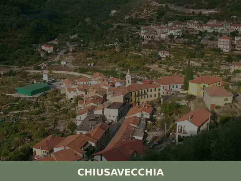
Chiusavecchia, Liguria: An Ancient Italian Village Guide
What to see in Chiusavecchia, Italy: Explore this Ligurian village at 140m altitude. Discover its historic core and the feast of San Biagio.
Armo
Armo, a village of 120 inhabitants above the Petrace valley in Calabria, rewards visitors with stone lanes, ancient olive terraces, and Aspromonte trails.
Savona
A port town of 58,500 souls on Liguria's western coast, Savona bridges medieval urban fabric with centuries of maritime trade and religious devotion.
Murialdo
What to see in Murialdo, Liguria, Italy: 8 borgate, Monte Camulera, and local cuisine across 37.5 sq km. Discover top attractions, events, and how to get there.
Monterosso al Mare
What to see in Monterosso al Mare, Italy: explore a 14-metre Neptune statue, a church built in 1282, and Cinque Terre's only sand beach. Discover the complete guide.
Genova
What to see in Genova: city at 18 m above sea level with UNESCO Rolli palaces and Europe's largest aquarium. Plan your visit with our full guide.
Cosio d’Arroscia
what to see a Cosio d'Arroscia: il village ligure a 721 m s.l.m. con 171 abitanti, la chiesa dei Santi Pietro e Paolo, i hiking trails dell'Alta Via e la festa patronale del 29 giugno.
Pallare
what to see in pallare: Explore this Ligurian comune, 15 km from Savona, Italy. Discover its geographical context and accessibility. Read our guide.
Sesta Godano
What to see in Sesta Godano, Italy? Explore this Ligurian village at 242 m (794 ft) altitude. Discover its mountain setting and local festivals. Read our guide.
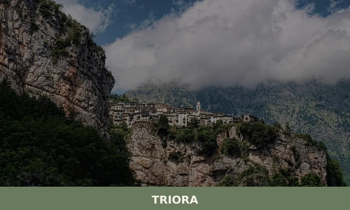
Triora
what to see in triora, Italy: Explore this historic village, home to 416 residents, and discover its ancient witch trials history and vibrant August festival. Plan your visit today.


🏡 Know Ranzo better than we do?
If you’re a local or have been there, your knowledge matters: add what’s missing or fix a detail on this page.