


Cervia
A coastal settlement built atop ancient salines, Cervia preserves nine centuries of salt heritage and 9 km of protected beaches in the Ravenna province.
Cervia: Medieval Salt Town on the Adriatic Coast
Cervia Village in Emilia-Romagna: Salt, Sea and Medieval Fortifications
Water defines Cervia at every scale. Low and level at 5 metres above sea level, this coastal comune spreads between the Adriatic shore and an intricate web of salt channels. The air carries a particular mineral clarity—the result of decades of seawater management and a landscape that appears as natural as it is man-made. This is a place where economy, settlement pattern and environment remain visibly interlocked.
Cervia village in Emilia-Romagna sits 20 kilometres south of Ravenna, a modest seaside town of around 29,000 residents with two identities that rarely meet: the medieval fortified settlement born from salt production, and the modern beach resort anchored to the Riviera. Visitors arrive for both the 827-hectare nature reserve protecting rare wading birds and flamingos, and the nine-kilometre strand of certified beaches.
From Ficocle to Cervia: A Thousand Years of Transformation
The oldest trace of human settlement in the territory dates to the Bronze Age, when shepherds camped in what is now the Montaletto fraction. Etruscan activity around saline operations is attested by finds during urban works in recent decades. By the first century before Christ, the area held settled populations dependent on salt extraction.
The place-name Ficocle first appears in written records around the fifth century. phykos) and fame (kleos)—a location celebrated for its marine algae. In 499, Pope Simmaco’s synodal acts name Geronzio as bishop of Ficocle; he was later killed near Cagli while returning to his diocese and eventually declared a saint.
Rather than fade, the population relocated to the centre of the saline marshes and built a fortified town. Over the eighth and ninth centuries, the marshland was systematically converted into salt ponds, and salt production achieved industrial scale. The name Cervia—likely derived from the Latin acervus (heap or mound) referring to salt stockpiles—became established by the tenth century.
By the thirteenth century, Cervia came under the influence of Ravenna and the Da Polenta family. Control subsequently shifted through several powers, including the Sforza and Venetian rule, before returning to the Papal States in 1509, where it remained until Italian unification.
Landscape and Natural Heritage
The territory embraces two ecosystems of conservation significance. A pine forest of 260 hectares—distributed across Milano Marittima, Cervia, Pinarella and Tagliata—preserves a Mediterranean woodland within an urbanised Adriatic coast. Twenty-seven hectares of this forest form part of a designated nature reserve.
More substantial still is the Saline di Cervia reserve, occupying 827 hectares of shallow lagoons and salt flats. It serves as the southern station of the Parco Regionale del Delta del Po and shelters populations of avocets, black-winged stilts, little egrets and dabchicks; pink flamingos transit seasonally. These wetlands support lagoon ecology. Mucilage blooms have occurred periodically in the northern Adriatic.
The territory extends to natural waterways that define its boundaries. Water temperature in summer averages 23–26 degrees Celsius across the bathing season, and periodic testing by ARPA has awarded the beaches the Blue Flag certification. Over 9 kilometres of sandy shore provide the main recreational draw for contemporary Cervia.
Salt Production and Economic Identity
Salt-making shaped Cervia’s survival from the Roman period through to modern times. The saline system visible today—channels, settling ponds, collection areas—descends directly from medieval engineering but reflects centuries of refinement. Medieval and early modern accounts record the trade’s dependency on seasonal labour, merchant networks extending to Venice and Ancona, and the constant threat from North African corsairs who specifically targeted salt shipments and facilities.
From the sixteenth to the eighteenth century, Cervia endured pirate raids. Environmental hardship accompanied commercial risk: the brackish channels that fed the salines bred malaria-carrying mosquitoes, and the seventeenth-century decline in population reflected both disease and economic crisis.
By then, Cervia’s identity as a salt town was giving way to its role as a coastal emporium, a transition that accelerated in the nineteenth and twentieth centuries as Cervia developed as a coastal resort.
The Medieval Town and Civic Structures
The historic core of the modern town preserves a compact, defended grid centred on the Palazzo Priorale. Cervia Vecchia era il borgo originario situato sulla costa e nelle lagune; la nuova Cervia fu ricostruita ex novo nel XVII secolo in una posizione leggermente diversa. Churches served the medieval community, and a defensive tower crowned the fortification.
The Saline Reserve and Visitor Routes
The Riserva Naturale delle Saline now permits pedestrian and cycling access along dyke paths, offering unobstructed views of the lagoon ecosystem. Birdwatching is rewarding during spring and autumn migration; summer affords views of the breeding colonies. The reserve integrates into the larger Po Delta Regional Park, linking Cervia to the broader natural corridor of the northern Adriatic littoral and the terrestrial provinces of Emilia-Romagna.
Milano Marittima and the Pine Forest
The frazione of Milano Marittima, developed in the twentieth century, occupies the northern section of the 260-hectare pineta. The forest itself—a mix of stone pine and maritime pine—survives as a green corridor between built areas and represents one of the few remaining examples of the coastal woodland that once characterised the Adriatic fringe. Walking and cycling trails traverse the woods; the park provides both amenity and ecological function.
The Beaches and Waterfront
The 9-kilometre beach system ranges from family-oriented sands with lifeguards and facilities to quieter sections toward the Savio River mouth. Water quality is monitored regularly; certification as a Blue Flag destination reflects consistent adherence to environmental and safety standards. The beach infrastructure includes bathing establishments, bicycle paths along the seafront, and access points from the town.
Food and Agricultural Tradition
Cervia’s food culture reflects its dual nature as a maritime and salt-producing comune. The fishing tradition sustained communities for centuries; modern restaurants draw on Adriatic catch—fish, crustaceans and cephalopods prepared locally. The flat, reclaimed landscape also supports vegetable cultivation and fruit orchards typical of the low Emilia-Romagna plain.
Salt itself remains a tangible product, though modern production is limited. Historical salt works and saline management continue to define the landscape and inform local identity, even as tourism and leisure have become the dominant economic sectors.
Planning Your Visit to Cervia
Cervia is most accessible by car or train. Cervia has its own railway station (Cervia-Milano Marittima) on the Adriatic coastal line, connecting to regional networks.
Summer (June to September) is peak season: warm water, long daylight, and full services at beaches and restaurants. Spring and autumn offer milder temperatures, fewer crowds, and optimal conditions for birdwatching in the saline reserve. Winter is quieter still; many seasonal facilities close, though the town remains accessible for those seeking solitude or off-season rates.
A day trip suffices for beach and reserve exploration; a long weekend allows deeper exploration of the medieval quarter, the pine forest, and nearby municipalities like Ravenna, which lies a short drive north and offers Byzantine mosaics and a richer urban history.
| Departure Point | Distance | Travel Time |
|---|---|---|
| Ravenna city centre | 20 km | 25–35 minutes by car; 45–60 minutes by bus |
| Bologna Centrale station | 120 km | approximately 1 hour 10–20 minutes by direct or connecting train |
| Rimini seafront | 30–35 km | 25–35 minutes by car |
| A14 motorway (Cesena Nord or A14dir Ravenna exit) | 20 km | 20 minutes to town centre |
Patron Saint and Local Observance
Frequently asked questions about Cervia
How do I get to Cervia from Ravenna by public transport?
Cervia is located 20 kilometres south of Ravenna and is accessible by regional train services connecting to Ravenna's main station. Direct bus routes also operate between Ravenna and Cervia, with journey times around 30–40 minutes. By car, take the A14 motorway and exit toward Ravenna, then follow coastal roads south. Parking is available near the town centre and beach areas, though summer availability may be limited.
When is the best time to visit Cervia?
Summer months (June–September) offer warm weather and full beach access, though expect crowds. May and October provide milder conditions ideal for exploring the medieval town and nature reserve with fewer visitors. Winter is quiet and suitable for observing migratory bird populations in the 827-hectare salt marsh reserve. The feast of San Paterniano, the town's patron saint, occurs in spring and features local religious observances and traditional celebrations.
What outdoor activities and routes are available in Cervia?
The nine-kilometre certified beach strand offers swimming and water sports. The 827-hectare Saline di Cervia nature reserve features walking and bird-watching trails protecting flamingos and rare wading birds. Cycling paths connect the town to surrounding coastal areas and salt channels. The flat terrain and well-marked trails make the reserve accessible for families and naturalists alike during designated visiting hours.
What is the historical significance of salt production in Cervia's development?
Cervia's name derives from the Latin word acervus, meaning salt heap, reflecting centuries of salt production that shaped the town's economy and settlement pattern. The predecessor settlement, Ficocle—known for seaweed abundance—transformed into a salt-producing centre. The intricate network of salt channels visible today remains central to the landscape identity, demonstrating how medieval communities engineered their environment for survival and commerce.
How long should I plan to spend visiting Cervia?
A day trip allows time for beach relaxation and exploring the medieval town centre. Two to three days enable visits to the Saline di Cervia nature reserve, guided bird-watching excursions, and leisurely exploration of historic fortifications and civic structures. Extended stays suit those combining Cervia with nearby Ravenna's Byzantine monuments and the broader Emilia-Romagna coast, positioned within regional routes.
📷 Photo Gallery — Cervia


In Emilia-Romagna More villages to discover
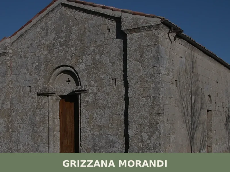
Grizzana Morandi
In 1929, the Bolognese painter Giorgio Morandi travelled to Grizzana for the first time — a scattered municipality in the Emilian Apennines that he would return to every summer for over thirty years. From the barns and tower-houses of this valley, he painted hundreds of landscapes, transforming the clay badlands and mountain ridgelines into universal […]
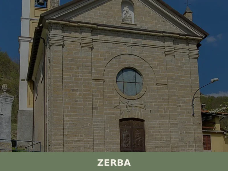
Zerba
With just 71 registered inhabitants, Zerba is the least populated municipality in the entire province of Piacenza and one of the smallest in Italy. Situated at 906 metres above sea level in the upper Val Boreca, on the border between Emilia-Romagna and Liguria, this mountain settlement retains a sandstone building fabric that follows precise construction […]
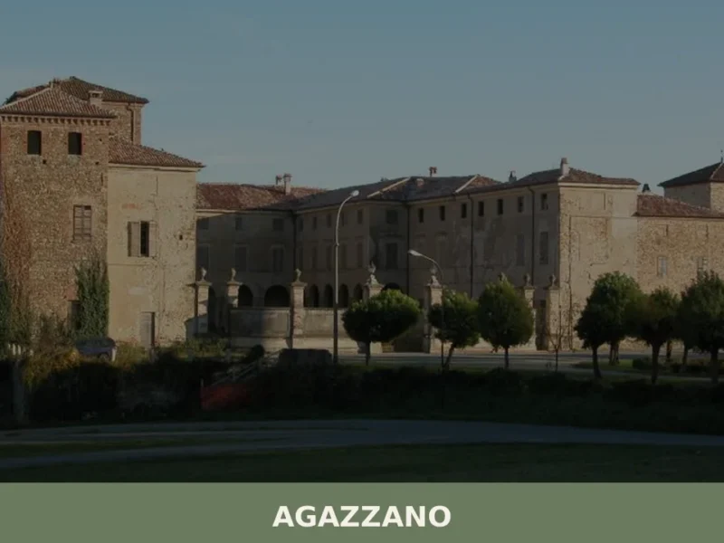
Agazzano
What to see in Agazzano, a village at 187 m in Piacenza province with 2,054 residents. Explore the medieval castle, Santa Maria Assunta church and Val Luretta. Plan your visit.
Bagnara di Romagna
What to see in Bagnara di Romagna, Italy? Explore this 'Borgo più bello' at 22 m (72 ft) altitude. Discover its historical charm and annual Patron Saint's Feast.
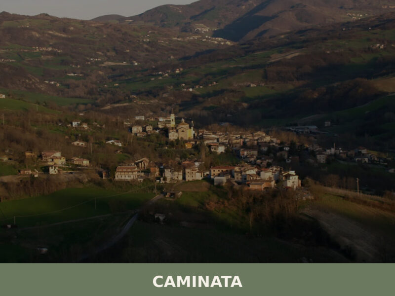
Caminata
Caminata sits at 364 metres in the Val Tidone, Piacenza province. A guide to its church, trails, Apennine food traditions, and surrounding landscape.
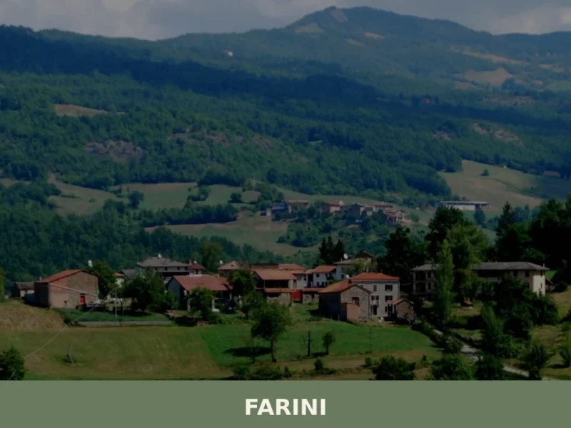
Farini
What to see in Farini, a village at 424 m in Val Nure with 1,043 residents: San Giuseppe Church, Apennine trails, PDO cured meats. Plan your visit and how to get there.
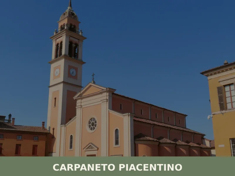
Carpaneto Piacentino
What to see in Carpaneto Piacentino: 7,598 residents, 114 m altitude, Saints Fermo & Rustico festival on 9 Aug, DOP cured meats. Plan your visit now.
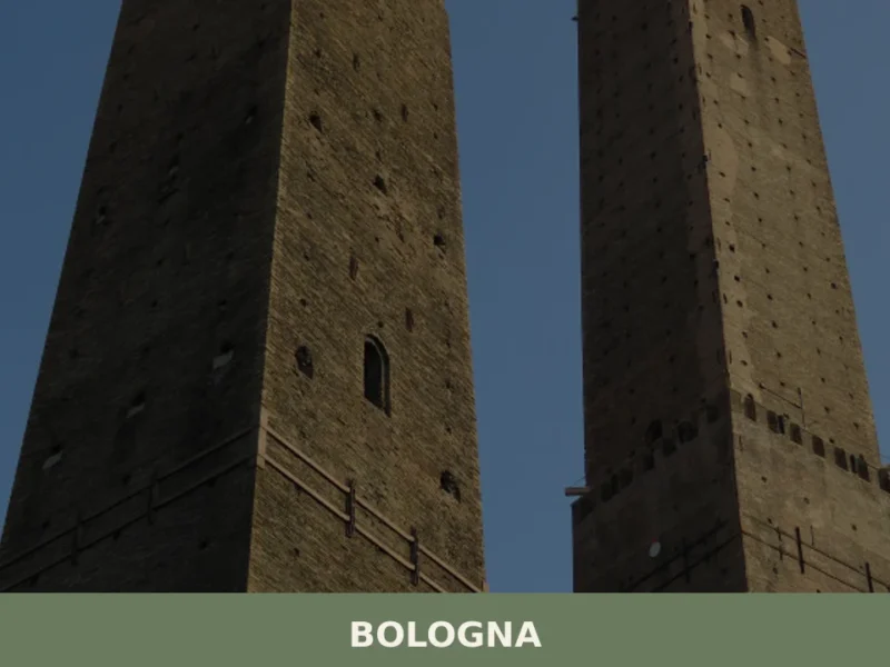
Bologna
What to see in Bologna: 388,000 inhabitants, UNESCO porticoes and the Two Towers. Plan your visit with our guide to tortellini, Mortadella IGP and top museums.
Imola
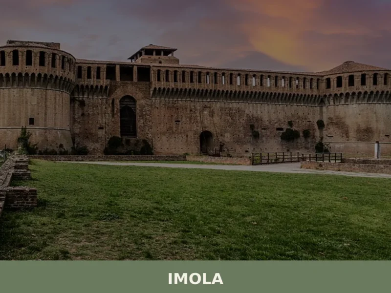
In 1953, on the track of the Autodromo Enzo e Dino Ferrari, Formula One cars raced in the Italian Grand Prix, placing Imola firmly in international motorsport history. But this city of 69,121 inhabitants, spread out at 47 metres above sea level along the banks of the River Santerno, had already existed for two thousand […]
Parma
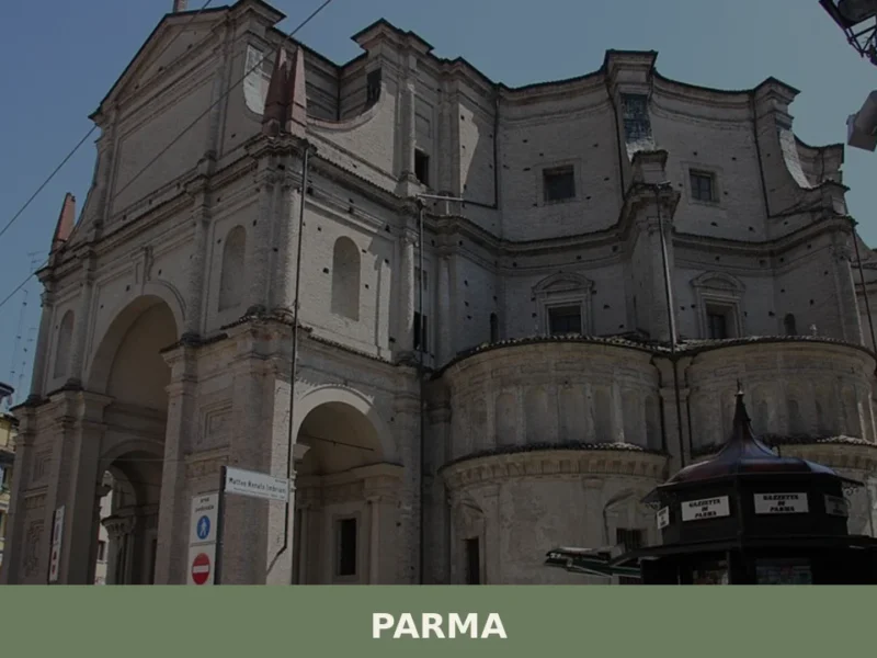
what to see in parma. Home to 177,714 residents, Parma offers the iconic Duomo, Baptistery, and world-famous Parma Ham. Explore its rich heritage.


🏡 Know Cervia better than we do?
If you’re a local or have been there, your knowledge matters: add what’s missing or fix a detail on this page.