


Lauria
Three river valleys, a Norman castle and the snow-capped Sirino massif give Lauria a territorial identity unlike any other town in southern Basilicata.
Lauria: Where the Valleys of the Noce, Sinni and Mercure Converge
Stone towers, a torrent once channelled beneath medieval streets, and three valleys opening in different directions toward different seas — Lauria announces itself as a crossroads long before you read a single signpost. The old town splits into two distinct hilltop quarters, each with its own rhythm, separated by a narrow corridor of lower ground that was once a buffer zone between rival fortified neighbourhoods. At 430 metres above sea level, the air already carries something of the Apennine ridge.
Lauria village in Basilicata draws visitors for two main reasons: its exceptional mountain landscape, anchored by the Sirino massif to the north, and its layered urban identity, written in two medieval quarters, a Norman castle and centuries of documented civic life. Both rewards take time to read. The landscape unfolds along hiking paths and valley roads; the urban character reveals itself only when you walk between the two old rioni and look for the details that distinguish one from the other.
From Uria to Lauria: Twelve Centuries of Documented Identity
The earliest written record of this settlement appears in a document from 1079, when the Archbishop of Salerno, Alfano, referred to the place as Uria. The town’s archives were destroyed during a historical massacre, so the written record is fragmentary, but the physical evidence reaches further back. A tomb of Lucanian origin found at the locality of Malfitano confirms human settlement well before Roman times, when the route later known as the Via Capua-Regium — the main north-south corridor through southern Italy, now roughly traced by the A2 motorway — already passed through this territory.
Several competing theories attempt to explain the name Lauria itself. One connects it to the Latin word laurus, the laurel tree, combined with a memory of the earlier settlement of Iriae. Another derives it from the Byzantine Greek laurion, a vessel used in olive pressing. A third links it to a laura, a community of Basilian monks documented on the hill of Armo, where a sanctuary to the Madonna Assunta later stood. Medieval chronicles also record that Guglielmo d’Altavilla adopted the name Lauria, incorporating a green laurel branch into the town’s coat of arms alongside the basilisk figure with the inscription Noli me tangere. The name, whatever its precise etymology, was stable by the Norman period.
Through the Middle Ages, Lauria served as the political and economic centre of the Noce valley. The Norman barony passed through several lords; one of them, Riccardo, held the town as a loyal supporter of King Manfredi. His son Ruggiero di Lauria rose to become admiral of Aragon under Pietro III and never lost a naval engagement. It was during Riccardo’s tenure that Lauria held, briefly, the role of seat of the giustizierato of Basilicata — the regional administrative and judicial district, roughly equivalent to a provincial capital — a distinction that reflects the town’s weight in the medieval south. Later, during the short-lived Parthenopean Republic of 1799, Lauria was designated the administrative centre of a cantone, confirming its recurring function as a territorial reference point across very different political regimes.
The Land That Shapes Every Journey Through Lauria
The Sirino Massif and Monte Papa
The mountain mass that dominates Lauria’s northern skyline carries snow on its upper slopes for roughly six months each year. Monte Papa reaches 2,005 metres; the Sirino peak stands at 1,907 metres. Both summits attract walkers and mountaineers. The massif also hosts ski infrastructure — five lifts and a chairlift, ski schools and equipment hire — most of which sits within the territory of the neighbouring municipality of Lagonegro, though the mountain landscape is inseparable from the experience of visiting Lauria. In summer, the locality of Conserva, at 1,400 metres within Lauria’s own municipal boundaries, offers a campsite from which to access the higher terrain on foot.
The River Sinni and the Cogliandrino Reservoir
The Sinni, one of Basilicata’s significant rivers, rises at 1,380 metres on the eastern slope of the Sirino massif, in Lauria’s own territory. The river is markedly torrential in nature: full and turbulent in winter, reduced to shallow channels in summer. Before leaving the Lauria area, the river is dammed near the locality of Cogliandrino, creating a reservoir at 672 metres that was built to generate hydroelectric power and is managed by Enel. The dam sits at the confluence of the Torrente Cogliandrino with the Sinni. For visitors arriving along the upper valley road, the water retained here gives the landscape an unexpected horizontal calm.
Lago della Rotonda
Between Monte Serra Rotonda (1,285 metres) and Monte Serra la Spina (1,652 metres), at an altitude of 914 metres, a small lake of karst origin occupies a natural basin. Lago della Rotonda covers 71 hectares in total, though the water surface today is considerably reduced — roughly 800 by 100 to 150 metres, with a maximum depth of around 2 metres. It collects surface runoff and alluvial water from the surrounding slopes. Lying about 13 kilometres north-east of the town centre, it sits within the perimeter of the Pollino National Park. The slopes above it carry specimens of the ancient pino loricato, the Bosnian pine that is the symbol of the Pollino range.
The Norman Castle and the Two Medieval Quarters
Lauria’s old town is divided into two hilltop rioni, an arrangement that reflects the medieval settlement pattern rather than later urban planning. The castle associated with Ruggiero di Lauria anchors the upper quarter, the rione superiore. Below it, the Torrente Cafaro — now covered over — once ran through the centre of the neighbourhood as a natural defensive element that reinforced the castle’s protection. The lower quarter, the area historically referred to as Ravita (a name derived from the Arabic rabit, meaning an annexed or neighbouring zone, which points to an earlier Saracen-period occupation), was where the Norman settlers established themselves. Walking between the two quarters means crossing the lower corridor that once separated them and reading the architectural differences that accumulated over centuries.
The Sanctuary of the Madonna dell’Armo
On the hill of Armo, a place of religious significance in Lauria since at least the medieval period, a sanctuary dedicated to the Madonna Assunta was erected on the site once occupied by the laura of Basilian monks. The original church was destroyed in 1806 during military operations connected to the Napoleonic campaigns in southern Italy. It was subsequently rebuilt through local devotion. The sanctuary remains an active site of pilgrimage and represents one of the visible threads connecting Lauria’s Byzantine monastic heritage to its present-day religious calendar, centred on the patron Domenico Lentini.
What Grows and What Reaches the Table
Lauria’s territory moves through a wide range of altitudes — from valley floors barely above sea level in the Noce basin to the high Sirino slopes at over 2,000 metres — and this vertical range defines its agricultural character more than any single product. Chestnut woodland covers significant portions of the middle altitudes. The river valleys support vegetable gardens and fruit cultivation. The town is positioned close enough to both the Tyrrhenian and Ionian coasts that fresh fish from either shore has always circulated in local markets, carried along the same valley roads that once served as trade routes.
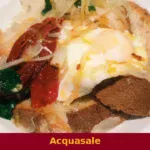
The broader Lagonegrese food culture, of which Lauria is part, draws on a highland pastoral tradition — cured meats, aged cheeses, legumes grown in mountain conditions — combined with the produce that moves up from the coasts. Local eating tends to follow seasonal availability rather than fixed specialities, and the best introduction is usually a trattoria table in one of the older quarters, where what arrives is determined by what was harvested or slaughtered that week.
Planning a Visit to Lauria: Seasons, Access and Nearby Villages
The most comfortable seasons for visiting are late spring and early autumn, when the mountain air is clear and the valley roads are easy to drive. Summer brings heat to the lower valleys but remains cool on the Sirino slopes, making July and August viable for hiking. Winter is the season for the ski area, though road conditions on the upper routes require attention after snowfall.
If you arrive by car, the A2 Salerno-Reggio Calabria motorway has exits serving the Lauria area directly — the same route that roughly follows the ancient Roman road through this stretch of the Apennine spine. The Fondovalle Sinnica connects east toward the Ionian coast; the Fondovalle del Noce connects west toward the Tyrrhenian. Lauria is therefore genuinely usable as a base for reaching very different landscapes within an hour’s drive. Visitors exploring the Lagonegrese highlands should also consider the villages immediately around Lauria: Castelluccio Inferiore and Castelluccio Superiore sit close to the north, while Castelsaraceno occupies a ridge to the east. Further into the Agri valley, Episcopia and Carbone extend the itinerary toward a different historical register.
The municipal emblem of Lauria carries a basilisk alongside a laurel branch, with the inscription Noli me tangere — a heraldic phrase that doubles as a statement of civic pride, recorded as the symbol granted when the town was freed from Saracen occupation.
Accommodation in Lauria ranges from small hotels near the town centre to rural rooms and agriturismo options in the outlying hamlets. The municipality includes twelve frazioni — among them Acqua delle Donne, Capraro, Pecorone and San Paolo — and a long list of named localities scattered across the valley slopes, several of which have their own small communities and local festivals. Allow at least two full days if you intend to combine the historic town with the mountain terrain.
| Departure | Distance | Time |
|---|---|---|
| Naples | approx. 180 km | approx. 2 h by car (A2) |
| Salerno | approx. 120 km | approx. 1 h 20 min by car (A2) |
| Potenza | approx. 100 km | approx. 1 h 15 min by car |
| Cosenza | approx. 90 km | approx. 1 h 10 min by car (A2) |
Frequently asked questions about Lauria
How do you reach Lauria by car or public transport?
By car, Lauria is accessible from the A2 Mediterranean motorway, Lauria Nord or Lauria Sud exit, approximately 200 km from Naples and 130 km from Reggio Calabria. The nearest railway station is Lagonegro, on the Battipaglia–Reggio Calabria line, about 15 km away. From there you can continue by bus or taxi. Fsbusitalia regional buses connect Lauria with Potenza and neighbouring towns.
When is Lauria's patron saint celebrated and what does the celebration include?
Lauria's patron saint is Domenico Lentini, a local priest beatified in 1997 by John Paul II. His liturgical feast day falls on 25 February. Lauria dedicates religious celebrations to him in the church where he is venerated, with solemn masses and processions. Being a locally beloved blessed, this commemoration represents one of the most deeply felt religious moments for the entire Lauria community.
What hiking trails exist around Lauria?
The main natural landmark is the Sirino-Papa massif, north of Lauria, reaching 2,005 metres. The area is included in the Pollino National Park and offers marked CAI trails towards the peak of Monte Papa and Lake Laudemio. The trails are frequented in summer and winter for skiing on the slopes of the Lauria-Sirino ski resort, one of the few facilities in southern Basilicata.
How long does it take to visit Lauria and where can you park?
To explore the two historic districts, the Norman castle and the ancient centre can be seen in 3-4 hours on foot. Free public car parks are available at the edges of the town centre, near the main street that runs through the modern part of the city. For the hamlets and viewpoints overlooking the three surrounding valleys, a car is recommended. A complete visit including excursions to Sirino requires at least a full day.
What historical curiosities distinguish Lauria from other Lucanian villages?
Lauria is noted for being the birthplace of Cardinal Niccolò Caracciolo in the 17th century and for being the site of significant Risorgimento events. The city is also remembered for the 1806 battle during the French occupation of the Kingdom of Naples. Its geographical position at the crossroads between the Tyrrhenian and Ionian seas made it historically contested and strategic, a characteristic reflected in the dual urban structure of the Upper and Lower districts.
📷 Photo Gallery — Lauria


In Basilicata More villages to discover
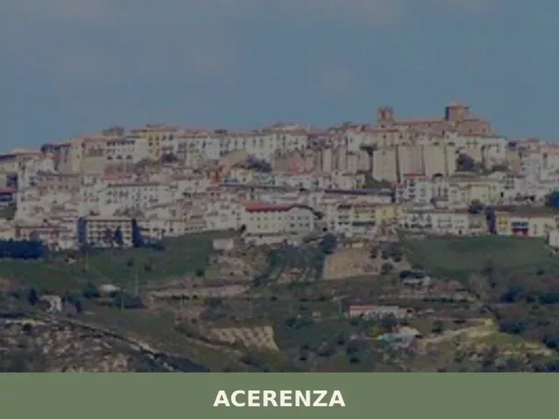
Acerenza
Discover what to see in Acerenza, Basilicata: a Norman cathedral, medieval streets, calanchi views and local food. Practical tips for visiting this hilltop episcopal town.
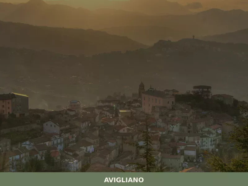
Avigliano
Discover what to see in Avigliano, a recognised cittu00e0 in Basilicata's Potenza province. History, attractions, food, and travel tips for this Apennine town.
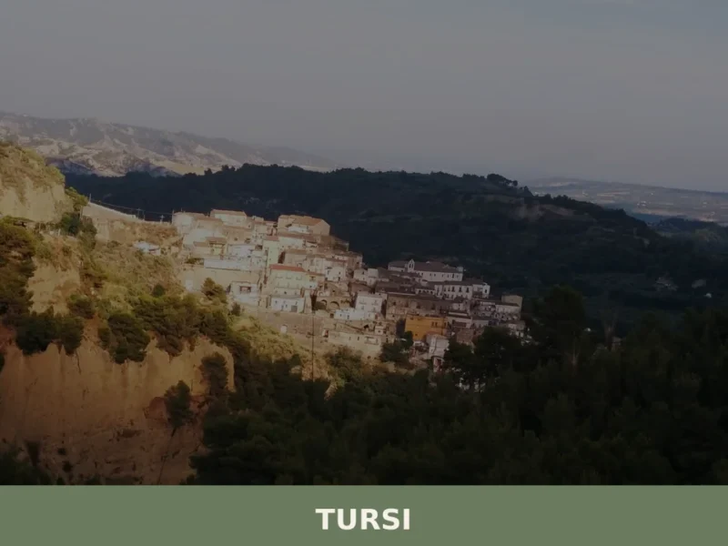
Tursi
The ochre-yellow clay slopes that surround Tursi do not stay still. Every significant rainfall shifts the marly sediment, exposing new gullies in the Cenozoic rock and deepening the three chasms — the Palmara ditch to the north, the St. Francis ditch to the east, and the Cathedral ditch to the west — that have protected […]
Banzi
In 1956, during archaeological excavations in the area of ancient Bantia, the “Bantine Table” was discovered, a bronze tablet inscribed in the Oscan language, providing direct evidence of the legislation of this Italic community from the 4th-3rd century BC. For those wondering what to see in banzi today, the village, located at 571 meters above […]
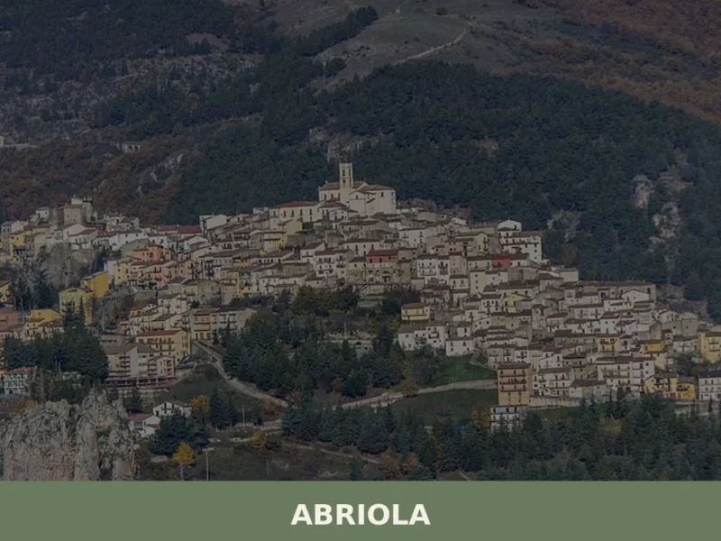
Abriola
Discover what to see in Abriola, a mountain village in Basilicata at 957m. Sanctuary, historic centre, local food, trails, and practical travel tips.
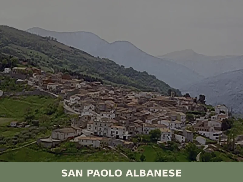
San Paolo Albanese
San Paolo Albanese, in the province of Potenza, stands out as Basilicata’s least populous municipality, recording a population of 280 inhabitants. This demographic reality gives the village an intimate dimension, where social relationships and the traditions of the Arbëreshë community remain strongly evident. For those wondering about what to see in san paolo albanese, the […]

Garaguso
What to see in Garaguso, Italy: a hilltop comune at 460 m with a Greek Heroon, an 18th-century palace, and Iron Age finds. Discover the top attractions now.
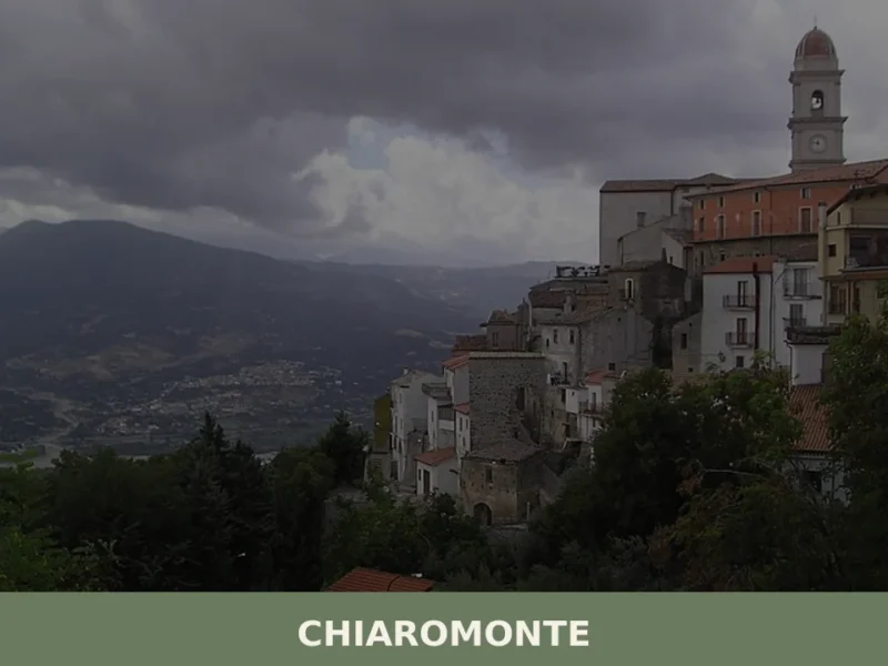
Chiaromonte
what to see in chiaromonte, Italy: Discover its 794m altitude and delve into its history, from ancient roots to the case study of Montegrano. Explore Basilicata.
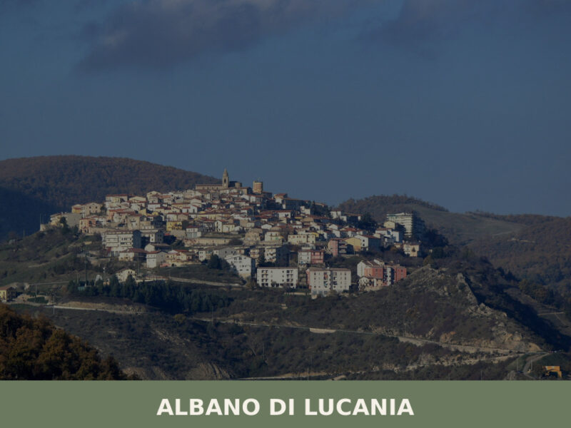
Albano di Lucania
A complete guide to Albano di Lucania in Basilicata — its medieval lanes, stone churches, Lucanian cuisine, and the quiet landscapes of the upper Basento valley.

Forenza
Discover Forenza, a hilltop village in Potenza province at 800m, with historic churches, Apennine panoramas, and authentic Lucanian cuisine.


🏡 Know Lauria better than we do?
If you’re a local or have been there, your knowledge matters: add what’s missing or fix a detail on this page.