Molini di Triora
What to see in Molini di Triora, Italy: a village at 460 m in Liguria. Discover top attractions, local food, festivals and how to get there. Read the guide.
Discover Molini di Triora
The Argentina River cuts through a valley floor wide enough to have once supported a chain of working mills, their stones fed by snowmelt channelled down from the Maritime Alps. At 460 m (1,509 ft) above sea level, the municipality spreads across 57.9 square kilometres (22.4 sq mi) of inland Liguria, where the valley broadens before narrowing again toward the higher ridgeline settlements.
The name itself records the industrial past: molini means mills in Italian, and the hydraulic geography of the place made it a natural production site before any modern infrastructure arrived.
Deciding what to see in Molini di Triora starts with understanding the village’s position: roughly 100 km (62 mi) southwest of Genoa and 25 km (16 mi) northwest of Imperia, in the Province of Imperia.
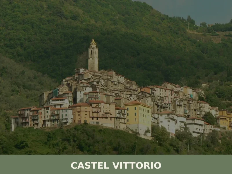
The municipality shares borders with eight neighbours, including Triora, Badalucco and Castelvittorio, creating a compact cluster of inland communities that visitors can cover in a single extended day. Molini di Triora attractions range from the river landscape and the historic mill infrastructure to the feast of San Lorenzo on 10 August, which draws locals from across the valley. The village currently counts around 613 inhabitants, a figure that reflects the gradual depopulation of interior Ligurian settlements over the twentieth century.
History of Molini di Triora
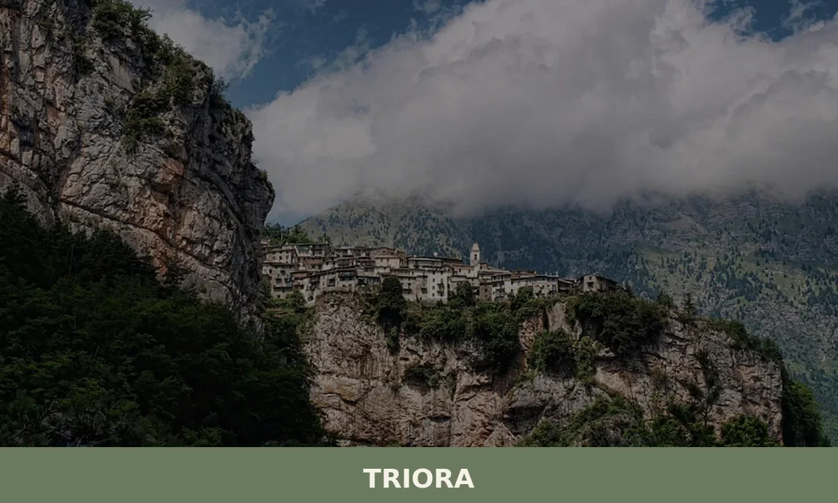
The municipality takes its full name from the combination of two realities: the mills that operated along the Argentina River and the proximity to Triora, the larger hilltop settlement to the northwest with which it has been historically and administratively linked.
The Ligurian name, Moin de Triêua, preserves both elements in the regional dialect, indicating how deeply the identity of this lower valley community was tied to the upland town. The Argentina valley was a corridor of movement and commerce long before modern roads replaced the mule tracks that connected the coast at San Remo with the alpine passes leading into what is now French territory.
The milling economy that gave the village its name was not incidental. The consistent flow of the Argentina River and its tributaries created conditions suited to grain and olive processing, and the mills served a catchment area that extended well beyond the municipal boundaries.
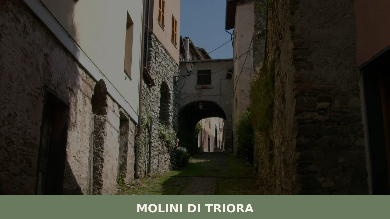
This productive function positioned Molini di Triora as a working settlement rather than a defensive or administrative one, which explains the character of its built fabric: practical structures oriented toward water access rather than the fortified hilltop layouts common in the surrounding area.
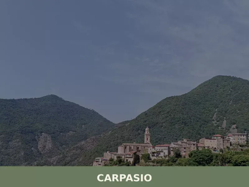
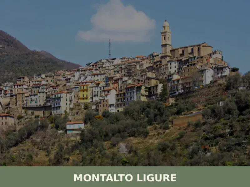
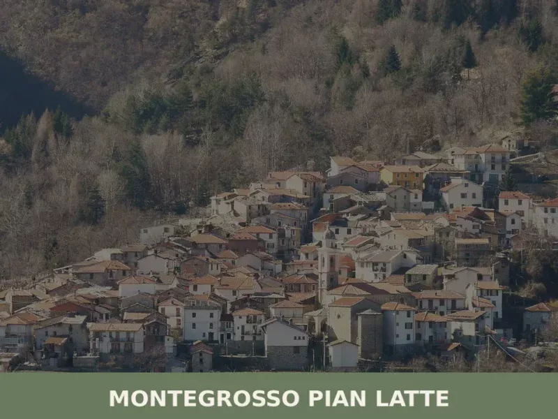
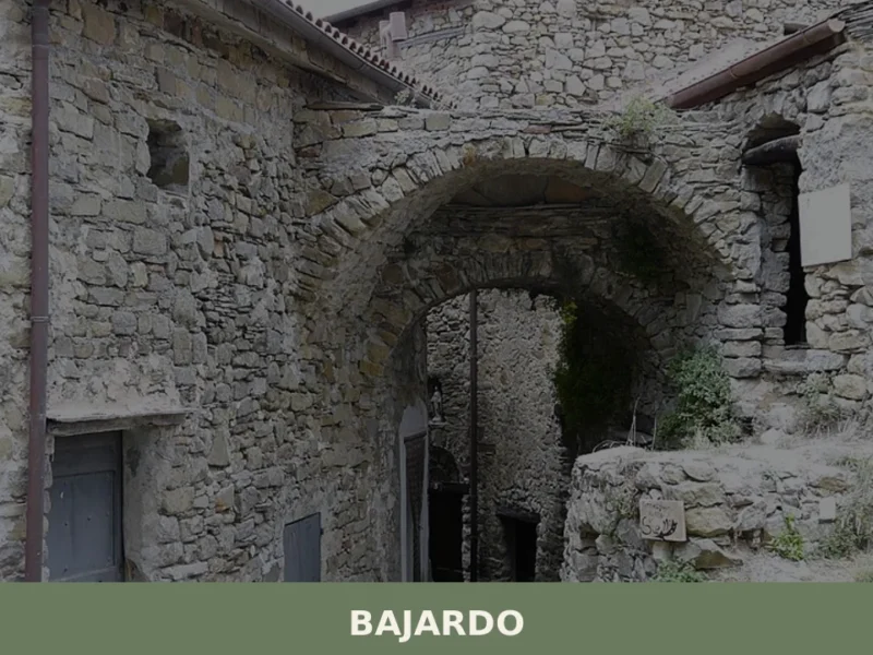
The borders of the municipality touch those of Badalucco, Bajardo, Carpasio, Castelvittorio, Montalto Ligure, Montegrosso Pian Latte, Rezzo and Triora, forming a dense network of interdependent communities that shared resources, markets and road access across centuries. Villages such as Pietrabruna, further south in the same province, developed along comparable lines, with local economies shaped by the terrain and the availability of water.
The twentieth century brought significant demographic change. As of 31 December 2004, the recorded population stood at 741, and the current figure of approximately 613 reflects a continuing outward migration that accelerated after World War II, when improved road connections made coastal employment accessible.
One figure linked to the municipality is the painter and sculptor Michael Green, whose presence in the area placed Molini di Triora on a small but documented cultural map.
The climate, classified under the Köppen system as Csb, a temperate oceanic or Mediterranean subtype, produces cool, relatively humid conditions at valley floor level, with winters that are noticeably colder than the coast 25 km (16 mi) away. This climatic reality has always shaped what the land can produce and when the valley is most accessible to outside visitors.
What to See in Molini di Triora, Liguria: Top Attractions
The Argentina River and Its Mill Sites
The Argentina River runs at the base of the valley at approximately 460 m (1,509 ft) elevation where it passes through the municipal centre, its bed rocky and fast-moving after autumn rains.
The historic mill sites that gave the village its name are distributed along the riverbanks, and the remnants of their stone structures remain visible in several locations.
Standing at the water’s edge, visitors can read the logic of the settlement directly in the landscape: channels cut to divert flow, stone platforms set close to the current, and the gradient of the riverbed that made mechanical milling viable here and not in the steeper gorges upstream. The best time to walk the river path is from late April through June, when water levels are substantial but not dangerous, and the vegetation along the banks is in full growth.
The Village of Corte
Corte is a distinct locality within the municipal area, positioned higher up the slope than Molini di Triora itself and visually separate from the main settlement. The two places are close in distance but differ clearly in altitude and character: Corte sits at a noticeably higher elevation, its compact group of buildings visible from the valley floor below. For visitors exploring what to see in Molini di Triora, the climb to Corte provides a different vantage point over the Argentina valley and a direct comparison between two settlement types — the valley-floor mill community and the hillside residential cluster.
The access path requires suitable footwear, as the gradient between the two localities is significant and the surface is uneven in places.
The Surrounding Municipal Borders and Valley Walks
The municipality’s 57.9 sq km (22.4 sq mi) territory encompasses a varied landscape of valley floor, forested slopes and higher ground approaching the ridgeline shared with Bajardo and Montegrosso Pian Latte.
Walking routes connect the main settlement with the border areas, passing through terrain characteristic of inland western Liguria: mixed woodland, dry-stone terracing built for olive and chestnut cultivation, and exposed ridges with views toward the Maritime Alps. The network of paths linking Molini di Triora with its eight bordering municipalities offers day-walking options at various levels of difficulty.
Those arriving from Isola del Cantone or other parts of Liguria will find the valley landscape here notably different from the coastal strip, with temperatures several degrees lower even in summer.
The Feast of San Lorenzo and the Village Centre
The village centre clusters around the civic and religious focal points that any settlement of this scale maintains, with the patron saint San Lorenzo providing the main liturgical and communal reference point. The feast on 10 August organises the public space of the village in ways that reveal its layout: the procession routes, the gathering points and the relationship between the church and the surrounding built fabric all become readable during the festival period.
The date of 10 August coincides with the Perseids meteor shower, historically known in Italy as the lacrime di San Lorenzo, or tears of Saint Lawrence, adding a natural spectacle to the evening celebrations. Visiting in early August allows travellers to experience both the festival and the driest, warmest period of the valley’s year.
The Work of Michael Green
The painter and sculptor Michael Green is documented as a figure linked to Molini di Triora, making the municipality one of the few small inland Ligurian villages with a named contemporary artist in its recorded history.
Green’s presence in the area connects the village to a broader network of artists who settled in the inland Ligurian valleys from the mid-twentieth century onward, drawn by lower living costs and the particular quality of light at higher elevations.
For visitors interested in the intersection of art and landscape, the fact of an artist’s long-term residence in a place as specific as this one is worth noting: it speaks to the conditions the valley offers, including the clear mountain air, the absence of coastal haze and the distinct colour palette of the Argentina valley’s geology.
Local Food and Typical Products of Molini di Triora
The food traditions of the Argentina valley reflect the geography of inland western Liguria rather than the coastal cuisine more familiar to international visitors.
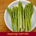
At 460 m (1,509 ft), the cultivable land produces ingredients suited to a cooler climate: chestnuts, which historically served as a staple carbohydrate across the inland Ligurian hills, dried legumes, and vegetables grown on terraced plots. The valley’s proximity to the French border introduced some cross-cultural influences in curing and preserving techniques, while the lower altitude of the coast — reachable within an hour by road — provided access to olive oil, the foundational fat of all Ligurian cooking.
The dishes associated with this part of the Province of Imperia follow the pattern of cucina povera, the Italian tradition of cooking built around minimal ingredients used with precision.
Pansoti, triangular pasta parcels filled with wild herbs and ricotta, dressed with a walnut sauce called salsa di noci, appear across western Liguria and would have been prepared in valley households using foraged greens from the slopes around the village.
Brandacujun, a vigorous preparation of salt cod mashed with potatoes and olive oil, reflects the preserved-fish trade that reached even the most interior settlements via the mule-track network. Chestnut flour preparations, including flatbreads cooked on stone, represent the older subsistence layer of the local diet, predating the arrival of wheat flour as a routine ingredient.
Olive oil from the Province of Imperia carries protected designation status, and while the primary olive groves are concentrated at lower altitudes, the oil pressed from the small-fruited Taggiasca variety has been a trade commodity in the Argentina valley for several hundred years. The Taggiasca olive, characteristically mild and low in bitterness, is the defining cultivar of western Liguria and distinguishes the oil produced here from those of eastern Liguria or Tuscany.
Local markets in the valley towns, particularly in Badalucco and the surrounding municipalities, offer the most direct access to producers during the autumn harvest period, running from October through December.
The autumn season also sees the production and sale of dried porcini mushrooms gathered from the forested slopes above the village.
The chestnut harvest in October provides a focal point for informal local gatherings, and visitors passing through the valley at that time will find fresh chestnuts available for purchase directly from growers. For those planning a food-focused visit, the period between late September and early November combines the best seasonal produce with cooler walking conditions and significantly reduced visitor numbers compared to the summer months.
Festivals, Events and Traditions of Molini di Triora
The central fixed point in the village’s annual calendar is the feast of San Lorenzo, patron saint of Molini di Triora, celebrated on 10 August. The date falls in the height of the Ligurian summer, when the valley is at its most accessible and the evenings are long enough for outdoor gatherings. Traditionally, the feast involves a religious procession, a Mass in honour of the patron, and communal celebrations in the village.
The coincidence with the Perseids meteor shower — visible on the same night — gives the evening an additional dimension that locals have historically marked as part of the feast’s significance.
The lacrime di San Lorenzo tradition ties the natural event directly to the saint’s commemorative date.
Beyond the patron feast, the village participates in the broader cycle of events that characterise the inland Ligurian calendar: autumn harvest gatherings centred on chestnuts and mushrooms, and informal food markets that connect valley producers with visitors from the coast and from neighbouring provinces. The Argentina valley as a whole maintains a tradition of sagre, local food festivals, in the surrounding municipalities during summer and early autumn, meaning that a stay in the Molini di Triora area in August or September is likely to coincide with at least one such event within easy driving distance.
When to Visit Molini di Triora, Italy and How to Get There
The best time to visit Molini di Triora depends on the type of experience a visitor is seeking. The Köppen Csb classification means the village has warm, relatively dry summers and cool, wetter winters. July and August bring the highest temperatures and the feast of San Lorenzo on 10 August, making this the most socially active period in the village. Late September through November offers cooler air, the chestnut and mushroom harvest season, and the best conditions for valley walking with good visibility toward the Maritime Alps.
Spring, from April through June, is consistently recommended for those whose primary interest is the river landscape and the surrounding countryside, when water levels are high and the slopes are at their most productive-looking.
Reaching Molini di Triora from major Italian cities requires combining rail and road transport. The nearest significant rail hub is Trenitalia services to Sanremo or Imperia Porto Maurizio on the coastal line, both approximately 25 to 35 km (16 to 22 mi) from the village.
From either coastal station, the journey inland follows the Argentina valley via the SS28 state road, a route of roughly 30 to 40 minutes by car depending on the starting point. From Genoa, the drive covers approximately 100 km (62 mi), typically taking between 90 minutes and two hours via the A10 motorway toward Imperia with exit at Arma di Taggia, followed by the inland valley road. From Milan, the total distance is approximately 230 km (143 mi), making Molini di Triora reachable as a long day trip or more comfortably as part of a multi-day itinerary in western Liguria.
International visitors should note that English is not widely spoken in the smaller shops and restaurants of the valley, and carrying cash in Euros is advisable as card payment infrastructure is limited in the interior municipalities. Further practical information for the area is available through the official municipality website of Molini di Triora.
Visitors with time to extend their itinerary westward along the coast and then back inland will find that Calice Ligure offers a comparable inland character further east, while those interested in the specific landscape of the Province of Imperia’s interior can also consider Plodio as a stop on a broader circuit of the region’s lesser-visited valley settlements. Both villages share the general pattern of small population centres set in hilly inland terrain, connected by secondary roads that reward slow travel by car or bicycle.
Photo Gallery of Molini di Triora
Do you have photos of Molini di Triora?
Share your photos of the village: the best ones will be added to the official gallery, with your credit.
Send your photosNearby Villages near Molini di Triora


📝 Incorrect information or updates?
Help us keep the Molini di Triora page accurate and up to date.