


Renon
At 1154 m above sea level, Renon offers earth pyramids, medieval castle ruins and a narrow-gauge railway surviving from 1907.
Renon: a High Plateau Between the Brenner Road and the Alps
At over a thousand metres above sea level, the plateau stretches wide and open between two deep valleys, the Isarco to the east and the Sarentino to the west. Stone farmhouses dot the pastures, the air carries a freshness that valley floors never quite reach, and the reddish earth pyramids rise from the eroded hillsides like sentinels that geology placed here without any human plan.
Renon, known in German as Ritten and in Ladin as Renon, sits at 1154 metres above sea level in the Province of Bolzano, Trentino-Alto Adige, and draws visitors with two contrasting appeals: the silence of a high alpine plateau that has kept its own pace for centuries, and a direct connection to Bolzano below that makes it unusually accessible for a mountain commune of this altitude.
From the Kaiserweg to the Sommerfrische: Renon Through the Centuries
The name itself carries age. The toponym is recorded as Ritano in documents from 871 to 875, then as Ritena in 1027, as Ritine in 1160, and as Rithen in 1179. Scholars trace the root to a Vulgar Latin form, retinone, probably of pre-Roman origin, suggesting that the plateau was named and inhabited long before any medieval record survives.
For several centuries during the Middle Ages, the plateau performed a strategic function that shaped its character. The gorge of the Val d’Isarco was difficult to traverse, and travellers long preferred the plateau route as an alternative. Before that infrastructure existed, travellers moving between Germany and Italy along the Brenner corridor often crossed the plateau instead. The route known as the Kaiserweg, or imperial road, descended from Colma, passed through Longomoso, and dropped back toward Rencio on the edge of Bolzano. The name reflected the reality: a long succession of Germanic kings and Holy Roman Emperors used this path, among them Conrad II and Frederick I. In 1179, Frederick I granted a significant market privilege at Longostagno, a document that confirms the economic weight the plateau already carried. In those same decades, a house of the Teutonic Order was established on the plateau, an institution whose presence reflects the strategic importance the territory held for powers beyond the local valley communities.
Later centuries brought a different kind of attention. From the 1840s onwards, the plateau became a destination for the aristocracy and bourgeoisie of Bolzano seeking relief from the summer heat of the valley floor. This phenomenon, known in German as Sommerfrische, the custom of spending summer weeks at altitude for the sake of cooler air, found one of its most articulate expressions here, spread in part through the writings of Ludwig Steub and Beda Weber. Sigmund Freud spent several holiday seasons on the plateau and a walking path departing from Collalbo, the municipal seat, at the locality of Schönblick and reaching Soprabolzano now bears his name. By the early twentieth century, the plateau had established a clear identity as a place of seasonal residence, a character it has not entirely shed.
Castles, Pyramids and the Narrow-Gauge Railway: the Territory Explained
The Earth Pyramids of Renon
Near Soprabolzano and at Longostagno, clusters of reddish earth pyramids rise from the eroded terrain in a formation that water and snow have sculpted over long periods. Each pinnacle is capped by a boulder that temporarily protects the column beneath from direct erosion. When the column narrows too far, the boulder falls and the pyramid disappears. The most significant groups stand in the valley of the Rio Rivellone and are visible from the cable car connecting Bolzano and Soprabolzano, giving travellers an aerial perspective on the geological process before they reach the plateau.
The Castles of the Plateau
The administrative territory of Renon holds several castle sites at different stages of survival. Castel Stein, located in the fraction of Collalbo in the locality of Siffiano, remains accessible. Castel Vanga stands as a private structure in the fraction that shares its name. At Auna di Sotto, only the ruins of Castel Zwingenstein survive; the lords of Zwingenstein administered the village from their castle until 1531, and their heraldic motif passed into the municipal coat of arms, formally recognised by provincial decree on 4 September 1967. Castel Roncolo, known as early as 1237, sits on a rock above the Talvera torrent at the entrance to the Val Sarentino, though it lies outside the municipal boundary and belongs to the territory of Bolzano.
The Narrow-Gauge Railway
Opened in 1907, the railway that once ran the full length from Bolzano to the plateau now operates only its upper section: a narrow-gauge line linking the fraction of Maria Assunta with Collalbo, calling at Soprabolzano, the lake of Costalovara, and Stella di Renon along the way. The lower Bolzano–Soprabolzano stretch was replaced in 1966 by the cable car, which was then completely rebuilt and reopened in May 2009. Travelling the surviving rail section is less about transport efficiency and more about understanding how the plateau relates to its own internal geography, fraction by fraction, at a pace suited to the altitude.
The Churches Across the Fractions
Because Renon is a comune sparso, a dispersed municipality with no single urban centre, its religious architecture is distributed across the fractions rather than concentrated in one place. The parish church of Santa Maria Assunta serves Longomoso, Santa Ottilia serves Longostagno, San Pietro Apostolo is the parish church of Vanga, San Giuseppe of Campodazzo, and San Leonardo of Auna di Sopra. The church of Santa Verena stands at the locality of Rotwand, and San Giovanni Battista sits on Monte San Giovanni. Together they trace the historical settlement pattern of the plateau across pasture and woodland.
The Walking Routes
The plateau carries a dense network of walking paths suited to different seasons and fitness levels. The path named after Sigmund Freud runs from Collalbo at Schönblick to Soprabolzano. The ruins of Castel Stein and Castel Zwingenstein serve as endpoints for other comfortable routes that combine historical interest with open views across the plateau. In winter, the frozen lake of Costalovara offers ice skating within a few hundred metres of the narrow-gauge railway stop.
A Plateau Pantry: Food and Production on the Renon Territory
The agricultural character of the plateau, its altitude and its cooler growing season, shapes what is produced and consumed here. The territory around Auna di Sotto, at approximately 900 metres along the road connecting Collalbo with Bolzano, is home to companies known well beyond the regional boundary: Loacker, the wafer and confectionery producer, alongside Finstral and Daunenstep, all based in the same fraction. Their presence underlines that the plateau is not only a landscape for leisure but a working economic territory with industrial output of genuine scale.
The traditions of alpine pasture that have long defined life at this altitude also connect Renon to a broader South Tyrolean food culture built around seasonal grazing and dairy production. The centuries-long dispute between the communities of Renon and Villandro over grazing rights on the adjacent Villandro plateau is a reminder that the management of these high pastures was never a minor matter but a source of real economic tension across generations.
Planning a Visit: Seasons, Access and Distances
The altitude of Renon means the plateau follows a seasonal rhythm distinct from the valley below. Summer brings the cool air that first drew visitors here in the nineteenth century and makes walking and cycling comfortable even in July and August. Autumn sharpens the light across the pastures and turns the edges of the woodland. Winter opens the skating rink at the Arena Ritten in Collalbo, where the ice hockey team Ritten Sport competes in the Alps Hockey League, and the lake of Costalovara freezes for open-air skating. The ski lifts serving the Corno del Renon at 2260 metres extend the winter season for those who want elevation beyond the plateau itself.
Access from Bolzano is straightforward. The cable car connects the city with Soprabolzano and the narrow-gauge railway continues from there to Collalbo, making it possible to reach the municipal seat without a car. The provincial road provides the road alternative. Visitors looking to explore the wider South Tyrolean plateau country may also find connections worth considering toward Barbiano to the south, or toward the wine-country settlements near Appiano sulla Strada del Vino. The city of Bolzano directly below provides the natural base for those combining the plateau with a wider itinerary through the Adige valley, including stops at Andriano or Bronzolo.
The commune counts around 8211 residents spread across fifteen fractions, with the municipal offices in Collalbo. German is the majority language, and most signs, menus and conversations operate in both German and Italian. The official municipal website at comune.renon.bz.it carries practical administrative information for longer stays or residency enquiries.
| Departure | Distance | Time |
|---|---|---|
| Bolzano (cable car) | direct connection | approx. 12 min |
| Bolzano (by road) | approx. 18 km | approx. 30 min |
| Trento | approx. 65 km | approx. 1 h |
| Innsbruck | approx. 90 km | approx. 1 h 15 min |
| Verona | approx. 175 km | approx. 1 h 50 min |
Frequently asked questions about Renon
Come si raggiunge Renon da Bolzano?
Da Bolzano si può salire a Renon in tre modi: in funivia dalla stazione di Bolzano Sud fino a Soprabolzano (circa 12 minuti), in auto percorrendo la strada provinciale SP 38 con circa 20 km di curve, oppure in autobus con la linea SAD. Dalla funivia di Soprabolzano parte la ferrovia a scartamento ridotto Renon che collega i principali abitati dell'altopiano fino a San Genesio. L'uscita autostradale più vicina è Bolzano Sud sull'A22.
Qual è il periodo migliore per visitare Renon?
La primavera e l'estate (maggio–settembre) sono ideali per escursioni e per osservare le piramidi di terra nelle migliori condizioni di luce. L'inverno offre paesaggi innevati e piste di fondo. L'altitudine di 1154 m garantisce temperature estive fresche, in media 5–7 °C inferiori rispetto a Bolzano. Luglio e agosto sono i mesi più frequentati, mentre settembre unisce clima mite e minore affollamento.
Esistono sentieri escursionistici documentati sull'altopiano del Renon?
Sì. Il percorso più noto è il Sentiero delle Piramidi di Terra presso Longomoso e Soprabolzano, segnalato e percorribile in circa 1–2 ore. L'altopiano è attraversato da numerosi sentieri CAI e dal celebre Keschtnweg (Sentiero dei Castagni) che scende verso Bolzano. Sono presenti anche itinerari ciclabili adatti a mountain bike e percorsi di Nordic Walking ufficialmente tracciati dall'ente turistico Ritten/Renon.
Quanto tempo occorre per visitare Renon?
Una visita completa richiede almeno una giornata intera: mezz'ora per la funivia da Bolzano, 1–2 ore per le piramidi di terra, un giro in ferrovia storica tra gli abitati e il tempo per esplorare Collalbo, sede comunale. Per chi desidera escursioni più lunghe o scoprire tutti e quindici i masi, è consigliabile pernottare almeno una notte sull'altopiano.
Dove si può parcheggiare a Renon?
Chi sale in auto trova parcheggi pubblici a Collalbo, principale centro dell'altopiano, e a Soprabolzano nei pressi della stazione della funivia. In alta stagione i parcheggi si saturano nelle ore centrali; si consiglia di utilizzare la funivia da Bolzano, che dispone di un parcheggio scambiatore alla stazione a valle, per ridurre il traffico sull'altopiano.
📷 Photo Gallery — Renon


In Trentino-South Tyrol More villages to discover
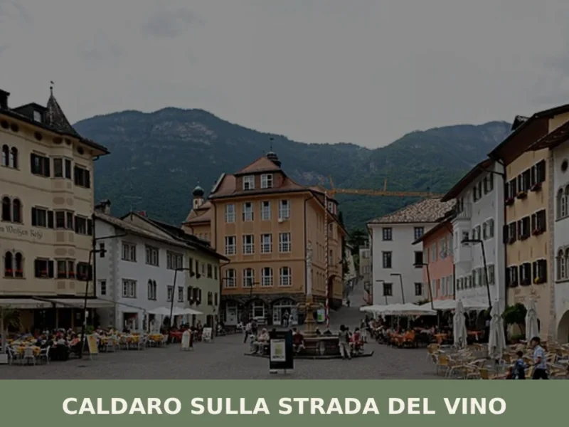
Caldaro sulla strada del vino
Caldaro sulla strada del vino — Kaltern an der Weinstraße in German — has 7,735 inhabitants and over 600 hectares of vineyards, the largest cultivated wine-growing area in South Tyrol. The place name itself declares the vocation of this centre in the province of Bolzano, which grew along the trade route linking the Bassa Atesina […]
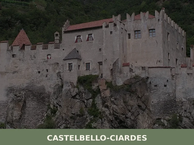
Castelbello-Ciardes
The municipality of Castelbello-Ciardes, home to 2,379 inhabitants at 587 metres above sea level in the Venosta Valley, owes its existence to a dual administrative identity: in 1928 the two separate villages of Castelbello (Kastelbell) and Ciardes (Tschars) were merged into a single municipality. Anyone looking into what to see in Castelbello-Ciardes will find an […]
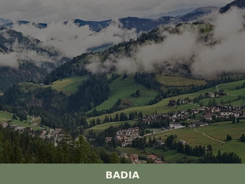
Badia
Badia has 3,396 inhabitants spread across six hamlets — San Leonardo, Pedraces, La Villa, San Cassiano, La Val and Antermoia — and occupies a stretch of the Val Badia where Ladin is the mother tongue for over ninety per cent of the population. Understanding what to see in Badia means entering a Dolomite valley where […]
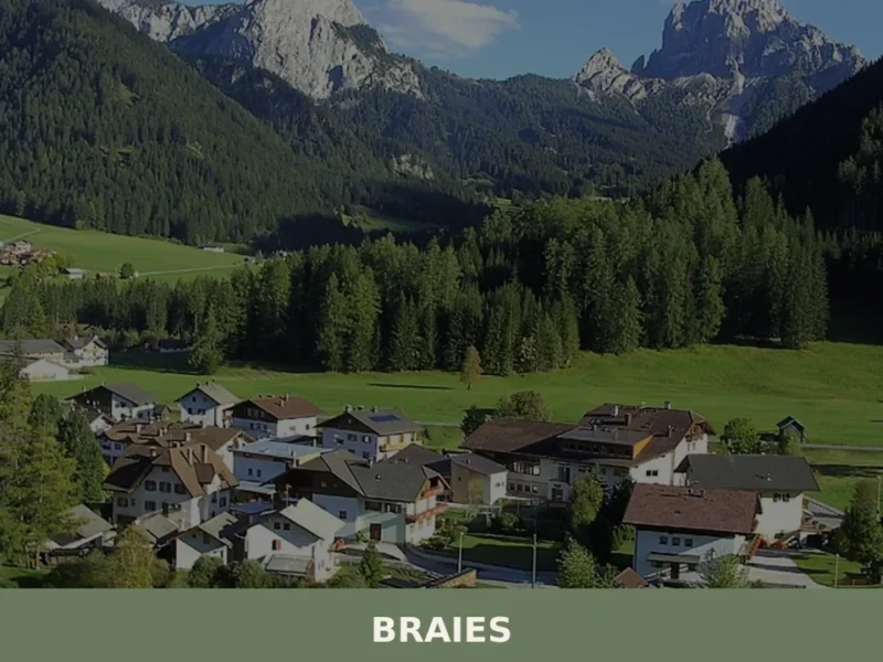
Braies
Lake Braies, sitting at 1496 metres above sea level, is the deepest natural lake in South Tyrol: 36 metres at its maximum point, fed by underground springs that filter through the Dolomite rock. This geological fact alone explains why hundreds of thousands of people reach this side valley off the Puster Valley every year. But […]
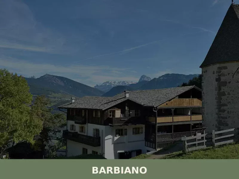
Barbiano
Barbiano covers 25.26 square kilometres on the right-hand slope of the Isarco Valley, spread across five hamlets — Barbiano village, Colma, San Giacomo, Saubach and Dreikirchen — each with its own architectural identity and historical function. Understanding what to see in Barbiano means crossing a territory that rises from 471 metres on the valley floor […]
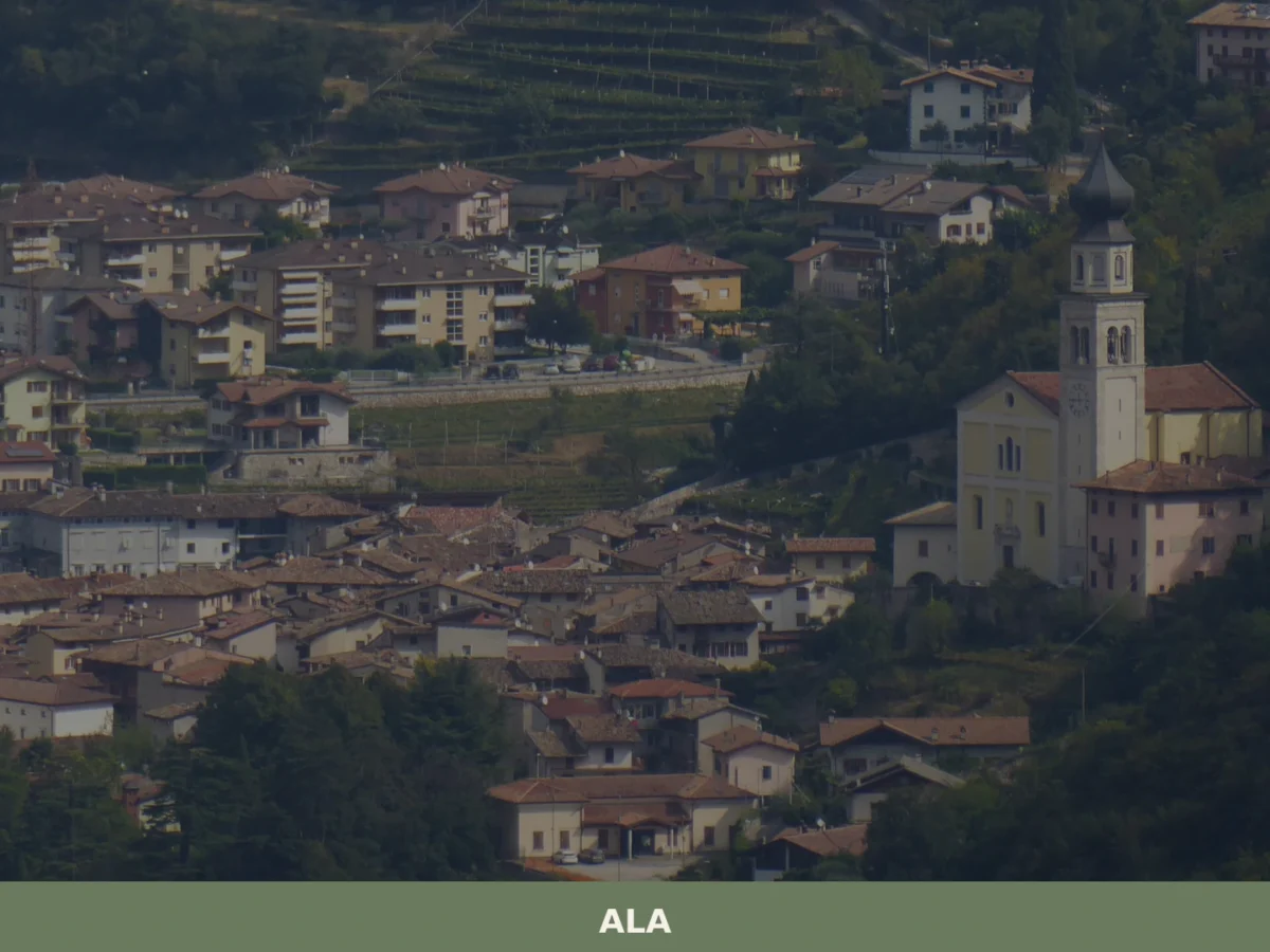
Ala
Discover what to see in Ala, Trentino: silk merchant palazzi, Habsburg border history, Vallagarina wines and the Valle dei Ronchi. Practical tips included.
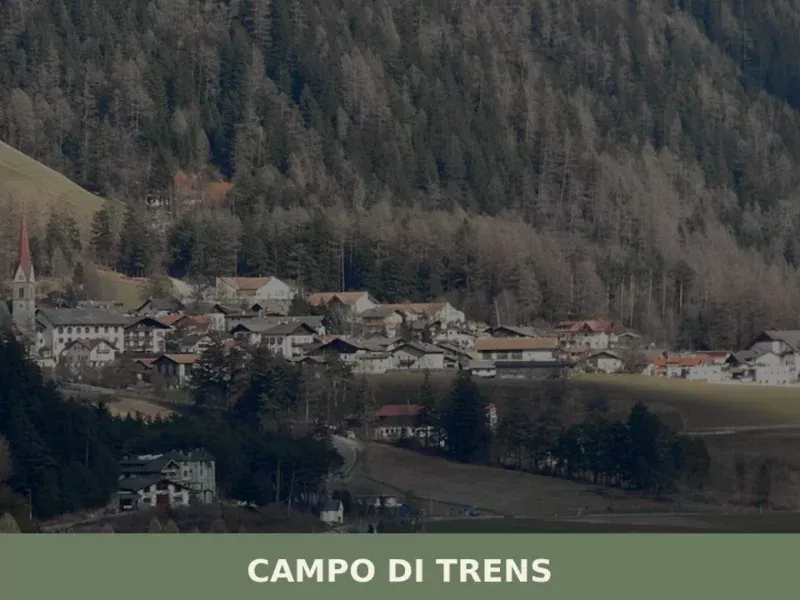
Campo di Trens
At 937 metres above sea level, along the Isarco valley between Vipiteno and Fortezza, the municipality of Campo di Trens has 2,679 inhabitants spread across the hamlets of Trens, Stilves and Mules. Anyone looking into what to see in Campo di Trens will find an area where the German language predominates — the official German […]
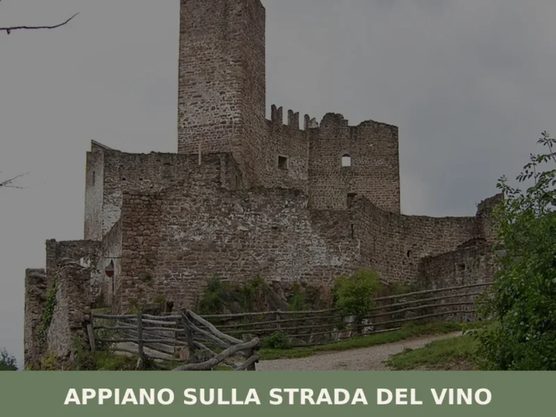
Appiano sulla strada del vino
The municipality of Appiano sulla strada del vino has 14,304 inhabitants spread across eight hamlets — San Michele, San Paolo, Cornaiano, Frangarto, Missiano, Monticolo, Gaido and Girlan (Cornaiano) — set between 200 and 500 metres above sea level on the left bank of the Adige river, in the middle of the Bassa Atesina (Lower South […]
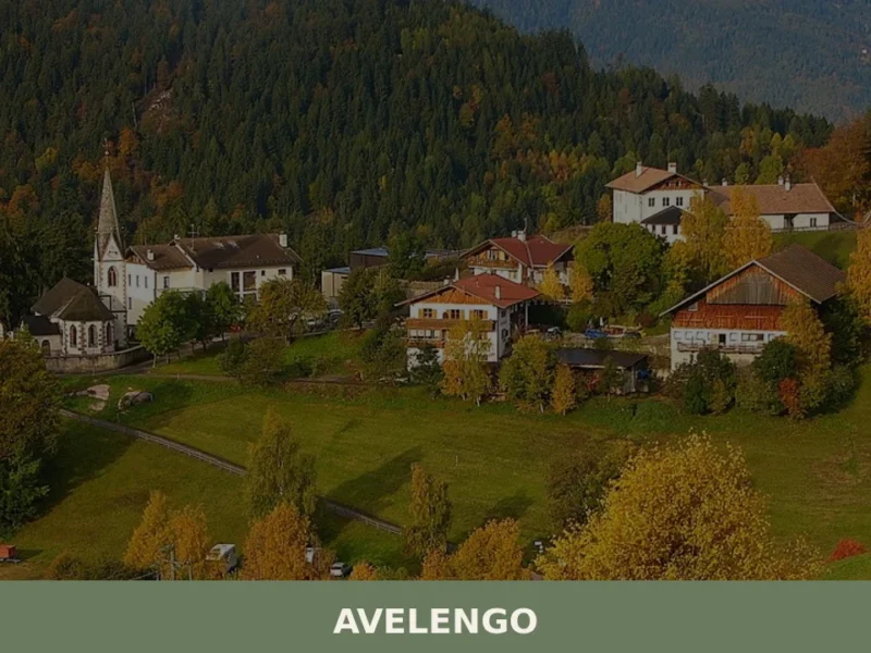
Avelengo
Avelengo has 796 inhabitants and sits at 1,290 metres above sea level on the plateau overlooking the Merano basin, on the southern side of the Sarntal Alps. Its municipal territory spans an altitudinal range from 600 to 2,200 metres, with high-altitude pastures that gave rise to one of the most extensively documented native horse breeds […]
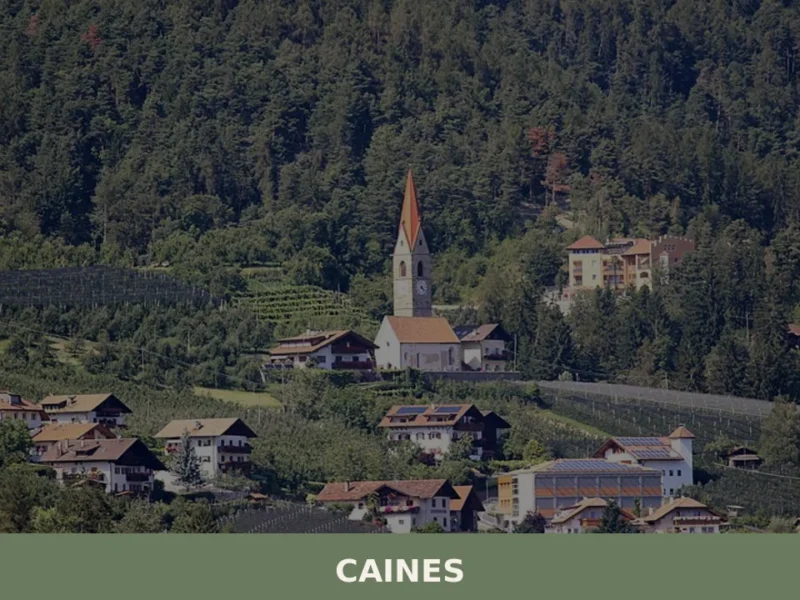
Caines
With just 398 registered inhabitants and an elevation of 592 metres above sea level, Caines — Kuens in German — is one of the smallest municipalities in the province of Bolzano. It extends across the sun-facing slope of the middle Passiria Valley, a few kilometres from Merano, on a natural terrace overlooking the confluence of […]
🧀 Italian traditional products


🏡 Know Renon better than we do?
If you’re a local or have been there, your knowledge matters: add what’s missing or fix a detail on this page.