Water and stone have shaped this corner of the Veneto for two thousand years. The flat plain of the Alta Padovana reveals itself through a network of canals and rivers—the Tergola flowing northwest to southeast, the artificially carved Muson dei Sassi running due north, intersecting at a single brick bridge that lets one watercourse cross another like a low-slung viaduct. Beneath these waterways lie invisible grid lines traced by Roman surveyors, and above them stands a single brick tower, 38 metres tall, with walls six metres on each side, remnants of a medieval castle.
San Giorgio delle Pertiche, a comune in Padova province with just over 10,000 inhabitants, sits at an altitude of 18 to 26 metres above sea level and owes its character to this layering of Roman, Longobard, medieval and Venetian histories. Two main attractions anchor a visitor’s understanding: the Torre Millenaria (the 11th-century tower that served a bishop’s fortress) and a network of noble villas, built during centuries of relative stability under Venetian rule.
Roman Grids and Longobard Memory
The territory of San Giorgio delle Pertiche preserves an extraordinary archaeological palimpsest. The cardo maximus of the ancient Agro Centuriato Patavino—the Roman surveyor’s north-south spine—now runs as the Strada Regionale del Santo through the village. Its east-west counterpart, the decumanus maximus, is known today as Via Desman. These lines were not arbitrary: Roman agrimensors used measuring rods called pertiche to lay out this vast grid of cadastral plots across the Paduan plains, carving the landscape into rectangles of uniform size for systematic land distribution and taxation.
An early historical theory, proposed by historian Enrico Nestore Legnazzi, suggests that the village’s surname—”delle Pertiche” (of the rods)—preserves the memory of these surveying instruments themselves. Once the centuriation was complete, the rods were consecrated and stored in a temple as sacred objects. A second explanation, less certain, links the name to Longobard burial customs: pertiche were long poles topped with bird sculptures, erected over cenotaphs to honour those who died far from home, with the bird oriented toward the distant place of death.
It is likely during the Longobard period that a church dedicated to San Giorgio—the warrior saint beloved by Germanic peoples—was founded. The presence of a place of worship would have drawn settlers and gradually shaped a true settlement around the religious nucleus.
Centuries Under Episcopal and Venetian Rule
In 911, the bishop of Padova received dominion over San Giorgio through a donation by Berengario I, a grant confirmed by Emperor Frederick Barbarossa in 1161. The bishop governed through appointed noble families, including the da Marostica, whose authority clashed with rival lords such as Sicherio of Sant’Andrea and the Fisoli family. By the mid-13th century, power shifted from ecclesiastical hands to those of the Padovan commune itself.
Around the mid-11th century, Bishop Bernardo erected a fortified castle near the church—a four-towered stronghold with moats, earthworks and walls. One tower survives, later converted into a bell tower. Its solid brick construction, built partly from Roman and Longobard materials, stands 38 metres high. In 1222, Bishop Giordano received Cardinal Ugolino of Anagni at this fortress, a papal legate collecting funds for the Fifth Crusade—an event commemorated in the village’s heraldic shield (granted in 1951), which displays a mount crowned with a cross, two episcopal mitres and gold coins symbolizing the crusade’s financing.
A second fortification, owned by the Burri family, stood to the south. It too has vanished, demolished in 1577 during Venetian hydraulic works, yet its name persists in the locality Torre di Burri. From the early 15th century onward, San Giorgio followed the destiny of all Paduan territory, entering the Venetian Republic’s domains. War—the conflict of the League of Cambrai—briefly damaged fortifications and infrastructure, but the Venetian era brought political stability and relative prosperity. Between the 16th and 17th centuries, a series of major water-management projects reshaped the landscape: the Muson dei Sassi was excavated, and the remarkable canal bridge at Torre di Burri was constructed, allowing the Muson to cross the Tergola without interruption. Several noble villas rose during these centuries, markers of Venetian landholding and seasonal retreat.
The Torre Millenaria and Medieval Defences
Torre Millenaria
Built around the 11th century under episcopal command, this tower anchored a medieval castle complex comprising four towers, deep moats, an earthen rampart and curtain walls. The 38-metre structure with walls six metres on each side employs a stark, unadorned style. Its lower courses are built from Roman and Longobard brick—material recycled from earlier centuries—making it a palimpsest of the plain’s long occupation. The castle complex was largely demolished in the 15th century during Venetian administrative restructuring. In subsequent centuries the tower underwent numerous vertical extensions and was eventually repurposed as the parish bell tower. The most recent restoration dates to the early 2000s.
Places of Spirit and Noble Residence
Parrocchial Church of San Giorgio
The origins of this church reach back to early medieval times. By 1297, papal tithes records show it held the rank of pieve (rural deanery), with authority over dependent churches scattered across the region—Campanigalli, Arsego, Campodarsego, Santa Giustina in Colle, Fratte and Carbantone. In the 16th century it exercised jurisdiction over San Marco in Camposampiero and San Michele delle Badesse. The building visitors see today was constructed between 1838 and 1868, then enlarged and reconsecrated in 1943. Its interior holds artworks spanning centuries: a late 15th-century painted stone Madonna della Salute (restored in 1911), a late 17th-century altarpiece by Antonio Zanchi depicting the Madonna della Cintola with Saints Giustina, Agostino and Monica, and a 1760 canvas by Giambattista Mengardi showing the Martyrdom of Saints Crispin and Crispinian. Two further paintings of equal size, executed in the manner of Titian’s workshop, depict Saint Blaise and Saint Rocco on one side and Saint Anthony Abbot with the Sorrowful Virgin on the other—likely fragments of a lost triptych.
Villa Prevedello
In the second half of the 17th century, the bishop of Padova—whose secular estate included the woodland area of Bosco—commissioned an elegant villa to serve as his palazzo dominicale, or country retreat. The residence stands in the Torre di Burri locality, near the junction of the Regionale del Santo and Via Anconetta. It once housed the canonico (canon) Giuseppe Scudolanzoni, a member of a noble Paduan family, whose tomb slab still rests in the adjacent small chapel. In 1928 the Prevedello family acquired the villa. The chapel has recently been transferred to the parish, which has undertaken thorough restoration work.
Villa Cassinari
Also known as Villa Meneghelli Cassinari and now owned by the Peroni Masiero family, this manor rises beside the Vandura torrent in the Caselle locality near the Strada Regionale 307. Its grounds include an ancient mill, no longer active but remarkable for its surviving water drop. The estate encompasses a substantial park, whose design is credited to Giuseppe Jappelli. The grounds feature colossal trees, including secular pines and a towering sequoia, specimens of considerable botanical significance. The landscape design reflects 19th-century aristocratic taste for picturesque composition and horticultural display.
Villa Mella
Located in the Arsego fraction, this historic residence—formerly known as Villa Pugnalin Valsecchi Carnaroli—displays three connected wings opening onto an English garden. The property and surrounding lands once belonged to the Soranzo, a noble Venetian family who held extensive possessions along the Piovego waterway during the 17th century, alongside the Morosini and Dolfin clans. As their territorial influence declined through the 18th century, the brothers Zuanne and Bertucci Soranzo attempted to reverse their fortunes by establishing a trade fair in 1747 at their Arsego villa, held annually under the jurisdiction of Camposampiero. During the First World War the villa served as a territorial hospital facility for the Italian Red Cross.
Arsego and the Fringe Villages
The frazione of Arsego, whose name likely derives from a small stream that once ran through its centre before being channelled into the Piovego di Villabozza canal system, appears in documented records as early as 1130 in an episcopal charter. Its parish church, rebuilt in later centuries, is dedicated to Saints Martin and Lambert. To the northwest lies Cavino, where a church of the Sacred Heart was built approximately 100 years ago. The locality of Torre di Burri, already mentioned, preserves both medieval memory and Venetian elegance. Scattered across the territory are smaller hamlets—Anconetta, Cocche (with its 1837 Madonna della Mercede chapel, erected as thanks for immunity from a deadly plague of 1831), Guizze, Russia, Rizzo and others—each with its own modest chapel or road-shrine, threading together the social fabric of the plain.
Water, Industry and Landscape
San Giorgio delle Pertiche occupies a completely flat terrain, with no elevation relief. The Tergola river enters from the northwest and exits toward the southeast, skirting the main settlement. The Muson dei Sassi flows in a north-south line along the Regionale del Santo. Minor watercourses—the Vandura, the Tergolino and the Piovego di Villabozza—crisscross the territory, creating the hydrological skeleton of an agricultural landscape. The medieval bridge canale at Torre di Burri, where Muson dei Sassi passes above the Tergola, represents an ingenious Venetian engineering solution to the challenge of managing two major waterways in close proximity.
The comune supports two industrial zones. The larger, centred in Arsego, hosts small and medium enterprises in metalworking, textiles and food production. A second zone extends along the northeastern border with Camposampiero and Borgoricco, anchored by a major shopping complex called le Centurie. Agriculture remains present but increasingly marginal, as manufacturing and commerce have reshaped the economic geography of the plain.
The Rhythm of a Paduan Village
Life in San Giorgio delle Pertiche follows the pattern of the Veneto’s low-lying towns: commuting, small-scale enterprise, parish activities and family networks rooted in land use and local memory. The railway station, with two platforms, connects the village to larger regional hubs—Padova, Treviso Centrale and Bassano del Grappa—enabling daily circulation. The religious calendar still marks the year: the feast of San Giorgio (the patron saint) remains a focal point, and the parish church continues as the social and spiritual nucleus. The waterways that define the landscape are no longer used for transport but serve drainage, irrigation and recreational purpose—kayaking and fishing attract visitors to the quieter reaches.
The villages and hamlets that ring the central piazza form concentric circles of identity. Arsego, Cavino, Torre di Burri and the smaller localities are not distant satellites but integral parts of the comune, each with its own chapel, history and local pride. The path of a visitor often becomes a slow loop through these fringe places, discovering a palazzo, a restored chapel, the careful hand of restoration, or simply the width of a canal and the shadow of a tree.
Local Tables and Agricultural Heritage
The Paduan plain has long been grain and vegetable country, with dairy production supporting a strong tradition of cheese-making. Padova province is known for polenta, risotto and the use of seasonal vegetables in simple, direct preparations. San Giorgio, as part of this agricultural zone, participates in these wider Venetan food customs—though specific local specialities or protected-designation products named exclusively to the village itself are not documented. The local rhythm still follows harvest cycles: spring greens, summer grain, autumn fruit and the winter storage staples that sustained farming communities through centuries. Markets in neighbouring towns and the village’s own small commercial streets offer access to regional producers, cheeses and preserved foods.
Planning Your Visit
San Giorgio delle Pertiche is best reached by rail or car from Padova, the provincial capital and a major centre for art and architecture. The flat landscape means cycling is a natural way to explore: the network of roads and canal towpaths offers safe, scenic routes between villages. Spring and early autumn are ideal seasons—temperatures are moderate, the plain is green, and the waterways are navigable. Summer heat can be intense on the unshaded plain; winter is grey but mild. A full day allows time to visit the Torre Millenaria, walk through the parish church, cycle to Villa Cassinari or Villa Prevedello, and explore Arsego’s industrial heritage or the small chapels scattered through the territory.
The village has basic accommodation and restaurants, though most visitors base themselves in Padova and make day trips. The railway station connects directly to the city centre; by car, the journey is under 20 kilometres and takes approximately 25–30 minutes depending on traffic. Nearby towns—Loreggia, Camposampiero and Campodarsego—offer additional layers of Venetian history and rural character and can be visited as part of a broader exploration of the Paduan hinterland.
| Departure Point | Distance | Approximate Travel Time |
|---|---|---|
| Padova (city centre) | 18 km | 25–30 minutes by car; 30–40 minutes by rail |
| Padova Centrale Railway Station | 18 km | Direct regional train service; 30–40 minutes |
| Abano Terme (thermal spa town) | 35 km | 40–50 minutes by car |
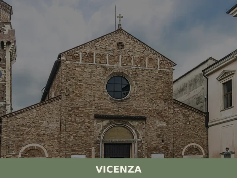
| Vicenza | 55 km | 55–65 minutes by car |
Visitors interested in Venetian rural architecture and the engineering of water management in the flat lands should allow extra time for the villas and the canal landscape. A guide familiar with local lore enhances understanding of the medieval fortress complex and the Longobard memory embedded in local names. The comune’s official website (https://www.comune.san-giorgio-delle-pertiche.pd.it) provides practical information, opening hours for churches and local events.