


Roma
The capital of Italy and the Lazio region, Roma encompasses 1287 km² and 2.7 million inhabitants, making it Europe’s largest commune and a global center of political, religious and cultural influence.
Roma: Caput Mundi and the Heart of Italian Identity
The weight of three thousand years rests visibly in Roma’s travertine facades, its terracotta roofs, the bend of the Tevere that determined the city’s birth. Stone speaks here—not metaphorically, but literally, through the columns and arches that line every district, from the ancient center to the modern quarters that sprawl outward. The city rises from a geological foundation laid down between 600,000 and 300,000 years ago, when extinct volcanoes to the southeast and northwest deposited layers of pyroclastic material that would become the hills upon which civilizations built.
At 20 metres above sea level, on the banks of the Tevere, Roma is the capital of the Italian Republic and the Lazio region. With a surface area of 1287.36 square kilometres and approximately 2.7 million inhabitants, it is the most populous comune in Italy and the third largest in the European Union after Berlin and Madrid. The city’s administrative reach extends across 29 bordering municipalities, and it remains the comune with the greatest expanse of green spaces in Europe. Within its boundaries stands the Città del Vaticano, a sovereign ecclesiastical state. From its founding—according to tradition on 21 April 753 BCE, though archaeological evidence suggests human settlement centuries earlier—Roma became the epicentre of an empire that reshaped the legal, linguistic, philosophical and artistic frameworks of the Western world.
“Caput mundi”—capital of the world. This epithet, drawn from ancient sources, captures not merely Rome’s geographic or political dominion, but its enduring role as the measure against which other cities are weighed.
Three Millennia: From Kingdom to Republic
The founding narrative attributes Roma’s establishment to Romolo, who, according to legend, performed the ritual foundation ceremony on the Palatino. Recent excavations at the Lapis niger, however, reveal settlements existing two centuries before the traditional 753 BCE date, indicating that Roma’s origins were more gradual than myth suggests. The city developed from the syncretism of Latin, Sabine and Etruscan peoples who inhabited the region.
For 244 years Roma operated under monarchical rule. The transition to a republican system fundamentally altered its trajectory. Over subsequent centuries, Roma became the centre of an expanding state that eventually dominated the Mediterranean basin and much of Europe, establishing itself as the originating point of the Latin language and transmitting laws, literary forms, architectural principles and philosophical doctrines that would persist into the modern era.
The papal period transformed Roma into a theocratic capital. From the consolidation of Church authority through the Reformation and beyond, the city served as the spiritual centre of Catholicism, its authority extending into the temporal realm. In 1871, following Italian unification, Roma became the capital of the Kingdom of Italy, a role it has maintained through the Republic established in 1946. The city hosted the Summer Olympic Games in 1960 and served as the founding location for the European Economic Community and Euratom. In 1980, UNESCO inscribed the historic centre, bounded by the Mura aureliane, into the World Heritage list, extending the designation in 1990 to include properties of the Holy See (Vatican and papal basilicas and palaces outside Vatican walls).
Geography and the Tevere Valley
Roma occupies a valley formation created by the Tevere, its principal waterway, and the Aniene, a northern tributary. The city originally developed on hills overlooking the Isola Tiberina, the river’s only natural ford, a geographic accident that determined settlement patterns for millennia. The territory encompasses diverse landscapes: the historic seven hills—Palatino, Aventino, Campidoglio, Quirinale, Viminale, Esquilino and Celio—along with three additional central hills (Gianicolo, Pincio and Vaticano), artificial elevations including Monte Testaccio and Monte Giordano, and outlying heights such as Monte Mario, which at 139 metres provides the city’s highest vantage point.
Beyond the historic core, the municipality extends across a mosaic of urban and rural zones. The eastern districts border the Colli Albani volcanic system; the northwest territories approach the Monti Sabatini. To the west lies the Tirreno Sea, with the Municipio Roma X commanding some 20 kilometres of sandy coastal access at the Lido di Ostia, making Roma Europe’s largest coastal municipality by area. The Municipio Roma XV reaches toward the lakes of Bracciano and Martignano, natural water bodies that provide both recreational and ecological functions. Small watercourses—the Almone and numerous fossi (drainage channels) of the Agro romano—traverse the territory, supplementing the Tevere’s role in water management.
Seismic classification varies across municipal districts. Municipalities IV, V, VI, VII, VIII and IX fall within Zone 2B (moderate seismicity), while the remaining territories are classified Zone 3A or 3B (low seismicity), reflecting the Quaternary geological stability of the region.
Monuments and Civic Identity
The Colosseum
The Colosseum stands as the most recognizable symbol of Roma and, in 2007, was designated among the New Seven Wonders of the World. Its travertine and brick mass, constructed in the first century CE, represents the engineering capabilities and cultural ambitions of the Flavian emperors. The amphitheatre originally accommodated gladiatorial combats and public spectacles. Today, as a fragmentary ruin, it continues to embody Roma’s physical connection to antiquity and remains the primary visual anchor for understanding the city’s ancient grandeur and its transition across centuries.
The Seven Hills and Urban Form
The seven historic hills define the geometric and symbolic core of Roma. Each hill hosted distinct functions: the Palatino served as an imperial residence; the Campidoglio hosted civic and religious authority; the Quirinale and Viminale developed as administrative and residential zones. The arrangement of these hills around the central valley determined street patterns, water management and social hierarchies for over two thousand years. Contemporary Roma still respects these ancient topographic divisions, its neighbourhoods radiating from or clustering around the original hilltop settlements.
The Isola Tiberina
This river island, the sole natural ford along the Tevere within the historic region, functioned as a crucial crossing point and settlement nucleus. Its geographic position enabled early Roma to control east-west traffic and facilitated the city’s development as a trading hub. The island’s role in facilitating communication and commerce underscores how geography, rather than military prowess alone, determined Roma’s rise. Today, the island remains a symbolic reference point for understanding the city’s origins and continued relationship with its primary waterway.
The Vatican Enclave
Within Roma’s administrative boundaries lies the Città del Vaticano, an independent ecclesiastical state and the headquarters of the Roman Catholic Church. Covering 0.44 square kilometres, it represents a unique political entity—a sovereign nation entirely contained within another state’s territory. The Vatican’s presence fundamentally shaped Roma’s modern character as a centre of both secular and religious governance, a duality unmatched among European capitals. The enclave is not a tourist attraction in the conventional sense but rather a political and spiritual reality that defines a significant portion of Roma’s global significance.
The Mura Aureliane
Constructed in the third century CE, these defensive walls encircle the ancient centre and delineate the UNESCO World Heritage zone. The walls stretch approximately 19 kilometres and originally featured 18 main gates. Though breached and rebuilt multiple times across centuries, they remain Rome’s primary historical boundary marker, distinguishing the archaeological and monumental core from the sprawling modern metropolis. Walking the perimeter of these walls provides a tangible sense of the ancient city’s extent and the subsequent expansion that followed.
Local Food and Agricultural Context
Roma’s position in the Lazio region places it within one of Italy’s most productive agricultural zones. The surrounding Agro romano—the countryside of Rome—historically supplied the city with grain, legumes, vegetables and wine. Though urban expansion has reduced cultivated land, surviving agricultural areas still produce vegetables, herbs and fruits typical of central Italy. The coastal areas accessible from the Municipio Roma X support fishing traditions, with the Tirreno providing seafood to local markets.
The city’s food culture reflects its long history of empire, pilgrimage and immigration. Roman cuisine, developed over centuries within the city’s walls, draws on Mediterranean staples—olive oil, grains, preserved meats, aged cheeses—and incorporates culinary influences from territories once controlled by the empire. Contemporary Roma sustains a vibrant market culture, with neighbourhood food vendors and established markets serving residents and visitors throughout the year.
When to Visit and How to Arrive
Roma’s Mediterranean climate (Köppen classification Csa) supports visitation throughout the year. Summers, from June to September, bring sustained heat exceeding 30°C, tempered on western exposures by the Ponentino, a westerly breeze from the Tirreno. The autumn and spring months—September to October and March to May—offer moderate temperatures and manageable precipitation. Winter rainfall peaks in November, December and April, with snow a rare occurrence. Annual precipitation averages approximately 800 millimetres. If you travel during spring or autumn, you will encounter the most comfortable conditions and fewer crowds.
Roma is served by three major airports: Fiumicino (Leonardo da Vinci), approximately 26 kilometres southwest, handles most international traffic; Ciampino, some 15 kilometres southeast, serves regional and budget carriers; and a smaller facility at Urbe, within the city. Ground transportation from these airports includes rail connections—particularly efficient from Fiumicino—as well as bus and car rental services. High-speed rail links Roma to major Italian cities: Florence (approximately 2.5 hours), Milan (3.5 hours), Naples (2.5 hours) and Venice (4.5 hours). Regional trains connect to nearby municipalities in Lazio, including Albano Laziale, Bracciano and Ariccia.
| Departure Point | Distance | Travel Time |
|---|---|---|
| Fiumicino Airport | 26 km | 35 minutes (train) |
| Ciampino Airport | 15 km | 40 minutes (train) |
| Florence (train) | 310 km | 2.5 hours |
| Naples (train) | 240 km | 2.5 hours |
| Milan (train) | 580 km | 3.5 hours |
If you arrive by car, you will encounter extensive motorway networks converging on Roma from all directions. However, navigating and parking within the historic centre presents challenges; authorities restrict vehicle access in numerous zones to preserve air quality and pedestrian safety. A personal vehicle proves most useful for exploring the municipality’s outlying districts and the broader Lazio region. Public transport—buses, trams and metro lines—efficiently connects central Roma to peripheral neighborhoods and adjacent municipalities. The city’s official website, https://www.comune.roma.rm.it, provides current information on municipal services, events and administrative procedures.
Frequently asked questions about Roma
What is the best time to visit Roma?
April to June and September to October offer ideal weather with mild temperatures and fewer crowds than summer. However, Roma is a year-round destination. The feast of Saints Peter and Paul (June 29) is celebrated with special religious ceremonies and events throughout the city. Winter months (December to February) are cooler but still pleasant, with lower accommodation prices. Avoid July and August when heat intensifies and tourist crowds peak.
How do I reach Roma by train?
Roma Termini is Italy's largest railway station, serving high-speed trains (Freccia) from Milan (2.5 hours), Florence (2 hours), and Naples (2 hours). Regional trains connect smaller cities. Termini is centrally located near major monuments and public transport hubs. Roma Tiburtina and Roma Ostiense are secondary stations. All stations link directly to the Metro system, buses, and taxis for onward travel throughout the city.
How many days should I spend in Roma?
A minimum of three to four days allows you to experience major attractions: Vatican Museums, Colosseum, Roman Forum, and iconic fountains and churches. Five to seven days permit deeper exploration of museums, lesser-known archaeological sites, neighborhood walks, and day trips to Tivoli or Castelli Romani. Extended stays enable leisurely dining, shopping in historic districts, and appreciation of the city's layered history across different areas.
Is there public transportation in Roma?
Yes, Roma has an extensive Metro system with three lines (A, B, C) connecting major districts. Buses and trams serve the entire city. A single journey ticket costs €2; daily passes and multi-day tourist passes offer better value. Most ancient monuments and attractions are accessible via Metro or walking. Taxis are widely available but more expensive. Bicycles and scooter rentals provide alternative mobility options for exploring neighborhoods.
What is the geographical significance of the Tevere River?
The Tevere River determined Roma's founding and development. The city is built on its left bank at 20 meters above sea level, where early settlements found natural defenses and fresh water. The river's bend created favorable conditions for settlement and trade. Ancient bridges like Ponte Sant'Angelo connected districts and facilitated expansion. The Tevere remains central to Roma's identity, with embankments (lungotereve) now offering recreational paths and views of historic architecture.
📷 Photo Gallery — Roma


In Lazio More villages to discover
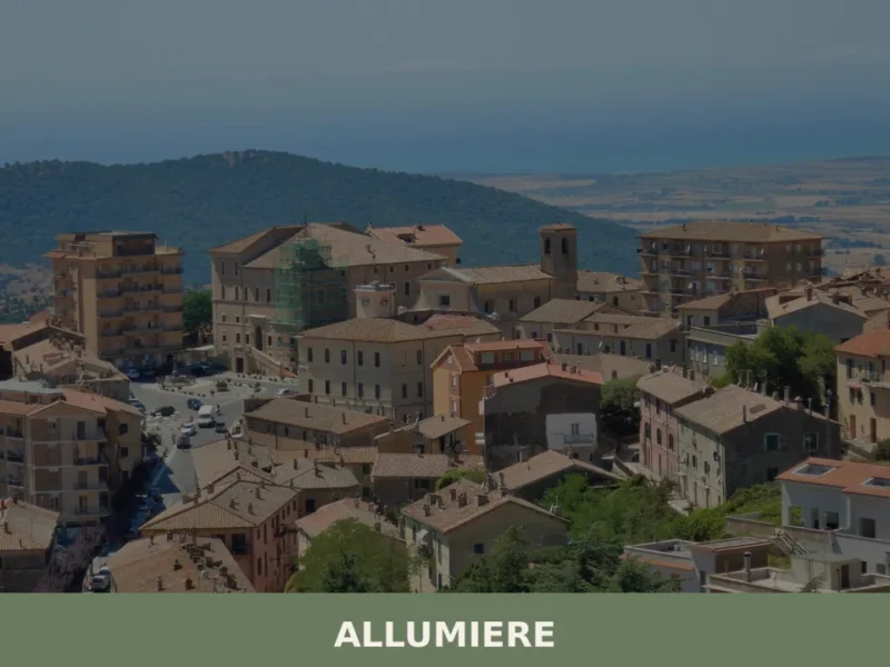
Allumiere
What to see in Allumiere, Lazio, Italy: explore the alunite mining history, Santa Maria Assunta church, and Borgo della Farnesiana. 4,146 inhabitants. Discover it now.
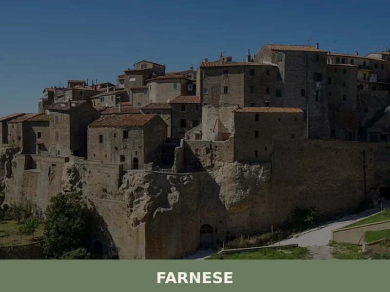
Farnese
The morning light, a pale gold filtering through the narrow aperture of a medieval archway, illuminates the rough-hewn basalt paving stones of Farnese. A faint scent of woodsmoke and damp earth hangs in the cool air, carried on a breeze that rustles the leaves of an ancient oak on the village’s periphery. Here, at 341 […]
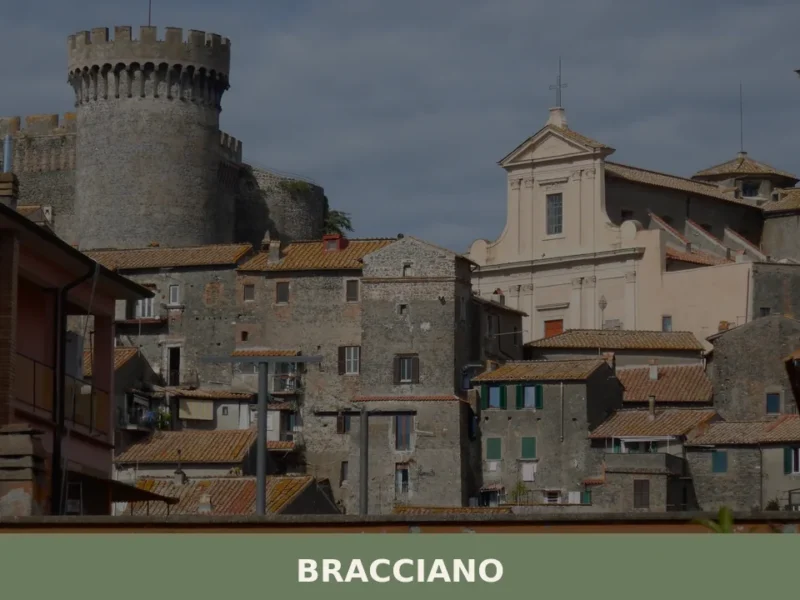
Bracciano
What to see in Bracciano, Italy: Discover its medieval castle and volcanic lake. Located 30 km (19 mi) from Rome, explore this Lazio village for a memorable day trip.
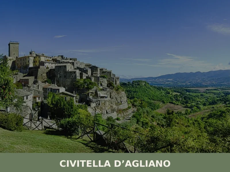
Civitella d’Agliano
What to See in Civitella d'Agliano: Tower, Castle, Festival. Discover the historic attractions of the village! Experience culture and flavors.
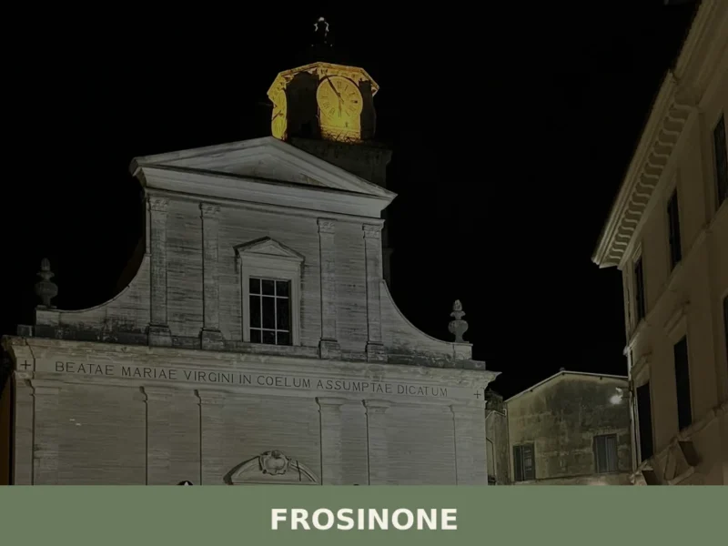
Frosinone
What to see in Frosinone: from the Cyclopean walls to the medieval old town. Discover the 5 top attractions and plan your visit.
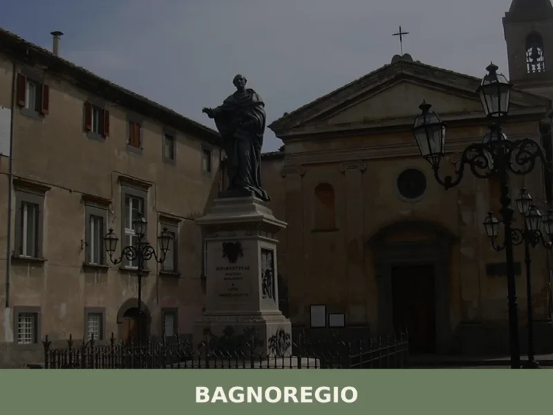
Bagnoregio
What to see in Bagnoregio, Lazio, Italy: explore Civita di Bagnoregio, the birthplace of St. Bonaventure, 90 km from Rome. Discover top attractions and local food.
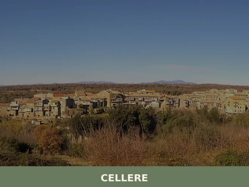
Cellere
what to see in cellere, Italy. Explore this Viterbo province village, 344 m high. Discover the Church of Sant'Egidio and local traditions. Read our guide!

Artena
What to see in Artena, Lazio, Italy: cyclopean walls from the 5th century BC, Palazzo Borghese, and 4 historic churches. Discover how to get there from Rome.
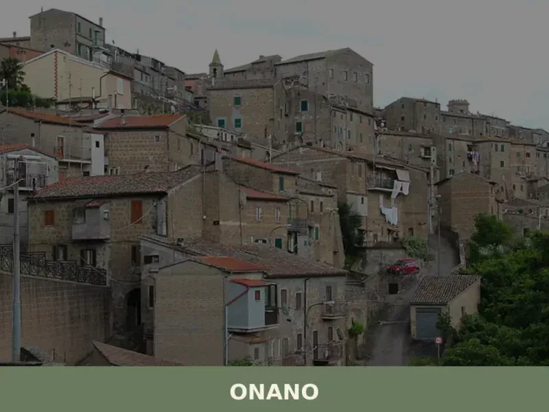
Onano
Onano has 898 inhabitants and sits at 485 metres above sea level on the southern slopes of Lake Bolsena, in the province of Viterbo. The municipal territory, stretching across lentil fields and oak groves, borders both Umbria and Tuscany — a point of triple regional convergence that has shaped the town’s economic and linguistic history. […]
Tessennano
In the heart of Viterbo’s Tuscia region, 302 meters above sea level, lies Tessennano, a settlement with 284 residents. Its hillside location, distant from major thoroughfares, has defined its profile through the centuries. For those wondering what to see in Tessennano, the village presents a historical layering perceptible in its architecture. The settlement develops around […]


🏡 Know Roma better than we do?
If you’re a local or have been there, your knowledge matters: add what’s missing or fix a detail on this page.